
Bayern
Beschrijving
Paden in deze landsdeel
- AlemannenwegGPX
- Alpen Weitwanderweg
- Altmühltal PanoramawegGPX
- Badener Weg
- BöhmwegGPX
- Bodensee RundwegGPX
- BurgenwegGPX
- Burgundenweg
- DonausteigGPX
- E6GPX
- E8GPX
- ErzwegGPX
- EselswegGPX
- Europäische Wasserscheideweg
- FrankenwegGPX
- Frankenweg (Schwäbischer Albverein)GPX
- Frankenweg Odenwald
- Fränkischer GebirgswegGPX
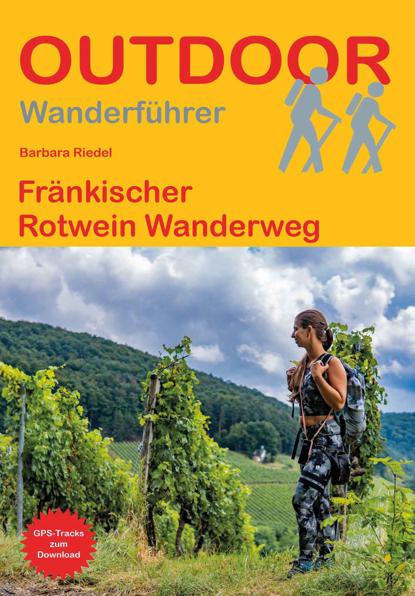
- Fränkischer Rotwein WanderwegGPX
- GlasschleifererwegGPX
- GoethewegGPX
- GoldsteigGPX
- GunthersteigGPX
- Höhenweg Fichtelgebirge
- Höhenweg Steinwaldweg
- Heilbronner HöhenwegGPX
- Hessenweg 3GPX
- Hessenweg 5GPX
- Hessenweg 9GPX
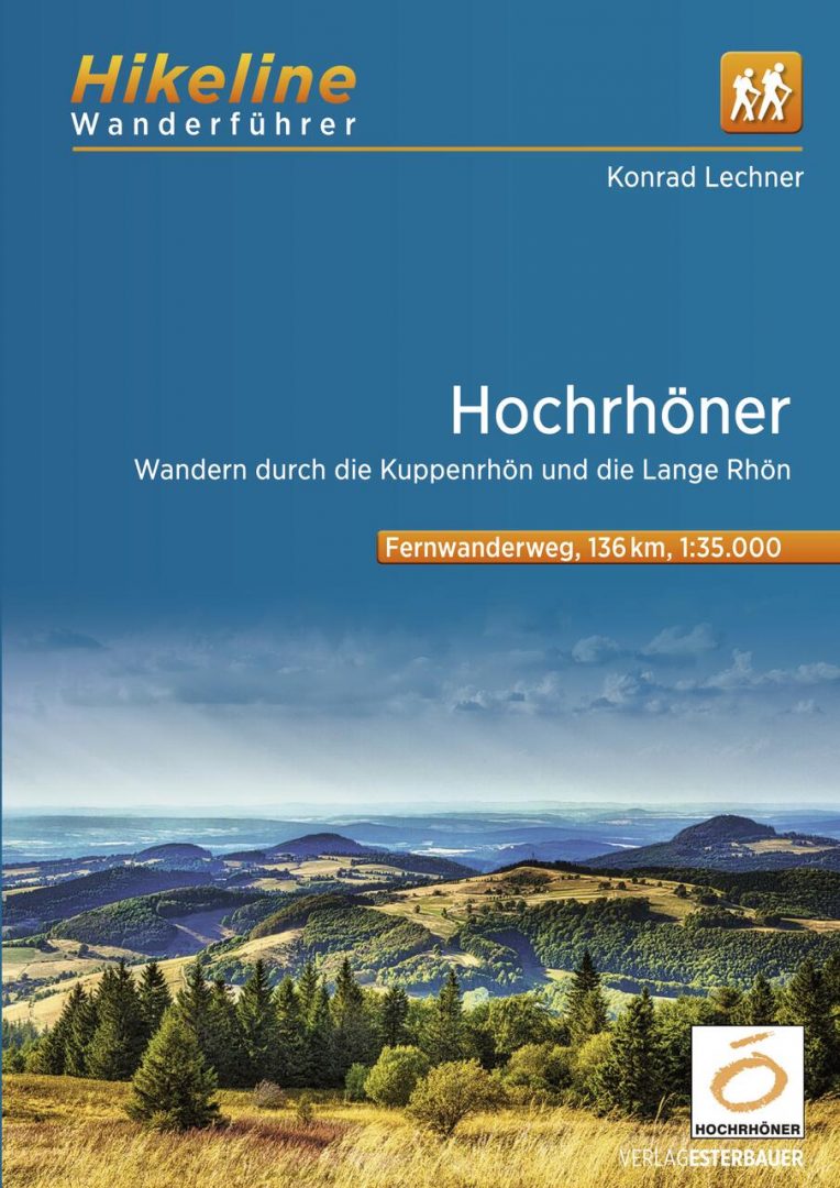
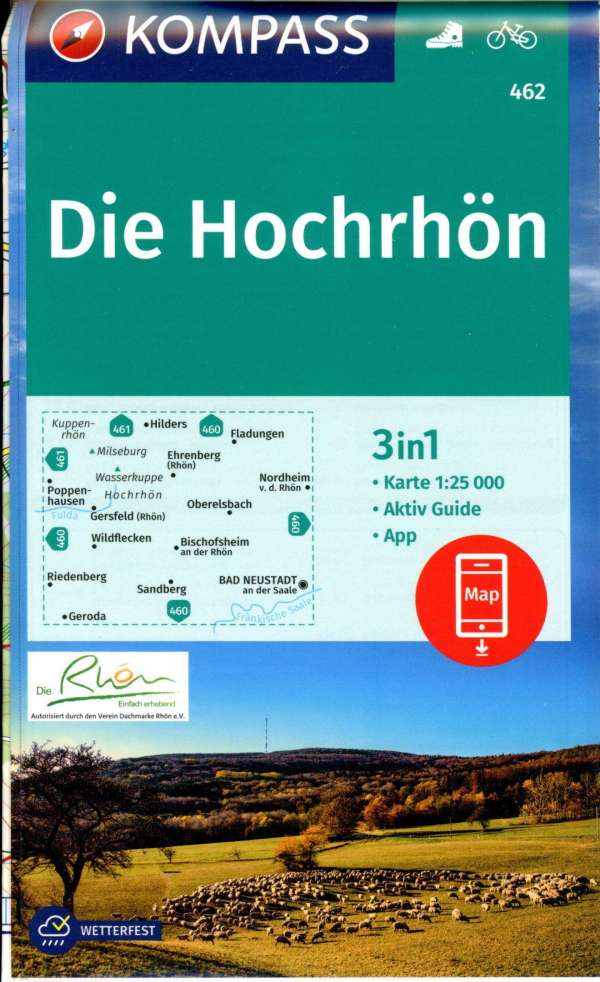
- HochrhönerGPX
- HohenzollernwegGPX
- JurasteigGPX
- König LudwigwegGPX
- Kelten ErlebniswegGPX
- KunigundenwegGPX
- Lech Höhenweg
- LechwegGPX
- Main-WerrawegGPX
- Maintal Höhenringweg
- MaximilianswegGPX
- NordwaldkammwegGPX
- NurtschwegGPX
- Oberallgäuer RundwanderwegGPX
- PandurensteigGPX
- PrälatenwegGPX
- Rhön HöhenwegGPX
- Romantische StrasseGPX
- Schwäbisch Allgäuer WanderwegGPX
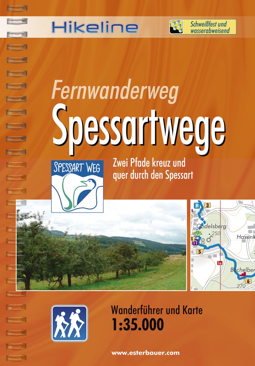
- SpessartwegGPX
- Steigerwald PanoramawegGPX
- Stromberg-Schwäbischer Waldweg
- Traumpfad München-VenedigGPX
- Via Claudia AugustaGPX
- Westweg FichtelgebirgeGPX
- ZeugenbergrundeGPX
Links
Feiten
Verslagen
Gidsen en kaarten
Overnachting
Organisaties
Reisorganisaties
GPS
Anders
Boeken
De Zwerver
Netherlands
2023
Netherlands
2023
De Zwerver
Netherlands
2010
Netherlands
2010
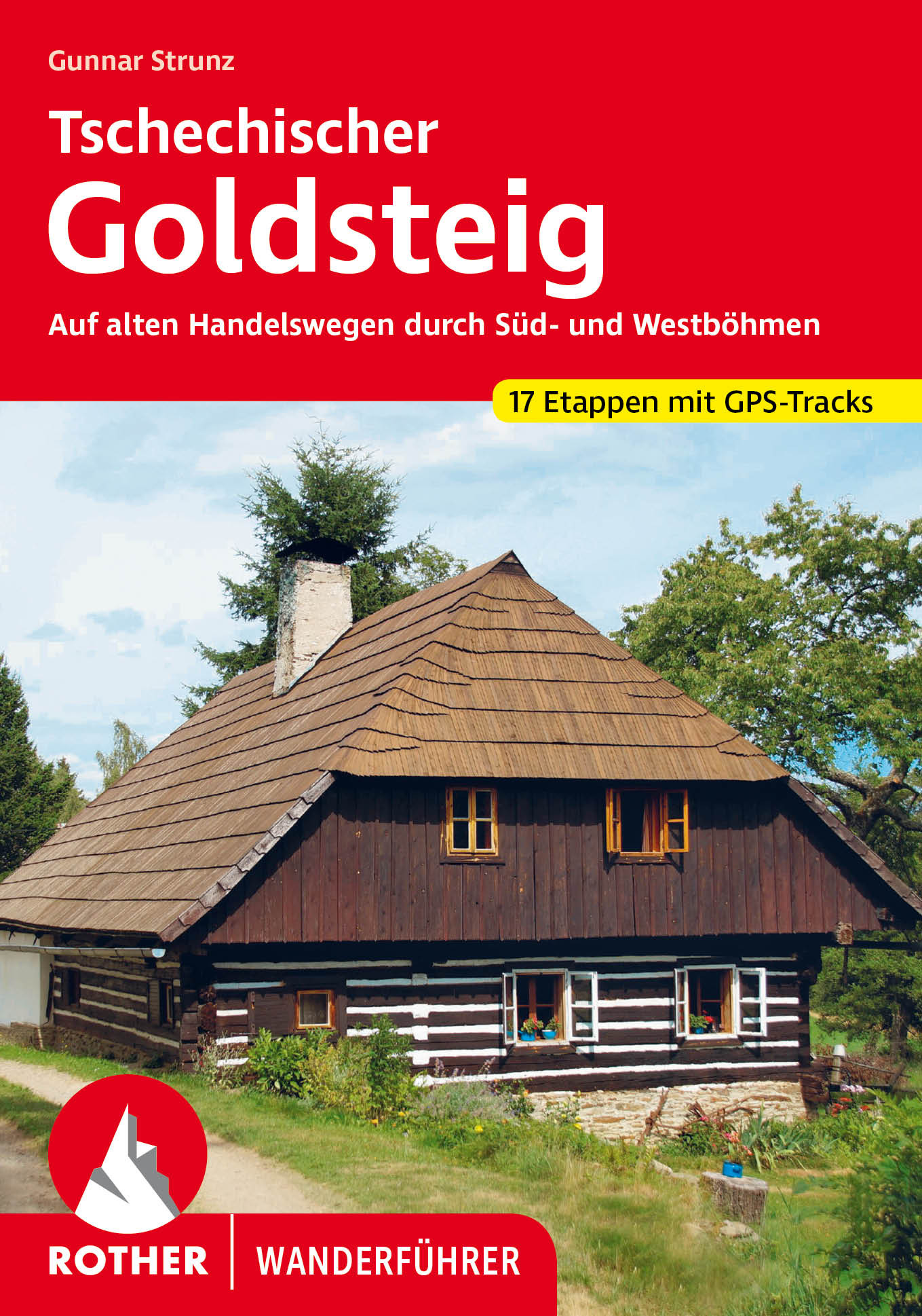
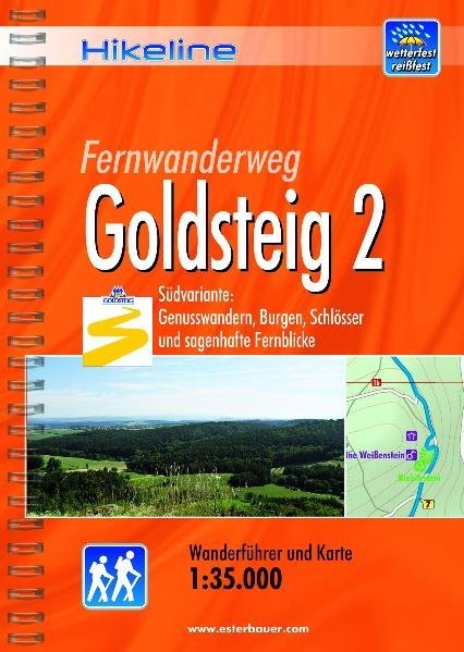
- Wandelgids Hikeline Goldsteig 2 | Esterbauer
- Handzame gids met een goede beschrijving van een meerdaagse tocht in dit gebied. De gids is in spiraalbinding en elke pagina is op scheur- en watervast papier gedrukt. Daar is echt over nagedacht! Der Goldsteig mit seinem beiden Varianten, zugleich Qualitätsweg Wanderbares Deutschland und einer der „Top Trails of Germany“, ist mit insgesamt ca.... Read more
De Zwerver
Netherlands
2021
Netherlands
2021
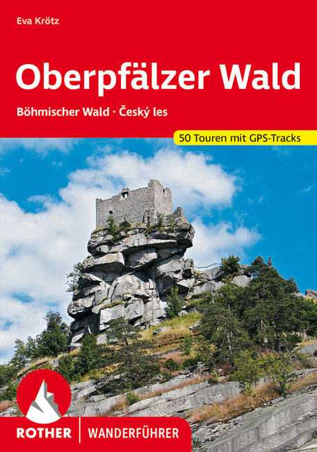
- Wandelgids Oberpfälzer Wald | Rother Bergverlag
- Uitstekende wandelgids met een groot aantal dagtochten in dal en hooggebergte. Met praktische informatie en beperkt kaartmateriaal! Wandelingen in verschillende zwaarte weergegeven in rood/blauw/zwart 160 Seiten mit 111 Farbabbildungen 50 Höhenprofile, 50 Wanderkärtchen im Maßstab 1:50.000, eine Übersichtskarte Die Oberpfalz, ein Stück... Read more

De Zwerver
Netherlands
2020
Netherlands
2020
- Wandelgids Leichte Wanderungen Münchner Berge | Rother Bergverlag
- 40 Touren zwischen Garmisch und Chiemgau Rother Wanderführer. 3. Auflage. Read more
De Zwerver
Netherlands
2009
Netherlands
2009
- Wandelgids Hikeline Spessartwege | Esterbauer
- Handzame gids met een goede beschrijving van een groot aantal dagtochten in dit gebied. De gids is in spiraalbinding en elke pagina is op scheur- en watervast papier gedrukt. Daar is echt over nagedacht! Vor mehr als hundert Jahren wurde das Gebiet des Spessarts zum Wandern entdeckt. Bereits am Ende des 19. Jahrhunderts konnte sich der... Read more
De Zwerver
Netherlands
2011
Netherlands
2011
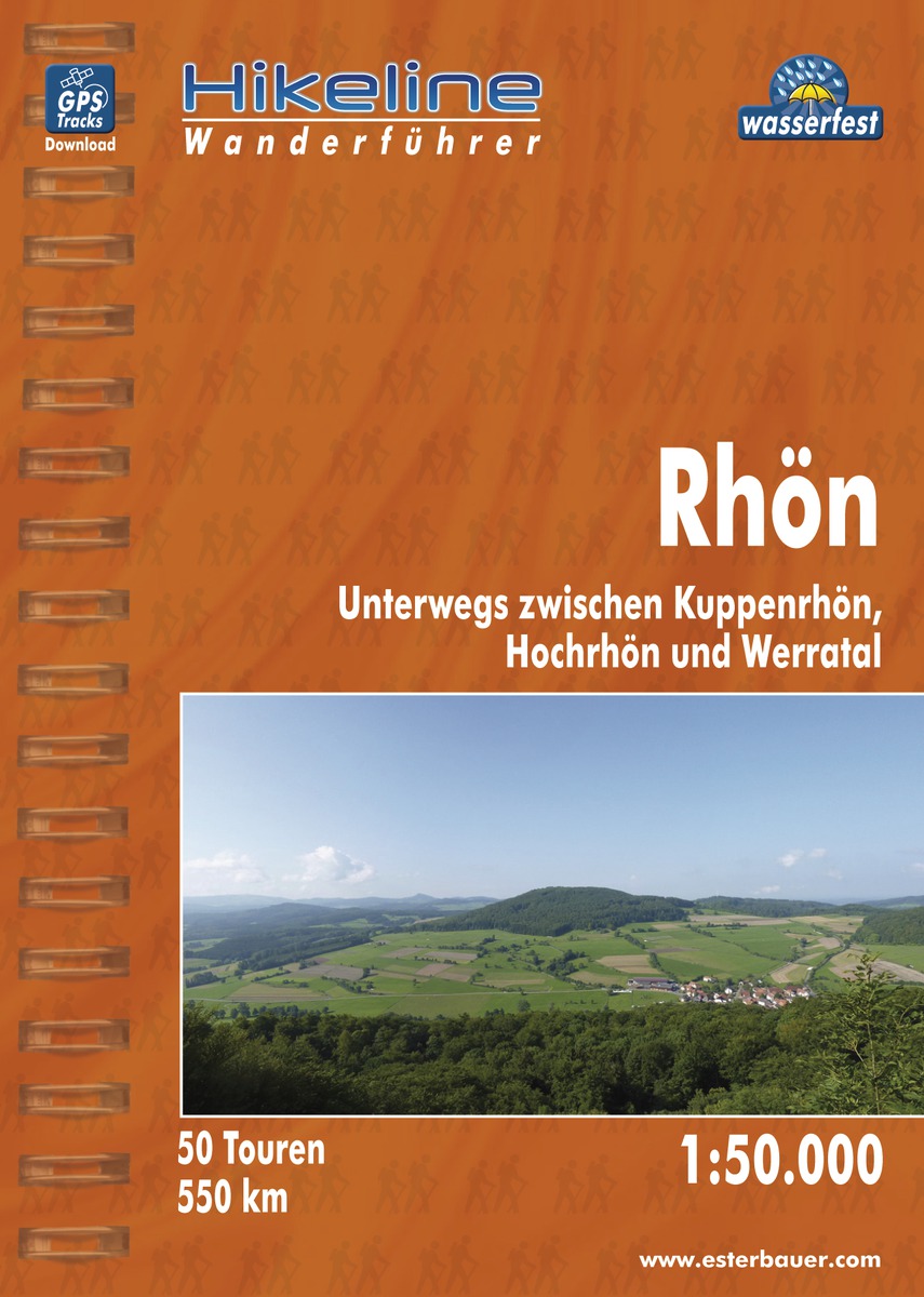
- Wandelgids Hikeline Rhön | Esterbauer
- Handzame gids met een goede beschrijving van een groot aantal dagtochten in dit gebied. De gids is in spiraalbinding en elke pagina is op scheur- en watervast papier gedrukt. Daar is echt over nagedacht! Länge, Höhenmeter Die 50 in diesem Buch beschriebenen Wandertouren sind jeweils zwischen 4 und 20 Kilometer lang, im Durchschnitt sind es... Read more
De Zwerver
Netherlands
2015
Netherlands
2015
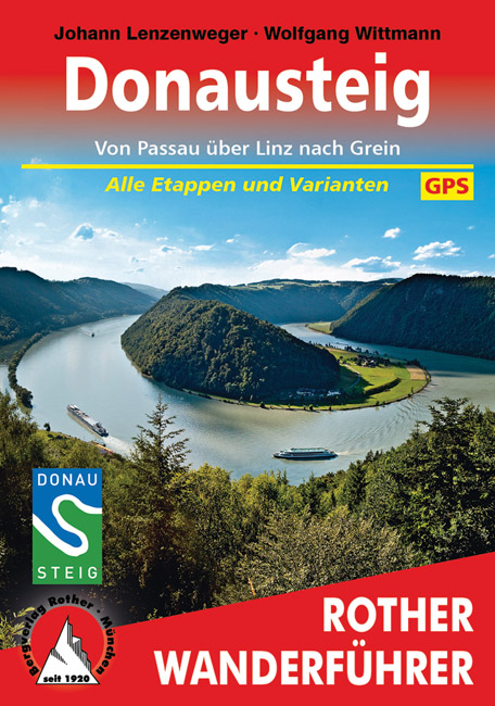
- Wandelgids Donausteig von Passau über Linz nach Grein | Rother Bergverlag
- Goede duidelijke beschrijving van deze meerdaagse wandeling van de Donausteig tussen Passau via Linz naar Grein. Voldoende info, zelfs kaartjes zijn behoorlijk goed en voldoende. Eine der schönsten Flusslandschaften Österreichs ist das Donautal, mit seinem Wechsel zwischen engen Durchbruchstälern und weiten Beckenlandschaften, mit... Read more
De Zwerver
Netherlands
2013
Netherlands
2013
- Wandelgids Lechweg | Conrad Stein Verlag
- Der Weg ist das Ziel. 1. Auflage. Read more

De Zwerver
Netherlands
2015
Netherlands
2015
- Wandelgids Nibelungensteig | Conrad Stein Verlag
- OutdoorHandbuch. 1. Auflage. Read more
De Zwerver
Netherlands
2021
Netherlands
2021
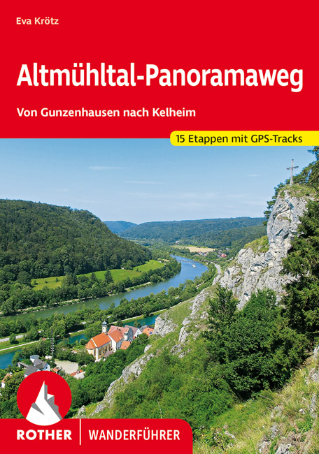
- Wandelgids Altmühltal-Panoramaweg | Rother Bergverlag
- Von Gunzenhausen nach Kelheim. 15 Etappen. Mit GPS-Daten Rother Wanderbuch Read more
Kaarten

De Zwerver
Netherlands
Netherlands
- Wandelkaart 1 Stara Planina gebergte | Domino
- Stara Planina Central: Zlatitsa to Kalofer map at 1:50,000 from Bulgarian publishers Domino, contoured and GPS compatible, with hiking trails, accommodation options including a list of local mountain refuges, etc. The map is double-sided and covers the mountains from just west of Ribaritsa and Zlatitsa eastwards beyond Kalofer to the peak of... Read more
- Also available from:
- Stanfords, United Kingdom

Stanfords
United Kingdom
United Kingdom
- Stara Planina Central: Zlatitsa to Kalofer Domino Map
- Stara Planina Central: Zlatitsa to Kalofer map at 1:50,000 from Bulgarian publishers Domino, contoured and GPS compatible, with hiking trails, accommodation options including a list of local mountain refuges, etc. The map is double-sided and covers the mountains from just west of Ribaritsa and Zlatitsa eastwards beyond Kalofer to the peak of... Read more
De Zwerver
Netherlands
Netherlands
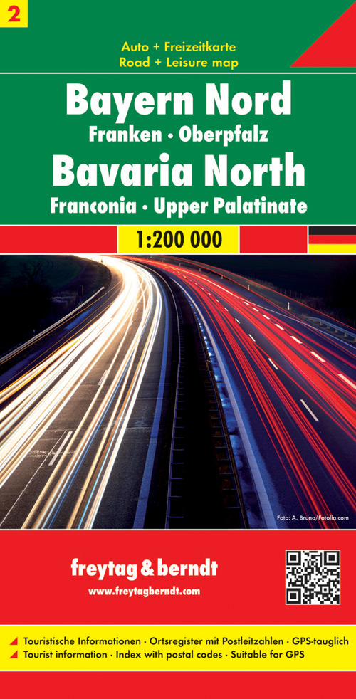
- Wegenkaart - landkaart 02 Beieren Noord- Bayern nord | Freytag & Berndt
- Bayern Nord - 1 : 200 000 ab 10.9 EURO Franken - Oberpfalz freytag & berndt Auto + Freizeitkarten. Neuauflage Read more
De Zwerver
Netherlands
Netherlands
De Zwerver
Netherlands
Netherlands
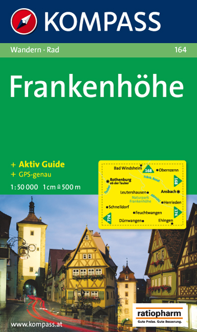
- Wandelkaart 164 Frankenhöhe | Kompass
- Goede wandelkaart met vrijwel alle topografische details en ingetekende routes. Ook met symbolen voor toeristische bezienswaardigheden, register. Berghutten duidelijk weergegeven. Gevaarlijke wandelroutes zijn goed herkenbaar. GPS toepasbaar. KOMPASS-Wanderkarten enthalten alles Wissenswerte für Wanderer wie aktuelle Wanderwege mit... Read more

De Zwerver
Netherlands
Netherlands
- Wandelkaart 2 Stara Planina gebergte | Domino
- Stara Planina Central: Uzana to Vratnik map at 1:50,000 from Bulgarian publishers Domino, contoured and GPS compatible, with hiking trails, accommodation options including a list of local mountain refuges, etc. The map is double-sided and covers the mountains from just west of the Uzana massif, the geographical centre of Bulgaria, eastwards to... Read more
- Also available from:
- Stanfords, United Kingdom

Stanfords
United Kingdom
United Kingdom
- Stara Planina Central: Uzana to Vratnik Domino Map
- Stara Planina Central: Uzana to Vratnik map at 1:50,000 from Bulgarian publishers Domino, contoured and GPS compatible, with hiking trails, accommodation options including a list of local mountain refuges, etc. The map is double-sided and covers the mountains from just west of the Uzana massif, the geographical centre of Bulgaria, eastwards to... Read more

De Zwerver
Netherlands
Netherlands
- Wandelkaart Sredna Gora - Bulgarije | Domino
- Pirin Mountains at 1:50,000 on a large, double-sided, contoured map with GPS waypoints for shelters and chalets, peaks, etc. and highlighting hiking routes. Topography is shown by contours at 40m intervals with additional relief shading and graphics and colouring for sandstone stacks, single rocks over 5m high, marshlands and different types of... Read more
De Zwerver
Netherlands
2018
Netherlands
2018
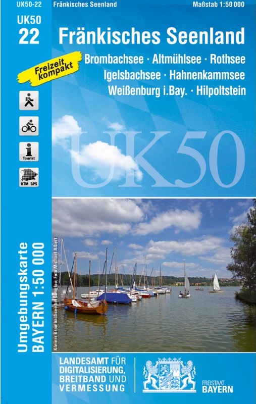
- Wandelkaart 22 UK50 Fränkisches Seenland | LVA Bayern
- Franconia Lake District, map no. 50-22 covering an area around Altmühlsee, Rothsee, Bronbachsee, Ingelsbachsee, Hahnenkamm and Dennenloher See, in a series of special contoured and GP-compatible recreational maps from the Bavarian state survey organization, with cartography of the German topographic survey at 1:50,000 and extensive additional... Read more
- Also available from:
- Stanfords, United Kingdom

Stanfords
United Kingdom
2018
United Kingdom
2018
- Franconia Lake District UK50-22
- Franconia Lake District, map no. 50-22 covering an area around Altmühlsee, Rothsee, Bronbachsee, Ingelsbachsee, Hahnenkamm and Dennenloher See, in a series of special contoured and GP-compatible recreational maps from the Bavarian state survey organization, with cartography of the German topographic survey at 1:50,000 and extensive additional... Read more
De Zwerver
Netherlands
Netherlands
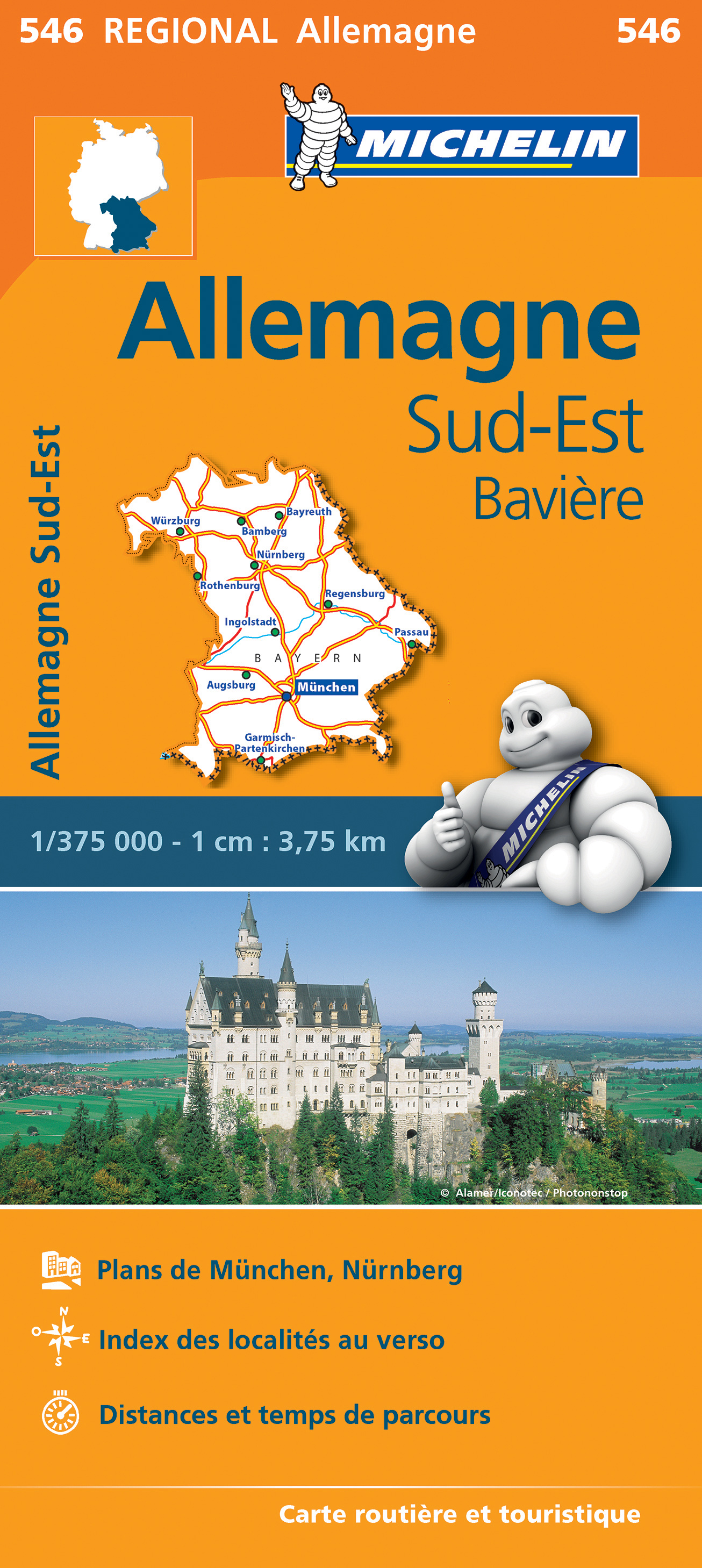
- Wegenkaart - landkaart 546 Bayern - Beieren | Michelin
- MICHELIN REGION BAVIERE ALLEMAGNE SEDes tavernes de Munich à la vieille ville de Nuremberg, toute une région sur une seule carte au 1/375 000e Read more

De Zwerver
Netherlands
Netherlands
- Wandelkaart 3 Stara Planina gebergte | Domino
- Stara Planina Western: Belogradchik to Berkovita map at 1:50,000 from Bulgarian publishers Domino, contoured and GPS compatible, with hiking trails, accommodation options including a list of local mountain refuges, etc. The map is double-sided and covers the mountains from the peak of Byala Voda near Belogradchik eastwards to just beyond... Read more
- Also available from:
- Stanfords, United Kingdom

Stanfords
United Kingdom
United Kingdom
- Stara Planina Western: Belogradchik to Berkovita Domino Map
- Stara Planina Western: Belogradchik to Berkovita map at 1:50,000 from Bulgarian publishers Domino, contoured and GPS compatible, with hiking trails, accommodation options including a list of local mountain refuges, etc. The map is double-sided and covers the mountains from the peak of Byala Voda near Belogradchik eastwards to just beyond... Read more
De Zwerver
Netherlands
Netherlands
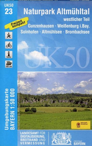
- Wandelkaart 23 UK50 Naturpark Altmühltal westlicher Teil | LVA Bayern
- The western part of the Altmühl Valley Regional Park, map no. 50-23 covering an area around Weißenburg, Eichstätt, Gunzenhausen and Monheim, in a series of special contoured and GP-compatible recreational maps from the Bavarian state survey organization, with cartography of the German topographic survey at 1:50,000 and extensive additional... Read more
- Also available from:
- Stanfords, United Kingdom

Stanfords
United Kingdom
United Kingdom
- Altmuhltal NP West UK50-23
- The western part of the Altmühl Valley Regional Park, map no. 50-23 covering an area around Weißenburg, Eichstätt, Gunzenhausen and Monheim, in a series of special contoured and GP-compatible recreational maps from the Bavarian state survey organization, with cartography of the German topographic survey at 1:50,000 and extensive additional... Read more

De Zwerver
Netherlands
Netherlands
- Wandelkaart 4 Stara Planina gebergte | Domino
- Stara Planina Western: Berkovita to Zlatitsa map at 1:50,000 from Bulgarian publishers Domino, contoured and GPS compatible, with hiking trails, accommodation options including a list of local mountain refuges, etc. The map is double-sided and covers the mountains from Varshets (directly north of Sofia) to just beyond Etrepole.Maps in the... Read more
- Also available from:
- Stanfords, United Kingdom

Stanfords
United Kingdom
United Kingdom
- Stara Planina Western: Berkovita to Zlatitsa Domino Map
- Stara Planina Western: Berkovita to Zlatitsa map at 1:50,000 from Bulgarian publishers Domino, contoured and GPS compatible, with hiking trails, accommodation options including a list of local mountain refuges, etc. The map is double-sided and covers the mountains from Varshets (directly north of Sofia) to just beyond Etrepole.Maps in the... Read more
De Zwerver
Netherlands
Netherlands
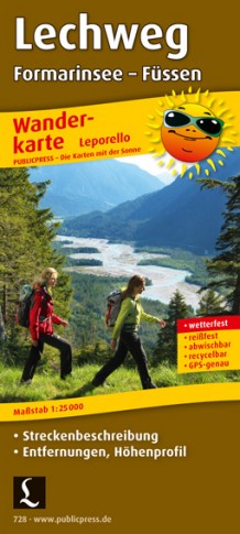
- Wandelkaart 728 Lechweg | Publicpress
- Mit Streckenbeschreibung, Entfernungen, Höhenprofil. Karte ohne Jahresangabe. Read more
De Zwerver
Netherlands
Netherlands