
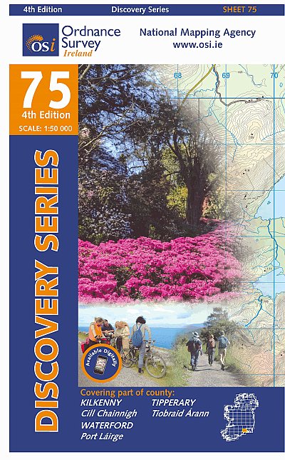
Waterford
Beschrijving

County Waterford has a pleasant landscape of rolling hills and rich with trees. It borders on Ireland’s south coast. It has some hill areas too: the Knockmealdown Mountains and the Comeragh Mountains. The East Munster Way runs from west to east through Waterford.
Paden in deze landsdeel
Links
Feiten
Verslagen
Gidsen en kaarten
Overnachting
Organisaties
Reisorganisaties
GPS
Anders
Boeken
De Zwerver
Netherlands
2023
Netherlands
2023
De Zwerver
Netherlands
2018
Netherlands
2018
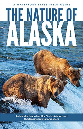
- Vogelgids - Natuurgids The Nature of Alaska | Waterford Press
- Compact yet comprehensive, The Nature of Alaska takes novice naturalists through an easy-to-read basic explanation of species, field identification tips, the evolution of animals and plants, Alaska's geography, ecosystems and climate, before delving into more detailed species identification. Exhaustively researched, beautifully illustrated... Read more
De Zwerver
Netherlands
2017
Netherlands
2017
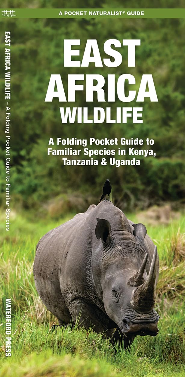
- Natuurgids East Africa Wildlife Kenia, Tanzania, Uganda | Waterford Press
- Een bijzonder handige uitklapkaart met alle veelvoorkomende dieren van Oost Afrika: Kenia, Tanzania en Uganda. Duidelijke illustraties, goede korte omschrijving van soort en leefgebied, geplastificeerd. Perhaps the top wildlife viewing area on earth, the legendary game reserves of the Serengeti and Maasai Mara attract millions of tourists each... Read more
De Zwerver
Netherlands
Netherlands
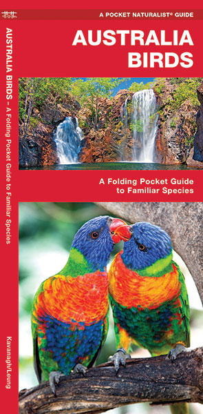
- Vogelgids - Natuurgids Australian Birds ( Australië ) | Waterford Press
- en bijzonder handige uitklapkaart met alle veelvoorkomende vogels van Australië. Duidelijke illustraties, goede korte omschrijving van soort en leefgebied, geplastificeerd. The Pocket Naturalist series introduces novices to common plants and animals and natural phenomena. Each pocket-sized, folding guide highlights up to 150 species and most... Read more
De Zwerver
Netherlands
Netherlands
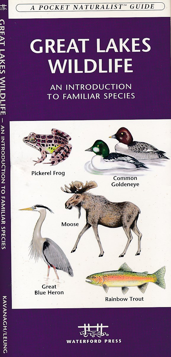
- Natuurgids Great Lakes wildlife | Waterford Press
- Great Lakes Wildlife is the perfect pocket-sized, folding guide for the nature enthusiast. This beautifully illustrated guide highlights over 140 familiar species of birds, mammals, reptiles, amphibians, insects and fishes and includes a map featuring prominent wildlife-viewing hotspots Laminated for durability, this handy guide is a great... Read more

De Zwerver
Netherlands
Netherlands
- Vogelgids - Natuurgids Alaska Birds | Waterford Press
- A great source of portable information and ideal for field use by novices and experts alike, this invaluable guide that is laminated for durability presents more than 140 bird species found in Alaska. It also includes a map featuring prominent, state-wide birding hotspots. Read more
De Zwerver
Netherlands
2003
Netherlands
2003
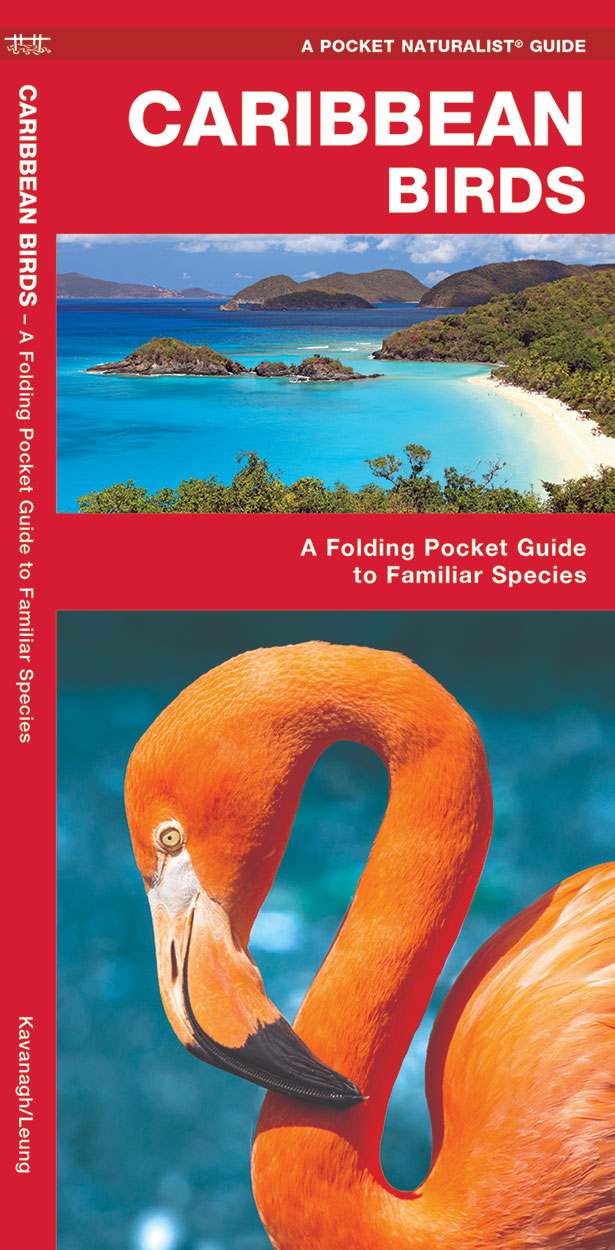
- Vogelgids - Natuurgids Caribbean Birds | Waterford Press
- Caribbean Birds is a pocket-sized, folding guide highlighting the most commonly seen birds in the Caribbean Islands. Laminated for durability, these handy guides are a great source of portable information for the vacationer or the avian enthusiast. A map of the Caribbean Islands on the back cover, completes this essential guide. Ideal for bird... Read more

De Zwerver
Netherlands
Netherlands
- Natuurgids India Wildlife | Waterford Press
- Handige uitklapkaart met een behoorlijk aantal dieren uit alle familie-groepen. Goede plaatjes zorgen voor de mogelijkheid van een snelle identificatie. India’s diverse habitats harbor an equally diverse assemblage of wildlife ranging from tigers and lions, to elephants, rhinos and flying lizards. This beautifully illustrated guide highlights... Read more
De Zwerver
Netherlands
Netherlands
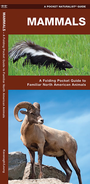
- Natuurgids Mammals : An Introduction to Familiar North American Species | Waterford Press
- Een bijzonder handige uitklapkaart met alle veelvoorkomende zoogdieren van Amerika. Duidelijke illustraties, goede korte omschrijving van soort en leefgebied, geplastificeerd. The Pocket Naturalist series introduces novices to common plants and animals and natural phenomena. Each pocket-sized, folding guide highlights up to 150 species and most... Read more

De Zwerver
Netherlands
2010
Netherlands
2010
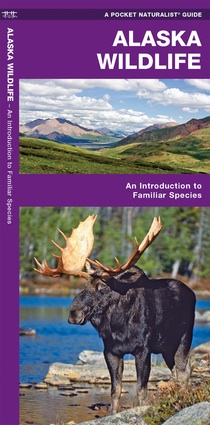
- Vogelgids - Natuurgids Alaska Wildlife An introduction to familiar species | Waterford Press
- Een bijzonder handige uitklapkaart met alle veelvoorkomende dieren van Alaska. Duidelijke illustraties, goede korte omschrijving van soort en leefgebied, geplastificeerd. Alaska Wildlife is the perfect pocket-sized, folding guide for the nature enthusiast. This beautifully illustrated guide highlights over 140 familiar species of birds,... Read more
De Zwerver
Netherlands
Netherlands
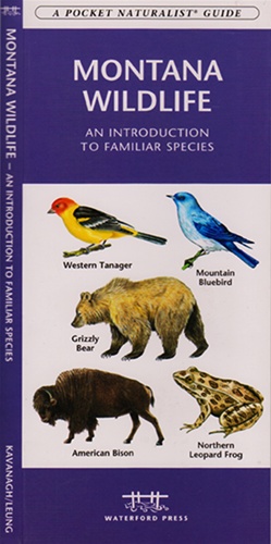
- Vogelgids - Natuurgids Montana Wildlife | Waterford Press
- the Pocket Naturalist card is a pocket-sized, folding card which provides simplified, easy-to-use reference to what everyone should know about familiar plants, animals, and natural history. Maps are included to highlight prominent sanctuaries and outstanding natural attractions. Every card is laminated so that it is waterproof and practical for... Read more
De Zwerver
Netherlands
2013
Netherlands
2013
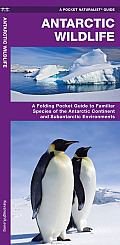
- Vogelgids - Natuurgids Antarctic Wildlife | Waterford Press
- Een bijzonder handige uitklapkaart met alle veelvoorkomende dieren van Antarctica. Duidelijke illustraties, goede korte omschrijving van soort en leefgebied, geplastificeerd. Familiar species, common plants, and natural phenomena are introduced in these beautifully illustrated guides to nature and the outdoors. Printed on laminated,... Read more
Kaarten
De Zwerver
Netherlands
Netherlands
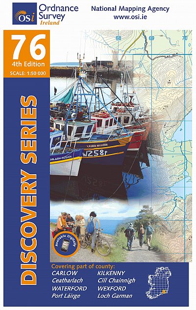
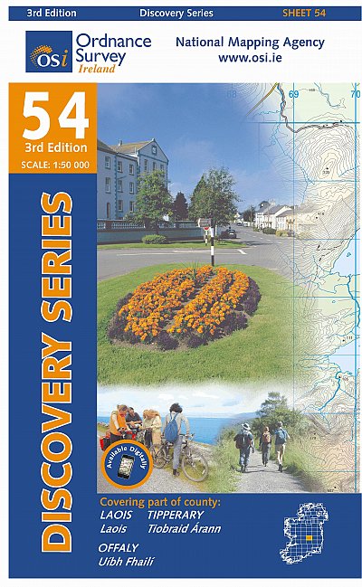
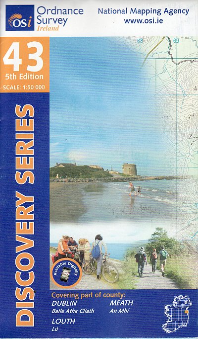
- Topografische kaart - Wandelkaart 76 Discovery Carlow, Kilkenny, Waterford, Wexford | Ordnance Survey Ireland
- Map No. 76, Kilkenny South-East - Wexford South-West in the Discovery series from the OSI, the Ordnance Survey of Ireland, which presents the country on detailed topographic maps at 1:50,000, with additional overprint highlighting campsites and caravan parks, youth hostels, etc. Current 4th edition of this map was published in April 2013.Maps... Read more
- Also available from:
- Stanfords, United Kingdom

Stanfords
United Kingdom
United Kingdom
- Carlow - Kilkenny - Waterford - Wexford OSI Discovery 76
- Map No. 76, Kilkenny South-East - Wexford South-West in the Discovery series from the OSI, the Ordnance Survey of Ireland, which presents the country on detailed topographic maps at 1:50,000, with additional overprint highlighting campsites and caravan parks, youth hostels, etc. Current 4th edition of this map was published in April 2013.Maps... Read more

De Zwerver
Netherlands
Netherlands
- Wandelkaart 3 Stara Planina gebergte | Domino
- Stara Planina Western: Belogradchik to Berkovita map at 1:50,000 from Bulgarian publishers Domino, contoured and GPS compatible, with hiking trails, accommodation options including a list of local mountain refuges, etc. The map is double-sided and covers the mountains from the peak of Byala Voda near Belogradchik eastwards to just beyond... Read more
- Also available from:
- Stanfords, United Kingdom

Stanfords
United Kingdom
United Kingdom
- Stara Planina Western: Belogradchik to Berkovita Domino Map
- Stara Planina Western: Belogradchik to Berkovita map at 1:50,000 from Bulgarian publishers Domino, contoured and GPS compatible, with hiking trails, accommodation options including a list of local mountain refuges, etc. The map is double-sided and covers the mountains from the peak of Byala Voda near Belogradchik eastwards to just beyond... Read more

De Zwerver
Netherlands
Netherlands
- Wandelkaart 4 Stara Planina gebergte | Domino
- Stara Planina Western: Berkovita to Zlatitsa map at 1:50,000 from Bulgarian publishers Domino, contoured and GPS compatible, with hiking trails, accommodation options including a list of local mountain refuges, etc. The map is double-sided and covers the mountains from Varshets (directly north of Sofia) to just beyond Etrepole.Maps in the... Read more
- Also available from:
- Stanfords, United Kingdom

Stanfords
United Kingdom
United Kingdom
- Stara Planina Western: Berkovita to Zlatitsa Domino Map
- Stara Planina Western: Berkovita to Zlatitsa map at 1:50,000 from Bulgarian publishers Domino, contoured and GPS compatible, with hiking trails, accommodation options including a list of local mountain refuges, etc. The map is double-sided and covers the mountains from Varshets (directly north of Sofia) to just beyond Etrepole.Maps in the... Read more
De Zwerver
Netherlands
Netherlands
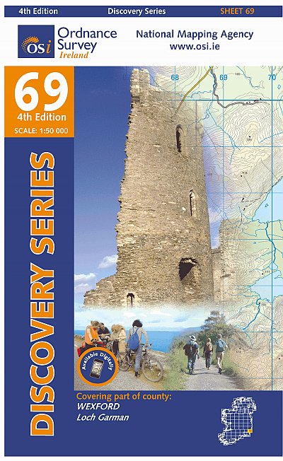
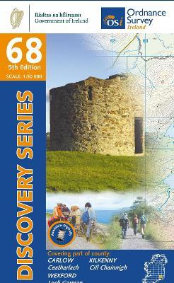
- Topografische kaart - Wandelkaart 69 Discovery Wexford | Ordnance Survey Ireland
- Map No. 69, Wexford Central in the Discovery series from the OSI, the Ordnance Survey of Ireland, which presents the country on detailed topographic maps at 1:50,000, with additional overprint highlighting campsites and caravan parks, youth hostels, etc. Current 4th edition of this map was published in January 2013.Maps in the Discovery series... Read more
- Also available from:
- Stanfords, United Kingdom

Stanfords
United Kingdom
United Kingdom
- Wexford OSI Discovery 69
- Map No. 69, Wexford Central in the Discovery series from the OSI, the Ordnance Survey of Ireland, which presents the country on detailed topographic maps at 1:50,000, with additional overprint highlighting campsites and caravan parks, youth hostels, etc. Current 4th edition of this map was published in January 2013.Maps in the Discovery series... Read more
De Zwerver
Netherlands
Netherlands
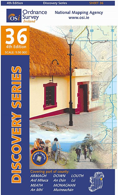
- Topografische kaart - Wandelkaart 36 Discovery Armagh, Down, Louth, Meath, Monaghan | Ordnance Survey Ireland
- Map No. 36, Louth in the Discovery series from the OSI, the Ordnance Survey of Ireland, which presents the country on detailed topographic maps at 1:50,000, with additional overprint highlighting campsites and caravan parks, youth hostels, etc. Current 4th edition of this title was published in February 2013.Maps in the Discovery series have... Read more
- Also available from:
- Stanfords, United Kingdom

Stanfords
United Kingdom
United Kingdom
- Armagh - Down - Louth - Meath - Monaghan OSI Discovery 36
- Map No. 36, Louth in the Discovery series from the OSI, the Ordnance Survey of Ireland, which presents the country on detailed topographic maps at 1:50,000, with additional overprint highlighting campsites and caravan parks, youth hostels, etc. Current 4th edition of this title was published in February 2013.Maps in the Discovery series have... Read more

De Zwerver
Netherlands
Netherlands
- Wandelkaart 5 Rila gebergte | Domino
- Rila Mountains at 1:50,000 on a large, double-sided, contoured map with GPS waypoints for shelters and chalets, peaks, etc. and highlighting hiking routes. Topography is shown by contours at 50m intervals with additional relief shading and graphics and colouring for scree, single rocks over 5m high, marshlands and pine scrub and forests. An... Read more
- Also available from:
- Stanfords, United Kingdom

Stanfords
United Kingdom
United Kingdom
- Rila Mountains Domino
- Rila Mountains at 1:50,000 on a large, double-sided, contoured map with GPS waypoints for shelters and chalets, peaks, etc. and highlighting hiking routes. Topography is shown by contours at 50m intervals with additional relief shading and graphics and colouring for scree, single rocks over 5m high, marshlands and pine scrub and forests. An... Read more

De Zwerver
Netherlands
Netherlands
- Wandelkaart Strandzha - Bulgarije | Domino
- Strandzha Mountains in the south-eastern corner of Bulgaria between Burgas to the Turkish border on a contoured and GPS compatible map from Domino showing local hiking trails and highlighting various interesting sites, with three more detailed enlargements at 1:25,000. Most place names are in both Latin and Cyrillic alphabet; map legend... Read more
- Also available from:
- Stanfords, United Kingdom

Stanfords
United Kingdom
United Kingdom
- Strandzha Mountains: Burgas to the Turkish Border Domino Map
- Strandzha Mountains in the south-eastern corner of Bulgaria between Burgas to the Turkish border on a contoured and GPS compatible map from Domino showing local hiking trails and highlighting various interesting sites, with three more detailed enlargements at 1:25,000. Most place names are in both Latin and Cyrillic alphabet; map legend... Read more

De Zwerver
Netherlands
Netherlands
- Wandelkaart 6 Pirin gebergte | Domino
- Pirin Mountains at 1:50,000 on a large, double-sided, contoured map with GPS waypoints for shelters and chalets, peaks, etc. and highlighting hiking routes. Topography is shown by contours at 40m intervals with additional relief shading and graphics and colouring for sandstone stacks, single rocks over 5m high, marshlands and different types of... Read more
- Also available from:
- Stanfords, United Kingdom

Stanfords
United Kingdom
United Kingdom
- Pirin Mountains Domino
- Pirin Mountains at 1:50,000 on a large, double-sided, contoured map with GPS waypoints for shelters and chalets, peaks, etc. and highlighting hiking routes. Topography is shown by contours at 40m intervals with additional relief shading and graphics and colouring for sandstone stacks, single rocks over 5m high, marshlands and different types of... Read more

De Zwerver
Netherlands
Netherlands
- Wandelkaart Sredna Gora - Bulgarije | Domino
- Pirin Mountains at 1:50,000 on a large, double-sided, contoured map with GPS waypoints for shelters and chalets, peaks, etc. and highlighting hiking routes. Topography is shown by contours at 40m intervals with additional relief shading and graphics and colouring for sandstone stacks, single rocks over 5m high, marshlands and different types of... Read more