
Rätikon
Beschrijving

The Rätikon mountains owe their beauty to the colors and forms of its mountains. One could easely compare them to the light and ragged Dolomites, more so than the nearby Verwall and Silvretta. The peaks are not that high, but difficult to reach. The highest summit, Schesaplana (2965 m) is definitely not recommended for the ordinary walker. On the other hand, there are no glaciers and permanent snow fields that, like in the Silvretta, form obstacles that makes venturing into them one step too far for many hikers.
The Rätikon spans three countries: Liechtenstein, Switzerland and Austria. Crossing from one country into the other is possible on many passes.
A good hiking option is the nine stages long Rätikon Höhenweg, that explores the entire massif. Another option is combining Rätikon and Silvretta in one long walk.
Kaart


Paden in deze regio
Links
Feiten
Verslagen
Gidsen en kaarten
Overnachting
Organisaties
Reisorganisaties
GPS
Anders
Boeken


Netherlands
2021
- Wandelgids Bodensee - Rätikon | Rother Bergverlag
- Uitstekende wandelgids met een groot aantal dagtochten in dal en hooggebergte. Met praktische informatie en beperkt kaartmateriaal! Wandelingen in verschillende zwaarte weergegeven in rood/blauw/zwart. Das Tourengebiet dieses Wanderführers reicht vom Bodensee fast bis zum Gletschereis der Schesaplana – es entspricht weitgehend der Vorarlberger... Read more
Netherlands
2014
- Klimgids - Klettersteiggids Rätikon | Rother Bergverlag
- Alle Routen für Wanderer und Bergsteiger Alpenvereinsführer. 10. Auflage. Read more

Netherlands
- Over the Top & Back Again
- Book of the Year Bronze Award 2010 (travel essays category), ForeWord Magazine After hiking some of the world's great trails, Brandon Wilson was excited to hear about the Via Alpina, paths running across eight countries on the backbone of the Alps. Besides promising immersion into Alpine life and wilderness, it was the ultimate adventure. It... Read more
- Also available from:
- Bol.com, Belgium
Belgium
- Over the Top & Back Again
- Book of the Year Bronze Award 2010 (travel essays category), ForeWord Magazine After hiking some of the world's great trails, Brandon Wilson was excited to hear about the Via Alpina, paths running across eight countries on the backbone of the Alps. Besides promising immersion into Alpine life and wilderness, it was the ultimate adventure. It... Read more
Netherlands
- WF5605 Montafon, Arlberg, Silvretta Kompass
- De Kompass wandelgids + kaart geeft een overzicht van alle wandelroutes in het gebied met nauwkeurige routeaanwijzingen en hoogteaanduidingen, De extra grote kaart, schaal 1:35 000, is ideaal om van te voren uw route uit te stippelen en om onderweg te gebruiken • naast de bekende bestemmingen, worden ook de minder bekende vermeld • openbaar... Read more
- Also available from:
- Bol.com, Belgium
Belgium
- WF5605 Montafon, Arlberg, Silvretta Kompass
- De Kompass wandelgids + kaart geeft een overzicht van alle wandelroutes in het gebied met nauwkeurige routeaanwijzingen en hoogteaanduidingen, De extra grote kaart, schaal 1:35 000, is ideaal om van te voren uw route uit te stippelen en om onderweg te gebruiken • naast de bekende bestemmingen, worden ook de minder bekende vermeld • openbaar... Read more

Netherlands
- Hiking in Switzerland
- This is the official guidebook to the Swiss section of the Via Alpina (National Route 1), published by the Swiss Hiking Federation. The Via Alpina is a network of five long-distance hiking routes which cross eight Alpine countries from Trieste to Monaco - over 5,000 kilometres of hiking trails in total. On Swiss soil, National Route 1 Via... Read more
- Also available from:
- Bol.com, Belgium
Belgium
- Hiking in Switzerland
- This is the official guidebook to the Swiss section of the Via Alpina (National Route 1), published by the Swiss Hiking Federation. The Via Alpina is a network of five long-distance hiking routes which cross eight Alpine countries from Trieste to Monaco - over 5,000 kilometres of hiking trails in total. On Swiss soil, National Route 1 Via... Read more

Netherlands
- Over the Top & Back Again
- Book of the Year Bronze Award 2010 (travel essays category), ForeWord Magazine After hiking some of the world's great trails, Brandon Wilson was excited to hear about the Via Alpina, paths running across eight countries on the backbone of the Alps. Besides promising immersion into Alpine life and wilderness, it was the ultimate adventure. It... Read more
- Also available from:
- Bol.com, Belgium
Belgium
- Over the Top & Back Again
- Book of the Year Bronze Award 2010 (travel essays category), ForeWord Magazine After hiking some of the world's great trails, Brandon Wilson was excited to hear about the Via Alpina, paths running across eight countries on the backbone of the Alps. Besides promising immersion into Alpine life and wilderness, it was the ultimate adventure. It... Read more

Netherlands
2014
- Walking in the Bavarian Alps
- Guidebook describing a both valley and mountain walks and treks in the Bavarian Alps. 85 walks are covered, including graded mountain routes, gentler valley walks, hut-to-hut routes and two multi-day tours, arranged by region with practical information on transport, accommodation and the like. Since the last edition of this guide many of the... Read more
- Also available from:
- Bol.com, Belgium
Belgium
2014
- Walking in the Bavarian Alps
- Guidebook describing a both valley and mountain walks and treks in the Bavarian Alps. 85 walks are covered, including graded mountain routes, gentler valley walks, hut-to-hut routes and two multi-day tours, arranged by region with practical information on transport, accommodation and the like. Since the last edition of this guide many of the... Read more

Netherlands
2019
- WF5966 Julische Alpen mit Karte Kompass
- De Kompass wandelgids + kaart geeft een overzicht van alle wandelroutes in het gebied met nauwkeurige routeaanwijzingen en hoogteaanduidingen, De extra grote kaart, schaal 1:35 000, is ideaal om van te voren uw route uit te stippelen en om onderweg te gebruiken; naast de bekende bestemmingen, worden ook de minder bekende vermeld; openbaar... Read more
- Also available from:
- Bol.com, Belgium
Belgium
2019
- WF5966 Julische Alpen mit Karte Kompass
- De Kompass wandelgids + kaart geeft een overzicht van alle wandelroutes in het gebied met nauwkeurige routeaanwijzingen en hoogteaanduidingen, De extra grote kaart, schaal 1:35 000, is ideaal om van te voren uw route uit te stippelen en om onderweg te gebruiken; naast de bekende bestemmingen, worden ook de minder bekende vermeld; openbaar... Read more
Netherlands
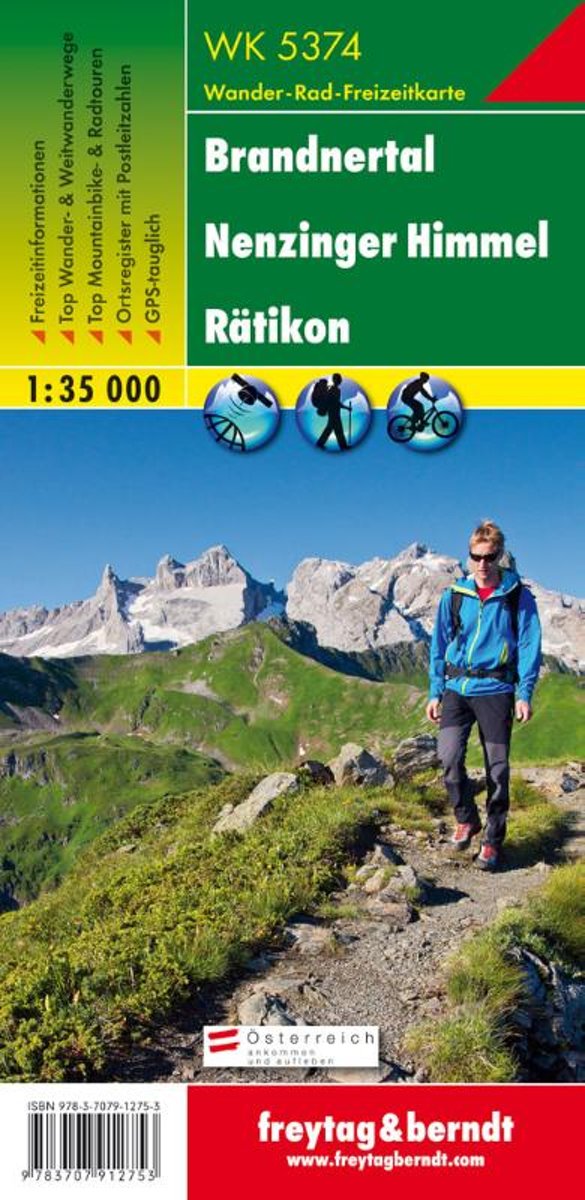
- Brandnertal • Nenzinger Himmel • Rätikon
- Wandel- en fietskaart • schaal 1:35,000 • activiteitengids • plaatsnamenregister met postcodes • wandel- en fietspaden • mountainbikeroutes • ski- en langlaufroutes • GPS-punten • UTM Read more
- Also available from:
- Bol.com, Belgium
Belgium
- Brandnertal • Nenzinger Himmel • Rätikon
- Wandel- en fietskaart • schaal 1:35,000 • activiteitengids • plaatsnamenregister met postcodes • wandel- en fietspaden • mountainbikeroutes • ski- en langlaufroutes • GPS-punten • UTM Read more
Netherlands
2016
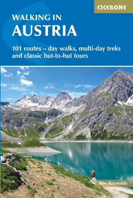
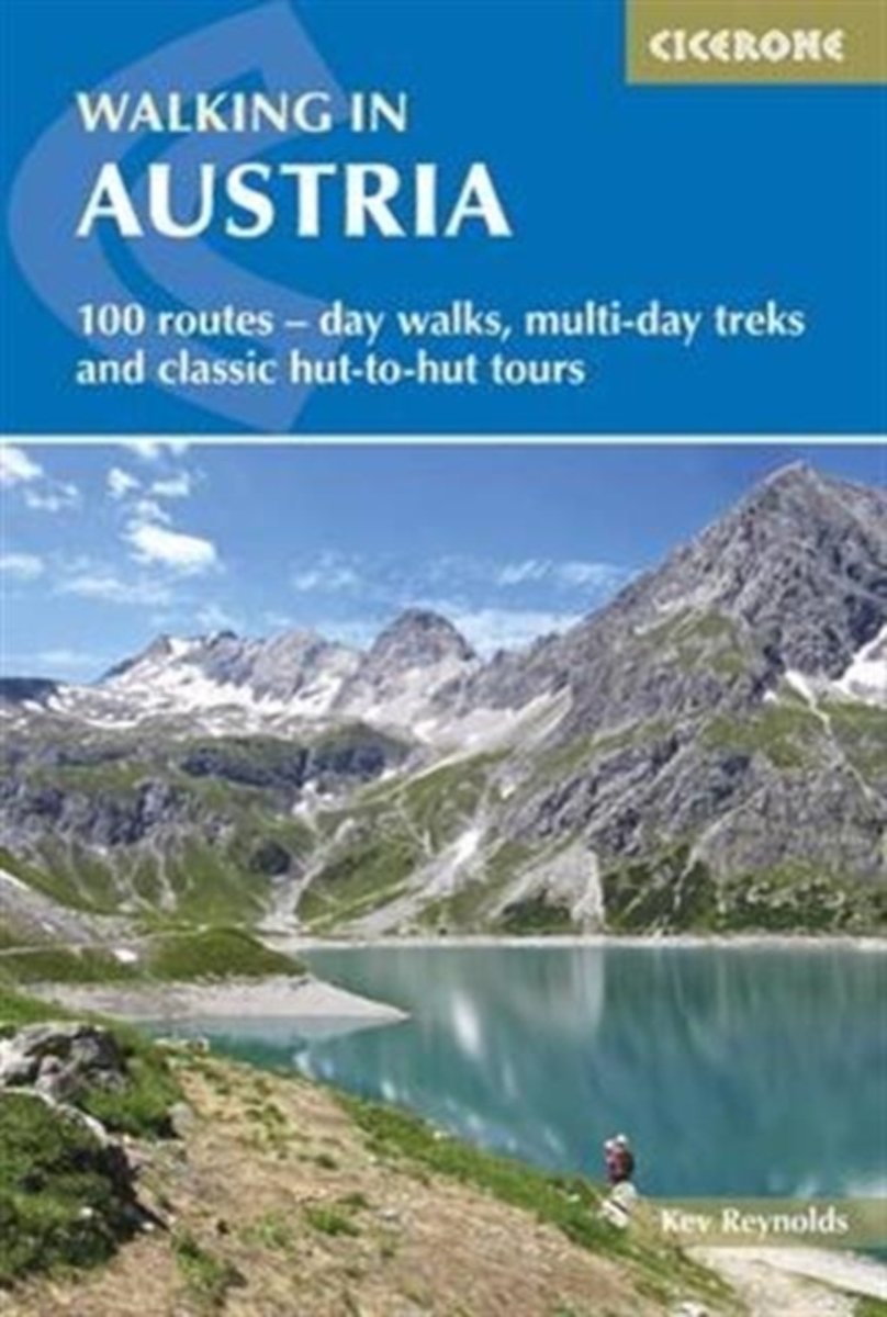
- Wandelgids Oostenrijk - Walking in Austria | Cicerone
- A comprehensive guidebook to walking routes in Austria. 101 routes, day walks, multi-day treks and classic hut-to-hut tours in the Ratikon, Silvretta, Stubai, and Zillertal Alps, the Hohe Tauern, and the Karawanken. With information on transport, accommodation, gear and safety, plus full details of over a hundred Austrian mountain huts. Read more
- Also available from:
- Bol.com, Netherlands
- Bol.com, Belgium
- Stanfords, United Kingdom
- The Book Depository, United Kingdom
Netherlands
2016
- Walking in Austria
- A comprehensive guidebook detailing walking routes in Austria. The 101 walks reflect the diversity of this popular region and cover Austria's magnificent Alps - including the Ratikon, Silvretta, Stubai and Zillertal - as well as the Dachsteingebirge, Hohe Tauern and the Karawanken. Graded according to difficulty and ranging from short walks of... Read more
Belgium
2016
- Walking in Austria
- A comprehensive guidebook detailing walking routes in Austria. The 101 walks reflect the diversity of this popular region and cover Austria's magnificent Alps - including the Ratikon, Silvretta, Stubai and Zillertal - as well as the Dachsteingebirge, Hohe Tauern and the Karawanken. Graded according to difficulty and ranging from short walks of... Read more

United Kingdom
2016
- Walking in Austria: 101 Routes - Day Walks, Multi-Day Treks and Classic Hut-to-Hut Tours
- A comprehensive guidebook detailing walking routes in Austria. The 101 walks reflect the diversity of this popular region and cover Austria`s magnificent Alps - including the Ratikon, Silvretta, Stubai and Zillertal - as well as the Dachsteingebirge, Hohe Tauern and the Karawanken. Graded according to difficulty and ranging from short walks of... Read more

United Kingdom
2016
- Walking in Austria
- 101 routes - day walks, multi-day treks and classic hut-to-hut tours Read more

Netherlands
2017
- The Swiss alpine pass route - Via Alpina route 1
- This guidebook presents the stunning Alpine Pass Route, now fully waymarked as Via Alpina 1. The 360km trail traverses Switzerland from east to west, from Sargans near the Liechtenstein border to Montreux on Lac Léman (Lake Geneva). Crossing sixteen Alpine passes, it showcases some of the country's most breathtaking mountain landscapes,... Read more
- Also available from:
- Bol.com, Belgium
- Stanfords, United Kingdom
Belgium
2017
- The Swiss alpine pass route - Via Alpina route 1
- This guidebook presents the stunning Alpine Pass Route, now fully waymarked as Via Alpina 1. The 360km trail traverses Switzerland from east to west, from Sargans near the Liechtenstein border to Montreux on Lac Léman (Lake Geneva). Crossing sixteen Alpine passes, it showcases some of the country's most breathtaking mountain landscapes,... Read more

United Kingdom
2017
- The Swiss Alpine Pass Route - via Alpina Route 1: Trekking East to West Across Switzerland
- This guidebook presents the stunning Alpine Pass Route, now fully waymarked as Via Alpina 1. The 360km trail traverses Switzerland from east to west, from Sargans near the Liechtenstein border to Montreux on Lac Leman (Lake Geneva). Crossing sixteen Alpine passes, it showcases some of the country`s most breathtaking mountain landscapes,... Read more
Kaarten

Netherlands
- Wandelkaart 02 Valli di lanzo e Moncenisio | IGC - Istituto Geografico Centrale
- Lanzo and Moncenisio Valleys, map no. 2, in a series contoured hiking maps at 1:50,000 with local trails, long-distance footpaths, mountain accommodation, etc. from the Turin based Istituto Geografico Centrale covering the Italian Alps and Piedmont, the lakes and northern Lombardy, and the Italian Riviera.The maps have contours at 50m... Read more
- Also available from:
- Stanfords, United Kingdom

United Kingdom
- Lanzo and Moncenisio Valleys IGC 2
- Lanzo and Moncenisio Valleys in a series contoured hiking maps at 1:50,000 with local trails, long-distance footpaths, mountain accommodation, etc. from the Turin based Istituto Geografico Centrale. This title also includes an overprint showing cycle routes.Maps in this series have contours at 50m intervals, enhanced by shading and graphic... Read more

Netherlands
- Wandelkaart 16 Genova, Genua, Varazze, Ovada | IGC - Istituto Geografico Centrale
- Genoa - Varazze - Ovada, map no. 16, in a series contoured hiking maps at 1:50,000 with local trails, long-distance footpaths, mountain accommodation, etc. from the Turin based Istituto Geografico Centrale covering the Italian Alps and Piedmont, the lakes and northern Lombardy, and the Italian Riviera.The maps have contours at 50m intervals,... Read more
- Also available from:
- Stanfords, United Kingdom

United Kingdom
- Genoa - Varazze - Ovada 50K IGC Map No. 16
- The coast of the Italian Riviera and its hinterland around Genoa in a series contoured hiking maps at 1:50,000 with local trails, long-distance footpaths, mountain accommodation, etc. from the Turin based Istituto Geografico Centrale.Maps in this series have contours at 50m intervals, enhanced by shading and graphic relief. An overprint... Read more

Netherlands
- Wandelkaart 01 Valli di Susa, chisone e germanasca | IGC - Istituto Geografico Centrale
- IGC heeft een serie gedetailleerde wandelkaarten voor het Italiaanse gedeelte van de Alpen (Piemonte). Voldoende gedetailleerd voor het volgen van het lokale wandelnetwerk. Voorzien van schaduwreliëf; hoogtelijnen en referentiehoogtes. Onderscheid in soort wandelpad ( bergpad, bergpad met hindernissen,gletsjerovergang). Ook zijn de... Read more
- Also available from:
- Stanfords, United Kingdom

United Kingdom
- Susa, Chisone & Germanasca Valleys: Sestiere - Sauze d`Oulx - Bardonecia 50K IGC Map No. 1
- Susa, Chisone and Germanasca Valleys, with coverage including Sestiere, Sauze d`Oulx and Bardonecia, in a series of contoured hiking maps at 1:50,000 with local trails, long-distance footpaths, mountain accommodation, etc. from the Turin based Istituto Geografico Centrale.Maps in this series have contours at 50m intervals, enhanced by shading... Read more

Netherlands
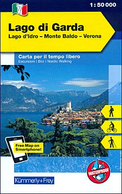
- Wandelkaart - Fietskaart 07 Outdoorkarte IT Gardasee - Gardameer | Kümmerly & Frey
- Lake Garda - Lake d'Idro - Monte Baldo - Verona area at 1:50,000 in a series of waterproof and tear-resistant, GPS compatible and contoured recreational maps from K Read more
- Also available from:
- Stanfords, United Kingdom
United Kingdom
- Lake Garda - Lake Idro - Monte Baldo - Verona K+F Outdoor Map 7
- Lake Garda - Lake d`Idro - Monte Baldo - Verona area at 1:50,000 in a series of waterproof and tear-resistant, GPS compatible and contoured recreational maps from Kümmerly + Frey with both local and long-distance hiking and cycling trails, ski routes, sites for other outdoor pursuits, accommodation, bus stops, etc. An inset provides a small... Read more

Netherlands
- Wandelkaart 03 Il parco nazionale del Gran Paradiso | IGC - Istituto Geografico Centrale
- Gran Paradiso National Park in a series contoured hiking maps at 1:50,000 with local trails, long-distance footpaths, mountain accommodation, etc, from the Turin based Istituto Geografico Centrale. This new edition published in late 2013 highlights, among other routes, the GTA (Grande Traversata delle Alpi), Via Alpina and Alta Via 2. Coverage... Read more
- Also available from:
- Stanfords, United Kingdom

United Kingdom
- Gran Paradiso National Park IGC 3
- Gran Paradiso National Park in a series contoured hiking maps at 1:50,000 with local trails, long-distance footpaths, mountain accommodation, etc, from the Turin based Istituto Geografico Centrale. The map highlights, among other routes, the GTA (Grande Traversata delle Alpi), Via Alpina and Alta Via 2. Coverage extends from Aosta at the top of... Read more

Netherlands
- Wandelkaart 17 Torino, Pinerolo e Bassa val di Susa | IGC - Istituto Geografico Centrale
- Turin - Pinerolo - Lower Susa Valley, map no. 17, in a series contoured hiking maps at 1:50,000 with local trails, long-distance footpaths, mountain accommodation, etc. from the Turin based Istituto Geografico Centrale covering the Italian Alps and Piedmont, the lakes and northern Lombardy, and the Italian Riviera.The maps have contours at 50m... Read more
- Also available from:
- Stanfords, United Kingdom

United Kingdom
- Turin - Pinerolo - Lower Susa Valley 50K IGC Map No. 17
- Turin - Pinerolo - Lower Susa Valley area of Piedmont in a series contoured hiking maps at 1:50,000 with local trails, long-distance footpaths, mountain accommodation, etc. from the Turin based Istituto Geografico Centrale.Maps in this series have contours at 50m intervals, enhanced by shading and graphic relief. An overprint highlights local... Read more

Netherlands
- Wandelkaart 04 Massiccio del Monte Bianco | IGC - Istituto Geografico Centrale
- The Mont Blanc Massif in a series contoured hiking maps at 1:50,000 with local trails, long-distance footpaths, mountain accommodation, etc, from the Turin based Istituto Geografico Centrale. This new edition published in late 2013 highlights, among other routes, the Alta Via 1 and the northern section of the Alta Via 2, both of which join up... Read more
- Also available from:
- Stanfords, United Kingdom

United Kingdom
- Mont Blanc Massif IGC 4
- The Mont Blanc Massif in a series contoured hiking maps at 1:50,000 with local trails, long-distance footpaths, mountain accommodation, etc, from the Turin based Istituto Geografico Centrale. The map highlights, among other routes, the Alta Via 1 and the northern section of the Alta Via 2, both of which join up with TMB, as well as the local... Read more

Netherlands
- Wandelkaart 20 Il Monferrato da Asti a Casale Monferrato | IGC - Istituto Geografico Centrale
- Il Monferrato, map no. 20, in a series contoured hiking maps at 1:50,000 with local trails, long-distance footpaths, mountain accommodation, etc. from the Turin based Istituto Geografico Centrale covering the Italian Alps and Piedmont, the lakes and northern Lombardy, and the Italian Riviera.The maps have contours at 50m intervals, enhanced by... Read more
- Also available from:
- Stanfords, United Kingdom

United Kingdom
- Il Monferrato: Asti - Casale Monferrato 50K IGC Map No. 20
- The Monferrato region of Piedmont east of Turin, between Asti and Casale Monferrato, in a series contoured hiking maps at 1:50,000 with local trails, long-distance footpaths, mountain accommodation, etc. from the Turin based Istituto Geografico Centrale. This title also shows local cycle routes.Maps in this series have contours at 50m... Read more

Netherlands
- Wandelkaart 19 Asti, Alba, Acqui terme | IGC - Istituto Geografico Centrale
- Asti - Alba - Acqui Terme area in a series contoured hiking maps at 1:50,000 with local trails, long-distance footpaths, mountain accommodation, etc. from the Turin based Istituto Geografico Centrale.Maps in this series have contours at 50m intervals, enhanced by shading and graphic relief. An overprint highlights local footpaths and... Read more
- Also available from:
- Stanfords, United Kingdom

United Kingdom
- Asti - Alba - Acqui Terme IGC 19
- Asti - Alba - Acqui Terme area in a series contoured hiking maps at 1:50,000 with local trails, long-distance footpaths, mountain accommodation, etc. from the Turin based Istituto Geografico Centrale.Maps in this series have contours at 50m intervals, enhanced by shading and graphic relief. An overprint highlights local footpaths and... Read more

Netherlands
- Wandelkaart 05 Cervino Matterhorn e Monte Rosa | IGC - Istituto Geografico Centrale
- Matterhorn/M.Cervino and Monte Rosa, map no. 5, in a series contoured hiking maps at 1:50,000 with local trails, long-distance footpaths, mountain accommodation, etc. from the Turin based Istituto Geografico Centrale covering the Italian Alps and Piedmont, the lakes and northern Lombardy, and the Italian Riviera.The maps have contours at 50m... Read more
- Also available from:
- Stanfords, United Kingdom

United Kingdom
- Matterhorn / M. Cervino - Monte Rosa IGC 5
- The Italian side of the Matterhorn and Monte Rosa, with coverage extending from Zermatt to Aosta, in a series contoured hiking maps at 1:50,000 with local trails, long-distance footpaths, mountain accommodation, etc. from the Turin based Istituto Geografico Centrale. Maps in this series have contours at 50m intervals, enhanced by shading and... Read more

Netherlands
- Wandelkaart 21 Il Canavese da Ivrea a Chivasso | IGC - Istituto Geografico Centrale
- Il Canavese: Ivrea to Chiavasso, map no. 21, in a series contoured hiking maps at 1:50,000 with local trails, long-distance footpaths, mountain accommodation, etc. from the Turin based Istituto Geografico Centrale covering the Italian Alps and Piedmont, the lakes and northern Lombardy, and the Italian Riviera.The maps have contours at 50m... Read more
- Also available from:
- Stanfords, United Kingdom

United Kingdom
- Il Canavese: Ivrea to Chiavasso 50K IGC Map No. 21
- Il Canavesea area including Ivrea and Chiavasso in a series contoured hiking maps at 1:50,000 with local trails, long-distance footpaths, mountain accommodation, etc. from the Turin based Istituto Geografico Centrale. This title also shows cycle routes.Maps in this series have contours at 50m intervals, enhanced by shading and graphic relief.... Read more

- Also available from:
- Stanfords, United Kingdom

United Kingdom
- Langhe Meridionali IGC 18
- The southern part of the Langhe region of Piedmont, famous for its wines, cheeses, and truffles, in a series contoured hiking maps at 1:50,000 with local trails, long-distance footpaths, mountain accommodation, etc. from the Turin based Istituto Geografico Centrale.Maps in this series have contours at 50m intervals, enhanced by shading and... Read more

Netherlands
- Wandelkaart 07 Valli Maira, grana e stura | IGC - Istituto Geografico Centrale
- Maira, Grana and Stura Valleys, map no. 7, in a series contoured hiking maps at 1:50,000 with local trails, long-distance footpaths, mountain accommodation, etc. from the Turin based Istituto Geografico Centrale covering the Italian Alps and Piedmont, the lakes and northern Lombardy, and the Italian Riviera.The maps have contours at 50m... Read more
- Also available from:
- Stanfords, United Kingdom

United Kingdom
- Maira, Grana and Stura Valleys IGC 7
- Maira, Grana and Stura Valleys in a series contoured hiking maps at 1:50,000 with local trails, long-distance footpaths, mountain accommodation, etc. from the Turin based Istituto Geografico Centrale.Maps in this series have contours at 50m intervals, enhanced by shading and graphic relief. An overprint highlights local footpaths and... Read more

Netherlands
- Wandelkaart 15 Finale Ligure Alassio Savona | IGC - Istituto Geografico Centrale
- The coast of the Italian Riviera around Albenga, Alassio and Savona in a series contoured hiking maps at 1:50,000 with local trails, long-distance footpaths, mountain accommodation, etc. from the Turin based Istituto Geografico Centrale.Maps in this series have contours at 50m intervals, enhanced by shading and graphic relief. An overprint... Read more
- Also available from:
- Stanfords, United Kingdom

United Kingdom
- Finale Ligure - Alassio - Savona IGC 15
- The coast of the Italian Riviera around Albenga, Alassio and Savona in a series contoured hiking maps at 1:50,000 with local trails, long-distance footpaths, mountain accommodation, etc. from the Turin based Istituto Geografico Centrale.Maps in this series have contours at 50m intervals, enhanced by shading and graphic relief. An overprint... Read more

Netherlands
- Wandelkaart 09 Ivrea, Biella e Bassa Valle d'Aosta | IGC - Istituto Geografico Centrale
- Ivrea - Biela - Lower Aosta Valley, map no. 9, in a series contoured hiking maps at 1:50,000 with local trails, long-distance footpaths, mountain accommodation, etc. from the Turin based Istituto Geografico Centrale covering the Italian Alps and Piedmont, the lakes and northern Lombardy, and the Italian Riviera.The maps have contours at 50m... Read more
- Also available from:
- Stanfords, United Kingdom

United Kingdom
- Ivrea - Biela - Lower Aosta Valley 50K IGC Map No. 9
- Ivrea - Biela - Lower Aosta Valley area in a series contoured hiking maps at 1:50,000 with local trails, long-distance footpaths, mountain accommodation, etc. from the Turin based Istituto Geografico Centrale. Maps in this series have contours at 50m intervals, enhanced by shading and graphic relief. An overprint highlights local footpaths and... Read more