
Pilatus
Beschrijving
- Hoogte 2128.00 m
Links
Feiten
Verslagen
Gidsen en kaarten
Overnachting
Organisaties
Reisorganisaties
GPS
Anders
Boeken

Stanfords
United Kingdom
United Kingdom
- Lucerne - Pilatus - Rigi Swisstopo 2510
- Map No. 2510, Lucerne - Pilatus – Rigi, STANDARD EDITION, in the topographic survey of Switzerland at 1:25,000 from Swisstopo, covering the mountains surrounding the northern and the central part of Lake Lucerne. Swiss topographic survey at 1:25,000 covers the whole country on 247 small format sheets, with special larger maps published for... Read more
Kaarten
De Zwerver
Netherlands
Netherlands
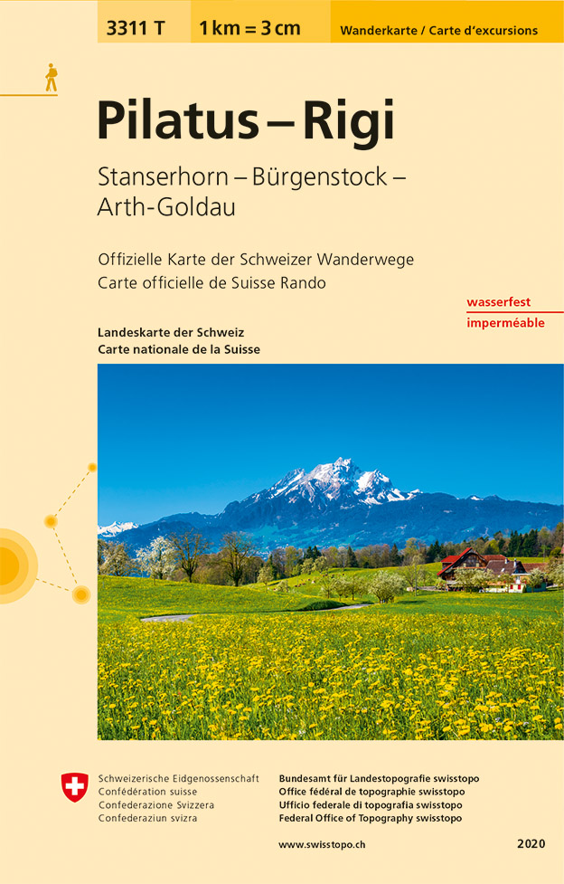
- Wandelkaart - Topografische kaart 3311T Pilatus-Rigi | Swisstopo
- Een nieuwe serie van de Zwitserse topografische dienst: eindelijk goede wandelkaarten met ingetekende wandelroutes op scheur- en watervast papier. Vooralsnog zijn ze uitgebracht van de populaire wandelgebieden en niet landelijk dekkend (zie overzicht) Op een gedetailleerde schaal van 1:33.333 met als ondergrond de onovertroffen topografische... Read more
- Also available from:
- Stanfords, United Kingdom

Stanfords
United Kingdom
United Kingdom
- Pilatus - Rigi - Stanserhorn - Burgenstock - Arth-Goldau Swisstopo Hiking 3311T
- Pilatus - Rigi area at 1:33,333 on light, waterproof and tear-resistant map No. 3311T published by Swisstopo in cooperation with the Swiss Hiking Federation. Cartography is the same as in Swisstopo’s 50K hiking maps, simply enlarged to 1:33,333 for extra clarity but without additional information. The map covers the central and southern part of... Read more
De Zwerver
Netherlands
Netherlands
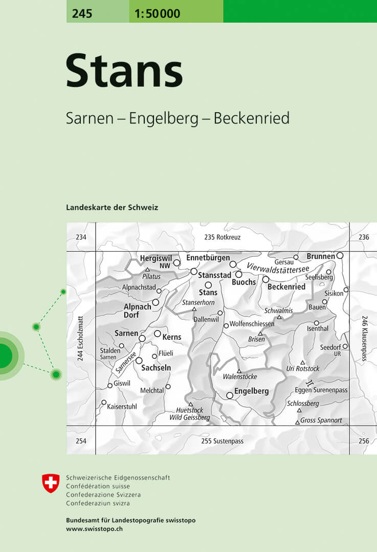
- Wandelkaart - Topografische kaart 245 Stans | Swisstopo
- Stans, map No. 245, in the standard topographic survey of Switzerland at 1:50,000 from Swisstopo, i.e. without the special overprint highlighting walking trails, local bus stops, etc, presented in Swisstopo Read more
- Also available from:
- Stanfords, United Kingdom

Stanfords
United Kingdom
United Kingdom
- Stans Swisstopo 245
- Stans, map No. 245, in the standard topographic survey of Switzerland at 1:50,000 from Swisstopo, i.e. without the special overprint highlighting walking trails, local bus stops, etc, presented in Swisstopo’s hiking editions of the 50K survey. Coverage includes the southern part of Lake Lucerne, Pilatus and the Engelberg area.Highly regarded... Read more
De Zwerver
Netherlands
Netherlands
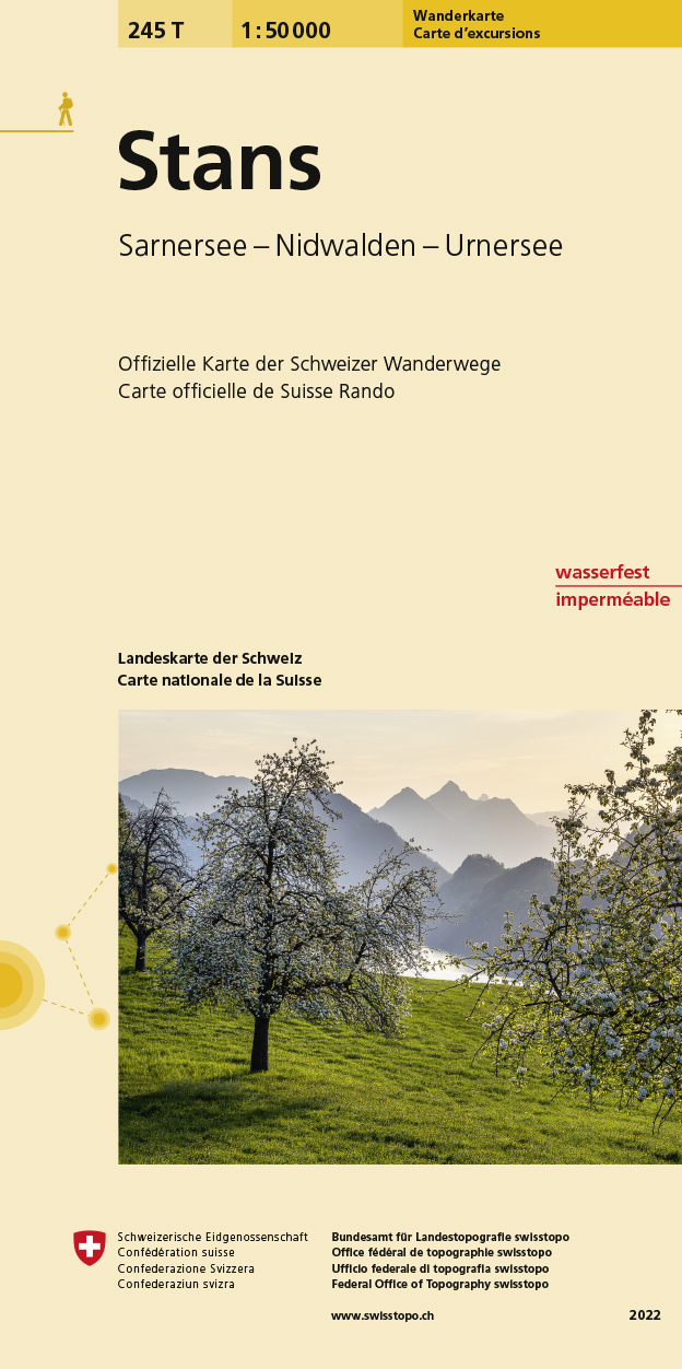
- Wandelkaart 245T Stans | Swisstopo
- Stans area, map No. 245T, at 1:50,000 in a special hiking edition of the country Read more
- Also available from:
- Stanfords, United Kingdom

Stanfords
United Kingdom
United Kingdom
- Stans Swisstopo Hiking 245T
- Stans area, map No. 245T, at 1:50,000 in a special hiking edition of the country’s topographic survey, published by Swisstopo in cooperation with the Swiss Hiking Federation. Coverage includes the southern part of Lake Lucerne, Pilatus and the Engelberg area.Cartography, identical to the standard version of the survey, is highly regarded for... Read more
De Zwerver
Netherlands
Netherlands
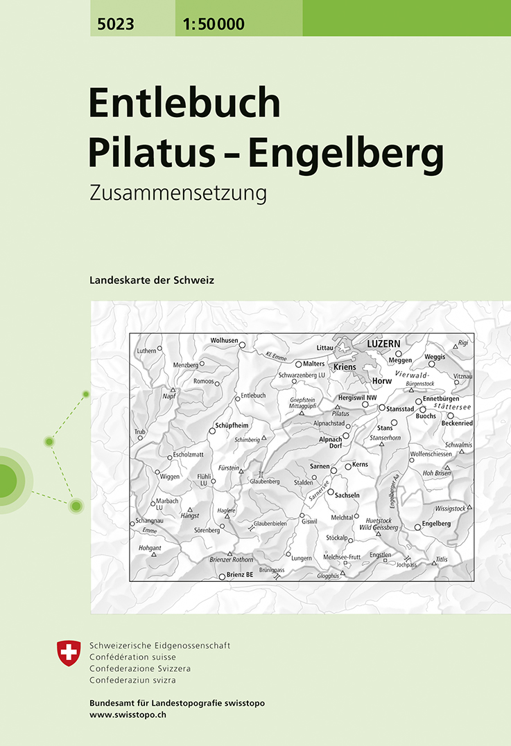
- Wandelkaart - Topografische kaart 5023 Entlebuch - Pilatus-Engelberg | Swisstopo
- Entlebuch - Pilatus - Engelberg area, map No. 5023, in the standard topographic survey of Switzerland at 1:50,000 from Swisstopo, i.e. without the special overprint highlighting walking trails, local bus stops, etc, presented in Swisstopo Read more
- Also available from:
- Stanfords, United Kingdom

Stanfords
United Kingdom
United Kingdom
- Entlebuch - Pilatus - Engelberg Swisstopo 5023
- Entlebuch - Pilatus - Engelberg area, map No. 5023, in the standard topographic survey of Switzerland at 1:50,000 from Swisstopo, i.e. without the special overprint highlighting walking trails, local bus stops, etc, presented in Swisstopo’s hiking editions of the 50K survey. Highly regarded for their superb use of graphic relief and hill... Read more

Stanfords
United Kingdom
United Kingdom
- Pilatus - Hasliberg Mountain Bike Map: Luzern - Engelberg - Meiringen
- Pilatus - Hasliberg Mountain Bike Map, covering the Luzern - Engelberg - Meiringen area, at 1:50,000 in a series of waterproof and tear-resistant, contoured mountain biking maps from Hallwag, each highlighting several circuits and providing route profiles, guidance on the difficulty and overall experience, etc. Each map in this series is... Read more

Stanfords
United Kingdom
United Kingdom
- Lake Luzern - Luzern - Rigi - Pilatus
- Lake Luzern - Luzern - Rigi - Pilatus area of central Switzerland, including the southern part of Lake Zug, presented at 1:50,000 on a waterproof and tear-resistant, contoured and GPS compatible map from the Hallwag/Kümmerly + Frey group, with route profiles, grading for the severity of the terrain and the degree of fitness required, etc.The... Read more

The Book Depository
United Kingdom
United Kingdom
- Vierwaldstattersee / Pilatus / Rigi / Mythen
- These laminated hiking maps at a scale of 1:40 000 are the ideal basis for planning a hiking tour.The precise cartography shows hiking trails including classification. Information on accommodation and restaurants, bus routes with stops, mountain railways, regional parks, sights and much more are included on the map.Thanks to the quality of the... Read more