
Yosemite National Park
Beschrijving
Paden in deze regio
Links
Feiten
Verslagen
Gidsen en kaarten
Overnachting
Organisaties
Reisorganisaties
GPS
Anders
Boeken

De Zwerver
Netherlands
Netherlands
- Reisverhaal Six Months With Three Pairs Of Undies | André De Jel, Lian De Jel
- The Pacific Crest Trail Read more
De Zwerver
Netherlands
2024
Netherlands
2024

De Zwerver
Netherlands
2018
Netherlands
2018
De Zwerver
Netherlands
2020
Netherlands
2020
Bol.com
Netherlands
Netherlands
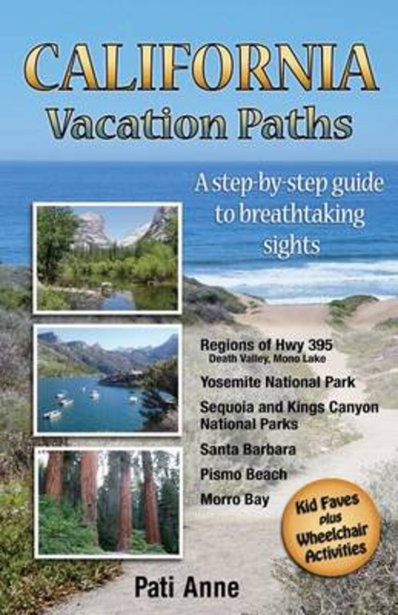
- California Vacation Paths
- Take the path less traveled Everyone is invited to walk a different road with this unique California travel guide. One main path leads visitors through six areas of California which hold some of the world's most breathtaking sights. No planning is needed; just follow this travel guide to activities that are laid out in successive order. Take... Read more
- Also available from:
- Bol.com, Belgium
Bol.com
Belgium
Belgium
- California Vacation Paths
- Take the path less traveled Everyone is invited to walk a different road with this unique California travel guide. One main path leads visitors through six areas of California which hold some of the world's most breathtaking sights. No planning is needed; just follow this travel guide to activities that are laid out in successive order. Take... Read more
Bol.com
Netherlands
Netherlands
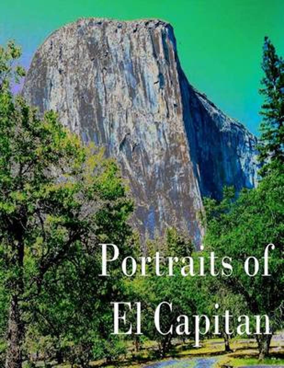
- Portraits of El Capitan
- El Capitan is a granite rock formation that rises 3000 feet (900 meters) above the floor of Yosemite Valley. Most serious mountain climbers want to climb it at least once. Here are pairs of photographic portraits in natural color and solarized color. The peak is seen from many angles, different times of day, and during different seasons. Read more
- Also available from:
- Bol.com, Belgium
Bol.com
Belgium
Belgium
- Portraits of El Capitan
- El Capitan is a granite rock formation that rises 3000 feet (900 meters) above the floor of Yosemite Valley. Most serious mountain climbers want to climb it at least once. Here are pairs of photographic portraits in natural color and solarized color. The peak is seen from many angles, different times of day, and during different seasons. Read more
Bol.com
Netherlands
Netherlands
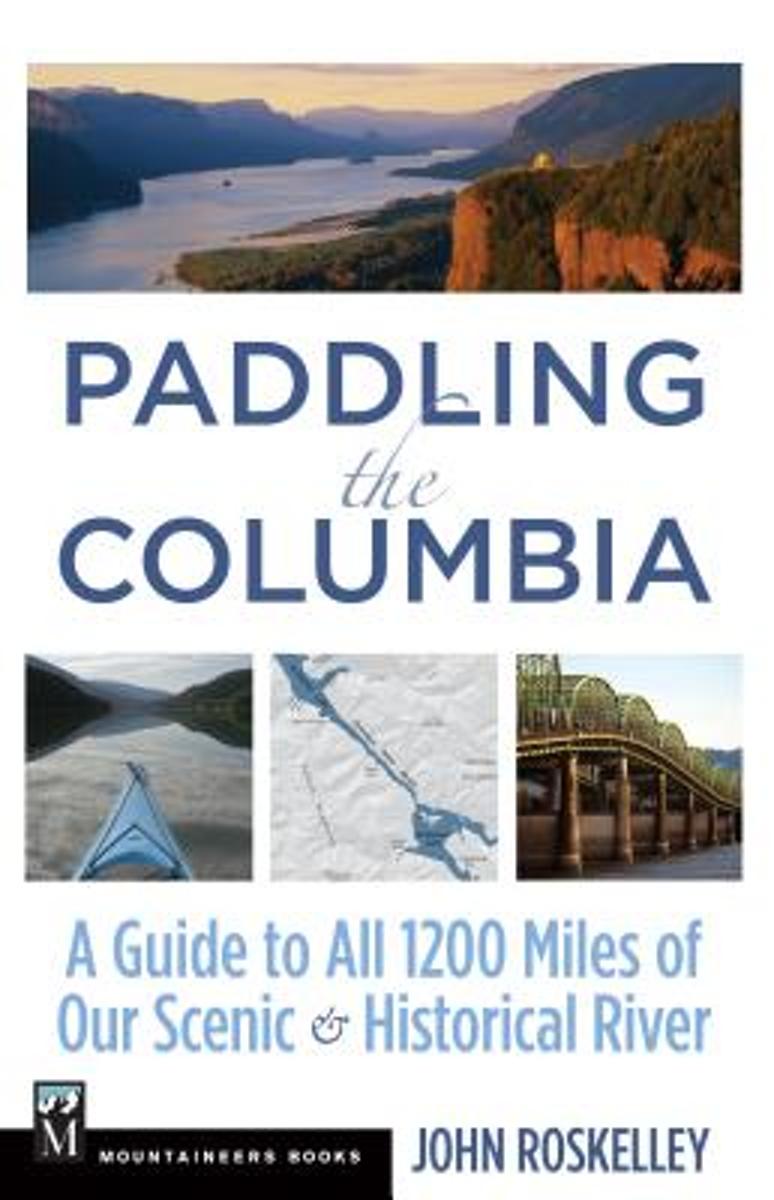
- Paddling the Columbia
- Follow in the wake literally of Lewis and Clark! A planner for all 1200 miles of the river whether in one continuous trip or in sectionsPaddling the Columbia begins at the river's headwaters on Columbia Lake in British Columbia and provides comprehensive information for traveling its full 1245 miles to the Pacific. The guidebook enables... Read more
- Also available from:
- Bol.com, Belgium
Bol.com
Belgium
Belgium
- Paddling the Columbia
- Follow in the wake literally of Lewis and Clark! A planner for all 1200 miles of the river whether in one continuous trip or in sectionsPaddling the Columbia begins at the river's headwaters on Columbia Lake in British Columbia and provides comprehensive information for traveling its full 1245 miles to the Pacific. The guidebook enables... Read more

Bol.com
Netherlands
Netherlands
- Walking Home
- "Walking Home" is one hiker's experience on the Pacific Crest Trail. Starting at the Mexican border with her best friend Syd, Jamie documents her thoughts in daily journal entries. Nature is felt through every page of this book. Read more
- Also available from:
- Bol.com, Belgium
Bol.com
Belgium
Belgium
- Walking Home
- "Walking Home" is one hiker's experience on the Pacific Crest Trail. Starting at the Mexican border with her best friend Syd, Jamie documents her thoughts in daily journal entries. Nature is felt through every page of this book. Read more
Bol.com
Netherlands
Netherlands
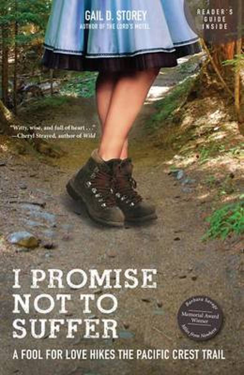
- I Promise Not to Suffer
- With comfortable urban lives in Houston, Texas, and career and life goals mostly accomplished, Gail D. Storey and her husband were in their fifties when they decided it was time to test themselves on a new path a 2,663-mile path known as the Pacific Crest Trail, which stretches from Mexico to Canada. "I Promise Not to Suffer" is Gail's... Read more
- Also available from:
- Bol.com, Belgium
Bol.com
Belgium
Belgium
- I Promise Not to Suffer
- With comfortable urban lives in Houston, Texas, and career and life goals mostly accomplished, Gail D. Storey and her husband were in their fifties when they decided it was time to test themselves on a new path a 2,663-mile path known as the Pacific Crest Trail, which stretches from Mexico to Canada. "I Promise Not to Suffer" is Gail's... Read more

Bol.com
Netherlands
Netherlands
- Of Moose and Men
- After landing the perfect job, Wellman drives to Maine where she spends five months living off grid, teaching Leave No Trace and confronting both men and moose in hilarious, behind the scene stories of what being a Ridgerunner on the Appalachian Trail really means. Known to the hiking community by her trail name 'Brawny', she has thru hiked the... Read more
- Also available from:
- Bol.com, Belgium
Bol.com
Belgium
Belgium
- Of Moose and Men
- After landing the perfect job, Wellman drives to Maine where she spends five months living off grid, teaching Leave No Trace and confronting both men and moose in hilarious, behind the scene stories of what being a Ridgerunner on the Appalachian Trail really means. Known to the hiking community by her trail name 'Brawny', she has thru hiked the... Read more
Bol.com
Netherlands
Netherlands
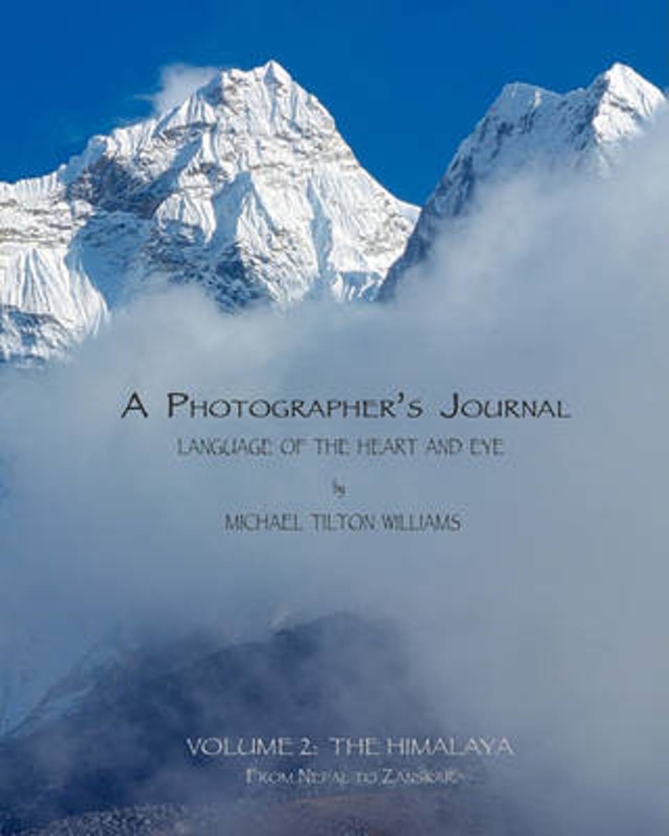
- A Photographer's Journal
- This book is powered by sweat and joy; steep hills and exhilarating telemark skiing descents into silent stands of snowy trees. The land and its smells and tastes are embedded in the memory of those lucky enough to have immersed themselves in it. My goal is to transport you: to the soft meadows, the smooth, hard granite, and the dancing trees... Read more
- Also available from:
- Bol.com, Belgium
Bol.com
Belgium
Belgium
- A Photographer's Journal
- This book is powered by sweat and joy; steep hills and exhilarating telemark skiing descents into silent stands of snowy trees. The land and its smells and tastes are embedded in the memory of those lucky enough to have immersed themselves in it. My goal is to transport you: to the soft meadows, the smooth, hard granite, and the dancing trees... Read more
Bol.com
Netherlands
Netherlands
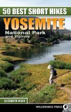
- 50 Best Short Hikes
- 50 Best Short Hikes: Yosemite National Park and Vicinity leads hikers of all skill levels to some of the most stunning landscapes Yosemite has to offer including: bubbling alpine creeks, smooth glaciated slabs, giant sequoias, deep dark blue lakes, and rock as far as the eye can see. In addition to in-depth hike descriptions, the author has... Read more
- Also available from:
- Bol.com, Belgium
Bol.com
Belgium
Belgium
- 50 Best Short Hikes
- 50 Best Short Hikes: Yosemite National Park and Vicinity leads hikers of all skill levels to some of the most stunning landscapes Yosemite has to offer including: bubbling alpine creeks, smooth glaciated slabs, giant sequoias, deep dark blue lakes, and rock as far as the eye can see. In addition to in-depth hike descriptions, the author has... Read more
Bol.com
Netherlands
Netherlands
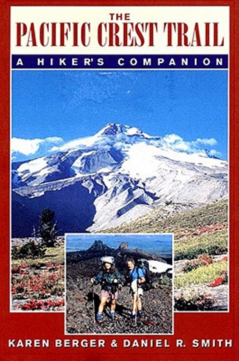
- The Pacific Crest Trail
- For many people, the Pacific Crest is the ultimate long-distance hiking trail. Beginning in the dry valleys of southern California, it follows the crest of the snow-capped Sierras, and ends in the ancient forests of Washington's Cascades. This is a guide to hiking the Pacific Crest. For each section of the trail, the authors describe the route... Read more
- Also available from:
- Bol.com, Belgium
Bol.com
Belgium
Belgium
- The Pacific Crest Trail
- For many people, the Pacific Crest is the ultimate long-distance hiking trail. Beginning in the dry valleys of southern California, it follows the crest of the snow-capped Sierras, and ends in the ancient forests of Washington's Cascades. This is a guide to hiking the Pacific Crest. For each section of the trail, the authors describe the route... Read more
Bol.com
Netherlands
Netherlands
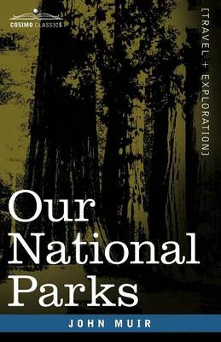
- Our National Parks
- A key founder of the modern conservation movement, John Muir was a champion of the preservation of the unspoiled wilderness and of the careful guardianship of the environment. This 1901 work, a collection of essays first published in the Atlantic Monthly, is Muir's valentine to the national parks of the American West. He introduces us to: . the... Read more
- Also available from:
- Bol.com, Belgium
Bol.com
Belgium
Belgium
- Our National Parks
- A key founder of the modern conservation movement, John Muir was a champion of the preservation of the unspoiled wilderness and of the careful guardianship of the environment. This 1901 work, a collection of essays first published in the Atlantic Monthly, is Muir's valentine to the national parks of the American West. He introduces us to: . the... Read more
Bol.com
Netherlands
2016
Netherlands
2016
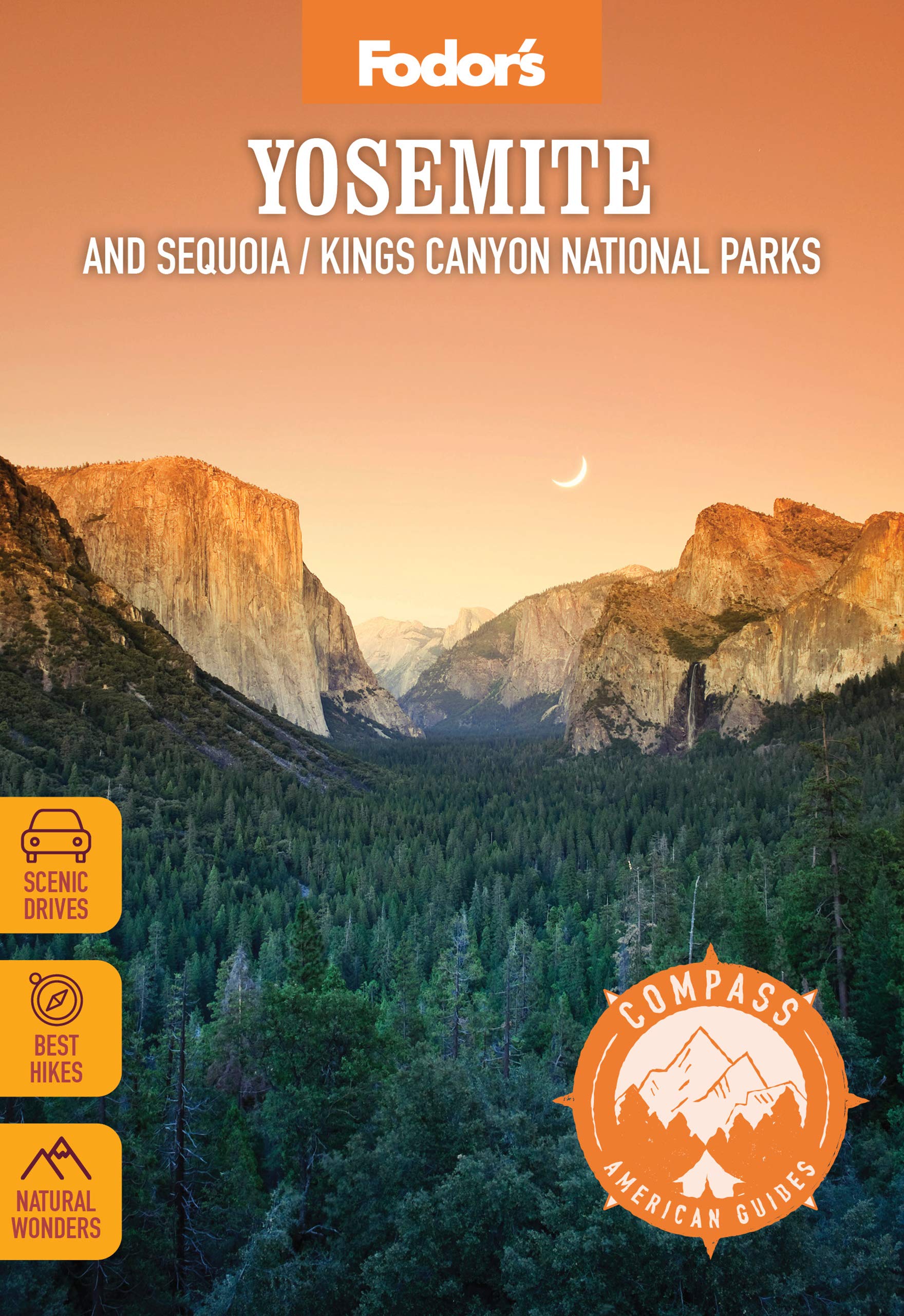
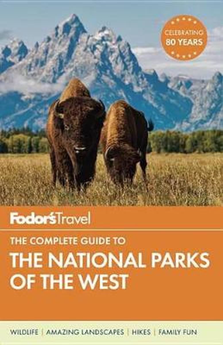
- Fodor's The Complete Guide To The National Parks Of The West
- Majestic mountains, towering redwoods, and river-carved canyons---a visit to the national parks of the West is a rite of passage. This full-color guide is the planning tool for a perfect parks trip. It includes 38 of the nation's best-loved parks, among them the Grand Canyon, Yosemite, Yellowstone, and Rocky Mountain. Read more
- Also available from:
- Bol.com, Belgium
Bol.com
Belgium
2016
Belgium
2016
- Fodor's The Complete Guide To The National Parks Of The West
- Majestic mountains, towering redwoods, and river-carved canyons---a visit to the national parks of the West is a rite of passage. This full-color guide is the planning tool for a perfect parks trip. It includes 38 of the nation's best-loved parks, among them the Grand Canyon, Yosemite, Yellowstone, and Rocky Mountain. Read more
Kaarten
De Zwerver
Netherlands
Netherlands
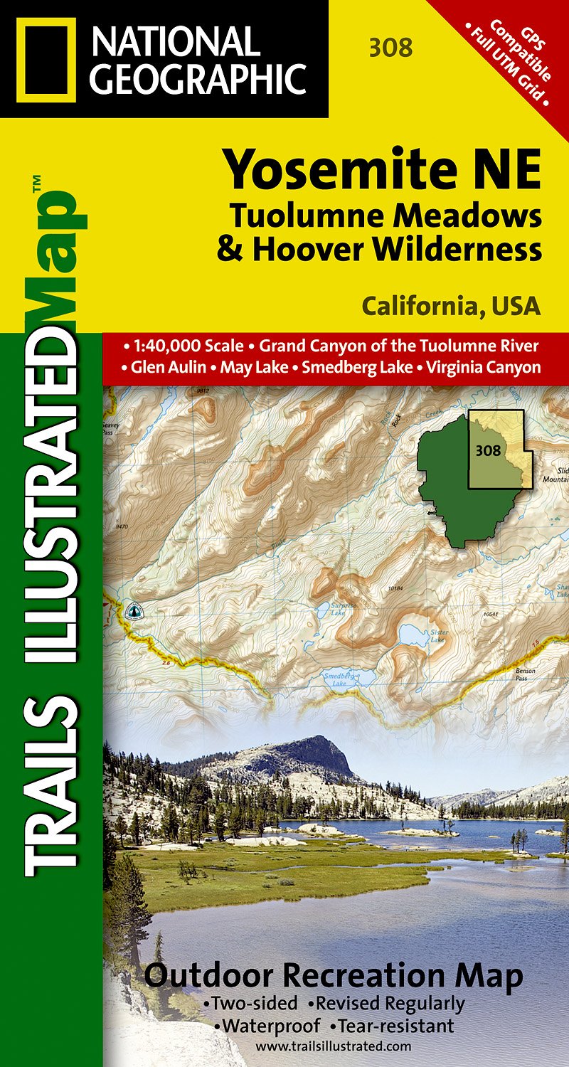
- Wandelkaart - Topografische kaart 308 Yosemite NE - Tuolumne Meadows and Hoover Wilderness | National Geographic
- Prachtige geplastificeerde kaart van het nationaal park. Met alle recreatieve voorzieningen als campsites, maar ook met topografische details en wandelroutes ed. Door uitgekiend kleurgebruik zeer prettig in gebruik. Scheur en watervast! Coverage of the Tuolomne Meadows and Hoover Wilderness area of Yosemite National Park includes Ansel Adams... Read more
- Also available from:
- Stanfords, United Kingdom

Stanfords
United Kingdom
United Kingdom
- Yosemite NE - Tuolumne Meadows & Hoover Wilderness CA
- Map No. 308, Yosemite NE: Tuolumne Meadows and Hoover Wilderness, CA, in an extensive series of GPS compatible, contoured hiking maps of USA’s national and state parks or forests and other popular recreational areas. Cartography based on the national topographic survey, with additional tourist information.The maps, with most titles now printed... Read more
De Zwerver
Netherlands
2019
Netherlands
2019
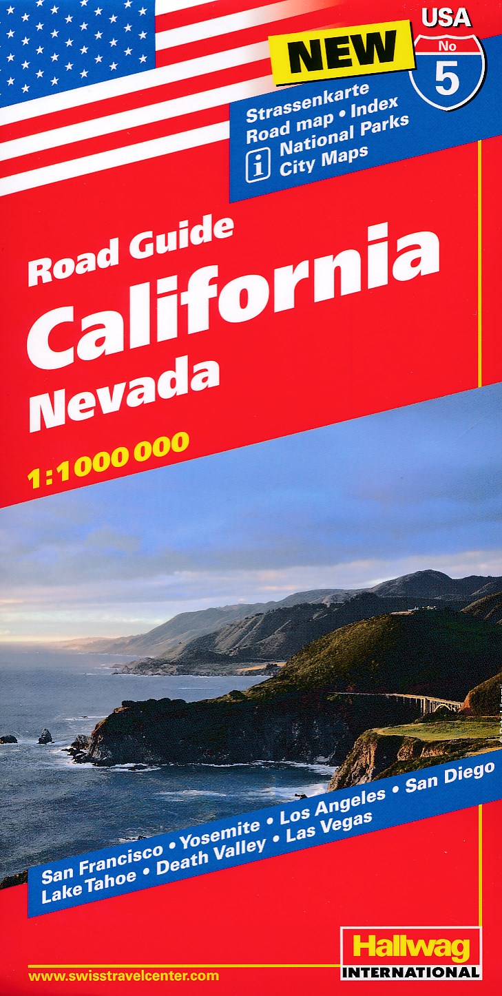
- Wegenkaart - landkaart 05 Californië, California - Nevada | Hallwag
- Hallwag USA Road Guide 05. California 1 : 1 000 000 ab 11.95 EURO Nevada. Straßenkarte. Road map. Index. National Parks. City Maps: San Francisco, Yosemite, Los Angeles, San Diego, Lake Tahoe, Death Valley, Las Vegas Hallwag USA Road Guide. Neuauflage, Laufzeit bis 2022 Read more
De Zwerver
Netherlands
Netherlands
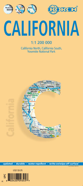
- Wegenkaart - landkaart Californië - California | Borch
- California ( Kalifornien) 1 : 1 200 000 ab 9.9 EURO California North, California South, Yosemite National Park Borch Map. 12. Auflage Read more
De Zwerver
Netherlands
2019
Netherlands
2019

Bol.com
Netherlands
Netherlands
- Mount Whitney
- Waterproof Tear-Resistant Topographic MapMount Whitney is universally famous as the highest mountain in the United State outside of Alaska, as well as the highest point in California. National Geographic's Trails Illustrated map of Mount Whitney is a two-sided, waterproof map designed to meet the needs of Whitney visitors with unmatched... Read more
- Also available from:
- Bol.com, Belgium
- Stanfords, United Kingdom
Bol.com
Belgium
Belgium
- Mount Whitney
- Waterproof Tear-Resistant Topographic MapMount Whitney is universally famous as the highest mountain in the United State outside of Alaska, as well as the highest point in California. National Geographic's Trails Illustrated map of Mount Whitney is a two-sided, waterproof map designed to meet the needs of Whitney visitors with unmatched... Read more

Stanfords
United Kingdom
United Kingdom
- Mount Whitney CA NGS Trails Illustrated Map 322
- Map No. 322, Mount Whitney in California at 1:40,000, in an extensive series of GPS compatible, contoured hiking maps of USA’s national and state parks or forests and other popular recreational areas. Cartography is based on the national topographic survey, with additional tourist information.The maps, with most titles now printed on light,... Read more

De Zwerver
Netherlands
Netherlands
- Wandelkaart - Topografische kaart 205 Sequoia - Kings Canyon National Parks | National Geographic
- Prachtige geplastificeerde kaart van het nationaal park. Met alle recreatieve voorzieningen als campsites, maar ook met topografische details en wandelroutes ed. Door uitgekiend kleurgebruik zeer prettig in gebruik. Scheur en watervast! Trails Illustrated maps are the most trusted and popular recreation maps available. Continually setting the... Read more
- Also available from:
- Bol.com, Netherlands
- Bol.com, Belgium
- Stanfords, United Kingdom
- The Book Depository, United Kingdom

Bol.com
Netherlands
Netherlands
- Sequoia/kings Canyon National Park
- Waterproof Tear-Resistant Topographic MapIn Sequioa and Kings Canyon National Parks you can walk among the world's largest trees, hike the alpine landscape of the Sierra Crest, and marvel at the towering granite cliffs of one of the deepest canyons in the United States. National Geographic's Trails Illustrated map of Sequoia and Kings... Read more
Bol.com
Belgium
Belgium
- Sequoia/kings Canyon National Park
- Waterproof Tear-Resistant Topographic MapIn Sequioa and Kings Canyon National Parks you can walk among the world's largest trees, hike the alpine landscape of the Sierra Crest, and marvel at the towering granite cliffs of one of the deepest canyons in the United States. National Geographic's Trails Illustrated map of Sequoia and Kings... Read more

Stanfords
United Kingdom
United Kingdom
- Sequoia - Kings Canyon National Parks CA NGS Trails Illustrated Map 205
- Map No. 205, Sequoia/Kings Canyon National Park, CA, in an extensive series of GPS compatible, contoured hiking maps of USA’s national and state parks or forests and other popular recreational areas. Cartography based on the national topographic survey, with additional tourist information.The maps, with most titles now printed on light,... Read more

The Book Depository
United Kingdom
United Kingdom
- Sequoia/kings Canyon National Park
- Trails Illustrated National Parks Read more

De Zwerver
Netherlands
Netherlands
- Wandelkaart - Topografische kaart 809 Mammoth Lakes - Mono Divide - Inyo and Sierra National Forests | National Geographic
- Prachtige geplastificeerde kaart van het bekende nationaal park. Met alle recreatieve voorzieningen als campsites, maar ook met topografische details en wandelroutes ed. Door uitgekiend kleurgebruik zeer prettig in gebruik. Scheur en watervast! Trails Illustrated Mammoth Lakes / Mono Divide is the first of five exciting new maps for the... Read more
- Also available from:
- Bol.com, Netherlands
- Bol.com, Belgium
- Stanfords, United Kingdom

Bol.com
Netherlands
Netherlands
- Mammoth Lakes/mono Divide
- Waterproof Tear-Resistant Topographic MapTrails Illustrated Mammoth Lakes / Mono Divide is the first of five exciting new maps for the California Sierra Nevadas that will combine to form seamless coverage of the high-use National Forest areas between Sequoia / Kings Canyon National Parks and Lake Tahoe. This region contains some of the... Read more
Bol.com
Belgium
Belgium
- Mammoth Lakes/mono Divide
- Waterproof Tear-Resistant Topographic MapTrails Illustrated Mammoth Lakes / Mono Divide is the first of five exciting new maps for the California Sierra Nevadas that will combine to form seamless coverage of the high-use National Forest areas between Sequoia / Kings Canyon National Parks and Lake Tahoe. This region contains some of the... Read more

Stanfords
United Kingdom
United Kingdom
- Mammoth Lakes - Mono Divide CA
- Map No. 809, Mammoth Lakes / Mono Divide, CA, in an extensive series of GPS compatible, contoured hiking maps of USA’s national and state parks or forests and other popular recreational areas. Cartography based on the national topographic survey, with additional tourist information.The maps, with most titles now printed on light, waterproof and... Read more

Bol.com
Netherlands
Netherlands
- Carson-iceberg/emigrant/mokleumne Wilderness Areas
- Waterproof Tear-Resistant Topographic MapPart of our exciting new coverage for California's Sierra Nevada, our Carson-Iceberg, Emigrant and Mokelumne Wilderness Trails Illustrated map details the high use recreation areas of Stanislaus and Humboldt-Toiyabe National Forests from Yosemite National Park north to Caples Lake and Markleeville.... Read more
- Also available from:
- Bol.com, Belgium
- Stanfords, United Kingdom
Bol.com
Belgium
Belgium
- Carson-iceberg/emigrant/mokleumne Wilderness Areas
- Waterproof Tear-Resistant Topographic MapPart of our exciting new coverage for California's Sierra Nevada, our Carson-Iceberg, Emigrant and Mokelumne Wilderness Trails Illustrated map details the high use recreation areas of Stanislaus and Humboldt-Toiyabe National Forests from Yosemite National Park north to Caples Lake and Markleeville.... Read more

Stanfords
United Kingdom
United Kingdom
- Carson-Iceberg - Emigrant and Mokleumne Wilderness Areas CA
- Map No. 807, Carson-Iceberg / Emigrant / Mokleumne Wilderness Areas, CA, in an extensive series of GPS compatible, contoured hiking maps of USA’s national and state parks or forests and other popular recreational areas. Cartography based on the national topographic survey, with additional tourist information.The maps, with most titles now... Read more
De Zwerver
Netherlands
Netherlands
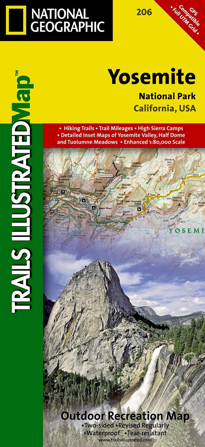
- Wandelkaart - Topografische kaart 206 Yosemite National Park | National Geographic
- Prachtige geplastificeerde kaart van het bekende nationaal park. Met alle recreatieve voorzieningen als campsites, maar ook met topografische details en wandelroutes ed. Door uitgekiend kleurgebruik zeer prettig in gebruik. Scheur en watervast! Coverage includes Stanislaus National Forest, Emigrant Wilderness, Carson Iceberg Wilderness, Toiyabe... Read more
- Also available from:
- Bol.com, Netherlands
- Bol.com, Belgium
- Stanfords, United Kingdom
- The Book Depository, United Kingdom
Bol.com
Netherlands
Netherlands
- Yosemite National Park
- Waterproof Tear-Resistant Topographic MapExplore the majesty of Yosemite National Park with National Geographic's Trails Illustrated map. Loaded with helpful information on camping, hiking, lodging, transportation, regulations, and safety, this map is an invaluable tool for casual park visitors and avid adventurers alike. Expertly... Read more
Bol.com
Belgium
Belgium
- Yosemite National Park
- Waterproof Tear-Resistant Topographic MapExplore the majesty of Yosemite National Park with National Geographic's Trails Illustrated map. Loaded with helpful information on camping, hiking, lodging, transportation, regulations, and safety, this map is an invaluable tool for casual park visitors and avid adventurers alike. Expertly... Read more

Stanfords
United Kingdom
United Kingdom
- Yosemite National Park CA NGS Trails Illustrated Map 206
- Map No. 206, Yosemite National Park, CA, in an extensive series of GPS compatible, contoured hiking maps of USA’s national and state parks or forests and other popular recreational areas. Cartography based on the national topographic survey, with additional tourist information.The maps, with most titles now printed on light, waterproof and... Read more


Bol.com
Netherlands
Netherlands
- Goat Rocks & Norse Peak Wilderness Area, Gifford-pinchot & Okanogan-wenatchee National Forests
- Waterproof Tear-Resistant Topographic MapGifford-Pinchot and Okanogan-Wenatchee National Forests Washington, USAOne of five new Trails Illustrated maps for the Washington Cascades region offers the most detailed and up-to-date map for the forest, carefully researched and developed in co-operation with local land managers and agencies.... Read more
- Also available from:
- Bol.com, Belgium
- Stanfords, United Kingdom
Bol.com
Belgium
Belgium
- Goat Rocks & Norse Peak Wilderness Area, Gifford-pinchot & Okanogan-wenatchee National Forests
- Waterproof Tear-Resistant Topographic MapGifford-Pinchot and Okanogan-Wenatchee National Forests Washington, USAOne of five new Trails Illustrated maps for the Washington Cascades region offers the most detailed and up-to-date map for the forest, carefully researched and developed in co-operation with local land managers and agencies.... Read more

Stanfords
United Kingdom
United Kingdom
- Goat Rocks - Norse Peak William O. Douglas Wilderness Area WA
- Map No. 823, Goat Rocks and Norse Peak Wilderness Area - Gifford-Pinchot and Okanogan-Wenatchee National Forests, WA, in an extensive series of GPS compatible, contoured hiking maps of USA’s national and state parks or forests and other popular recreational areas. Cartography based on the national topographic survey, with additional tourist... Read more

Bol.com
Netherlands
Netherlands
- Alpine Lakes Wilderness Area, Mount Baker-snoqualmie & Okanogan-wenatchee National Forests
- Waterproof Tear-Resistant Topographic MapMount Baker-Snoqualmie and Okanogan-Wenatchee National Forests Washington, USAOne of five new Trails Illustrated maps for the Washington Cascades region offering the most detailed and up-to-date map for the forest, carefully researched and developed in co-operation with local land managers and... Read more
- Also available from:
- Bol.com, Belgium
- Stanfords, United Kingdom
Bol.com
Belgium
Belgium
- Alpine Lakes Wilderness Area, Mount Baker-snoqualmie & Okanogan-wenatchee National Forests
- Waterproof Tear-Resistant Topographic MapMount Baker-Snoqualmie and Okanogan-Wenatchee National Forests Washington, USAOne of five new Trails Illustrated maps for the Washington Cascades region offering the most detailed and up-to-date map for the forest, carefully researched and developed in co-operation with local land managers and... Read more

Stanfords
United Kingdom
United Kingdom
- Alpine Lakes Wilderness - Mt Baker-Snoqualmie and Okanogan-Wenatchee National Forests WA
- Map No. 825, Alpine Lakes Wilderness Area - Mount Baker-Snoqualmie Wilderness Areas and Okanogan-Wenatchee National Forests, WA, in an extensive series of GPS compatible, contoured hiking maps of USA’s national and state parks or forests and other popular recreational areas. Cartography based on the national topographic survey, with additional... Read more
De Zwerver
Netherlands
Netherlands
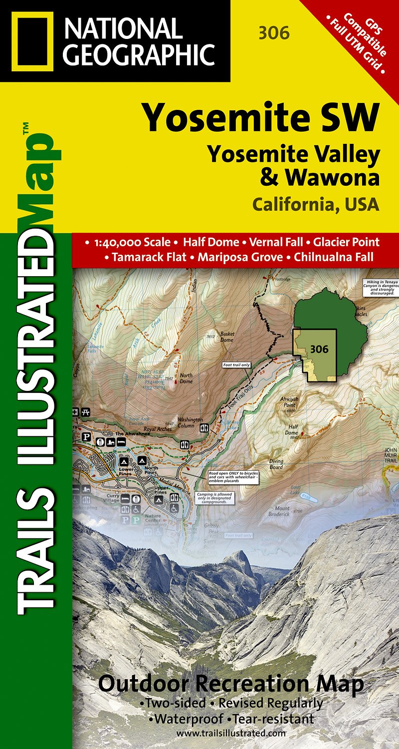
- Wandelkaart - Topografische kaart 306 Yosemite SW - Yosemite Valley & Wawona | National Geographic
- Prachtige geplastificeerde kaart van het nationaal park. Met alle recreatieve voorzieningen als campsites, maar ook met topografische details en wandelroutes ed. Door uitgekiend kleurgebruik zeer prettig in gebruik. Scheur en watervast! Coverage of the Yosemite Valley and Wawona area of Yosemite National Park includes Sierra National Forest,... Read more
- Also available from:
- Stanfords, United Kingdom
- The Book Depository, United Kingdom

Stanfords
United Kingdom
United Kingdom
- Yosemite SW - Yosemite Valley and Wawona CA NGS Trails Illustrated Mpa 306
- Map No. 306, Yosemite SW: Yosemite Valley and Wawona, CA, in an extensive series of GPS compatible, contoured hiking maps of USA’s national and state parks or forests and other popular recreational areas. Cartography based on the national topographic survey, with additional tourist information.The maps, with most titles now printed on light,... Read more

The Book Depository
United Kingdom
United Kingdom
- Yosemite Sw, Yosemite Valley & Wawona
- Trails Illustrated National Parks Read more
De Zwerver
Netherlands
Netherlands
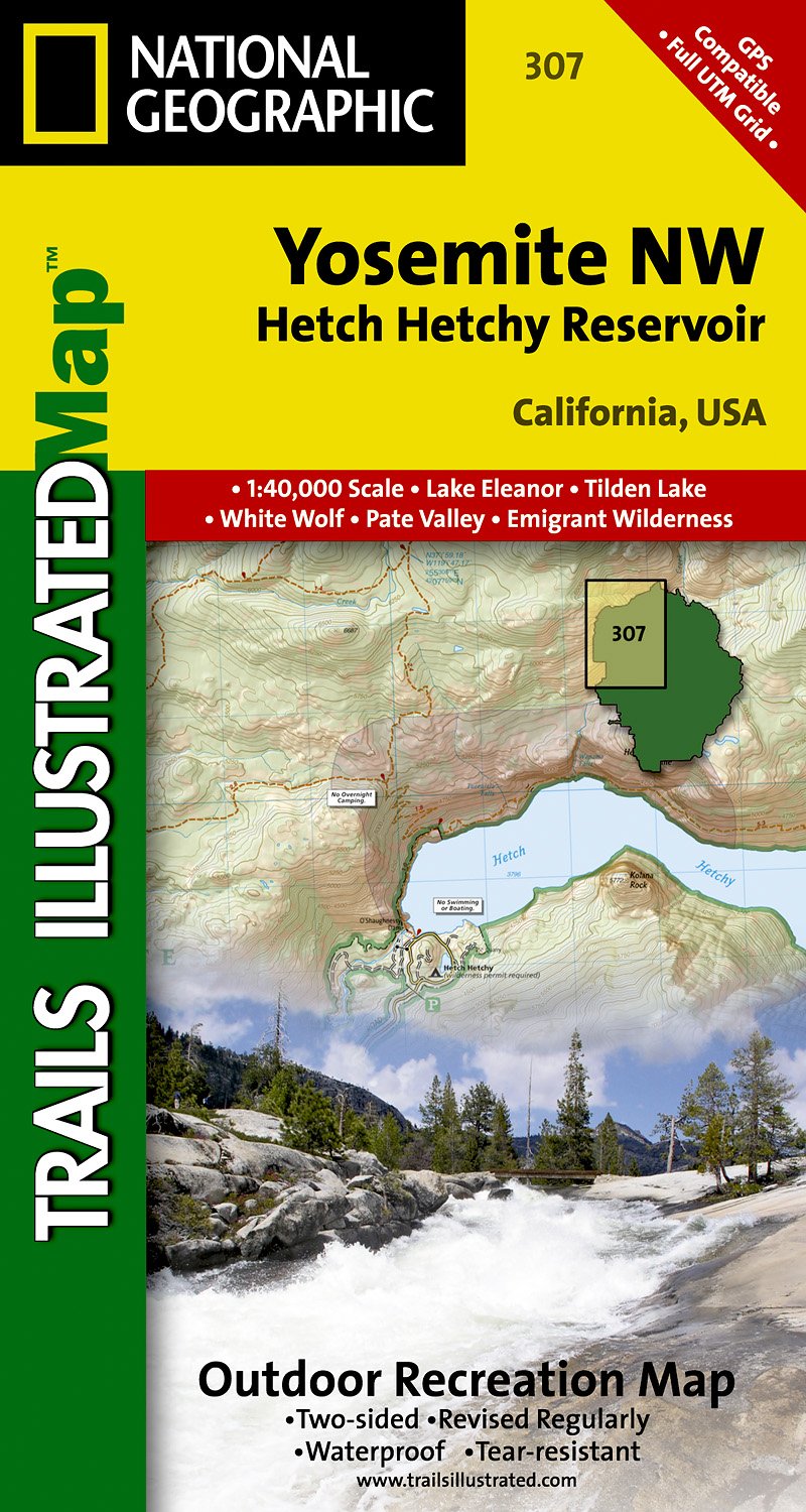
- Wandelkaart - Topografische kaart 307 Yosemite NW - Hetch Hetchy Reservoir | National Geographic
- Prachtige geplastificeerde kaart van het nationaal park. Met alle recreatieve voorzieningen als campsites, maar ook met topografische details en wandelroutes ed. Door uitgekiend kleurgebruik zeer prettig in gebruik. Scheur en watervast! Coverage of the Yosemite Valley and Wawona area of Yosemite National Park includes Sierra National Forest,... Read more
- Also available from:
- Stanfords, United Kingdom
- The Book Depository, United Kingdom

Stanfords
United Kingdom
United Kingdom
- Yosemite NW - Hetch Hetchy Reservoir CA
- Map No. 307, Yosemite NW: Hetch Hetchy Reservoir, CA, in an extensive series of GPS compatible, contoured hiking maps of USA’s national and state parks or forests and other popular recreational areas. Cartography based on the national topographic survey, with additional tourist information.The maps, with most titles now printed on light,... Read more

The Book Depository
United Kingdom
United Kingdom
- Yosemite Nw, Hetch Hetchy Reservoir
- Trails Illustrated National Parks Read more
De Zwerver
Netherlands
Netherlands
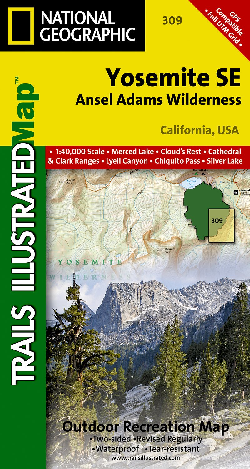
- Wandelkaart 309 Yosemite SE - Ansel Adams Wilderness | National Geographic
- Prachtige geplastificeerde kaart van het nationaal park. Met alle recreatieve voorzieningen als campsites, maar ook met topografische details en wandelroutes ed. Door uitgekiend kleurgebruik zeer prettig in gebruik. Scheur en watervast! Coverage of the Tuolomne Meadows and Hoover Wilderness area of Yosemite National Park includes Ansel Adams... Read more
- Also available from:
- Stanfords, United Kingdom
- The Book Depository, United Kingdom

Stanfords
United Kingdom
United Kingdom
- Yosemite SE - Ansel Adams Wilderness CA
- Map No. 309, Yosemite SE: Ansel Adams Wilderness, CA, in an extensive series of GPS compatible, contoured hiking maps of USA’s national and state parks or forests and other popular recreational areas. Cartography based on the national topographic survey, with additional tourist information.The maps, with most titles now printed on light,... Read more

The Book Depository
United Kingdom
United Kingdom
- Yosemite Se, Ansel Adams Wilderness
- Trails Illustrated National Parks Read more