
Tennessee
Beschrijving
In Tennessee, the Appalachian Trail reaches its highest point: the Clingmans Dome at 6643 feet (2025 m).
Most important trails are the Benton MacKaye Trail (288 miles in the Appalachians, shared with Georgia and North Carolina), the 165 mile Cumberland Trail along the western side of the Appalachians and the edge of the Cumberland Plateau, the 260 mile Sheltowee Trace Trail, partly in Kentucky.
Also, Tennessee hosts part of the Eastern Continental Trail.
The famous and busy Great Smoky Mountains National Park lies on the border with North Carolina. North and south lies the Cherokee National Forest.
Kaart

Paden in deze landsdeel
Links
Feiten
Verslagen
Gidsen en kaarten
Overnachting
Organisaties
Reisorganisaties
GPS
Anders
Boeken

De Zwerver
Netherlands
2018
Netherlands
2018
- Wandelgids USA: Appalachian Trail | Conrad Stein Verlag
- Handzame overzichtsgids van deze geweldige en uitdagende lange afstands wandeling in het oosten van de USA: de Appalachian Trail. Het is een ideale gids om de hele tocht voor te bereiden en als basisgids bij je te hebben. Goede beschrijvingen van etappes en veel praktische informatie. Het enige wat mager is zijn dekaarten: goed voor overzicht... Read more


De Zwerver
Netherlands
Netherlands
- Also available from:
- Bol.com, Belgium
Bol.com
Netherlands
Netherlands
- Appalachian Trail Design, Construction, and Maintenance
- This is the classic, comprehensive manual on how to build a footpath to withstand the beating of 8 million boots a year (some hitting the ground 5 million times), to rest lightly on the land, to preserve the natural resources around it, and to allow a true backcountry experience-all at the same time. It is addressed to those who work on the... Read more
- Also available from:
- Bol.com, Belgium
Bol.com
Belgium
Belgium
- Appalachian Trail Design, Construction, and Maintenance
- This is the classic, comprehensive manual on how to build a footpath to withstand the beating of 8 million boots a year (some hitting the ground 5 million times), to rest lightly on the land, to preserve the natural resources around it, and to allow a true backcountry experience-all at the same time. It is addressed to those who work on the... Read more
Bol.com
Netherlands
Netherlands
- Paddling The Tennessee River
- Paddling the Tennessee RiverA Voyage on Easy WaterKim TrevathanOutdoor Tennessee SeriesIn late August 1998, Kim Trevathan and his dog, Jasper, set out by canoe on a long, slow trip down the 652 miles of the Tennessee River, the largest tributary of the Ohio. Trevathan wanted to experience the river in its entirety, from Knoxville s narrow,... Read more
- Also available from:
- Bol.com, Belgium
Bol.com
Belgium
Belgium
- Paddling The Tennessee River
- Paddling the Tennessee RiverA Voyage on Easy WaterKim TrevathanOutdoor Tennessee SeriesIn late August 1998, Kim Trevathan and his dog, Jasper, set out by canoe on a long, slow trip down the 652 miles of the Tennessee River, the largest tributary of the Ohio. Trevathan wanted to experience the river in its entirety, from Knoxville s narrow,... Read more

Bol.com
Netherlands
Netherlands
- Walkin' on the Happy Side of Misery
- Recollections of grueling climbs, knee-wrecking descents, mountaintop thunderstorms, snakes underfoot, and the myriad characters encountered on an AT thru-hike. Read more
- Also available from:
- Bol.com, Belgium
- The Book Depository, United Kingdom
Bol.com
Belgium
Belgium
- Walkin' on the Happy Side of Misery
- Recollections of grueling climbs, knee-wrecking descents, mountaintop thunderstorms, snakes underfoot, and the myriad characters encountered on an AT thru-hike. Read more

The Book Depository
United Kingdom
United Kingdom
- Walkin' on the Happy Side of Misery
- A Slice of Life on the Appalachian Trail Read more
Bol.com
Netherlands
Netherlands
- Appalachian Trail Guide to Shenandoah National Park
- This is the official guide to the 107 miles of the Appalachian Trail that bisect Shenandoah National Park (the route of Skyline Drive, renowned for fall drives, was the original route of the A.T.). This book includes background information and trail-route descriptions for the A.T., as well as descriptions for about 400 miles of popular side... Read more
- Also available from:
- Bol.com, Belgium
Bol.com
Belgium
Belgium
- Appalachian Trail Guide to Shenandoah National Park
- This is the official guide to the 107 miles of the Appalachian Trail that bisect Shenandoah National Park (the route of Skyline Drive, renowned for fall drives, was the original route of the A.T.). This book includes background information and trail-route descriptions for the A.T., as well as descriptions for about 400 miles of popular side... Read more

Bol.com
Netherlands
Netherlands
- My Appalachian Trial I
- Steve Adams, a retired, overweight, 61-year-old Brit, who had never hiked in his life, decided one day that he wanted an adventure. Not willing to settle for just any old adventure, he decided to hike the entire length of Americas Appalachian Trail, a beguiling attraction for many hikers, both home-grown and from all corners of the globe.... Read more
- Also available from:
- Bol.com, Belgium
- The Book Depository, United Kingdom
Bol.com
Belgium
Belgium
- My Appalachian Trial I
- Steve Adams, a retired, overweight, 61-year-old Brit, who had never hiked in his life, decided one day that he wanted an adventure. Not willing to settle for just any old adventure, he decided to hike the entire length of Americas Appalachian Trail, a beguiling attraction for many hikers, both home-grown and from all corners of the globe.... Read more


Bol.com
Netherlands
Netherlands
- Rethinking Life on the Appalachian Trail
- Many dream of thru-hiking the Appalachian Trail. For Gary Bond, that dream had lain just below the surface for over 30 years. But in 2008, Bond adopted the trail name Rethinker and the dream was traded for an adventure. At the TrailheadLeading up to this excursion and the chosen trail name was a period of rethinking for Bond. The beliefs that... Read more
- Also available from:
- Bol.com, Belgium
- The Book Depository, United Kingdom
Bol.com
Belgium
Belgium
- Rethinking Life on the Appalachian Trail
- Many dream of thru-hiking the Appalachian Trail. For Gary Bond, that dream had lain just below the surface for over 30 years. But in 2008, Bond adopted the trail name Rethinker and the dream was traded for an adventure. At the TrailheadLeading up to this excursion and the chosen trail name was a period of rethinking for Bond. The beliefs that... Read more

The Book Depository
United Kingdom
United Kingdom
- Rethinking Life on the Appalachian Trail
- The Thru-hike of "Rethinker" Read more

Bol.com
Netherlands
Netherlands
- My Trip to Chattanooga
- Told through the eyes of eight-year-old Micki as she relates her adventures in Chattanooga, Tennessee. She takes you to an aquarium and an amusement park; to an underground waterfall and a Civil War Battlefield; on a fast ride down the River Gorge and a fast slide down a hill on a piece of cardboard; a walk across a glass bridge and a stroll... Read more
- Also available from:
- Bol.com, Belgium
Bol.com
Belgium
Belgium
- My Trip to Chattanooga
- Told through the eyes of eight-year-old Micki as she relates her adventures in Chattanooga, Tennessee. She takes you to an aquarium and an amusement park; to an underground waterfall and a Civil War Battlefield; on a fast ride down the River Gorge and a fast slide down a hill on a piece of cardboard; a walk across a glass bridge and a stroll... Read more
Bol.com
Netherlands
Netherlands
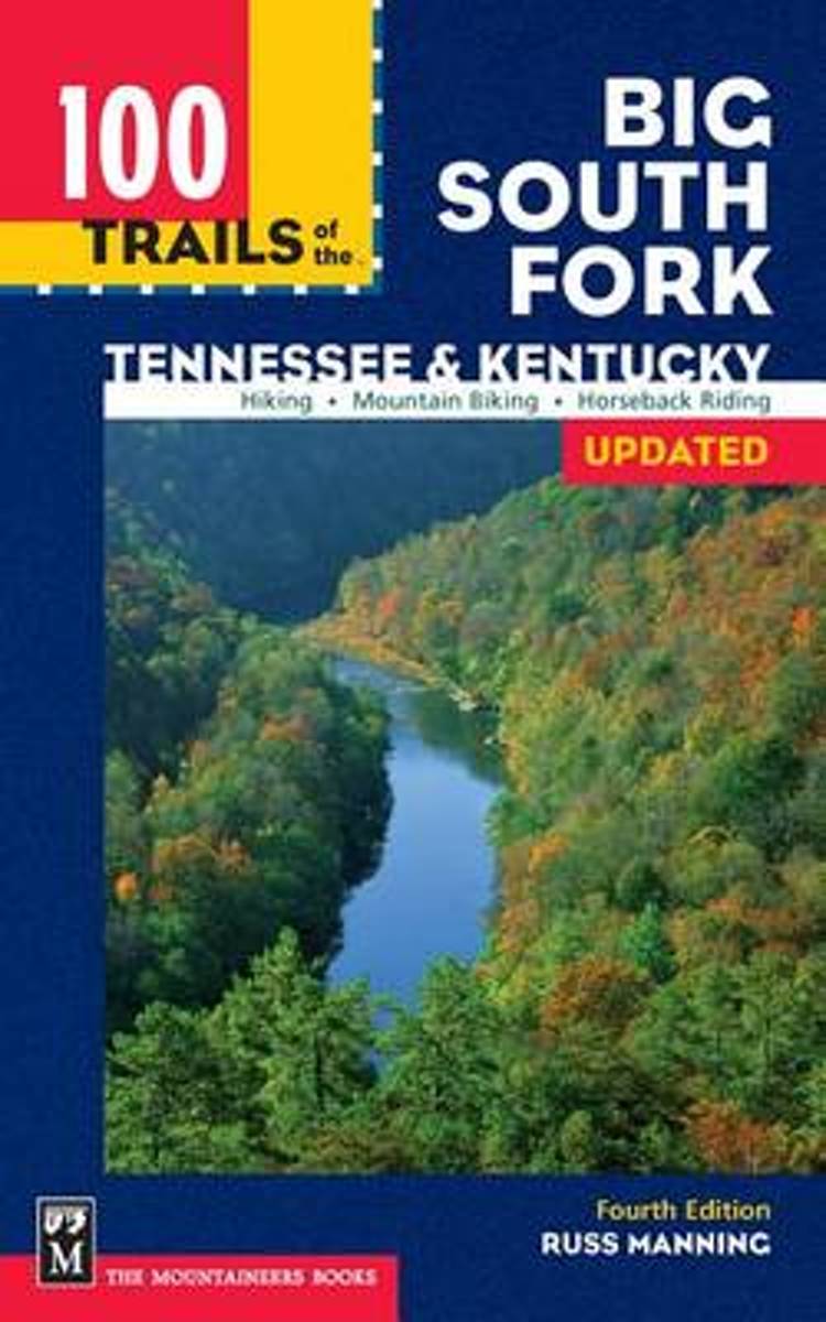
- 100 Trails of the Big South Fork
- Escape with Russ Manning, the Southeast's hiking expert, into the deep gorges and rock shelters that make this area a natural utopia. He has trekked along every trail and behind every waterfall, from Yahoo Falls to the Gentleman's Swimming Hole--in 100 Trails of the Big South Fork, he guides you to and trough the land's best of best! Read more
- Also available from:
- Bol.com, Belgium
Bol.com
Belgium
Belgium
- 100 Trails of the Big South Fork
- Escape with Russ Manning, the Southeast's hiking expert, into the deep gorges and rock shelters that make this area a natural utopia. He has trekked along every trail and behind every waterfall, from Yahoo Falls to the Gentleman's Swimming Hole--in 100 Trails of the Big South Fork, he guides you to and trough the land's best of best! Read more

Bol.com
Netherlands
Netherlands
- Hiking Tennessee Trails Journal
- Tennessee has some of the best hiking trails in the entire United States. This hiking journal allows you to record all those special trails and experiences you had while getting back to nature. Hiking is a great way to get back in touch with a slower pace of life. The experiences while performing these activities are endless. Writing in a... Read more
- Also available from:
- Bol.com, Belgium
Bol.com
Belgium
Belgium
- Hiking Tennessee Trails Journal
- Tennessee has some of the best hiking trails in the entire United States. This hiking journal allows you to record all those special trails and experiences you had while getting back to nature. Hiking is a great way to get back in touch with a slower pace of life. The experiences while performing these activities are endless. Writing in a... Read more

Bol.com
Netherlands
Netherlands
- Birds and Birdwatchers
- Here is a book for birdwatchers who wish to go beyond field identification. This wide-ranging essay collection, drawn from the author's avocational interest in ornithology, explores many avian topics that would otherwise be found in a shelf of resources. Here, for example, is ornithological history from Audubon and Wilson to Peterson and... Read more
- Also available from:
- Bol.com, Belgium
Bol.com
Belgium
Belgium
- Birds and Birdwatchers
- Here is a book for birdwatchers who wish to go beyond field identification. This wide-ranging essay collection, drawn from the author's avocational interest in ornithology, explores many avian topics that would otherwise be found in a shelf of resources. Here, for example, is ornithological history from Audubon and Wilson to Peterson and... Read more
Kaarten

De Zwerver
Netherlands
Netherlands
- Wandelkaart - Topografische kaart 318 Mount Rogers High Country - Grayson Highlands State Park | National Geographic
- Prachtige geplastificeerde kaart van het bekende nationaal park. Met alle recreatieve voorzieningen als campsites, maar ook met topografische details en wandelroutes ed. Door uitgekiend kleurgebruik zeer prettig in gebruik. Scheur en watervast! National Geographic's Trails Illustrated map of Mount Rogers High Country and Grayson Highlands... Read more
- Also available from:
- Bol.com, Netherlands
- Bol.com, Belgium
- Stanfords, United Kingdom
- The Book Depository, United Kingdom

Bol.com
Netherlands
Netherlands
- Mount Rogers High Country
- Waterproof Tear-Resistant Topographic MapNational Geographic's Trails Illustrated map of Mount Rogers High Country and Grayson Highlands State Park, Southwest Virginia, is a two-sided, waterproof, topographic trail map designed to meet the needs of outdoor enthusiasts with unmatched durability and detail. This map was created in... Read more
Bol.com
Belgium
Belgium
- Mount Rogers High Country
- Waterproof Tear-Resistant Topographic MapNational Geographic's Trails Illustrated map of Mount Rogers High Country and Grayson Highlands State Park, Southwest Virginia, is a two-sided, waterproof, topographic trail map designed to meet the needs of outdoor enthusiasts with unmatched durability and detail. This map was created in... Read more

Stanfords
United Kingdom
United Kingdom
- Mount Rogers High Country VA
- Map No. 318 - Mount Rogers High Country in Virginia in an extensive series of GPS compatible, contoured hiking maps of USA’s national and state parks or forests and other popular recreational areas. Cartography based on the national topographic survey, with additional tourist information.The maps, with most titles now printed on light,... Read more

The Book Depository
United Kingdom
United Kingdom
- Mount Rogers High Country
- Trails Illustrated Other Rec. Areas Read more

De Zwerver
Netherlands
Netherlands
- Wandelkaart - Topografische kaart 747 Green Mountain National Forest North - Moosalamoo NRA - Rutland | National Geographic
- Prachtige geplastificeerde kaart van het bekende nationaal park. Met alle recreatieve voorzieningen als campsites, maar ook met topografische details en wandelroutes ed. Door uitgekiend kleurgebruik zeer prettig in gebruik. Scheur en watervast! National Geographic's Green Mountain National Forest North Trails Illustrated topographic map is... Read more
- Also available from:
- Bol.com, Netherlands
- Bol.com, Belgium
- Stanfords, United Kingdom
- The Book Depository, United Kingdom

Bol.com
Netherlands
Netherlands
- Green Mountains N.F., Moosalamoo NRA/Rutland
- Waterproof Tear-Resistant Topographic MapNational Geographic's Green Mountain National Forest North Trails Illustrated topographic map is the most comprehensive available for outdoor enthusiasts of all types. Designed to be easy-to-read, yet highly detailed this map includes a comprehensive road and trail network distinguishing between... Read more
Bol.com
Belgium
Belgium
- Green Mountains N.F., Moosalamoo NRA/Rutland
- Waterproof Tear-Resistant Topographic MapNational Geographic's Green Mountain National Forest North Trails Illustrated topographic map is the most comprehensive available for outdoor enthusiasts of all types. Designed to be easy-to-read, yet highly detailed this map includes a comprehensive road and trail network distinguishing between... Read more

Stanfords
United Kingdom
United Kingdom
- Green Mountain National Forest - Moosalamoo NRA - Rutland VT
- Map No. 747, Green Mountain National Forest: Moosalamoo NRA - Rutland area in Vermont, in an extensive series of GPS compatible, contoured hiking maps of USA’s national and state parks or forests and other popular recreational areas. Cartography based on the national topographic survey, with additional tourist information.The maps, with most... Read more

The Book Depository
United Kingdom
United Kingdom
- Green Mountains N.f., Moosalamoo Nra/rutland
- Trails Illustrated Other Rec. Areas Read more

De Zwerver
Netherlands
Netherlands
- Wandelkaart - Topografische kaart 316 Cades Cove - Elkmont - Great Smoky Mountains National Park | National Geographic
- Prachtige geplastificeerde kaart van het bekende nationaal park. Met alle recreatieve voorzieningen als campsites, maar ook met topografische details en wandelroutes ed. Door uitgekiend kleurgebruik zeer prettig in gebruik. Scheur en watervast! This title provides an increased scale of one of the most visited National Parks in the US, and one... Read more
- Also available from:
- Bol.com, Netherlands
- Bol.com, Belgium
- Stanfords, United Kingdom

Bol.com
Netherlands
Netherlands
- Cades Cove/elkmont, Great Smoky Mountains National Park
- Waterproof Tear-Resistant Topographic MapThis title provides an increased scale of one of the most visited National Parks in the US, and one of our more popular map titles. This increased scale will provide greater detail to the backcountry users and Appalachian Trail through-hikers.Park Introduction:Great Smoky Mountains National Park is... Read more
Bol.com
Belgium
Belgium
- Cades Cove/elkmont, Great Smoky Mountains National Park
- Waterproof Tear-Resistant Topographic MapThis title provides an increased scale of one of the most visited National Parks in the US, and one of our more popular map titles. This increased scale will provide greater detail to the backcountry users and Appalachian Trail through-hikers.Park Introduction:Great Smoky Mountains National Park is... Read more

Stanfords
United Kingdom
United Kingdom
- Cades Cove - Elkmont - Great Smoky Mountains National Park NC/TN
- Map No. 316, Great Smoky Mountains National Park: Cades Cove - Elkmont, NC/TN, in an extensive series of GPS compatible, contoured hiking maps of USA’s national and state parks or forests and other popular recreational areas. Cartography based on the national topographic survey, with additional tourist information.The maps, with most titles now... Read more

Bol.com
Netherlands
Netherlands
- Springer & Cohutta Mountains, Chattahoochee National Forest
- Waterproof Tear-Resistant Topographic MapLocated just north of Atlanta, the Chattahoochee National Forest contains the southern terminus of the Appalachian Trail along with an abundance of recreational opportunities for outdoor enthusiasts of all interests.This detailed recreation map contains carefully researched trails, campsites,... Read more
- Also available from:
- Bol.com, Belgium
- Stanfords, United Kingdom
Bol.com
Belgium
Belgium
- Springer & Cohutta Mountains, Chattahoochee National Forest
- Waterproof Tear-Resistant Topographic MapLocated just north of Atlanta, the Chattahoochee National Forest contains the southern terminus of the Appalachian Trail along with an abundance of recreational opportunities for outdoor enthusiasts of all interests.This detailed recreation map contains carefully researched trails, campsites,... Read more

Stanfords
United Kingdom
United Kingdom
- Chattahoochee National Forest - Springer and Cohutta Mountains GA/SC 777
- Map No. 777, Chattahoochee National Forest: Springer and Cohutta Mountains, GA/SC, in an extensive series of GPS compatible, contoured hiking maps of USA’s national and state parks or forests and other popular recreational areas. Cartography based on the national topographic survey, with additional tourist information.The maps, with most titles... Read more