Ardèche
Beschrijving

The Ardèche is a region in the south of France, west of the Rhône. There are high plateaus, mountains up to 1.754 m and extensive forests.
Kaart

Paden in deze regio
Links
Feiten
Verslagen
Gidsen en kaarten
Overnachting
Organisaties
Reisorganisaties
GPS
Anders
Boeken
De Zwerver
Netherlands
2021
Netherlands
2021

De Zwerver
Netherlands
2022
Netherlands
2022

De Zwerver
Netherlands
2023
Netherlands
2023
De Zwerver
Netherlands
2019
Netherlands
2019
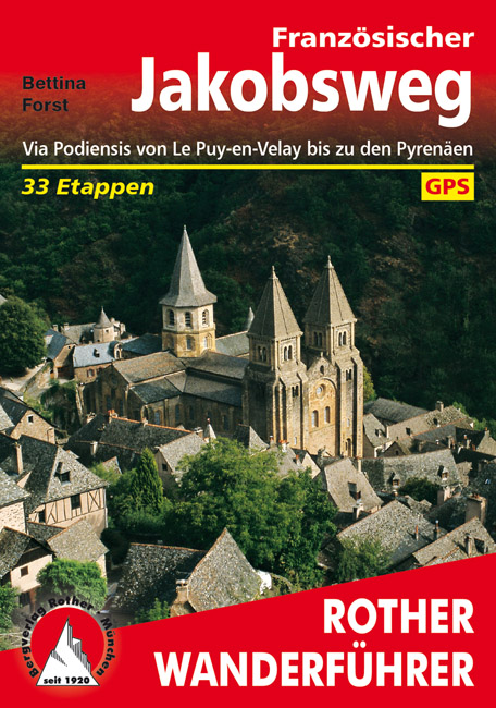
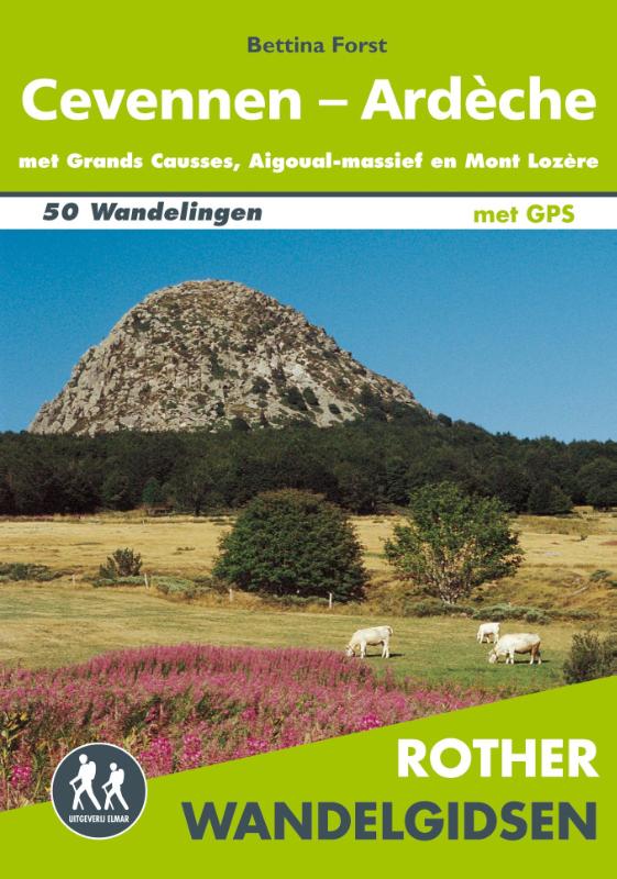
- Wandelgids - Pelgrimsroute 253 Französischer Jakobsweg GR65 | Rother Bergverlag
- Via Podiensis von Le Puy-en-Velay bis zu den Pyrenäen. 33 Etappen Rother Wanderführer. 4., aktualisierte Auflage. Read more


De Zwerver
Netherlands
2023
Netherlands
2023

De Zwerver
Netherlands
2023
Netherlands
2023
- Also available from:
- Stanfords, United Kingdom

Stanfords
United Kingdom
2021
United Kingdom
2021
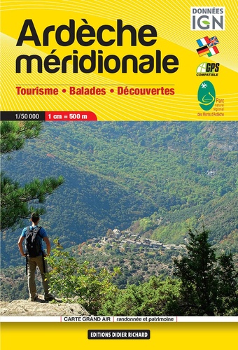
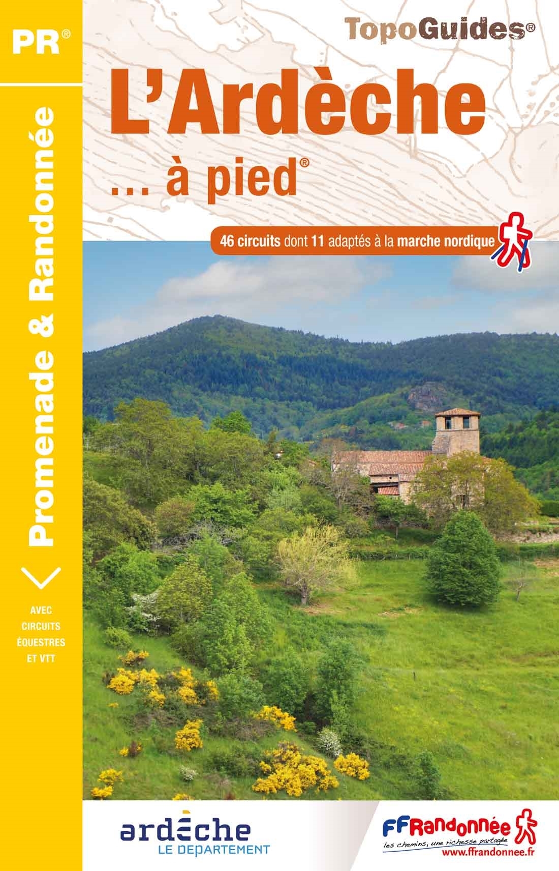
- L`Ardèche à pied D007
- L`Ardèche à pied, FFRP topo-guide Ref. No.D007, with 46 day walks of varying length and difficulty in the department of Ardèche in the Massif Central. Each walk is presented on a separate colour extract from IGN’s topographic survey of France at 1:25,000, with its description cross-referenced to the map. Current edition of this title was... Read more
De Zwerver
Netherlands
2022
Netherlands
2022


De Zwerver
Netherlands
2017
Netherlands
2017
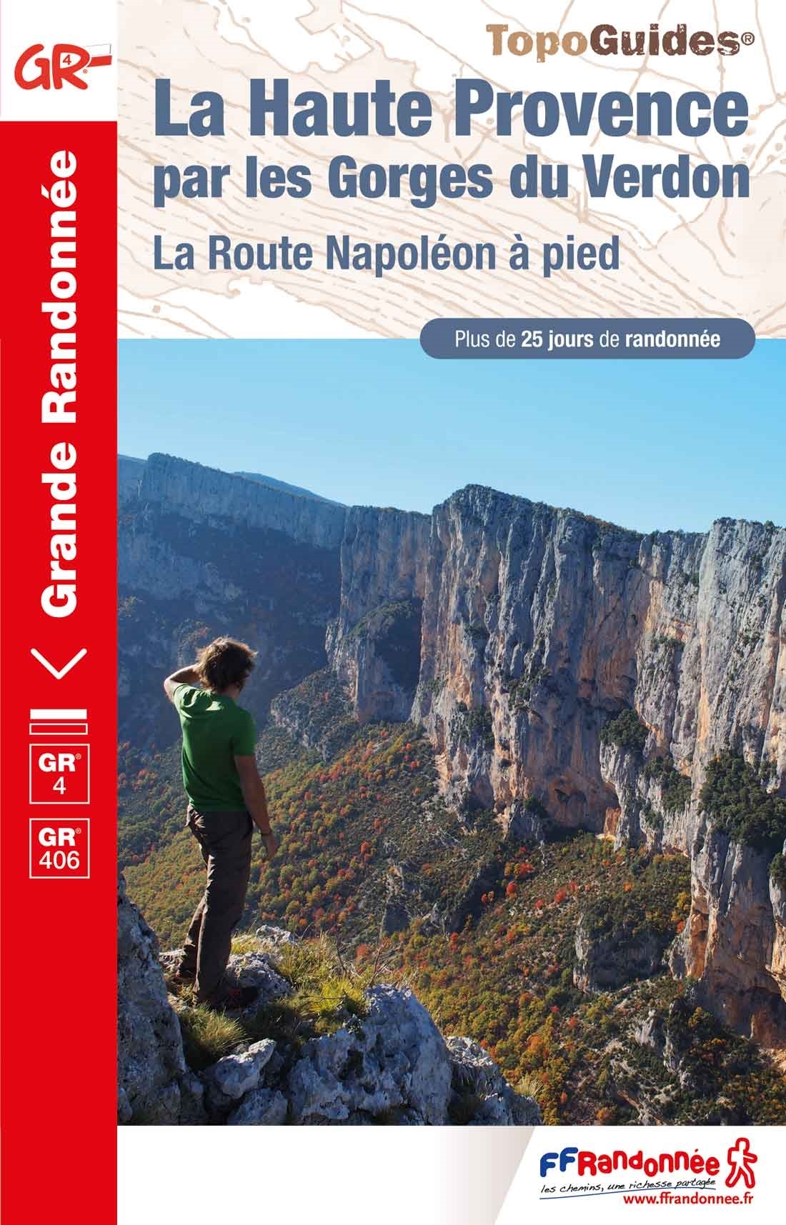
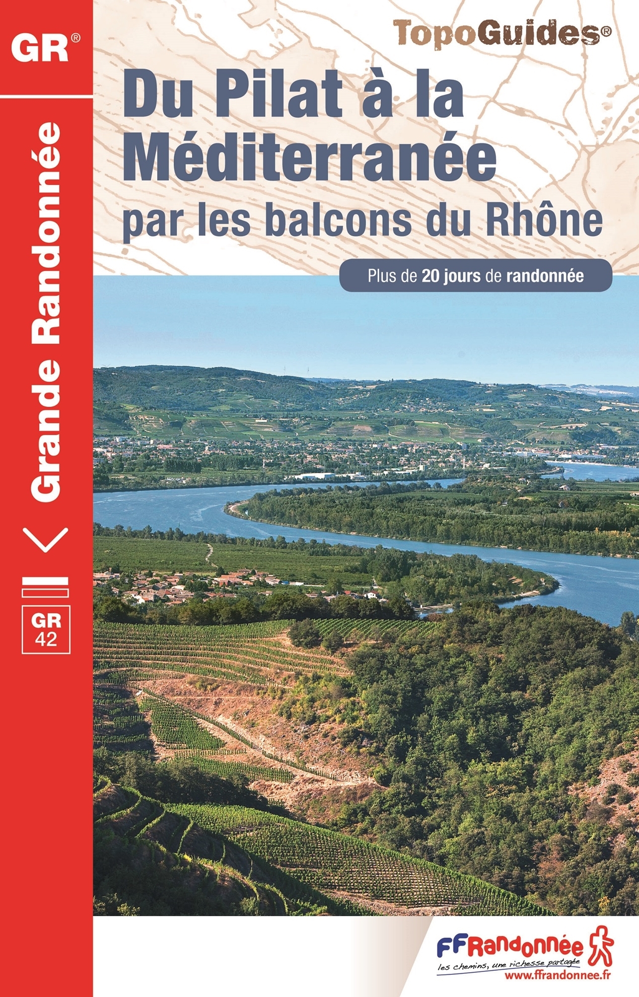
- Wandelgids 411 Du Pilat à la Méditerranée GR42 | FFRP
- Fout lopen wordt op deze manier wel erg moeilijk. Met symbolen is weergegeven welke voorzieningen (openbaar vervoer / winkels / overnachtingen) er zijn langs of bij de route. De gids bevat een lijst met overnachtingsadressen inclusief telefoonnummers, soms aangevuld met websites/mailadressen. Alle gidsen bevatten een door ons toegevoegde... Read more
- Also available from:
- Stanfords, United Kingdom
Stanfords
United Kingdom
2017
United Kingdom
2017
- Du Pilat à la Méditerranée par les balcons du Rhône - GR 42
- Going wrong this way becomes very difficult. Symbols indicate which facilities (public transport / shops / overnight stays) there are along or near the route. The guide contains a list of overnight addresses including telephone numbers, sometimes supplemented with websites / email addresses. All guides contain an extensive French.The route... Read more
Meer boeken…

Kaarten

De Zwerver
Netherlands
2020
Netherlands
2020
- Wandelatlas - Pelgrimsroute (kaart) 161 Chemins de Compostelle GR65 | Michelin
- Véritable petit atlas détaillant chaque étape avec indications précises concernant les villes de départ et d'arrivée ainsi que pour les localités traversées (auberges, refuges, restaurants, pharmacies, gare, épiceries, Km parcourus, Km restants....).Ce petit atlas suit le chemin du... Read more
De Zwerver
Netherlands
Netherlands
- Also available from:
- Stanfords, United Kingdom

Stanfords
United Kingdom
United Kingdom
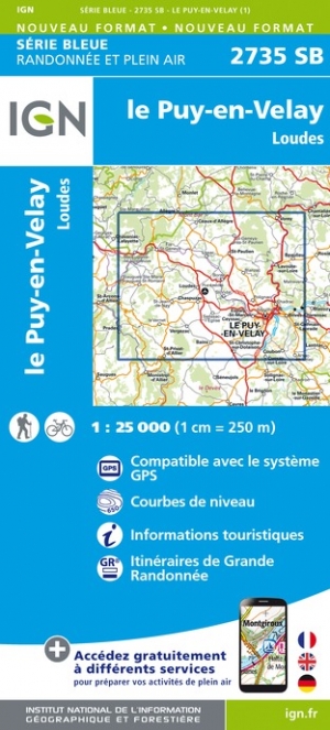
- le Puy-en-Velay - Loudes IGN 2735SB
- Topographic survey of France at 1:25,000 in IGN`s excellent TOP25 / Série Bleue series. All the maps are GPS compatible, with a 1km UTM grid plus latitude and longitude lines at 5’ intervals. Contours are at 5m intervals except for mountainous areas where the maps have contours at 10m intervals, vividly enhanced by hill shading and graphics for... Read more
De Zwerver
Netherlands
Netherlands
- Also available from:
- Stanfords, United Kingdom

Stanfords
United Kingdom
United Kingdom
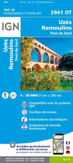
- Uzes - Remoulins - Pont du Gard IGN 2941OT
- Topographic survey of France at 1:25,000 in IGN`s excellent TOP25 / Série Bleue series. All the maps are GPS compatible, with a 1km UTM grid plus latitude and longitude lines at 5’ intervals. Contours are at 5m intervals except for mountainous areas where the maps have contours at 10m intervals, vividly enhanced by hill shading and graphics for... Read more
De Zwerver
Netherlands
Netherlands
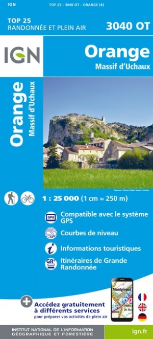
- Wandelkaart - Topografische kaart 3040OT Orange | IGN - Institut Géographique National
- De wandelkaart die de perfectie benadert! Werkelijk alle topografische details zijn er op te vinden; van hoogtelijnen tot aan bruggetjes en allerlei wandelpaden. Daarnaast hebben de makers een flinke dosis toeristische informatie op de kaart verwerkt: campings, gites d étape; restaurants en ingetekende doorgaande wandelpaden, de grandes... Read more
- Also available from:
- Stanfords, United Kingdom

Stanfords
United Kingdom
United Kingdom
- Orange - Massif d`Uchaux IGN 3040OT
- Topographic survey of France at 1:25,000 in IGN`s excellent TOP25 / Série Bleue series. All the maps are GPS compatible, with a 1km UTM grid plus latitude and longitude lines at 5’ intervals. Contours are at 5m intervals except for mountainous areas where the maps have contours at 10m intervals, vividly enhanced by hill shading and graphics for... Read more
De Zwerver
Netherlands
2024
Netherlands
2024
De Zwerver
Netherlands
Netherlands
- Also available from:
- Stanfords, United Kingdom

Stanfords
United Kingdom
United Kingdom
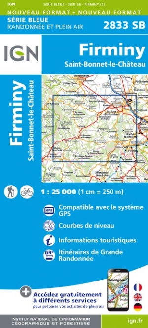
- Firminy - Saint-Bonnet-le-Chateau IGN 2833SB
- Topographic survey of France at 1:25,000 in IGN`s excellent TOP25 / Série Bleue series. All the maps are GPS compatible, with a 1km UTM grid plus latitude and longitude lines at 5’ intervals. Contours are at 5m intervals except for mountainous areas where the maps have contours at 10m intervals, vividly enhanced by hill shading and graphics for... Read more
De Zwerver
Netherlands
Netherlands
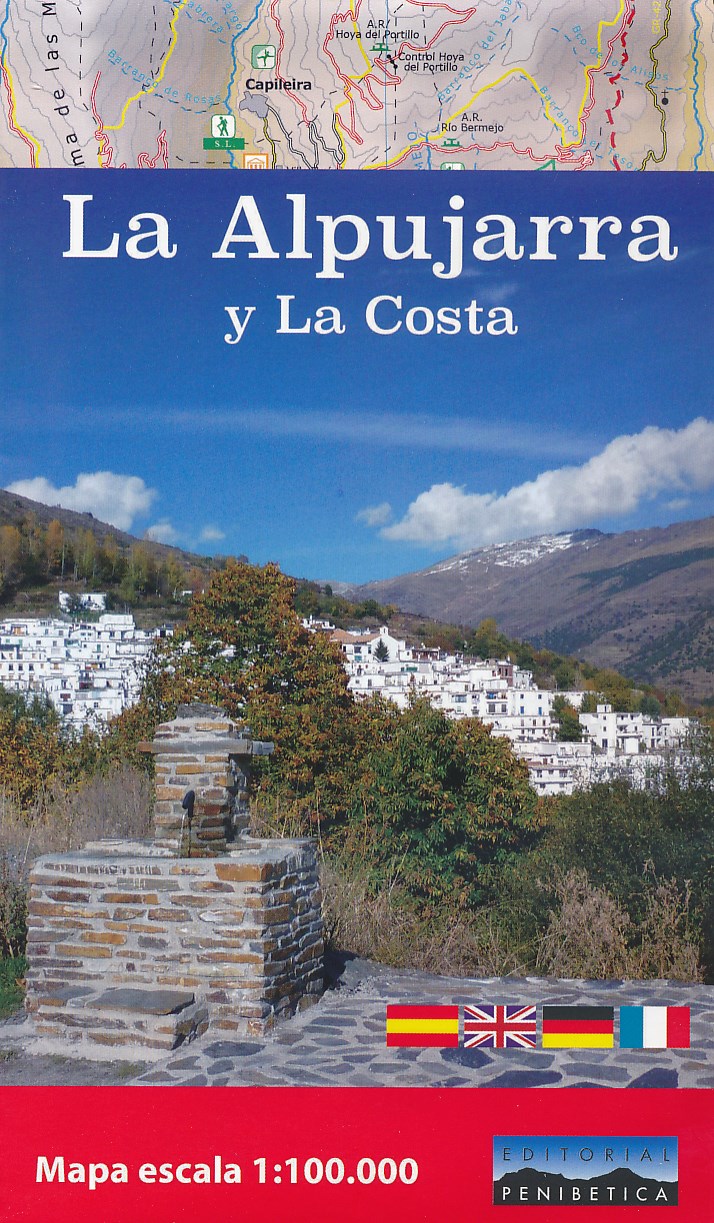
- Wegenkaart - landkaart - Wandelkaart La Alpujarra y la Costa - Alpujarras | Editorial Penibetica
- The Alpujarra region of Andalucía on an indexed, contoured map at 1:100,000 from Editorial Penibetica, extending from the coast between Motril and Roquetas de Mar across southern slopes of the Sierra Nevada to its peaks including Mulhacén. On the reverse are multilingual descriptions and photos of various places of interest.Coverage extends... Read more
- Also available from:
- Stanfords, United Kingdom

Stanfords
United Kingdom
United Kingdom
- La Alpujarra and La Costa Editorial Penibetica
- The Alpujarra region of Andalucía on an indexed, contoured map at 1:100,000 from Editorial Penibetica, extending from the coast between Motril and Roquetas de Mar across southern slopes of the Sierra Nevada to its peaks including Mulhacén. On the reverse are multilingual descriptions and photos of various places of interest.Coverage extends... Read more
De Zwerver
Netherlands
Netherlands
- Also available from:
- Stanfords, United Kingdom

Stanfords
United Kingdom
United Kingdom
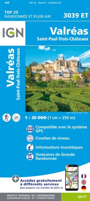
- Valreas - Saint-Paul-Trois-Chateaux IGN 3039ET
- Topographic survey of France at 1:25,000 in IGN`s excellent TOP25 / Série Bleue series. All the maps are GPS compatible, with a 1km UTM grid plus latitude and longitude lines at 5’ intervals. Contours are at 5m intervals except for mountainous areas where the maps have contours at 10m intervals, vividly enhanced by hill shading and graphics for... Read more
De Zwerver
Netherlands
2024
Netherlands
2024
De Zwerver
Netherlands
Netherlands
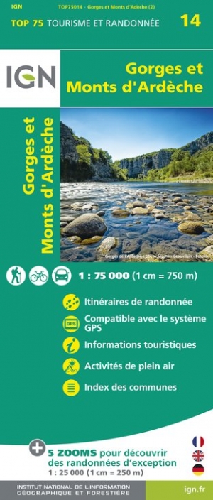
- Fietskaart - Wandelkaart 14 Gorges et Monts d'Ardèche - Ardeche | IGN - Institut Géographique National
- Selected tourist regions of the France on GPS compatible, contoured TOP 75 maps at 1:75,000 from the IGN, highlighting local and long-distance hiking paths, cycling routes and sites for other recreational activities. Each title includes five large panels with mapping at 1:25,000 to cover its most popular areas in greater detail. Cartography of... Read more
- Also available from:
- Stanfords, United Kingdom

Stanfords
United Kingdom
United Kingdom
- Gorges and Monts d`Ardèche IGN 75014
- Selected tourist regions of the France on GPS compatible, contoured TOP 75 maps at 1:75,000 from the IGN, highlighting local and long-distance hiking paths, cycling routes and sites for other recreational activities. Each title includes five large panels with mapping at 1:25,000 to cover its most popular areas in greater detail. Cartography of... Read more
De Zwerver
Netherlands
Netherlands
- Also available from:
- Stanfords, United Kingdom

Stanfords
United Kingdom
United Kingdom
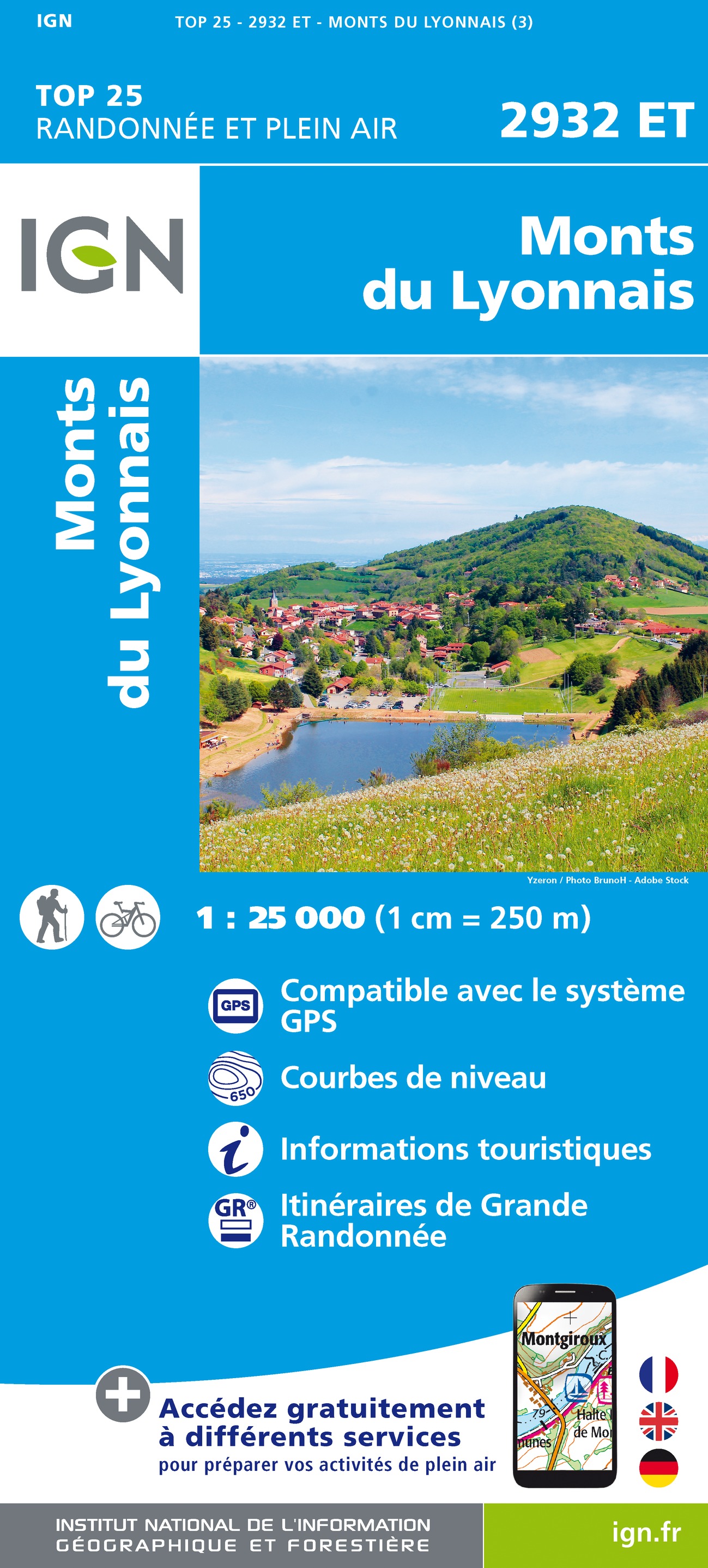
- Monts du Lyonnais IGN 2932ET
- Topographic survey of France at 1:25,000 in IGN`s excellent TOP25 / Série Bleue series. All the maps are GPS compatible, with a 1km UTM grid plus latitude and longitude lines at 5’ intervals. Contours are at 5m intervals except for mountainous areas where the maps have contours at 10m intervals, vividly enhanced by hill shading and graphics for... Read more
Meer kaarten…