De Zwerver
Netherlands
2023
De Zwerver
Netherlands
2023
De Zwerver
Netherlands
2023
De Zwerver
Netherlands
» Click to open
Stanfords
United Kingdom
  • Reading & Windsor - Henley-on-Thames & Bracknell OS Landranger Map 175 (paper)
  • Reading – Windsor area, including a section of the Thames Path / E2 European Long-distance Path, on a paper version of map No. 175 from the Ordnance Survey’s Landranger series at 1:50,000, with contoured and GPS compatible topographic mapping plus tourist information.MOBILE DOWNLOADS: As well as the physical edition of the map, each Landranger... Read more
» Click to close
De Zwerver
Netherlands
2022
De Zwerver
Netherlands
De Zwerver
Netherlands
2015
» Click to open
Stanfords
United Kingdom
2015
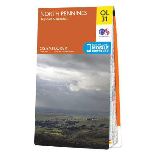
  • North Pennines: Teesdale & Weardale OS Explorer Map OL31 (paper)
  • The northern part of the Pennines including Teesdale and Weardale on a detailed topographic and GPS compatible map OL31, paper version, from the Ordnance Survey’s 1:25,000 Explorer series. Coverage include Barnard Castle, Middleton-in-Teesdale, Stanhope, Blagill, Gilderdale Forest, Milburn Forest, Hamsterley Forest, Middleton Common, the peaks... Read more
» Click to close
De Zwerver
Netherlands
» Click to open
Stanfords
United Kingdom
  • Kettering, Corby, Market Harborough & Stamford OS Landranger Map 141 (paper)
  • The area around Kettering, Corby, Market Harborough and Stamford, including Rockingham Forest and part of the E2 European Long-distance Path, on a paper version of map No. 141 from the Ordnance Survey’s Landranger series at 1:50,000, with contoured and GPS compatible topographic mapping plus tourist information.MOBILE DOWNLOADS: As well as the... Read more
» Click to close
De Zwerver
Netherlands
2015
» Click to open
Stanfords
United Kingdom
2015
» Click to close
De Zwerver
Netherlands
» Click to open
Stanfords
United Kingdom
  • Birmingham, Wolverhampton & The Black Country OS Landranger Map 139 (paper)
  • Birmingham with the surrounding area including the Black Country, Wolverhampton, Walsall, Solihull, Stourbridge, Bromsgrove and a section of the E2 European Long-distance Path on a paper version of map No. 139 from the Ordnance Survey’s Landranger series at 1:50,000, with contoured and GPS compatible topographic mapping plus tourist... Read more
» Click to close
Bol.com
Netherlands
» Click to open
Bol.com
Belgium
  • Guide to Peak District Pub Walks
  • Discover the beauty of the Peak District with this guide to some of the finest walking in the country. Routes include walks beside Dovestone, Ladybower and Redmires reservoirs, the Monsal Trail, and the ancient hillfort of Carl Wak. Explore the Norman-built Peveril Castle at Castleton, the magnificence of Chatsworth House and the beauty of the... Read more
Stanfords
United Kingdom
  • Guide to Peak District Pub Walks
  • Discover the beauty of the Peak District with this guide to some of the finest walking in the country. Routes include walks beside Dovestone, Ladybower and Redmires reservoirs, the Monsal Trail, and the ancient hillfort of Carl Wak. Explore the Norman-built Peveril Castle at Castleton, the magnificence of Chatsworth House and the beauty of the... Read more
The Book Depository
United Kingdom
» Click to close
Bol.com
Netherlands
» Click to open
Bol.com
Belgium
  • More Baskets And How To Make Them
  • More Baskets AND How to Make Them MARY WHITE a Author of How to Make Baskets Illustrated from photographs, and drawings by the author GARDEN CITY NEW YORK DOUBLEDAY, PAGE COMPANY 1916 MORE BASKETS AND HOW TO MAKE THEM z - -2 1 r i c 5 Z c 2 L - L v 2 y T .C I n C C 2 2s - L M CLC g .E 2 Copyright. 1903, by Doubleday, Page Cornpant Publirhtd,... Read more
» Click to close
Bol.com
Netherlands
» Click to open
Bol.com
Belgium
  • In the Footprints of Wainwright
  • Derry Brabbs spent the best part of a decade taking the photographs for the large-format illustrated walking guides which A. Wainwright wrote from 1984 to 1992, when his legendary series of Pictorial Guides to the Lakeland Fells was complete. This is a fascinating account of Derry's training and adventures from his early days as a photographer,... Read more
» Click to close
Bol.com
Netherlands
» Click to open
Bol.com
Belgium
  • Bavarian Rhon
  • The upland region extending over the border country of the German federal states of Bavaria, Hesse, and Thuringia is showcased here for its exceptional scenery: extensive forested areas alternating with dark high moors, clear rivers, and empty plateaus with impressive mountains such as the Kreuzberg, the holy mountain of the Franconians.... Read more
» Click to close
Bol.com
Netherlands
» Click to open
Bol.com
Belgium
  • Plan & Go Pennine Way
  • Plan & Go - Pennine Way is the comprehensive guide to hiking one of Britain's best known and toughest trails. In a clear and concise manner, the book describes what to expect from the 268-mile journey along the 'backbone of England' and provides all the essential planning information to save you time and effort with your own preparations.... Read more
» Click to close