Stanfords
United Kingdom
2016
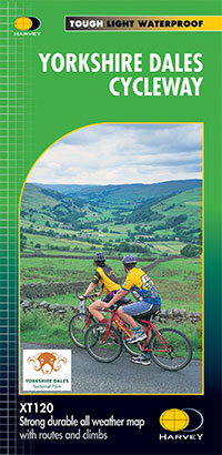
- Yorkshire Dales Cycle Way
- Yorkshire Dales Cycle Way, 210km / 130 miles long circular route presented by Harvey Map Services at 1:100,000 on a light, waterproof and tear resistant, contoured map, with enlargements for the course of the route in the urban areas, plus additional tourist information.The route, with alternative start/finish points in Ilkley or Skipton, is... Read more