
De Zwerver
Netherlands
De Zwerver
Netherlands
- Wandelkaart - Topografische kaart 1115 Säntis | Swisstopo
- Zeer gedetailleerde wandelkaart van een deel van Zwitserland. De topografische details van deze kaarten zijn onovertroffen; de werkelijkheid is perfect weergegeven op deze kaart van uitzonderlijk hoog niveau. Ze zijn geschikt voor alle soorten gebruik: voor eenvoudige wandeltochten in simpel terrein tot zware bergtochten en beklimmingen van de... Read more

Stanfords
United Kingdom
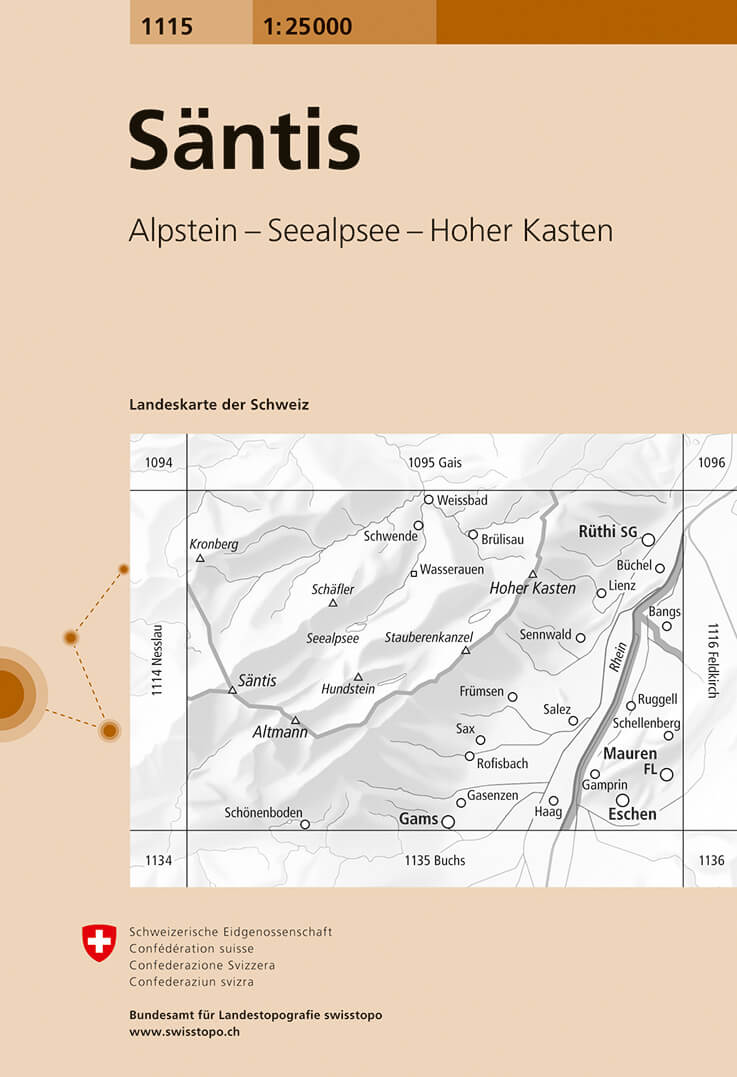
- Säntis Swisstopo 1115
- Map No. 1115, Säntis, in the topographic survey of Switzerland at 1:25,000 from Bundesamt für Landestopographie (swisstopo), covering the whole country on 247 small format sheets, with special larger maps published for popular regions including some titles now available in hiking versions.Highly regarded for their superb use of graphic relief... Read more
De Zwerver
Netherlands
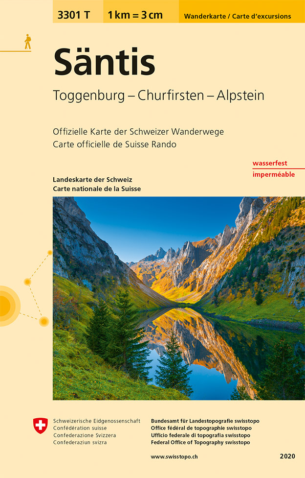
- Wandelkaart - Topografische kaart 3301T Säntis | Swisstopo
- Een nieuwe serie van de Zwitserse topografische dienst: eindelijk goede wandelkaarten met ingetekende wandelroutes op scheur- en watervast papier. Vooralsnog zijn ze uitgebracht van de populaire wandelgebieden en niet landelijk dekkend (zie overzicht) Op een gedetailleerde schaal van 1:33.333 met als ondergrond de onovertroffen topografische... Read more
De Zwerver
Netherlands

Stanfords
United Kingdom
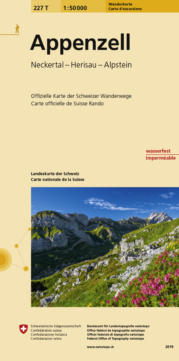
- Appenzell Swisstopo Hiking 227T
- Appenzell area, map No. 227T, at 1:50,000 in a special hiking edition of the country’s topographic survey, published by Swisstopo in cooperation with the Swiss Hiking Federation. Coverage includes the peak of Säntis and the north-western corner of Liechtenstein. Cartography, identical to the standard version of the survey, is highly regarded... Read more
De Zwerver
Netherlands

Stanfords
United Kingdom
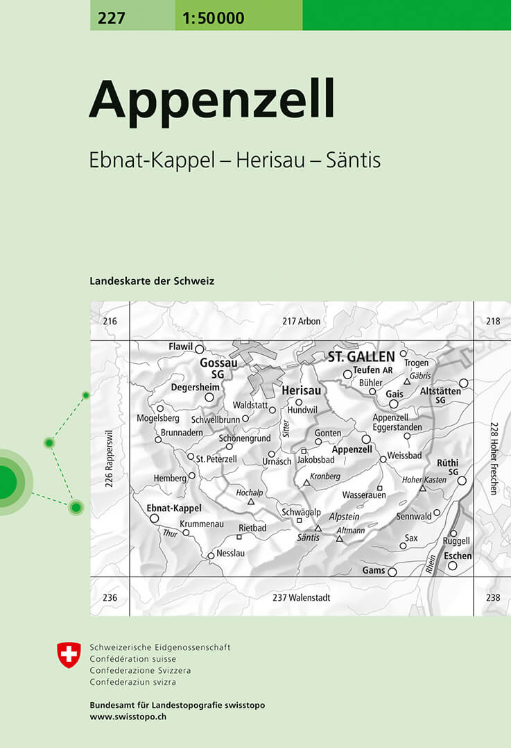
- Appenzell Swisstopo 227
- Appenzell, map No. 227, in the standard topographic survey of Switzerland at 1:50,000 from Swisstopo, i.e. without the special overprint highlighting walking trails, local bus stops, etc, presented in Swisstopo’s hiking editions of the 50K survey. Coverage includes the peak of Säntis and the north-western corner of Liechtenstein. Highly... Read more
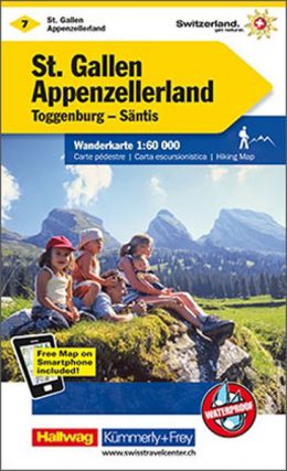
De Zwerver
Netherlands
- Wandelkaart 07 St. Gallen - Appenzellerland | Kümmerly & Frey
- Zeer duidelijke wandelkaart van een deel van Zwitserland. Deze kaart - gemaakt op scheur en watervast papier - is bedoeld voor de gewone en gemiddelde bergwandelaar. Ook voor huttentochten is deze zeker geschikt. Slechts voor de gevorderde wandelaar die glesjers gaat overschrijden zijn de 25.000 topografische kaarten aan te raden. Op deze... Read more

Stanfords
United Kingdom
- Appenzellerland - Säntis
- 33 specially selected hiking trails in the Appenzellerland - Säntis region of Switzerland presented at 1:50,000 on a waterproof and tear-resistant, contoured and GPS compatible map from the Hallwag/Kümmerly + Frey group, with route profiles, grading for the severity of the terrain and the degree of fitness required, etc.The cartography provides... Read more

Stanfords
United Kingdom
- Lake Constance F&B Leisure & Panorama
- Lake Constance area at 1:75,000 on a touring and cycling map from Freytag & Berndt prominently highlighting scenic roads and special tourist routes, recommended cycling routes, and locations worth visiting. Coverage extends from north of Ravensburg in Germany to St. Gallen in Switzerland, and includes Bregenz and Dornbirn in Austria.On the... Read more
