De Zwerver
Netherlands

Stanfords
United Kingdom
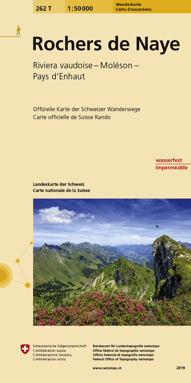
- Rochers de Naye Swisstopo Hiking 262T
- Rochers de Naye area, map No. 262T, at 1:50,000 in a special hiking edition of the country’s topographic survey, published by Swisstopo in cooperation with the Swiss Hiking Federation. Coverage extends from the eastern end of Lake Geneva with Vevey and Montreux to the peaks of Le Moléson and Dent de Ruth.Cartography, identical to the standard... Read more
De Zwerver
Netherlands
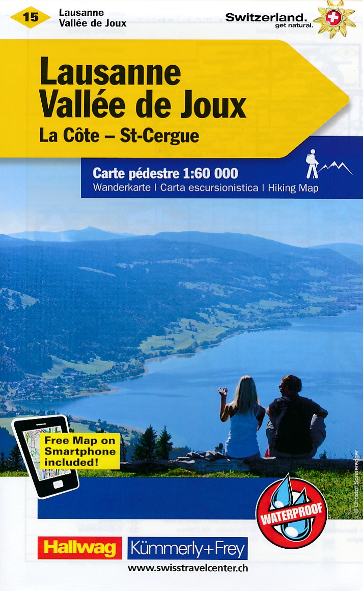
- Wandelkaart 15 Lausanne - Vallée de Joux | Kümmerly & Frey
- Zeer duidelijke wandelkaart van een deel van Zwitserland. Deze kaart - gemaakt op scheur en watervast papier - is bedoeld voor de gewone en gemiddelde bergwandelaar. Ook voor huttentochten is deze zeker geschikt. Slechts voor de gevorderde wandelaar die glesjers gaat overschrijden zijn de 25.000 topografische kaarten aan te raden. Op deze... Read more
De Zwerver
Netherlands

Stanfords
United Kingdom
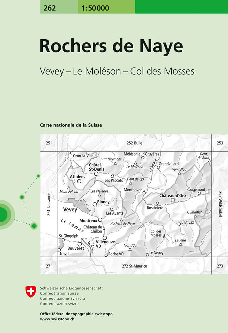
- Rochers de Naye Swisstopo 262
- Rochers de Naye, map No. 262, in the standard topographic survey of Switzerland at 1:50,000 from Swisstopo, i.e. without the special overprint highlighting walking trails, local bus stops, etc, presented in Swisstopo’s hiking editions of the 50K survey. Coverage extends from the eastern end of Lake Geneva with Vevey and Montreux to the peaks of... Read more
De Zwerver
Netherlands
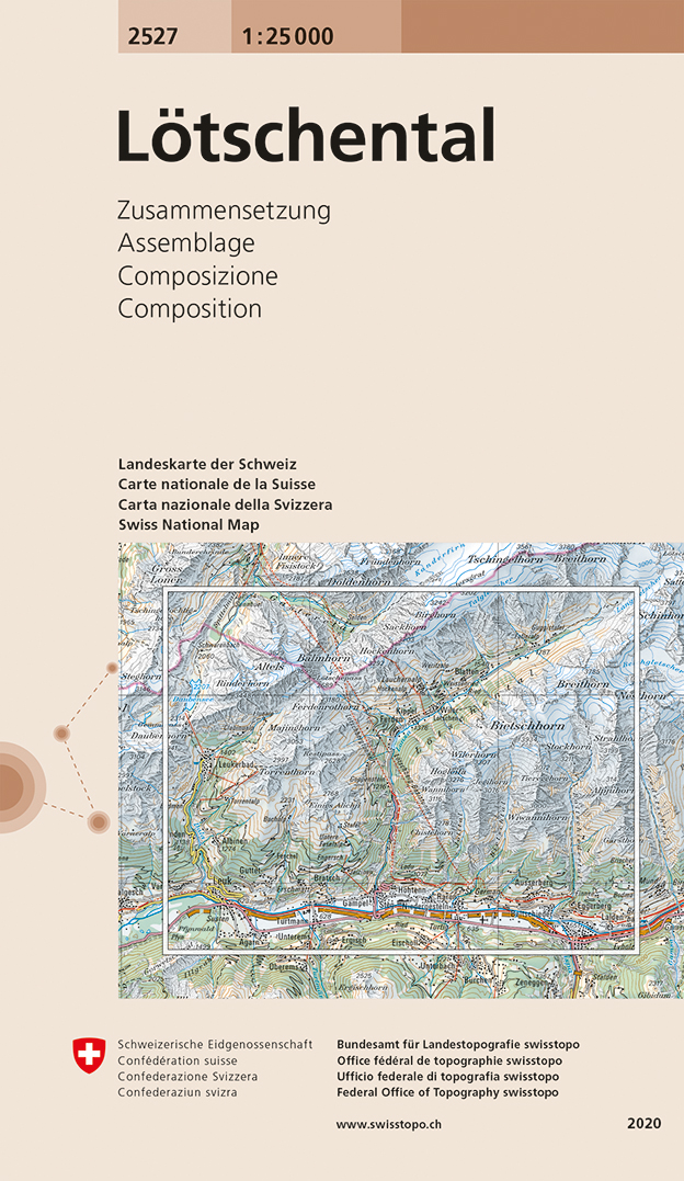
- Wandelkaart - Topografische kaart 2527 Lötschental | Swisstopo
- Map No. 2527, Lötschental, in the topographic survey of Switzerland at 1:25,000 from Swisstopo, covering the peaks and the valley north of the Rhone between Leuk and Visp. Swiss topographic survey at 1:25,000 covers the whole country on 247 small format sheets, with special larger maps published for popular regions including some titles now... Read more

Stanfords
United Kingdom
- Lötschental Swisstopo 2527
- Map No. 2527, Lötschental, in the topographic survey of Switzerland at 1:25,000 from Swisstopo, covering the peaks and the valley north of the Rhone between Leuk and Visp. Swiss topographic survey at 1:25,000 covers the whole country on 247 small format sheets, with special larger maps published for popular regions including some titles now... Read more
De Zwerver
Netherlands

Stanfords
United Kingdom
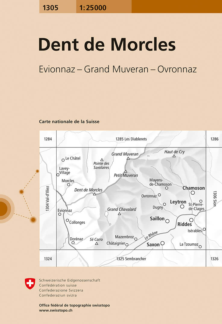
- Dent de Morcles Swisstopo 1305
- Map No. 1305, Dent de Morcles, in the topographic survey of Switzerland at 1:25,000 from Bundesamt für Landestopographie (swisstopo), covering the whole country on 247 small format sheets, with special larger maps published for popular regions including some titles now available in hiking versions.Highly regarded for their superb use of graphic... Read more
De Zwerver
Netherlands

Stanfords
United Kingdom
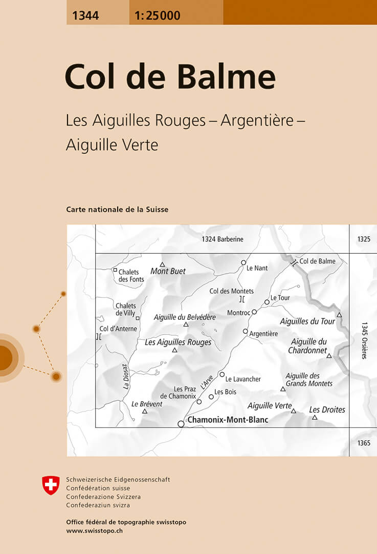
- Col de Balme Swisstopo 1344
- Map No. 1344, Col de Balme, in the topographic survey of Switzerland at 1:25,000 from Bundesamt für Landestopographie (swisstopo), covering the whole country on 247 small format sheets, with special larger maps published for popular regions including some titles now available in hiking versions.Highly regarded for their superb use of graphic... Read more
De Zwerver
Netherlands

Stanfords
United Kingdom
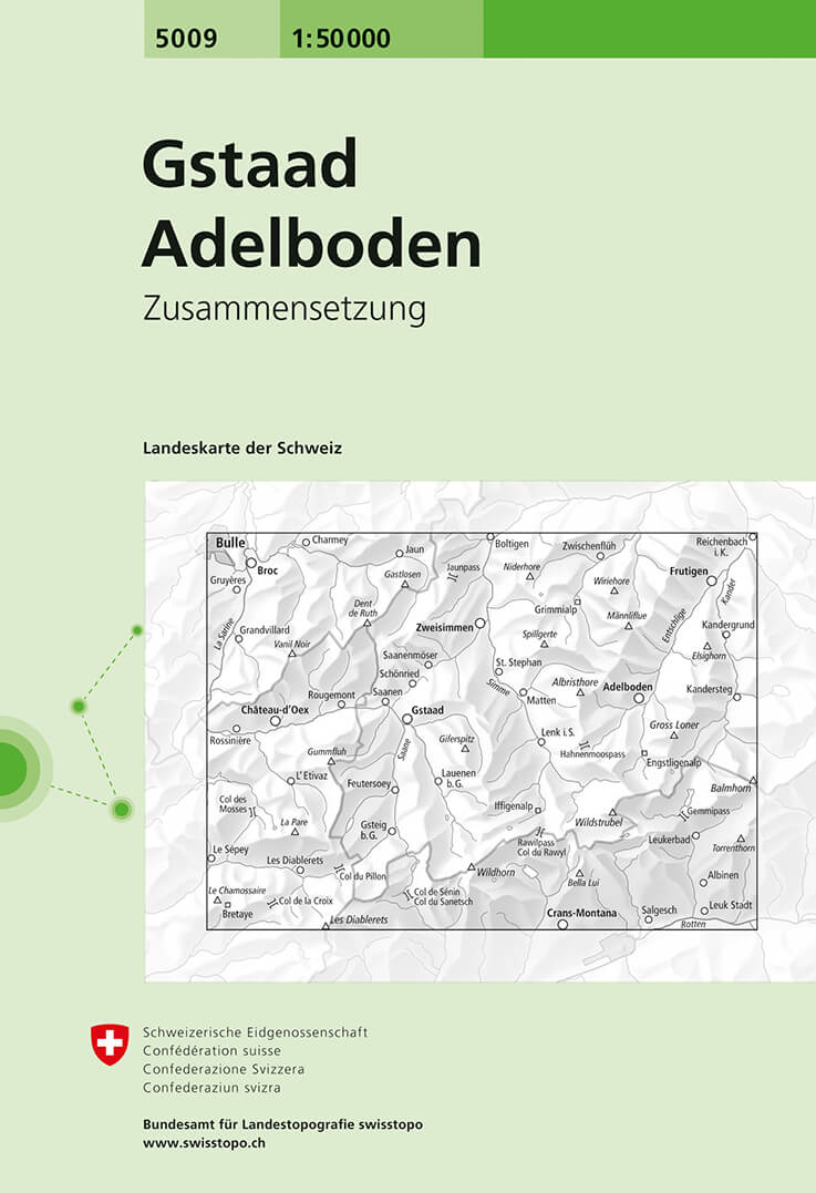
- Gstaad - Adelboden Swisstopo 5009
- Gstaad - Adelboden area, map No. 5009, in the standard topographic survey of Switzerland at 1:50,000 from Swisstopo, i.e. without the special overprint highlighting walking trails, local bus stops, etc, presented in Swisstopo’s hiking editions of the 50K survey. Coverage extends from Bulle in the north-western corner of the map to Leuk in the... Read more

De Zwerver
Netherlands

Stanfords
United Kingdom
- Il Monferrato: Asti - Casale Monferrato 50K IGC Map No. 20
- The Monferrato region of Piedmont east of Turin, between Asti and Casale Monferrato, in a series contoured hiking maps at 1:50,000 with local trails, long-distance footpaths, mountain accommodation, etc. from the Turin based Istituto Geografico Centrale. This title also shows local cycle routes.Maps in this series have contours at 50m... Read more
De Zwerver
Netherlands

Stanfords
United Kingdom
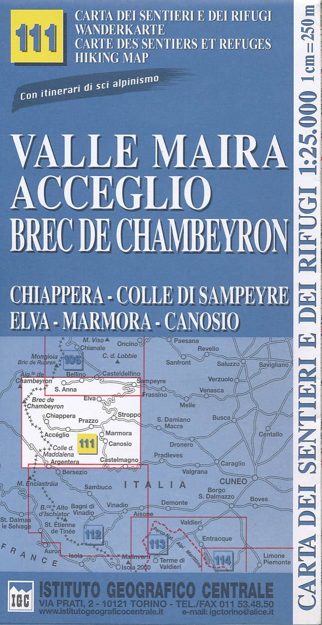
- Valle Maira - Acceglio 25K IGC Map No. 111
- Valle Maira - Acceglio area at 1:25,000 in a series of contoured, GPS compatible walking maps from the Turin based Istituto Geografico Centrale, highlighting hiking trails including long-distance routes, ski routes and alpine accommodation. Maps in this series have contours at 25m intervals, enhanced by shading and graphic relief for very clear... Read more
De Zwerver
Netherlands

Stanfords
United Kingdom
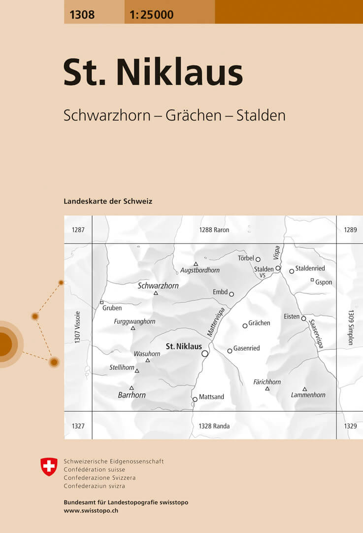
- St. Niklaus Swisstopo 1308
- Map No. 1308, St. Niklaus, in the topographic survey of Switzerland at 1:25,000 from Bundesamt für Landestopographie (swisstopo), covering the whole country on 247 small format sheets, with special larger maps published for popular regions including some titles now available in hiking versions.Highly regarded for their superb use of graphic... Read more
De Zwerver
Netherlands

Stanfords
United Kingdom
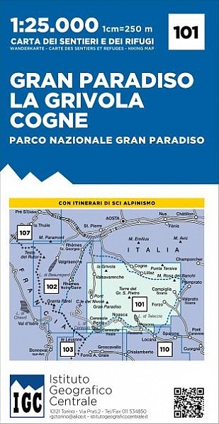
- Gran Paradiso - La Grivola - Cogne IGC 101
- Gran Paradiso - La Grivola - Cogne area of the Italian Alps at 1:25,000 in a series of contoured, GPS compatible walking maps from the Turin based Istituto Geografico Centrale, highlighting hiking trails including long-distance routes, ski routes and alpine accommodation. Maps in this series have contours at 25m intervals, enhanced by shading... Read more
De Zwerver
Netherlands

Stanfords
United Kingdom
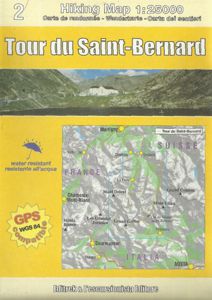
- Tour of Saint-Bernard L`Escursionista Editore Map-Guide
- Tour of Saint-Bernard long-distance hiking route presented on a waterproof and tear-resistant, contoured and GPS compatible map at 1:25,000 published jointly by L’Escursionista Editore and Editrek, plus a separate multilingual guide booklet with stage by stage descriptions and other tourist information.Contour interval is 25m and the map has... Read more
De Zwerver
Netherlands

Stanfords
United Kingdom
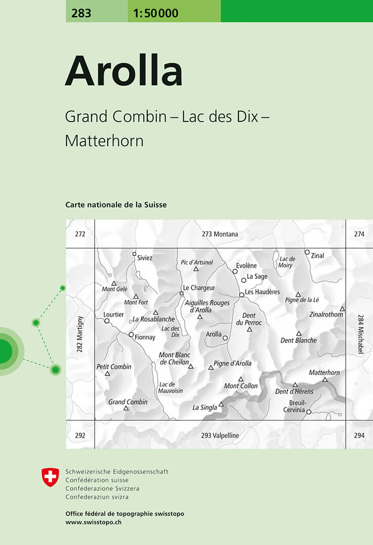
- Arolla Swisstopo 283
- Arolla, map No. 283, in the standard topographic survey of Switzerland at 1:50,000 from Swisstopo, i.e. without the special overprint highlighting walking trails, local bus stops, etc, presented in Swisstopo’s hiking editions of the 50K survey. The map covers the peaks from the Matterhorn to Grand Combin, and the southern part of Val d’Herens... Read more

De Zwerver
Netherlands

Stanfords
United Kingdom
- Gran Paradiso National Park IGC 3
- Gran Paradiso National Park in a series contoured hiking maps at 1:50,000 with local trails, long-distance footpaths, mountain accommodation, etc, from the Turin based Istituto Geografico Centrale. The map highlights, among other routes, the GTA (Grande Traversata delle Alpi), Via Alpina and Alta Via 2. Coverage extends from Aosta at the top of... Read more
De Zwerver
Netherlands

Stanfords
United Kingdom
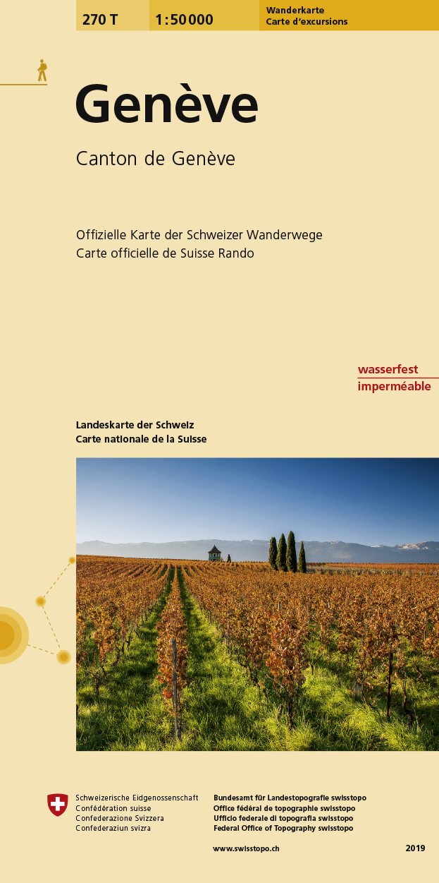
- Geneva Swisstopo Hiking 270T
- Geneva area, map No. 270T, at 1:50,000 in a special hiking edition of the country’s topographic survey, published by Swisstopo in cooperation with the Swiss Hiking Federation. The map covers the south-western tip of Lake Geneva and includes the French territory with Gex and Crête de la Neige, the highest peak in the Jura mountains.Cartography,... Read more