De Zwerver
Netherlands
» Click to open
Stanfords
United Kingdom
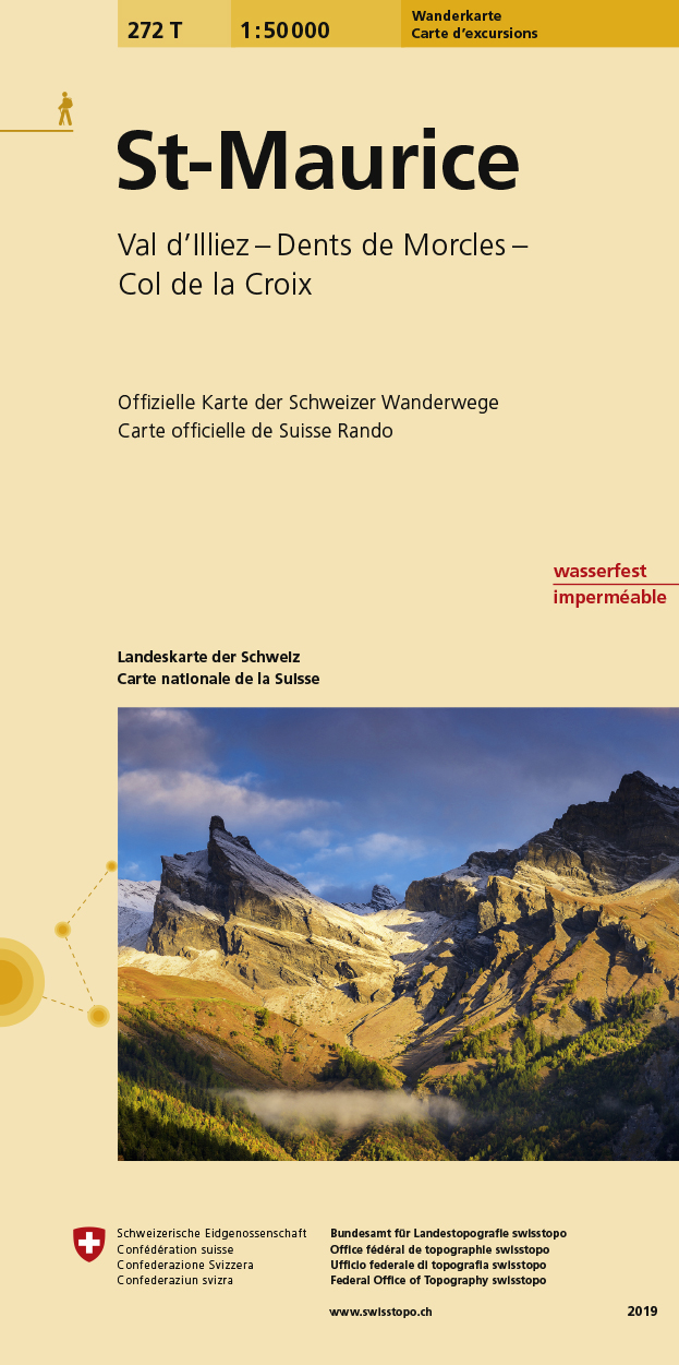
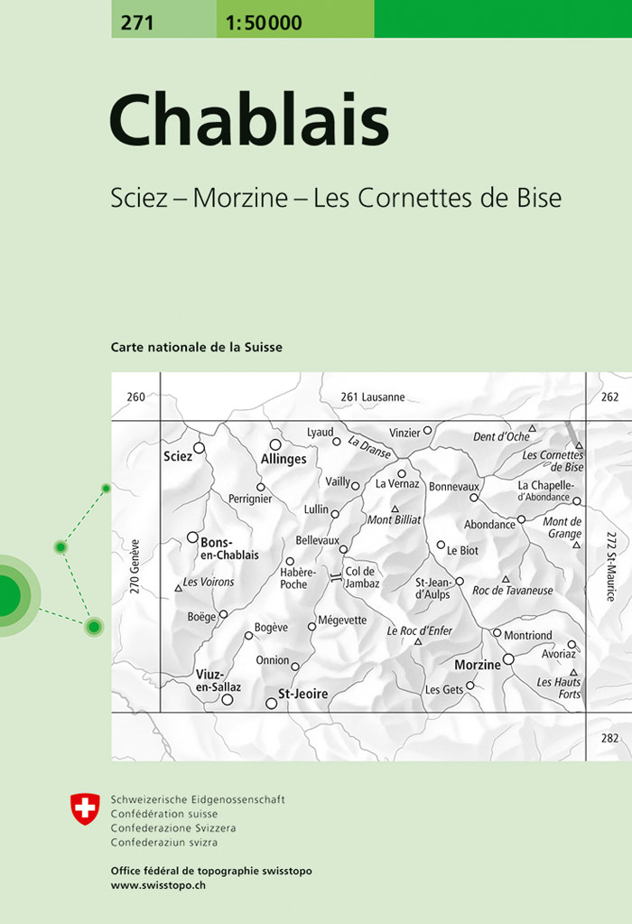
  • Chablais Swisstopo 271
  • Chablais, map No. 271, in the standard topographic survey of Switzerland at 1:50,000 from Swisstopo, i.e. without the special overprint highlighting walking trails, local bus stops, etc, presented in Swisstopo’s hiking editions of the 50K survey. The map covers the northern part of the French Alps, including Morzine, Abodance and the resort of... Read more
» Click to close
De Zwerver
Netherlands
» Click to open
Stanfords
United Kingdom
  • St-Maurice Swisstopo Hiking 272T
  • St-Maurice area, map No. 272T, at 1:50,000 in a special hiking edition of the country’s topographic survey, published by Swisstopo in cooperation with the Swiss Hiking Federation. Coverage extends from the resort of Les Diablerets and Col du Pillon in the north-east to Dents du Midi in the south.Cartography, identical to the standard version of... Read more
» Click to close
De Zwerver
Netherlands
2012
» Click to open
Stanfords
United Kingdom
2012
  • Lake Geneva - Chablais - Faucigny
  • Lake Geneva - Chablais - Faucigny area of the French Alps at 1:60,000 on a contoured and GPS compatible map from Didier Richard with a base derived from IGN’s topographic survey, highlighting both local hiking routes and the GR network of long-distance paths, gîtes and mountain refuges, interesting natural and cultural sites, etc. The map... Read more
» Click to close
Stanfords
United Kingdom
Stanfords
United Kingdom
Stanfords
United Kingdom
De Zwerver
Netherlands
» Click to open
Stanfords
United Kingdom
  • Lake Geneva and Mont Blanc IGN 75007
  • Selected tourist regions of the France on GPS compatible, contoured TOP 75 maps at 1:75,000 from the IGN, highlighting local and long-distance hiking paths, cycling routes and sites for other recreational activities. Each title includes five large panels with mapping at 1:25,000 to cover its most popular areas in greater detail. Cartography of... Read more
The Book Depository
United Kingdom
  • Leman et Mont Blanc entre - Chablais Faucigny
  • Selected tourist regions of the France on GPS compatible, contoured TOP 75 maps at 1:75,000 from the IGN, highlighting local and long-distance hiking paths, cycling routes and sites for other recreational activities. Each title includes five large panels with mapping at 1:25,000 to cover its most popular areas in greater detail. Cartography of... Read more
» Click to close