
Castilla y León
Beschrijving
Kaart

Paden in deze regio
- GR1 Sendero Histórico, Senda TransversalGPX
- GR10 Senderos de la MielGPX
- GR100 Ruta de la PlataGPX
- GR14 Sendero del DueroGPX
- GR186 Caminos de MedinaGPX
- GR26 Senda de Tierra de CamposGPX
- GR260 Vuelta al Moncayo-Calcenada
- GR27 Sendero del Valle Esgueva
- GR28 Sendero de Tierra de PinaresGPX
- GR29 Sendero del río Pisuerga
- GR30 Sendero de los Montes de TorozosGPX
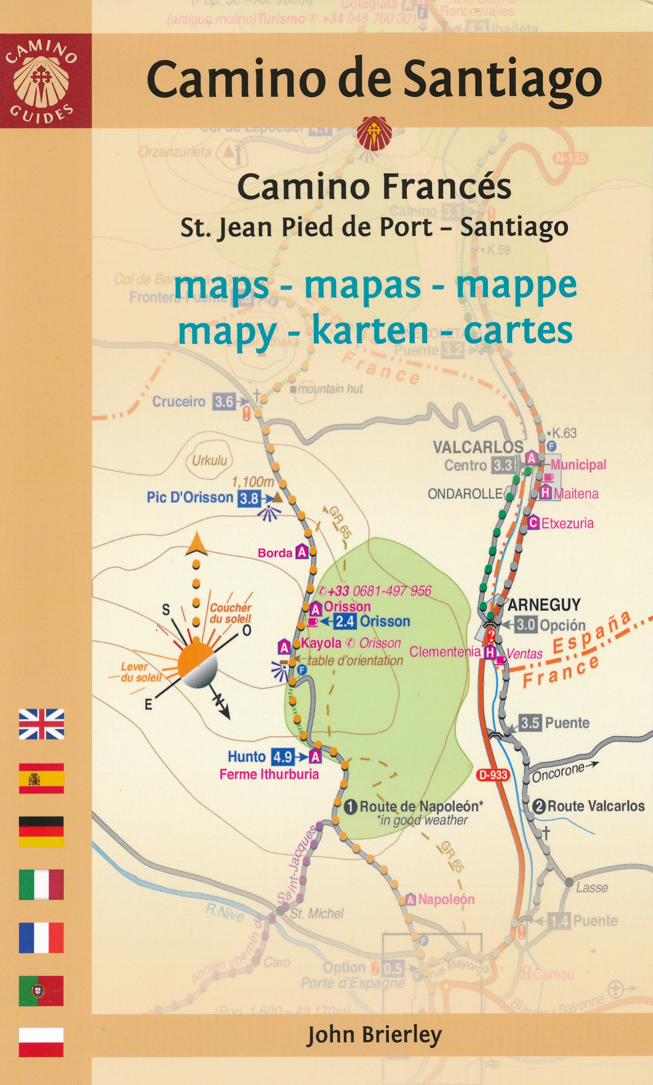
- GR65 Camino de SantiagoGPX
- GR69 Circular de HueteGPX
- GR82 Sierra de la DemandaGPX
- GR84 Canal del DueroGPX
- GR85 Ruta de los SentidosGPX
- GR86 Sendero Ibérico SorianoGPX
- GR89 Canales de CastillaGPX
- GR99 Sendero del EbroGPX
Links
Feiten
Verslagen
Gidsen en kaarten
Overnachting
Organisaties
Reisorganisaties
GPS
Anders
Boeken


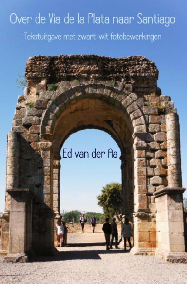
De Zwerver
Netherlands
2023
Netherlands
2023
De Zwerver
Netherlands
2015
Netherlands
2015
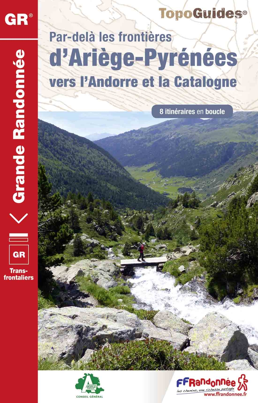
- Wandelgids 1098 Par dela les Frontieres d' Ariège - Pyrenees | FFRP
- Franstalige wandelgids. Uitstekende beschrijving met gedetailleerd kaartmateriaal (topografisch, IGN) en veel praktische informatie over zwaarte, hoogte en hutten. Bijna onmisbaar voor het lopen van deze route. In andere beschrijvingen zijn geen goede kaarten bijgevoegd! Wij leveren er een beknopte Frans-Nederlandse woordenlijst bij. Dans le... Read more
- Also available from:
- Stanfords, United Kingdom

Stanfords
United Kingdom
2015
United Kingdom
2015
- GRP: Ariège-Pyrénées – Andorre - Catalogne FFRP Topo-guide No. 1098
- Par-delà les frontiers d’Ariège-Pyrénées vers Andorre et la Catalogne, FFRP topoguide Ref. no. 1098, covering 384kms of trails in eight cross-border circuits in the Pyrenees between 36kms and 72kms long. The routes include a 70kms tour in the footsteps of Charlemagne, a 44kms Three Nations circuit, etc. Current edition of this title was... Read more
De Zwerver
Netherlands
2014
Netherlands
2014
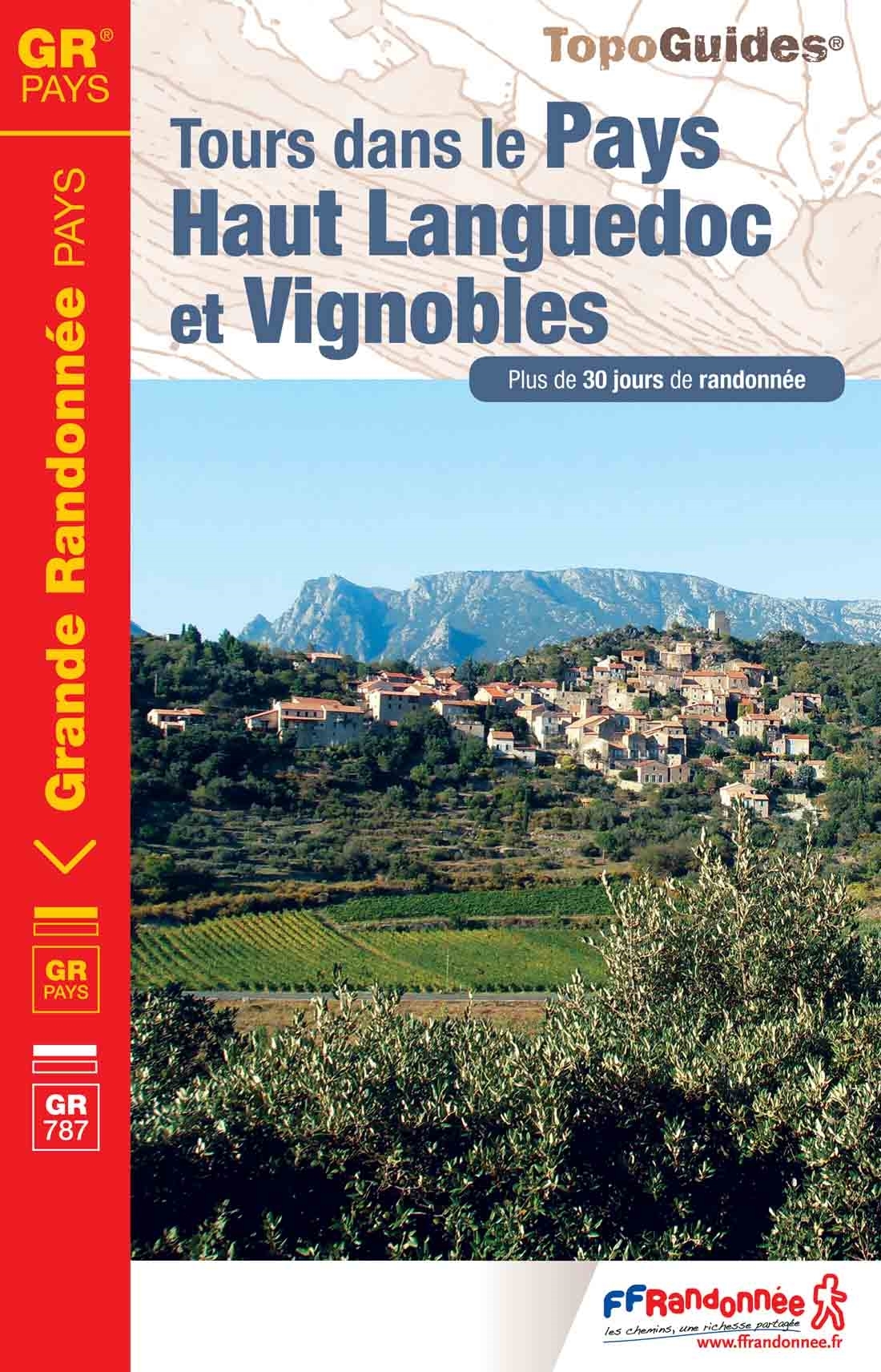
- Wandelgids 3400 Tours dans le Pays Haut Languedoc et Vignobles GR787 | FFRP
- Guide FFRandonnée Tours dans le Pays Haut Languedoc et Vignobles - 3400 - GR, GR Pays, 446 km de sentiers GR. En complément du topo-guide 3481 'Tours dans la montagne du Haut-Languedoc'.Situé en plein cœur du département de l'Aveyron, entre les monts de Lacaune, le Larzac et l'Aubrac, le Lévézou déroule ses collines rêveuses revêtues de... Read more
- Also available from:
- Stanfords, United Kingdom

Stanfords
United Kingdom
2014
United Kingdom
2014
- GRP Tours dans le Pays Haut Languedoc et Vignobles FFRP Topo-guide No. 3400
- Tours dans le Pays Haut Languedoc et Vignobles, FFRP topoguide Ref. no. 3400, covering several routes and circuits, over 446kms in all, in the area west of Lodève and Béziers. Current edition of this title was published in May 2014.ABOUT THE FFRP (Fédération française de la randonnée pédestre) TOPOGUIDES: published in a handy A5 paperback... Read more

De Zwerver
Netherlands
2024
Netherlands
2024
- Also available from:
- Stanfords, United Kingdom

Stanfords
United Kingdom
2020
United Kingdom
2020
- Les Yvelines à pied D078
- Les Yvelines à pied, FFRP topo-guide Ref. No. D078, with 43 day walks of varying length and difficulty in the department of Les Yvelines. The guide, which also includes two GR de Pays routes totaling 150 kms, covers an area west and south-west of Paris with Versailles, Saint-Germain-en-Laye and the forest of Rambouillet. Each walk is presented... Read more
De Zwerver
Netherlands
2012
Netherlands
2012
- Wandelgids 4303 Robe de bure et cotte de mailles | FFRP
- Guide FFRandonnée Robe de bure et cotte de mailles - 4303 - GR Pays, 163 km de sentiers GR 'Robe de bure et cotte de maille'… un intitulé pour le moins énigmatique pour un GR® de Pays ! Lieux de culte - la bure - et châteaux - la cotte de maille - tels sont les édifices que cette boucle de 9 jours vous invite à découvrir dans cette moitié... Read more
- Also available from:
- Stanfords, United Kingdom

Stanfords
United Kingdom
2012
United Kingdom
2012
- GRP Robe de Bure et Cotte de Mailles FFRP Topo-guide No. 4303
- Robe de Bure et Cotte de Mailles, FFRP topoguide Ref. no. 4303, a 163km circuit in the Haute-Loire area of the Massif Central between Le-Puy-en-Velay and Brioude. Current edition of this title was published in September 2012.ABOUT THE FFRP (Fédération française de la randonnée pédestre) TOPOGUIDES: published in a handy A5 paperback format, the... Read more

De Zwerver
Netherlands
2015
Netherlands
2015
- Wandelgids 6543 Sentier vers Saint-Jacques-de-Compostelle via Vezelay : Périgueux - Roncevaux - GR654 | FFRP
- Guide FFRandonnée Sentier vers St-Jacques-de-Compostelle : Périgueux-Ronceveaux. GR 654. Voie de Vézelay vers Compostelle : suite de l'itinéraire décrit dans le topo-guide réf. 6542 'Sentier vers St-Jacques-de-Compostelle : Vézelay-Périgueux'.Passé le seuil du Périgord blanc,... Read more
- Also available from:
- Stanfords, United Kingdom

Stanfords
United Kingdom
2015
United Kingdom
2015
- GR654 Sentier St-Jacques: Perigueux - Roncevaux FFRP Topo-guide No. 6543
- Sentier St-Jacques: Perigueux - Roncevaux, FFRP topoguide Ref. no. 6543, covering the second part of the Way of St James route along the GR654 which starts in Vézelay, the section from Perigueux to the Pyrenees. Also covered is an eastern route from Bergerac to Montréal-de-Gers. Current edition of this title was published in June 2014.ABOUT THE... Read more

De Zwerver
Netherlands
2022
Netherlands
2022

Meer boeken…
Kaarten

De Zwerver
Netherlands
2020
Netherlands
2020
- Wandelatlas - Pelgrimsroute (kaart) 160 Camino de Santiago | Michelin
- Parcourez le Chemin Français (Camino Francés) avec ce petit atlas de poche Michelin. L'outil idéal pour mieux s'y retrouver lors de la préparation du voyage de randonnée sur ce sentier historique qui part de Saint-Jean-Pied-de-Port, dans le Pays basque français, et qui traverse tout le nord de l'Espagne... Read more

De Zwerver
Netherlands
2021
Netherlands
2021
- Also available from:
- Stanfords, United Kingdom

Stanfords
United Kingdom
2021
United Kingdom
2021
- France - Ways of St James IGN Map 922
- France: Ways of St James to Compostela Map from the IGN presents an overview of all the routes across France taken by pilgrims on their way to Santiago de Compostela and the tomb of the apostle St James - the greatest of all goals for thousands of pilgrims in Europe during the Middle Ages. The map was prepared by the IGN and the Association de... Read more

De Zwerver
Netherlands
2020
Netherlands
2020
- Wandelatlas - Pelgrimsroute (kaart) 161 Chemins de Compostelle GR65 | Michelin
- Véritable petit atlas détaillant chaque étape avec indications précises concernant les villes de départ et d'arrivée ainsi que pour les localités traversées (auberges, refuges, restaurants, pharmacies, gare, épiceries, Km parcourus, Km restants....).Ce petit atlas suit le chemin du... Read more

De Zwerver
Netherlands
Netherlands
- Pelgrimsroute (kaart) - Wandelkaart Camino de Santiago in Spanje | CNIG - Instituto Geográfico Nacional
- All roads leading to Santiago de Compostela in the Iberian Peninsula are represented on this Caminos de Santiago / The Way of St. James Map. Routes highlighted on a physical map of the Iberian Peninsula at 1:1,250,000 from IGN/CNIG, Spain civilian topographic survey organization. The base map with altitude colouring and relief shading provides... Read more
- Also available from:
- Stanfords, United Kingdom

Stanfords
United Kingdom
United Kingdom
- Caminos de Santiago / Ways of St. James on the Iberian Peninsula CNIG Overview Map
- All roads leading to Santiago de Compostela in the Iberian Peninsula are represented on this Caminos de Santiago / The Way of St. James Map. Routes highlighted on a physical map of the Iberian Peninsula at 1:1,250,000 from IGN/CNIG, Spain civilian topographic survey organization. The base map with altitude colouring and relief shading provides... Read more
De Zwerver
Netherlands
Netherlands
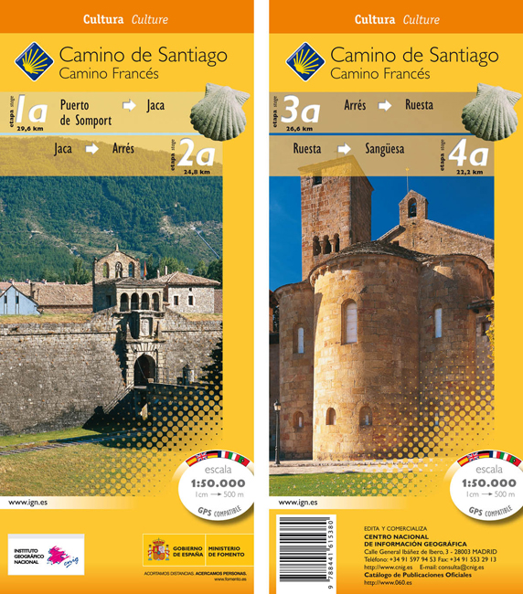
- Wandelkaart 1a-4a Camino Santiago de Compostella Puerte Somport - Sangüesa | CNIG - Instituto Geográfico Nacional
- Camino de Santiago: Stages 1a/2a/3a/4a, Col de Somport/Sangüesa, in a series of double-sided topographic maps at 1:50,000 from the Spanish civilian survey organization, overprinted with the route and sights, plus information of accommodation and other facilities, route profiles, etc.Each 1:50,000 map is double-sided and has four 57 x 35cm... Read more
- Also available from:
- Stanfords, United Kingdom

Stanfords
United Kingdom
United Kingdom
- Camino de Santiago: Stages 1a/2a/3a/4a, Col de Somport/Sangüesa 50K CNIG Map
- Camino de Santiago: Stages 1a/2a/3a/4a, Col de Somport/Sangüesa, in a series of double-sided topographic maps at 1:50,000 from the Spanish civilian survey organization, overprinted with the route and sights, plus information of accommodation and other facilities, route profiles, etc.Each 1:50,000 map is double-sided and has four 57 x 35cm... Read more
De Zwerver
Netherlands
Netherlands
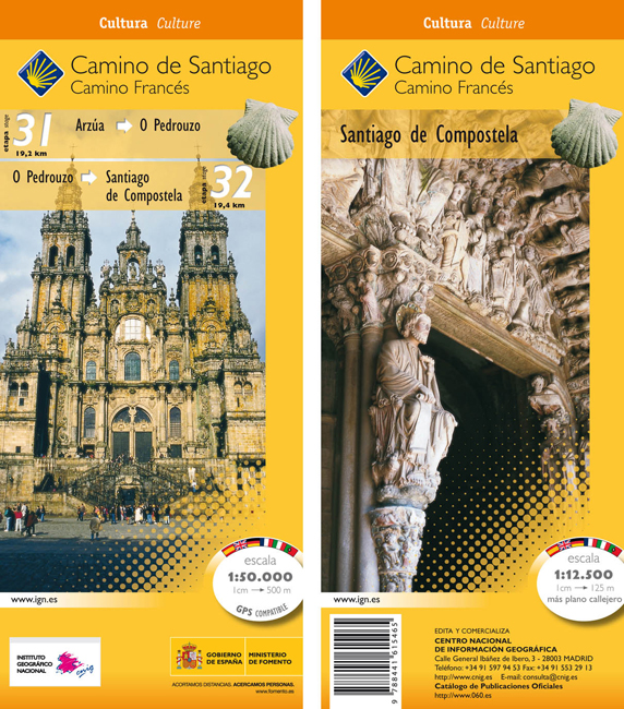
- Wandelkaart 31-32 Camino Santiago de Compostella Arzúa - Santiago | CNIG - Instituto Geográfico Nacional
- The Way of St James: the two last stages, 31 and 32, from Arzúa to Santiago de Compostela, plus a street plan of Santiago de Compostela in a series of double-sided topographic maps at 1:50,000 from the Spanish civilian survey organization, overprinted with the route and sights, plus information of accommodation and other facilities, route... Read more
- Also available from:
- Stanfords, United Kingdom
Stanfords
United Kingdom
United Kingdom
- Camino de Santiago: Stages 31/32, Arzúa/Santiago de Compostela 50K CNIG Map
- The Way of St James: the two last stages, 31 and 32, from Arzúa to Santiago de Compostela, plus a street plan of Santiago de Compostela in a series of double-sided topographic maps at 1:50,000 from the Spanish civilian survey organization, overprinted with the route and sights, plus information of accommodation and other facilities, route... Read more

De Zwerver
Netherlands
Netherlands
- Wandelkaart 06 Couserans - Val D'aran | Rando Editions
- Uitstekende wandelkaart met veel toeristische informatie en bijzonder gedetailleerd. Wandelroute en hutten / campings zijn ingetekend, met hoogtelijnen. Andere dorpen op deze kaart: PN d'Aigües Tortes - St. Girons - Massat - Guzet Neige - Aulus les Bains (Frankrijk - Pyreneeen). GPS Compatible Read more
- Also available from:
- Stanfords, United Kingdom

Stanfords
United Kingdom
United Kingdom
- Couserans-Val d`Aran Rando Editions 6
- The Couserans region of the French Pyrenees, from St-Girons to Pic de Maubermé and Pica d’Estats, on a contoured and GPS compatible map at 1:50,000 from Rando Editions with topographic base provided by the IGN, highlighting local and long-distance hiking trails, etc. Topography is vividly presented by contours at 20m intervals enhanced by... Read more

De Zwerver
Netherlands
Netherlands
- Wandelkaart 07 Haute Ariege | Rando Editions
- Itinéraires de rando, infos culturelles, touristiques et sportives, gîtes, refuges : toutes ces infos sont disponibles sur cette carte à cheval sur France et Espagne. Read more
- Also available from:
- Stanfords, United Kingdom

Stanfords
United Kingdom
United Kingdom
- Haute-Ariége Rando Editions 7
- The Haute-Ariége region of the French Pyrenees, from Foix to Pica d`Estats and the Col de Puymorens, on a contoured and GPS compatible map at 1:50,000 from Rando Editions with topographic base provided by the IGN, highlighting local and long-distance hiking trails, etc. Topography is vividly presented by contours at 20m intervals enhanced by... Read more

- Also available from:
- Stanfords, United Kingdom

Stanfords
United Kingdom
United Kingdom
- Pays Basque West Rando Editions 1
- The westernmost section of the French Pyrenees between the Atlantic coast and St-Jean-Pied-de-Port on a contoured and GPS compatible map at 1:50,000 from Rando Editions with topographic base provided by the IGN, highlighting local and long-distance hiking trails, cycle and mountain bike routes, etc. Coverage along the Atlantic coast starts at... Read more
De Zwerver
Netherlands
Netherlands
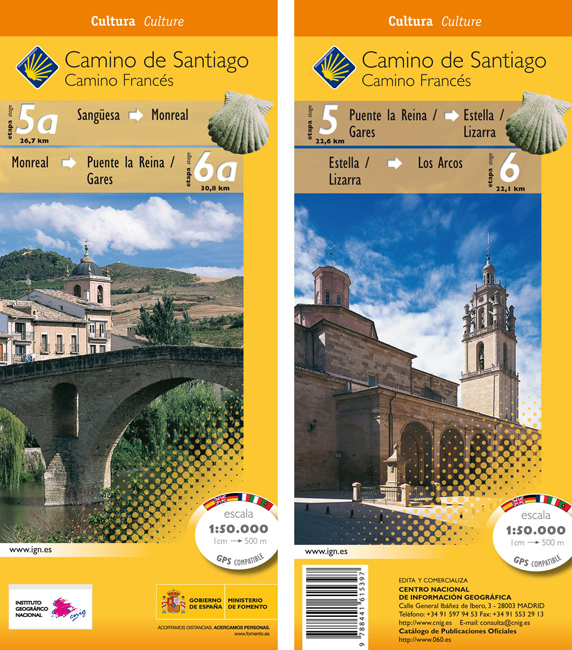
- Wandelkaart 5A-6 Camino Santiago de Compostella Sangüesa - Los Arcos | CNIG - Instituto Geográfico Nacional
- The Way of St James: Stages 5/5a/6/6a, Sangüesa/Puente la Reina/Los Arcos in a series of double-sided topographic maps at 1:50,000 from the Spanish civilian survey organization, overprinted with the route and sights, plus information of accommodation and other facilities, route profiles, etc.Each 1:50,000 map is double-sided and has four 57 x... Read more
- Also available from:
- Stanfords, United Kingdom
Stanfords
United Kingdom
United Kingdom
- Camino de Santiago: Stages 5/5a/6/6a, Sangüesa/Puente la Reina/Los Arcos 50K CNIG Map
- The Way of St James: Stages 5/5a/6/6a, Sangüesa/Puente la Reina/Los Arcos in a series of double-sided topographic maps at 1:50,000 from the Spanish civilian survey organization, overprinted with the route and sights, plus information of accommodation and other facilities, route profiles, etc.Each 1:50,000 map is double-sided and has four 57 x... Read more

De Zwerver
Netherlands
Netherlands
- Wegenkaart - landkaart Camino de Santiago - Camino Frances | CNIG - Instituto Geográfico Nacional
- Northern Spain on an overview map at 1:500,000 highlighting the course of the Camino Francés route of the Way of St James from the Pyrenees to Santiago de Compostela via Burgos and León. Published by Spain’s civilian survey organization as part of their set providing topographic coverage of the route at 1:50,000, the map is also available... Read more
- Also available from:
- Stanfords, United Kingdom

Stanfords
United Kingdom
United Kingdom
- Way of St James / Camino de Santiago CNIG Overview Map
- Northern Spain on an overview map at 1:500,000 highlighting the course of the Camino Francés route of the Way of St James from the Pyrenees to Santiago de Compostela via Burgos and León. Published by Spain’s civilian survey organization as part of their set providing topographic coverage of the route at 1:50,000, the map is also available... Read more

De Zwerver
Netherlands
Netherlands
- Wandelkaart 02 Pays Basque Est | Rando Editions
- Uitstekende wandelkaart met veel toeristische informatie en bijzonder gedetailleerd. Wandelroutes en GR paden en hutten / campings zijn ingetekend, met hoogtelijnen. Andere dorpen op deze kaart: Arrette - la Pierre St. Martin - St. Jean Pied de Port (Frankrijk - Pyreneeen) Versant français et espagnol : Barétous; Soule, Basse-Navarre, vallée... Read more
- Also available from:
- Stanfords, United Kingdom

Stanfords
United Kingdom
United Kingdom
- Pays Basque East Rando Editions 2
- Western Pyrenees in France from the peaks of Iguzuki and Iparla, across St-Jean-Pied-de-Port and Larrau, to Pic d’Anie on a contoured and GPS compatible map at 1:50,000 from Rando Editions with topographic base provided by the IGN, highlighting local and long-distance hiking trails, cycle and mountain bike routes, etc. Topography is vividly... Read more

De Zwerver
Netherlands
2021
Netherlands
2021
- Also available from:
- Stanfords, United Kingdom

De Zwerver
Netherlands
Netherlands
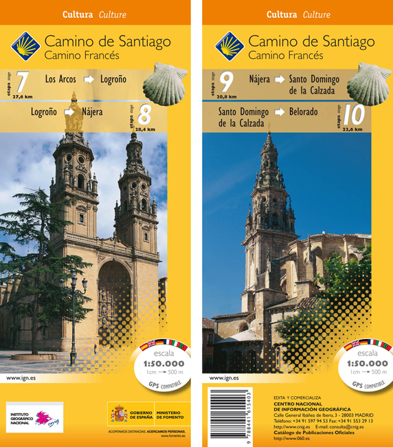
- Wandelkaart 7-10 Camino Santiago de Compostella Los Arcos - Belorado | CNIG - Instituto Geográfico Nacional
- Camino de Santiago: Stages 7/8/9/10, Los Arcos/Belorado, in a series of double-sided topographic maps at 1:50,000 from the Spanish civilian survey organization, overprinted with the route and sights, plus information of accommodation and other facilities, route profiles, etc.Each 1:50,000 map is double-sided and has four 57 x 35cm panels with... Read more
- Also available from:
- Stanfords, United Kingdom
Stanfords
United Kingdom
United Kingdom
- Camino de Santiago: Stages 7/8/9/10, Los Arcos/Belorado 50K CNIG Map
- Camino de Santiago: Stages 7/8/9/10, Los Arcos/Belorado, in a series of double-sided topographic maps at 1:50,000 from the Spanish civilian survey organization, overprinted with the route and sights, plus information of accommodation and other facilities, route profiles, etc.Each 1:50,000 map is double-sided and has four 57 x 35cm panels with... Read more

De Zwerver
Netherlands
Netherlands
- Wandelkaart 08 Cerdagne Capcir | Rando Editions
- Uitstekende wandelkaart met veel toeristische informatie en bijzonder gedetailleerd. Wandelroute en hutten / campings zijn ingetekend, met hoogtelijnen. Andere dorpen op deze kaart: Ax les Thermes - Massif de l'Aston - Canillo - Soldeu - Mérens les Vals - Porté Puymorens - Mijanès - Puyvalador - Olette - Mont Louis - Font Romeu - Núria -... Read more
- Also available from:
- Stanfords, United Kingdom

Stanfords
United Kingdom
United Kingdom
- Cerdagne-Capcir Rando Editions 8
- The Cerdagne-Capcir region of the French Pyrenees, from Ax-les Thermes to Font Romeu and Bourg-Madame, on a contoured and GPS compatible map at 1:50,000 from Rando Editions with topographic base provided by the IGN, highlighting local and long-distance hiking trails, etc. Topography is vividly presented by contours at 20m intervals enhanced by... Read more