
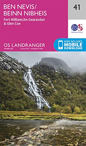
Ben Nevis
Beschrijving
- Hoogte 1344.00 m
Links
Feiten
Verslagen
Gidsen en kaarten
Overnachting
Organisaties
Reisorganisaties
GPS
Anders
Boeken
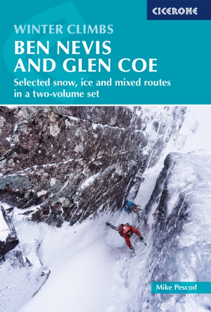
De Zwerver
Netherlands
2022
Netherlands
2022
De Zwerver
Netherlands
2015
Netherlands
2015
- Also available from:
- Stanfords, United Kingdom

Stanfords
United Kingdom
2015
United Kingdom
2015
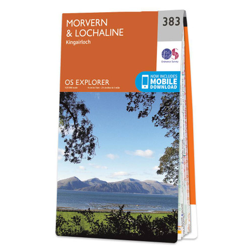
- Morvern & Lochaline - Kingairloch OS Explorer Map 383 (paper)
- Morvern, Lochaline and Kingairloch area on a detailed topographic and GPS compatible map No. 383, paper version, from the Ordnance Survey’s 1:25,000 Explorer series. MOBILE DOWNLOADS: this title and all the other OS Explorer maps include a code for downloading after purchase the digital version onto your smartphone or tablet for viewing on the... Read more
De Zwerver
Netherlands
Netherlands
- Also available from:
- Stanfords, United Kingdom

Stanfords
United Kingdom
United Kingdom
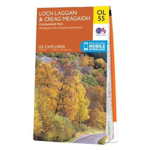
- Loch Laggan & Creag Meagaidh - Corrieyairick Pass OS Explorer Map OL55 (paper)
- Loch Laggan and Creag Meagaidh area of the Scottish Highlands on a detailed topographic and GPS compatible map OL55, paper version, from the Ordnance Survey’s 1:25,000 Explorer series. Coverage includes a section of the Cairngorms National Park, the Corrieyairack Pass and Forest, six Munro peaks including Cael Charn and Carn Liath, Badenoch,... Read more
- Also available from:
- Stanfords, United Kingdom

Stanfords
United Kingdom
2016
United Kingdom
2016
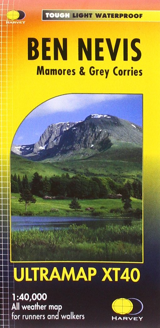
- Ben Nevis - Mamores & Grey Corries Harvey Ultramap XT40
- Ben Nevis with the Mamores and Grey Corries ranges at 1:40,000 on a waterproof and tear-resistant, pocket-size Ultramap from Harvey Map Services with the same cartography as their Superwalker map of this area. The peak of Ben Nevis is also shown in greater detail at 1:20,000. The map divides the area north/south, with a good overlap between the... Read more
De Zwerver
Netherlands
2017
Netherlands
2017
- Also available from:
- Bol.com, Netherlands
- Bol.com, Belgium
- Stanfords, United Kingdom
- The Book Depository, United Kingdom

Bol.com
Netherlands
2017
Netherlands
2017
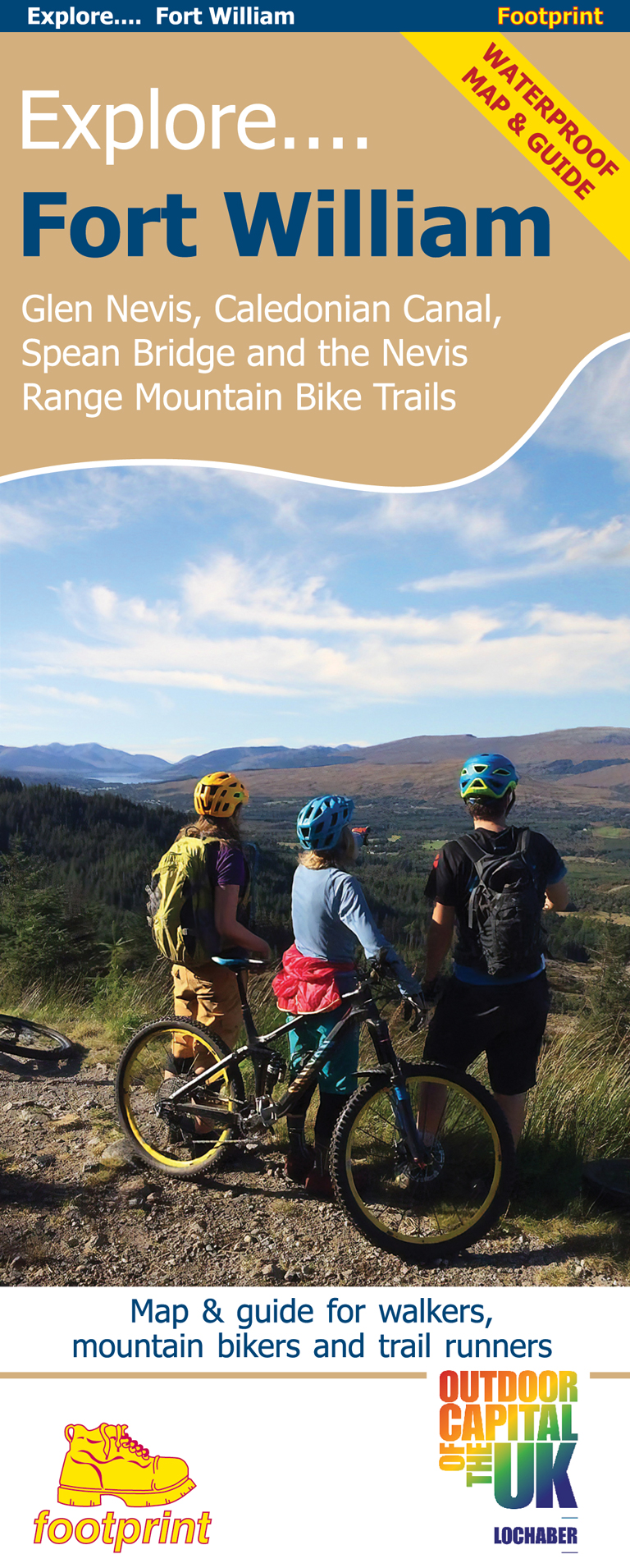
- Fort William & Glen Coe
- Fort William and Glen Coe encompass one of the greatest areas of sea and mountain landscape in Scotland, backed by some of the biggest and most demanding peaks. This is Scotland's fjord land, a drowned coastland with long sea arms wending far inland, and the walks range from Fort William at sea level to Ben Nevis, the highest summit in Britain.... Read more
Bol.com
Belgium
2017
Belgium
2017
- Fort William & Glen Coe
- Fort William and Glen Coe encompass one of the greatest areas of sea and mountain landscape in Scotland, backed by some of the biggest and most demanding peaks. This is Scotland's fjord land, a drowned coastland with long sea arms wending far inland, and the walks range from Fort William at sea level to Ben Nevis, the highest summit in Britain.... Read more

Stanfords
United Kingdom
2017
United Kingdom
2017
- Fort William and Glen Coe
- Fort William and Glen Coe encompass one of the greatest areas of sea and mountain landscape in Scotland, backed by some of the biggest and most demanding peaks. This is Scotland`s fjord land, a drowned coastland with long sea arms wending far inland, and the walks range from Fort William at sea level to Ben Nevis, the highest summit in Britain.... Read more

Bol.com
Netherlands
Netherlands
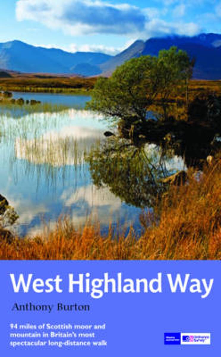
- West Highland Way
- Fully revised second edition of the first of Trailblazer's 10-title series of British Walking Guides. The West Highland Way is the most popular long-distance path in the country, passing through some of the most spectacular scenery in all of Britain. From the outskirts of Glasgow it winds for 95 miles along the wooded banks of Loch Lomond,... Read more
- Also available from:
- Bol.com, Belgium
Bol.com
Belgium
Belgium
- West Highland Way
- Fully revised second edition of the first of Trailblazer's 10-title series of British Walking Guides. The West Highland Way is the most popular long-distance path in the country, passing through some of the most spectacular scenery in all of Britain. From the outskirts of Glasgow it winds for 95 miles along the wooded banks of Loch Lomond,... Read more
Bol.com
Netherlands
2011
Netherlands
2011
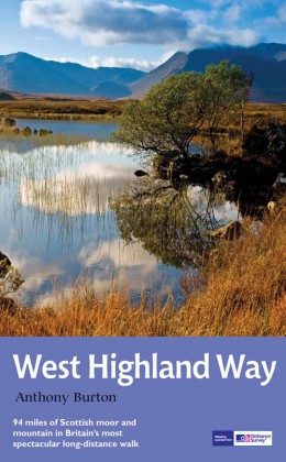
- The West Highland Way
- The West Highland Way is Scotland's most popular long-distance walk, running 96 miles (155 km) from Glasgow, Scotland's largest city, through its first National Park, across the western Highlands to the foot of its highest mountain, Ben Nevis. This is the fourth, fully revised edition of the popular rucksack-friendly guidebook and includes the... Read more
- Also available from:
- Bol.com, Belgium
Bol.com
Belgium
2011
Belgium
2011
- The West Highland Way
- The West Highland Way is Scotland's most popular long-distance walk, running 96 miles (155 km) from Glasgow, Scotland's largest city, through its first National Park, across the western Highlands to the foot of its highest mountain, Ben Nevis. This is the fourth, fully revised edition of the popular rucksack-friendly guidebook and includes the... Read more
Bol.com
Netherlands
Netherlands
- The National 3 Peaks - Taking Up the Challenge
- Discovery Walking Guides Celebrating 25 Years of Adventures is slashing the selling price of its Challenge biiks from GBP8.99 to GBP4.99 until 30 September 2013. Undertaking the National Three Peaks walk has become a hugely popular challenge. Many 'challengers' are motivated by a wish to raise money for a charitable cause. But as well as that,... Read more
- Also available from:
- Bol.com, Belgium
- Stanfords, United Kingdom
- The Book Depository, United Kingdom
Bol.com
Belgium
Belgium
- The National 3 Peaks - Taking Up the Challenge
- Discovery Walking Guides Celebrating 25 Years of Adventures is slashing the selling price of its Challenge biiks from GBP8.99 to GBP4.99 until 30 September 2013. Undertaking the National Three Peaks walk has become a hugely popular challenge. Many 'challengers' are motivated by a wish to raise money for a charitable cause. But as well as that,... Read more

Stanfords
United Kingdom
United Kingdom
- The National 3 Peaks – Taking up the Challenge
- The National 3 Peaks – Taking up the Challenge is Steve Williams’ inspirational Discovery Walking Guide to planning, preparing and completing the 3 Peaks Challenge of climbing Ben Nevis, Snowdon and Scafell Pike in 24 hours. Part narrative and part practical guide, the author explores the training that walkers need to do before attempting the... Read more

Bol.com
Netherlands
2016
Netherlands
2016
- West Highland Way Map Booklet
- All the mapping you need to complete the 95 mile (153km) West Highland Way, an official Scottish Long Distance Route from Milngavie near Glasgow to Fort William. Showcasing the wild beauty of western Scotland, the trail is a journey from the lowlands to the highlands, passing Loch Lomond then crossing Rannoch Moor before finishing in the shadow... Read more
- Also available from:
- Bol.com, Belgium
- Stanfords, United Kingdom
Bol.com
Belgium
2016
Belgium
2016
- West Highland Way Map Booklet
- All the mapping you need to complete the 95 mile (153km) West Highland Way, an official Scottish Long Distance Route from Milngavie near Glasgow to Fort William. Showcasing the wild beauty of western Scotland, the trail is a journey from the lowlands to the highlands, passing Loch Lomond then crossing Rannoch Moor before finishing in the shadow... Read more

Stanfords
United Kingdom
2016
United Kingdom
2016
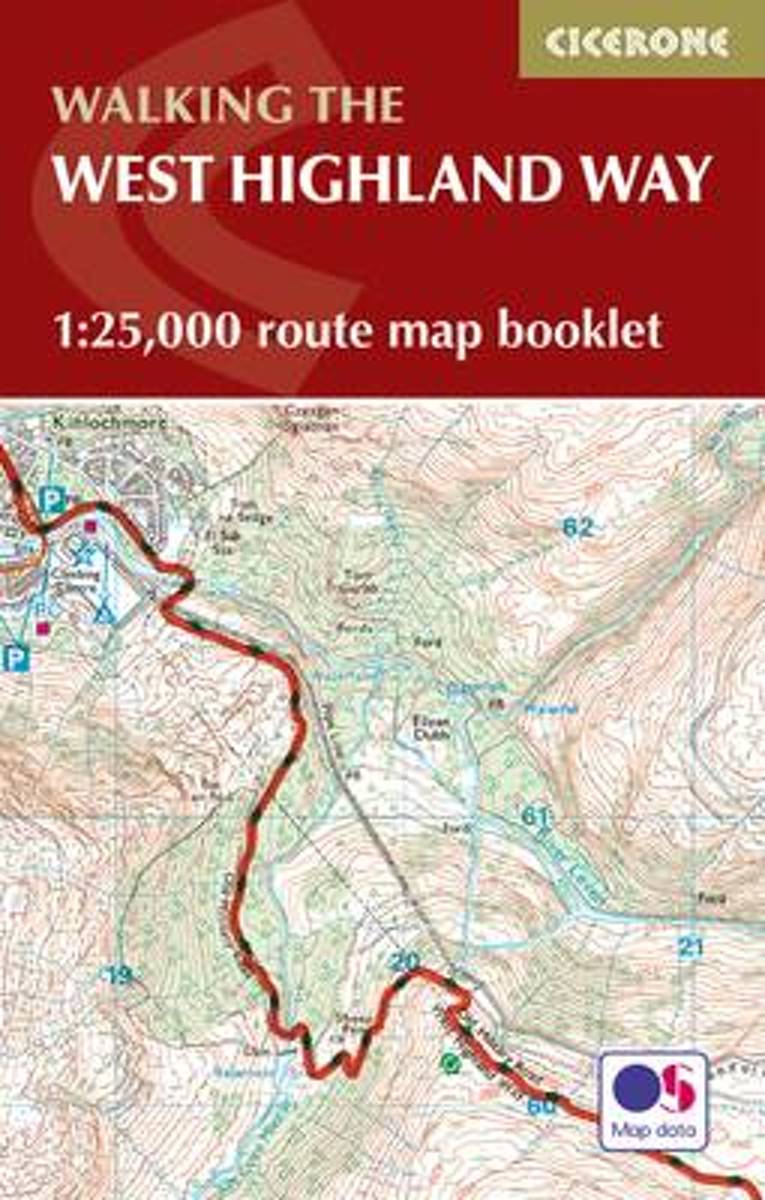
- West Highland Way Cicerone Map Booklet
- Map coverage of the West Highland Way, 152km (95 miles) from Milngavie on theoutskirts of Glasgow to Fort William. The trail typically takes 8 days to walk in its entirety. This compact booklet of Ordnance Survey 1:25,000 maps shows the full route, providing all of the mapping you need to complete the trail, and eliminating the need to fold and... Read more
Bol.com
Netherlands
Netherlands
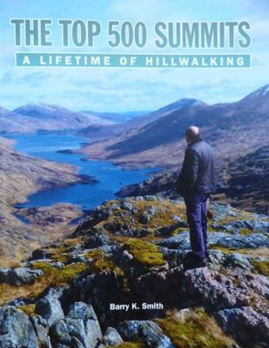
- The Top 500 Summits
- The Top 500 Summits are the highest 500 mountains in Britain and Ireland with a drop of at least 500 feet on all sides. From the highest mountain on the list, Ben Nevis (4,411ft) to the lowest, Knockanaffrin in Ireland (2,477ft), this guide tells Barry's personal journey over all 500 summits. Other walkers who have shared in some of Barry's... Read more
- Also available from:
- Bol.com, Belgium
Bol.com
Belgium
Belgium
- The Top 500 Summits
- The Top 500 Summits are the highest 500 mountains in Britain and Ireland with a drop of at least 500 feet on all sides. From the highest mountain on the list, Ben Nevis (4,411ft) to the lowest, Knockanaffrin in Ireland (2,477ft), this guide tells Barry's personal journey over all 500 summits. Other walkers who have shared in some of Barry's... Read more
Bol.com
Netherlands
Netherlands
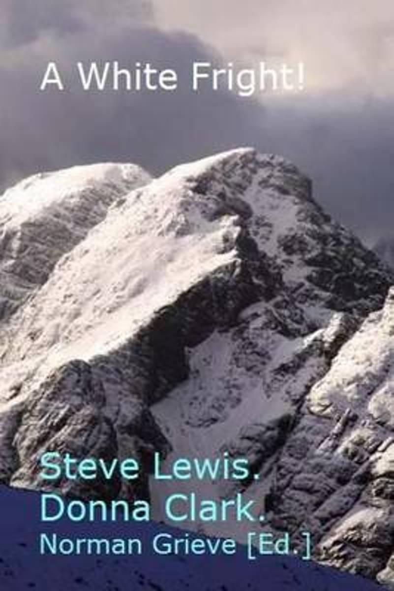
- A White Fright!
- P.2 Solo ascent of Beinn Sgritheall (with hangover). P.6 Richie's Gully: A white fright. P.11 A Western Tatra Ridge. P.17 An accidental Graham. P.23 Ben Nevis - My first hike in 20 years - A psychological report. Read more
- Also available from:
- Bol.com, Belgium
Bol.com
Belgium
Belgium
- A White Fright!
- P.2 Solo ascent of Beinn Sgritheall (with hangover). P.6 Richie's Gully: A white fright. P.11 A Western Tatra Ridge. P.17 An accidental Graham. P.23 Ben Nevis - My first hike in 20 years - A psychological report. Read more
- Also available from:
- Bol.com, Netherlands
- Bol.com, Belgium
- The Book Depository, United Kingdom
Bol.com
Netherlands
2016
Netherlands
2016
- The West Highland Way
- The 93-mile West Highland Way is indisputably Britain's most spectacular long-distance path. The first section, following the eastern shore of Loch Lomond, offers an idyllic waterside walk, with the full grandeur of the Highlands gradually revealing itself. Then, after crossing the barren wilderness of the Rannoch Moor, the walker climbs the... Read more
Bol.com
Belgium
2016
Belgium
2016
- The West Highland Way
- The 93-mile West Highland Way is indisputably Britain's most spectacular long-distance path. The first section, following the eastern shore of Loch Lomond, offers an idyllic waterside walk, with the full grandeur of the Highlands gradually revealing itself. Then, after crossing the barren wilderness of the Rannoch Moor, the walker climbs the... Read more

Bol.com
Netherlands
Netherlands
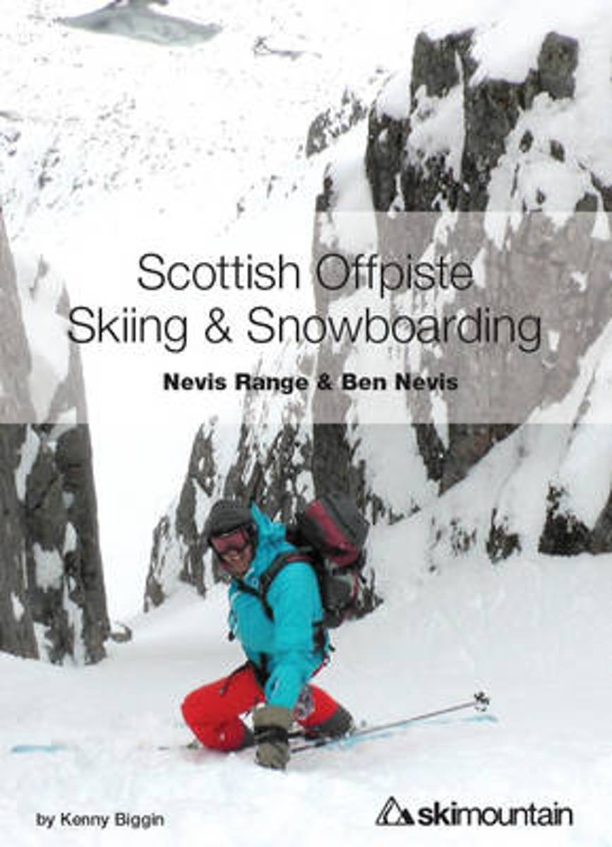
- Scottish Offpiste Skiing & Snowboarding
- The second in the Scottish Offpiste guidebook series, this colourful book focuses on the incredible mountains of Glencoe centred around the historic White Corries ski area. 93 routes, 230 pages, 210 full colour photos and diagrams - plus a completely new section on avalanche and mountain safety and decision making.This offpiste skiing and... Read more
- Also available from:
- Bol.com, Belgium
Bol.com
Belgium
Belgium
- Scottish Offpiste Skiing & Snowboarding
- The second in the Scottish Offpiste guidebook series, this colourful book focuses on the incredible mountains of Glencoe centred around the historic White Corries ski area. 93 routes, 230 pages, 210 full colour photos and diagrams - plus a completely new section on avalanche and mountain safety and decision making.This offpiste skiing and... Read more
Bol.com
Netherlands
Netherlands
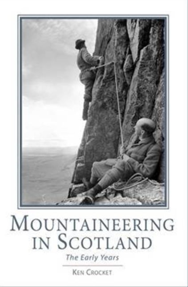
- Mountaineering in Scotland
- From Ken Crocket, author of Ben Nevis - Britain's Highest Mountain, comes the full story of the dawning of mountaineering in Scotland. It will shock many to discover that within a few years, Victorian climbers brought climbing in Scotland to technical levels not surpassed until the 1940s. The book breaks new ground as the comprehensive record... Read more
- Also available from:
- Bol.com, Belgium
Bol.com
Belgium
Belgium
- Mountaineering in Scotland
- From Ken Crocket, author of Ben Nevis - Britain's Highest Mountain, comes the full story of the dawning of mountaineering in Scotland. It will shock many to discover that within a few years, Victorian climbers brought climbing in Scotland to technical levels not surpassed until the 1940s. The book breaks new ground as the comprehensive record... Read more
De Zwerver
Netherlands
2016
Netherlands
2016
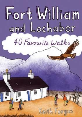
- Wandelgids Fort William and Lochaber | Pocket Mountains
- 40 Favourite Walks Read more
- Also available from:
- Bol.com, Netherlands
- Bol.com, Belgium
- Stanfords, United Kingdom
- The Book Depository, United Kingdom

Bol.com
Netherlands
2016
Netherlands
2016
- Fort William and Lochaber
- With the historic town of Fort William at its heart, Lochaber boasts some of Scotland's most celebrated mountains and glens, beautiful sea lochs and, on the craggy west coast, dazzling white sandy beaches. Ben Nevis may draw the crowds, but with countless miles of lower-level paths and tracks to explore there is far more than Britain's highest... Read more
Bol.com
Belgium
2016
Belgium
2016
- Fort William and Lochaber
- With the historic town of Fort William at its heart, Lochaber boasts some of Scotland's most celebrated mountains and glens, beautiful sea lochs and, on the craggy west coast, dazzling white sandy beaches. Ben Nevis may draw the crowds, but with countless miles of lower-level paths and tracks to explore there is far more than Britain's highest... Read more

Stanfords
United Kingdom
2016
United Kingdom
2016
- Fort William and Lochaber: 40 Favourite Walks
- With the historic town of Fort William at its heart, Lochaber boasts some of Scotland`s most celebrated mountains and glens, beautiful sea lochs and, on the craggy west coast, dazzling white sandy beaches. Ben Nevis may draw the crowds, but with countless miles of lower-level paths and tracks to explore there is far more than Britain`s highest... Read more

Kaarten

De Zwerver
Netherlands
2022
Netherlands
2022
- Wandelkaart Ben Nevis | Harvey Maps
- Ben Nevis with the Mamores and Grey Corries ranges at 1:25,000 on a double-sided, waterproof and tear-resistant map from Harvey Map Services with the peak area shown in greater detail at 1:12,500. The map divides the area north/south, with a good overlap between the sides, extending from Fort William past Loch Treig to Chno Deang, plus south to... Read more
- Also available from:
- Stanfords, United Kingdom

Stanfords
United Kingdom
2022
United Kingdom
2022
- Ben Nevis - Mamores & Grey Corries Harvey Superwalker XT25
- Ben Nevis with the Mamores and Grey Corries ranges at 1:25,000 on a double-sided, waterproof and tear-resistant map from Harvey Map Services in their Superwalker series, with the peak area also shown in greater detail at 1:12,500. The map divides the area north/south, with a good overlap between the sides, extending from Fort William past Loch... Read more

Bol.com
Netherlands
2014
Netherlands
2014
- Great Glen Way
- This guidebook (fully updated 2014) contains all you need to plan and enjoy a holiday walking or cycling along Scotland's historic Great Glen (77 miles/125 km). The Way runs between Fort William and Inverness, beside Scotland's highest mountain, along the historic Caledonian Canal and past beautiful lochs, including Loch Ness with its famous... Read more
- Also available from:
- Bol.com, Belgium
Bol.com
Belgium
2014
Belgium
2014
- Great Glen Way
- This guidebook (fully updated 2014) contains all you need to plan and enjoy a holiday walking or cycling along Scotland's historic Great Glen (77 miles/125 km). The Way runs between Fort William and Inverness, beside Scotland's highest mountain, along the historic Caledonian Canal and past beautiful lochs, including Loch Ness with its famous... Read more

De Zwerver
Netherlands
2018
Netherlands
2018
- Wandelkaart West Highland Way | Harvey Maps
- Wandelkaart van de West Highland Way met uitsnedes van de route. Leap forward in technical excellence. Tough, light and 100% wateproof. Compact and light - the map itself weighs just 60gms - a third of the weight of a laminated map, and much less bulky. And you can fold or refold it time and again, or stuff it in your back pocket and it... Read more
- Also available from:
- Bol.com, Netherlands
- Bol.com, Belgium
- Stanfords, United Kingdom

Bol.com
Netherlands
2018
Netherlands
2018
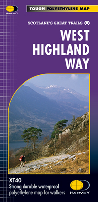
- West Highland Way XT40
- The West Highland Way is 96 miles (153 km) long and links Milngavie (Glasgow) to Fort William. It run's from Scotland's largest city to the foot of its highest mountain, Ben Nevis, through the Loch Lomond and Trossachs National Park.Detailed mapping, full legend in English, French and German. National Grid. Read more
Bol.com
Belgium
2018
Belgium
2018
- West Highland Way XT40
- The West Highland Way is 96 miles (153 km) long and links Milngavie (Glasgow) to Fort William. It run's from Scotland's largest city to the foot of its highest mountain, Ben Nevis, through the Loch Lomond and Trossachs National Park.Detailed mapping, full legend in English, French and German. National Grid. Read more
Stanfords
United Kingdom
2018
United Kingdom
2018
- West Highland Way Harvey National Trail XT40
- The West Highland Way, Scotland’s premier 153km / 96 miles long trail from Milngavie near Glasgow along Loch Lomond to Fort William presented at 1:40,000 on a light, waterproof and tear-resistant map from Harvey Map Services. The whole route is covered by nine overlapping panels, and the map includes small street plan of Milngavie, Tyndrum,... Read more

Stanfords
United Kingdom
United Kingdom
- National 3 Peaks Challenge Minimaps Set: Ben Nevis, Scafell Pike and Snowdon.
- The three peaks which are part of the National Three Peaks Challenge: Ben Nevis, Scafell Pike and Snowdon shown on handy size, waterproof and tear-resistant extracts from the Ordnance Survey 1:25,000 Explorer series. The three maps are sold together in a presentation wallet which also includes brief descriptions and spaces for recording your... Read more

Stanfords
United Kingdom
United Kingdom
- The Three Peaks Challenge - Snowdon OS Explorer Map
- The mountains of the Three Peaks Challenge - Ben Nevis, Scafell Pike and Snowdon – on extracts from the Ordnance Survey 1:25,000 Explorer series, with enlargements of the summits, extracts from regional mapping to show road access, and an overview road map linking the three peaks.The area around each peak is presented on a 36x36cm panel with an... Read more

De Zwerver
Netherlands
2018
Netherlands
2018
- Wandelkaart East Highland Way | Harvey Maps
- East Highland Way, a 132km / 82 miles trail on a light, waterproof and tear-resistant map at 1:40,000 from Harvey Map Services presenting the route accompanied by extensive additional tourist information. The route links Fort Williams, the northern point of the West Highland Way and the southern point of the Great Glen Way, with Aviemore, the... Read more
- Also available from:
- Stanfords, United Kingdom
- The Book Depository, United Kingdom

Stanfords
United Kingdom
2018
United Kingdom
2018
- East Highland Way Harvey National Trail XT40
- East Highland Way, a 132km / 82 miles trail on a light, waterproof and tear-resistant map at 1:40,000 from Harvey Map Services presenting the route accompanied by extensive additional tourist information. The route links Fort Williams, the northern point of the West Highland Way and the southern point of the Great Glen Way, with Aviemore, the... Read more

The Book Depository
United Kingdom
2018
United Kingdom
2018
- East Highland Way
- East Highland Way, a 132km / 82 miles trail on a light, waterproof and tear-resistant map at 1:40,000 from Harvey Map Services presenting the route accompanied by extensive additional tourist information. The route links Fort Williams, the northern point of the West Highland Way and the southern point of the Great Glen Way, with Aviemore, the... Read more

De Zwerver
Netherlands
Netherlands
- Wandelkaart Great Glen Way | Harvey Maps
- Great Glen Way, a 126km/79 miles trail from Fort William along Loch Ness to Inverness, presented at 1:40,000 on a light, waterproof and tear-resistant map from Harvey Map Services. The whole route is covered on four overlapping panels, and includes street plans of Fort William (showing the start/end of the West Highland Way) and Inverness. Map... Read more
- Also available from:
- Stanfords, United Kingdom
- The Book Depository, United Kingdom

Stanfords
United Kingdom
United Kingdom
- Great Glen Way Harvey National Trail XT40
- Great Glen Way, a 126km/79 miles trail from Fort William along Loch Ness to Inverness, presented at 1:40,000 on a light, waterproof and tear-resistant map from Harvey Map Services. The whole route is covered on four overlapping panels, and includes street plans of Fort William (showing the start/end of the West Highland Way) and Inverness. Map... Read more

The Book Depository
United Kingdom
United Kingdom
- Great Glen Way
- Great Glen Way, a 126km/79 miles trail from Fort William along Loch Ness to Inverness, presented at 1:40,000 on a light, waterproof and tear-resistant map from Harvey Map Services. The whole route is covered on four overlapping panels, and includes street plans of Fort William (showing the start/end of the West Highland Way) and Inverness. Map... Read more

De Zwerver
Netherlands
2013
Netherlands
2013
- Wandelkaart South Loch Ness Trail | Harvey Maps
- The South Loch Ness Trail, a 45km / 28 mile long hiking route from Loch Tarff near Fort Augustus on the southern tip of Loch Ness to Torbreck on the outskirts of Inverness at 1:40,000 on GPS compatible, light, waterproof and tear-resistant map from Harvey Map Services. The map also highlights the course of the Trail of the 7 Lochs, an 80km / 50... Read more
- Also available from:
- Stanfords, United Kingdom
- The Book Depository, United Kingdom

Stanfords
United Kingdom
2013
United Kingdom
2013
- South Loch Ness Trail Harvey National Trail XT40
- The South Loch Ness Trail, a 45km / 28 mile long hiking route from Loch Tarff near Fort Augustus on the southern tip of Loch Ness to Torbreck on the outskirts of Inverness at 1:40,000 on GPS compatible, light, waterproof and tear-resistant map from Harvey Map Services. The map also highlights the course of the Trail of the 7 Lochs, an 80km / 50... Read more

The Book Depository
United Kingdom
2013
United Kingdom
2013
- South Loch Ness Trail
- The South Loch Ness Trail, a 45km / 28 mile long hiking route from Loch Tarff near Fort Augustus on the southern tip of Loch Ness to Torbreck on the outskirts of Inverness at 1:40,000 on GPS compatible, light, waterproof and tear-resistant map from Harvey Map Services. The map also highlights the course of the Trail of the 7 Lochs, an 80km / 50... Read more

De Zwerver
Netherlands
2018
Netherlands
2018
- Wandelkaart Ben Nevis & Glen Coe | Harvey Maps
- Waterproof mountain map of Ben Nevis & Glen Coe from Harvey at 1:40,000, with a geological map of the region on the reverse, an enlargement of Ben Nevis' summit, and advice on navigating the region safely.MAIN MAP: Topography is shown through clear altitude shading, spot heights, contours at 15m intervals, and index contours at 75m intervals. A... Read more
- Also available from:
- Stanfords, United Kingdom
- The Book Depository, United Kingdom

Stanfords
United Kingdom
2018
United Kingdom
2018
- Ben Nevis & Glen Coe Harvey British Mountain Map XT40
- Waterproof mountain map of Ben Nevis & Glen Coe from Harvey at 1:40,000, with a geological map of the region on the reverse, an enlargement of Ben Nevis` summit, and advice on navigating the region safely.*MAIN MAP:* Topography is shown through clear altitude shading, spot heights, contours at 15m intervals, and index contours at 75m intervals.... Read more

The Book Depository
United Kingdom
2018
United Kingdom
2018
- Ben Nevis and Glen Coe
- Waterproof mountain map of Ben Nevis & Glen Coe from Harvey at 1:40,000, with a geological map of the region on the reverse, an enlargement of Ben Nevis' summit, and advice on navigating the region safely.MAIN MAP: Topography is shown through clear altitude shading, spot heights, contours at 15m intervals, and index contours at 75m intervals. A... Read more

De Zwerver
Netherlands
Netherlands
- Wandelkaart The West Highland Way | Footprint maps
- The West Highland Way waterproof map from Footprint is a map-guide to the 95 mile (153km) route between Milngavie and Fort William. The mapping is based on Ordnance Survey data at a scale of 1:40,000, with compact and concise information for walkers. Read more
- Also available from:
- Stanfords, United Kingdom
- The Book Depository, United Kingdom

Stanfords
United Kingdom
United Kingdom
- The West Highland Way - 95 Mile Route Between Milngavie and Fort William
- The West Highland Way waterproof map from Footprint is a map-guide to the 95 mile (153km) route between Milngavie and Fort William. The mapping is based on Ordnance Survey data at a scale of 1:40,000, with compact and concise information for walkers. Read more

The Book Depository
United Kingdom
United Kingdom
- The West Highland Way (Footprint Map)
- A Footprint Map-Guide to the 95 Mile Route Between Milngavie and Fort William Read more

Stanfords
United Kingdom
United Kingdom
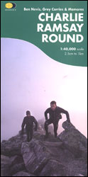
- Charlie Ramsay Round: Ben Nevis, Grey Corries and Mamores
- Charlie Ramsay Round, a route from the Ben Nevis Youth Hostel across the peak itself and 23 more summits including the Grey Corries and Mamores ranges, presented at 1:40,000 on a contoured, GPS compatible map from Harvey Map Services, printed on light, waterproof and tear-resistant paper. Contours are at 15m intervals enhanced by graphic relief... Read more
- Also available from:
- The Book Depository, United Kingdom
The Book Depository
United Kingdom
United Kingdom
- Charlie Ramsay Round
- Charlie Ramsay Round, a route from the Ben Nevis Youth Hostel across the peak itself and 23 more summits including the Grey Corries and Mamores ranges, presented at 1:40,000 on a contoured, GPS compatible map from Harvey Map Services, printed on light, waterproof and tear-resistant paper. Contours are at 15m intervals enhanced by graphic relief... Read more