
Nantahala National Forest
Beschrijving
Paden in deze regio
Links
Feiten
Verslagen
Gidsen en kaarten
Overnachting
Organisaties
Reisorganisaties
GPS
Anders
Boeken


De Zwerver
Netherlands
Netherlands

De Zwerver
Netherlands
2018
Netherlands
2018
- Wandelgids USA: Appalachian Trail | Conrad Stein Verlag
- Handzame overzichtsgids van deze geweldige en uitdagende lange afstands wandeling in het oosten van de USA: de Appalachian Trail. Het is een ideale gids om de hele tocht voor te bereiden en als basisgids bij je te hebben. Goede beschrijvingen van etappes en veel praktische informatie. Het enige wat mager is zijn dekaarten: goed voor overzicht... Read more

Bol.com
Netherlands
Netherlands
- Appalachian Trail in Bits and Pieces
- Mary Mama Boots Sands introduced more than 100 Girl Scouts to the adventures of the Appalachian Trail during more than 16 years of hiking it in sections. It all adds up to well more than 100 individual adventures. Read more
- Also available from:
- Bol.com, Belgium
Bol.com
Belgium
Belgium
- Appalachian Trail in Bits and Pieces
- Mary Mama Boots Sands introduced more than 100 Girl Scouts to the adventures of the Appalachian Trail during more than 16 years of hiking it in sections. It all adds up to well more than 100 individual adventures. Read more

Bol.com
Netherlands
Netherlands
- A Walk in the Woods
- In the company of his friend Stephen Katz (last seen in the bestselling Neither Here nor There), Bill Bryson set off to hike the Appalachian Trail, the longest continuous footpath in the world. Ahead lay almost 2,200 miles of remote mountain wilderness filled with bears, moose, bobcats, rattlesnakes, poisonous plants, disease-bearing tics, the... Read more
- Also available from:
- Bol.com, Belgium
Bol.com
Belgium
Belgium
- A Walk in the Woods
- In the company of his friend Stephen Katz (last seen in the bestselling Neither Here nor There), Bill Bryson set off to hike the Appalachian Trail, the longest continuous footpath in the world. Ahead lay almost 2,200 miles of remote mountain wilderness filled with bears, moose, bobcats, rattlesnakes, poisonous plants, disease-bearing tics, the... Read more
Bol.com
Netherlands
Netherlands
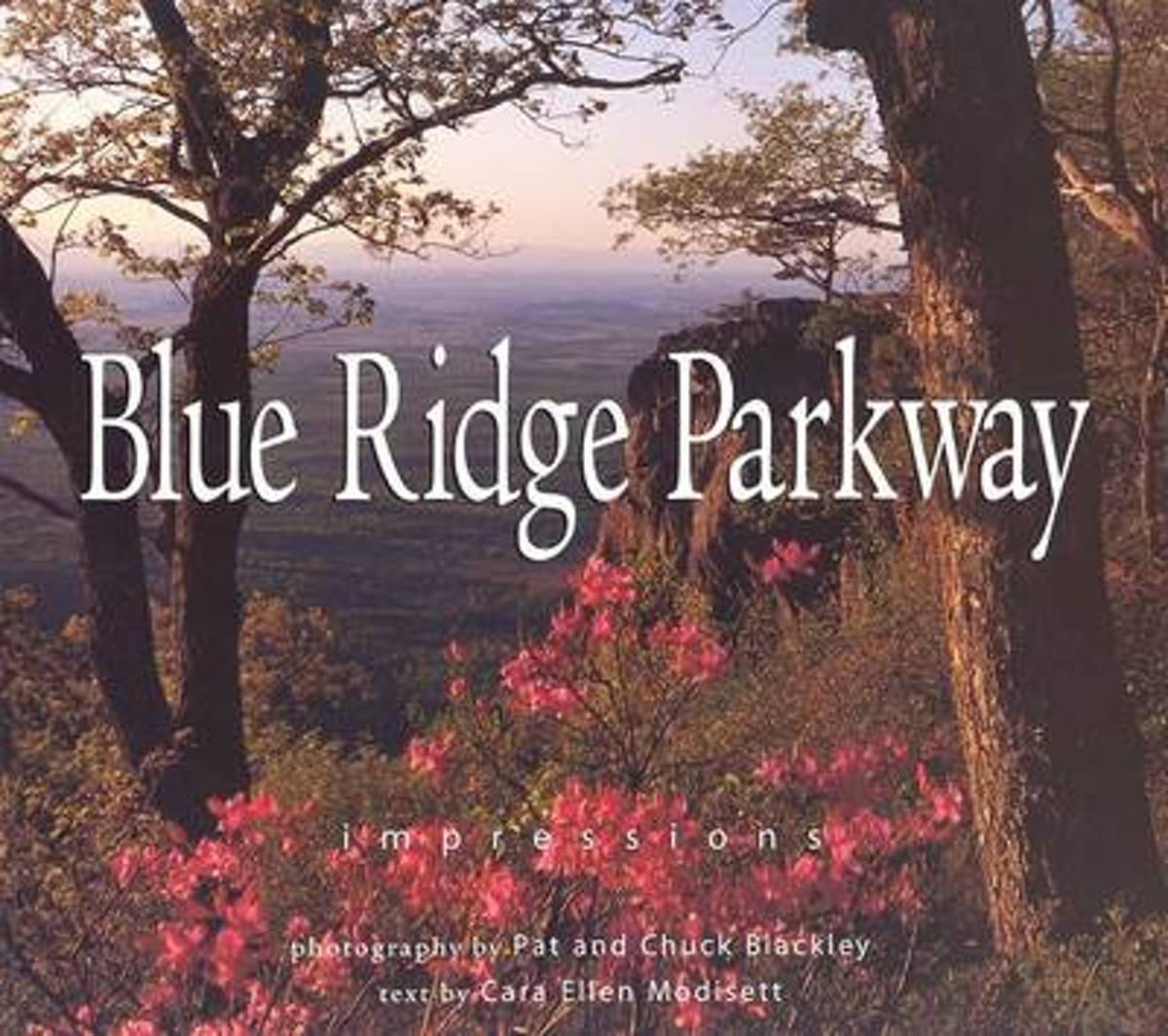
- Blue Ridge Parkway
- One of the most beloved parks in the country, Blue Ridge Parkway, called America's Most Scenic Drive, is a 469-mile roadway that climbs the ridgelines and peaks of the Appalachian Mountains between Shenandoah National park and the Great Smoky Mountains. Historic sites such as gristmills, bridges, and one-room schoolhouses exist along the... Read more
- Also available from:
- Bol.com, Belgium
Bol.com
Belgium
Belgium
- Blue Ridge Parkway
- One of the most beloved parks in the country, Blue Ridge Parkway, called America's Most Scenic Drive, is a 469-mile roadway that climbs the ridgelines and peaks of the Appalachian Mountains between Shenandoah National park and the Great Smoky Mountains. Historic sites such as gristmills, bridges, and one-room schoolhouses exist along the... Read more
De Zwerver
Netherlands
Netherlands
- Also available from:
- Bol.com, Netherlands
- Bol.com, Belgium
Bol.com
Netherlands
Netherlands
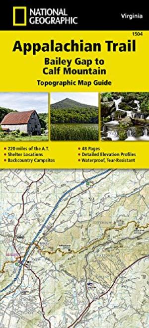
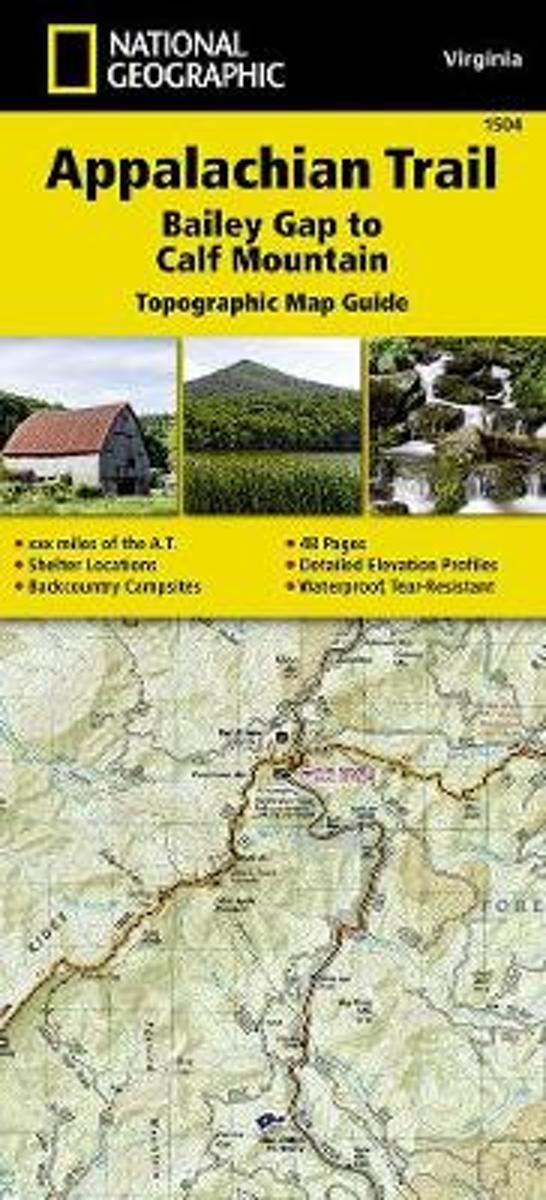
- Appalachian Trail, Bailey Gap To Calf Mountain, Virginia
- Waterproof Tear-Resistant Topographic Map GuideThe Bailey Gap to Calf MountainTopographic Map Guide makes a perfect traveling companion when traversing the central Virginia section of the Appalachian Trail (A.T.). The A.T. in central Virginia falls mostly within National Forest land, traveling through mature forests and over high mountain... Read more
Bol.com
Belgium
Belgium
- Appalachian Trail, Bailey Gap To Calf Mountain, Virginia
- Waterproof Tear-Resistant Topographic Map GuideThe Bailey Gap to Calf MountainTopographic Map Guide makes a perfect traveling companion when traversing the central Virginia section of the Appalachian Trail (A.T.). The A.T. in central Virginia falls mostly within National Forest land, traveling through mature forests and over high mountain... Read more
Bol.com
Netherlands
Netherlands
- Appalachian Trail Thru-Hiker's Companion (2018)
- The champion of Appalachian Trail guides for long-distance hiking for a quarter-century! With professionally crafted elevation profiles, almost 50 updated maps, and redesigned tables for more at-a-glance information on-trail. Still the only such guide written by volunteers for which all the proceeds are returned to the Trail by these two... Read more
- Also available from:
- Bol.com, Belgium
Bol.com
Belgium
Belgium
- Appalachian Trail Thru-Hiker's Companion (2018)
- The champion of Appalachian Trail guides for long-distance hiking for a quarter-century! With professionally crafted elevation profiles, almost 50 updated maps, and redesigned tables for more at-a-glance information on-trail. Still the only such guide written by volunteers for which all the proceeds are returned to the Trail by these two... Read more

Bol.com
Netherlands
Netherlands
- An Ultralighter's True Trail Stories
- Book two in the Journey series, this volume is filled with stories and ultralight backpacking tips from Carol "Brawny" Wellman. Trail descriptions for the Pacific Crest Trail, Appalachian Trail, John Muir Trail, Continental Divide Trail, Colorado Trail, Vermont Trail, Bartram Trail, including trail guide, plus the Foothills Trail. Learn how to... Read more
- Also available from:
- Bol.com, Belgium
Bol.com
Belgium
Belgium
- An Ultralighter's True Trail Stories
- Book two in the Journey series, this volume is filled with stories and ultralight backpacking tips from Carol "Brawny" Wellman. Trail descriptions for the Pacific Crest Trail, Appalachian Trail, John Muir Trail, Continental Divide Trail, Colorado Trail, Vermont Trail, Bartram Trail, including trail guide, plus the Foothills Trail. Learn how to... Read more

Bol.com
Netherlands
Netherlands
- A Walk in the Woods
- A CLASSIC FROM THE NEW YORK TIMES BESTSELLING AUTHOR OF ONE SUMMERBack in America after twenty years in Britain, Bill Bryson decided to reacquaint himself with his native country by walking the 2,100-mile Appalachian Trail, which stretches from Georgia to Maine. The AT offers an astonishing landscape of silent forests and sparkling lakesand to... Read more
- Also available from:
- Bol.com, Belgium
Bol.com
Belgium
Belgium
- A Walk in the Woods
- A CLASSIC FROM THE NEW YORK TIMES BESTSELLING AUTHOR OF ONE SUMMERBack in America after twenty years in Britain, Bill Bryson decided to reacquaint himself with his native country by walking the 2,100-mile Appalachian Trail, which stretches from Georgia to Maine. The AT offers an astonishing landscape of silent forests and sparkling lakesand to... Read more
Bol.com
Netherlands
Netherlands
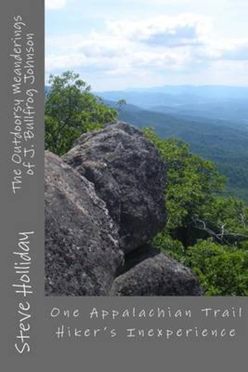
- The Outdoorsy Meanderings of J. Bullfrog Johnson
- Documenting a last-ditch effort for fresh air, new beginnings, and a long-lost smile, The Outdoorsy Meanderings offers readers interesting characters met along a brief hike on the Appalachian Trail, as well as a look at the mental and emotional state of a person coming to terms with a past, while hoping to get a handle on the present and... Read more
- Also available from:
- Bol.com, Belgium
Bol.com
Belgium
Belgium
- The Outdoorsy Meanderings of J. Bullfrog Johnson
- Documenting a last-ditch effort for fresh air, new beginnings, and a long-lost smile, The Outdoorsy Meanderings offers readers interesting characters met along a brief hike on the Appalachian Trail, as well as a look at the mental and emotional state of a person coming to terms with a past, while hoping to get a handle on the present and... Read more
Bol.com
Netherlands
Netherlands
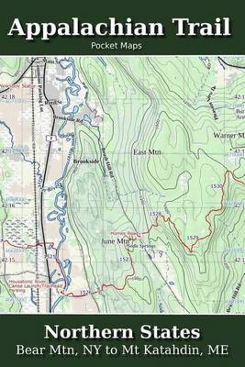
- Appalachian Trail Pocket Maps - Northern States
- Major Update for 2018Northern States - Bear Mtn, NY to Mt. Katahdin, METhe Appalachian Trail Pocket Map Series is a complete and concise set of topographic maps created with digitized base maps covering every step of the 2,180 mile trail from Georgia to Maine.These are not 40 year old scanned USGS topo maps. They are created digitally with the... Read more
- Also available from:
- Bol.com, Belgium
Bol.com
Belgium
Belgium
- Appalachian Trail Pocket Maps - Northern States
- Major Update for 2018Northern States - Bear Mtn, NY to Mt. Katahdin, METhe Appalachian Trail Pocket Map Series is a complete and concise set of topographic maps created with digitized base maps covering every step of the 2,180 mile trail from Georgia to Maine.These are not 40 year old scanned USGS topo maps. They are created digitally with the... Read more
Bol.com
Netherlands
Netherlands
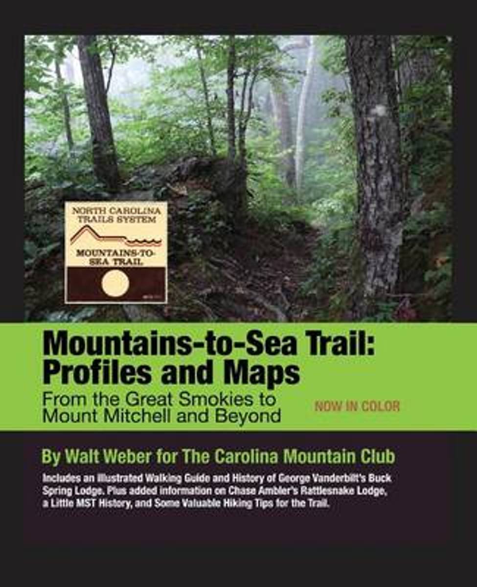
- Mountains-To-Sea Trail
- This is the second edition, now in color, of the popular guide to the Mountains-to-Sea Trail (MST) in Western North Carolina. It includes topographical maps and trail elevation profiles, making it easy to understand both the distance and difficulty of the hike you plan. All trail distances and elevations have been rechecked since the first... Read more
- Also available from:
- Bol.com, Belgium
Bol.com
Belgium
Belgium
- Mountains-To-Sea Trail
- This is the second edition, now in color, of the popular guide to the Mountains-to-Sea Trail (MST) in Western North Carolina. It includes topographical maps and trail elevation profiles, making it easy to understand both the distance and difficulty of the hike you plan. All trail distances and elevations have been rechecked since the first... Read more

Bol.com
Netherlands
Netherlands
- New England
- This fully revised and updated third edition of "The Rough Guide to New England" uncovers one of America's most popular and historic regions, from the colonial villages of Vermont to the ski slopes of New Hampshire and the chic restaurants of Boston. There is informed coverage on where to hike, ski, bike, camp and explore the outdoors, from the... Read more
- Also available from:
- Bol.com, Belgium
Bol.com
Belgium
Belgium
- New England
- This fully revised and updated third edition of "The Rough Guide to New England" uncovers one of America's most popular and historic regions, from the colonial villages of Vermont to the ski slopes of New Hampshire and the chic restaurants of Boston. There is informed coverage on where to hike, ski, bike, camp and explore the outdoors, from the... Read more

Bol.com
Netherlands
2012
Netherlands
2012
- The Rough Guide to New England
- The Rough Guide to New England is the ultimate travel guide to this compellingly historic region, packed with comprehensive coverage of every attraction. Honest, accurate reviews, detailed practical information, new top 5 lists, insider tips and illuminating photographs throughout will ensure that your visit is a truly memorable one.Discover... Read more
- Also available from:
- Bol.com, Belgium
Bol.com
Belgium
2012
Belgium
2012
- The Rough Guide to New England
- The Rough Guide to New England is the ultimate travel guide to this compellingly historic region, packed with comprehensive coverage of every attraction. Honest, accurate reviews, detailed practical information, new top 5 lists, insider tips and illuminating photographs throughout will ensure that your visit is a truly memorable one.Discover... Read more
Kaarten

Bol.com
Netherlands
Netherlands
- Springer & Cohutta Mountains, Chattahoochee National Forest
- Waterproof Tear-Resistant Topographic MapLocated just north of Atlanta, the Chattahoochee National Forest contains the southern terminus of the Appalachian Trail along with an abundance of recreational opportunities for outdoor enthusiasts of all interests.This detailed recreation map contains carefully researched trails, campsites,... Read more
- Also available from:
- Bol.com, Belgium
- Stanfords, United Kingdom
Bol.com
Belgium
Belgium
- Springer & Cohutta Mountains, Chattahoochee National Forest
- Waterproof Tear-Resistant Topographic MapLocated just north of Atlanta, the Chattahoochee National Forest contains the southern terminus of the Appalachian Trail along with an abundance of recreational opportunities for outdoor enthusiasts of all interests.This detailed recreation map contains carefully researched trails, campsites,... Read more

Stanfords
United Kingdom
United Kingdom
- Chattahoochee National Forest - Springer and Cohutta Mountains GA/SC 777
- Map No. 777, Chattahoochee National Forest: Springer and Cohutta Mountains, GA/SC, in an extensive series of GPS compatible, contoured hiking maps of USA’s national and state parks or forests and other popular recreational areas. Cartography based on the national topographic survey, with additional tourist information.The maps, with most titles... Read more

De Zwerver
Netherlands
Netherlands
- Wandelkaart - Topografische kaart 318 Mount Rogers High Country - Grayson Highlands State Park | National Geographic
- Prachtige geplastificeerde kaart van het bekende nationaal park. Met alle recreatieve voorzieningen als campsites, maar ook met topografische details en wandelroutes ed. Door uitgekiend kleurgebruik zeer prettig in gebruik. Scheur en watervast! National Geographic's Trails Illustrated map of Mount Rogers High Country and Grayson Highlands... Read more
- Also available from:
- Bol.com, Netherlands
- Bol.com, Belgium
- Stanfords, United Kingdom
- The Book Depository, United Kingdom

Bol.com
Netherlands
Netherlands
- Mount Rogers High Country
- Waterproof Tear-Resistant Topographic MapNational Geographic's Trails Illustrated map of Mount Rogers High Country and Grayson Highlands State Park, Southwest Virginia, is a two-sided, waterproof, topographic trail map designed to meet the needs of outdoor enthusiasts with unmatched durability and detail. This map was created in... Read more
Bol.com
Belgium
Belgium
- Mount Rogers High Country
- Waterproof Tear-Resistant Topographic MapNational Geographic's Trails Illustrated map of Mount Rogers High Country and Grayson Highlands State Park, Southwest Virginia, is a two-sided, waterproof, topographic trail map designed to meet the needs of outdoor enthusiasts with unmatched durability and detail. This map was created in... Read more

Stanfords
United Kingdom
United Kingdom
- Mount Rogers High Country VA
- Map No. 318 - Mount Rogers High Country in Virginia in an extensive series of GPS compatible, contoured hiking maps of USA’s national and state parks or forests and other popular recreational areas. Cartography based on the national topographic survey, with additional tourist information.The maps, with most titles now printed on light,... Read more

The Book Depository
United Kingdom
United Kingdom
- Mount Rogers High Country
- Trails Illustrated Other Rec. Areas Read more
De Zwerver
Netherlands
Netherlands
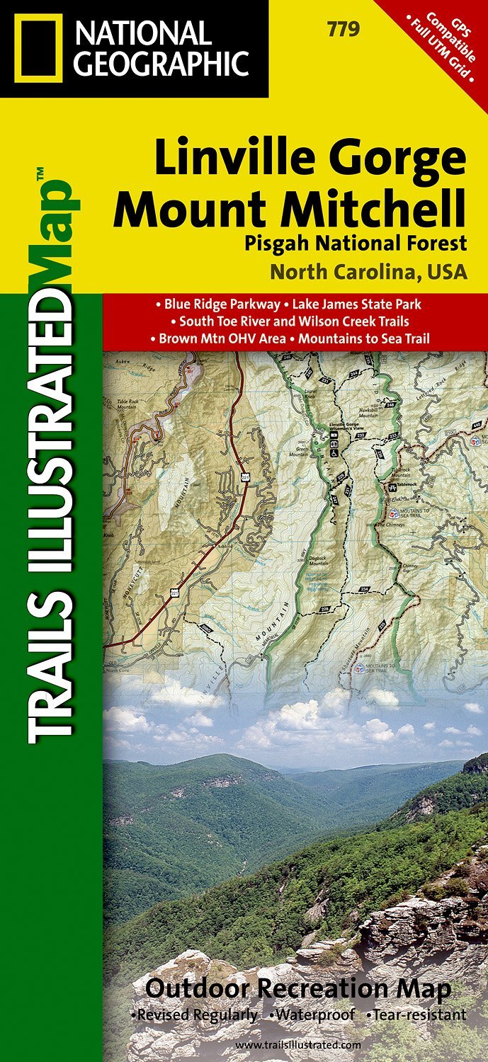
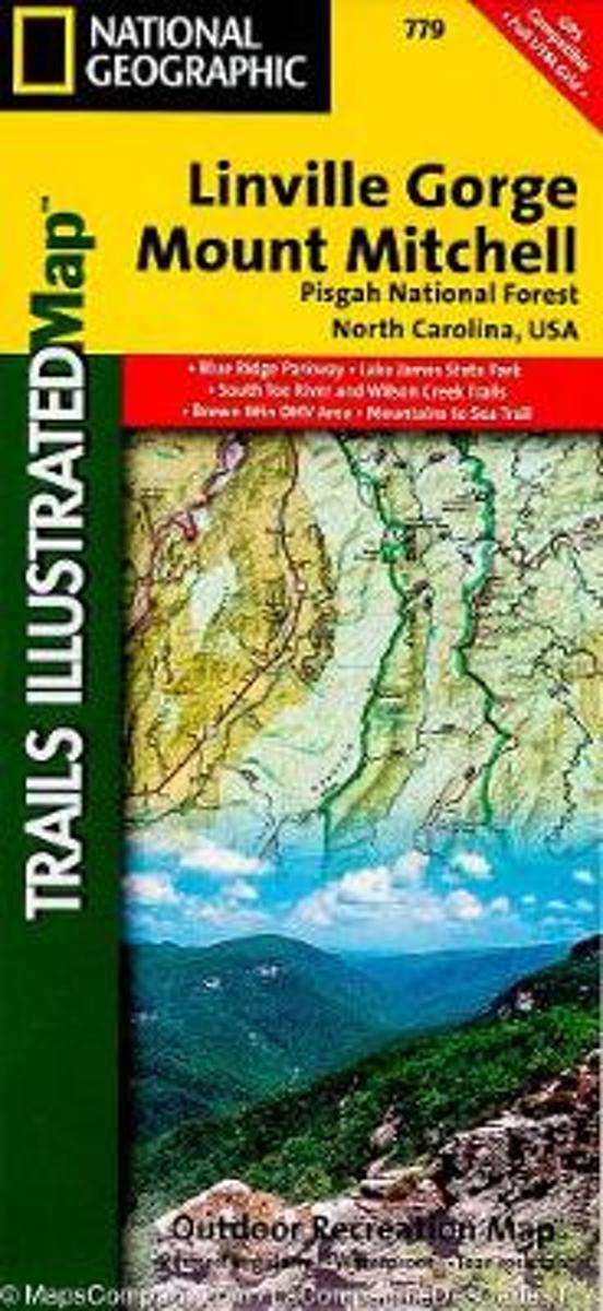
- Wandelkaart - Topografische kaart 779 Linville Gorge - Mount Mitchell - Pisgah National Forest | National Geographic
- Prachtige geplastificeerde kaart van het bekende nationaal park. Met alle recreatieve voorzieningen als campsites, maar ook met topografische details en wandelroutes ed. Door uitgekiend kleurgebruik zeer prettig in gebruik. Scheur en watervast! Coverage includes Pisgah National Forest, Grandfather Ranger District (complete) and Appalachian... Read more
- Also available from:
- Bol.com, Netherlands
- Bol.com, Belgium
- Stanfords, United Kingdom
- The Book Depository, United Kingdom
Bol.com
Netherlands
Netherlands
- Linville Gorge/mount Mitchell, Pisgah National Forest
- Waterproof Tear-Resistant Topographic MapExpertly researched and created in partnership with local land management agencies, National Geographic's Trails Illustrated map of Linville Gorge and Mount Mitchell provides an unparalleled tool for exploring these remarkable features within Pisgah National Forest. This map includes such key areas... Read more
Bol.com
Belgium
Belgium
- Linville Gorge/mount Mitchell, Pisgah National Forest
- Waterproof Tear-Resistant Topographic MapExpertly researched and created in partnership with local land management agencies, National Geographic's Trails Illustrated map of Linville Gorge and Mount Mitchell provides an unparalleled tool for exploring these remarkable features within Pisgah National Forest. This map includes such key areas... Read more

Stanfords
United Kingdom
United Kingdom
- Pisgah National Forest - Linville Gorge - Mt. Mitchell NC
- Map No. 779, Pisgah National Forest: Linville Gorge - Mt. Mitchell, NC, in an extensive series of GPS compatible, contoured hiking maps of USA’s national and state parks or forests and other popular recreational areas. Cartography based on the national topographic survey, with additional tourist information.The maps, with most titles now... Read more

The Book Depository
United Kingdom
United Kingdom
- Linville Gorge/mount Mitchell, Pisgah National Forest
- Trails Illustrated Other Rec. Areas Read more

De Zwerver
Netherlands
Netherlands
- Wandelkaart - Topografische kaart 747 Green Mountain National Forest North - Moosalamoo NRA - Rutland | National Geographic
- Prachtige geplastificeerde kaart van het bekende nationaal park. Met alle recreatieve voorzieningen als campsites, maar ook met topografische details en wandelroutes ed. Door uitgekiend kleurgebruik zeer prettig in gebruik. Scheur en watervast! National Geographic's Green Mountain National Forest North Trails Illustrated topographic map is... Read more
- Also available from:
- Bol.com, Netherlands
- Bol.com, Belgium
- Stanfords, United Kingdom
- The Book Depository, United Kingdom

Bol.com
Netherlands
Netherlands
- Green Mountains N.F., Moosalamoo NRA/Rutland
- Waterproof Tear-Resistant Topographic MapNational Geographic's Green Mountain National Forest North Trails Illustrated topographic map is the most comprehensive available for outdoor enthusiasts of all types. Designed to be easy-to-read, yet highly detailed this map includes a comprehensive road and trail network distinguishing between... Read more
Bol.com
Belgium
Belgium
- Green Mountains N.F., Moosalamoo NRA/Rutland
- Waterproof Tear-Resistant Topographic MapNational Geographic's Green Mountain National Forest North Trails Illustrated topographic map is the most comprehensive available for outdoor enthusiasts of all types. Designed to be easy-to-read, yet highly detailed this map includes a comprehensive road and trail network distinguishing between... Read more

Stanfords
United Kingdom
United Kingdom
- Green Mountain National Forest - Moosalamoo NRA - Rutland VT
- Map No. 747, Green Mountain National Forest: Moosalamoo NRA - Rutland area in Vermont, in an extensive series of GPS compatible, contoured hiking maps of USA’s national and state parks or forests and other popular recreational areas. Cartography based on the national topographic survey, with additional tourist information.The maps, with most... Read more

The Book Depository
United Kingdom
United Kingdom
- Green Mountains N.f., Moosalamoo Nra/rutland
- Trails Illustrated Other Rec. Areas Read more

De Zwerver
Netherlands
Netherlands
- Wandelkaart - Topografische kaart 316 Cades Cove - Elkmont - Great Smoky Mountains National Park | National Geographic
- Prachtige geplastificeerde kaart van het bekende nationaal park. Met alle recreatieve voorzieningen als campsites, maar ook met topografische details en wandelroutes ed. Door uitgekiend kleurgebruik zeer prettig in gebruik. Scheur en watervast! This title provides an increased scale of one of the most visited National Parks in the US, and one... Read more
- Also available from:
- Bol.com, Netherlands
- Bol.com, Belgium
- Stanfords, United Kingdom

Bol.com
Netherlands
Netherlands
- Cades Cove/elkmont, Great Smoky Mountains National Park
- Waterproof Tear-Resistant Topographic MapThis title provides an increased scale of one of the most visited National Parks in the US, and one of our more popular map titles. This increased scale will provide greater detail to the backcountry users and Appalachian Trail through-hikers.Park Introduction:Great Smoky Mountains National Park is... Read more
Bol.com
Belgium
Belgium
- Cades Cove/elkmont, Great Smoky Mountains National Park
- Waterproof Tear-Resistant Topographic MapThis title provides an increased scale of one of the most visited National Parks in the US, and one of our more popular map titles. This increased scale will provide greater detail to the backcountry users and Appalachian Trail through-hikers.Park Introduction:Great Smoky Mountains National Park is... Read more

Stanfords
United Kingdom
United Kingdom
- Cades Cove - Elkmont - Great Smoky Mountains National Park NC/TN
- Map No. 316, Great Smoky Mountains National Park: Cades Cove - Elkmont, NC/TN, in an extensive series of GPS compatible, contoured hiking maps of USA’s national and state parks or forests and other popular recreational areas. Cartography based on the national topographic survey, with additional tourist information.The maps, with most titles now... Read more