
Great Western Trail
Beschrijving
- Name Great Western Trail (GWT)
- Lengte van pad 7,170 km, 4,455 mijl
- Lengte in dagen 350 dagen
- Traildino graad MW, Gemiddelde wandeling, trektocht
- Huttentrektocht graad T1, Wandeling
 GWT, 4455 miles (7170 km)
A north-south trail running from Canada to Mexico through Arizona, Idaho, Montana, Utah and Wyoming. Some segments are for non-motorized, some are shared use, while other portions are developed for motorized use. It's 4455 miles (7170 km) long, when finished.
Select some tracks
☐Great Western Trail - Utah, 1362km
☐Great Western Trail - Arizona, 306km
☐GWT - 207 - Catwalk National Recreation Trail, 2.2km
☐GWT - 181 - Holt-Apache Trail West, 15km
☐GWT - 182 - Crest Trai North, 11km
☐GWT - 176 - Flying V Trail, 3km
☐Great Western Trail, 13km
☐Great Western Trail, 29km
☐Rain Creek Divide Trail, 16km
☐GWT - 012 - Trail 12, 3.3km
☐GWT - 020, 7km
☐GWT - 023, 11km
☐GWT - 025, 6.8km
☐GWT - 026 - Green Fly Trail, 22km
☐GWT - 027, 13km
☐GWT - 029, 7.4km
☐GWT - 030 - Trotter Trail, 17km
☐GWT - 031, 7.1km
☐GWT - 053 - Meadows Trail, 9.6km
☐GWT - 094 - Black Canyon Trail, 18km
☐GWT - 095 - Brannon Park Trail, 16km
☐GWT - 096 - Apache Creek Trail, 14km
☐GWT - 097 - Gila Flat Trail, 6.5km
☐GWT - 101, 8.5km
☐GWT - 102 - Turkeyfeather Montain Trail, 12km
☐GWT - 141, 4.7km
☐GWT - 143, 4.8km
☐GWT - 150 - Granite Peak Trail, 1.9km
☐GWT - 153 - Mogollon Creek Trail, 28km
☐GWT - 155 - Turkey Creek Trail, 43km
☐GWT - 156 - Prior Creek Trail, 8.7km
☐GWT - 157 - Middle Fork Trail, 65km
☐GWT - 158, 18km
☐GWT - 159 - Miller Springs Trail, 3.7km
☐GWT - 160 - Granny Mountain Trail, 33km
☐GWT - 161 - Little Creek Trail, 13km
☐GWT - 162 - Ring Canyon Trail, 22km
☐GWT - 163 - EE Trail, 3.1km
☐GWT - 164 Woodland Park Trail, 40km
☐GWT - 165 - Pine Flat Trail, 4.4km
☐GWT - 169, 7.3km
☐GWT - 171 - Iron Creek Mesa Trail #171, 9.8km
☐GWT - 179 - Deloche/Wynn Canyon Trail, 3.8km
☐GWT - 172 - Iron Creek Trail, 11km
☐GWT - 175 - Clayton Mesa Trail, 8.4km
☐GWT - 177, 10km
☐GWT - 180 - Little Dry Trail, 16km
☐GWT - 181 - Holt-Apache Trail, 26km
☐GWT - 182 - Crest Trail, 20km
☐GWT - 187, 2.5km
☐GWT - 189, 13km
☐GWT - 206 - Redstone Trail #206, 13km
☐GWT - 207- Whitewater Trail, 19km
☐GWT -214 - Little Whitewater Trail, 12km
☐GWT - 217, 5.2km
☐GWT - 218, 13km
☐GWT - 221, 13km
☐GWT - 224, 11km
☐GWT - 225, 4.6km
☐GWT - 247 - Spring Canyon Trail, 11km
☐GWT - 268 - Hells Hole Trail, 3.7km
☐GWT - 301, 3.9km
☐GWT - 302, 6.3km
☐GWT - 403 - Brushy Mountain Trail, 12km
☐GWT - 700 - Rocky Canyon Trail, 18km
☐GWT - 705 - Aeroplane Mesa Trail, 6km
☐GWT - 706 - Flying V Trail, 8.2km
☐GWT - 708 - Tom Moore Canyon Trail, 18km
☐GWT - 709 - Military Trail, 11km
☐GWT - 713, 6.3km
☐GWT - 716 - Middle Mesa Trail, 13km
☐GWT - 724 - Gila River Trail, 20km
☐GWT - 729 Little Bear Canyon Trail, 6.4km
☐GWT - 730, 4.4km
☐GWT - 752 - Parking Lot Access Trail, 0.9km
☐GWT - 771, 8.7km
☐GWT - 772, 14km
☐GWT - 773, 7km
☐GWT - 781 - Grouse Mountain Trail, 0.7km
☐GWT - 789, 1.5km
☐GWT - 792, 1.6km
☐GWT - 804, 6.9km
☐GWT - 814, 3.7km
☐GWT - 815, 6.4km
Kaart


Links
Feiten
Verslagen
Gidsen en kaarten
Overnachting
Organisaties
Reisorganisaties
GPS
Anders
Boeken
Bol.com
Netherlands
Netherlands
- Willis Canyon
- Waterproof Tear-Resistant Topographic Map National Geographics Trails Illustrated map of Willis Canyon in Bryce Canyon National Park is designed to meet the needs of outdoor enthusiasts with unmatched durability and detail. Expertly researched and created in partnership with local land management agencies, this map features Kodachrome Basin... Read more
- Also available from:
- Bol.com, Belgium
- Stanfords, United Kingdom
Bol.com
Belgium
Belgium
- Willis Canyon
- Waterproof Tear-Resistant Topographic Map National Geographics Trails Illustrated map of Willis Canyon in Bryce Canyon National Park is designed to meet the needs of outdoor enthusiasts with unmatched durability and detail. Expertly researched and created in partnership with local land management agencies, this map features Kodachrome Basin... Read more

Stanfords
United Kingdom
United Kingdom
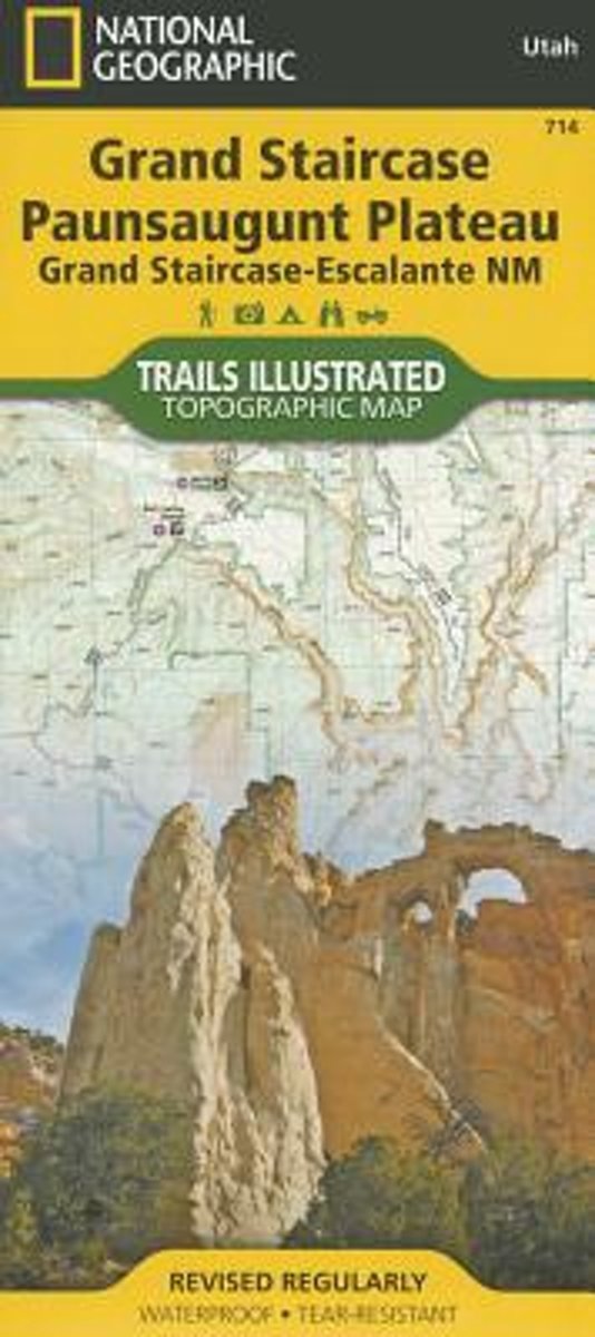
- Grand Staircase - Paunsaugunt Plateau - Grand Staircase-Escalante NM
- Map No. 714 covering at 1:75,000 the Grand Staircase, Paunsaugunt Plateau (Grand Staircase-Escalante National Monument) area of Utah. The title is part of an extensive series in the National Geographic’s Trails Illustrated imprint of GPS compatible, contoured hiking maps of USA’s national and state parks or forests and other popular... Read more
Bol.com
Netherlands
Netherlands
- Sycamore Canyon & Verde Valley Wildnerness Areas, Coconino, Kaibab, & Prescott National Forests
- Waterproof Tear-Resistant Topographic MapNational Geographic's Sycamore Canyon / Verde Valley Trails Illustrated topographic map is the most comprehensive available for outdoor enthusiasts of all types. Designed to be easy-to-read, yet highly detailed this map includes a comprehensive road and trail network distinguishing between major,... Read more
- Also available from:
- Bol.com, Belgium
- Stanfords, United Kingdom
Bol.com
Belgium
Belgium
- Sycamore Canyon & Verde Valley Wildnerness Areas, Coconino, Kaibab, & Prescott National Forests
- Waterproof Tear-Resistant Topographic MapNational Geographic's Sycamore Canyon / Verde Valley Trails Illustrated topographic map is the most comprehensive available for outdoor enthusiasts of all types. Designed to be easy-to-read, yet highly detailed this map includes a comprehensive road and trail network distinguishing between major,... Read more

Stanfords
United Kingdom
United Kingdom
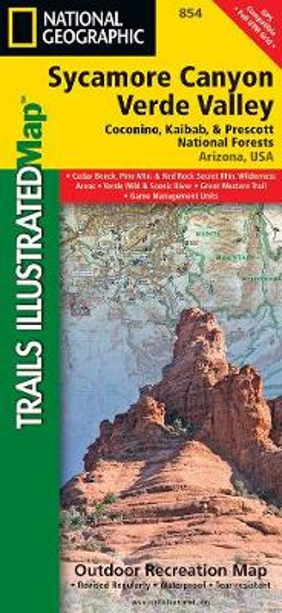
- Sycamore Canyon - Verde Valley - Coconino, Kaibab and Prescott National Forests AZ
- Map No. 854, Coconino National Forest: Sycamore Canyon and Verde Valley Wilderness Areas, AZ, in an extensive series of GPS compatible, contoured hiking maps of USA’s national and state parks or forests and other popular recreational areas. Cartography based on the national topographic survey, with additional tourist information.The maps, with... Read more
Bol.com
Netherlands
Netherlands
- Driving the Great Western Trail in Arizona
- This third edition of ''Driving the Great Western Trail in Arizona,'' contains four new trails. In addition, two of the original trails have been modified. Would you like to camp on an Indian Reservation or in an unspoiled forest or star-lit desert accompanied by the sounds of native wildlife?Would you like to show your children where the deer... Read more
- Also available from:
- Bol.com, Belgium
Bol.com
Belgium
Belgium
- Driving the Great Western Trail in Arizona
- This third edition of ''Driving the Great Western Trail in Arizona,'' contains four new trails. In addition, two of the original trails have been modified. Would you like to camp on an Indian Reservation or in an unspoiled forest or star-lit desert accompanied by the sounds of native wildlife?Would you like to show your children where the deer... Read more
Kaarten

De Zwerver
Netherlands
Netherlands
- Wandelkaart 262 Grand Canyon East - Oost | National Geographic
- Prachtige geplastificeerde kaart van het nationaal park. Met alle recreatieve voorzieningen als campsites, maar ook met topografische details en wandelroutes ed. Door uitgekiend kleurgebruik zeer prettig in gebruik. Scheur en watervast! Grand Canyon East (#262) and Grand Canyon West (#263) combine to cover the entire Grand Canyon National Park... Read more
- Also available from:
- Bol.com, Netherlands
- Bol.com, Belgium

Bol.com
Netherlands
Netherlands
- Grand Canyon East
- Waterproof Tear-Resistant Topographic MapGrand Canyon East (#262) and Grand Canyon West (#263) combine to cover the entire Grand Canyon National Park and its bordering public lands. Both maps contain detailed and easy-to-read trail and road networks, locations of facilities, points of interest, and highly accurate terrain with thousands... Read more
Bol.com
Belgium
Belgium
- Grand Canyon East
- Waterproof Tear-Resistant Topographic MapGrand Canyon East (#262) and Grand Canyon West (#263) combine to cover the entire Grand Canyon National Park and its bordering public lands. Both maps contain detailed and easy-to-read trail and road networks, locations of facilities, points of interest, and highly accurate terrain with thousands... Read more

De Zwerver
Netherlands
Netherlands
- Wandelkaart - Topografische kaart 219 Bryce Canyon National Park | National Geographic
- Prachtige geplastificeerde kaart van het bekende nationaal park. Met alle recreatieve voorzieningen als campsites, maar ook met topografische details en wandelroutes ed. Door uitgekiend kleurgebruik zeer prettig in gebruik. Scheur en watervast! This informative Trails Illustrated map will help you plan trips and explore the area in and around... Read more
- Also available from:
- Bol.com, Netherlands
- Bol.com, Belgium
- Stanfords, United Kingdom
- The Book Depository, United Kingdom

Bol.com
Netherlands
Netherlands
- Bryce Canyon National Park
- Waterproof Tear-Resistant Topographic MapNational Geographic's Trails Illustrated map of Bryce Canyon National Park is designed to meet the needs of outdoor enthusiasts by combining valuable information with unmatched detail of this unique landscape of hoodoos and forest. Created in partnership with local land management agencies, this... Read more
Bol.com
Belgium
Belgium
- Bryce Canyon National Park
- Waterproof Tear-Resistant Topographic MapNational Geographic's Trails Illustrated map of Bryce Canyon National Park is designed to meet the needs of outdoor enthusiasts by combining valuable information with unmatched detail of this unique landscape of hoodoos and forest. Created in partnership with local land management agencies, this... Read more

Stanfords
United Kingdom
United Kingdom
- Bryce Canyon National Park UT NGS Trails Illustrated Map 219
- Map No. 219, Bryce Canyon National Park, UT, in an extensive series of GPS compatible, contoured hiking maps of USA’s national and state parks or forests and other popular recreational areas. Cartography based on the national topographic survey, with additional tourist information.The maps, with most titles now printed on light, waterproof and... Read more

The Book Depository
United Kingdom
United Kingdom
- Bryce Canyon National Park
- Trails Illustrated National Parks Read more