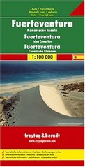
Fuerteventura at 1:100,000 on a map from Freytag & Berndt with icons highlighting numerous places of interest and recreational facilities including campsites. The islandRead more
Fuerteventura at 1:100,000 on a map from Freytag & Berndt with icons highlighting numerous places of interest and recreational facilities including campsites. The island’s topography is well presented by relief shading with spot heights, names of peaks and other geographical features, and boundaries of protected areas.The map highlights scenic...Read more
Lanzarote at 1:50,000 on a contoured and GPS compatible map from Kompass, with extensive tourist overprint, plus street plans of Arrecife, Puerto del Carmen and Teguise. Coverage includes the nearby islands of Graciosa, Montaña Clara and Alwegranza.Topography is vividly presented by contours at 50m intervals, enhanced by relief shading plus...Read more
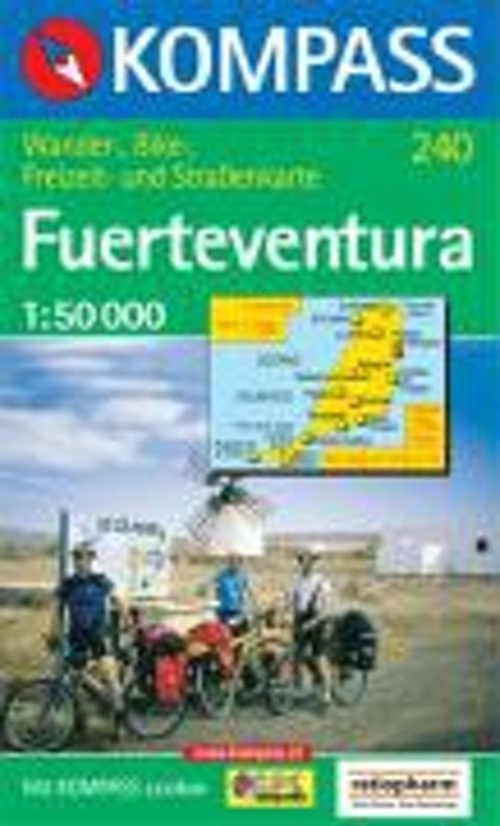
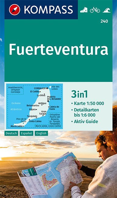
Fuerteventura ar 1:50,000 in a series of maps of the Canary Islands from Kompass, Europe’s leading publisher of detailed, contoured hiking maps. Excellent also for exploring each island on bike or by car, the maps highlight numerous hiking trails, indicating difficult sections, and show cycle routes. A wide range of symbols highlight various...Read more
Toeristische kaart voor wandelen, fietsen en vrije tijd met activiteitengids en stadsplattegronden • goed leesbare schaal van 1:50 000 • te gebruiken met GPS • met praktische informatie over de regio • wandel- en fietspaden • aanbevolen routes • kastelen • uitzichtpunten • stranden en baaien • toeristische informatie • veel topografische...Read more
Toeristische kaart voor wandelen, fietsen en vrije tijd met activiteitengids en stadsplattegronden • goed leesbare schaal van 1:50 000 • te gebruiken met GPS • met praktische informatie over de regio • wandel- en fietspaden • aanbevolen routes • kastelen • uitzichtpunten • stranden en baaien • toeristische informatie • veel topografische...Read more
Toeristische kaart voor wandelen, fietsen en vrije tijd met activiteitengids en stadsplattegronden • goed leesbare schaal van 1:50 000 • te gebruiken met GPS • met praktische informatie over de regio • wandel- en fietspaden • aanbevolen routes • kastelen • uitzichtpunten • stranden en baaien • toeristische informatie • veel topografische...Read more
Toeristische kaart voor wandelen, fietsen en vrije tijd met activiteitengids en stadsplattegronden • goed leesbare schaal van 1:50 000 • te gebruiken met GPS • met praktische informatie over de regio • wandel- en fietspaden • aanbevolen routes • kastelen • uitzichtpunten • stranden en baaien • toeristische informatie • veel topografische...Read more
Deze digitale wandel-, fiets- en skiroute kaarten van Kompass op CD of DVD zijn bruikbaar met GPS • je kunt inzoomen op de kaart tot een schaal van 1: 10 000 • prima manier om je eigen route te plannen, met hoogteprofielen • zeer eenvoudig om de gekozen route te printen of te downloaden op mobiele telefoon of PDA • vlieg vogelvlucht over een...Read more
Deze digitale wandel-, fiets- en skiroute kaarten van Kompass op CD of DVD zijn bruikbaar met GPS • je kunt inzoomen op de kaart tot een schaal van 1: 10 000 • prima manier om je eigen route te plannen, met hoogteprofielen • zeer eenvoudig om de gekozen route te printen of te downloaden op mobiele telefoon of PDA • vlieg vogelvlucht over een...Read more
Toeristische kaart voor wandelen, fietsen en vrije tijd met activiteitengids en stadsplattegronden; goed leesbare schaal van 1:50 000; te gebruiken met GPS; met praktische informatie over de regio; wandel- en fietspaden; aanbevolen routes; kastelen; uitzichtpunten; stranden en baaien; toeristische informatie; veel topografische details; DuitstaligRead more
Toeristische kaart voor wandelen, fietsen en vrije tijd met activiteitengids en stadsplattegronden; goed leesbare schaal van 1:50 000; te gebruiken met GPS; met praktische informatie over de regio; wandel- en fietspaden; aanbevolen routes; kastelen; uitzichtpunten; stranden en baaien; toeristische informatie; veel topografische details; DuitstaligRead more
Our latest hiking research on Tenerife has resulted in new editions of Walk! Tenerife and Tenerife Hikers' Super-Durable Maps being published in 2017. Thanks to Jan Kostura's 2016 research we have several new hiking adventures described in detail in Walk! Tenerife. Jan's gps records of his research for new routes and updating of current routes...Read more
Our latest hiking research on Tenerife has resulted in new editions of Walk! Tenerife and Tenerife Hikers' Super-Durable Maps being published in 2017. Thanks to Jan Kostura's 2016 research we have several new hiking adventures described in detail in Walk! Tenerife. Jan's gps records of his research for new routes and updating of current routes...Read more
Gran Tarajal area of Fuerteventura, map No. 1100 in the topographic coverage of the Canary Islands at 1:50,000 from the Instituto Geográfico Nacional - Centro Nacional de Información Geograficá, Spain’s civilian survey organization. Maps in the MTN50 (Mapa Topográfico Nacional) series begun in late 1990s have contours at 20m intervals enhanced...Read more
Topographic coverage of the Canary Islands at 1:25,000 published by the Instituto Geográfico Nacional – Centro Nacional de Información Geografica, the country’s civilian survey organization. The maps have contours at 10m intervals and colouring and/or graphics to show different types of vegetation or land use. Boundaries of national parks and...Read more
Topographic coverage of the Canary Islands at 1:25,000 published by the Instituto Geográfico Nacional – Centro Nacional de Información Geografica, the country’s civilian survey organization. The maps have contours at 10m intervals and colouring and/or graphics to show different types of vegetation or land use. Boundaries of national parks and...Read more
Eastern Canary Islands (Gran Canaria, Fuerteventure and Lanzarote) at 1:500,000 in a series of regional road map of Spain from the country’s civilian survey organization IGN-CNIG (Instituto Geográfico Nacional - Centro Nacional de Información Geográfica), vividly presenting the topography by altitude colouring, boundaries of national/natural...Read more
Topographic coverage of the Canary Islands at 1:25,000 published by the Instituto Geográfico Nacional – Centro Nacional de Información Geografica, the country’s civilian survey organization. The maps have contours at 10m intervals and colouring and/or graphics to show different types of vegetation or land use. Boundaries of national parks and...Read more