De Zwerver
Netherlands
Netherlands
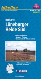
- Fietskaart NDS17 Bikeline Radkarte Lüneburger Heide Süd | Esterbauer
- Bikeline Fahrradkarte Deutschland Lüneburger Heide Süd 1:75.000 ab 6.9 EURO Bad Fallingbostel, Bergen - Eschede, Schwarmstedt - Winsen ( ALLER ), GPS-tauglich mit UTM-Netz, wasserfest und reißfest Bikeline Radkarte Niedersachsen. 1. Auflage Read more