De Zwerver
Netherlands
De Zwerver
Netherlands
» Click to open
Stanfords
United Kingdom
  • Mont Lozere - Florac - PN des Cevennes IGN 2739OT
  • Topographic survey of France at 1:25,000 in IGN`s excellent TOP25 / Série Bleue series. All the maps are GPS compatible, with a 1km UTM grid plus latitude and longitude lines at 5’ intervals. Contours are at 5m intervals except for mountainous areas where the maps have contours at 10m intervals, vividly enhanced by hill shading and graphics for... Read more
» Click to close
De Zwerver
Netherlands
» Click to open
Stanfords
United Kingdom
  • Saint-Hippolyte-du-Fort - Anduze - Saint-Jean-du-Gard IGN 2741ET
  • Topographic survey of France at 1:25,000 in IGN`s excellent TOP25 / Série Bleue series. All the maps are GPS compatible, with a 1km UTM grid plus latitude and longitude lines at 5’ intervals. Contours are at 5m intervals except for mountainous areas where the maps have contours at 10m intervals, vividly enhanced by hill shading and graphics for... Read more
The Book Depository
United Kingdom
  • St-Hippolyte-du-Fort Anduze / St-Jean-du-Gard
  • Topographic survey of France at 1:25,000 in IGN`s excellent TOP25 / Série Bleue series. All the maps are GPS compatible, with a 1km UTM grid plus latitude and longitude lines at 5’ intervals. Contours are at 5m intervals except for mountainous areas where the maps have contours at 10m intervals, vividly enhanced by hill shading and graphics for... Read more
» Click to close
De Zwerver
Netherlands
» Click to open
Stanfords
United Kingdom
  • le Bleymard - la Bastide-Puylaurent IGN 2738SB
  • Topographic survey of France at 1:25,000 in IGN`s excellent TOP25 / Série Bleue series. All the maps are GPS compatible, with a 1km UTM grid plus latitude and longitude lines at 5’ intervals. Contours are at 5m intervals except for mountainous areas where the maps have contours at 10m intervals, vividly enhanced by hill shading and graphics for... Read more
The Book Depository
United Kingdom
» Click to close
De Zwerver
Netherlands
» Click to open
Stanfords
United Kingdom
  • The Stevenson Trail IGN 89023
  • Robert Louis Stevenson’s and his donkey Modestine’s trail from the “Travels with a Donkey in the Cevennes”, now the GR70 long-distance hiking route, presented at 1:90,000 on a waterproof and tear-resistant map from IGN with cartography from their highly popular TOP100 series. Coverage starts in Le Puy-en-Velay along the GR3/GR43 and continues... Read more
The Book Depository
United Kingdom
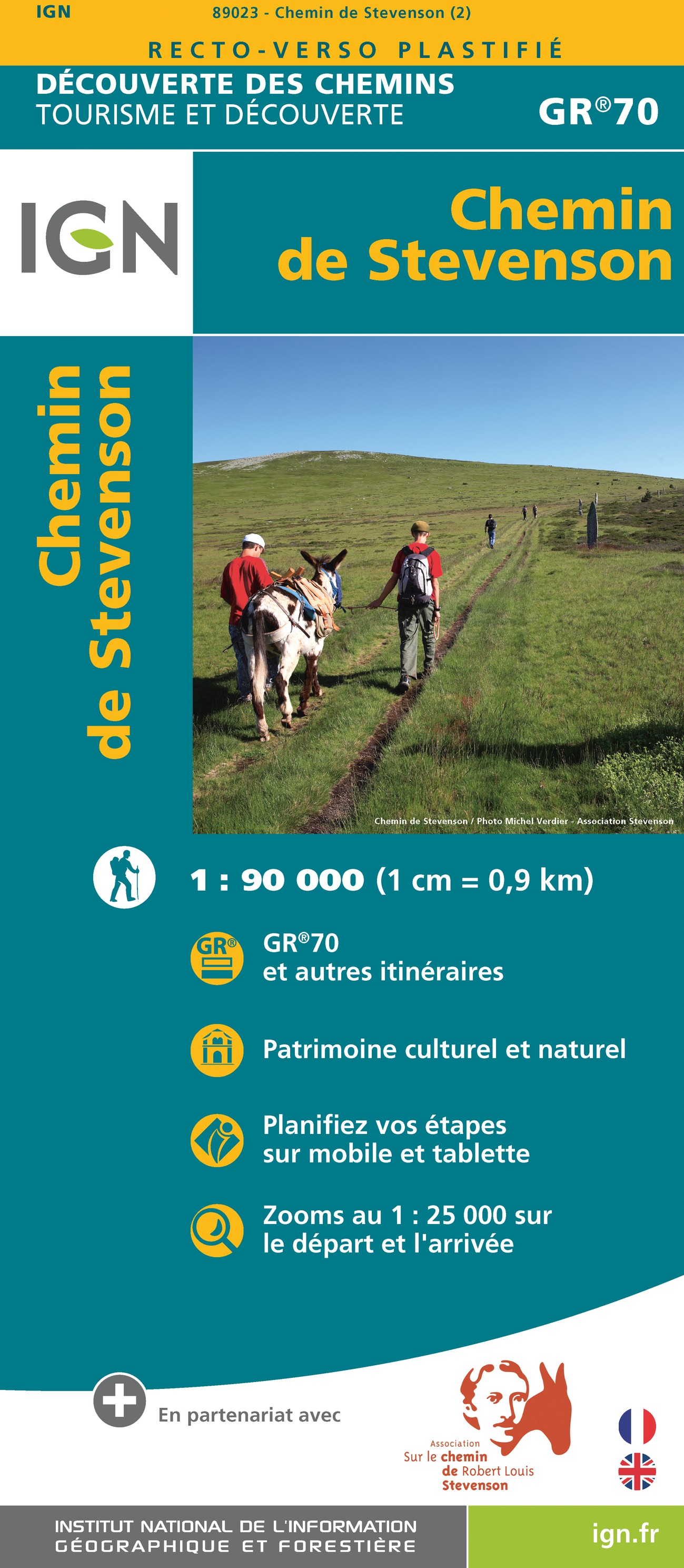
  • Chemin de Stevenson GR70 2022
  • Robert Louis Stevenson’s and his donkey Modestine’s trail from the “Travels with a Donkey in the Cevennes”, now the GR70 long-distance hiking route, presented at 1:90,000 on a waterproof and tear-resistant map from IGN with cartography from their highly popular TOP100 series. Coverage starts in Le Puy-en-Velay along the GR3/GR43 and continues... Read more
» Click to close