De Zwerver
Netherlands
Netherlands
- Wandelkaart Shropshire Way | Harvey Maps
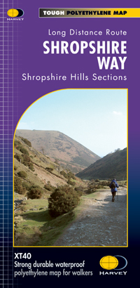
- The Shropshire Way, created from hiking trails in the county which can be combined into long-distance routes or circuits, presented at 1:40,000 on a light, waterproof and tear-resistant map from Harvey Map Services. The map presents the heart of Shropshire between Ludlow and Much Wenlock on one large panel, with an inset extending it eastwards... Read more
- Also available from:
- Stanfords, United Kingdom
- The Book Depository, United Kingdom

Stanfords
United Kingdom
United Kingdom
- Shropshire Way Harvey National Trail XT40
- The Shropshire Way, created from hiking trails in the county which can be combined into long-distance routes or circuits, presented at 1:40,000 on a light, waterproof and tear-resistant map from Harvey Map Services. The map presents the heart of Shropshire between Ludlow and Much Wenlock on one large panel, with an inset extending it eastwards... Read more
