Bol.com
Netherlands
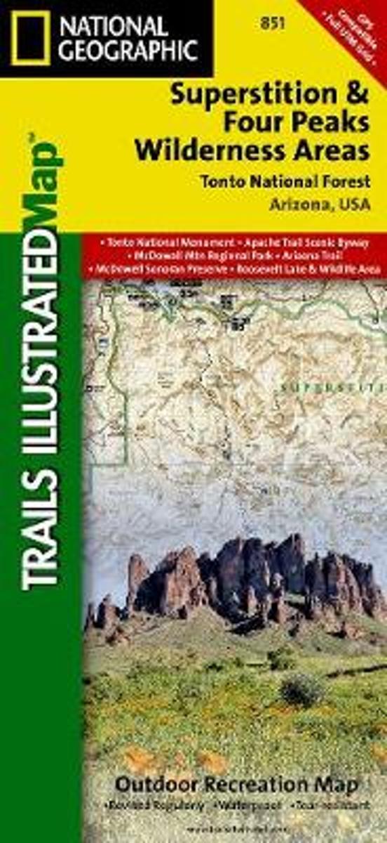
- Superstition & Four Peaks Wilderness Areas, Tonto National Forest
- Waterproof Tear-Resistant Topographic MapOne of the most-visited urban forests in the U.S., with approximately 5.8 million visitors annually, the Tonto National Forest spans almost 3 million acres of diverse terrain just outside of Phoenix, AZ. Tonto encompasses a wide variety of vegetation ranging from cactus-studded desert to... Read more
- Also available from:
- Bol.com, Belgium
- Stanfords, United Kingdom
» Click to openBol.com
Belgium
- Superstition & Four Peaks Wilderness Areas, Tonto National Forest
- Waterproof Tear-Resistant Topographic MapOne of the most-visited urban forests in the U.S., with approximately 5.8 million visitors annually, the Tonto National Forest spans almost 3 million acres of diverse terrain just outside of Phoenix, AZ. Tonto encompasses a wide variety of vegetation ranging from cactus-studded desert to... Read more

Stanfords
United Kingdom
- Superstition & Four Peaks Wilderness Areas - Tonto National Forest AZ
- Map No. 851, Tonto National Forest: Superstition and Four Peaks Wilderness Areas, AZ, in an extensive series of GPS compatible, contoured hiking maps of USA’s national and state parks or forests and other popular recreational areas. Cartography based on the national topographic survey, with additional tourist information.The maps, with most... Read more
Bol.com
Netherlands
- Also available from:
- Bol.com, Belgium
- Stanfords, United Kingdom
» Click to open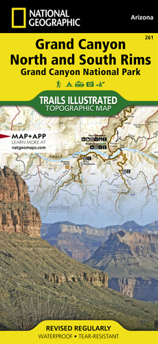
De Zwerver
Netherlands
- Wandelkaart - Topografische kaart 261 Grand Canyon | National Geographic
- Prachtige geplastificeerde kaart van het bekende nationaal park. Met alle recreatieve voorzieningen als campsites, maar ook met topografische details en wandelroutes ed. Door uitgekiend kleurgebruik zeer prettig in gebruik. Scheur en watervast! Grand Canyon, Bright Angel Canyon/North & South Rims (#261) replaces the previous Grand Canyon... Read more
Bol.com
Netherlands
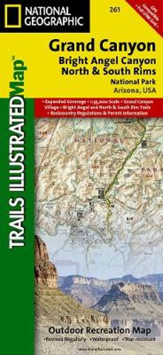
- Grand Canyon, Bright Angel Canyon/north & South Rims
- Waterproof Tear-Resistant Topographic MapExplore the uniquely inspiring and wondrous landscape of the Grand Canyon with National Geographic's Trails Illustrated map of Grand Canyon National Park, North and South Rims. Expertly researched and created in partnership with local land management agencies, this map is designed to meet the needs... Read more
Bol.com
Belgium
- Grand Canyon, Bright Angel Canyon/north & South Rims
- Waterproof Tear-Resistant Topographic MapExplore the uniquely inspiring and wondrous landscape of the Grand Canyon with National Geographic's Trails Illustrated map of Grand Canyon National Park, North and South Rims. Expertly researched and created in partnership with local land management agencies, this map is designed to meet the needs... Read more

De Zwerver
Netherlands
- Wandelkaart 262 Grand Canyon East - Oost | National Geographic
- Prachtige geplastificeerde kaart van het nationaal park. Met alle recreatieve voorzieningen als campsites, maar ook met topografische details en wandelroutes ed. Door uitgekiend kleurgebruik zeer prettig in gebruik. Scheur en watervast! Grand Canyon East (#262) and Grand Canyon West (#263) combine to cover the entire Grand Canyon National Park... Read more

Bol.com
Netherlands
- Grand Canyon East
- Waterproof Tear-Resistant Topographic MapGrand Canyon East (#262) and Grand Canyon West (#263) combine to cover the entire Grand Canyon National Park and its bordering public lands. Both maps contain detailed and easy-to-read trail and road networks, locations of facilities, points of interest, and highly accurate terrain with thousands... Read more
Bol.com
Belgium
- Grand Canyon East
- Waterproof Tear-Resistant Topographic MapGrand Canyon East (#262) and Grand Canyon West (#263) combine to cover the entire Grand Canyon National Park and its bordering public lands. Both maps contain detailed and easy-to-read trail and road networks, locations of facilities, points of interest, and highly accurate terrain with thousands... Read more
