
Outer Hebrides
Beschrijving
Island group in the Norht Atlantic, off the west coast of Scotland: Lewis and Harris, South Uist, North Uist, Benbecula, Barra, Scalpay, Great Bernera, Grimsay, Berneray, Eriskay, Vatersay.
The islands are very diverse in character. Lewis is flat, Harris is mountainous, Uist is flat again. It's a birders paradise. Long continuous trails are missing. But on the other hand the islands are relatively isolated to the main car driven tourist industry. Backpacking and hopping from one island to the other is a good idea.
Links
Feiten
Verslagen
Gidsen en kaarten
Overnachting
Organisaties
Reisorganisaties
GPS
Anders
Boeken
De Zwerver
Netherlands
2020
Netherlands
2020
De Zwerver
Netherlands
2020
Netherlands
2020
De Zwerver
Netherlands
2007
Netherlands
2007
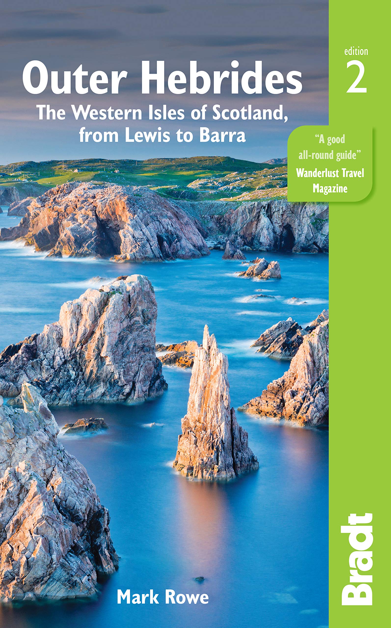
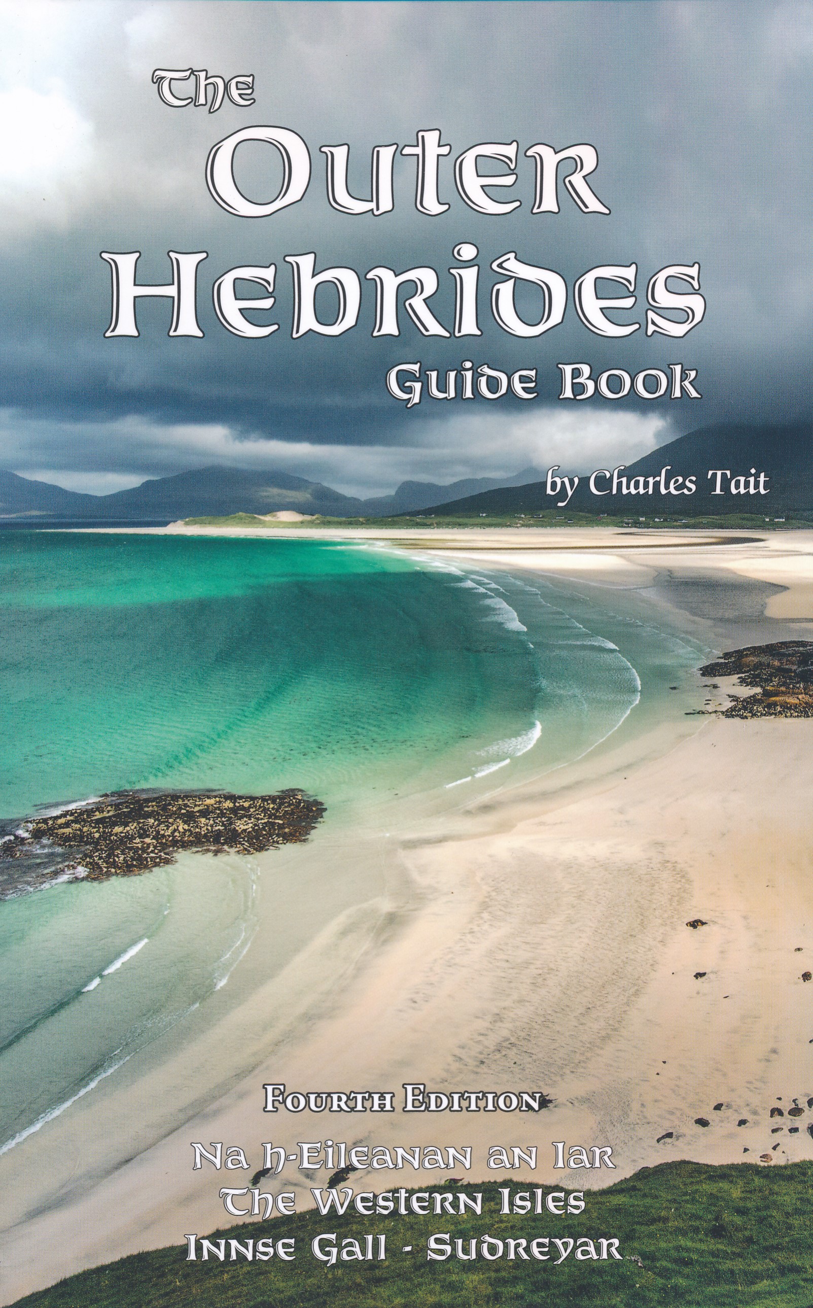
- Reisgids Lewis and Harris - Pevensey Island Guides | Pevensey Island guides
- Meer fotoboek dan reisgids, maar wel eentje om perfect de sfeer te proeven van deze bijzonder eilanden. Suitable for the discerning tourist and island devotee, this work describes everything the visitor needs to know about the islands' heritage, landscape, climate, flora and fauna. It contains information on the key places of interest, from... Read more
.jpg)
De Zwerver
Netherlands
2008
Netherlands
2008
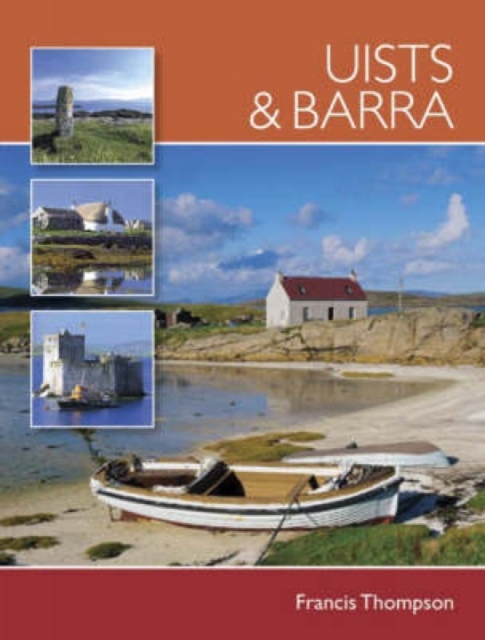
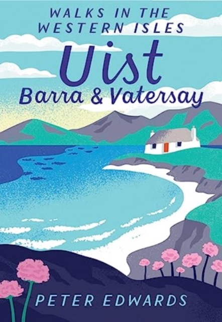
- Reisgids Uists & Barra | David Charles
- The essential guide for the discerning tourist and island devotee, ´´Uists & Barra´´ describes everything the visitor needs to know about the islands´ heritage, landscape, climate, flora and fauna. It contains fascinating information about all the key places of interest, from the stunning, rugged beaches, to the ancient buildings and ruins... Read more
De Zwerver
Netherlands
2019
Netherlands
2019
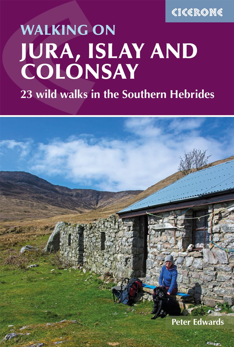
- Wandelgids Walking on Jura, Islay and Colonsay | Cicerone
- Guidebook to Jura, Scarba, Islay and Colonsay in the Hebrides, describing 22 walks plus a 5-day 89km trek along Jura's remote west coast. The routes range from 6.5 to 25km and cover rough - and often pathless - terrain suitable for fit, competent walkers. Even the coastal walks offer challenges. Read more
- Also available from:
- Stanfords, United Kingdom

Stanfords
United Kingdom
2019
United Kingdom
2019
- Walking on Jura, Islay and Colonsay: 23 wild walks in the Southern Hebrides
- This guidebook presents a selection of 23 walking routes on the wild and beautiful southern islands of Scotland`s Inner Hebrides, with nine walks on Jura, one on neighbouring Scarba, seven on Islay and five on Colonsay, plus a spectacular 5-day trek along Jura`s dramatic west coast. The wildest of the southern Hebrides, the walking on Jura is... Read more
Bol.com
Netherlands
Netherlands
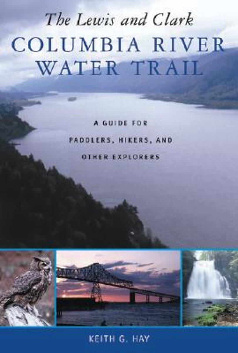
- The Lewis and Clark Columbia River Water Trail
- The Lewis and Clark expedition traveled the final 450 miles of their journey to the Pacific Ocean entirely by water, the last segment along the Columbia River. Beginning near the Bonneville Dam, the lower Columbia has been designated the Lewis and Clark Columbia River Water Trail in recognition of its rich historical significance. With this... Read more
- Also available from:
- Bol.com, Belgium
Bol.com
Belgium
Belgium
- The Lewis and Clark Columbia River Water Trail
- The Lewis and Clark expedition traveled the final 450 miles of their journey to the Pacific Ocean entirely by water, the last segment along the Columbia River. Beginning near the Bonneville Dam, the lower Columbia has been designated the Lewis and Clark Columbia River Water Trail in recognition of its rich historical significance. With this... Read more
Bol.com
Netherlands
Netherlands
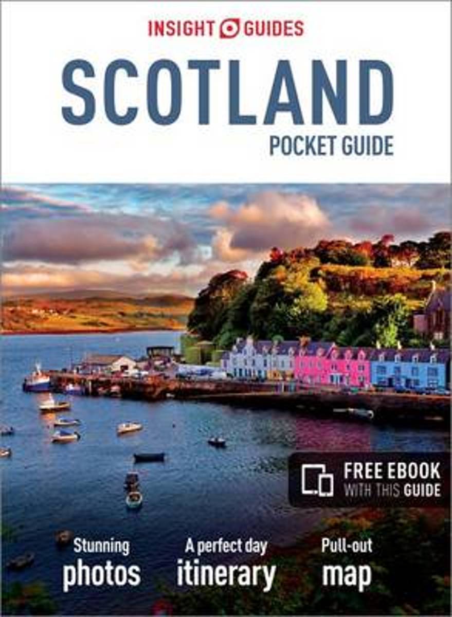
- Insight Guides Pocket Scotland
- Insight Guides: Inspiring your next adventureA rich and varied country, Scotland offers everything from historical sights and world-class museums and galleries to some of the most beautiful scenery in Britain. Be inspired to visit by the brand newInsight Pocket Guide Scotland, a concise, full-color guide to this fascinating country that... Read more
- Also available from:
- Bol.com, Belgium
Bol.com
Belgium
Belgium
- Insight Guides Pocket Scotland
- Insight Guides: Inspiring your next adventureA rich and varied country, Scotland offers everything from historical sights and world-class museums and galleries to some of the most beautiful scenery in Britain. Be inspired to visit by the brand newInsight Pocket Guide Scotland, a concise, full-color guide to this fascinating country that... Read more
Bol.com
Netherlands
Netherlands
- A Tramp Abroad
- A Tramp Abroad is a work of non-fiction travel literature by American author Mark Twain, published in 1880. The book details a journey by the author, with his friend Harris (a character created for the book, and based on his closest friend, Joseph Twichell), through central and southern Europe. While the stated goal of the journey is to walk... Read more
- Also available from:
- Bol.com, Belgium
Bol.com
Belgium
Belgium
- A Tramp Abroad
- A Tramp Abroad is a work of non-fiction travel literature by American author Mark Twain, published in 1880. The book details a journey by the author, with his friend Harris (a character created for the book, and based on his closest friend, Joseph Twichell), through central and southern Europe. While the stated goal of the journey is to walk... Read more

Bol.com
Netherlands
Netherlands
- Land of Second Chances
- ** Winner of the British Sports Book Awards 2014 New Writer of the Year ** Where there is hope there can be redemption. Meet Adrien Niyonshuti, a member of the Rwandan cycling team. Adrien was seven years old when he lost his family in the 1994 genocide that tore Rwanda apart. Almost twenty years later he has a shot at representing his country... Read more
- Also available from:
- Bol.com, Belgium
Bol.com
Belgium
Belgium
- Land of Second Chances
- ** Winner of the British Sports Book Awards 2014 New Writer of the Year ** Where there is hope there can be redemption. Meet Adrien Niyonshuti, a member of the Rwandan cycling team. Adrien was seven years old when he lost his family in the 1994 genocide that tore Rwanda apart. Almost twenty years later he has a shot at representing his country... Read more
Kaarten

De Zwerver
Netherlands
Netherlands
- Wandelkaart - Topografische kaart 201 Trails Illustrated Yellowstone National Park | National Geographic
- Prachtige geplastificeerde kaart van het bekende nationaal park. Met alle recreatieve voorzieningen als campsites, maar ook met topografische details en wandelroutes ed. Door uitgekiend kleurgebruik zeer prettig in gebruik. Scheur en watervast! Detailed and accurate coverage for Yellowstone National Park. Includes a detailed road network and... Read more
- Also available from:
- Bol.com, Netherlands
- Bol.com, Belgium
- Stanfords, United Kingdom
- The Book Depository, United Kingdom

Bol.com
Netherlands
Netherlands
- Yellowstone National Park
- Waterproof Tear-Resistant Topographic MapNational Geographic's Trails Illustrated map of Yellowstone National Park is designed to meet the needs of outdoor enthusiasts by combining valuable information with unmatched detail of America's first national park. Expertly researched and created in partnership with local land management... Read more
Bol.com
Belgium
Belgium
- Yellowstone National Park
- Waterproof Tear-Resistant Topographic MapNational Geographic's Trails Illustrated map of Yellowstone National Park is designed to meet the needs of outdoor enthusiasts by combining valuable information with unmatched detail of America's first national park. Expertly researched and created in partnership with local land management... Read more

Stanfords
United Kingdom
United Kingdom
- Yellowstone National Park WY/MT NGS Trails Illustrated Map 201
- Map No. 201, Yellowstone National Park, WY/MT, in an extensive series of GPS compatible, contoured hiking maps of USA’s national and state parks or forests and other popular recreational areas. Cartography based on the national topographic survey, with additional tourist information.The maps, with most titles now printed on light, waterproof... Read more

The Book Depository
United Kingdom
United Kingdom
- Yellowstone National Park
- Trails Illustrated National Parks Read more

De Zwerver
Netherlands
Netherlands
- Wandelkaart - Topografische kaart 318 Mount Rogers High Country - Grayson Highlands State Park | National Geographic
- Prachtige geplastificeerde kaart van het bekende nationaal park. Met alle recreatieve voorzieningen als campsites, maar ook met topografische details en wandelroutes ed. Door uitgekiend kleurgebruik zeer prettig in gebruik. Scheur en watervast! National Geographic's Trails Illustrated map of Mount Rogers High Country and Grayson Highlands... Read more
- Also available from:
- Bol.com, Netherlands
- Bol.com, Belgium
- Stanfords, United Kingdom
- The Book Depository, United Kingdom

Bol.com
Netherlands
Netherlands
- Mount Rogers High Country
- Waterproof Tear-Resistant Topographic MapNational Geographic's Trails Illustrated map of Mount Rogers High Country and Grayson Highlands State Park, Southwest Virginia, is a two-sided, waterproof, topographic trail map designed to meet the needs of outdoor enthusiasts with unmatched durability and detail. This map was created in... Read more
Bol.com
Belgium
Belgium
- Mount Rogers High Country
- Waterproof Tear-Resistant Topographic MapNational Geographic's Trails Illustrated map of Mount Rogers High Country and Grayson Highlands State Park, Southwest Virginia, is a two-sided, waterproof, topographic trail map designed to meet the needs of outdoor enthusiasts with unmatched durability and detail. This map was created in... Read more

Stanfords
United Kingdom
United Kingdom
- Mount Rogers High Country VA
- Map No. 318 - Mount Rogers High Country in Virginia in an extensive series of GPS compatible, contoured hiking maps of USA’s national and state parks or forests and other popular recreational areas. Cartography based on the national topographic survey, with additional tourist information.The maps, with most titles now printed on light,... Read more

The Book Depository
United Kingdom
United Kingdom
- Mount Rogers High Country
- Trails Illustrated Other Rec. Areas Read more

De Zwerver
Netherlands
Netherlands
- Wandelkaart - Topografische kaart 215 Glacier - Waterton Lakes National Park | National Geographic
- Prachtige geplastificeerde kaart van het bekende nationaal park. Met alle recreatieve voorzieningen als campsites, maar ook met topografische details en wandelroutes ed. Door uitgekiend kleurgebruik zeer prettig in gebruik. Scheur en watervast! Waterton Lakes National Park, Canada includes Waterton Park, Upper and Middle Waterton Lakes, The... Read more
- Also available from:
- Bol.com, Netherlands
- Bol.com, Belgium
- Stanfords, United Kingdom

Bol.com
Netherlands
Netherlands
- Glacier/waterton Lakes National Parks
- Waterproof Tear-Resistant Topographic MapNational Geographic's Trails Illustrated map of Glacier and Waterton Lakes National Parks offers unparalleled detail for outdoor enthusiasts exploring the pristine landscape of forests, mountains, lakes, and meadows within these two spectacular parks. Created in partnership with local land... Read more
Bol.com
Belgium
Belgium
- Glacier/waterton Lakes National Parks
- Waterproof Tear-Resistant Topographic MapNational Geographic's Trails Illustrated map of Glacier and Waterton Lakes National Parks offers unparalleled detail for outdoor enthusiasts exploring the pristine landscape of forests, mountains, lakes, and meadows within these two spectacular parks. Created in partnership with local land... Read more

Stanfords
United Kingdom
United Kingdom
- Glacier - Waterton Lakes National Park MT
- Map No. 215, Glacier/Waterton Lakes National Park, MT, in an extensive series of GPS compatible, contoured hiking maps of USA’s national and state parks or forests and other popular recreational areas. Cartography based on the national topographic survey, with additional tourist information.The maps, with most titles now printed on light,... Read more

Stanfords
United Kingdom
United Kingdom
- C65 Crinan To Mallaig & Barra
- Plans included: Castle Bay (Barra) (1:25,000) Mallaig (1:10,000) Tobermory (Mull) (1:22,500) Caledonian Canal Entrance (1:40,000) Lynn of Lorn (1:40,000) Dunstaffnage Bay (1:20,000) Oban (1:15,000) Loch Feochan Entrance (1:25,000) Sound of Luing (1:30,000) On the 2013 edition of this chart, depths from the latest known surveys have been... Read more

Stanfords
United Kingdom
United Kingdom
- C67 North Minch & Isle of Lewis
- Plans included:Loch Inchard (Kinlochbervie) (1:12 500)Loch Inver (1:15 000)Ullapool (1:10 000)Stornoway Harbour (1:15 000)Loch Carloway (1:20 000)On this 2017 edition the latest depth surveys have been included. The chart specification has been improved to show coloured light flashes. There has been general updating throughout. Read more

Stanfords
United Kingdom
United Kingdom
- C48 A Coruna to Porto
- Plans included: A Coruna (1:50 000) Ria de Corme e Laxe (1:75 000) Ria de Camarinas (1:50 000) Ria de Muros (1:75 000) Approaches to Ria de Arousa (1:150 000) Ria de Arousa (1:150 000) Cabo de Cruz (1:40 000) Vilagarcia (1:35 000) Illa de Arousa to Cambados (1:40 000) Ria de Pontevedra (1:150 000) Ria de Vigo (1:150 000) Baiona (1:85 000)... Read more