
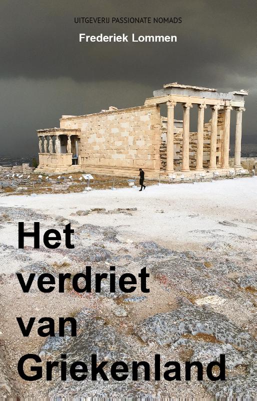
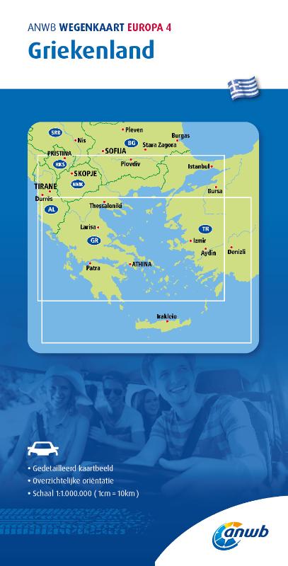
Griekenland
Beschrijving

Greece is a famous beach destination, and many island hoppers like to go for a walk now and again. Most islands are quite suitable for hiking, and locally guides and maps are available giving good descriptions of trails. But the crowded summer season is hot and dry. April is a much better month for hiking, with all flowers in full bloom, and also May, although it will start to get busier. June is more quiet but very hot. The busy season then lasts until winter. Although common in the past, your chances of actually following in the footsteps of mules carrying their loads in the traditional manner are dim.
But there is more. If you've had enough of the island's oregano, you can head for the mainland Pindos Mountains in the province of Epirus, on the border with Albania. European long distance trail E6, running from west to east, leads right across the Pindos. In the wide expanse of forests and pastures you may cross tracks with a bear (see the picture of a bear track which caused the author to freeze with fear), or if not, then at least with one or two herdsmen smelling of the inevitable ewe's cheese. Smolikos is the highest peak, reaching up to 2637m. Walking season in the mountains is from May, when the mountain tops are still covered in snow, until mid October. Greek mountain ranges have been made increasingly accessible over the years thanks to over 100 mountain huts.
Make an effort, and find out Greece has almost twenty national trails, maintained by regional mountaineering clubs. European long distance trail E4 enters Northern Greece from Bulgaria, and runs south via Mount Olympus (2918m), highest mountain of Greece and pleasant abode of Zeus. If you plan to spend the night there yourself in July or August, make sure to reserve in advance. The trail then leads across the Peleponessos, leaving it in the south, and continues on the island of Crete. Crete of course is famous for its Samaria gorge, the longest in Europe. It is impossible to lose your way here, simply join the crowd.
The Internet is not yet a very good source of information on Greek hiking, but maps and guides are easy to find. More information can be obtained through the Hellenic Federation of Mountaineering and Climbing.
Paden
Regios
- Agatohonissi, Dodecanese
- Amorgos, Cyclades
- Anafi, Cyclades
- Andros, Cyclades
- Antiparos, Cyclades
- Arki, Dodecanese
- Astipalea, Dodecanese
- Corfu
- Crete
- Cyclades Islands
- Dodecanese Islands
- Donoussa, Cyclades
- Folegandros, Cyclades
- Fourni, Dodecanese
- Greek Islands
- Ikaria, Dodecanese
- Ionian Islands
- Ios, Cyclades
- Iraklia, Cyclades
- Kalymnos, Dodecanese
- Karpathos
- Kea, Cyclades
- Kefalonia
- Kimolos, Cyclades
- Kithnos, Cyclades
- Kos
- Koufonisi, Cyclades
- Leros, Dodecanese
- Lesbos
- Lipsi, Dodecanese
- Milos, Cyclades
- Naxos, Cyclades
- Paros, Cyclades
- Patmos, Dodecanese
- Paxos
- Peleponnese
- Peloponnesos
- Pindos Mountains
- Rhodos
- Samos, Dodecanese
- Santorini, Cyclades
- Schinoussa, Cyclades
- Serifos, Cyclades
- Sifnos, Cyclades
- Sikinos, Cyclades
- Syros, Cyclades
- Telendos, Dodecanese
- Thirassia, Cyclades
- Tinos, Cyclades
- Zakynthos


 - by K.")


Links
Feiten
Verslagen
Gidsen en kaarten
Overnachting
Organisaties
Reisorganisaties
GPS
Anders
Boeken
Netherlands
2015
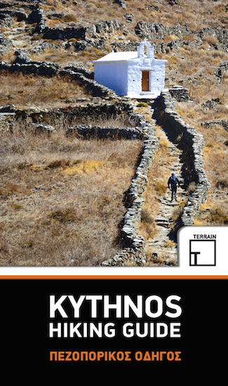
- Wandelgids Kythnos hiking guide | Terrain maps
- Kythnos Hiking Guide by Terrain Editions, includes eleven walks into history, nature and the most interesting sights of Kythnos, one of the beautiful Cyclades islands in the Aegean sea. Explore Kythnos on foot, a small island boasting ninety sheltered bays, sixty exceptional sandy beaches, famous hot springs and a spa centre by the sea, nine... Read more
- Also available from:
- Stanfords, United Kingdom

United Kingdom
2015
- Kythnos Hiking Guide
- Kythnos Hiking Guide by Terrain Editions, includes eleven walks into history, nature and the most interesting sights of Kythnos, one of the beautiful Cyclades islands in the Aegean sea. Explore Kythnos on foot, a small island boasting ninety sheltered bays, sixty exceptional sandy beaches, famous hot springs and a spa centre by the sea, nine... Read more
Netherlands
2018
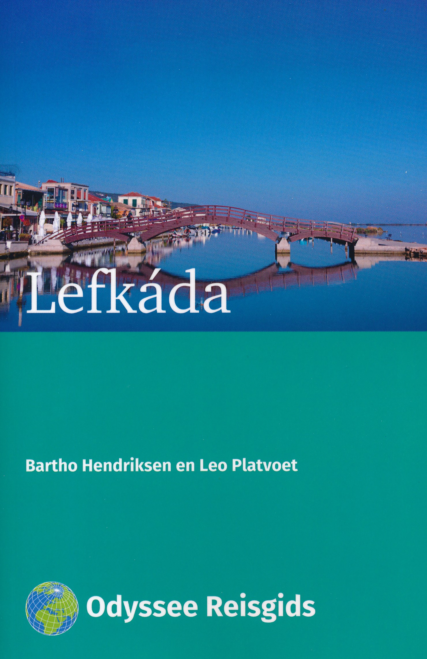
- Reisgids Lefkáda - Lefkas | Odyssee Reisgidsen
- Kleine reisgids in A5 formaat. Vrij dun, maar wel volgestopt met nuttige informatie. Lefkáda; ook wel Lefkas genoemd, is in grootte het vierde Ionische eiland. Hoewel je een vraagteken kunt zetten achter de benaming `eiland'; want Lefkáda is met een dam verbonden met het vasteland. Zo'n driekwart deel van Lefkáda is bedekt met bergen, waarvan... Read more
Netherlands
2019
Netherlands
2016
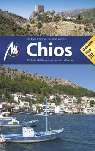
- Reisgids Chios | Michael Müller Verlag
- Uitstekende, diepgaande reisgids over dit deel van het land. Met veel achtergrondinformatie en ook praktische zaken als overnachtingen en eet- en drinkgelegenheden. Thematische hoofdstukken over geschiedenis, geologie etc. Let op: Duits! Ganz Griechenland auf einer Insel: Hochgebirge und Waldgebiete im Norden, fruchtbare Ebenen und unberührte... Read more
Netherlands
2018
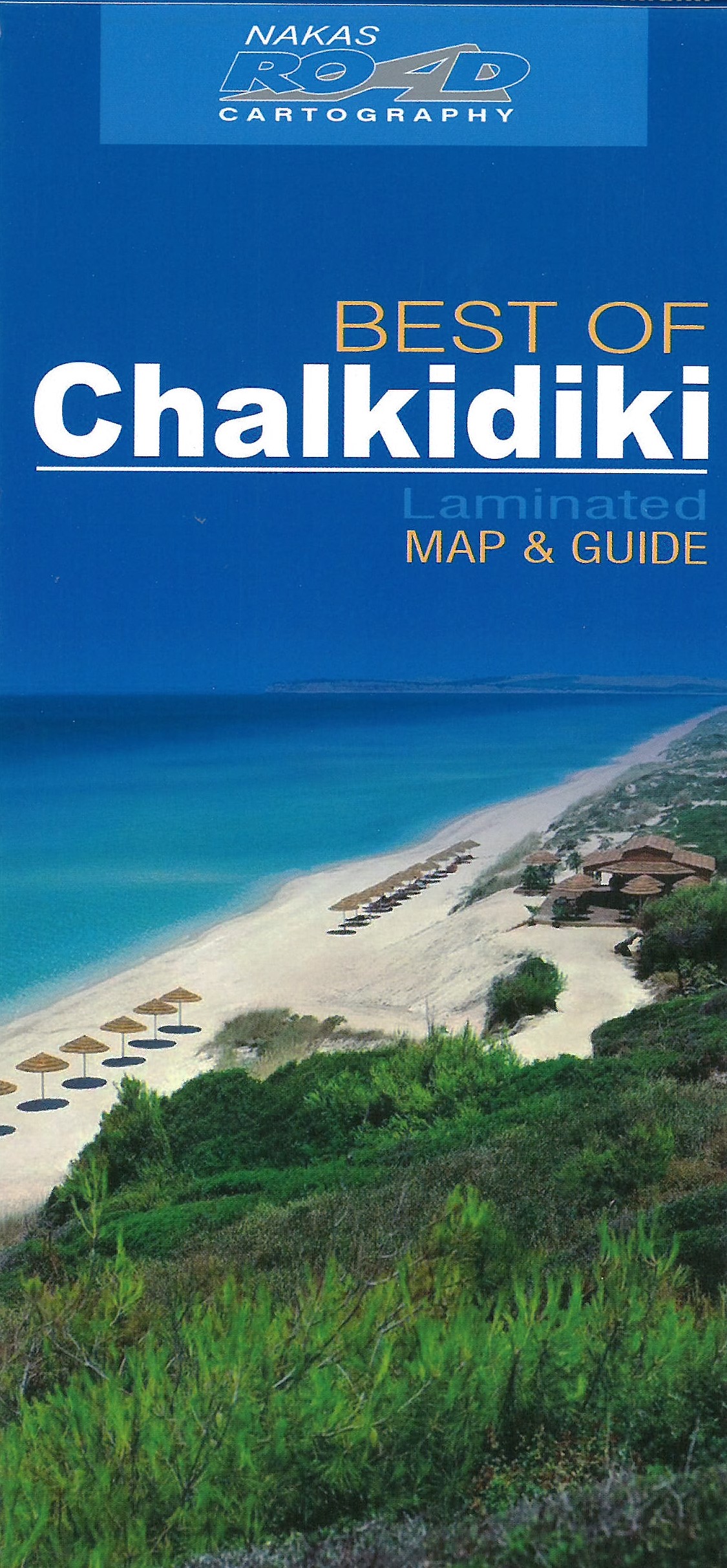
- Reisgids Live! Chalkidiki - Thessaloniki | Merian
- MERIAN live! Reiseführer Chalkidiki Thessaloniki ab 11.99 EURO Mit Extra-Karte zum Herausnehmen Merian live! Read more


Netherlands
2017
- Reisgids Direkt Chalkidikí | Dumont
- Dit zijn handzame, praktische reisgidsen en geven u de belangrijkste highlights om deze 'direkt' te beleven. Er is aandacht voor culturele bezienswaardigheden als ook voor natuurlijke bezienswaardigheden. De gids geeft de reiziger de gelegenheid om eenvoudig en snel te navigeren in het reisgebied en 'direkt' in het dagelijks leven van de lokale... Read more
Kaarten

Netherlands
2016
- Wandelgids The Cretan Way E4 | Anavasi
- The Cretan Way is a 500km walking route which takes you from east to west across the varied and spectacular landscapes of Crete. It is the ideal way to discover the rural, mountainous and costal regions of this incredible island. This guide is based on a 28-day walk.This guide includes practical information, maps at a scale of 1:25.000 of... Read more
- Also available from:
- Stanfords, United Kingdom

United Kingdom
2016
- The Cretan Way - A 28 Day Walk
- The Cretan Way is a 500km walking route which takes you from east to west across the varied and spectacular landscapes of Crete. It is the ideal way to discover the rural, mountainous and costal regions of this incredible island. This guide is based on a 28-day walk.This guide includes practical information, maps at a scale of 1:25.000 of... Read more
Netherlands
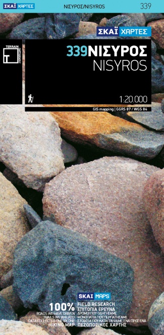
- Wandelkaart 339 Nisyros | Terrain maps
- Nisyros and the nearby island of Ghyali at 1:20,000 on a contoured, GPS compatible hiking map published by Terrain Cartography group together with Skai Maps, and printed on light, waterproof and tear-resistant Polyart plastic paper, with extensive tourist information.Topography is very well presented by contours, enhanced by spot heights,... Read more
- Also available from:
- Stanfords, United Kingdom

United Kingdom
- Nisyros Terrain Editions 339
- Nisyros and the nearby island of Ghyali at 1:20,000 on a contoured, GPS compatible hiking map published by Terrain Cartography group together with Skai Maps, and printed on light, waterproof and tear-resistant Polyart plastic paper, with extensive tourist information.Topography is very well presented by contours, enhanced by spot heights,... Read more
Netherlands
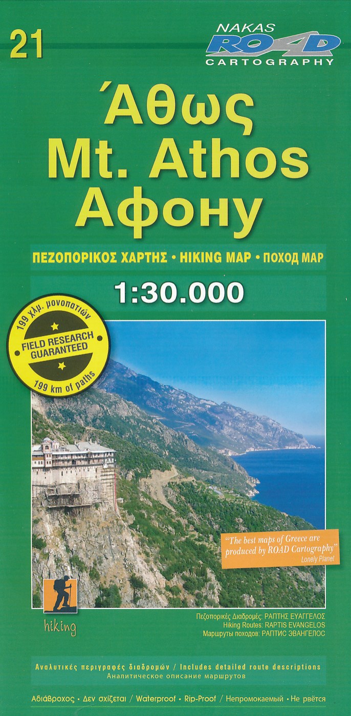
- Wandelkaart 21 Mt. Athos | Road Editions
- Gedetailleerde wandelkaart van Athos met hoogtelijnen, wandelroutes en bezienswaardigheden. Bijgelverd een kleine gids in o.a. engels over de routes en bezienswaardigheden. Read more
Netherlands
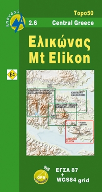
- Wandelkaart 2.6 Mt. Elikon - Griekenland vasteland | Anavasi
- Mt Elikon in a series of waterproof and tear-resistant hiking maps at scales varying from 1:50,000 to 1:10,000, with a UTM grid for GPS users. Contour interval varies depending on the scale, on most maps it is 20m. Relief shading, spot heights, springs, seasonal streams and, in most titles, landscape/land-use variations, e.g. forests, orchards,... Read more
- Also available from:
- Stanfords, United Kingdom

United Kingdom
- Mt Elikon Anavasi 2.6
- Mt Elikon in a series of waterproof and tear-resistant hiking maps at scales varying from 1:50,000 to 1:10,000, with a UTM grid for GPS users. Contour interval varies depending on the scale, on most maps it is 20m. Relief shading, spot heights, springs, seasonal streams and, in most titles, landscape/land-use variations, e.g. forests, orchards,... Read more
Netherlands
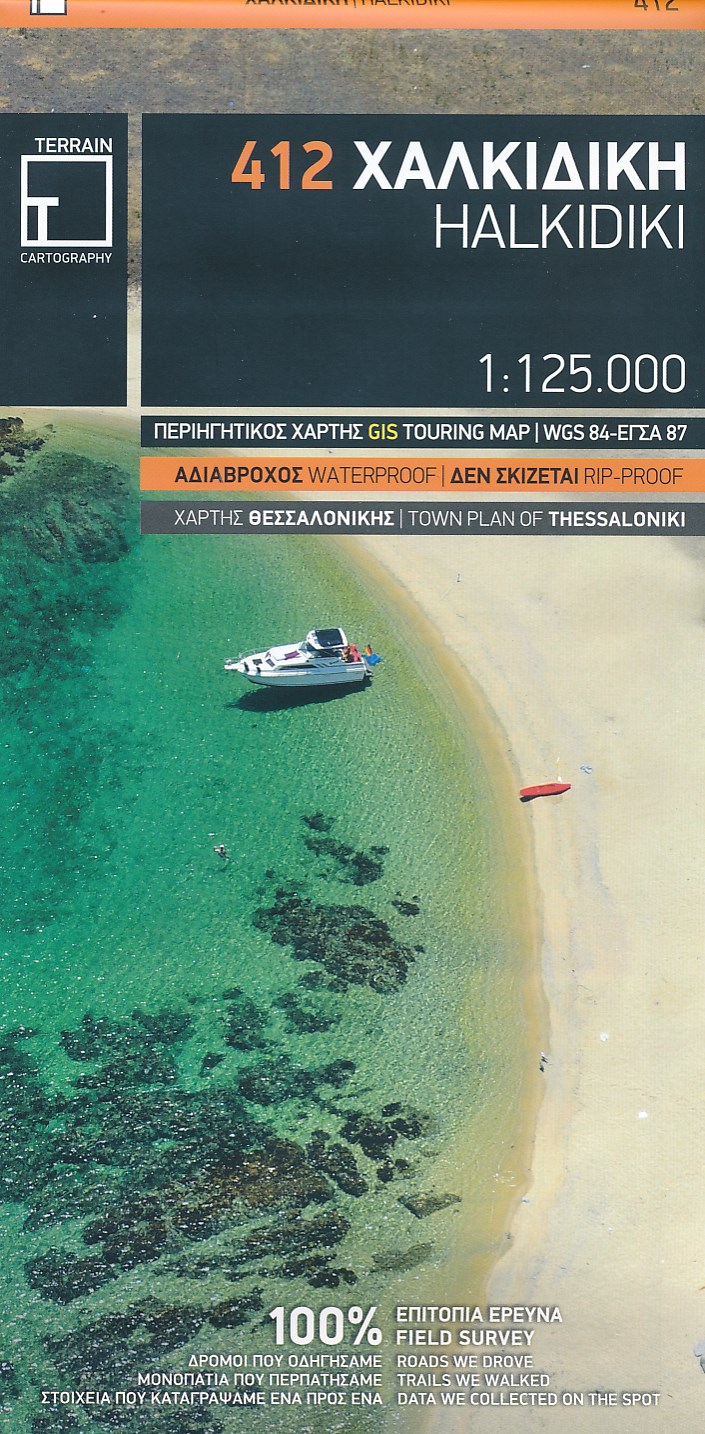
- Wandelkaart - Wegenkaart - landkaart 412 Halkidiki - Chalkidiki | Terrain maps
- Gedetailleerde wegenkaart en wandelkaart met alle kleine wegen, wandelpaden, hoogtelijnen en toeristische informatie aangegeven. Alle tekst is tweetalig in Engels en Grieks en de waterproof kaart is geschikt voor gebruik met GPS. We walked all trails. We drove all roads. We sailed around each and every island. We recorded every single sight.... Read more

Netherlands
- Wandelkaart 4.21 Meteora 3D | Anavasi
- Wandelkaart van Meteora en directe omgeving. Op de achterzijde een 3D kaart waarbij het bijgeleverde brilletje tot z'n recht komt. The hiking map of Meteora in scale 1:10 000 by Anavasi editions is a world first in the printed cartography with its the three-dimensional depiction. We provide the special glasses and we let wander back you back to... Read more
Netherlands
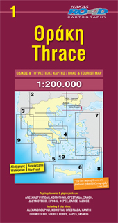
- Wegenkaart - landkaart 1 Thracië - Thrace | Road Editions
- Thrace 1 : 200 000 ab 9.99 EURO new edition Read more
Netherlands
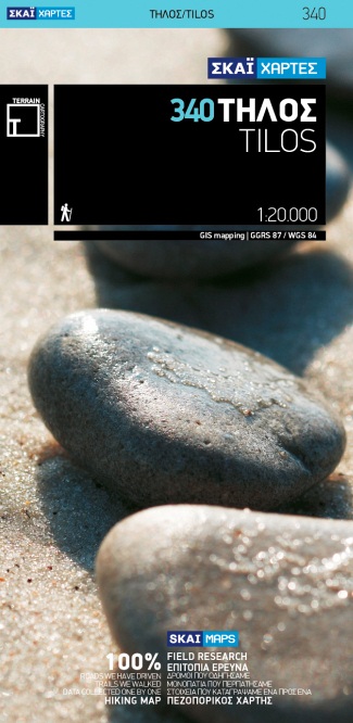
- Wandelkaart 340 Tilos | Terrain maps
- Tilos at 1:20,000 on a contoured, GPS compatible hiking map published by Terrain Cartography group together with Skai Maps, and printed on light, waterproof and tear-resistant Polyart plastic paper, with extensive tourist information.Topography is very well presented by contours, enhanced by spot heights, subtle relief shading and additional... Read more
- Also available from:
- Stanfords, United Kingdom

United Kingdom
- Tilos Terrain Editions 340
- Tilos at 1:20,000 on a contoured, GPS compatible hiking map published by Terrain Cartography group together with Skai Maps, and printed on light, waterproof and tear-resistant Polyart plastic paper, with extensive tourist information.Topography is very well presented by contours, enhanced by spot heights, subtle relief shading and additional... Read more
Netherlands
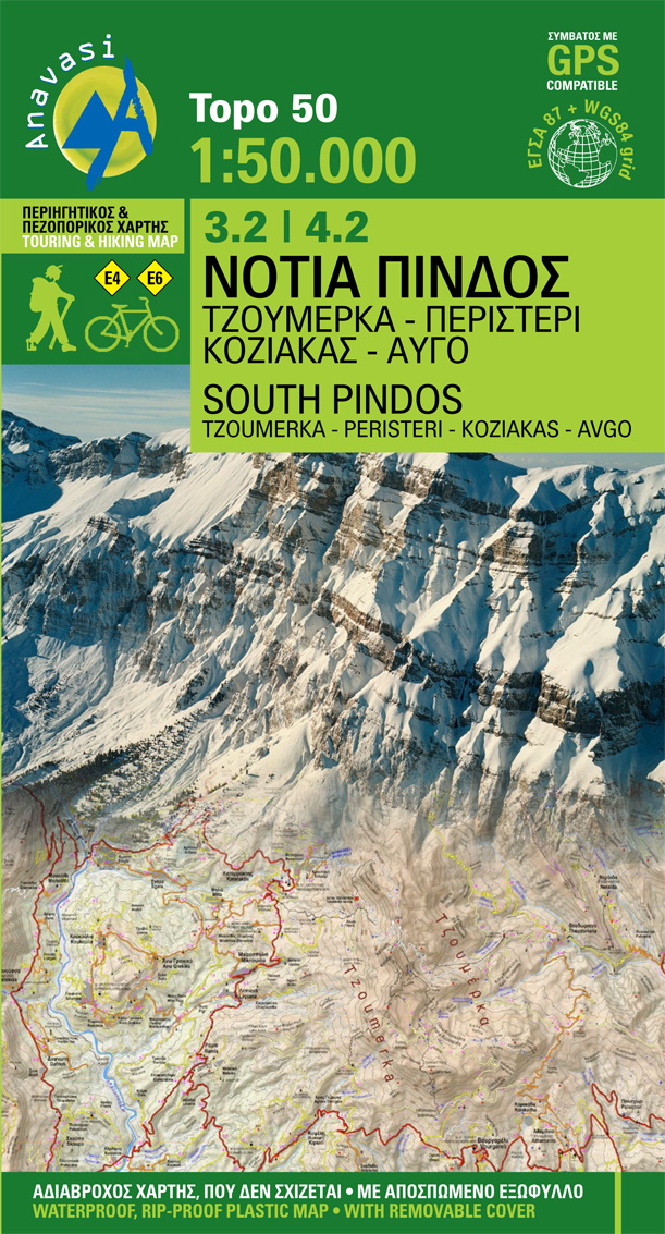
- Wandelkaart 3.2-4.2 South Pindos | Anavasi
- Uitstekende topografische kaarten van een deel van Griekenland: zonder meer hele goede kaarten voor wandeltochten in een onbekend stuk Griekenland! Ze zijn gedrukt op scheurvast en watervast papier op een schaal van 1:50.000 met een UTM grid voor GPS gebruikers. Op de meeste kaarten is geven de hoogtelijnen een interval van 20m. aan. Met... Read more
- Also available from:
- Stanfords, United Kingdom

United Kingdom
- South Pindos - Tzoumerka – Peristeri – Koziakas – Aygo Anavasi 3.2/4.2
- South Pindos: Tzoumerka – Peristeri – Koziakas – Aygo area at 1:50,000 in a series of GPS compatible, waterproof and tear-resistant hiking maps from Anavasi. The map is double-sided: on one side are the peaks of Peristeri, Kakardhitsa and Tzoumerka with the map extending north to Metsovo; on the reverse coverage extend westwards beyond the... Read more
Netherlands
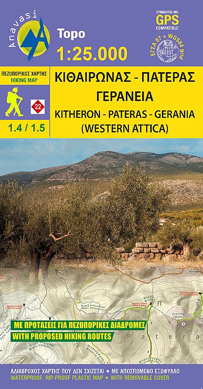
- Wandelkaart 1.4-1.5 Mt Kitheron - Mt Pateras - Mt Gerania | Anavasi
- Mt Kitheronas in a series of waterproof and tear-resistant hiking maps at scales varying from 1:50,000 to 1:10,000, with a UTM grid for GPS users. Contour interval varies depending on the scale, on most maps it is 20m. Relief shading, spot heights, springs, seasonal streams and, in most titles, landscape/land-use variations, e.g. forests,... Read more
- Also available from:
- Stanfords, United Kingdom

United Kingdom
- Kitheron - Pateras - Gerania Anavasi 1.4/1.5
- Mt Kitheronas in a series of waterproof and tear-resistant hiking maps at scales varying from 1:50,000 to 1:10,000, with a UTM grid for GPS users. Contour interval varies depending on the scale, on most maps it is 20m. Relief shading, spot heights, springs, seasonal streams and, in most titles, landscape/land-use variations, e.g. forests,... Read more