
Utrecht
Beschrijving
Kaart

Paden in deze landsdeel
- E11GPX
- E8GPX
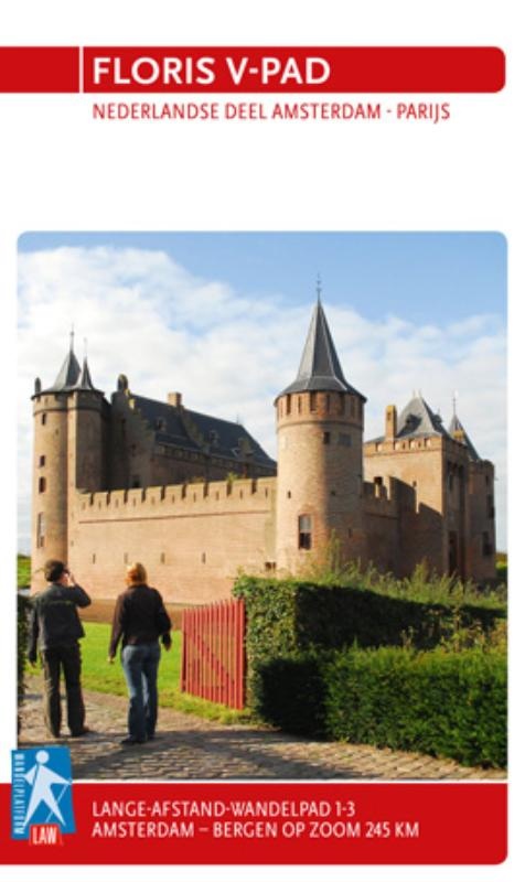
- Floris V-padGPX
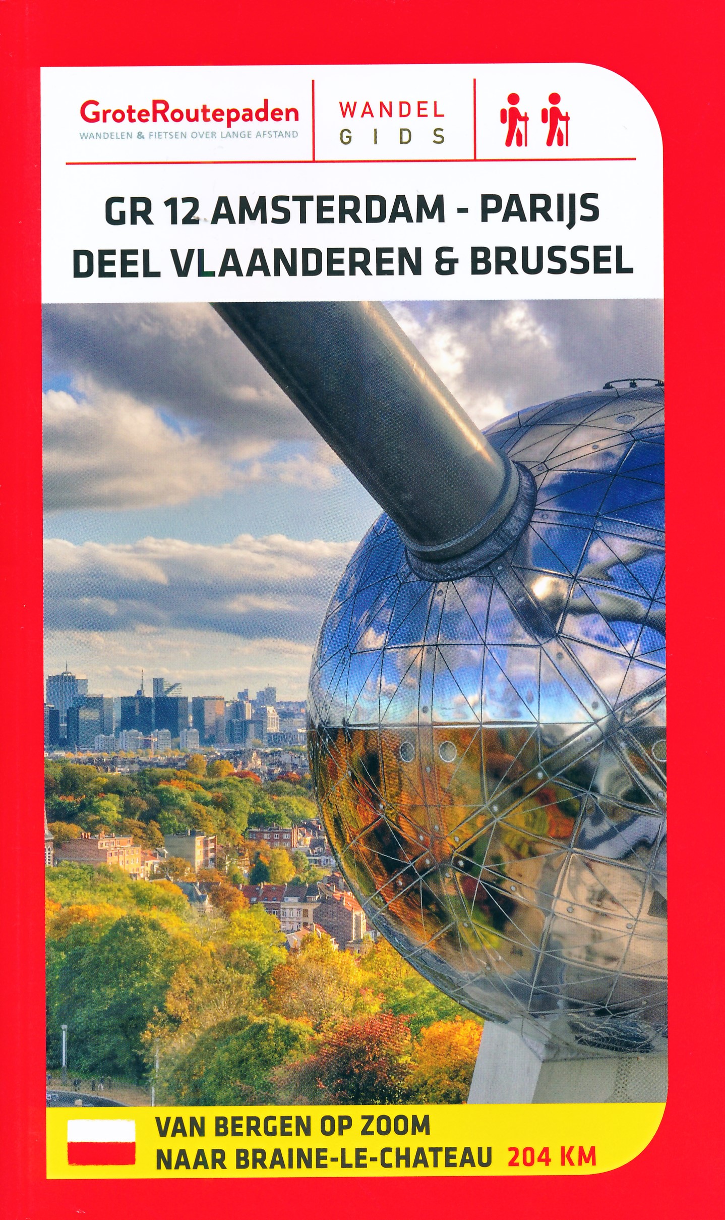
- GR12 - Amsterdam - ParisGPX
- GrebbeliniepadGPX
- Groene HartpadGPX
- Grote RivierenpadGPX
- Jacobsweg Amstelredam
- Jacobsweg Amsvorde
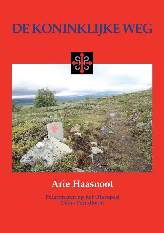
- Koninklijke WegGPX
- Maarten van RossumpadGPX
- MarskramerpadGPX
- Rijndeltapad
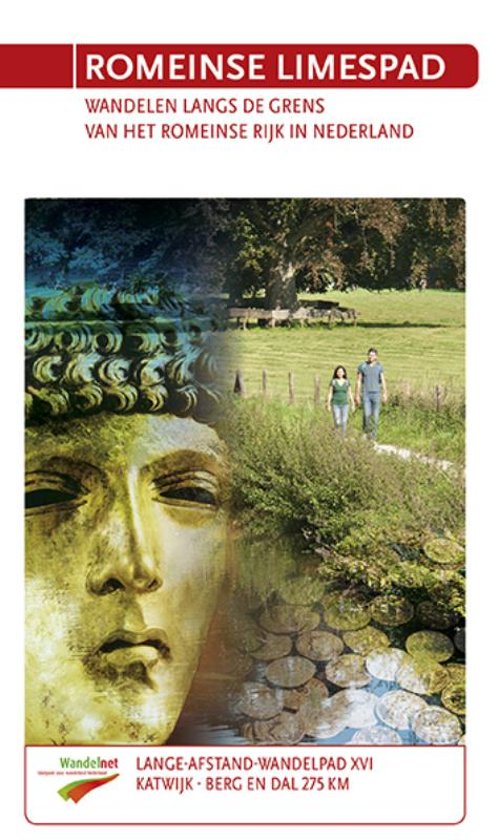
- Romeinse LimespadGPX
- Rondom Berg en Bosch
- Rondom de DomGPX
- Stichtse Dorpenpad
- TrekvogelpadGPX
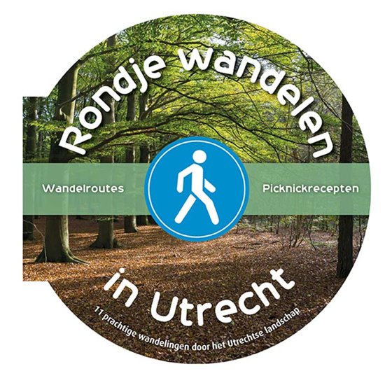
- UtrechtpadGPX
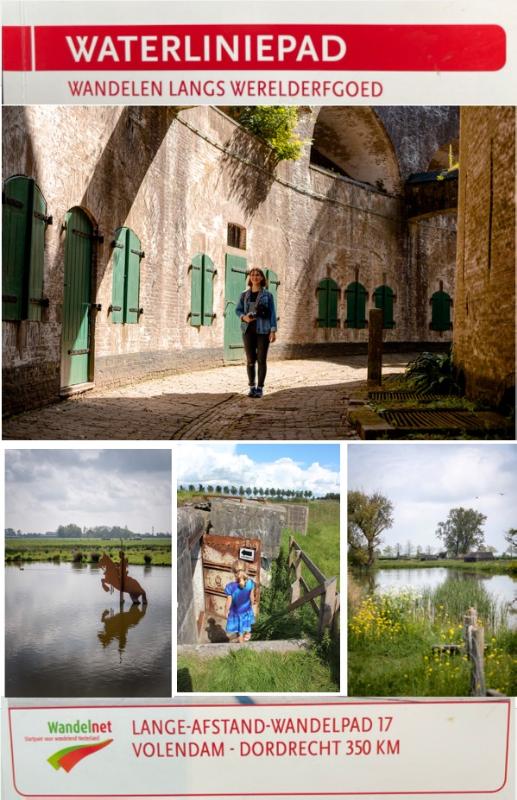
- WaterliniepadGPX
- WesterborkpadGPX
- Willebrordus Wandelpad
- WillibrorduswandelpadGPX
- ZuiderzeepadGPX
Links
Feiten
Verslagen
Gidsen en kaarten
Overnachting
Organisaties
Reisorganisaties
GPS
Anders
Boeken
De Zwerver
Netherlands
2009
Netherlands
2009
- Wandelgids 1-3 LAW Floris V-pad | Wandelnet
- Routegids met gedetailleerde topografische kaarten waar de route duidelijk op ingetekend is. Daarnaast alle noodzakelijke informatie als openbaar vervoer en overnachtingsadressen. Amsterdam -Bergen op Zoom. Het Floris V-pad leidt dwars door een oer-Hollands landschap over onverharde dijken en paden, die vaak speciaal voor wandelaars zijn... Read more
De Zwerver
Netherlands
2018
Netherlands
2018
- Wandelgids 16-XVI LAW Romeinse Limespad | Wandelnet
- Katwijk aan Zee- Berg en Dal(Duivelsberg) 275 km 'Sin; sin, sin…dex; sin' 'Links; links, links…rechts; links' Een Romeinse centurio roept commando's naar zijn soldaten die op hun sandalen keurig in gelid marcheren. Ze zijn op weg naar hun castellum… Waarom kwamen de Romeinen zo'n 2000 jaar geleden naar ons koude, natte land? Stap in de... Read more

De Zwerver
Netherlands
2023
Netherlands
2023
De Zwerver
Netherlands
2014
Netherlands
2014
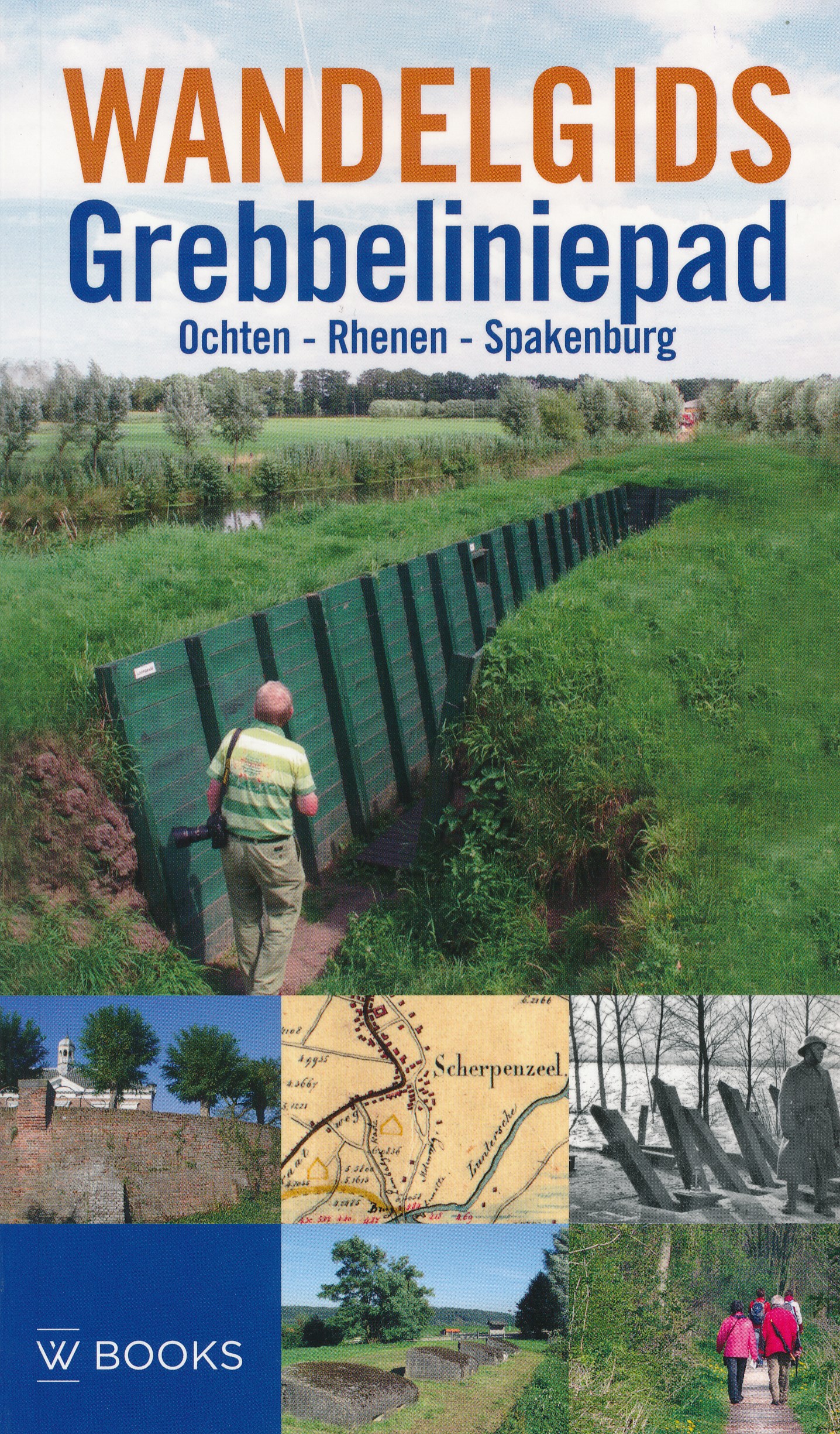
- Wandelgids Grebbeliniepad Ochten - Rhenen - Spakenburg | Uitgeverij Wbooks
- Wandelen in Grebbelinie heeft iets geheimzinnigs; de sporen van 200 jaar vestinggeschiedenis liggen overal verborgen in het groen. In deze vernieuwde uitgave van de Wandelgids Grebbeliniepad is de linie voor het eerst over de gehele lengte te bewandelen. Met de toevoeging van het ontbrekende deel door de Neder-Betuwe langs o.a. het Hoornwerk... Read more
De Zwerver
Netherlands
2017
Netherlands
2017
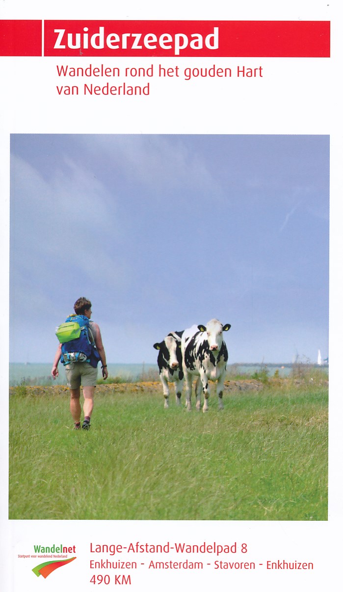
- Wandelgids 8 LAW Zuiderzeepad | Wandelnet
- wandelen rondom de Zuiderzee Read more
De Zwerver
Netherlands
2017
Netherlands
2017
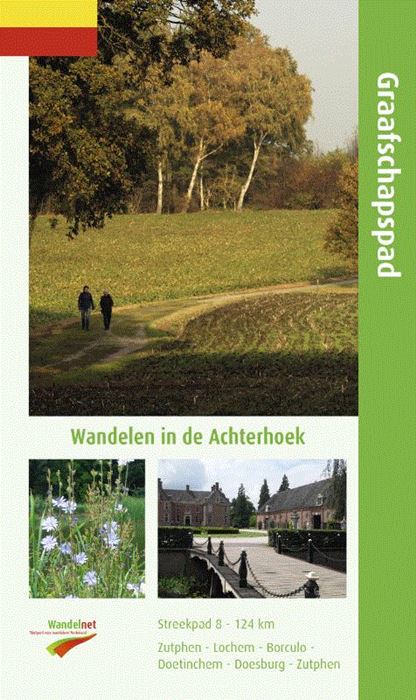
- Wandelgids S8 Streekpad Graafschapspad | Wandelnet
- Routegids met gedetailleerde topografische kaarten waar de route duidelijk op ingetekend is. Daarnaast alle noodzakelijke informatie als openbaar vervoer en overnachtingsadressen. Traject : Rondom Vorden / Lengte : 124 km Een afwisselende route in een verrassend stukje Nederland. Kleine bosjes, landgoederen en Saksische boerderijen in de... Read more
- Also available from:
- Stanfords, United Kingdom

Stanfords
United Kingdom
2020
United Kingdom
2020
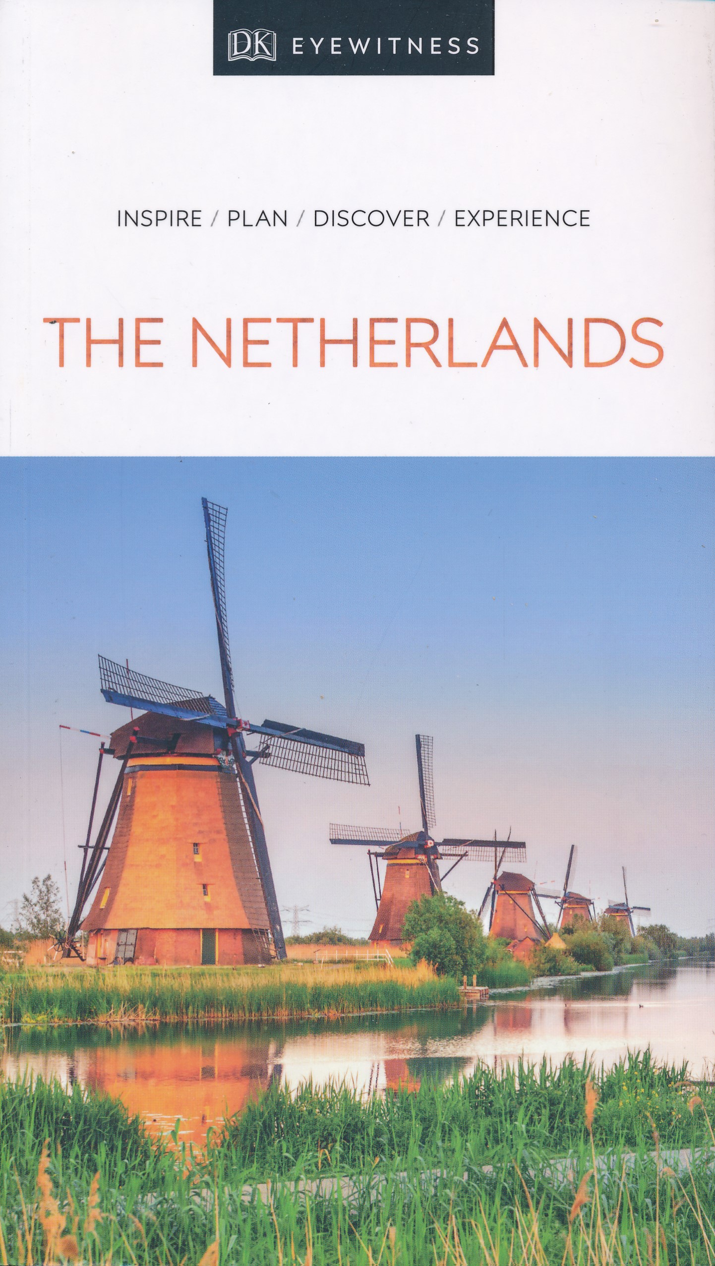
- DK Eyewitness The Netherlands 7/5/20
- Colourful canals and culture-filled cities - welcome to the Netherlands.Whether you want to immerse yourself in the exquisite art of Amsterdam`s galleries, cycle through fields of tulips or go cheese tasting in Gouda, your DK Eyewitness travel guide makes sure you experience all that the Netherlands has to offer. The Netherlands boasts... Read more
Kaarten

De Zwerver
Netherlands
Netherlands
- Wandelkaart 5 Rila gebergte | Domino
- Rila Mountains at 1:50,000 on a large, double-sided, contoured map with GPS waypoints for shelters and chalets, peaks, etc. and highlighting hiking routes. Topography is shown by contours at 50m intervals with additional relief shading and graphics and colouring for scree, single rocks over 5m high, marshlands and pine scrub and forests. An... Read more
- Also available from:
- Stanfords, United Kingdom

Stanfords
United Kingdom
United Kingdom
- Rila Mountains Domino
- Rila Mountains at 1:50,000 on a large, double-sided, contoured map with GPS waypoints for shelters and chalets, peaks, etc. and highlighting hiking routes. Topography is shown by contours at 50m intervals with additional relief shading and graphics and colouring for scree, single rocks over 5m high, marshlands and pine scrub and forests. An... Read more

De Zwerver
Netherlands
Netherlands
- Wandelkaart Sredna Gora - Bulgarije | Domino
- Pirin Mountains at 1:50,000 on a large, double-sided, contoured map with GPS waypoints for shelters and chalets, peaks, etc. and highlighting hiking routes. Topography is shown by contours at 40m intervals with additional relief shading and graphics and colouring for sandstone stacks, single rocks over 5m high, marshlands and different types of... Read more

De Zwerver
Netherlands
Netherlands
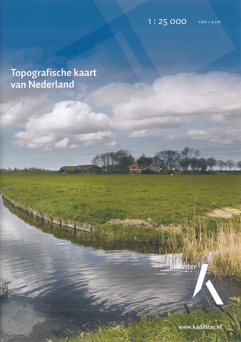
- Topografische kaart - Wandelkaart 32A Soestdijk | Kadaster
- De meest gedetailleerde kaart die via de verkoopkanalen verkrijgbaar is. Gemaakt door de Nederlandse Topografische dienst bevat deze kaart alle topografische elementen van het landschap en geeft daarmee een nauwkeurig beeld van het terrein. De meeste kaarten hebben een kaartbeeld dat overeenkomt met 12,5 x 10 kilometer in werkelijkheid. Naast... Read more
De Zwerver
Netherlands
Netherlands
- Topografische kaart - Wandelkaart 32C Zeist | Kadaster
- De meest gedetailleerde kaart die via de verkoopkanalen verkrijgbaar is. Gemaakt door de Nederlandse Topografische dienst bevat deze kaart alle topografische elementen van het landschap en geeft daarmee een nauwkeurig beeld van het terrein. De meeste kaarten hebben een kaartbeeld dat overeenkomt met 12,5 x 10 kilometer in werkelijkheid. Naast... Read more

De Zwerver
Netherlands
Netherlands

De Zwerver
Netherlands
Netherlands
- Wandelkaart 6 Pirin gebergte | Domino
- Pirin Mountains at 1:50,000 on a large, double-sided, contoured map with GPS waypoints for shelters and chalets, peaks, etc. and highlighting hiking routes. Topography is shown by contours at 40m intervals with additional relief shading and graphics and colouring for sandstone stacks, single rocks over 5m high, marshlands and different types of... Read more
- Also available from:
- Stanfords, United Kingdom

Stanfords
United Kingdom
United Kingdom
- Pirin Mountains Domino
- Pirin Mountains at 1:50,000 on a large, double-sided, contoured map with GPS waypoints for shelters and chalets, peaks, etc. and highlighting hiking routes. Topography is shown by contours at 40m intervals with additional relief shading and graphics and colouring for sandstone stacks, single rocks over 5m high, marshlands and different types of... Read more

De Zwerver
Netherlands
Netherlands
- Topografische kaart - Wandelkaart 32D Woudenberg | Kadaster
- De meest gedetailleerde kaart die via de verkoopkanalen verkrijgbaar is. Gemaakt door de Nederlandse Topografische dienst bevat deze kaart alle topografische elementen van het landschap en geeft daarmee een nauwkeurig beeld van het terrein. De meeste kaarten hebben een kaartbeeld dat overeenkomt met 12,5 x 10 kilometer in werkelijkheid. Naast... Read more
De Zwerver
Netherlands
Netherlands

De Zwerver
Netherlands
Netherlands
- Wandelkaart - Wegenkaart - landkaart 7 Westelijke Rhodopen - Western Rhodopes | Domino
- Western Rhodope Mountains at 1:100,000 on a contoured GPS compatible map from Domino extending from just west of the Pirin National Park to Asenovgrad in the north-east. The map is double-sided with a good overlap between the sides. Topography is shown by contours at 50m intervals with relief shading and spot heights, plus colouring for... Read more
- Also available from:
- Stanfords, United Kingdom

Stanfords
United Kingdom
United Kingdom
- Western Rhodope Mountains Domino Map
- Western Rhodope Mountains at 1:100,000 on a contoured GPS compatible map from Domino extending from just west of the Pirin National Park to Asenovgrad in the north-east. The map is double-sided with a good overlap between the sides. Topography is shown by contours at 50m intervals with relief shading and spot heights, plus colouring for... Read more

De Zwerver
Netherlands
Netherlands
- Topografische kaart - Wandelkaart 38B Schoonhoven | Kadaster
- De meest gedetailleerde kaart die via de verkoopkanalen verkrijgbaar is. Gemaakt door de Nederlandse Topografische dienst bevat deze kaart alle topografische elementen van het landschap en geeft daarmee een nauwkeurig beeld van het terrein. De meeste kaarten hebben een kaartbeeld dat overeenkomt met 12,5 x 10 kilometer in werkelijkheid. Naast... Read more

De Zwerver
Netherlands
Netherlands
- Wandelkaart 1 Stara Planina gebergte | Domino
- Stara Planina Central: Zlatitsa to Kalofer map at 1:50,000 from Bulgarian publishers Domino, contoured and GPS compatible, with hiking trails, accommodation options including a list of local mountain refuges, etc. The map is double-sided and covers the mountains from just west of Ribaritsa and Zlatitsa eastwards beyond Kalofer to the peak of... Read more
- Also available from:
- Stanfords, United Kingdom

Stanfords
United Kingdom
United Kingdom
- Stara Planina Central: Zlatitsa to Kalofer Domino Map
- Stara Planina Central: Zlatitsa to Kalofer map at 1:50,000 from Bulgarian publishers Domino, contoured and GPS compatible, with hiking trails, accommodation options including a list of local mountain refuges, etc. The map is double-sided and covers the mountains from just west of Ribaritsa and Zlatitsa eastwards beyond Kalofer to the peak of... Read more