
Castilla y León
Beschrijving
Kaart

Paden in deze regio
- GR1 Sendero Histórico, Senda TransversalGPX
- GR10 Senderos de la MielGPX
- GR100 Ruta de la PlataGPX
- GR14 Sendero del DueroGPX
- GR186 Caminos de MedinaGPX
- GR26 Senda de Tierra de CamposGPX
- GR260 Vuelta al Moncayo-Calcenada
- GR27 Sendero del Valle Esgueva
- GR28 Sendero de Tierra de PinaresGPX
- GR29 Sendero del río Pisuerga
- GR30 Sendero de los Montes de TorozosGPX
- GR65 Camino de SantiagoGPX
- GR69 Circular de HueteGPX
- GR82 Sierra de la DemandaGPX
- GR84 Canal del DueroGPX
- GR85 Ruta de los SentidosGPX
- GR86 Sendero Ibérico SorianoGPX
- GR89 Canales de CastillaGPX
- GR99 Sendero del EbroGPX
Links
Feiten
Verslagen
Gidsen en kaarten
Overnachting
Organisaties
Reisorganisaties
GPS
Anders
Boeken
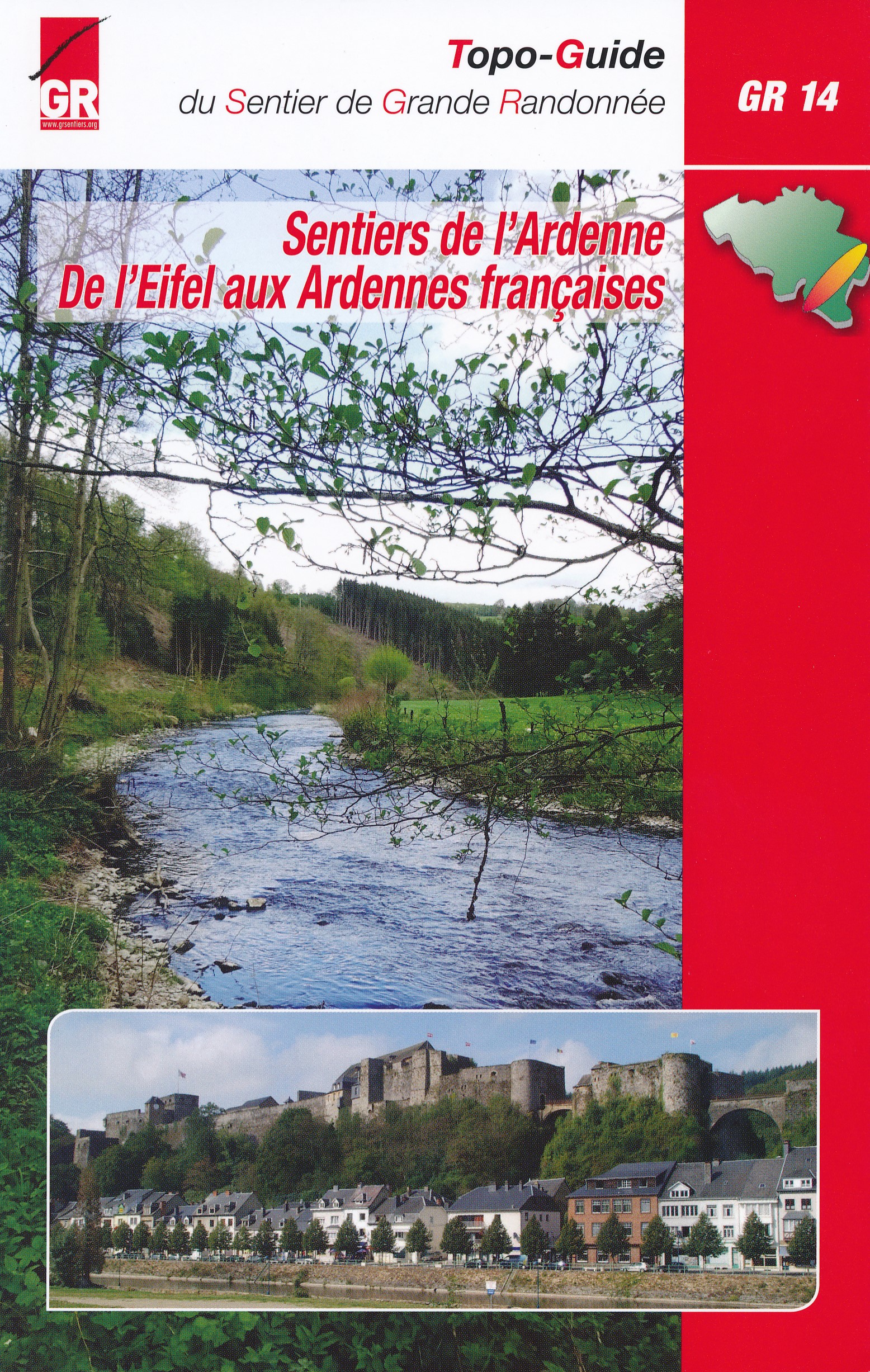
De Zwerver
Netherlands
2018
Netherlands
2018
- Wandelgids GR14 Sentier de l'Ardenne | GR Sentiers
- GR 14 neemt je mee door uitgestrekte bossen; loopt langs betoverende rivieren zoals de Warche, Amblève; Liene, Ourthe, Lesse en de Semois en doet typische dorpjes en charmante kleine steden aan zoals Stavelot, Trois-Ponts, Lierneux, La Roche, Saint-Hubert enBouillon. De route is een onuitputtelijke bron van ontdekkingen voor de wandelaar die... Read more
De Zwerver
Netherlands
2015
Netherlands
2015
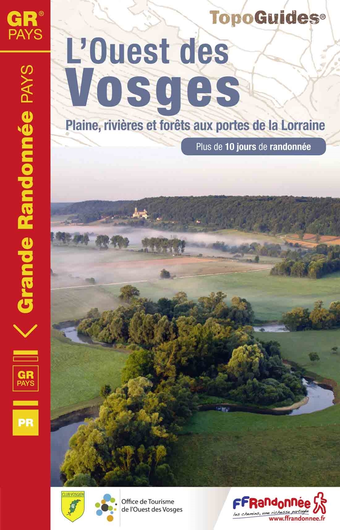
- Wandelgids 881 L'Ouest des Vosges | FFRP
- Guide FFRandonnée l'ouest des Vosges .1 GR® de Pays et 18 balades.Dans l'ouest des Vosges, l'horizon s'adoucit, les résideux cèdent le pas aux feuillus et les nombreux cours d'eau entaillent joliment ce pa... Read more
- Also available from:
- Stanfords, United Kingdom

Stanfords
United Kingdom
2015
United Kingdom
2015
- GR de Pays: Ouest des Vosges FFRP Topo-guide No. 881
- Ouest des Vosges, FFRP topoguide Ref. No. 881, covering a hiking circuit from Neufchâtel plus 18 local walks in the western part of the department of Vosges, Current edition of this title was published in July 2015. PLEASE NOTE: the area covered by this guide is not in the Vosges Mountains.ABOUT THE FFRP (Fédération française de la randonnée... Read more
De Zwerver
Netherlands
2014
Netherlands
2014
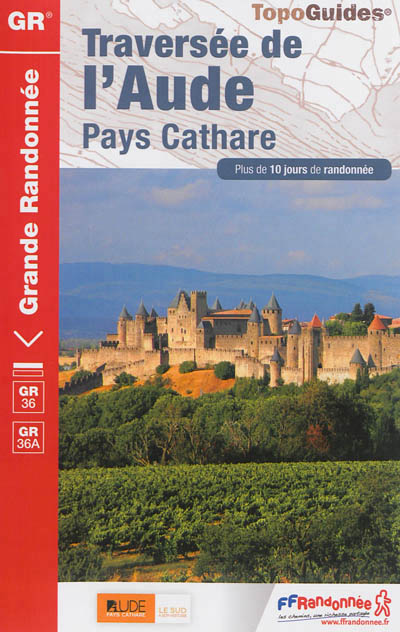
- Wandelgids 360 Traversée de l'Aude - Pays Cathare GR36 - GR36A | FFRP
- Guide FFRandonnée Traversée de l'Aude - Pays Cathare - 360 - GR36 , 36A150 km de sentiers au cœur de l'Occitanie, à la rencontre des richesses naturelles et patrimoniales de l'Aude, Pays Cathare.Cheminant de la Normandie à l'Espagne, le GR® 36 traverse l'Aude de part en part, du nord au sud. Frais ombrages du Canal du Midi, Cité médiévale de... Read more
- Also available from:
- Stanfords, United Kingdom

Stanfords
United Kingdom
2014
United Kingdom
2014
- GR36/36A: Traversée de l`Aude - Pays Cathare FFRP Topo-guide No. 360
- Traversée de l`Aude - Pays Cathare, FFRP topoguide Ref. No.360, covering the 150km long GR360 across the department of Aude in south-western France from the Montaigne Noire via Carcassonne to St-Paul-de-Fenouillet in the Pyrenees. Several variants from the southern half of the route offer possibilities for shorter local tours. Current edition... Read more

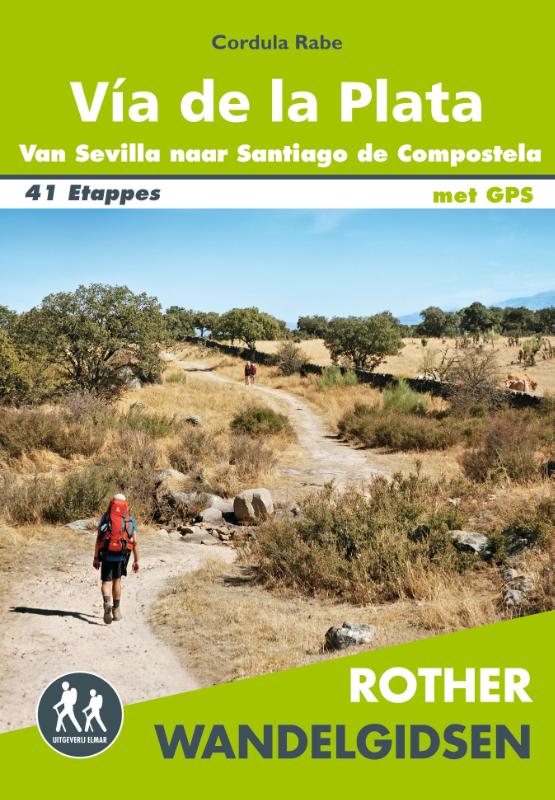
De Zwerver
Netherlands
2023
Netherlands
2023
De Zwerver
Netherlands
2019
Netherlands
2019
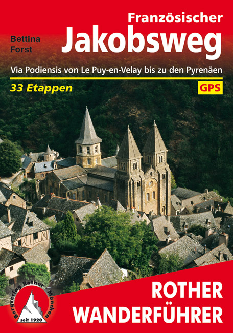
- Wandelgids - Pelgrimsroute 253 Französischer Jakobsweg GR65 | Rother Bergverlag
- Via Podiensis von Le Puy-en-Velay bis zu den Pyrenäen. 33 Etappen Rother Wanderführer. 4., aktualisierte Auflage. Read more

De Zwerver
Netherlands
2015
Netherlands
2015
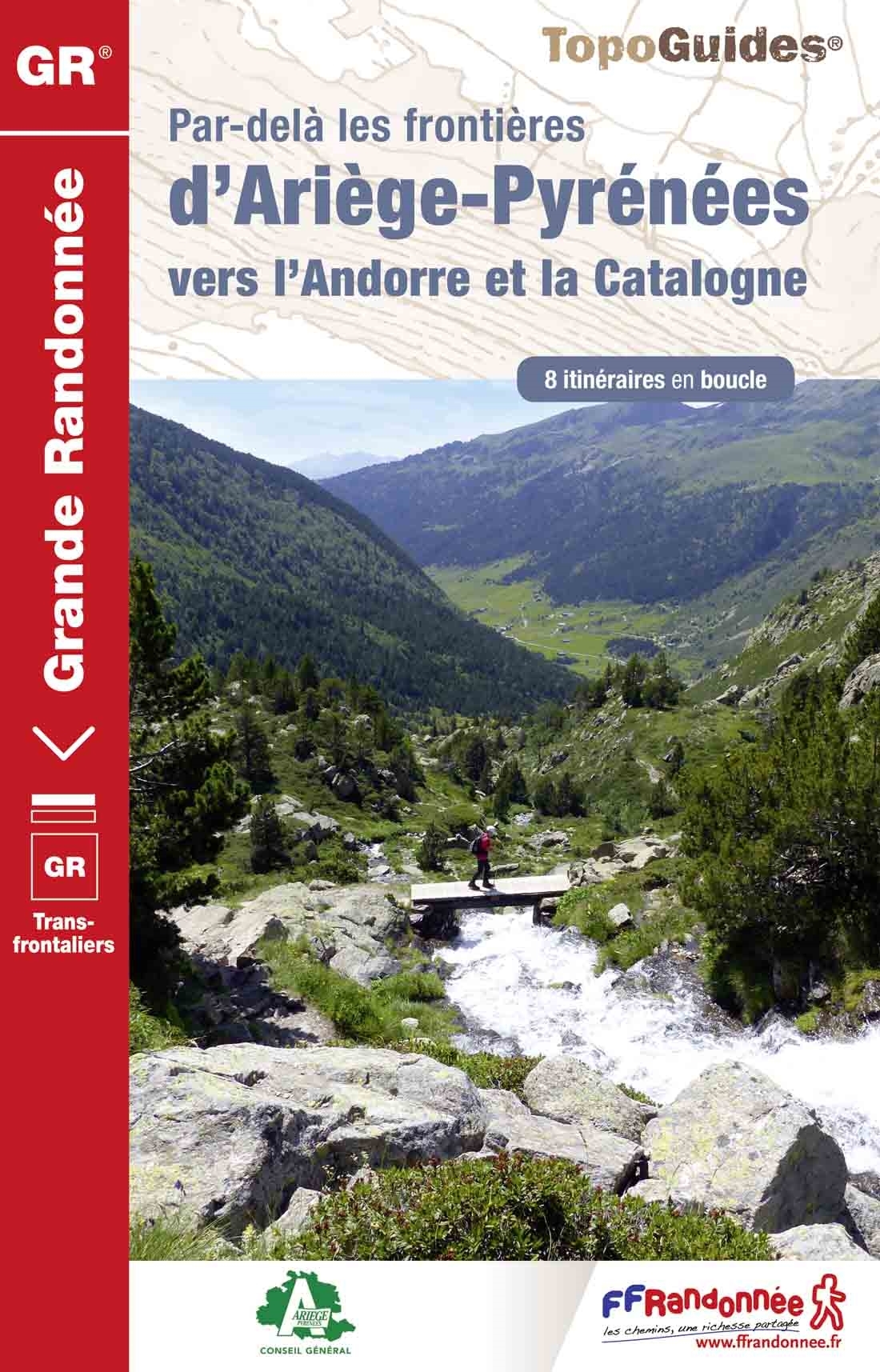
- Wandelgids 1098 Par dela les Frontieres d' Ariège - Pyrenees | FFRP
- Franstalige wandelgids. Uitstekende beschrijving met gedetailleerd kaartmateriaal (topografisch, IGN) en veel praktische informatie over zwaarte, hoogte en hutten. Bijna onmisbaar voor het lopen van deze route. In andere beschrijvingen zijn geen goede kaarten bijgevoegd! Wij leveren er een beknopte Frans-Nederlandse woordenlijst bij. Dans le... Read more
- Also available from:
- Stanfords, United Kingdom

Stanfords
United Kingdom
2015
United Kingdom
2015
- GRP: Ariège-Pyrénées – Andorre - Catalogne FFRP Topo-guide No. 1098
- Par-delà les frontiers d’Ariège-Pyrénées vers Andorre et la Catalogne, FFRP topoguide Ref. no. 1098, covering 384kms of trails in eight cross-border circuits in the Pyrenees between 36kms and 72kms long. The routes include a 70kms tour in the footsteps of Charlemagne, a 44kms Three Nations circuit, etc. Current edition of this title was... Read more
De Zwerver
Netherlands
2014
Netherlands
2014
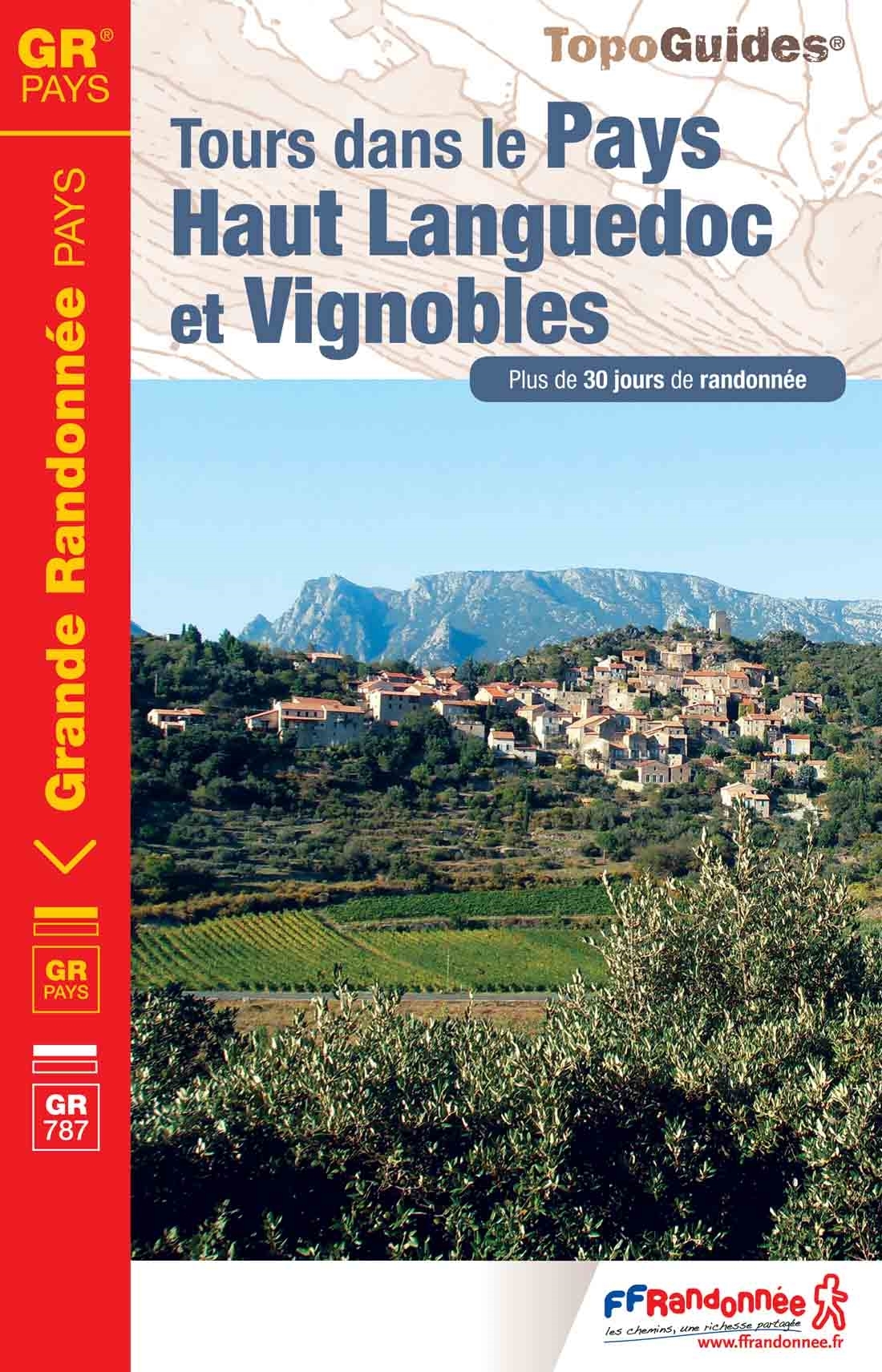
- Wandelgids 3400 Tours dans le Pays Haut Languedoc et Vignobles GR787 | FFRP
- Guide FFRandonnée Tours dans le Pays Haut Languedoc et Vignobles - 3400 - GR, GR Pays, 446 km de sentiers GR. En complément du topo-guide 3481 'Tours dans la montagne du Haut-Languedoc'.Situé en plein cœur du département de l'Aveyron, entre les monts de Lacaune, le Larzac et l'Aubrac, le Lévézou déroule ses collines rêveuses revêtues de... Read more
- Also available from:
- Stanfords, United Kingdom

Stanfords
United Kingdom
2014
United Kingdom
2014
- GRP Tours dans le Pays Haut Languedoc et Vignobles FFRP Topo-guide No. 3400
- Tours dans le Pays Haut Languedoc et Vignobles, FFRP topoguide Ref. no. 3400, covering several routes and circuits, over 446kms in all, in the area west of Lodève and Béziers. Current edition of this title was published in May 2014.ABOUT THE FFRP (Fédération française de la randonnée pédestre) TOPOGUIDES: published in a handy A5 paperback... Read more

De Zwerver
Netherlands
2023
Netherlands
2023
De Zwerver
Netherlands
2023
Netherlands
2023
Kaarten

De Zwerver
Netherlands
2020
Netherlands
2020
- Wandelatlas - Pelgrimsroute (kaart) 160 Camino de Santiago | Michelin
- Parcourez le Chemin Français (Camino Francés) avec ce petit atlas de poche Michelin. L'outil idéal pour mieux s'y retrouver lors de la préparation du voyage de randonnée sur ce sentier historique qui part de Saint-Jean-Pied-de-Port, dans le Pays basque français, et qui traverse tout le nord de l'Espagne... Read more

De Zwerver
Netherlands
2021
Netherlands
2021
- Also available from:
- Stanfords, United Kingdom

Stanfords
United Kingdom
2021
United Kingdom
2021
- France - Ways of St James IGN Map 922
- France: Ways of St James to Compostela Map from the IGN presents an overview of all the routes across France taken by pilgrims on their way to Santiago de Compostela and the tomb of the apostle St James - the greatest of all goals for thousands of pilgrims in Europe during the Middle Ages. The map was prepared by the IGN and the Association de... Read more

De Zwerver
Netherlands
2020
Netherlands
2020
- Wandelatlas - Pelgrimsroute (kaart) 161 Chemins de Compostelle GR65 | Michelin
- Véritable petit atlas détaillant chaque étape avec indications précises concernant les villes de départ et d'arrivée ainsi que pour les localités traversées (auberges, refuges, restaurants, pharmacies, gare, épiceries, Km parcourus, Km restants....).Ce petit atlas suit le chemin du... Read more

De Zwerver
Netherlands
Netherlands
- Pelgrimsroute (kaart) - Wandelkaart Camino de Santiago in Spanje | CNIG - Instituto Geográfico Nacional
- All roads leading to Santiago de Compostela in the Iberian Peninsula are represented on this Caminos de Santiago / The Way of St. James Map. Routes highlighted on a physical map of the Iberian Peninsula at 1:1,250,000 from IGN/CNIG, Spain civilian topographic survey organization. The base map with altitude colouring and relief shading provides... Read more
- Also available from:
- Stanfords, United Kingdom

Stanfords
United Kingdom
United Kingdom
- Caminos de Santiago / Ways of St. James on the Iberian Peninsula CNIG Overview Map
- All roads leading to Santiago de Compostela in the Iberian Peninsula are represented on this Caminos de Santiago / The Way of St. James Map. Routes highlighted on a physical map of the Iberian Peninsula at 1:1,250,000 from IGN/CNIG, Spain civilian topographic survey organization. The base map with altitude colouring and relief shading provides... Read more
De Zwerver
Netherlands
Netherlands
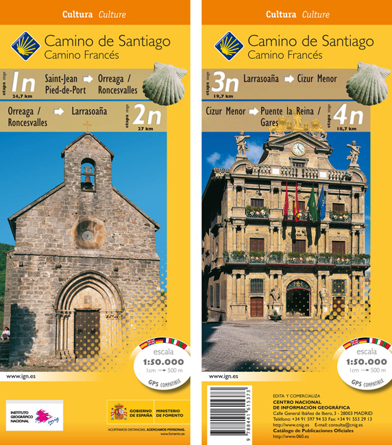
- Wandelkaart 1n-4n Camino Santiago de Compostella St-Jean - Puente Reina | CNIG - Instituto Geográfico Nacional
- The Way of St James: Stages 1n/2n/3n/4n, Saint-Jean-Pied-de-Port/Puente la Reina, in a series of double-sided topographic maps at 1:50,000 from the Spanish civilian survey organization, overprinted with the route and sights, plus information of accommodation and other facilities, route profiles, etc.Each 1:50,000 map is double-sided and has... Read more
- Also available from:
- Stanfords, United Kingdom

Stanfords
United Kingdom
United Kingdom
- Camino de Santiago: Stages 1n/2n/3n/4n, Saint-Jean-Pied-de-Port/Puente la Reina 50K CNIG Map
- The Way of St James: Stages 1n/2n/3n/4n, Saint-Jean-Pied-de-Port/Puente la Reina, in a series of double-sided topographic maps at 1:50,000 from the Spanish civilian survey organization, overprinted with the route and sights, plus information of accommodation and other facilities, route profiles, etc.Each 1:50,000 map is double-sided and has... Read more
De Zwerver
Netherlands
Netherlands
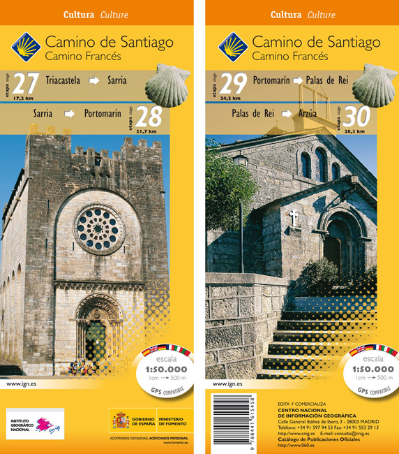
- Wandelkaart 27-30 Camino Santiago de Compostella Triacastela - Arzúa | CNIG - Instituto Geográfico Nacional
- Camino de Santiago: Camino de Santiago: Stages 27/28/29/30, Triacastela/Arzúa, in a series of double-sided topographic maps at 1:50,000 from the Spanish civilian survey organization, overprinted with the route and sights, plus information of accommodation and other facilities, route profiles, etc.Each 1:50,000 map is double-sided and has four... Read more
- Also available from:
- Stanfords, United Kingdom
Stanfords
United Kingdom
United Kingdom
- Camino de Santiago: Stages 27/28/29/30, Triacastela/Arzúa 50K CNIG Map
- Camino de Santiago: Camino de Santiago: Stages 27/28/29/30, Triacastela/Arzúa, in a series of double-sided topographic maps at 1:50,000 from the Spanish civilian survey organization, overprinted with the route and sights, plus information of accommodation and other facilities, route profiles, etc.Each 1:50,000 map is double-sided and has four... Read more

De Zwerver
Netherlands
Netherlands
- Wandelkaart 11 Collioure-Cadaqués | Rando Editions
- Uitstekende wandelkaart met veel toeristische informatie en bijzonder gedetailleerd. Wandelroute en hutten / campings zijn ingetekend, met hoogtelijnen. Read more
- Also available from:
- Stanfords, United Kingdom

Stanfords
United Kingdom
United Kingdom
- Collioure-Cadaqués Rando Editions 11
- The easternmost part of the French Pyrenees, including Perpignan and the resorts on the Mediterranean coast, on a contoured and GPS compatible map at 1:50,000 from Rando Editions with topographic base provided by the IGN, highlighting local and long-distance hiking trails, etc. Topography is shown by contours at 20m intervals enhanced by... Read more
De Zwerver
Netherlands
Netherlands
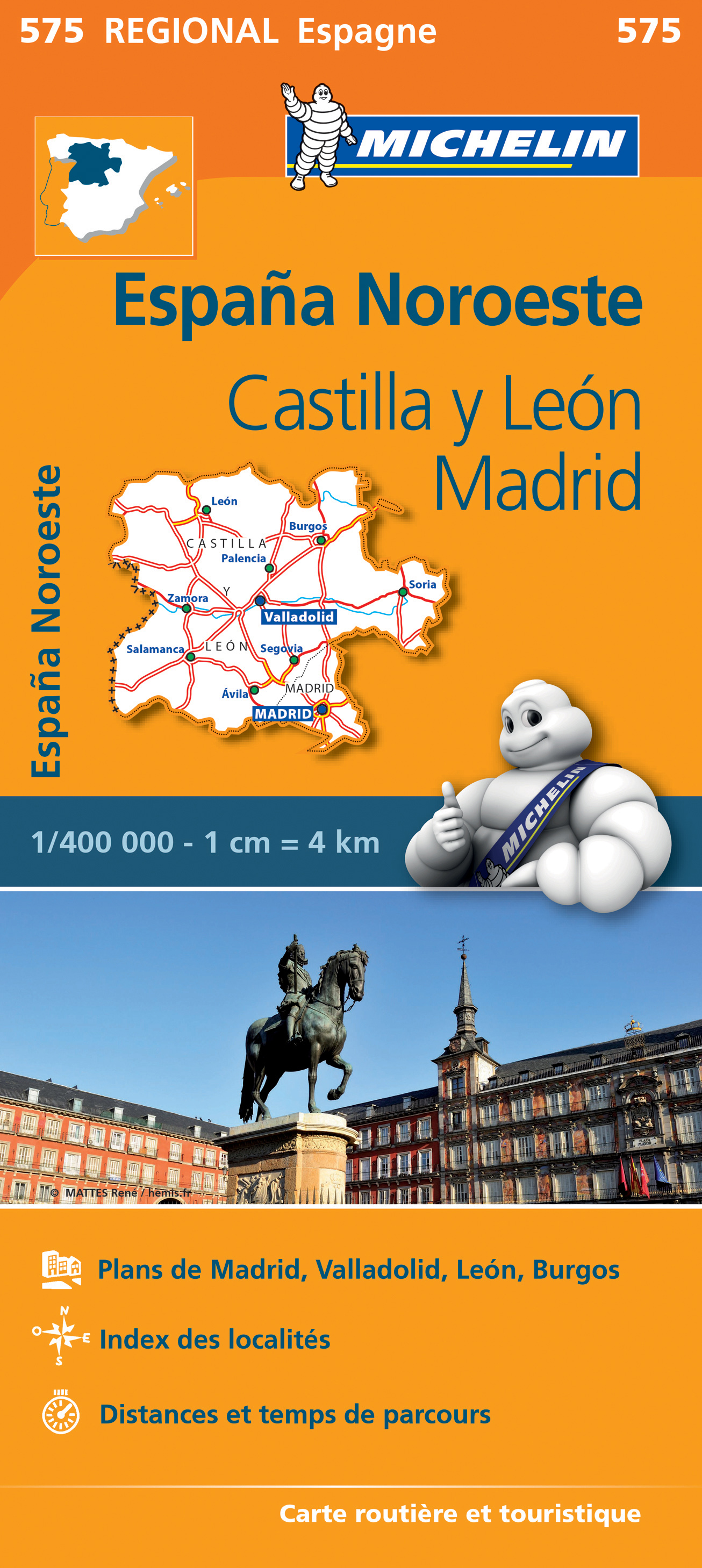
- Wegenkaart - landkaart 575 Castilla y León - Madrid - Valladolid - Zamora | Michelin
- Une carte fiable pour parcourir les régions d'Europe Read more
De Zwerver
Netherlands
Netherlands
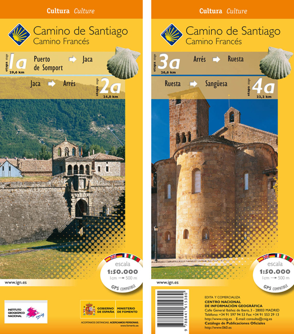
- Wandelkaart 1a-4a Camino Santiago de Compostella Puerte Somport - Sangüesa | CNIG - Instituto Geográfico Nacional
- Camino de Santiago: Stages 1a/2a/3a/4a, Col de Somport/Sangüesa, in a series of double-sided topographic maps at 1:50,000 from the Spanish civilian survey organization, overprinted with the route and sights, plus information of accommodation and other facilities, route profiles, etc.Each 1:50,000 map is double-sided and has four 57 x 35cm... Read more
- Also available from:
- Stanfords, United Kingdom
Stanfords
United Kingdom
United Kingdom
- Camino de Santiago: Stages 1a/2a/3a/4a, Col de Somport/Sangüesa 50K CNIG Map
- Camino de Santiago: Stages 1a/2a/3a/4a, Col de Somport/Sangüesa, in a series of double-sided topographic maps at 1:50,000 from the Spanish civilian survey organization, overprinted with the route and sights, plus information of accommodation and other facilities, route profiles, etc.Each 1:50,000 map is double-sided and has four 57 x 35cm... Read more
De Zwerver
Netherlands
Netherlands
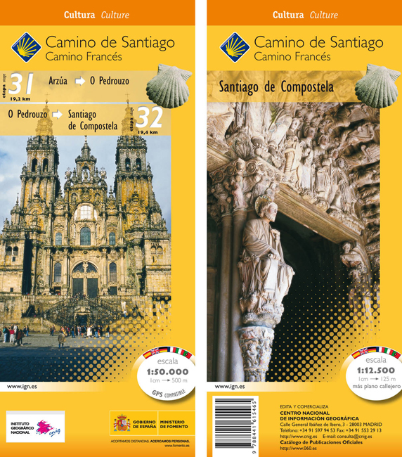
- Wandelkaart 31-32 Camino Santiago de Compostella Arzúa - Santiago | CNIG - Instituto Geográfico Nacional
- The Way of St James: the two last stages, 31 and 32, from Arzúa to Santiago de Compostela, plus a street plan of Santiago de Compostela in a series of double-sided topographic maps at 1:50,000 from the Spanish civilian survey organization, overprinted with the route and sights, plus information of accommodation and other facilities, route... Read more
- Also available from:
- Stanfords, United Kingdom
Stanfords
United Kingdom
United Kingdom
- Camino de Santiago: Stages 31/32, Arzúa/Santiago de Compostela 50K CNIG Map
- The Way of St James: the two last stages, 31 and 32, from Arzúa to Santiago de Compostela, plus a street plan of Santiago de Compostela in a series of double-sided topographic maps at 1:50,000 from the Spanish civilian survey organization, overprinted with the route and sights, plus information of accommodation and other facilities, route... Read more

De Zwerver
Netherlands
Netherlands
- Wandelkaart 06 Couserans - Val D'aran | Rando Editions
- Uitstekende wandelkaart met veel toeristische informatie en bijzonder gedetailleerd. Wandelroute en hutten / campings zijn ingetekend, met hoogtelijnen. Andere dorpen op deze kaart: PN d'Aigües Tortes - St. Girons - Massat - Guzet Neige - Aulus les Bains (Frankrijk - Pyreneeen). GPS Compatible Read more
- Also available from:
- Stanfords, United Kingdom

Stanfords
United Kingdom
United Kingdom
- Couserans-Val d`Aran Rando Editions 6
- The Couserans region of the French Pyrenees, from St-Girons to Pic de Maubermé and Pica d’Estats, on a contoured and GPS compatible map at 1:50,000 from Rando Editions with topographic base provided by the IGN, highlighting local and long-distance hiking trails, etc. Topography is vividly presented by contours at 20m intervals enhanced by... Read more

- Also available from:
- Stanfords, United Kingdom

Stanfords
United Kingdom
United Kingdom
- Pays Basque West Rando Editions 1
- The westernmost section of the French Pyrenees between the Atlantic coast and St-Jean-Pied-de-Port on a contoured and GPS compatible map at 1:50,000 from Rando Editions with topographic base provided by the IGN, highlighting local and long-distance hiking trails, cycle and mountain bike routes, etc. Coverage along the Atlantic coast starts at... Read more
De Zwerver
Netherlands
Netherlands
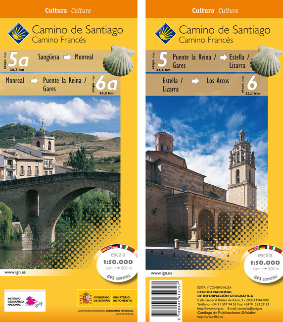
- Wandelkaart 5A-6 Camino Santiago de Compostella Sangüesa - Los Arcos | CNIG - Instituto Geográfico Nacional
- The Way of St James: Stages 5/5a/6/6a, Sangüesa/Puente la Reina/Los Arcos in a series of double-sided topographic maps at 1:50,000 from the Spanish civilian survey organization, overprinted with the route and sights, plus information of accommodation and other facilities, route profiles, etc.Each 1:50,000 map is double-sided and has four 57 x... Read more
- Also available from:
- Stanfords, United Kingdom
Stanfords
United Kingdom
United Kingdom
- Camino de Santiago: Stages 5/5a/6/6a, Sangüesa/Puente la Reina/Los Arcos 50K CNIG Map
- The Way of St James: Stages 5/5a/6/6a, Sangüesa/Puente la Reina/Los Arcos in a series of double-sided topographic maps at 1:50,000 from the Spanish civilian survey organization, overprinted with the route and sights, plus information of accommodation and other facilities, route profiles, etc.Each 1:50,000 map is double-sided and has four 57 x... Read more

De Zwerver
Netherlands
Netherlands
- Wegenkaart - landkaart Camino de Santiago - Camino Frances | CNIG - Instituto Geográfico Nacional
- Northern Spain on an overview map at 1:500,000 highlighting the course of the Camino Francés route of the Way of St James from the Pyrenees to Santiago de Compostela via Burgos and León. Published by Spain’s civilian survey organization as part of their set providing topographic coverage of the route at 1:50,000, the map is also available... Read more
- Also available from:
- Stanfords, United Kingdom

Stanfords
United Kingdom
United Kingdom
- Way of St James / Camino de Santiago CNIG Overview Map
- Northern Spain on an overview map at 1:500,000 highlighting the course of the Camino Francés route of the Way of St James from the Pyrenees to Santiago de Compostela via Burgos and León. Published by Spain’s civilian survey organization as part of their set providing topographic coverage of the route at 1:50,000, the map is also available... Read more

De Zwerver
Netherlands
Netherlands
- Wandelkaart 07 Haute Ariege | Rando Editions
- Itinéraires de rando, infos culturelles, touristiques et sportives, gîtes, refuges : toutes ces infos sont disponibles sur cette carte à cheval sur France et Espagne. Read more
- Also available from:
- Stanfords, United Kingdom

Stanfords
United Kingdom
United Kingdom
- Haute-Ariége Rando Editions 7
- The Haute-Ariége region of the French Pyrenees, from Foix to Pica d`Estats and the Col de Puymorens, on a contoured and GPS compatible map at 1:50,000 from Rando Editions with topographic base provided by the IGN, highlighting local and long-distance hiking trails, etc. Topography is vividly presented by contours at 20m intervals enhanced by... Read more