
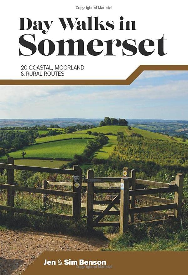
Somerset
Beschrijving
A rural county of rolling hills. Walking is good in the hills like the Quantock Hills, Mendip Hills, Blackdown Hills and the Exmore National Park. Highlight is the coast: the South West Coast Path starts in Somerset.
Paden in deze regio
Links
Feiten
Verslagen
Gidsen en kaarten
Overnachting
Organisaties
Reisorganisaties
GPS
Anders
Boeken
De Zwerver
Netherlands
2019
Netherlands
2019
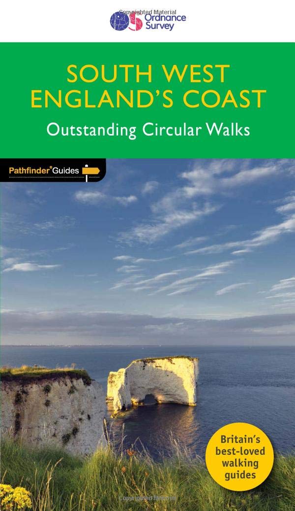
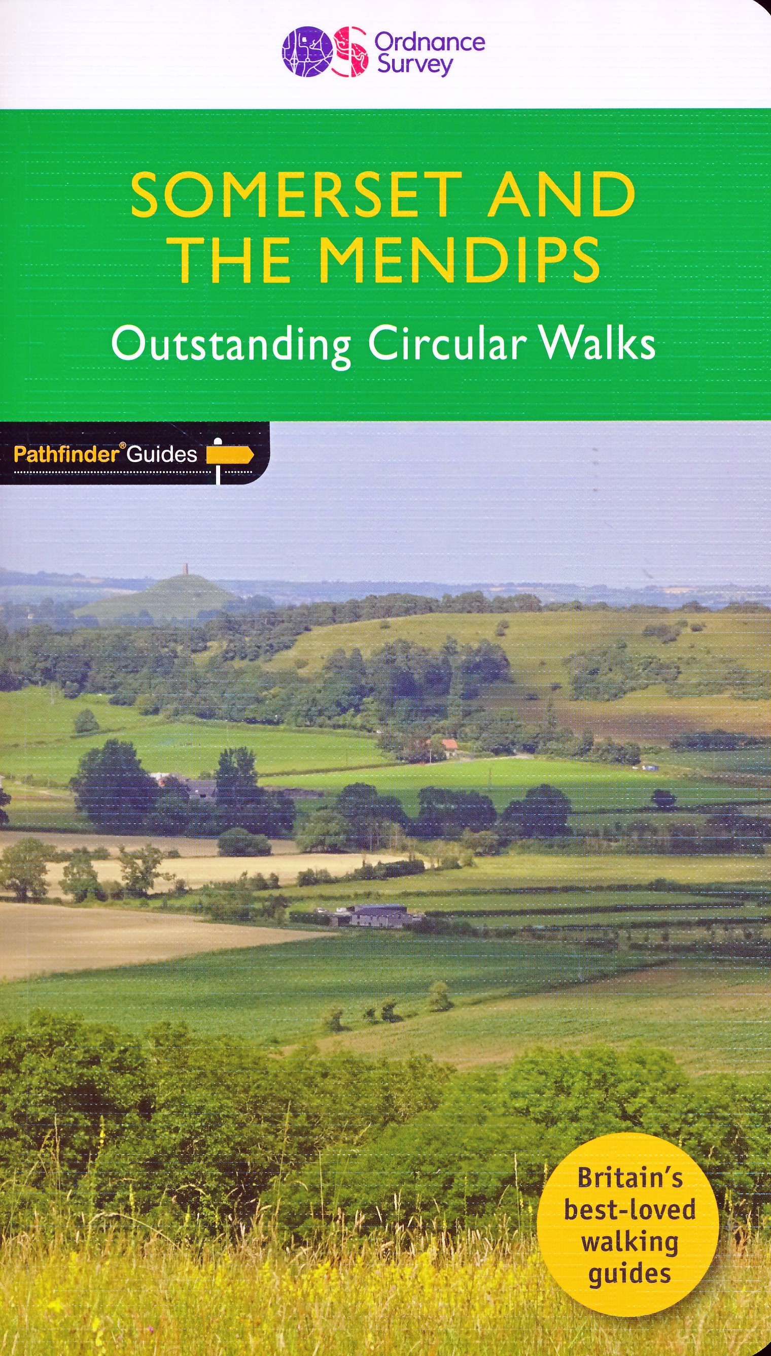
- Wandelgids 69 Pathfinder Guides South West England's Coast | Ordnance Survey
- Are you planning a holiday to Devon, Cornwall or the Jurassic Coast? Do you enjoy a walk with stunning coastal scenery? The South West Coast Path is the UK`s most popular National Trail - with Tintagel voted the `best walk in Britain` in a survey of 4,000 readers of Country Walking magazine. Pathfinder (R) Guide to Coastal Walks in South West... Read more
- Also available from:
- Stanfords, United Kingdom

Stanfords
United Kingdom
2019
United Kingdom
2019
- South West England Coast Walks
- Are you planning a holiday to Devon, Cornwall or the Jurassic Coast? Do you enjoy a walk with stunning coastal scenery? The South West Coast Path is the UK`s most popular National Trail - with Tintagel voted the `best walk in Britain` in a survey of 4,000 readers of Country Walking magazine. Pathfinder (R) Guide to Coastal Walks in South West... Read more
De Zwerver
Netherlands
2019
Netherlands
2019
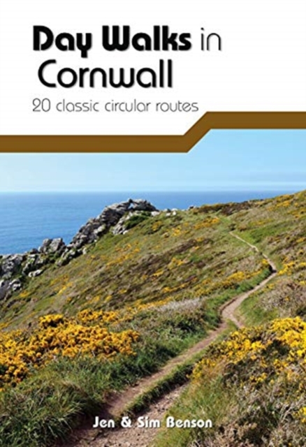
- Wandelgids Day Walks in Cornwall | Vertebrate Publishing
- 20 coastal & moorland routes Read more
- Also available from:
- Stanfords, United Kingdom

Stanfords
United Kingdom
2019
United Kingdom
2019
- Day Walks in Cornwall: 20 coastal & moorland routes
- Day Walks in Cornwall features 20 circular routes between 7.2 and 13.7 miles (11.6km and 22km) in length, suitable for hillwalkers of all abilities. Researched and written by experienced authors Jen and Sim Benson, and covering the extremities of this stunning peninsula, the walks reach areas from Bude to the Isles of Scilly, and from Rame Head... Read more

De Zwerver
Netherlands
2013
Netherlands
2013
- Reisgids Wild guide - Devon, Cornwall en Zuidwest Engeland | Wild Things Publishing
- This compendium of adventures features the best wild places to visit in the south west of England, covering Devon, Cornwall, Somerset and Dorset, including ideas for local food and accommodation. Explore hidden gems, from the swimming rivers, secret beaches and lost ruins of Cornwall and Somerset, to the ancient woods and meadows of Devon and... Read more
- Also available from:
- Stanfords, United Kingdom

Stanfords
United Kingdom
2013
United Kingdom
2013
- Wild Guide South West England: Hidden Places, Great Adventures and the Good Life
- This compendium of adventures features the best wild places to visit in the south west of England, covering Devon, Cornwall, Somerset and Dorset, including ideas for local food and accommodation. Explore hidden gems, from the swimming rivers, secret beaches and lost ruins of Cornwall and Somerset, to the ancient woods and meadows of Devon and... Read more
De Zwerver
Netherlands
2013
Netherlands
2013
- Reisgids New York: Staten Island | Somerset Books
- The New York borough of Staten Island is better known for its ferry ride and views of the Manhattan skyline than for itself. This readable, engrossing guide is devoted entirely to discovering the island. Lovingly researched and packed with stories past and present, it unlocks the secrets of a fascinating place and of the men and women who made... Read more
De Zwerver
Netherlands
2022
Netherlands
2022
- Also available from:
- Stanfords, United Kingdom

De Zwerver
Netherlands
2019
Netherlands
2019
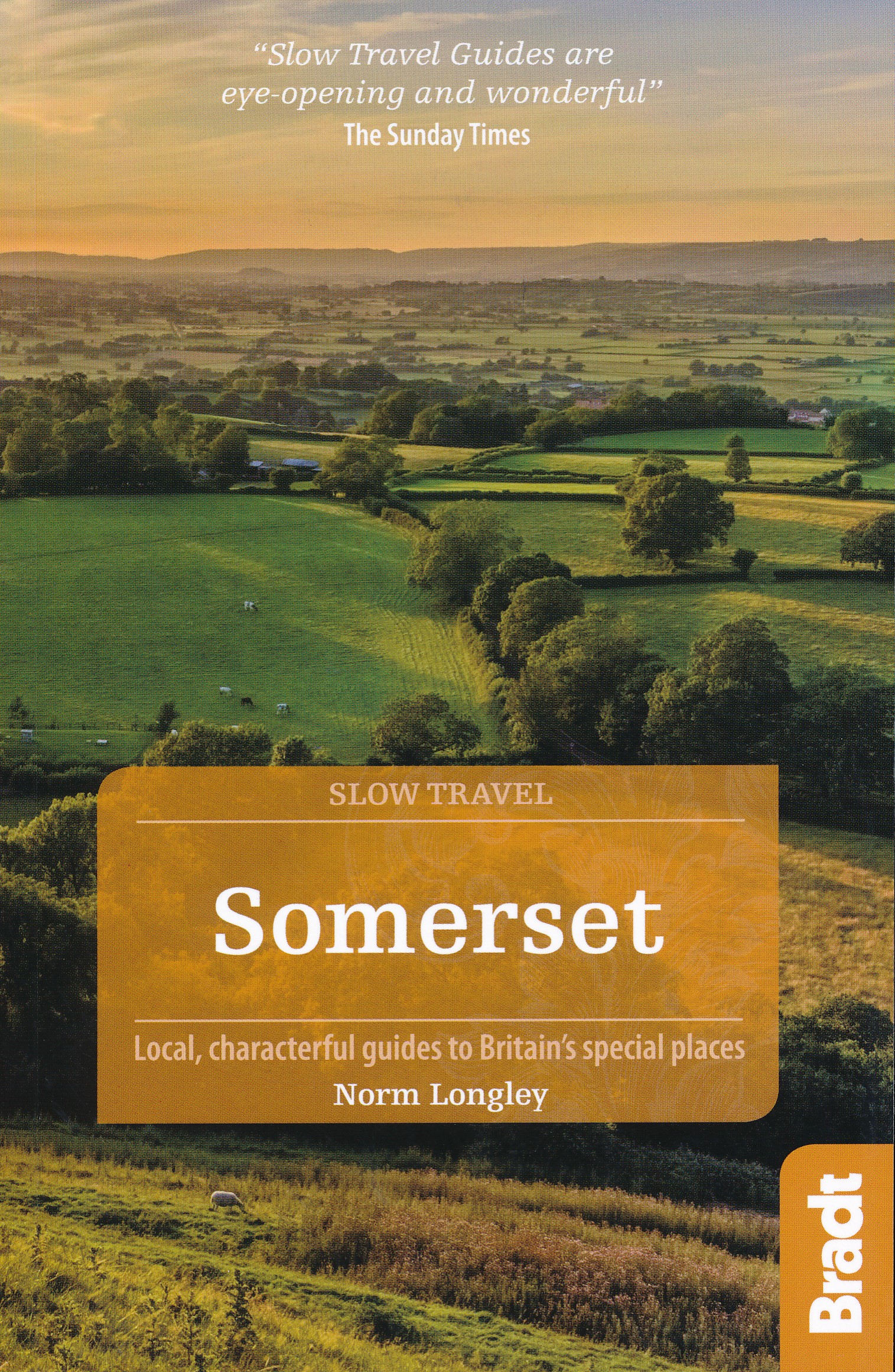
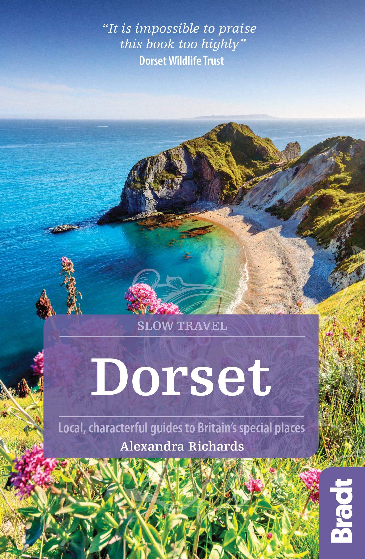
- Reisgids Slow Travel Dorset | Bradt Travel Guides
- This new third edition of Bradt`s popular guide to Dorset - part of its distinctive series of `Slow Travel` guides to local UK regions - has been thoroughly updated to reflect all the most recent changes to the region. Where - and what - to eat, where and when to go and what to see are all covered, providing an essential guide to one of... Read more
- Also available from:
- Stanfords, United Kingdom

Stanfords
United Kingdom
2019
United Kingdom
2019
- Dorset (Slow Travel) Bradt Guide
- This new third edition of Bradt`s popular guide to Dorset - part of its distinctive series of `Slow Travel` guides to local UK regions - has been thoroughly updated to reflect all the most recent changes to the region. Where - and what - to eat, where and when to go and what to see are all covered, providing an essential guide to one of... Read more
De Zwerver
Netherlands
Netherlands
- Also available from:
- Stanfords, United Kingdom

Stanfords
United Kingdom
United Kingdom
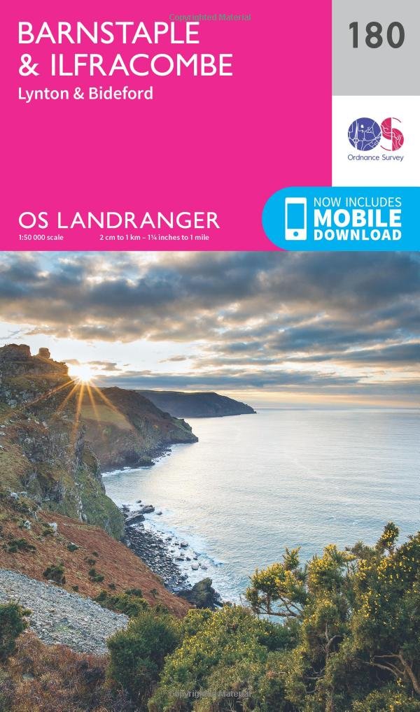
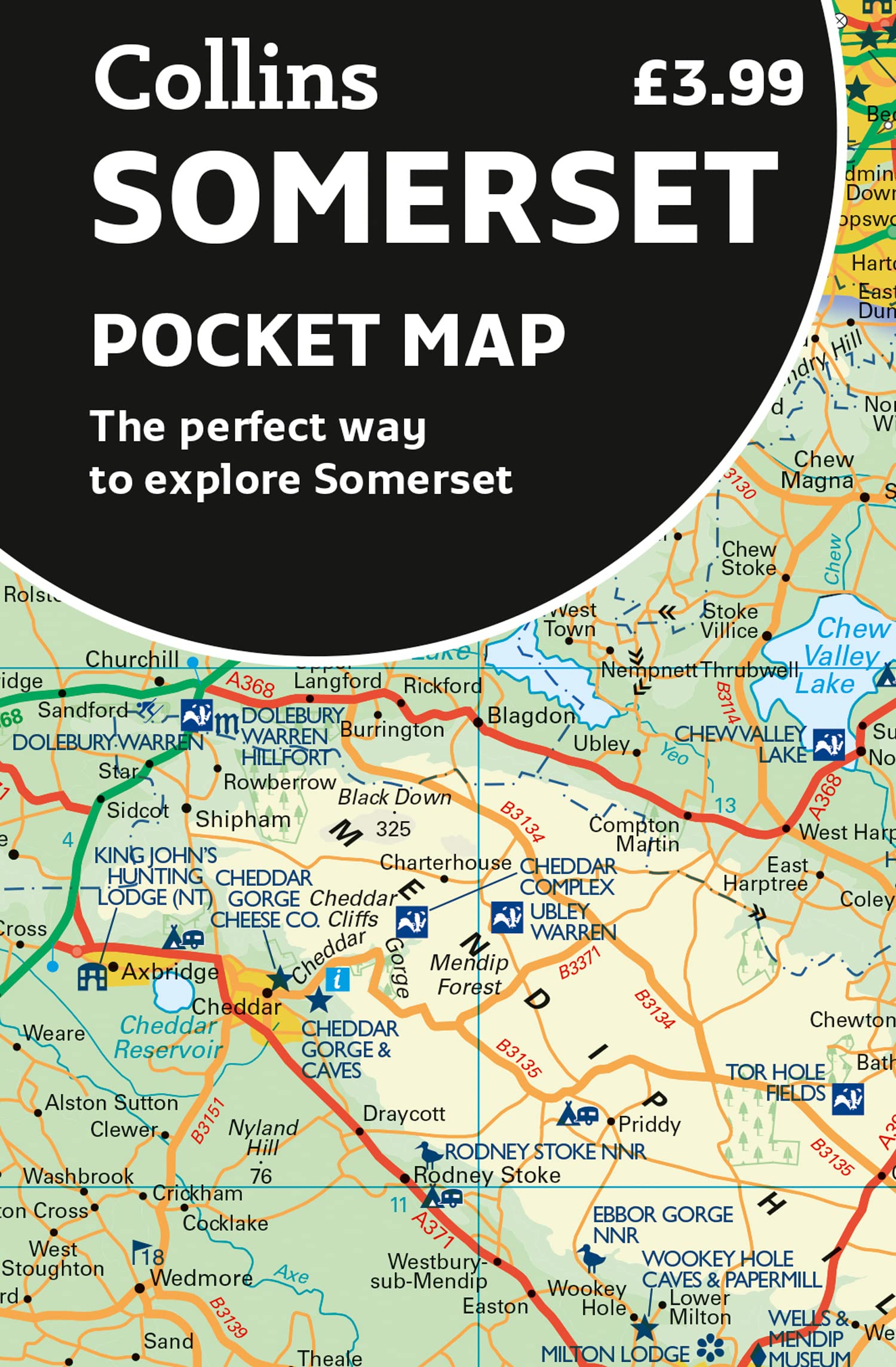
- Barnstaple, Ilfracombe, Lynton & Bideford OS Landranger Map 180 (paper)
- Barnstaple and Ilfracombe area, including the western part of the Exmoor National Park and a section of the South West Coast Path, on a paper version of map No. 180 from the Ordnance Survey’s Landranger series at 1:50,000, with contoured and GPS compatible topographic mapping plus tourist information.MOBILE DOWNLOADS: As well as the physical... Read more
Bol.com
Netherlands
2013
Netherlands
2013
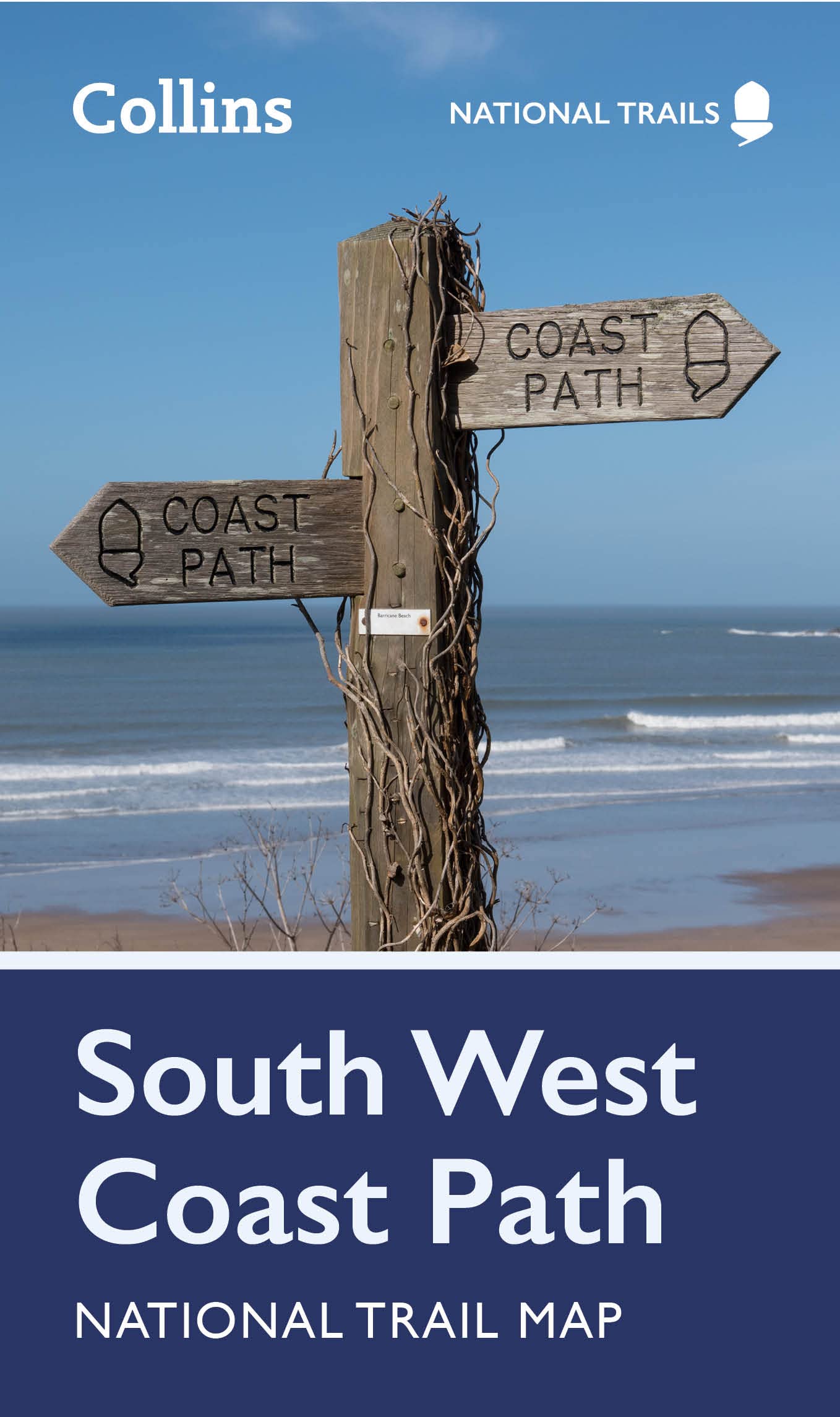
- South West Coast Path
- The South West Coast Path is the longest of Britain's National Trails, following the spectacular coastline for 630 miles around the southernmost tip of England from Somerset all the way to Dorset. This volume of the Official National Trail Guide, published in association with Natural England, features the second section of 169 miles (271 km),... Read more
- Also available from:
- Bol.com, Belgium
- Stanfords, United Kingdom
- The Book Depository, United Kingdom
Bol.com
Belgium
2013
Belgium
2013
- South West Coast Path
- The South West Coast Path is the longest of Britain's National Trails, following the spectacular coastline for 630 miles around the southernmost tip of England from Somerset all the way to Dorset. This volume of the Official National Trail Guide, published in association with Natural England, features the second section of 169 miles (271 km),... Read more

Stanfords
United Kingdom
2013
United Kingdom
2013
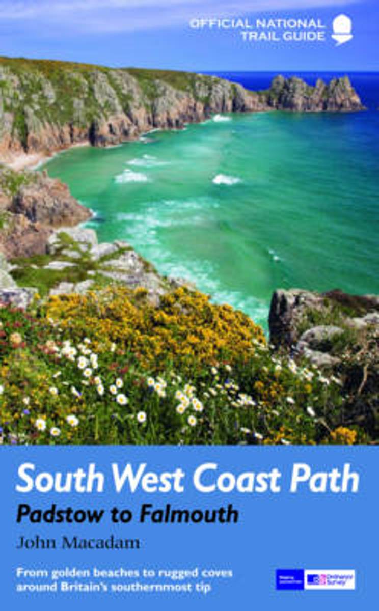
- South West Coast Path National Trail: Padstow to Falmouth
- The second part of the South West Coast Path, a 169-km/271 mile section along the Cornish coast from Padstow to Falmouth, in a series of walking guides to the National Trails in England and Wales with colour extracts from the Ordnance Survey`s Explorer series at 1:25,000 showing points along the route cross-referenced to the text. The maps also... Read more

The Book Depository
United Kingdom
2013
United Kingdom
2013
- South West Coast Path: Padstow to Falmouth
- National Trail Guide Read more
De Zwerver
Netherlands
2021
Netherlands
2021
- Wandelgids South West Coast Path Map Booklet | Cicerone
- Map of the northern section of the 630-mile (1,014km) South West Coast Path National Trail. Covers the trail from Minehead to Falmouth along the north Devon and Cornish coastline. This convenient and compact booklet of Ordnance Survey 1:25,000 maps shows the route, providing all of the mapping you need to walk the trail in either direction. Read more
- Also available from:
- Bol.com, Netherlands
- Bol.com, Belgium
- Stanfords, United Kingdom
- The Book Depository, United Kingdom
Bol.com
Netherlands
2017
Netherlands
2017
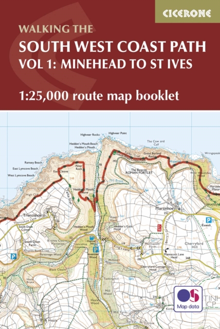
- South West Coast Path Map Booklet - Minehead to St Ives
- The South West Coast Path is Britain's longest National Trail, stretching some 630 miles (1014km) between Minehead in Somerset and Poole in Dorset. It takes in a National Park, 5 Areas of Outstanding Natural Beauty, National Heritage Coasts and a UNESCO World Heritage Site. This booklet of Ordnance Survey 1:25,000 Explorer maps has been... Read more
Bol.com
Belgium
2017
Belgium
2017
- South West Coast Path Map Booklet - Minehead to St Ives
- The South West Coast Path is Britain's longest National Trail, stretching some 630 miles (1014km) between Minehead in Somerset and Poole in Dorset. It takes in a National Park, 5 Areas of Outstanding Natural Beauty, National Heritage Coasts and a UNESCO World Heritage Site. This booklet of Ordnance Survey 1:25,000 Explorer maps has been... Read more

Stanfords
United Kingdom
2017
United Kingdom
2017
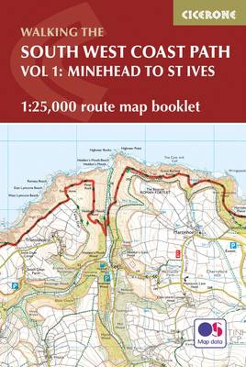
- South West Coast Path 1 - Minehead to St Ives Cicerone Map Booklet
- The South West Coast Path is Britain`s longest National Trail, stretching some 630 miles (1014km) between Minehead in Somerset and Poole in Dorset. It takes in a National Park, 5 Areas of Outstanding Natural Beauty, National Heritage Coasts and a UNESCO World Heritage Site. This booklet of Ordnance Survey 1:25,000 Explorer maps has been... Read more

The Book Depository
United Kingdom
2017
United Kingdom
2017
- South West Coast Path Map Booklet - Vol 1: Minehead to St Ives
- 1:25,000 OS Route Mapping Read more

Bol.com
Netherlands
Netherlands
- Cornwall, Devon and Somerset
- This title features: dynamic two-colour layout for easy navigation; colour section that gives a photographic overview of the region, together with special features of the particular counties, tailored itineraries and lists of the best things to do - whether it's walks, beaches or activities; and, top Don't Miss sights for each chapter. Explore... Read more
- Also available from:
- Bol.com, Belgium
Bol.com
Belgium
Belgium
- Cornwall, Devon and Somerset
- This title features: dynamic two-colour layout for easy navigation; colour section that gives a photographic overview of the region, together with special features of the particular counties, tailored itineraries and lists of the best things to do - whether it's walks, beaches or activities; and, top Don't Miss sights for each chapter. Explore... Read more
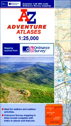
Kaarten
De Zwerver
Netherlands
Netherlands
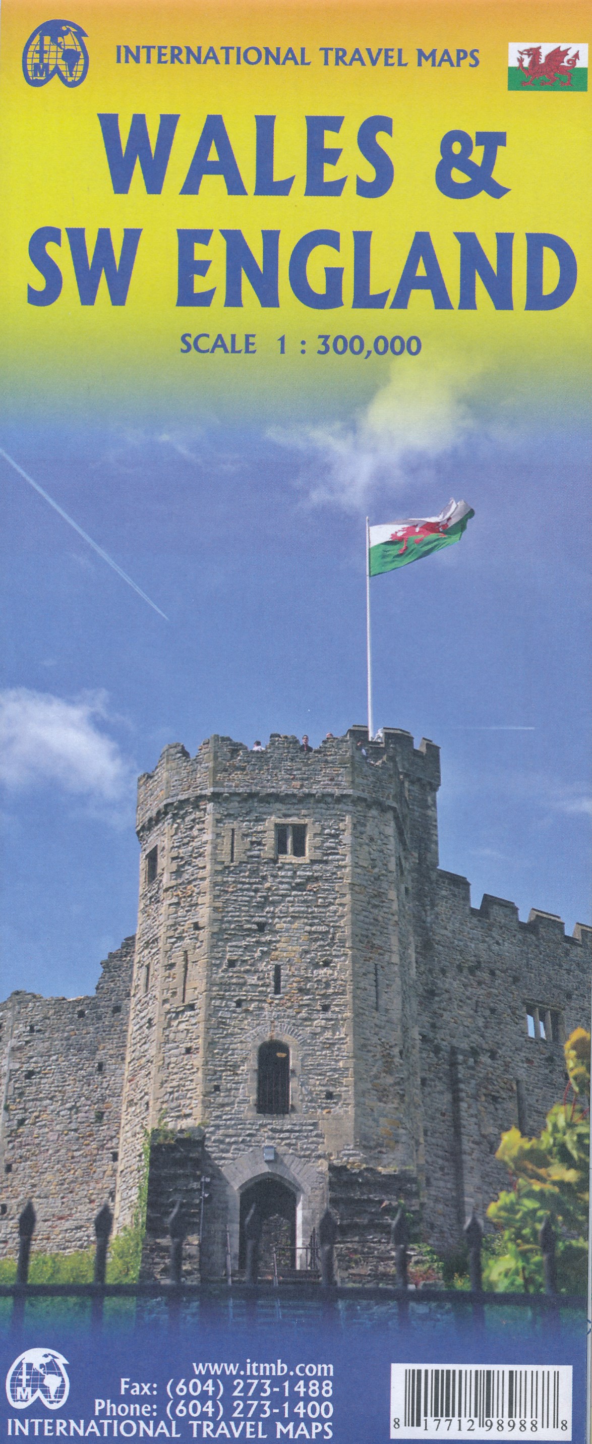
- Wegenkaart - landkaart Wales & southwest England | ITMB
- Wales & SW England 1:300 000 ab 10.49 EURO doppelseitig Wales SW England/West Country - Cornwall, Devon & Somerset International Travel Map ITM. 1. Auflage Read more
De Zwerver
Netherlands
2023
Netherlands
2023
Bol.com
Netherlands
Netherlands
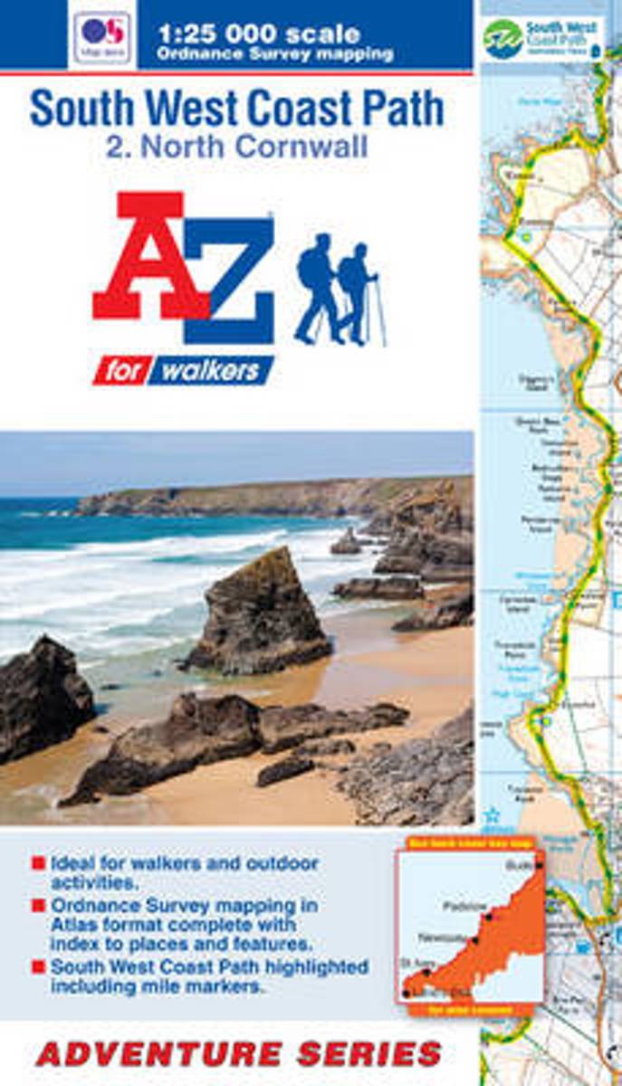
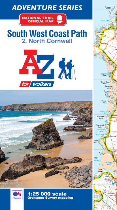
- SW Coast Path North Cornwall Adventure Atlas
- South West Coast Path 2 - North Cornwall Adventure Atlas at 1:25,000 in a series of handy A5 size Adventure Atlases from Geographers' A-Z Map Company with cartography from the Ordnance Survey Read more
- Also available from:
- Bol.com, Belgium
Bol.com
Belgium
Belgium
- SW Coast Path North Cornwall Adventure Atlas
- South West Coast Path 2 - North Cornwall Adventure Atlas at 1:25,000 in a series of handy A5 size Adventure Atlases from Geographers' A-Z Map Company with cartography from the Ordnance Survey Read more
Bol.com
Netherlands
Netherlands
- SW Coast Path North Cornwall Adventure Atlas
- AZ heeft de meest gedetailleerde wandelkaarten van delen van het South West Coast Path gebundeld in een atlasje. Daardoor is het heel handig qua formaat. De kaarten zelf zijn perfect voor het wandelen. Schaal 1:25.000 The perfect companion for those who love the great outdoors, the A-Z Adventure Series features OS 1:25000 scale mapping in a... Read more
- Also available from:
- Bol.com, Belgium
Bol.com
Belgium
Belgium
- SW Coast Path North Cornwall Adventure Atlas
- AZ heeft de meest gedetailleerde wandelkaarten van delen van het South West Coast Path gebundeld in een atlasje. Daardoor is het heel handig qua formaat. De kaarten zelf zijn perfect voor het wandelen. Schaal 1:25.000 The perfect companion for those who love the great outdoors, the A-Z Adventure Series features OS 1:25000 scale mapping in a... Read more
Bol.com
Netherlands
Netherlands
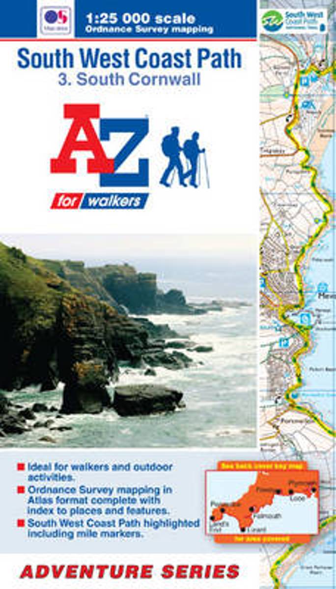
- SW Coast Path South Cornwall Adventure Atlas
- South West Coast Path 3 - South Cornwall Adventure Atlas at 1:25,000 in a series of handy A5 size Adventure Atlases from Geographers' A-Z Map Company with cartography from the Ordnance Survey Read more
- Also available from:
- Bol.com, Belgium
Bol.com
Belgium
Belgium
- SW Coast Path South Cornwall Adventure Atlas
- South West Coast Path 3 - South Cornwall Adventure Atlas at 1:25,000 in a series of handy A5 size Adventure Atlases from Geographers' A-Z Map Company with cartography from the Ordnance Survey Read more

Bol.com
Netherlands
Netherlands
- Cotswolds Mountain Biking
- The Cotswold Hills stretch across the counties of Gloucestershire and Oxfordshire, and extend into parts of Wiltshire, Somerset, Worcestershire and Warwickshire. Cotswolds Mountain Biking - 20 Classic Rides reveals all on the excellent and varied mountain biking tucked away in this Area of Outstanding Natural Beauty. The latest title in... Read more
- Also available from:
- Bol.com, Belgium
- Stanfords, United Kingdom
Bol.com
Belgium
Belgium
- Cotswolds Mountain Biking
- The Cotswold Hills stretch across the counties of Gloucestershire and Oxfordshire, and extend into parts of Wiltshire, Somerset, Worcestershire and Warwickshire. Cotswolds Mountain Biking - 20 Classic Rides reveals all on the excellent and varied mountain biking tucked away in this Area of Outstanding Natural Beauty. The latest title in... Read more

Stanfords
United Kingdom
United Kingdom
- Cotswolds Mountain Biking : 20 Classic Rides
- Vertebrate’s guide to mountain biking in the Cotswolds covers 20 classic rides between 14km and 77km in length, suitable for mountain bikers of all abilities –many of which are within easy reach of major towns and cities, including Birmingham, Coventry, Worcester, Gloucester, Oxford, Banbury, Swindon, Cheltenham and Bristol.Each route is... Read more
Bol.com
Netherlands
Netherlands
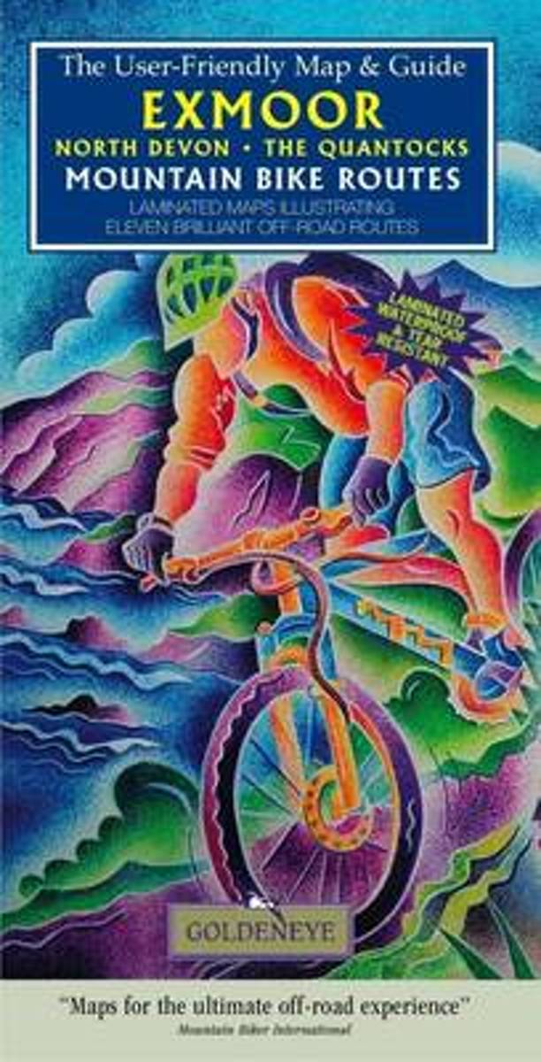
- Exmoor North Devon the Quantocks Mountain Bike Routes
- Laminated maps illustrating ten brilliant off-road routes Read more
- Also available from:
- Bol.com, Belgium
Bol.com
Belgium
Belgium
- Exmoor North Devon the Quantocks Mountain Bike Routes
- Laminated maps illustrating ten brilliant off-road routes Read more

Bol.com
Netherlands
2017
Netherlands
2017
- SW Coast Path South Devon Adventure Atlas
- South West Coast Path 4 - South Devon Adventure at 1:25,000 in a series of handy A5 size Adventure Atlases from Geographers` A-Z Map Company with cartography from the Ordnance Survey’s Explorer series. The guide covers the 210 km / 131 mile section of the SWCP National Trail between Plymouth and Lyme Regis and includes a route planner... Read more
- Also available from:
- Bol.com, Belgium
- Stanfords, United Kingdom
Bol.com
Belgium
2017
Belgium
2017
- SW Coast Path South Devon Adventure Atlas
- South West Coast Path 4 - South Devon Adventure at 1:25,000 in a series of handy A5 size Adventure Atlases from Geographers` A-Z Map Company with cartography from the Ordnance Survey’s Explorer series. The guide covers the 210 km / 131 mile section of the SWCP National Trail between Plymouth and Lyme Regis and includes a route planner... Read more

Stanfords
United Kingdom
2017
United Kingdom
2017
- South West Coast Path 4 - South Devon Adventure Atlas
- South West Coast Path 4 - South Devon Adventure at 1:25,000 in a series of handy A5 size Adventure Atlases from Geographers` A-Z Map Company with cartography from the Ordnance Survey’s Explorer series. The guide covers the 210 km / 131 mile section of the SWCP National Trail between Plymouth and Lyme Regis and includes a route planner... Read more
Bol.com
Netherlands
2017
Netherlands
2017
- SW Coast Path South Cornwall Adventure Atlas
- South West Coast Path 3 - South Cornwall Adventure Atlas at 1:25,000 in a series of handy A5 size Adventure Atlases from Geographers` A-Z Map Company with cartography from the Ordnance Survey’s Explorer series. The guide covers the 252km / 158 mile section of the SWCP National Trail between Land’s End and Plymouth and includes a route planner... Read more
- Also available from:
- Bol.com, Belgium
- Stanfords, United Kingdom
Bol.com
Belgium
2017
Belgium
2017
- SW Coast Path South Cornwall Adventure Atlas
- South West Coast Path 3 - South Cornwall Adventure Atlas at 1:25,000 in a series of handy A5 size Adventure Atlases from Geographers` A-Z Map Company with cartography from the Ordnance Survey’s Explorer series. The guide covers the 252km / 158 mile section of the SWCP National Trail between Land’s End and Plymouth and includes a route planner... Read more

Stanfords
United Kingdom
2017
United Kingdom
2017
- South West Coast Path 3 - South Cornwall A-Z Adventure Atlas
- South West Coast Path 3 - South Cornwall Adventure Atlas at 1:25,000 in a series of handy A5 size Adventure Atlases from Geographers` A-Z Map Company with cartography from the Ordnance Survey’s Explorer series. The guide covers the 252km / 158 mile section of the SWCP National Trail between Land’s End and Plymouth and includes a route planner... Read more
Bol.com
Netherlands
Netherlands
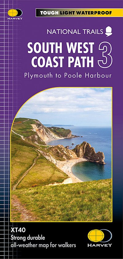
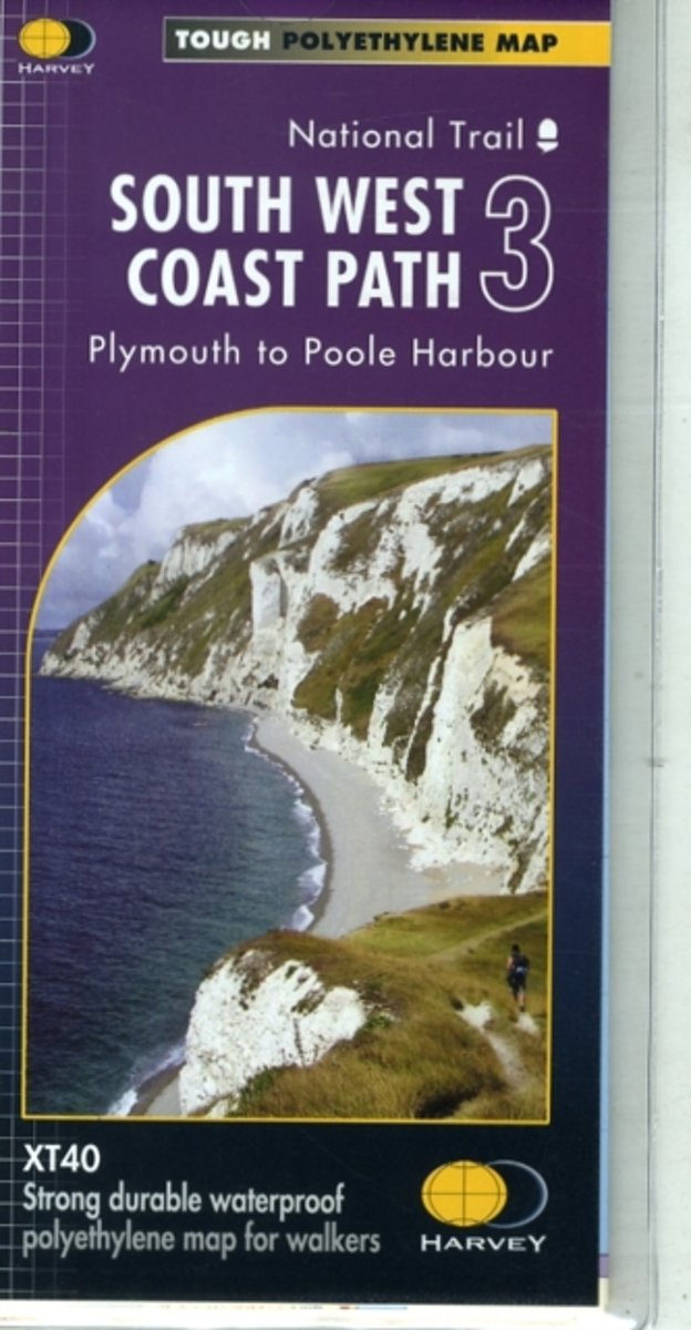
- South West Coast Path 3 XT40
- The third section of the South West Coast Path National Trail, from Plymouth to Poole Harbour along the southern coast Devon and the coast of Dorset, presented by Harvey Map Services at 1:40,000 on a light, waterproof and tear-resistant map, showing the path on 11 overlapping panels.In this new 2015 edition the whole route from Minehead to... Read more
- Also available from:
- Bol.com, Belgium
- Stanfords, United Kingdom
- The Book Depository, United Kingdom
Bol.com
Belgium
Belgium
- South West Coast Path 3 XT40
- The third section of the South West Coast Path National Trail, from Plymouth to Poole Harbour along the southern coast Devon and the coast of Dorset, presented by Harvey Map Services at 1:40,000 on a light, waterproof and tear-resistant map, showing the path on 11 overlapping panels.In this new 2015 edition the whole route from Minehead to... Read more

Stanfords
United Kingdom
United Kingdom
- South West Coast Path 3 - Plymouth to Poole Harbour Harvey National Trail XT40
- The third section of the South West Coast Path National Trail, from Plymouth to Poole Harbour along the southern coast Devon and the coast of Dorset, presented by Harvey Map Services at 1:40,000 on a light, waterproof and tear-resistant map, showing the path on 11 overlapping panels.In this new 2015 edition the whole route from Minehead to... Read more


Bol.com
Netherlands
Netherlands
- SW Coast Path North Devon & Somerset Adventure Atlas
- South West Coast Path 1 - North Devon & Somerset Adventure Atlas at 1:25,000 in a series of handy A5 size Adventure Atlases from Geographers` A-Z Map Company with cartography from the Ordnance Survey’s Explorer series. The guide covers the 199km / 125 mile section of the SWCP National Trail between Bude and Minehead and includes a route planner... Read more
- Also available from:
- Bol.com, Belgium
Bol.com
Belgium
Belgium
- SW Coast Path North Devon & Somerset Adventure Atlas
- South West Coast Path 1 - North Devon & Somerset Adventure Atlas at 1:25,000 in a series of handy A5 size Adventure Atlases from Geographers` A-Z Map Company with cartography from the Ordnance Survey’s Explorer series. The guide covers the 199km / 125 mile section of the SWCP National Trail between Bude and Minehead and includes a route planner... Read more

Stanfords
United Kingdom
United Kingdom
- North Devon Cycling Map 82
- The northern half of Devon at 1:100,000 on a handy size, 50x35cm, double-sided contoured map from Croydecycle, printed on waterproof and tear-resistant synthetic paper and showing National Cycle routes and numerous local facilities, including campsites, pubs, etc. Coverage extends along the northern coast from the Somerset border to Clovelly,... Read more