
Sierra National Forest
Beschrijving
Paden in deze regio
Links
Feiten
Verslagen
Gidsen en kaarten
Overnachting
Organisaties
Reisorganisaties
GPS
Anders
Boeken

De Zwerver
Netherlands
2018
Netherlands
2018

De Zwerver
Netherlands
Netherlands
- Reisverhaal Six Months With Three Pairs Of Undies | André De Jel, Lian De Jel
- The Pacific Crest Trail Read more

Bol.com
Netherlands
Netherlands
- The Cactus Eaters
- A chronicle of one young couple's hike along the 2,650-mile Pacific Crest Trail describes how the author and his girlfriend made the trek from Mexico to Canada, the hardships and adventures they encountered along the way, the transforming powers of the natural world, the colorful characters they met, and the insights they gained about nature,... Read more
- Also available from:
- Bol.com, Belgium
- Stanfords, United Kingdom
Bol.com
Belgium
Belgium
- The Cactus Eaters
- A chronicle of one young couple's hike along the 2,650-mile Pacific Crest Trail describes how the author and his girlfriend made the trek from Mexico to Canada, the hardships and adventures they encountered along the way, the transforming powers of the natural world, the colorful characters they met, and the insights they gained about nature,... Read more

Stanfords
United Kingdom
United Kingdom
- Cactus Eaters
- When Dan and his girlfriend set out to hike the Pacific Crest Trail, his parents wondered how two people who had never shared an apartment could survive in a four-by-six foot tent in the desert. Not to mention the fact that the trail stretches from Mexico to Canada, through boiling desert and snowcapped mountain passes. Despite the warnings of... Read more
Bol.com
Netherlands
Netherlands
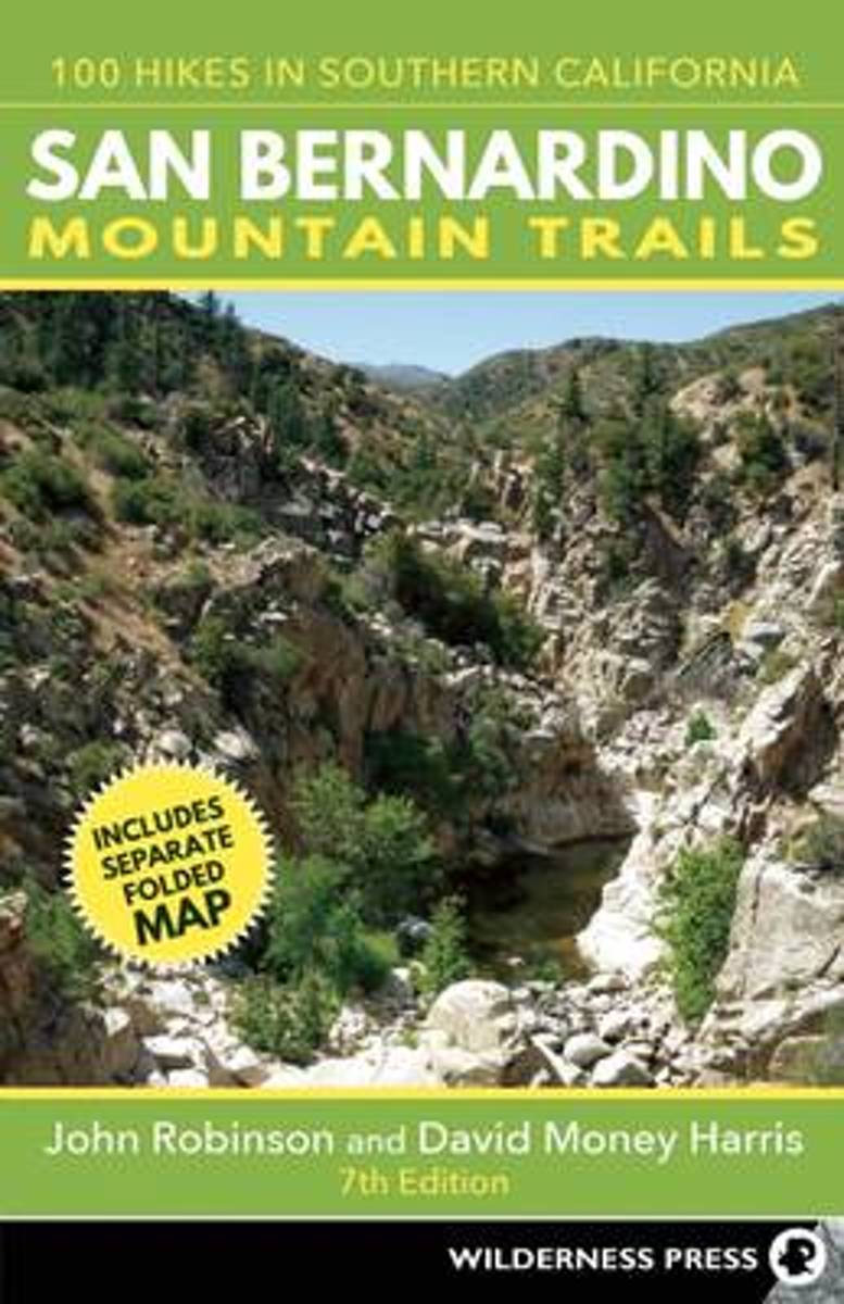
- San Bernardino Mountain Trails
- Southern California's highest and most rugged mountains are in the San Bernardino and San Jacinto ranges, in a unique region where desert cactus and pine trees, plus snow-capped peaks and palm oases, are found in close proximity. With the Pacific Crest Trail weaving its way through the mountains and desert, there are endless opportunities to... Read more
- Also available from:
- Bol.com, Belgium
Bol.com
Belgium
Belgium
- San Bernardino Mountain Trails
- Southern California's highest and most rugged mountains are in the San Bernardino and San Jacinto ranges, in a unique region where desert cactus and pine trees, plus snow-capped peaks and palm oases, are found in close proximity. With the Pacific Crest Trail weaving its way through the mountains and desert, there are endless opportunities to... Read more
Bol.com
Netherlands
Netherlands
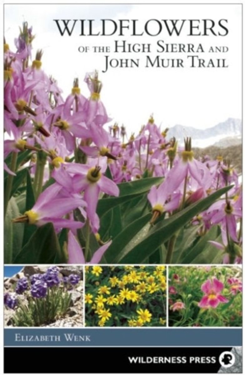
- Wildflowers of the High Sierra and John Muir Trail
- This new book by Sierra expert Elizabeth Wenk includes photos and descriptions of approximately 300 species of wildflowers and flowering shrubs in the High Sierra. Focused on areas above 8,000 feet in elevation from Yosemite south through the Whitney Region, by restricting the collection of species to higher elevations, the book can include all... Read more
- Also available from:
- Bol.com, Belgium
Bol.com
Belgium
Belgium
- Wildflowers of the High Sierra and John Muir Trail
- This new book by Sierra expert Elizabeth Wenk includes photos and descriptions of approximately 300 species of wildflowers and flowering shrubs in the High Sierra. Focused on areas above 8,000 feet in elevation from Yosemite south through the Whitney Region, by restricting the collection of species to higher elevations, the book can include all... Read more
Bol.com
Netherlands
2016
Netherlands
2016
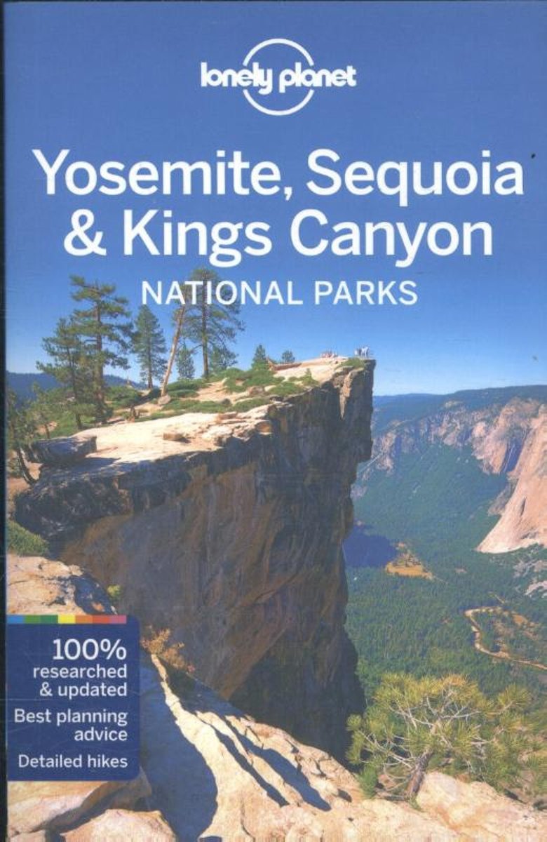
- Lonely Planet Yosemite, Sequoia & Kings Canyon National Parks
- # 1 best-selling guide to Yosemite, Sequoia & Kings Canyon National Parks* Lonely Planet Yosemite, Sequoia & Kings Canyon National Parks is your passport to the most relevant, up-to-date advice on what to see and skip, and what hidden discoveries await you. Go fishing in Yosemite Valley; canoeing and kayaking in Mammoth Lakes, or horseback... Read more
- Also available from:
- Bol.com, Belgium
Bol.com
Belgium
2016
Belgium
2016
- Lonely Planet Yosemite, Sequoia & Kings Canyon National Parks
- # 1 best-selling guide to Yosemite, Sequoia & Kings Canyon National Parks* Lonely Planet Yosemite, Sequoia & Kings Canyon National Parks is your passport to the most relevant, up-to-date advice on what to see and skip, and what hidden discoveries await you. Go fishing in Yosemite Valley; canoeing and kayaking in Mammoth Lakes, or horseback... Read more
Bol.com
Netherlands
Netherlands
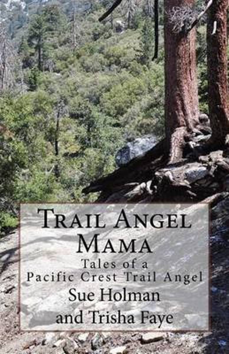
- Trail Angel Mama
- Trail magic; kindnesses from the hearts of strangers add magic to hikers journeys. This magic is often small a bottle of water, a ride into town, a candy bar. Sometimes the generosity is a meal or a bed for the night. The Holmans, day hikers themselves, live near the Pacific Crest Trail. They searched for a way to give back to their... Read more
- Also available from:
- Bol.com, Belgium
- The Book Depository, United Kingdom
Bol.com
Belgium
Belgium
- Trail Angel Mama
- Trail magic; kindnesses from the hearts of strangers add magic to hikers journeys. This magic is often small a bottle of water, a ride into town, a candy bar. Sometimes the generosity is a meal or a bed for the night. The Holmans, day hikers themselves, live near the Pacific Crest Trail. They searched for a way to give back to their... Read more

Bol.com
Netherlands
Netherlands
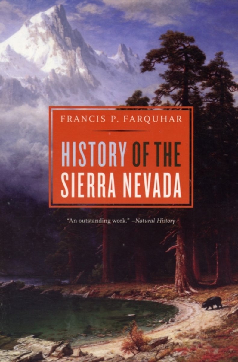
- History of the Sierra Nevada, Revised and Updated
- From the time it was sighted by Spanish explorers in the eighteenth century through the creation of the John Muir trail, the building of the Hetch Hetchy Dam, and the founding of the Sierra Club, the great snowy range of California has provided fulfillment to generations of trappers, immigrants, engineers, naturalists, and tourists. Now a... Read more
- Also available from:
- Bol.com, Belgium
Bol.com
Belgium
Belgium
- History of the Sierra Nevada, Revised and Updated
- From the time it was sighted by Spanish explorers in the eighteenth century through the creation of the John Muir trail, the building of the Hetch Hetchy Dam, and the founding of the Sierra Club, the great snowy range of California has provided fulfillment to generations of trappers, immigrants, engineers, naturalists, and tourists. Now a... Read more
Bol.com
Netherlands
Netherlands
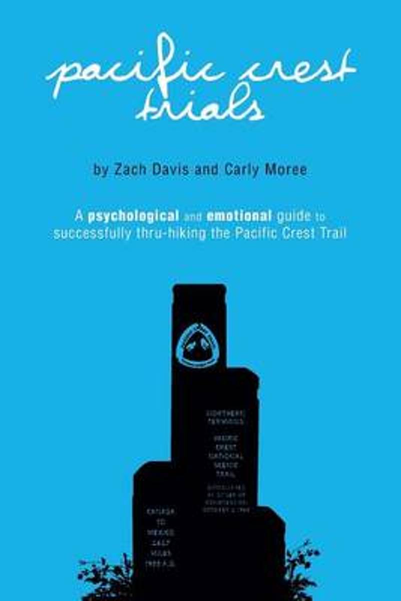
- Pacific Crest Trials
- Thru-hiking the Pacific Crest Trail is 90% mental. Each year, thousands of backpackerstake to the Pacific Crest Trail with the intention of successfully thru-hiking the 2,650-mile footpath that extends fromMexico toCanada. Despite months of research, thousands of dollars poured into their gear, and countless hours dedicated to grinding away on... Read more
- Also available from:
- Bol.com, Belgium
- The Book Depository, United Kingdom
Bol.com
Belgium
Belgium
- Pacific Crest Trials
- Thru-hiking the Pacific Crest Trail is 90% mental. Each year, thousands of backpackerstake to the Pacific Crest Trail with the intention of successfully thru-hiking the 2,650-mile footpath that extends fromMexico toCanada. Despite months of research, thousands of dollars poured into their gear, and countless hours dedicated to grinding away on... Read more

The Book Depository
United Kingdom
United Kingdom
- Pacific Crest Trials
- A Psychological and Emotional Guide to Successfully Thru-Hiking the Pacific Crest Trail Read more
Bol.com
Netherlands
Netherlands
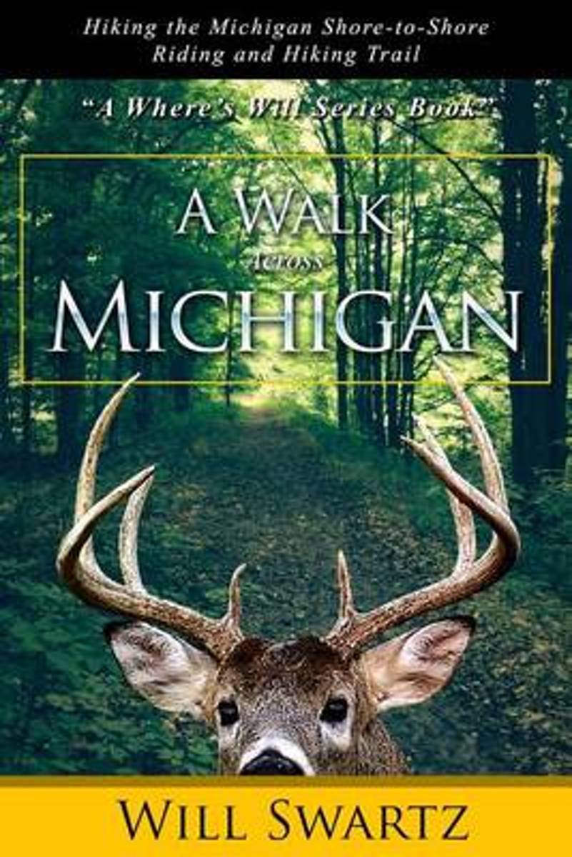
- A Walk Across Michigan
- "Hey ----Aren't you supposed to be working? " And yet, here you are searching for another good book to read ---in the hiking section of all places. Does that mean you've thought about going on a backpacking adventure of your own, like all the people who through-hike the Appalachian Trail (AT)? Me too. Do you long to reconnect with America,... Read more
- Also available from:
- Bol.com, Belgium
Bol.com
Belgium
Belgium
- A Walk Across Michigan
- "Hey ----Aren't you supposed to be working? " And yet, here you are searching for another good book to read ---in the hiking section of all places. Does that mean you've thought about going on a backpacking adventure of your own, like all the people who through-hike the Appalachian Trail (AT)? Me too. Do you long to reconnect with America,... Read more
Bol.com
Netherlands
Netherlands
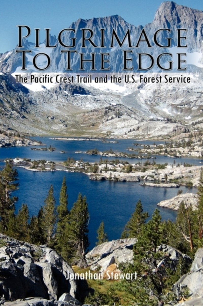
- Pilgrimage to the Edge
- Pilgrimage to the Edge details a four year odyssey hiking the Pacific Crest Trail with unique insights gained from thirty-three years of public service. It showcases the hard-won fight to preserve America's public lands and the diversity of people who continue to use and work them. It vividly displays the contemporary challenges of caring for... Read more
- Also available from:
- Bol.com, Belgium
Bol.com
Belgium
Belgium
- Pilgrimage to the Edge
- Pilgrimage to the Edge details a four year odyssey hiking the Pacific Crest Trail with unique insights gained from thirty-three years of public service. It showcases the hard-won fight to preserve America's public lands and the diversity of people who continue to use and work them. It vividly displays the contemporary challenges of caring for... Read more
De Zwerver
Netherlands
2018
Netherlands
2018
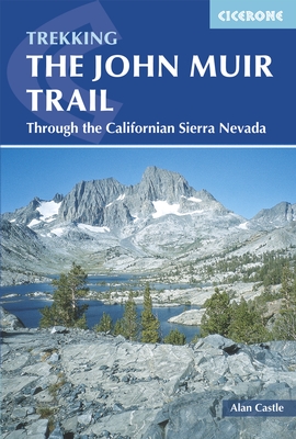
- Wandelgids The John Muir Trail | Cicerone
- Guidebook to walking the John Muir Trail through California's High Sierra from Yosemite (El Capitan and Half Dome) to the summit of Mount Witney. The 216 mile hike is split into 21 daily stages, with full information on preparation, permits, wilderness, bears, water and trekking skills. Part of the Pacific Crest Trail. Read more
- Also available from:
- Bol.com, Netherlands
- Bol.com, Belgium
- The Book Depository, United Kingdom
Bol.com
Netherlands
2015
Netherlands
2015
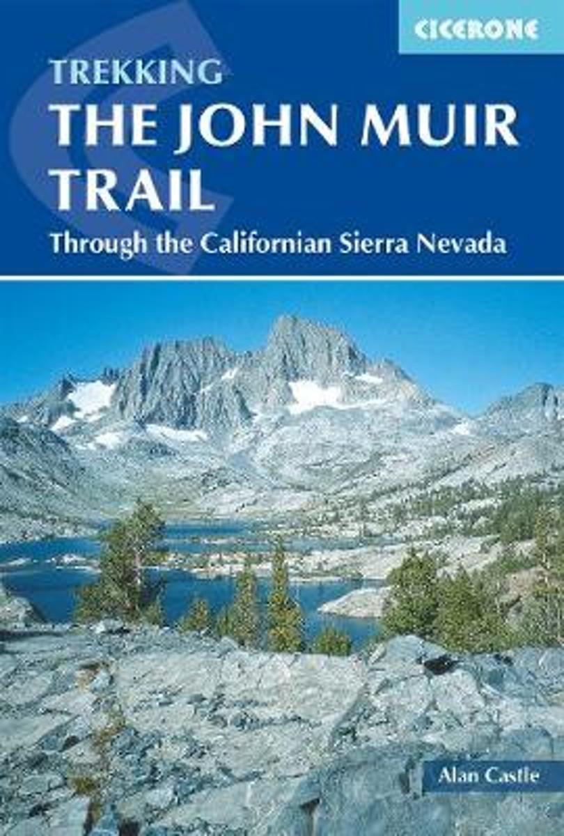
- The John Muir Trail
- The John Muir Trail (JMT) is one of the world's most spectacular treks and is North America's best known mid-distance walking trail. It runs for 216 miles through the high Sierra Nevada mountains of California, from Yosemite Valley to the summit of Mount Whitney (14,496 ft), the highest peak in the USA outside Alaska. The walking trail, which... Read more
Bol.com
Belgium
2015
Belgium
2015
- The John Muir Trail
- The John Muir Trail (JMT) is one of the world's most spectacular treks and is North America's best known mid-distance walking trail. It runs for 216 miles through the high Sierra Nevada mountains of California, from Yosemite Valley to the summit of Mount Whitney (14,496 ft), the highest peak in the USA outside Alaska. The walking trail, which... Read more

The Book Depository
United Kingdom
2015
United Kingdom
2015
- The John Muir Trail
- Through the Californian Sierra Nevada Read more
Bol.com
Netherlands
Netherlands
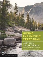
- Hiking the Pacific Crest Trail
- Section Hiking from Tuolumne Meadows to Green Pass Read more
- Also available from:
- Bol.com, Belgium
Bol.com
Belgium
Belgium
- Hiking the Pacific Crest Trail
- Section Hiking from Tuolumne Meadows to Green Pass Read more
Bol.com
Netherlands
Netherlands
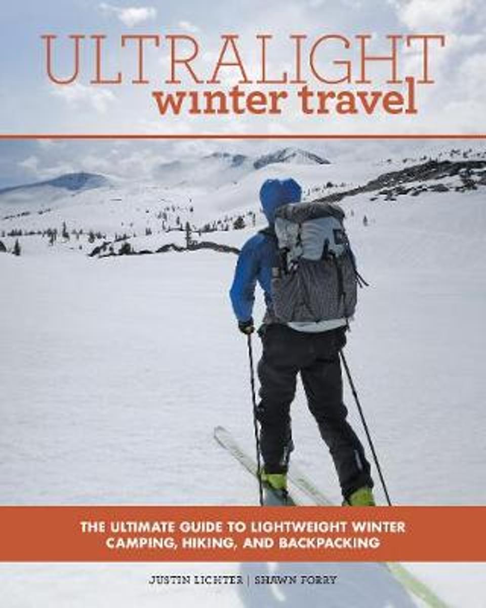
- Ultralight Winter Travel
- The key to winter travel is knowing how to travel as light as possible. The Ultralight series is perfect for both beginner and experts alike as Justin Lichter and Shawn Forry, the first ever winter thru-hikers of the Pacific Crest Trail, use their knowledge to form the most comprehensive companion for traveling farther with less weight.... Read more
- Also available from:
- Bol.com, Belgium
- The Book Depository, United Kingdom
Bol.com
Belgium
Belgium
- Ultralight Winter Travel
- The key to winter travel is knowing how to travel as light as possible. The Ultralight series is perfect for both beginner and experts alike as Justin Lichter and Shawn Forry, the first ever winter thru-hikers of the Pacific Crest Trail, use their knowledge to form the most comprehensive companion for traveling farther with less weight.... Read more

The Book Depository
United Kingdom
United Kingdom
- Ultralight Winter Travel
- The Ultimate Guide to Lightweight Winter Camping, Hiking, and Backpacking Read more
Bol.com
Netherlands
Netherlands
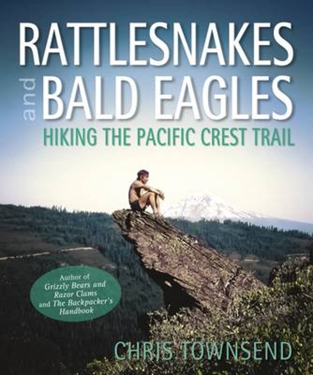
- Rattlesnakes and Bald Eagles
- As probably the world's most experienced long distance walker who also writes, Chris Townsend has many stories to tell and many photographs to illustrate them with. Of all his adventures, those he enjoyed on America's Pacific Crest Trail in the Eighties are among his favourites. The PCT runs 2,600 miles from Mexico to Canada through desert,... Read more
- Also available from:
- Bol.com, Belgium
- The Book Depository, United Kingdom
Bol.com
Belgium
Belgium
- Rattlesnakes and Bald Eagles
- As probably the world's most experienced long distance walker who also writes, Chris Townsend has many stories to tell and many photographs to illustrate them with. Of all his adventures, those he enjoyed on America's Pacific Crest Trail in the Eighties are among his favourites. The PCT runs 2,600 miles from Mexico to Canada through desert,... Read more

The Book Depository
United Kingdom
United Kingdom
- Rattlesnakes and Bald Eagles
- Hiking the Pacific Crest Trail Read more
Kaarten

Bol.com
Netherlands
Netherlands
- Goat Rocks & Norse Peak Wilderness Area, Gifford-pinchot & Okanogan-wenatchee National Forests
- Waterproof Tear-Resistant Topographic MapGifford-Pinchot and Okanogan-Wenatchee National Forests Washington, USAOne of five new Trails Illustrated maps for the Washington Cascades region offers the most detailed and up-to-date map for the forest, carefully researched and developed in co-operation with local land managers and agencies.... Read more
- Also available from:
- Bol.com, Belgium
- Stanfords, United Kingdom
Bol.com
Belgium
Belgium
- Goat Rocks & Norse Peak Wilderness Area, Gifford-pinchot & Okanogan-wenatchee National Forests
- Waterproof Tear-Resistant Topographic MapGifford-Pinchot and Okanogan-Wenatchee National Forests Washington, USAOne of five new Trails Illustrated maps for the Washington Cascades region offers the most detailed and up-to-date map for the forest, carefully researched and developed in co-operation with local land managers and agencies.... Read more

Stanfords
United Kingdom
United Kingdom
- Goat Rocks - Norse Peak William O. Douglas Wilderness Area WA
- Map No. 823, Goat Rocks and Norse Peak Wilderness Area - Gifford-Pinchot and Okanogan-Wenatchee National Forests, WA, in an extensive series of GPS compatible, contoured hiking maps of USA’s national and state parks or forests and other popular recreational areas. Cartography based on the national topographic survey, with additional tourist... Read more

Bol.com
Netherlands
Netherlands
- Alpine Lakes Wilderness Area, Mount Baker-snoqualmie & Okanogan-wenatchee National Forests
- Waterproof Tear-Resistant Topographic MapMount Baker-Snoqualmie and Okanogan-Wenatchee National Forests Washington, USAOne of five new Trails Illustrated maps for the Washington Cascades region offering the most detailed and up-to-date map for the forest, carefully researched and developed in co-operation with local land managers and... Read more
- Also available from:
- Bol.com, Belgium
- Stanfords, United Kingdom
Bol.com
Belgium
Belgium
- Alpine Lakes Wilderness Area, Mount Baker-snoqualmie & Okanogan-wenatchee National Forests
- Waterproof Tear-Resistant Topographic MapMount Baker-Snoqualmie and Okanogan-Wenatchee National Forests Washington, USAOne of five new Trails Illustrated maps for the Washington Cascades region offering the most detailed and up-to-date map for the forest, carefully researched and developed in co-operation with local land managers and... Read more

Stanfords
United Kingdom
United Kingdom
- Alpine Lakes Wilderness - Mt Baker-Snoqualmie and Okanogan-Wenatchee National Forests WA
- Map No. 825, Alpine Lakes Wilderness Area - Mount Baker-Snoqualmie Wilderness Areas and Okanogan-Wenatchee National Forests, WA, in an extensive series of GPS compatible, contoured hiking maps of USA’s national and state parks or forests and other popular recreational areas. Cartography based on the national topographic survey, with additional... Read more
De Zwerver
Netherlands
Netherlands
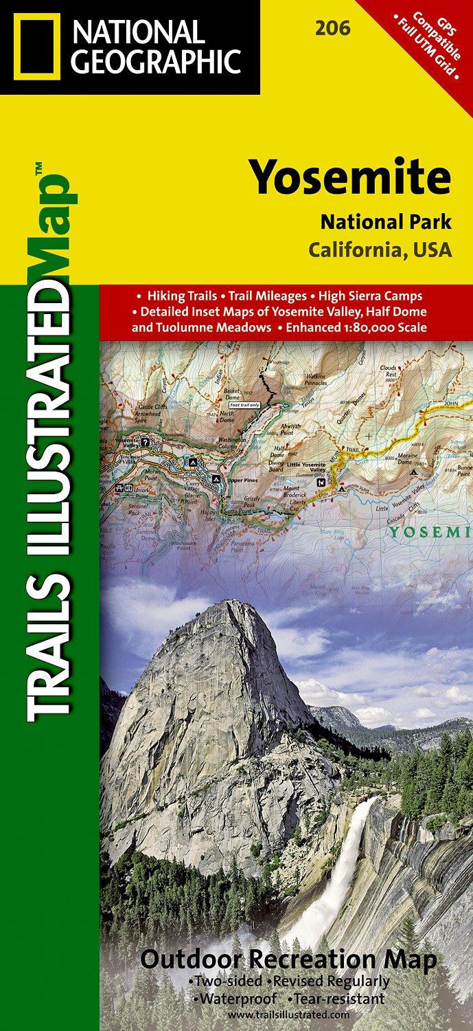
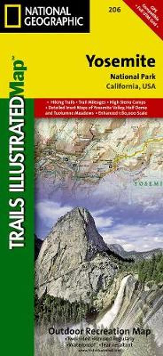
- Wandelkaart - Topografische kaart 206 Yosemite National Park | National Geographic
- Prachtige geplastificeerde kaart van het bekende nationaal park. Met alle recreatieve voorzieningen als campsites, maar ook met topografische details en wandelroutes ed. Door uitgekiend kleurgebruik zeer prettig in gebruik. Scheur en watervast! Coverage includes Stanislaus National Forest, Emigrant Wilderness, Carson Iceberg Wilderness, Toiyabe... Read more
- Also available from:
- Bol.com, Netherlands
- Bol.com, Belgium
- Stanfords, United Kingdom
- The Book Depository, United Kingdom
Bol.com
Netherlands
Netherlands
- Yosemite National Park
- Waterproof Tear-Resistant Topographic MapExplore the majesty of Yosemite National Park with National Geographic's Trails Illustrated map. Loaded with helpful information on camping, hiking, lodging, transportation, regulations, and safety, this map is an invaluable tool for casual park visitors and avid adventurers alike. Expertly... Read more
Bol.com
Belgium
Belgium
- Yosemite National Park
- Waterproof Tear-Resistant Topographic MapExplore the majesty of Yosemite National Park with National Geographic's Trails Illustrated map. Loaded with helpful information on camping, hiking, lodging, transportation, regulations, and safety, this map is an invaluable tool for casual park visitors and avid adventurers alike. Expertly... Read more

Stanfords
United Kingdom
United Kingdom
- Yosemite National Park CA NGS Trails Illustrated Map 206
- Map No. 206, Yosemite National Park, CA, in an extensive series of GPS compatible, contoured hiking maps of USA’s national and state parks or forests and other popular recreational areas. Cartography based on the national topographic survey, with additional tourist information.The maps, with most titles now printed on light, waterproof and... Read more


Bol.com
Netherlands
Netherlands
- Mount Whitney
- Waterproof Tear-Resistant Topographic MapMount Whitney is universally famous as the highest mountain in the United State outside of Alaska, as well as the highest point in California. National Geographic's Trails Illustrated map of Mount Whitney is a two-sided, waterproof map designed to meet the needs of Whitney visitors with unmatched... Read more
- Also available from:
- Bol.com, Belgium
- Stanfords, United Kingdom
Bol.com
Belgium
Belgium
- Mount Whitney
- Waterproof Tear-Resistant Topographic MapMount Whitney is universally famous as the highest mountain in the United State outside of Alaska, as well as the highest point in California. National Geographic's Trails Illustrated map of Mount Whitney is a two-sided, waterproof map designed to meet the needs of Whitney visitors with unmatched... Read more

Stanfords
United Kingdom
United Kingdom
- Mount Whitney CA NGS Trails Illustrated Map 322
- Map No. 322, Mount Whitney in California at 1:40,000, in an extensive series of GPS compatible, contoured hiking maps of USA’s national and state parks or forests and other popular recreational areas. Cartography is based on the national topographic survey, with additional tourist information.The maps, with most titles now printed on light,... Read more

De Zwerver
Netherlands
Netherlands
- Wandelkaart - Topografische kaart 205 Sequoia - Kings Canyon National Parks | National Geographic
- Prachtige geplastificeerde kaart van het nationaal park. Met alle recreatieve voorzieningen als campsites, maar ook met topografische details en wandelroutes ed. Door uitgekiend kleurgebruik zeer prettig in gebruik. Scheur en watervast! Trails Illustrated maps are the most trusted and popular recreation maps available. Continually setting the... Read more
- Also available from:
- Bol.com, Netherlands
- Bol.com, Belgium
- Stanfords, United Kingdom
- The Book Depository, United Kingdom

Bol.com
Netherlands
Netherlands
- Sequoia/kings Canyon National Park
- Waterproof Tear-Resistant Topographic MapIn Sequioa and Kings Canyon National Parks you can walk among the world's largest trees, hike the alpine landscape of the Sierra Crest, and marvel at the towering granite cliffs of one of the deepest canyons in the United States. National Geographic's Trails Illustrated map of Sequoia and Kings... Read more
Bol.com
Belgium
Belgium
- Sequoia/kings Canyon National Park
- Waterproof Tear-Resistant Topographic MapIn Sequioa and Kings Canyon National Parks you can walk among the world's largest trees, hike the alpine landscape of the Sierra Crest, and marvel at the towering granite cliffs of one of the deepest canyons in the United States. National Geographic's Trails Illustrated map of Sequoia and Kings... Read more

Stanfords
United Kingdom
United Kingdom
- Sequoia - Kings Canyon National Parks CA NGS Trails Illustrated Map 205
- Map No. 205, Sequoia/Kings Canyon National Park, CA, in an extensive series of GPS compatible, contoured hiking maps of USA’s national and state parks or forests and other popular recreational areas. Cartography based on the national topographic survey, with additional tourist information.The maps, with most titles now printed on light,... Read more

The Book Depository
United Kingdom
United Kingdom
- Sequoia/kings Canyon National Park
- Trails Illustrated National Parks Read more

De Zwerver
Netherlands
Netherlands
- Wandelkaart - Topografische kaart 809 Mammoth Lakes - Mono Divide - Inyo and Sierra National Forests | National Geographic
- Prachtige geplastificeerde kaart van het bekende nationaal park. Met alle recreatieve voorzieningen als campsites, maar ook met topografische details en wandelroutes ed. Door uitgekiend kleurgebruik zeer prettig in gebruik. Scheur en watervast! Trails Illustrated Mammoth Lakes / Mono Divide is the first of five exciting new maps for the... Read more
- Also available from:
- Bol.com, Netherlands
- Bol.com, Belgium
- Stanfords, United Kingdom

Bol.com
Netherlands
Netherlands
- Mammoth Lakes/mono Divide
- Waterproof Tear-Resistant Topographic MapTrails Illustrated Mammoth Lakes / Mono Divide is the first of five exciting new maps for the California Sierra Nevadas that will combine to form seamless coverage of the high-use National Forest areas between Sequoia / Kings Canyon National Parks and Lake Tahoe. This region contains some of the... Read more
Bol.com
Belgium
Belgium
- Mammoth Lakes/mono Divide
- Waterproof Tear-Resistant Topographic MapTrails Illustrated Mammoth Lakes / Mono Divide is the first of five exciting new maps for the California Sierra Nevadas that will combine to form seamless coverage of the high-use National Forest areas between Sequoia / Kings Canyon National Parks and Lake Tahoe. This region contains some of the... Read more

Stanfords
United Kingdom
United Kingdom
- Mammoth Lakes - Mono Divide CA
- Map No. 809, Mammoth Lakes / Mono Divide, CA, in an extensive series of GPS compatible, contoured hiking maps of USA’s national and state parks or forests and other popular recreational areas. Cartography based on the national topographic survey, with additional tourist information.The maps, with most titles now printed on light, waterproof and... Read more

Bol.com
Netherlands
Netherlands
- Carson-iceberg/emigrant/mokleumne Wilderness Areas
- Waterproof Tear-Resistant Topographic MapPart of our exciting new coverage for California's Sierra Nevada, our Carson-Iceberg, Emigrant and Mokelumne Wilderness Trails Illustrated map details the high use recreation areas of Stanislaus and Humboldt-Toiyabe National Forests from Yosemite National Park north to Caples Lake and Markleeville.... Read more
- Also available from:
- Bol.com, Belgium
- Stanfords, United Kingdom
Bol.com
Belgium
Belgium
- Carson-iceberg/emigrant/mokleumne Wilderness Areas
- Waterproof Tear-Resistant Topographic MapPart of our exciting new coverage for California's Sierra Nevada, our Carson-Iceberg, Emigrant and Mokelumne Wilderness Trails Illustrated map details the high use recreation areas of Stanislaus and Humboldt-Toiyabe National Forests from Yosemite National Park north to Caples Lake and Markleeville.... Read more

Stanfords
United Kingdom
United Kingdom
- Carson-Iceberg - Emigrant and Mokleumne Wilderness Areas CA
- Map No. 807, Carson-Iceberg / Emigrant / Mokleumne Wilderness Areas, CA, in an extensive series of GPS compatible, contoured hiking maps of USA’s national and state parks or forests and other popular recreational areas. Cartography based on the national topographic survey, with additional tourist information.The maps, with most titles now... Read more
De Zwerver
Netherlands
Netherlands
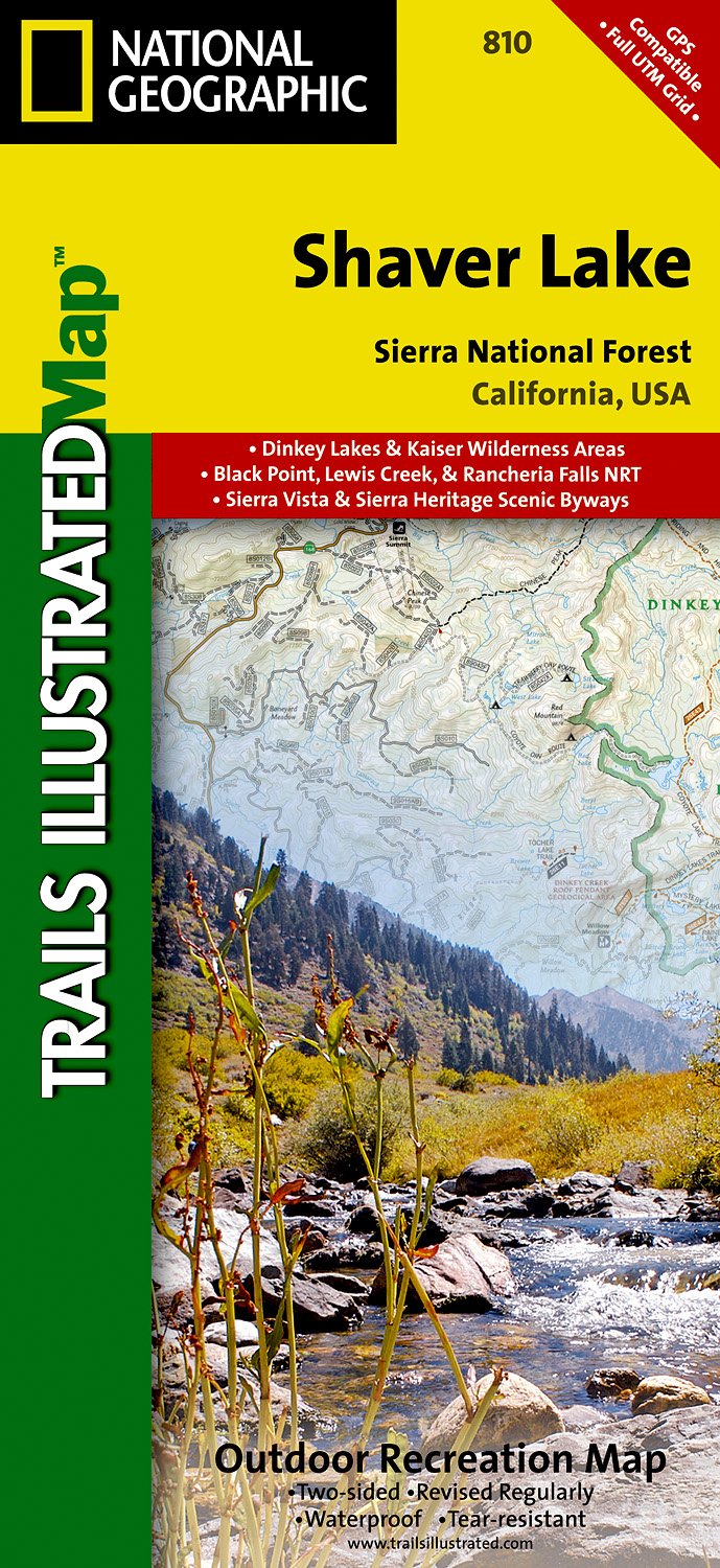
- Wandelkaart - Topografische kaart 810 Shaver Lake - Sierra National Forest | National Geographic
- Prachtige geplastificeerde kaart van het bekende nationaal park. Met alle recreatieve voorzieningen als campsites, maar ook met topografische details en wandelroutes ed. Door uitgekiend kleurgebruik zeer prettig in gebruik. Scheur en watervast! Trails Illustrated Shaver Lake / Sierra National Forest is the second of five exciting new maps for... Read more
- Also available from:
- Stanfords, United Kingdom
- The Book Depository, United Kingdom

Stanfords
United Kingdom
United Kingdom
- Shaver Lake - Sierra National Forest CA
- Map No. 810, Shaver Lake / Sierra National Forest, CA, in an extensive series of GPS compatible, contoured hiking maps of USA’s national and state parks or forests and other popular recreational areas. Cartography based on the national topographic survey, with additional tourist information.The maps, with most titles now printed on light,... Read more

The Book Depository
United Kingdom
United Kingdom
- Shaver Lake/sierra National Forest
- Trails Illustrated Other Rec. Areas Read more