
Sierra High Route
Beschrijving
- Name Sierra High Route
- Lengte van pad 314 km, 195 mijl
- Lengte in dagen 30 dagen
- Traildino graad DW, Moeilijke wandeling, bushwalk
- Huttentrektocht graad T3, Veeleisende bergtocht
 This cross-country hiking trail, 195 miles (314 km) long, deep into the Sierra Nevada. Much of the Sierra High Route runs parallel to the John Muir Trail, staying east of that trail and keeping above the timberline to higher elevations. Part is off-trail, including class-3 rock faces in which footholds and handholds must be carefully chosen and tested.
Kaart


Links
Feiten
Verslagen
Gidsen en kaarten
Overnachting
Organisaties
Reisorganisaties
GPS
Anders
Boeken

Bol.com
Netherlands
Netherlands
- Sierra High Route
- * Author conceived and pioneered the Sierra High Route * Covers Kings Canyon National Park to northern Yosemite National Park * Each route chapter includes points of interest, maps, approach instructions, and directions No ordinary guidebook, Sierra High Route leads you from point to point through a spectacular 195-mile timberline route in... Read more
- Also available from:
- Bol.com, Belgium
Bol.com
Belgium
Belgium
- Sierra High Route
- * Author conceived and pioneered the Sierra High Route * Covers Kings Canyon National Park to northern Yosemite National Park * Each route chapter includes points of interest, maps, approach instructions, and directions No ordinary guidebook, Sierra High Route leads you from point to point through a spectacular 195-mile timberline route in... Read more
Bol.com
Netherlands
Netherlands
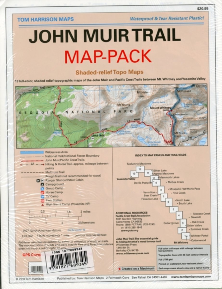
- Map-pack of the John Muir Trail
- Shaded Relief Topo Maps packet of the famous Sierra High Route that will take hikers from Mount Whitney to Yosemite, CA. Well marked trails over USGS topo maps that were beautifully enhanced with shaded relief to better distinguish details. Scale 1:630360. 1 inch on map equals 1 mile. Whitney Portal, Symmes Creek, Onion Valley, Oak Creek,... Read more
- Also available from:
- Bol.com, Belgium
- The Book Depository, United Kingdom
Bol.com
Belgium
Belgium
- Map-pack of the John Muir Trail
- Shaded Relief Topo Maps packet of the famous Sierra High Route that will take hikers from Mount Whitney to Yosemite, CA. Well marked trails over USGS topo maps that were beautifully enhanced with shaded relief to better distinguish details. Scale 1:630360. 1 inch on map equals 1 mile. Whitney Portal, Symmes Creek, Onion Valley, Oak Creek,... Read more
