
Catalunya
Beschrijving
Kaart

Paden in deze regio
- Carros de FocGPX
- GR1 Sendero Histórico, Senda TransversalGPX
- GR107 - El Camí dels Bons HomesGPX
- GR11 Sendero PirenaicoGPX
- GR150 Alrededor de la Sierra de CadíGPX
- GR170 L'Estany - VidràGPX
- GR171 Pinós - PaülsGPX
- GR172 Bellprat - Montserrat - La MussaraGPX
- GR173 Vallès NaturalGPX
- GR174 Sender del PrioratGPX
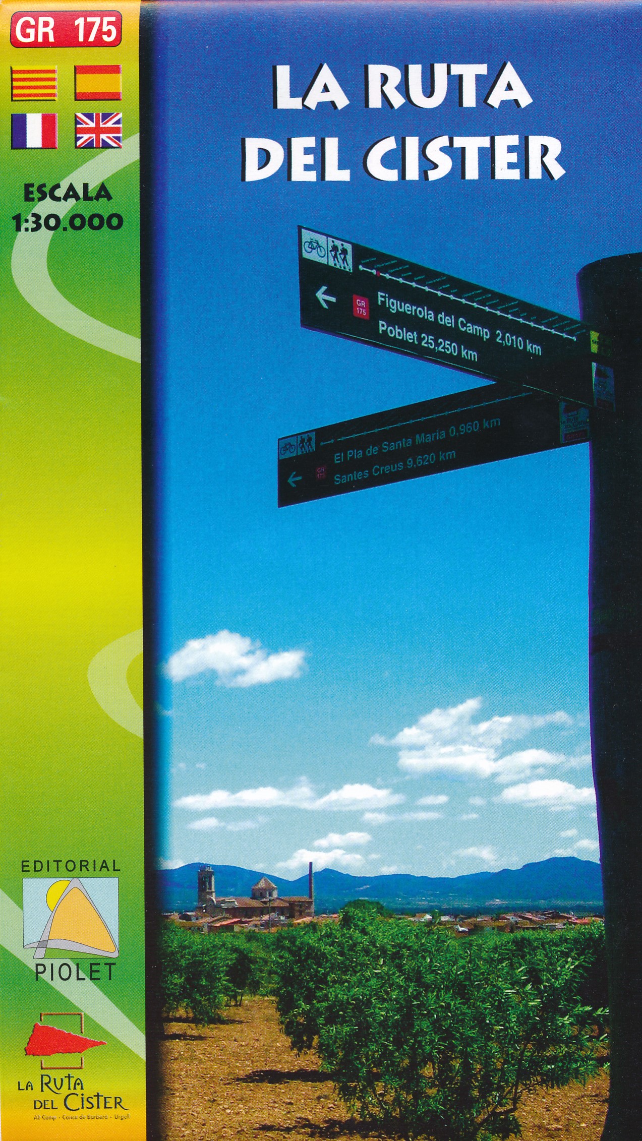
- GR175 Ruta del CisterGPX
- GR176 Ruta de les Vint ErmitesGPX
- GR177 Ruta del MoianésGPX
- GR178 Ruta d'en SerrallongaGPX
- GR179 Sender del MaquisGPX
- GR192 Cambrils - AmpostaGPX
- GR2 La Jonquera - AiguafredaGPX
- GR210 Camí vora TerGPX
- GR211 Circular del Vall d'AranGPX
- GR241 Sender Circular de BorredàGPX
- GR3 Sendero Central de CatalunyaGPX
- GR4 Puigcerdà - MontserratGPX
- GR5 Sendero de los Parques Naturales, Sender dels MiradorsGPX
- GR6 Barcelona - MontserratGPX
- GR65 Camino de SantiagoGPX
- GR7 Andorra - TarifaGPX
- GR8 Puertos de Beceite - JavalambreGPX
- GR83 - Camí del Nord o del CanigóGPX
- GR92 Sender MediterraneoGPX
- GR96 Cami Romeu a MontserratGPX
- GR97 Sendero de la Tordera al LlobregatGPX
- GR99 Sendero del EbroGPX
Links
Feiten
Verslagen
Gidsen en kaarten
Overnachting
Organisaties
Reisorganisaties
GPS
Anders
Boeken

De Zwerver
Netherlands
2009
Netherlands
2009
- Wandelgids GR 5 Mer Du Nord-Mediterrannee Noordzee - Middellandse Zee deel Ardennen (Maastricht - Diekirch ) | GR Sentiers
- LET OP: deze wandelgids van dit deel van de GR5 is alleen nog maar in het Frans leverbaar. De Nederlandstalige versie is geheel uitverkocht, niet meer te bestellen en er komt naar alle waarschijnlijkheid geen nieuwe versie in het Nederlands! Uitstekende routegids met gedetailleerde kaarten en een routebeschrijving. Fout lopen wordt op deze... Read more


De Zwerver
Netherlands
Netherlands

De Zwerver
Netherlands
2021
Netherlands
2021

De Zwerver
Netherlands
2023
Netherlands
2023
De Zwerver
Netherlands
2024
Netherlands
2024
De Zwerver
Netherlands
2021
Netherlands
2021
- Wandelgids 270 Rother Wandefuhrer Spanje Costa Brava | Rother Bergverlag
- Uitstekende wandelgids met een groot aantal dagtochten in dal en hooggebergte. Met praktische informatie en beperkt kaartmateriaal! Wandelingen in verschillende zwaarte weergegeven in rood/blauw/zwart. Die »wilde Küste« Spaniens ist eines der beliebtesten Ferienziele der Iberischen Halbinsel. Von den andernorts bekannten Auswüchsen... Read more

Meer boeken…

Kaarten

De Zwerver
Netherlands
2020
Netherlands
2020
- Wandelatlas - Pelgrimsroute (kaart) 161 Chemins de Compostelle GR65 | Michelin
- Véritable petit atlas détaillant chaque étape avec indications précises concernant les villes de départ et d'arrivée ainsi que pour les localités traversées (auberges, refuges, restaurants, pharmacies, gare, épiceries, Km parcourus, Km restants....).Ce petit atlas suit le chemin du... Read more

De Zwerver
Netherlands
Netherlands
- Pelgrimsroute (kaart) - Wandelkaart Camino de Santiago in Spanje | CNIG - Instituto Geográfico Nacional
- All roads leading to Santiago de Compostela in the Iberian Peninsula are represented on this Caminos de Santiago / The Way of St. James Map. Routes highlighted on a physical map of the Iberian Peninsula at 1:1,250,000 from IGN/CNIG, Spain civilian topographic survey organization. The base map with altitude colouring and relief shading provides... Read more
- Also available from:
- Stanfords, United Kingdom

Stanfords
United Kingdom
United Kingdom
- Caminos de Santiago / Ways of St. James on the Iberian Peninsula CNIG Overview Map
- All roads leading to Santiago de Compostela in the Iberian Peninsula are represented on this Caminos de Santiago / The Way of St. James Map. Routes highlighted on a physical map of the Iberian Peninsula at 1:1,250,000 from IGN/CNIG, Spain civilian topographic survey organization. The base map with altitude colouring and relief shading provides... Read more

De Zwerver
Netherlands
2020
Netherlands
2020
- Wandelatlas - Pelgrimsroute (kaart) 160 Camino de Santiago | Michelin
- Parcourez le Chemin Français (Camino Francés) avec ce petit atlas de poche Michelin. L'outil idéal pour mieux s'y retrouver lors de la préparation du voyage de randonnée sur ce sentier historique qui part de Saint-Jean-Pied-de-Port, dans le Pays basque français, et qui traverse tout le nord de l'Espagne... Read more

De Zwerver
Netherlands
2021
Netherlands
2021
- Also available from:
- Stanfords, United Kingdom

Stanfords
United Kingdom
2021
United Kingdom
2021
- France - Ways of St James IGN Map 922
- France: Ways of St James to Compostela Map from the IGN presents an overview of all the routes across France taken by pilgrims on their way to Santiago de Compostela and the tomb of the apostle St James - the greatest of all goals for thousands of pilgrims in Europe during the Middle Ages. The map was prepared by the IGN and the Association de... Read more
De Zwerver
Netherlands
Netherlands
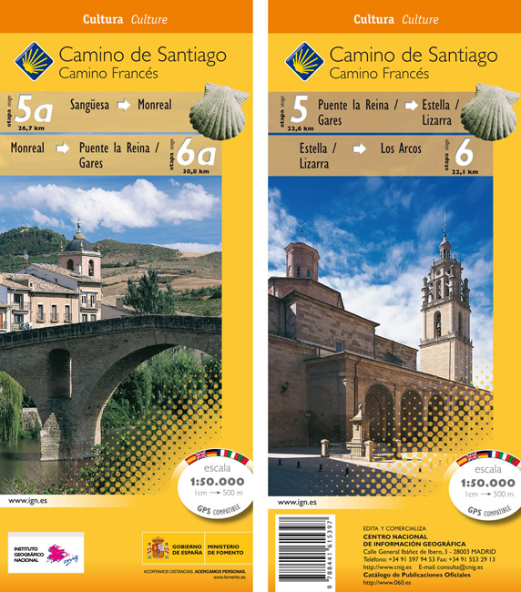
- Wandelkaart 5A-6 Camino Santiago de Compostella Sangüesa - Los Arcos | CNIG - Instituto Geográfico Nacional
- The Way of St James: Stages 5/5a/6/6a, Sangüesa/Puente la Reina/Los Arcos in a series of double-sided topographic maps at 1:50,000 from the Spanish civilian survey organization, overprinted with the route and sights, plus information of accommodation and other facilities, route profiles, etc.Each 1:50,000 map is double-sided and has four 57 x... Read more
- Also available from:
- Stanfords, United Kingdom

Stanfords
United Kingdom
United Kingdom
- Camino de Santiago: Stages 5/5a/6/6a, Sangüesa/Puente la Reina/Los Arcos 50K CNIG Map
- The Way of St James: Stages 5/5a/6/6a, Sangüesa/Puente la Reina/Los Arcos in a series of double-sided topographic maps at 1:50,000 from the Spanish civilian survey organization, overprinted with the route and sights, plus information of accommodation and other facilities, route profiles, etc.Each 1:50,000 map is double-sided and has four 57 x... Read more

De Zwerver
Netherlands
Netherlands
- Wegenkaart - landkaart Camino de Santiago - Camino Frances | CNIG - Instituto Geográfico Nacional
- Northern Spain on an overview map at 1:500,000 highlighting the course of the Camino Francés route of the Way of St James from the Pyrenees to Santiago de Compostela via Burgos and León. Published by Spain’s civilian survey organization as part of their set providing topographic coverage of the route at 1:50,000, the map is also available... Read more
- Also available from:
- Stanfords, United Kingdom

Stanfords
United Kingdom
United Kingdom
- Way of St James / Camino de Santiago CNIG Overview Map
- Northern Spain on an overview map at 1:500,000 highlighting the course of the Camino Francés route of the Way of St James from the Pyrenees to Santiago de Compostela via Burgos and León. Published by Spain’s civilian survey organization as part of their set providing topographic coverage of the route at 1:50,000, the map is also available... Read more
De Zwerver
Netherlands
2014
Netherlands
2014
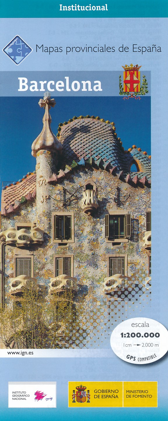
- Wegenkaart - landkaart Mapa Provincial Barcelona | CNIG - Instituto Geográfico Nacional
- Barcelona Province in a series of contoured, GPS-compatible, indexed road maps at 1:200,000 from the IGN - CNIG, Spain Read more
- Also available from:
- Stanfords, United Kingdom

Stanfords
United Kingdom
2014
United Kingdom
2014
- Barcelona Province 200K CNIG Map No. 9
- Contoured, GPS-compatible, indexed road map at 1:200,000 from CNIG - Spain’s civilian survey organization, with exceptionally informative presentation of the landscape and highlighting for facilities and places of interest including campsites and paradors.Maps in CNIG’s 200K Provincial Series provide an excellent picture the topography through... Read more
De Zwerver
Netherlands
Netherlands
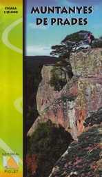
- Wandelkaart Muntanyes de Prades (Catalonië) | Editorial Piolet
- Muntanyes de Prades at 1:25,000 in a series of GPS compatible maps from Editorial Piolet with cartography based on Spain Read more
- Also available from:
- Stanfords, United Kingdom

Stanfords
United Kingdom
United Kingdom
- Muntanyes de Prades
- Muntanyes de Prades at 1:25,000 in a series of GPS compatible maps from Editorial Piolet with cartography based on Spain’s civilian topographic survey overprinted with hiking routes and other tourist information. Hiking maps in the Editorial Piolet series, unless indicated to the contrary in the individual description, have contours at 10m... Read more
De Zwerver
Netherlands
Netherlands
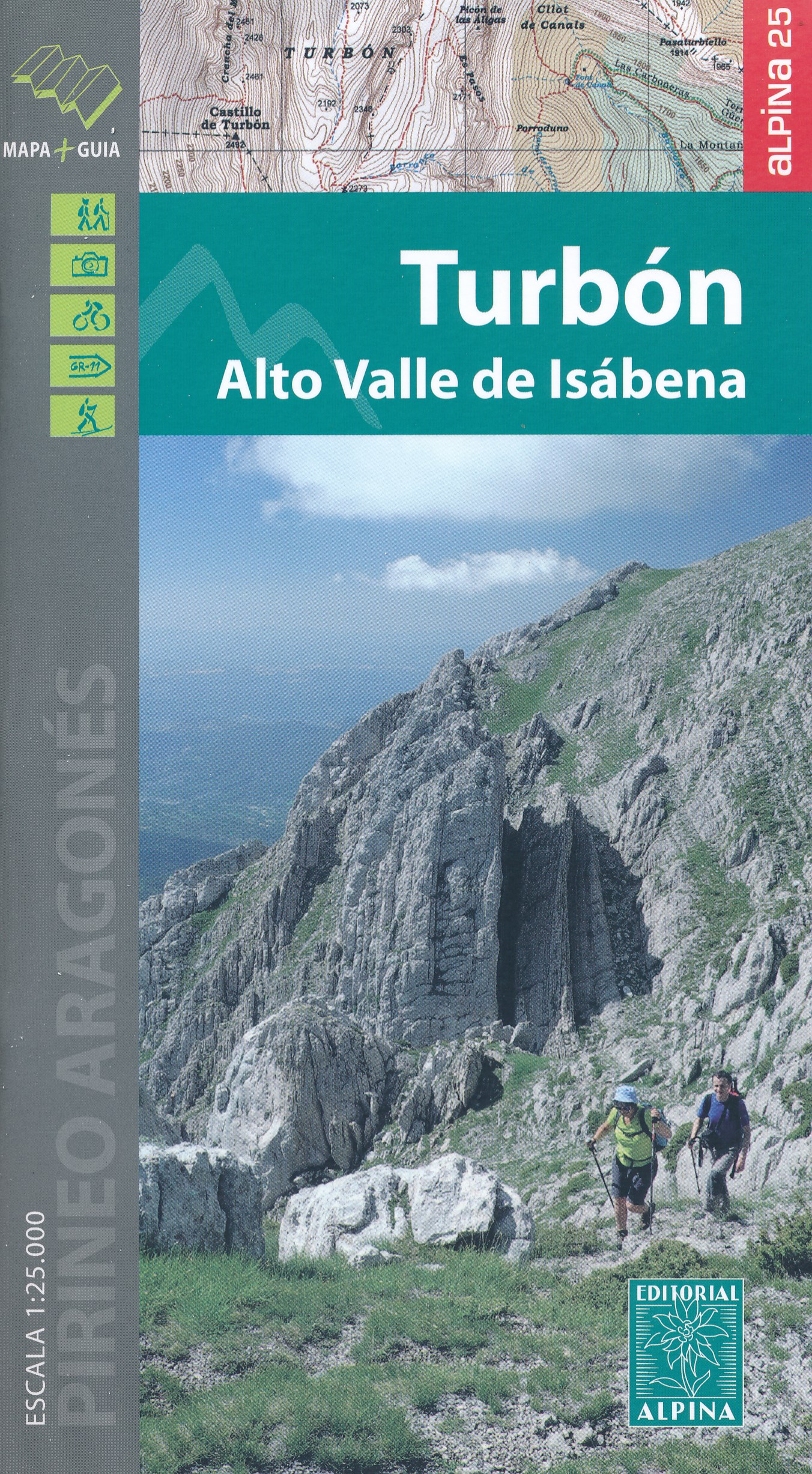
- Wandelkaart 17 Turbón, Alto Valle de Isábena | Editorial Alpina
- El Turbón - Alto Valle de Isábena in an extensive and very popular series of walking maps from Editorial Alpina covering the Pyrenees, Catalonia and other selected hiking areas in Spain, including Picos de Europa, Sierra Nevada and parts of Andalucía, Majorca, etc. Scales vary from 1:50,000 to 1:10,000, with the majority of the titles at... Read more
- Also available from:
- Stanfords, United Kingdom

Stanfords
United Kingdom
United Kingdom
- El Turbón – Alto Valle de Isábena Editorial Alpina
- El Turbón - Alto Valle de Isábena in an extensive and very popular series of walking maps from Editorial Alpina covering the Pyrenees, Catalonia and other selected hiking areas in Spain, including Picos de Europa, Sierra Nevada and parts of Andalucía, Majorca, etc. Scales vary from 1:50,000 to 1:10,000, with the majority of the titles at... Read more

De Zwerver
Netherlands
2016
Netherlands
2016
- Wandelkaart 04 Vanoise - Beaufortain | Didier Richard
- Vanoise National Park and the Beaufortain Massif in the French Alps at 1:60,000 on a contoured and GPS compatible map from Didier Richard with a base derived from IGN Read more
- Also available from:
- Stanfords, United Kingdom

Stanfords
United Kingdom
2016
United Kingdom
2016
- Vanoise National Park - Beaufortain Didier Richard 04
- Vanoise National Park and the Beaufortain Massif in the French Alps at 1:60,000 on a contoured and GPS compatible map from Didier Richard with a base derived from IGN’s topographic survey, highlighting both local hiking routes and the GR network of long-distance paths, gîtes and mountain refuges, interesting natural and cultural sites, etc. The... Read more


De Zwerver
Netherlands
Netherlands
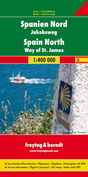
- Wegenkaart - landkaart Spanje Noord - Camino de Santiago | Freytag & Berndt
- Spanien - Jakobsweg, Autokarte 1:400.000 ab 10.9 EURO Touristische Informationen, Pilgerpass, Citypläne, Ortsregister mit GPS Freytag & Berndt Autokarte Read more