
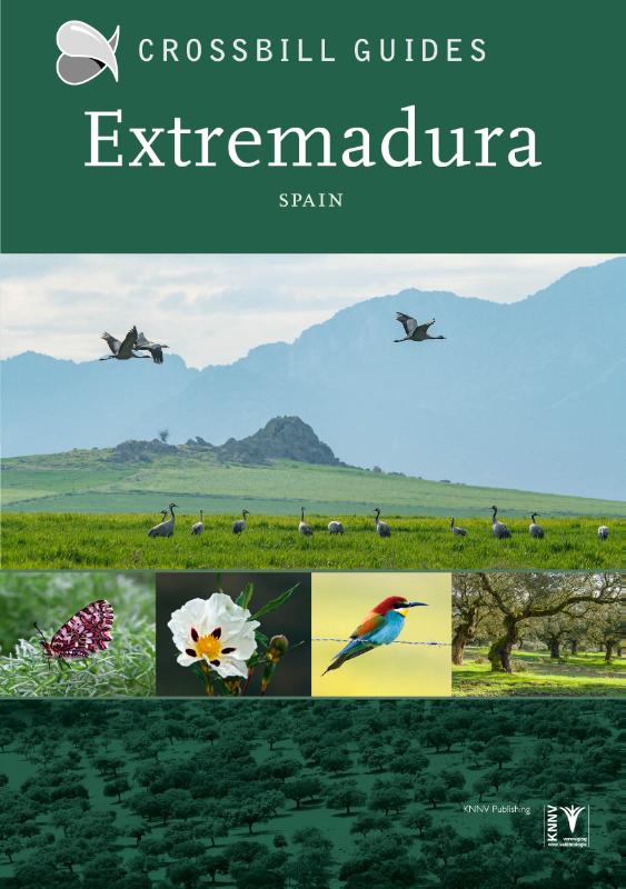
Extremadura
Beschrijving
Kaart

Paden in deze regio
Links
Feiten
Verslagen
Gidsen en kaarten
Overnachting
Organisaties
Reisorganisaties
GPS
Anders
Boeken
De Zwerver
Netherlands
2017
Netherlands
2017
De Zwerver
Netherlands
2019
Netherlands
2019
De Zwerver
Netherlands
2023
Netherlands
2023
Bol.com
Netherlands
Netherlands
- Via de la Plata - der Jakobsweg
- Die Via de la Plata ist die zweite große Pilgerroute Spaniens - und die große Alternative zum Camino Francés. Der über 1000 Kilometer lange Weg durch Andalusien, die Extremadura, Kastilien und Galizien bis nach Santiago entfaltet die ganze landschaftliche und kulturelle Schönheit Spaniens und ermöglicht auch heute noch ursprüngliche... Read more
- Also available from:
- Bol.com, Belgium
Bol.com
Belgium
Belgium
- Via de la Plata - der Jakobsweg
- Die Via de la Plata ist die zweite große Pilgerroute Spaniens - und die große Alternative zum Camino Francés. Der über 1000 Kilometer lange Weg durch Andalusien, die Extremadura, Kastilien und Galizien bis nach Santiago entfaltet die ganze landschaftliche und kulturelle Schönheit Spaniens und ermöglicht auch heute noch ursprüngliche... Read more
Bol.com
Netherlands
Netherlands
- Where to Watch Birds in Southern and Western Spain
- Southern Iberia is in the top rank of European birding hotspots. The third edition of this popular book, first published in 1994, continues to ensure that visitors can make the most of the region's many attractions. Regular visits have brought the information on all sites up-to-date: maps, access details and species lists have received... Read more
- Also available from:
- Bol.com, Belgium
Bol.com
Belgium
Belgium
- Where to Watch Birds in Southern and Western Spain
- Southern Iberia is in the top rank of European birding hotspots. The third edition of this popular book, first published in 1994, continues to ensure that visitors can make the most of the region's many attractions. Regular visits have brought the information on all sites up-to-date: maps, access details and species lists have received... Read more
Bol.com
Netherlands
Netherlands
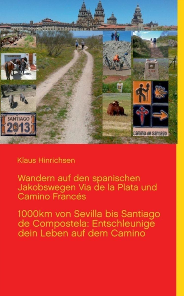
- Wandern Auf Den Spanischen Jakobswegen Via de La Plata Und Camino Frances
- Neben den ausf hrlichen Tagesberichten ber das Erlebte auf der Via de la Plata und dem Camino Frances war es mein erkl rtes Ziel, den Pilgerfreunden einen Wanderf hrer mit allen notwendigen Informationen in kompakter Weise zur Hand zu geben, damit der Weg zu einem unbeschwerten, unvergleichlichen Erlebnis wird. Dieser Ratgeber und... Read more
- Also available from:
- Bol.com, Belgium
Bol.com
Belgium
Belgium
- Wandern Auf Den Spanischen Jakobswegen Via de La Plata Und Camino Frances
- Neben den ausf hrlichen Tagesberichten ber das Erlebte auf der Via de la Plata und dem Camino Frances war es mein erkl rtes Ziel, den Pilgerfreunden einen Wanderf hrer mit allen notwendigen Informationen in kompakter Weise zur Hand zu geben, damit der Weg zu einem unbeschwerten, unvergleichlichen Erlebnis wird. Dieser Ratgeber und... Read more
Bol.com
Netherlands
Netherlands
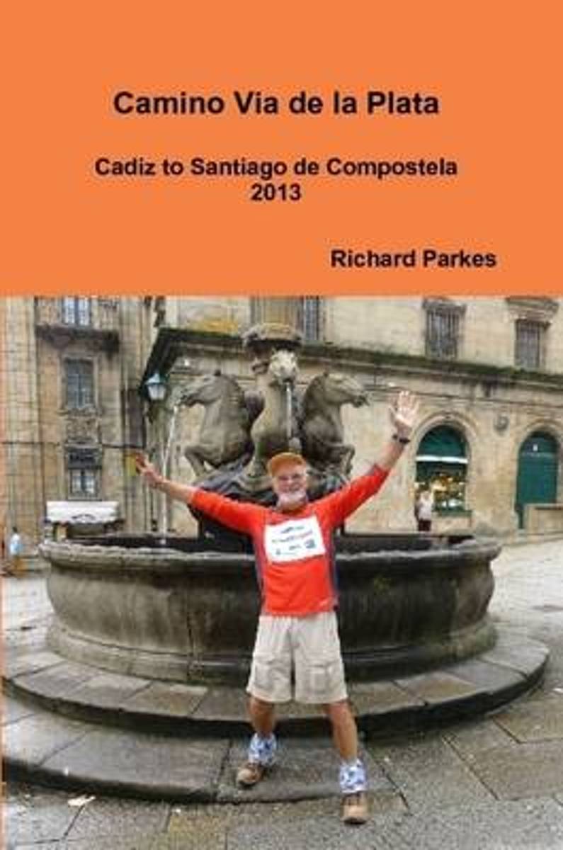
- Camino via De La Plata
- Story and guide of my journey from Cadiz to Santiago de Compostela on the Camino Via de la Plata. Includes personal reflections,some details of the history and the importance of this route to the Romans. This walk was used to collect donations towards prostate cancer research. Read more
- Also available from:
- Bol.com, Belgium
Bol.com
Belgium
Belgium
- Camino via De La Plata
- Story and guide of my journey from Cadiz to Santiago de Compostela on the Camino Via de la Plata. Includes personal reflections,some details of the history and the importance of this route to the Romans. This walk was used to collect donations towards prostate cancer research. Read more
De Zwerver
Netherlands
2017
Netherlands
2017
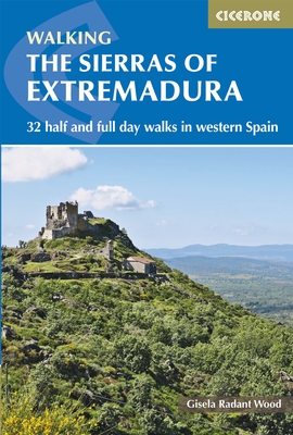
- Wandelgids The Sierras of Extremadura | Cicerone
- Guidebook to Extremadura, one of Spain's most unspoilt regions, comprising the provinces of Caceres and Badajoz. 32 mainly circular walks (6 to 19km) explore Sierras, rolling hills and oak forests criss-crossed by thousands of kilometres of ancient paths. Includes the Jerte Valley, the hill town of Montánchez, Guadalupe and Monesterio. Read more
- Also available from:
- Bol.com, Netherlands
- Bol.com, Belgium
- Stanfords, United Kingdom
- The Book Depository, United Kingdom

Bol.com
Netherlands
2017
Netherlands
2017
- The Sierras of Extremadura
- This guidebook showcases 32 walks exploring the sierras of Caceres and Badajoz, one of Spain's least known regions and a gem for walkers and nature lovers. Walks range in length from 6 to 20km are suitable for any reasonably fit walker. They can be done from a number of bases in the area including San Martin de Trevejo, Gata, Hervas, Jerte,... Read more
Bol.com
Belgium
2017
Belgium
2017
- The Sierras of Extremadura
- This guidebook showcases 32 walks exploring the sierras of Caceres and Badajoz, one of Spain's least known regions and a gem for walkers and nature lovers. Walks range in length from 6 to 20km are suitable for any reasonably fit walker. They can be done from a number of bases in the area including San Martin de Trevejo, Gata, Hervas, Jerte,... Read more

Stanfords
United Kingdom
2017
United Kingdom
2017
- The Sierras of Extremadura: 32 half and full day walks in western Spain`s hills
- This guidebook showcases 32 walks exploring the sierras of Caceres and Badajoz, one of Spain`s least known regions and a gem for walkers and nature lovers. Walks range in length from 6 to 20km are suitable for any reasonably fit walker. They can be done from a number of bases in the area including San Martin de Trevejo, Gata, Hervas, Jerte,... Read more

The Book Depository
United Kingdom
2017
United Kingdom
2017
- The Sierras of Extremadura
- 32 half and full-day walks in western Spain's hills Read more
Kaarten

De Zwerver
Netherlands
Netherlands
- Pelgrimsroute (kaart) - Wandelkaart Camino de Santiago in Spanje | CNIG - Instituto Geográfico Nacional
- All roads leading to Santiago de Compostela in the Iberian Peninsula are represented on this Caminos de Santiago / The Way of St. James Map. Routes highlighted on a physical map of the Iberian Peninsula at 1:1,250,000 from IGN/CNIG, Spain civilian topographic survey organization. The base map with altitude colouring and relief shading provides... Read more
- Also available from:
- Stanfords, United Kingdom

Stanfords
United Kingdom
United Kingdom
- Caminos de Santiago / Ways of St. James on the Iberian Peninsula CNIG Overview Map
- All roads leading to Santiago de Compostela in the Iberian Peninsula are represented on this Caminos de Santiago / The Way of St. James Map. Routes highlighted on a physical map of the Iberian Peninsula at 1:1,250,000 from IGN/CNIG, Spain civilian topographic survey organization. The base map with altitude colouring and relief shading provides... Read more
De Zwerver
Netherlands
Netherlands
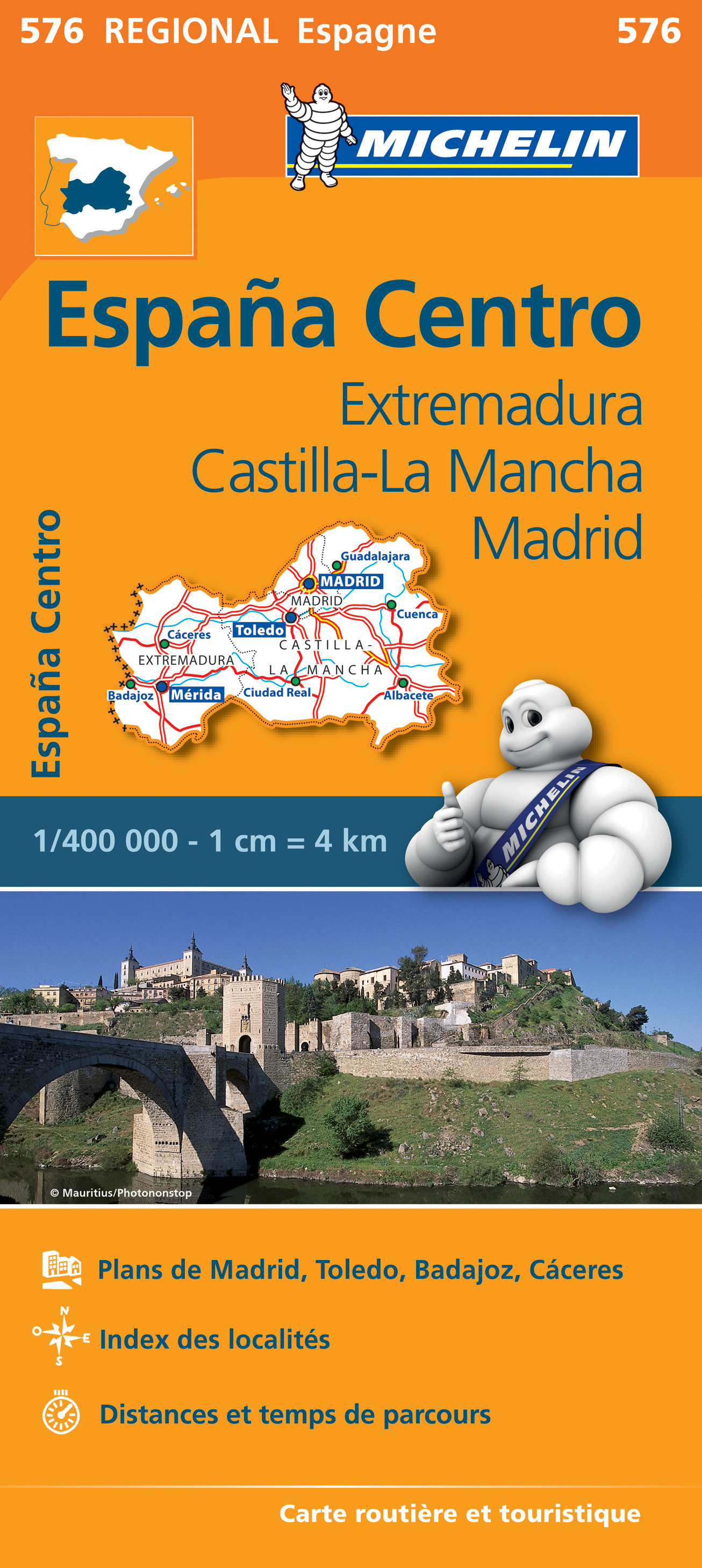
- Wegenkaart - landkaart 576 Extremadura - Castilla La Mancha - Madrid - Toledo - Mérida | Michelin
- Une carte fiable pour parcourir les régions d'Europe Read more
De Zwerver
Netherlands
2021
Netherlands
2021

Stanfords
United Kingdom
United Kingdom
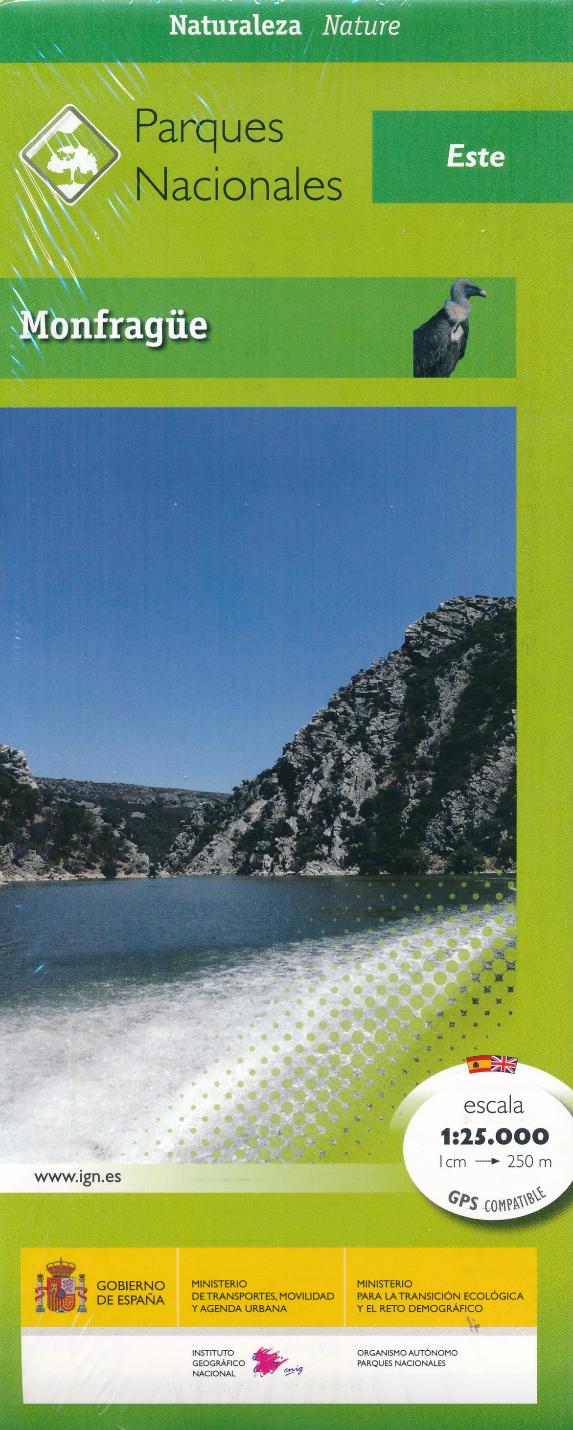
- Sierra Norte Natural Park CNIG Map
- Sierra Norte, directly north of Seville on the border with the Extremadura region, on a contoured and GPS compatible map at 1:100,000 from IGN/CNIG with cartography from their topographic survey of Spain. The map has contours at 50m intervals enhanced by bold relief shading with colouring and graphics to show different types of vegetation, and... Read more

Stanfords
United Kingdom
United Kingdom
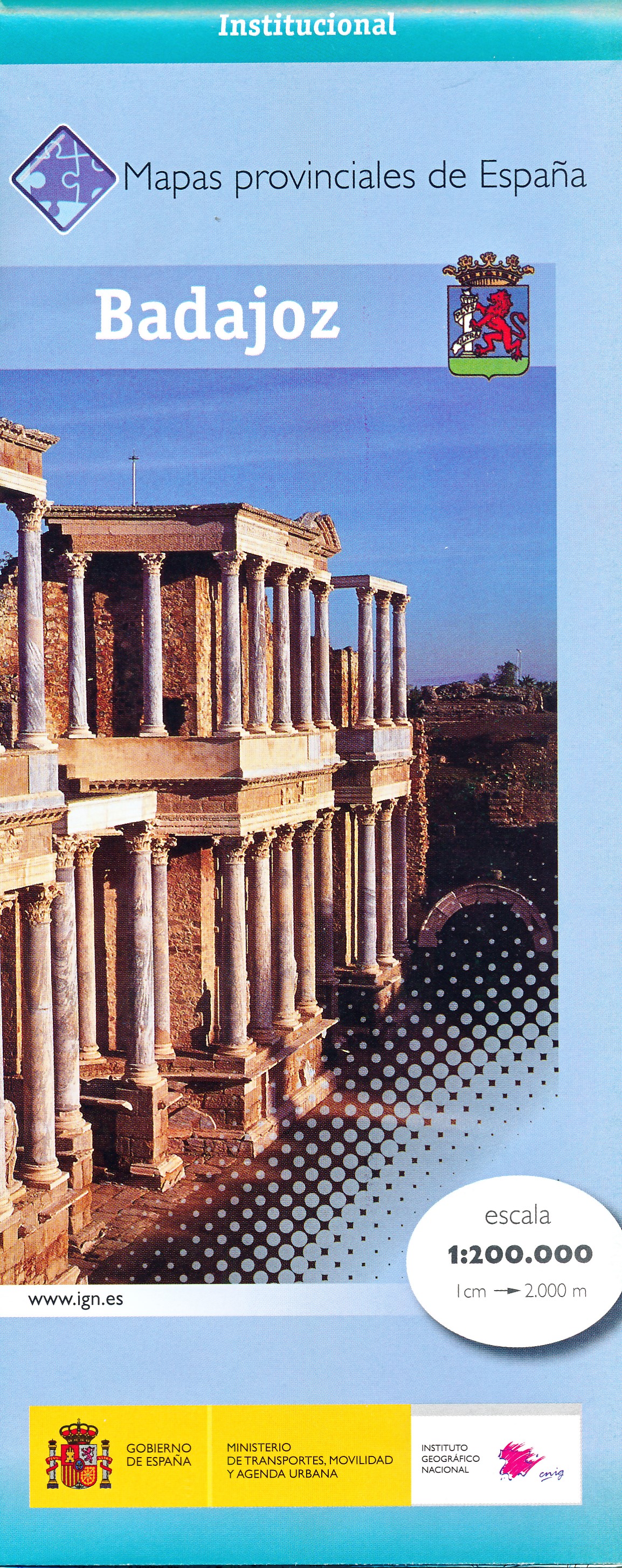
- Extremadura: Badajoz - Toledo - Córdoba 500K CNIG Regional Map No. 8
- The south-western part of central Spain between the Portuguese border and Toledo, Ciudad Real and Córdoba, at 1:500,000 in a series of regional road maps from the country’s civilian survey organization IGN-CNIG (Instituto Geográfico Nacional - Centro Nacional de Información Geográfica), vividly presenting the topography by altitude colouring,... Read more

Stanfords
United Kingdom
United Kingdom
- Extremadura Auotomous Community CNIG Physical Road Map
- Extremadura Autonomous Region of Spain at 1:300,000 in a series of physical road maps from IGN/CNIG - the country’s civilian survey organization, with an excellent presentation of the topography through relief shading and altitude colouring, plenty of names of mountain ranges, peaks, etcRelief shading is enhanced by bright altitude colouring,... Read more

Stanfords
United Kingdom
United Kingdom
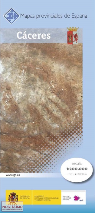
- Cáceres Province 200K CNIG Map Np. 11
- Contoured, GPS-compatible, indexed road map at 1:200,000 from CNIG - Spain’s civilian survey organization, with exceptionally informative presentation of the landscape and highlighting for facilities and places of interest including campsites and paradors.Maps in CNIG’s 200K Provincial Series provide an excellent picture the topography through... Read more

Stanfords
United Kingdom
United Kingdom
- Badajoz Province 200K CNIG Map No. 7
- Contoured, GPS-compatible, indexed road map at 1:200,000 from CNIG - Spain’s civilian survey organization, with exceptionally informative presentation of the landscape and highlighting for facilities and places of interest including campsites and paradors.Maps in CNIG’s 200K Provincial Series provide an excellent picture the topography through... Read more