
Three Peaks
Beschrijving
The "Three Peaks" refer to the highest peaks in Scotland, England and Wales. The Three Peaks challenge involves climbing Snowdon, Scafell Pike and Ben Nevis, in under 24 hours.
Links
Feiten
Verslagen
Gidsen en kaarten
Overnachting
Organisaties
Reisorganisaties
GPS
Anders
Boeken
De Zwerver
Netherlands
2022
Netherlands
2022
De Zwerver
Netherlands
2024
Netherlands
2024
De Zwerver
Netherlands
2018
Netherlands
2018
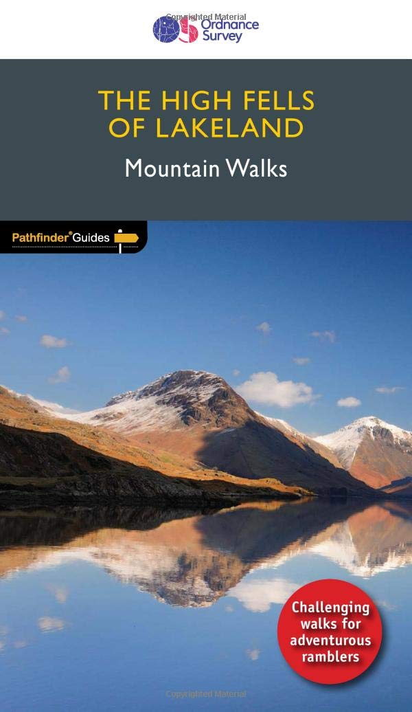
- Wandelgids 71 Pathfinder Guides The High Fells of Lakeland | Ordnance Survey
- Are you planning a holiday to the Lake District? Do you enjoy a hill-walking challenge with impressive mountain-top views? Inside Pathfinder (R) Guide to the High Fells of Lakeland are 20 majestic and challenging fell walks amid the glorious scenery of the Lake District mountains with clear and easy-to-follow route directions compiled from the... Read more
- Also available from:
- Stanfords, United Kingdom

Stanfords
United Kingdom
2018
United Kingdom
2018
- The High Fells of Lakeland
- Are you planning a holiday to the Lake District? Do you enjoy a hill-walking challenge with impressive mountain-top views? Inside Pathfinder (R) Guide to the High Fells of Lakeland are 20 majestic and challenging fell walks amid the glorious scenery of the Lake District mountains with clear and easy-to-follow route directions compiled from the... Read more
De Zwerver
Netherlands
2015
Netherlands
2015
- Also available from:
- Stanfords, United Kingdom

Stanfords
United Kingdom
2015
United Kingdom
2015
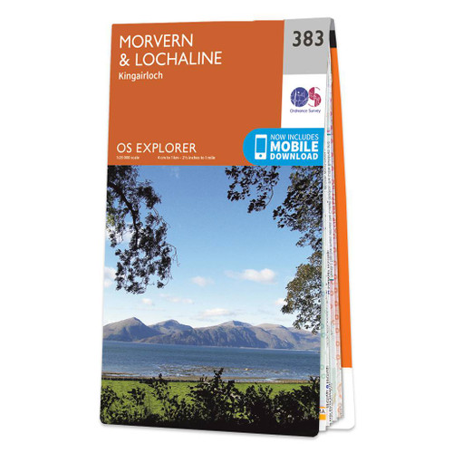
- Morvern & Lochaline - Kingairloch OS Explorer Map 383 (paper)
- Morvern, Lochaline and Kingairloch area on a detailed topographic and GPS compatible map No. 383, paper version, from the Ordnance Survey’s 1:25,000 Explorer series. MOBILE DOWNLOADS: this title and all the other OS Explorer maps include a code for downloading after purchase the digital version onto your smartphone or tablet for viewing on the... Read more
De Zwerver
Netherlands
Netherlands
- Also available from:
- Stanfords, United Kingdom

Stanfords
United Kingdom
United Kingdom
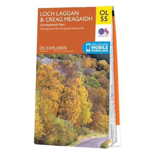
- Loch Laggan & Creag Meagaidh - Corrieyairick Pass OS Explorer Map OL55 (paper)
- Loch Laggan and Creag Meagaidh area of the Scottish Highlands on a detailed topographic and GPS compatible map OL55, paper version, from the Ordnance Survey’s 1:25,000 Explorer series. Coverage includes a section of the Cairngorms National Park, the Corrieyairack Pass and Forest, six Munro peaks including Cael Charn and Carn Liath, Badenoch,... Read more
- Also available from:
- Stanfords, United Kingdom

Stanfords
United Kingdom
2016
United Kingdom
2016
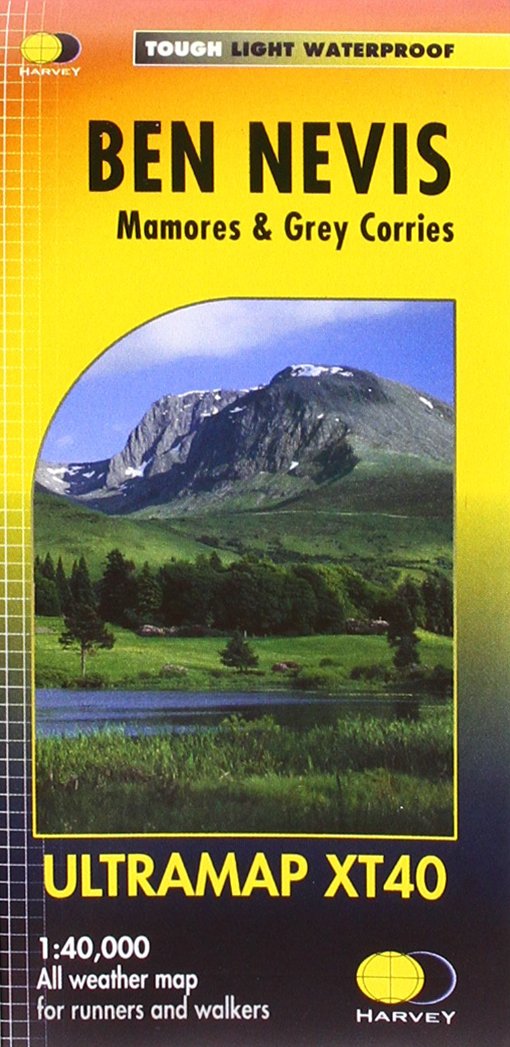
- Ben Nevis - Mamores & Grey Corries Harvey Ultramap XT40
- Ben Nevis with the Mamores and Grey Corries ranges at 1:40,000 on a waterproof and tear-resistant, pocket-size Ultramap from Harvey Map Services with the same cartography as their Superwalker map of this area. The peak of Ben Nevis is also shown in greater detail at 1:20,000. The map divides the area north/south, with a good overlap between the... Read more
Bol.com
Netherlands
Netherlands
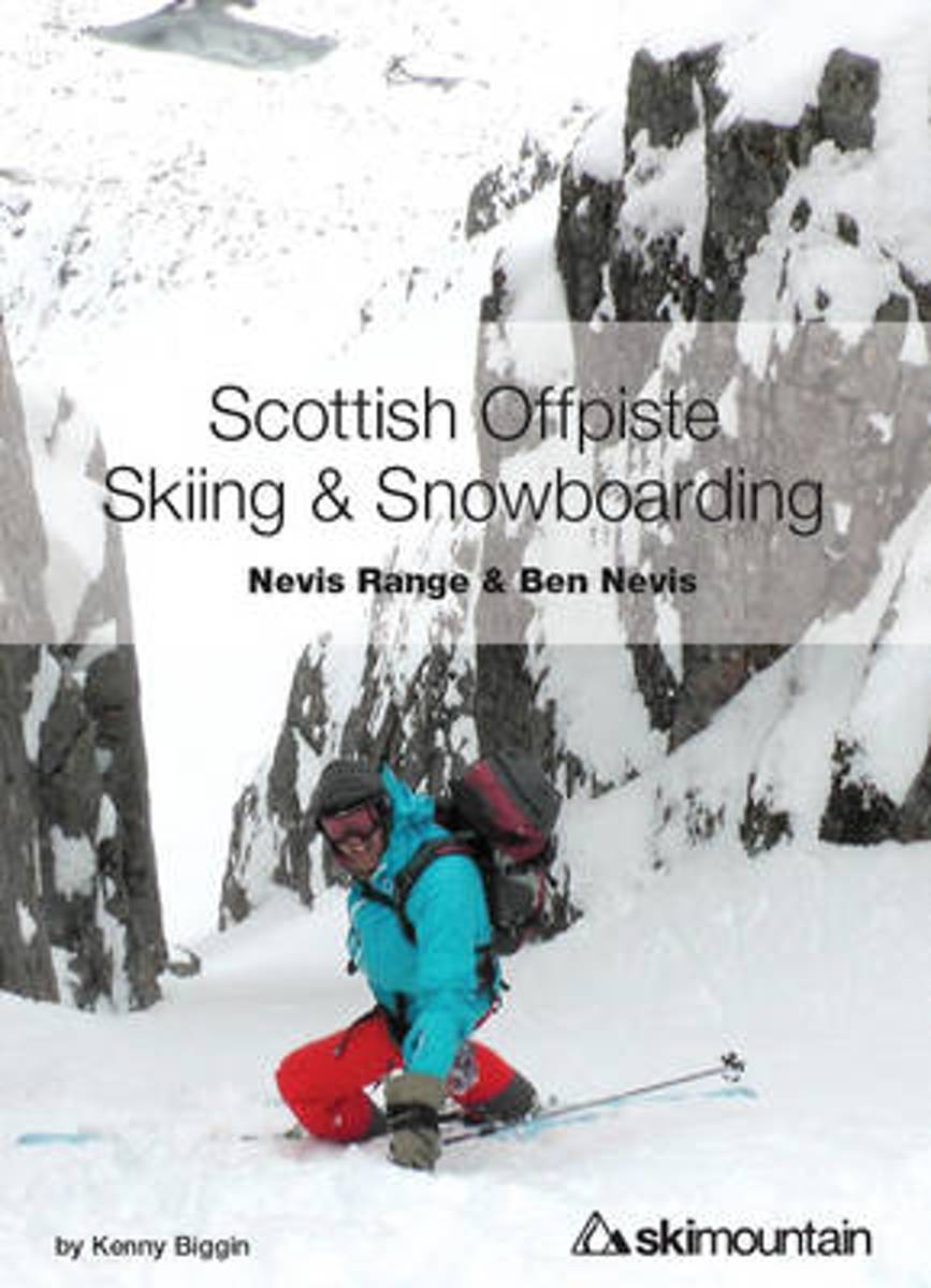
- Scottish Offpiste Skiing & Snowboarding
- The second in the Scottish Offpiste guidebook series, this colourful book focuses on the incredible mountains of Glencoe centred around the historic White Corries ski area. 93 routes, 230 pages, 210 full colour photos and diagrams - plus a completely new section on avalanche and mountain safety and decision making.This offpiste skiing and... Read more
- Also available from:
- Bol.com, Belgium
Bol.com
Belgium
Belgium
- Scottish Offpiste Skiing & Snowboarding
- The second in the Scottish Offpiste guidebook series, this colourful book focuses on the incredible mountains of Glencoe centred around the historic White Corries ski area. 93 routes, 230 pages, 210 full colour photos and diagrams - plus a completely new section on avalanche and mountain safety and decision making.This offpiste skiing and... Read more
De Zwerver
Netherlands
2019
Netherlands
2019
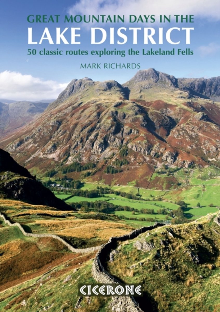
- Wandelgids Great Mountain Days in the Lake District | Cicerone
- An inspirational guidebook to 50 challenging walks on the high fells of the Lake District. The graded circular routes, between 4 and 14 miles in length, cover classic Lakeland summits like Fairfield, Scafell Pike, Great Gable and Blencathra, to the lesser-known High Spy, King's How and Brund Fell. Read more
- Also available from:
- Bol.com, Netherlands
- Bol.com, Belgium
- Stanfords, United Kingdom
- The Book Depository, United Kingdom
Bol.com
Netherlands
2013
Netherlands
2013
- Great Mountain Days in the Lake District
- An inspirational guidebook to 50 memorable walks through the high fells of the Lake District. From the favourite summits of Scafell, Bowfell, Great Gable, the Crinkle Crags, to lesser-known fells, this guide offers only the best walks to explore all that is pure Lakeland. Some of the 50 walks described in is this larger format book are well... Read more
Bol.com
Belgium
2013
Belgium
2013
- Great Mountain Days in the Lake District
- An inspirational guidebook to 50 memorable walks through the high fells of the Lake District. From the favourite summits of Scafell, Bowfell, Great Gable, the Crinkle Crags, to lesser-known fells, this guide offers only the best walks to explore all that is pure Lakeland. Some of the 50 walks described in is this larger format book are well... Read more

Stanfords
United Kingdom
2013
United Kingdom
2013
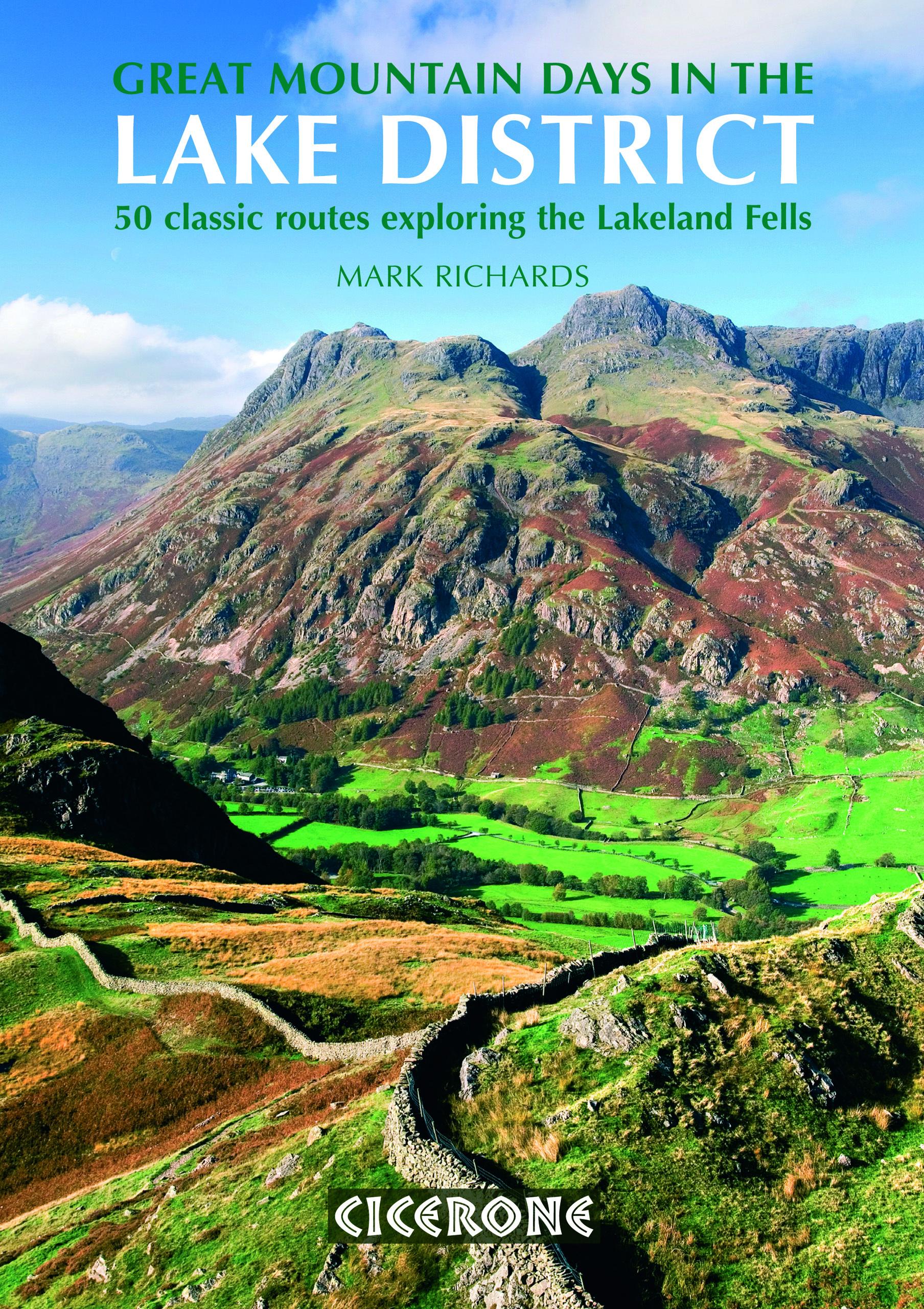
- Lake District Great Mountain Days: 50 Classic Routes for Exploring the Lakeland Fells
- Great Mountain Days in the Lake District is Mark Richards’ large format Cicerone guide exploring the classic routes of the Lakeland Fells. The guide is both practical and inspirational in providing details of 50 diverse expeditions on the high fells. Memorable mountain walks that are covered include routes up Scafell Pike, Bowfell, Blencathra... Read more

The Book Depository
United Kingdom
2013
United Kingdom
2013
- Great Mountain Days in the Lake District
- 50 classic routes exploring the Lakeland Fells Read more
Bol.com
Netherlands
Netherlands
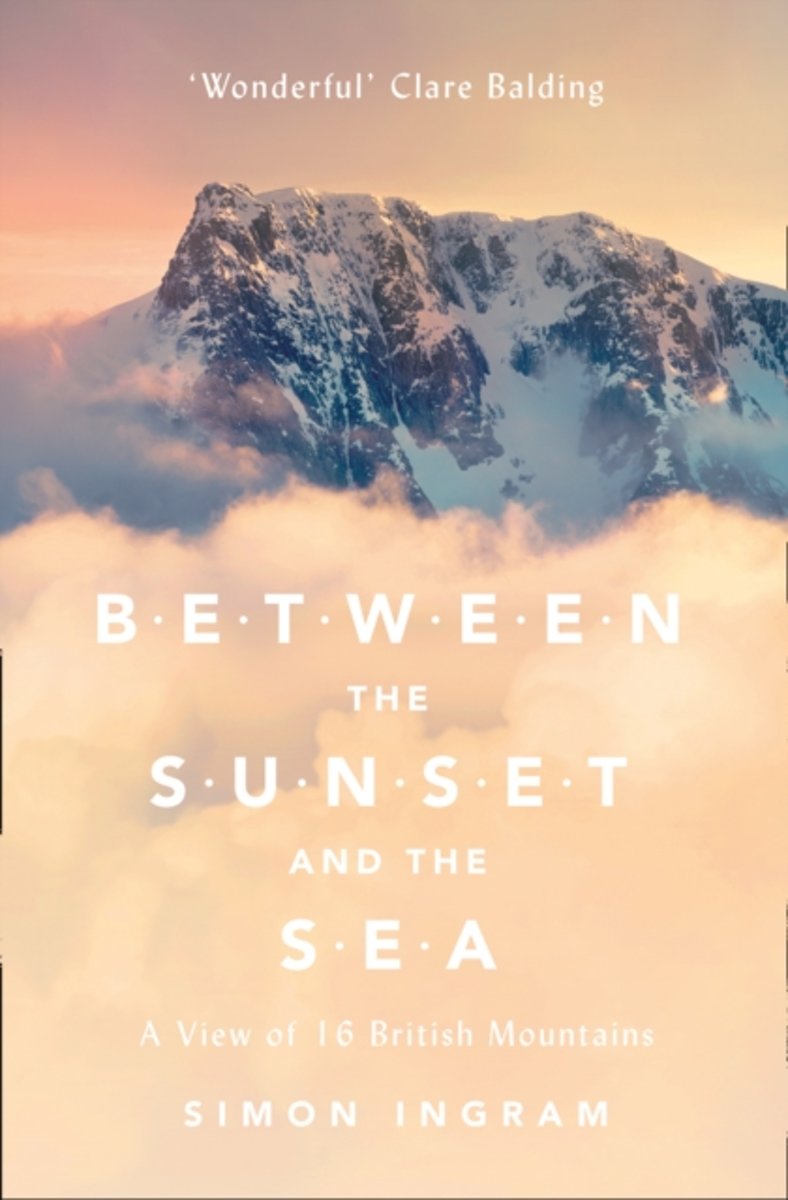
- Between the Sunset and the Sea
- Simon Ingram takes us high into Britain's most forbidding and astonishing wild places through all the seasons of the year - from the first blush of spring to the darkest bite of the mountain winter.In the late 18th century, mountains shifted from being universally reviled to becoming the most inspiring things on earth. Simply put, the monsters... Read more
- Also available from:
- Bol.com, Belgium
- The Book Depository, United Kingdom
Bol.com
Belgium
Belgium
- Between the Sunset and the Sea
- Simon Ingram takes us high into Britain's most forbidding and astonishing wild places through all the seasons of the year - from the first blush of spring to the darkest bite of the mountain winter.In the late 18th century, mountains shifted from being universally reviled to becoming the most inspiring things on earth. Simply put, the monsters... Read more

The Book Depository
United Kingdom
United Kingdom
- Between the Sunset and the Sea
- A View of 16 British Mountains Read more
De Zwerver
Netherlands
2018
Netherlands
2018
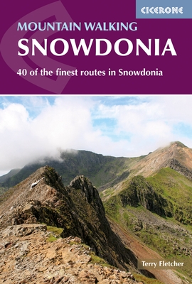
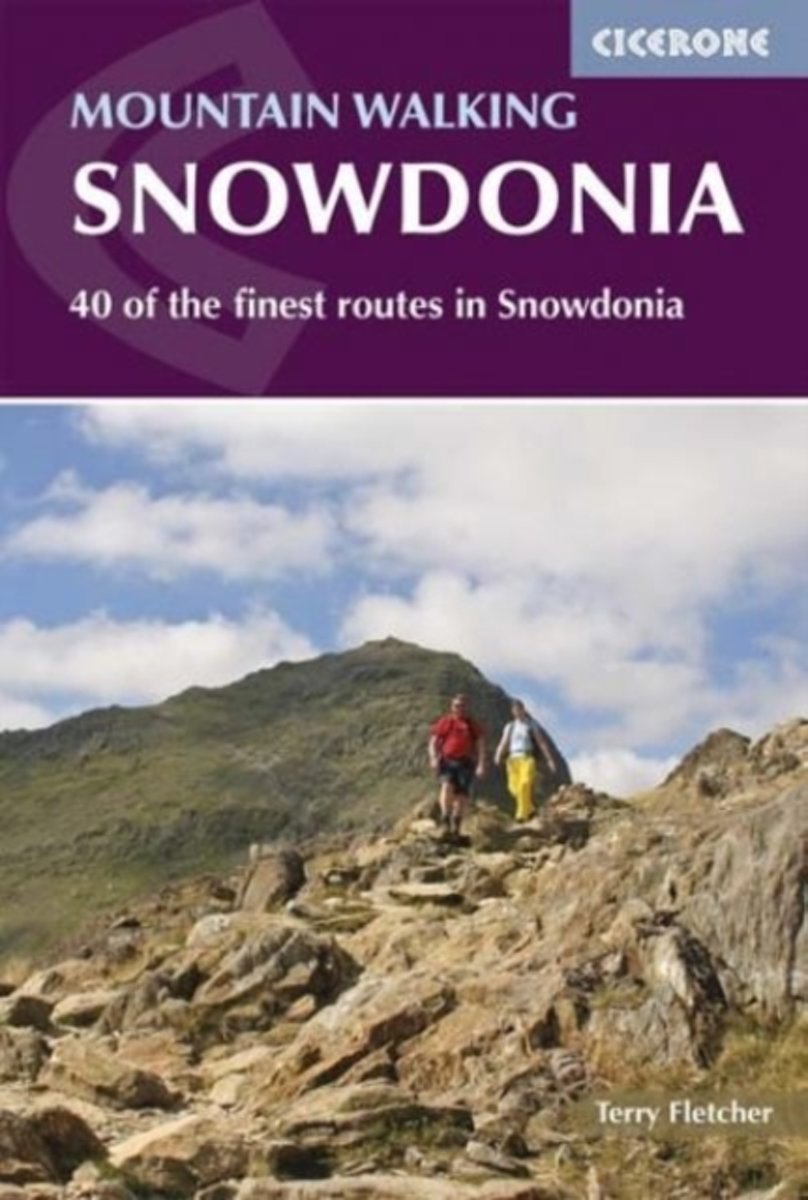
- Wandelgids Mountain walking Snowdonia | Cicerone
- Guidebook to 40 of Snowdonia's best day walks, with routes up Snowdon and Tryfan, including the Snowdon Horseshoe, Cadair Idris, Y Garn and The Rhinogs. The routes range from Grade 1 scrambles like Crib Goch or Bristly Ridge, to riverside and forest walks. Includes details of a two day traverse of all 15 of Snowdonia's 3000ft peaks. Read more
- Also available from:
- Bol.com, Netherlands
- Bol.com, Belgium
- Stanfords, United Kingdom
- The Book Depository, United Kingdom
Bol.com
Netherlands
2016
Netherlands
2016
- Mountain walking in Snowdonia
- This guidebook describes 40 day walks exploring Snowdonia. It showcases some of the best mountain walks in the area, with routes up Snowdon and Tryfan alongside other classic peaks like Y Garn, Cadair Idris and the Glyders. Routes are graded easy to strenuous and include airy and pulse-quickening scrambles such as Crib Goch and Bristly Ridge as... Read more
Bol.com
Belgium
2016
Belgium
2016
- Mountain walking in Snowdonia
- This guidebook describes 40 day walks exploring Snowdonia. It showcases some of the best mountain walks in the area, with routes up Snowdon and Tryfan alongside other classic peaks like Y Garn, Cadair Idris and the Glyders. Routes are graded easy to strenuous and include airy and pulse-quickening scrambles such as Crib Goch and Bristly Ridge as... Read more

Stanfords
United Kingdom
2016
United Kingdom
2016
- Mountain Walking in Snowdonia: 40 Finest Routes in Snowdonia
- This guidebook describes 40 day walks exploring Snowdonia. It showcases some of the best mountain walks in the area, with routes up Snowdon and Tryfan alongside other classic peaks like Y Garn, Cadair Idris and the Glyders. Routes are graded easy to strenuous and include airy and pulse-quickening scrambles such as Crib Goch and Bristly Ridge as... Read more

The Book Depository
United Kingdom
2016
United Kingdom
2016
- Mountain Walking in Snowdonia
- 40 of the finest routes in Snowdonia Read more
Bol.com
Netherlands
2017
Netherlands
2017
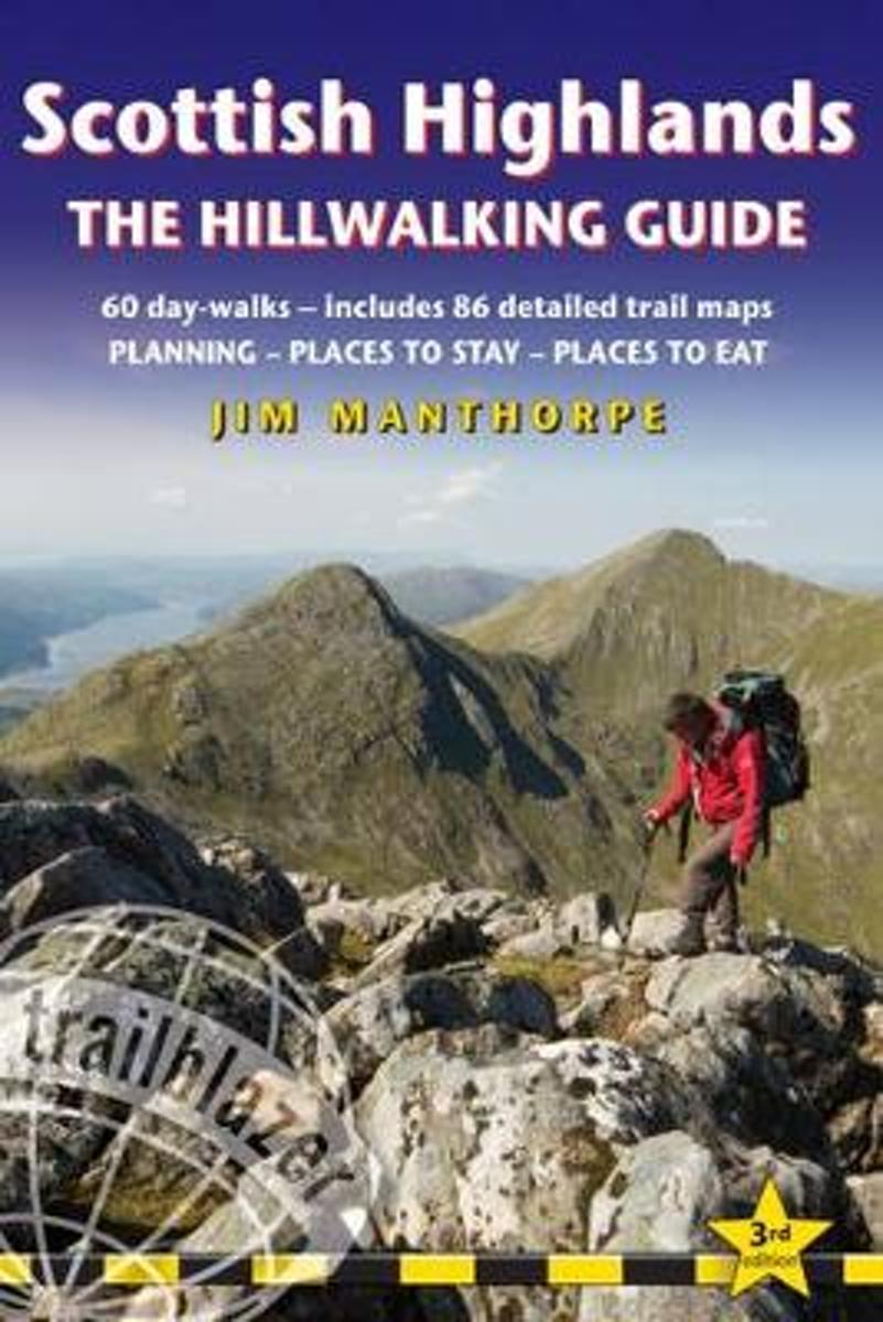
- Scottish Highlands - the Hillwalking Guide
- Practical walking guide to over 80 hills in the Scottish Highlands & Islands. Covers hill walks, monros, corbetts & tracks including Ben Nevis & Cairngorm walks. Includes 86 walking maps; places to stay, places to eat, points of interest; 60 day-walks; guides to 62 gateway towns and villages; public transport information. Read more
- Also available from:
- Bol.com, Belgium
- Stanfords, United Kingdom
Bol.com
Belgium
2017
Belgium
2017
- Scottish Highlands - the Hillwalking Guide
- Practical walking guide to over 80 hills in the Scottish Highlands & Islands. Covers hill walks, monros, corbetts & tracks including Ben Nevis & Cairngorm walks. Includes 86 walking maps; places to stay, places to eat, points of interest; 60 day-walks; guides to 62 gateway towns and villages; public transport information. Read more

Stanfords
United Kingdom
2017
United Kingdom
2017
- Scottish Highlands - the Hillwalking Guide
- Practical walking guide to over 80 hills in the Scottish Highlands and Islands. This Scottish hill-walking book covers Scottish hill walks, monros, corbetts and tracks including Ben Nevis walking guide and Cairngorm walks. Includes 86 detailed walking maps: walking times, directions, tricky junctions, places to stay, places to eat, points of... Read more
Bol.com
Netherlands
2011
Netherlands
2011
- Hillwalking in Wales - Vol 2
- The second book in a two-volume series describing walking routes up every 2000-footer in Wales - all 166 of them. The result is not just a guide to the mountains of Snowdonia, but a handbook of over 450 routes covering 21 Welsh mountain ranges - the whale-backed ridges of the Black Mountains, the Brecon Beacons' precipitous escarpments, the... Read more
- Also available from:
- Bol.com, Belgium
- Stanfords, United Kingdom
- The Book Depository, United Kingdom
Bol.com
Belgium
2011
Belgium
2011
- Hillwalking in Wales - Vol 2
- The second book in a two-volume series describing walking routes up every 2000-footer in Wales - all 166 of them. The result is not just a guide to the mountains of Snowdonia, but a handbook of over 450 routes covering 21 Welsh mountain ranges - the whale-backed ridges of the Black Mountains, the Brecon Beacons' precipitous escarpments, the... Read more

Stanfords
United Kingdom
2011
United Kingdom
2011
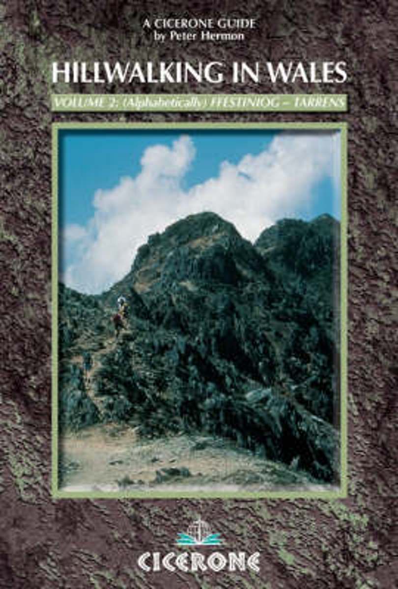
- Wales Hill Walking - Volume 2 - Ffestiniog Hills - Tarrens
- Hill Walking in Wales Volume 2 is part of an alphabetically arranged, two-book series of Peter Hermon’s Cicerone guides describing walking routes up every single 2000-footer in Wales. This volume covers the many hills of South Wales, taking in the Ffestiniog hills, Fforest Fawr, Glyders, Hirnants, Mynydd Du, Nantlle/Hebog hills, Plynlimon,... Read more

The Book Depository
United Kingdom
2011
United Kingdom
2011
- Hillwalking in Wales - Vol 2
- The second of two guidebooks describing walking routes up every 2000-footer in Wales - covers the Ffestiniog hills to the Tarrens. The routes are arranged alphabetically over the two volumes. Vol 2 Read more
Bol.com
Netherlands
Netherlands
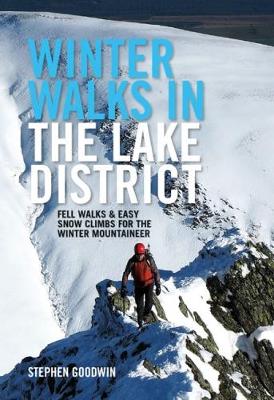
- Winter Walks in the Lake District
- Winter Walks in the Lake District is a collection of enjoyable walks and easy winter climbs designed to make the most of the winter conditions that regularly descend on the Lake District. Local author Stephen Goodwin has selected his favourite cold-weather outings, which all share the magic and exhilaration that snow or even a hoar frost brings... Read more
- Also available from:
- Bol.com, Belgium
- Stanfords, United Kingdom
Bol.com
Belgium
Belgium
- Winter Walks in the Lake District
- Winter Walks in the Lake District is a collection of enjoyable walks and easy winter climbs designed to make the most of the winter conditions that regularly descend on the Lake District. Local author Stephen Goodwin has selected his favourite cold-weather outings, which all share the magic and exhilaration that snow or even a hoar frost brings... Read more

Stanfords
United Kingdom
United Kingdom
- Winter Walks in the Lake District: Fell walks & easy snow climbs for the winter mountaineer
- Winter Walks in the Lake District is a collection of enjoyable walks and easy winter climbs designed to make the most of the winter conditions that regularly descend on the Lake District. Local author Stephen Goodwin has selected his favourite cold-weather outings, which all share the magic and exhilaration that snow or even a hoar frost brings... Read more
Bol.com
Netherlands
Netherlands
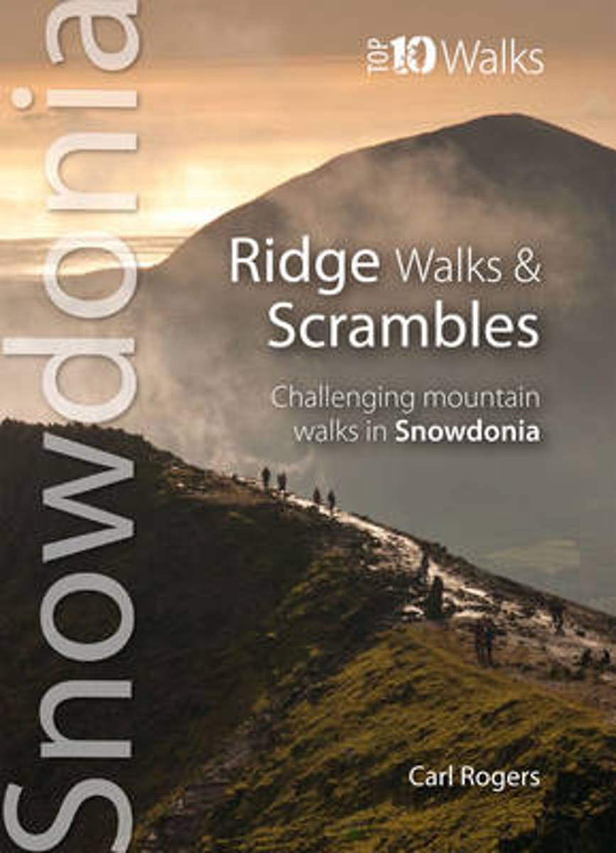
- Ridge Walks & Scrambles
- This attractive and cleverly structured guide gives walkers ten of the finest challenging walks and scrambles on the high mountains of the Snowdonia National Park in a popular pocketable format. With clear information, an introduction for each walk, expertly written numbered directions, large scale Ordnance Survey maps, eye-grabbing panoramic... Read more
- Also available from:
- Bol.com, Belgium
- Stanfords, United Kingdom
- The Book Depository, United Kingdom
Bol.com
Belgium
Belgium
- Ridge Walks & Scrambles
- This attractive and cleverly structured guide gives walkers ten of the finest challenging walks and scrambles on the high mountains of the Snowdonia National Park in a popular pocketable format. With clear information, an introduction for each walk, expertly written numbered directions, large scale Ordnance Survey maps, eye-grabbing panoramic... Read more

Stanfords
United Kingdom
United Kingdom
- Ridge Walks & Scrambles: Challenging Mountain Walks in Snowdonia
- This attractive and cleverly structured guide gives walkers ten of the finest challenging walks and scrambles on the high mountains of the Snowdonia National Park in a popular pocketable format. With clear information, an introduction for each walk, expertly written numbered directions, large scale Ordnance Survey maps, eye-grabbing panoramic... Read more

The Book Depository
United Kingdom
United Kingdom
- Ridge Walks & Scrambles
- Challenging Mountain Walks in Snowdonia Read more
Bol.com
Netherlands
Netherlands
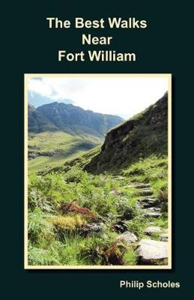
- The Best Walks Near Fort William
- From easy walks to big days out, low level and mountainous; this guide presents a small selection of popular routes near to Fort William. The Abstracts section allows a quick and easy way to find a suitable walk. The route descriptions are to-the-point, don't waffle and have diagrams. The contents are chosen to answer the following frequently... Read more
- Also available from:
- Bol.com, Belgium
Bol.com
Belgium
Belgium
- The Best Walks Near Fort William
- From easy walks to big days out, low level and mountainous; this guide presents a small selection of popular routes near to Fort William. The Abstracts section allows a quick and easy way to find a suitable walk. The route descriptions are to-the-point, don't waffle and have diagrams. The contents are chosen to answer the following frequently... Read more
Kaarten
De Zwerver
Netherlands
2021
Netherlands
2021
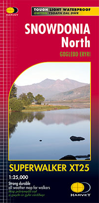
- Wandelkaart Snowdonia Noord /Snowdon,Glyders,Carnedds | Harvey Maps
- The northern part of Snowdonia with Snowdon and the Glyders and Carnedds peaks at 1:25,000 on a waterproof and tear-resistant map from Harvey Map Services in their Superwalker series. The map is double-sided with an overlap between the sides; coverage extends from west of Llanberis eastwards to Betws-y-Coed. Map legend and additional notes are... Read more
- Also available from:
- Stanfords, United Kingdom

Stanfords
United Kingdom
2021
United Kingdom
2021
- Snowdonia North Harvey Superwalker XT25
- The northern part of Snowdonia with Snowdon and the Glyders and Carnedds peaks at 1:25,000 on a light, waterproof and tear-resistant map from Harvey Map Services. The map is double-sided with an overlap between the sides; coverage extends from west of Llanberis eastwards to Betws-y-Coed. Map legend and additional notes are also in Welsh.PLEASE... Read more

De Zwerver
Netherlands
2022
Netherlands
2022
- Wandelkaart Ben Nevis | Harvey Maps
- Ben Nevis with the Mamores and Grey Corries ranges at 1:25,000 on a double-sided, waterproof and tear-resistant map from Harvey Map Services with the peak area shown in greater detail at 1:12,500. The map divides the area north/south, with a good overlap between the sides, extending from Fort William past Loch Treig to Chno Deang, plus south to... Read more
- Also available from:
- Stanfords, United Kingdom

Stanfords
United Kingdom
2022
United Kingdom
2022
- Ben Nevis - Mamores & Grey Corries Harvey Superwalker XT25
- Ben Nevis with the Mamores and Grey Corries ranges at 1:25,000 on a double-sided, waterproof and tear-resistant map from Harvey Map Services in their Superwalker series, with the peak area also shown in greater detail at 1:12,500. The map divides the area north/south, with a good overlap between the sides, extending from Fort William past Loch... Read more
De Zwerver
Netherlands
2021
Netherlands
2021
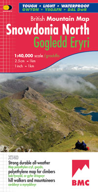
- Wandelkaart Snowdonia Noord | Harvey Maps
- Waterproof mountain map of Snowdonia from Harvey at 1:40,000, with a geological map of the region on the reverse, enlargements of Snowdon and Tryfan, and advice on navigating the region safely.MAIN MAP: Topography is shown through clear altitude shading, spot heights, contours at 15m intervals, and index contours at 75m intervals. A variety of... Read more
- Also available from:
- Stanfords, United Kingdom

Stanfords
United Kingdom
2021
United Kingdom
2021
- Snowdonia North / Gogledd Eryri Harvey British Mountain Map XT40
- Waterproof mountain map of Snowdonia North from Harvey at 1:40,000, with a geological map of the region on the reverse, enlargements of Snowdon and Tryfan, and advice on navigating the region safely.*MAIN MAP:* Topography is shown through clear altitude shading, spot heights, contours at 15m intervals, and index contours at 75m intervals. A... Read more

De Zwerver
Netherlands
2018
Netherlands
2018
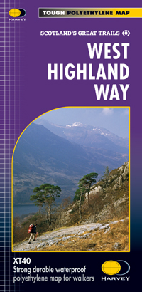
- Wandelkaart West Highland Way | Harvey Maps
- Wandelkaart van de West Highland Way met uitsnedes van de route. Leap forward in technical excellence. Tough, light and 100% wateproof. Compact and light - the map itself weighs just 60gms - a third of the weight of a laminated map, and much less bulky. And you can fold or refold it time and again, or stuff it in your back pocket and it... Read more
- Also available from:
- Bol.com, Netherlands
- Bol.com, Belgium
- Stanfords, United Kingdom

Bol.com
Netherlands
2018
Netherlands
2018
- West Highland Way XT40
- The West Highland Way is 96 miles (153 km) long and links Milngavie (Glasgow) to Fort William. It run's from Scotland's largest city to the foot of its highest mountain, Ben Nevis, through the Loch Lomond and Trossachs National Park.Detailed mapping, full legend in English, French and German. National Grid. Read more
Bol.com
Belgium
2018
Belgium
2018
- West Highland Way XT40
- The West Highland Way is 96 miles (153 km) long and links Milngavie (Glasgow) to Fort William. It run's from Scotland's largest city to the foot of its highest mountain, Ben Nevis, through the Loch Lomond and Trossachs National Park.Detailed mapping, full legend in English, French and German. National Grid. Read more
Stanfords
United Kingdom
2018
United Kingdom
2018
- West Highland Way Harvey National Trail XT40
- The West Highland Way, Scotland’s premier 153km / 96 miles long trail from Milngavie near Glasgow along Loch Lomond to Fort William presented at 1:40,000 on a light, waterproof and tear-resistant map from Harvey Map Services. The whole route is covered by nine overlapping panels, and the map includes small street plan of Milngavie, Tyndrum,... Read more

Bol.com
Netherlands
2014
Netherlands
2014
- Great Glen Way
- This guidebook (fully updated 2014) contains all you need to plan and enjoy a holiday walking or cycling along Scotland's historic Great Glen (77 miles/125 km). The Way runs between Fort William and Inverness, beside Scotland's highest mountain, along the historic Caledonian Canal and past beautiful lochs, including Loch Ness with its famous... Read more
- Also available from:
- Bol.com, Belgium
Bol.com
Belgium
2014
Belgium
2014
- Great Glen Way
- This guidebook (fully updated 2014) contains all you need to plan and enjoy a holiday walking or cycling along Scotland's historic Great Glen (77 miles/125 km). The Way runs between Fort William and Inverness, beside Scotland's highest mountain, along the historic Caledonian Canal and past beautiful lochs, including Loch Ness with its famous... Read more

Bol.com
Netherlands
Netherlands
- Wales Mountain Biking
- Wales Mountain Biking is the 12th title in Vertebrate Publishing's bestselling series of UK mountain biking guidebooks. This book showcases 20 routes in Wales, between 12km and 50km in length, suitable for all levels of mountain bikers. Split into three sections, South Wales, Mid Wales and North Wales, this book includes classic loops in the... Read more
- Also available from:
- Bol.com, Belgium
- Stanfords, United Kingdom
Bol.com
Belgium
Belgium
- Wales Mountain Biking
- Wales Mountain Biking is the 12th title in Vertebrate Publishing's bestselling series of UK mountain biking guidebooks. This book showcases 20 routes in Wales, between 12km and 50km in length, suitable for all levels of mountain bikers. Split into three sections, South Wales, Mid Wales and North Wales, this book includes classic loops in the... Read more

Stanfords
United Kingdom
United Kingdom
- Wales Mountain Biking
- Vertebrate’s guide to mountain biking in Wales covers 20 recommended mountain bike trails, routes and rides ranging from 12km to 50km. The routes themselves have been devised and tested by local riders to help you get the very best out of the Welsh trails.Each route is described with easy-to-follow instructions, information on difficulty,... Read more
Bol.com
Netherlands
Netherlands
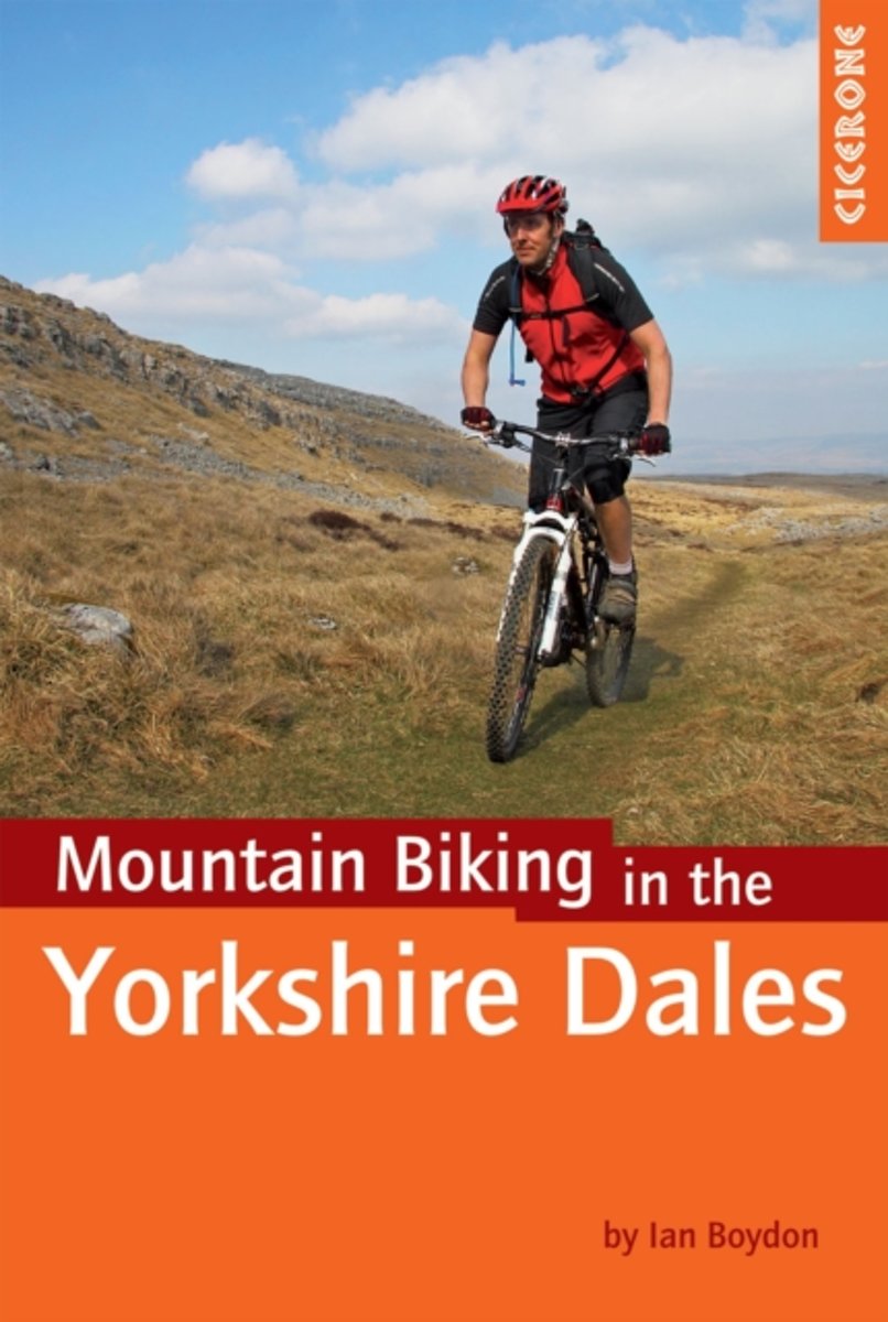
- Mountain Biking in the Yorkshire Dales
- A guidebook of 30 short, medium, long and full-day mountain bike routes across the Yorkshire Dales. The graded circular rides visit all the major dales and include loops around two of the famous Yorkshire Three Peaks - Whernside and Pen-y-ghent. Routes are graded for difficulty and this guidebook gives all the necessary background information.... Read more
- Also available from:
- Bol.com, Belgium
- Stanfords, United Kingdom
Bol.com
Belgium
Belgium
- Mountain Biking in the Yorkshire Dales
- A guidebook of 30 short, medium, long and full-day mountain bike routes across the Yorkshire Dales. The graded circular rides visit all the major dales and include loops around two of the famous Yorkshire Three Peaks - Whernside and Pen-y-ghent. Routes are graded for difficulty and this guidebook gives all the necessary background information.... Read more

Stanfords
United Kingdom
United Kingdom
- Yorkshire Dales Mountain Biking
- Mountain Biking in the Yorkshire Dales guide from Cicerone Press with 30 circular routes suitable for all levels of experience, each presented on a map extract from the OS Landranger series and with a route profile.Route lengths vary from 14km to 58km. For each route the guide indicates what percentage of its length is off road and provides an... Read more

Stanfords
United Kingdom
United Kingdom
- West Cumbria 1864-1869
- Map No. 89, West Cumbria 1864-1869, in the Cassini Historical Series of old Ordnance Survey mapping of England and Wales at 1:50,000 in a format designed to offer a convenient comparison with the present day coverage from the OS, and most locations in three different editions. Old historical maps have been combined so that the sheet lines... Read more
Stanfords
United Kingdom
United Kingdom
- Snowdon / Yr Wyddfa 1903-1910
- Map No. 115, Snowdon / Yr Wyddfa 1903-1910, in the Cassini Historical Series of old Ordnance Survey mapping of England and Wales at 1:50,000 in a format designed to offer a convenient comparison with the present day coverage from the OS, and most locations in three different editions. Old historical maps have been combined so that the sheet... Read more
Stanfords
United Kingdom
United Kingdom
- Penrith and Keswick 1864-1869
- Map No. 90, Penrith and Keswick 1864-1869, in the Cassini Historical Series of old Ordnance Survey mapping of England and Wales at 1:50,000 in a format designed to offer a convenient comparison with the present day coverage from the OS, and most locations in three different editions. Old historical maps have been combined so that the sheet... Read more
Stanfords
United Kingdom
United Kingdom
- West Cumbria 1864-1925 (3-map set)
- Map No. 89, West Cumbria 1864-1925 (3-map set), in the Cassini Historical Series of old Ordnance Survey mapping of England and Wales at 1:50,000 in a format designed to offer a convenient comparison with the present day coverage from the OS, and most locations in three different editions. Old historical maps have been combined so that the sheet... Read more
Stanfords
United Kingdom
United Kingdom
- Snowdon / Yr Wyddfa 1840-1841
- Map No. 115, Snowdon / Yr Wyddfa 1840-1841, in the Cassini Historical Series of old Ordnance Survey mapping of England and Wales at 1:50,000 in a format designed to offer a convenient comparison with the present day coverage from the OS, and most locations in three different editions. Old historical maps have been combined so that the sheet... Read more
Stanfords
United Kingdom
United Kingdom
- Penrith and Keswick 1864-1925 (3-map set)
- Map No. 90, Penrith and Keswick 1864-1925 (3-map set), in the Cassini Historical Series of old Ordnance Survey mapping of England and Wales at 1:50,000 in a format designed to offer a convenient comparison with the present day coverage from the OS, and most locations in three different editions. Old historical maps have been combined so that... Read more