
George Washington National Forest
Beschrijving
Paden in deze regio
Links
Feiten
Verslagen
Gidsen en kaarten
Overnachting
Organisaties
Reisorganisaties
GPS
Anders
Boeken

De Zwerver
Netherlands
Netherlands


De Zwerver
Netherlands
2018
Netherlands
2018
- Wandelgids USA: Appalachian Trail | Conrad Stein Verlag
- Handzame overzichtsgids van deze geweldige en uitdagende lange afstands wandeling in het oosten van de USA: de Appalachian Trail. Het is een ideale gids om de hele tocht voor te bereiden en als basisgids bij je te hebben. Goede beschrijvingen van etappes en veel praktische informatie. Het enige wat mager is zijn dekaarten: goed voor overzicht... Read more

Bol.com
Netherlands
Netherlands
- Becoming Odyssa
- After graduating from college, Jennifer isn't sure what she wants to do with her life. She is drawn to the Appalachian Trail, a 2175-mile footpath that stretches from Georgia to Maine. Though her friends and family think she's crazy, she sets out alone to hike the trail, hoping it will give her time to think about what she wants to do next. The... Read more
- Also available from:
- Bol.com, Belgium
Bol.com
Belgium
Belgium
- Becoming Odyssa
- After graduating from college, Jennifer isn't sure what she wants to do with her life. She is drawn to the Appalachian Trail, a 2175-mile footpath that stretches from Georgia to Maine. Though her friends and family think she's crazy, she sets out alone to hike the trail, hoping it will give her time to think about what she wants to do next. The... Read more

Bol.com
Netherlands
Netherlands
- Mountain Adventures
- During their five years at MIT the Gilbertson twins have challenged themselves to a variety of adventures in the White Mountains of New Hampshire, numerous mountain climbs in the western United States and hiked the entire 2100] miles of the Appalachian Trail. In this collection of stories, readers will travel with the adventurers up and down... Read more
- Also available from:
- Bol.com, Belgium
Bol.com
Belgium
Belgium
- Mountain Adventures
- During their five years at MIT the Gilbertson twins have challenged themselves to a variety of adventures in the White Mountains of New Hampshire, numerous mountain climbs in the western United States and hiked the entire 2100] miles of the Appalachian Trail. In this collection of stories, readers will travel with the adventurers up and down... Read more
Bol.com
Netherlands
Netherlands
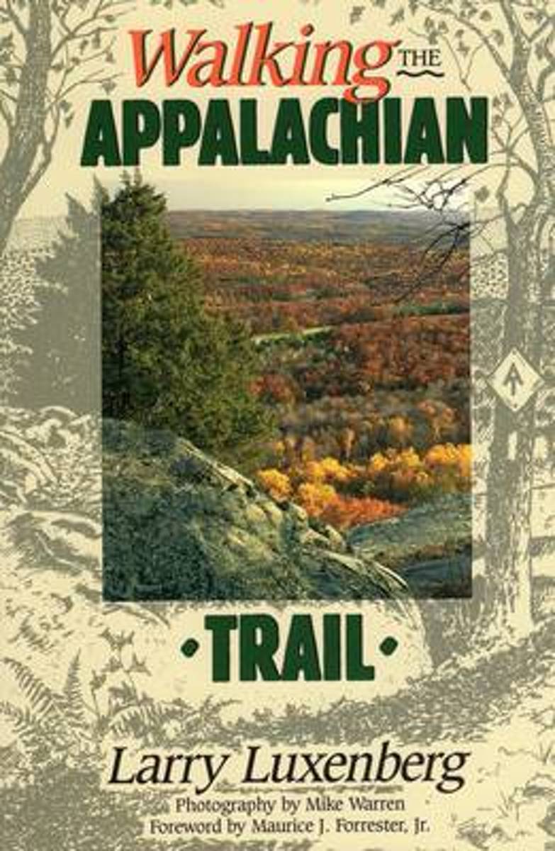
- Walking the Appalachian Trail
- Accounts by thru-hikers, organized by topic. Foreword by hiker Maurice Forrester and stunning color photos by Mike Warren. Read more
- Also available from:
- Bol.com, Belgium
- The Book Depository, United Kingdom
Bol.com
Belgium
Belgium
- Walking the Appalachian Trail
- Accounts by thru-hikers, organized by topic. Foreword by hiker Maurice Forrester and stunning color photos by Mike Warren. Read more


Bol.com
Netherlands
Netherlands
- Waffle Print
- The Appalachian Trail is a continuous path in a canopy. It might be nicknamed the "social rooted trail" as the chance of not seeing a soul on a single day is nil, but the chance to stumble on a root is 100%. But a continuous trail from Key West, Florida, to the Gaspé Peninsula, Quebec, would diversify the experience of long-distance hiking.... Read more
- Also available from:
- Bol.com, Belgium
Bol.com
Belgium
Belgium
- Waffle Print
- The Appalachian Trail is a continuous path in a canopy. It might be nicknamed the "social rooted trail" as the chance of not seeing a soul on a single day is nil, but the chance to stumble on a root is 100%. But a continuous trail from Key West, Florida, to the Gaspé Peninsula, Quebec, would diversify the experience of long-distance hiking.... Read more
Bol.com
Netherlands
Netherlands
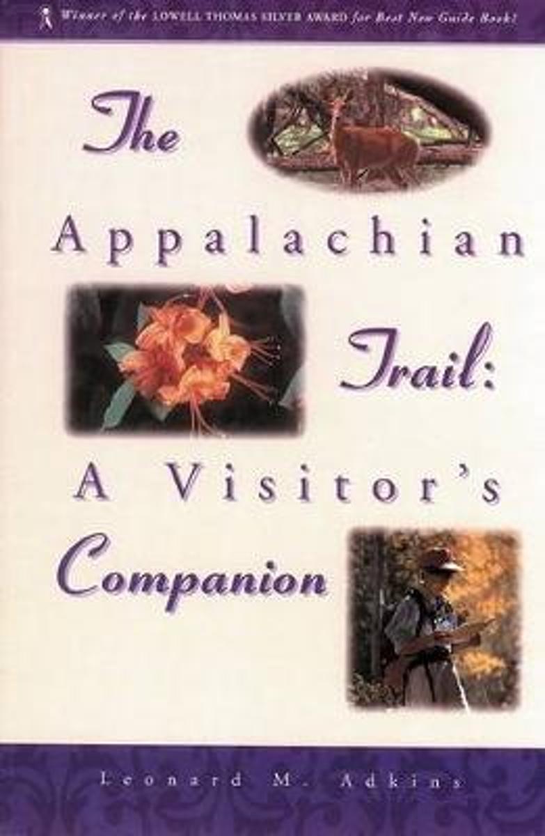
- The Appalachian Trail Visitor's Companion
- Finally, a comprehensive naturalist's guide to the Appalachian Trail. Never again will your shoulders ache from lugging dozens of guidebooks in your backpack. The Appalachian Trail: A Visitor's Companion contains all the essential information about the AT - from the trail's fascinating history to detailed information on the geology, trees,... Read more
- Also available from:
- Bol.com, Belgium
Bol.com
Belgium
Belgium
- The Appalachian Trail Visitor's Companion
- Finally, a comprehensive naturalist's guide to the Appalachian Trail. Never again will your shoulders ache from lugging dozens of guidebooks in your backpack. The Appalachian Trail: A Visitor's Companion contains all the essential information about the AT - from the trail's fascinating history to detailed information on the geology, trees,... Read more
De Zwerver
Netherlands
Netherlands
- Also available from:
- Bol.com, Netherlands
- Bol.com, Belgium
Bol.com
Netherlands
Netherlands
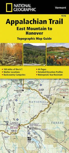
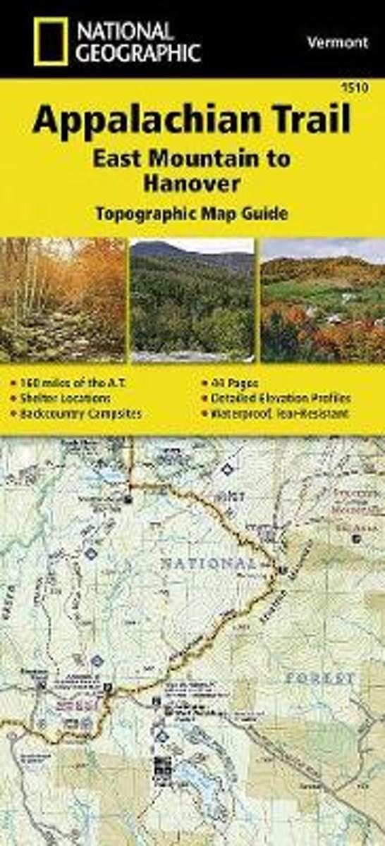
- Appalachian Trail, East Mountain To Hanover, Vermont
- Waterproof Tear-Resistant Topographic Map GuideThe East Mountain to Hanover Topographic Map Guide makes a perfect traveling companion when traversing the Vermont section of the Appalachian Trail (A.T.). The landscape of Vermont is a variety of wooded mountains, forests of white pine and paper birch, and rolling terrain dotted by fields... Read more
Bol.com
Belgium
Belgium
- Appalachian Trail, East Mountain To Hanover, Vermont
- Waterproof Tear-Resistant Topographic Map GuideThe East Mountain to Hanover Topographic Map Guide makes a perfect traveling companion when traversing the Vermont section of the Appalachian Trail (A.T.). The landscape of Vermont is a variety of wooded mountains, forests of white pine and paper birch, and rolling terrain dotted by fields... Read more
Bol.com
Netherlands
Netherlands
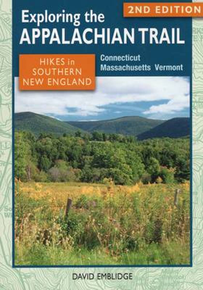
- Exploring the Appalachian Trail
- A guide to 27 great day hikes and overnight backpacking trips on the Appalachian Trail in Connecticut, Massachusetts, and Vermont. Read more
- Also available from:
- Bol.com, Belgium
Bol.com
Belgium
Belgium
- Exploring the Appalachian Trail
- A guide to 27 great day hikes and overnight backpacking trips on the Appalachian Trail in Connecticut, Massachusetts, and Vermont. Read more
De Zwerver
Netherlands
Netherlands
- Also available from:
- Bol.com, Netherlands
- Bol.com, Belgium
- The Book Depository, United Kingdom
Bol.com
Netherlands
Netherlands
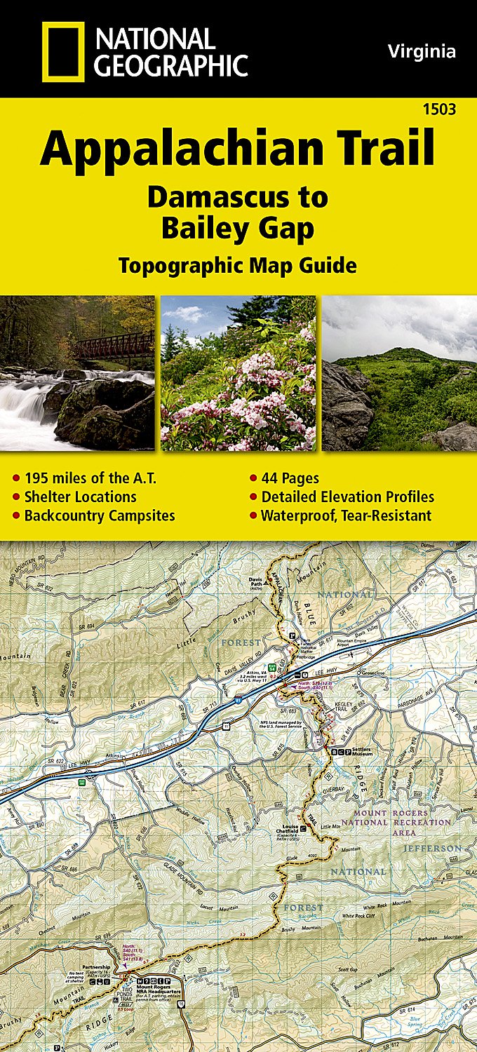
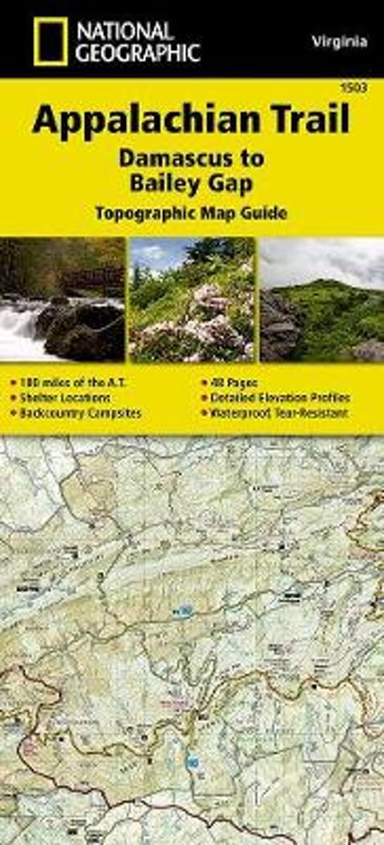
- Appalachian Trail, Damascus To Bailey Gap, Virginia
- Waterproof Tear-Resistant Topographic Map GuideThe Damascus to Bailey Gap Topographic Map Guide makes a perfect traveling companion when traversing the southwest Virginia section of the Appalachian Trail (A.T.). The A.T. in southwest Virginia travels through a culturally and historically rich area that includes fertile farmland, long,... Read more
Bol.com
Belgium
Belgium
- Appalachian Trail, Damascus To Bailey Gap, Virginia
- Waterproof Tear-Resistant Topographic Map GuideThe Damascus to Bailey Gap Topographic Map Guide makes a perfect traveling companion when traversing the southwest Virginia section of the Appalachian Trail (A.T.). The A.T. in southwest Virginia travels through a culturally and historically rich area that includes fertile farmland, long,... Read more

The Book Depository
United Kingdom
United Kingdom
- Appalachian Trail, Damascus To Bailey Gap, Virginia
- Trails Illustrated Read more
Bol.com
Netherlands
Netherlands
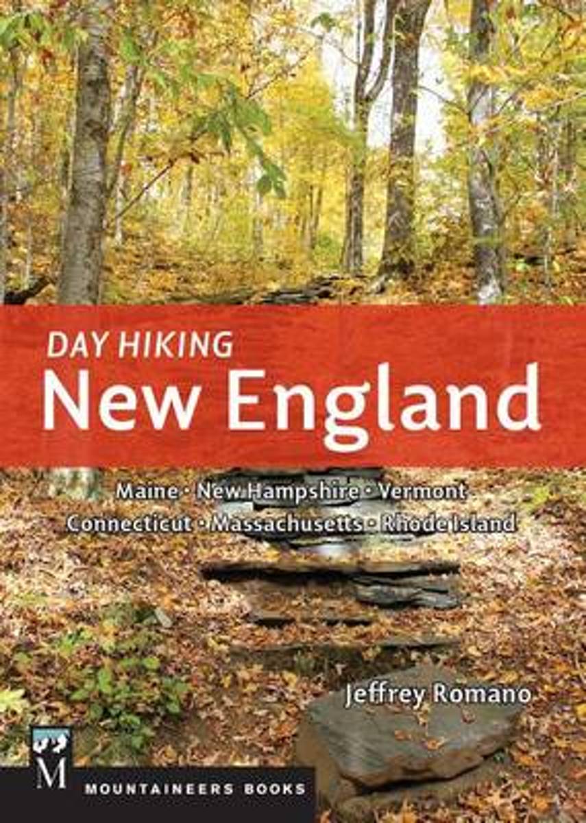
- Day Hiking New England
- *CLICK HERE to download sample hikes from Day Hiking New England* *Provides difficulty ratings, hike distances, GPS coordinates, elevation gains, permitting information, and more *115 routes including many loops *Doesn't overlap with the author's 100 Classics Hikes: New England together the two guides capture more than 200 unique hiking... Read more
- Also available from:
- Bol.com, Belgium
- The Book Depository, United Kingdom
Bol.com
Belgium
Belgium
- Day Hiking New England
- *CLICK HERE to download sample hikes from Day Hiking New England* *Provides difficulty ratings, hike distances, GPS coordinates, elevation gains, permitting information, and more *115 routes including many loops *Doesn't overlap with the author's 100 Classics Hikes: New England together the two guides capture more than 200 unique hiking... Read more

The Book Depository
United Kingdom
United Kingdom
- Day Hiking New England
- Maine, New Hampshire, Vermont, Connecticut, Massachusetts. Rhode Island Read more

Bol.com
Netherlands
Netherlands
- On Trails
- "Winner of the Pacific Northwest Book Award""The best outdoors book of the year"" —Sierra ClubA New York Times BestsellerA Best Book of the Year—as chosen by The Boston Globe, The Seattle Times, Amazon, National Post, New York magazine, The Telegraph, Booklist, The Guardian BookshopFrom a debut talent who's been compared to Annie Dillard,... Read more
- Also available from:
- Bol.com, Belgium
- The Book Depository, United Kingdom
Bol.com
Belgium
Belgium
- On Trails
- "Winner of the Pacific Northwest Book Award""The best outdoors book of the year"" —Sierra ClubA New York Times BestsellerA Best Book of the Year—as chosen by The Boston Globe, The Seattle Times, Amazon, National Post, New York magazine, The Telegraph, Booklist, The Guardian BookshopFrom a debut talent who's been compared to Annie Dillard,... Read more


Bol.com
Netherlands
Netherlands
- Appalachian Trail Guide to Tennessee-North Carolina
- The official guide to 302 miles of the Appalachian Trail, from Damascus, Va., near the Tennessee line south to the southern end of the Great Smoky Mountains National Park at Fontana Dam, N.C. The six detached maps (three sheets) included in the packet are water- and tear-resistant in seven colors at a scale of an inch to a mile, with elevation... Read more
- Also available from:
- Bol.com, Belgium
Bol.com
Belgium
Belgium
- Appalachian Trail Guide to Tennessee-North Carolina
- The official guide to 302 miles of the Appalachian Trail, from Damascus, Va., near the Tennessee line south to the southern end of the Great Smoky Mountains National Park at Fontana Dam, N.C. The six detached maps (three sheets) included in the packet are water- and tear-resistant in seven colors at a scale of an inch to a mile, with elevation... Read more
Bol.com
Netherlands
Netherlands
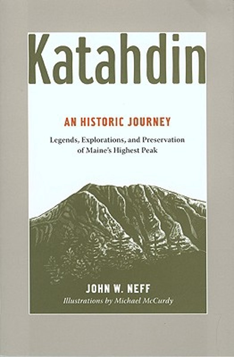
- Katahdin
- For millennia, Mount Katahdin has loomed over the changing landscape we now call Maine's North Woods, inspiring and challenging people, from the Native Americans whose trade routes rounded its base; to Henry David Thoreau and Governor Percival P. Baxter, who forged new approaches to nature and conservation; to the hundreds of outdoorspeople who... Read more
- Also available from:
- Bol.com, Belgium
Bol.com
Belgium
Belgium
- Katahdin
- For millennia, Mount Katahdin has loomed over the changing landscape we now call Maine's North Woods, inspiring and challenging people, from the Native Americans whose trade routes rounded its base; to Henry David Thoreau and Governor Percival P. Baxter, who forged new approaches to nature and conservation; to the hundreds of outdoorspeople who... Read more
Kaarten

De Zwerver
Netherlands
Netherlands
- Wandelkaart - Topografische kaart 318 Mount Rogers High Country - Grayson Highlands State Park | National Geographic
- Prachtige geplastificeerde kaart van het bekende nationaal park. Met alle recreatieve voorzieningen als campsites, maar ook met topografische details en wandelroutes ed. Door uitgekiend kleurgebruik zeer prettig in gebruik. Scheur en watervast! National Geographic's Trails Illustrated map of Mount Rogers High Country and Grayson Highlands... Read more
- Also available from:
- Bol.com, Netherlands
- Bol.com, Belgium
- Stanfords, United Kingdom
- The Book Depository, United Kingdom

Bol.com
Netherlands
Netherlands
- Mount Rogers High Country
- Waterproof Tear-Resistant Topographic MapNational Geographic's Trails Illustrated map of Mount Rogers High Country and Grayson Highlands State Park, Southwest Virginia, is a two-sided, waterproof, topographic trail map designed to meet the needs of outdoor enthusiasts with unmatched durability and detail. This map was created in... Read more
Bol.com
Belgium
Belgium
- Mount Rogers High Country
- Waterproof Tear-Resistant Topographic MapNational Geographic's Trails Illustrated map of Mount Rogers High Country and Grayson Highlands State Park, Southwest Virginia, is a two-sided, waterproof, topographic trail map designed to meet the needs of outdoor enthusiasts with unmatched durability and detail. This map was created in... Read more

Stanfords
United Kingdom
United Kingdom
- Mount Rogers High Country VA
- Map No. 318 - Mount Rogers High Country in Virginia in an extensive series of GPS compatible, contoured hiking maps of USA’s national and state parks or forests and other popular recreational areas. Cartography based on the national topographic survey, with additional tourist information.The maps, with most titles now printed on light,... Read more

The Book Depository
United Kingdom
United Kingdom
- Mount Rogers High Country
- Trails Illustrated Other Rec. Areas Read more

De Zwerver
Netherlands
Netherlands
- Wandelkaart - Topografische kaart 747 Green Mountain National Forest North - Moosalamoo NRA - Rutland | National Geographic
- Prachtige geplastificeerde kaart van het bekende nationaal park. Met alle recreatieve voorzieningen als campsites, maar ook met topografische details en wandelroutes ed. Door uitgekiend kleurgebruik zeer prettig in gebruik. Scheur en watervast! National Geographic's Green Mountain National Forest North Trails Illustrated topographic map is... Read more
- Also available from:
- Bol.com, Netherlands
- Bol.com, Belgium
- Stanfords, United Kingdom
- The Book Depository, United Kingdom

Bol.com
Netherlands
Netherlands
- Green Mountains N.F., Moosalamoo NRA/Rutland
- Waterproof Tear-Resistant Topographic MapNational Geographic's Green Mountain National Forest North Trails Illustrated topographic map is the most comprehensive available for outdoor enthusiasts of all types. Designed to be easy-to-read, yet highly detailed this map includes a comprehensive road and trail network distinguishing between... Read more
Bol.com
Belgium
Belgium
- Green Mountains N.F., Moosalamoo NRA/Rutland
- Waterproof Tear-Resistant Topographic MapNational Geographic's Green Mountain National Forest North Trails Illustrated topographic map is the most comprehensive available for outdoor enthusiasts of all types. Designed to be easy-to-read, yet highly detailed this map includes a comprehensive road and trail network distinguishing between... Read more

Stanfords
United Kingdom
United Kingdom
- Green Mountain National Forest - Moosalamoo NRA - Rutland VT
- Map No. 747, Green Mountain National Forest: Moosalamoo NRA - Rutland area in Vermont, in an extensive series of GPS compatible, contoured hiking maps of USA’s national and state parks or forests and other popular recreational areas. Cartography based on the national topographic survey, with additional tourist information.The maps, with most... Read more

The Book Depository
United Kingdom
United Kingdom
- Green Mountains N.f., Moosalamoo Nra/rutland
- Trails Illustrated Other Rec. Areas Read more

De Zwerver
Netherlands
Netherlands
- Wandelkaart - Topografische kaart 316 Cades Cove - Elkmont - Great Smoky Mountains National Park | National Geographic
- Prachtige geplastificeerde kaart van het bekende nationaal park. Met alle recreatieve voorzieningen als campsites, maar ook met topografische details en wandelroutes ed. Door uitgekiend kleurgebruik zeer prettig in gebruik. Scheur en watervast! This title provides an increased scale of one of the most visited National Parks in the US, and one... Read more
- Also available from:
- Bol.com, Netherlands
- Bol.com, Belgium
- Stanfords, United Kingdom

Bol.com
Netherlands
Netherlands
- Cades Cove/elkmont, Great Smoky Mountains National Park
- Waterproof Tear-Resistant Topographic MapThis title provides an increased scale of one of the most visited National Parks in the US, and one of our more popular map titles. This increased scale will provide greater detail to the backcountry users and Appalachian Trail through-hikers.Park Introduction:Great Smoky Mountains National Park is... Read more
Bol.com
Belgium
Belgium
- Cades Cove/elkmont, Great Smoky Mountains National Park
- Waterproof Tear-Resistant Topographic MapThis title provides an increased scale of one of the most visited National Parks in the US, and one of our more popular map titles. This increased scale will provide greater detail to the backcountry users and Appalachian Trail through-hikers.Park Introduction:Great Smoky Mountains National Park is... Read more

Stanfords
United Kingdom
United Kingdom
- Cades Cove - Elkmont - Great Smoky Mountains National Park NC/TN
- Map No. 316, Great Smoky Mountains National Park: Cades Cove - Elkmont, NC/TN, in an extensive series of GPS compatible, contoured hiking maps of USA’s national and state parks or forests and other popular recreational areas. Cartography based on the national topographic survey, with additional tourist information.The maps, with most titles now... Read more

Bol.com
Netherlands
Netherlands
- Springer & Cohutta Mountains, Chattahoochee National Forest
- Waterproof Tear-Resistant Topographic MapLocated just north of Atlanta, the Chattahoochee National Forest contains the southern terminus of the Appalachian Trail along with an abundance of recreational opportunities for outdoor enthusiasts of all interests.This detailed recreation map contains carefully researched trails, campsites,... Read more
- Also available from:
- Bol.com, Belgium
- Stanfords, United Kingdom
Bol.com
Belgium
Belgium
- Springer & Cohutta Mountains, Chattahoochee National Forest
- Waterproof Tear-Resistant Topographic MapLocated just north of Atlanta, the Chattahoochee National Forest contains the southern terminus of the Appalachian Trail along with an abundance of recreational opportunities for outdoor enthusiasts of all interests.This detailed recreation map contains carefully researched trails, campsites,... Read more

Stanfords
United Kingdom
United Kingdom
- Chattahoochee National Forest - Springer and Cohutta Mountains GA/SC 777
- Map No. 777, Chattahoochee National Forest: Springer and Cohutta Mountains, GA/SC, in an extensive series of GPS compatible, contoured hiking maps of USA’s national and state parks or forests and other popular recreational areas. Cartography based on the national topographic survey, with additional tourist information.The maps, with most titles... Read more