
Himalayas
Beschrijving
Links
Feiten
Verslagen
Gidsen en kaarten
Overnachting
Organisaties
Reisorganisaties
GPS
Anders
Boeken
De Zwerver
Netherlands
2018
Netherlands
2018
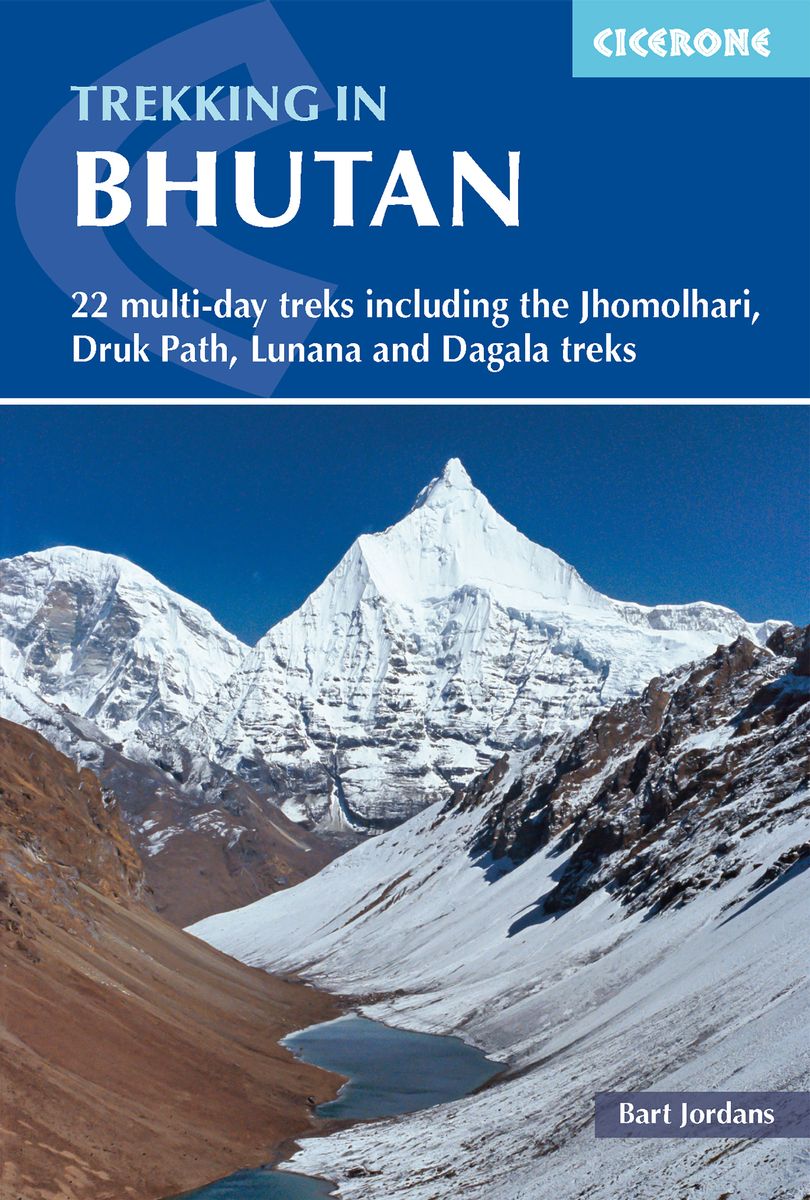
- Wandelgids Trekking in Bhutan | Cicerone
- A guidebook to 22 multi-day treks in the Himalayan Kingdom of Bhutan, including the Jhomolhari, Druk Path and Dagala treks. The trails vary from 2 to 23 days long. The routes are mostly in western and central Bhutan, and range from easy to strenuous depending on the length, altitude and difficulty. Includes advice on cultural awareness. Read more

De Zwerver
Netherlands
2020
Netherlands
2020
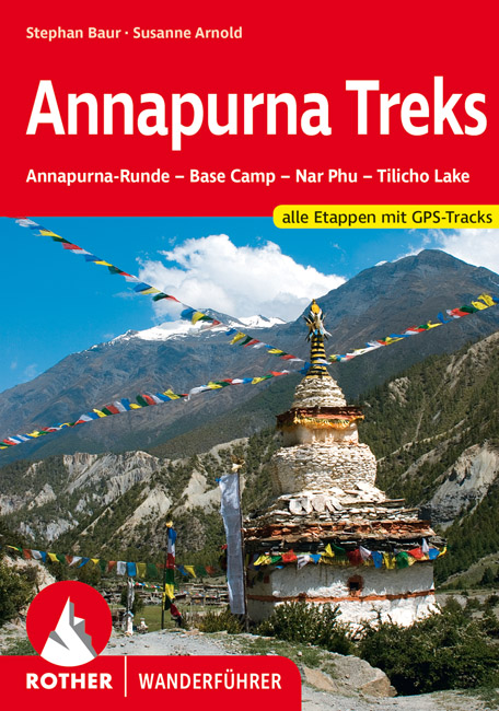
- Wandelgids Annapurna Treks | Rother Bergverlag
- Der Himalaya, das Dach der Welt, zieht viele Bergsteiger und Wanderer magisch an. Kein anderes Land wird so eng mit Trekking im Himalaya verbunden wie Nepal; das Annapurna-Gebiet zählt wohl zu den bekanntesten Trekkinggebieten der Erde. Es sind die Gegensätze, die diese Region so einzigartig machen: schneebedeckte Eisriesen und grüne... Read more
De Zwerver
Netherlands
2010
Netherlands
2010
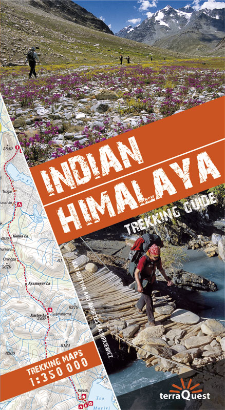
- Wandelgids Trekking Guide Indian Himalaya | TerraQuest
- Ce guide unique des montagnes de l''Himalaya indien, avec description et carte détaillée de 22 circuits de trekking, contient les informations nécessaires pour chaque niveau, du débutant au professionnel chevronné.La découverte de 10 régions (avec carte à l'échelle de 1/350... Read more
Bol.com
Netherlands
Netherlands
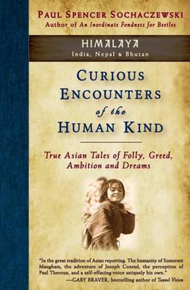
- Curious Encounters of the Human Kind - Himalaya
- What's a woman to do when a Hindu god doesn't return her mountain? Would you risk your life by hugging a tree? How do you find a nameless young girl you first met (for five minutes) twenty-six years earlier? For environmental consciousness, should we trust the international bureaucrats or a Bhutanese farmer? Does the yeti illuminate the dark... Read more
- Also available from:
- Bol.com, Belgium
Bol.com
Belgium
Belgium
- Curious Encounters of the Human Kind - Himalaya
- What's a woman to do when a Hindu god doesn't return her mountain? Would you risk your life by hugging a tree? How do you find a nameless young girl you first met (for five minutes) twenty-six years earlier? For environmental consciousness, should we trust the international bureaucrats or a Bhutanese farmer? Does the yeti illuminate the dark... Read more
Bol.com
Netherlands
Netherlands
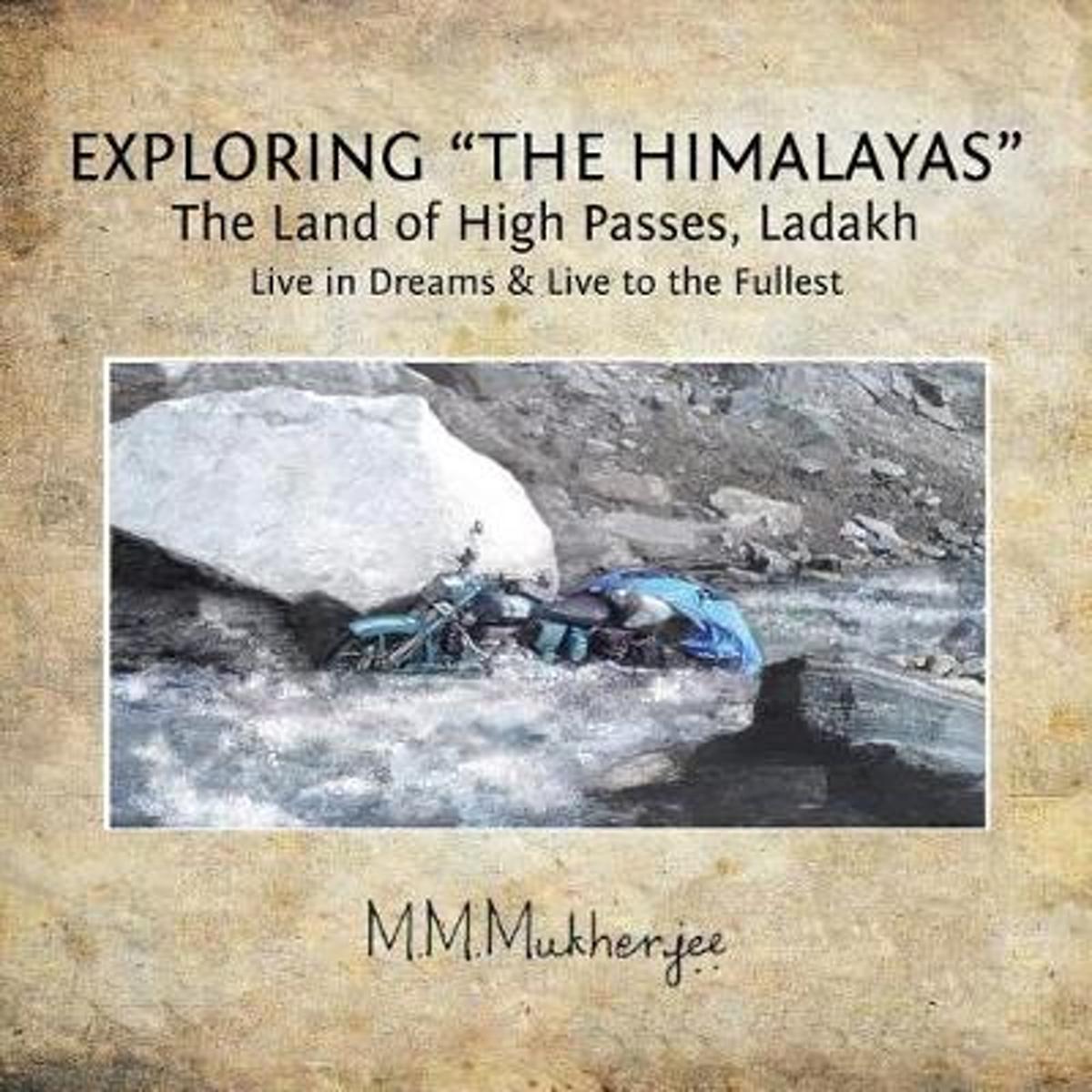
- Exploring the Himalayas
- The water was icy cold and my feet were getting numb so I had to come out of the chilled water leaving my motorcycle stranded.She was still standing upright with the heavy loads without a stand The repetitive calling of the mighty Himalayas was irresistible to Mukul and he set out, away from his mundane living, answering the call, testing his... Read more
- Also available from:
- Bol.com, Belgium
Bol.com
Belgium
Belgium
- Exploring the Himalayas
- The water was icy cold and my feet were getting numb so I had to come out of the chilled water leaving my motorcycle stranded.She was still standing upright with the heavy loads without a stand The repetitive calling of the mighty Himalayas was irresistible to Mukul and he set out, away from his mundane living, answering the call, testing his... Read more
Bol.com
Netherlands
Netherlands
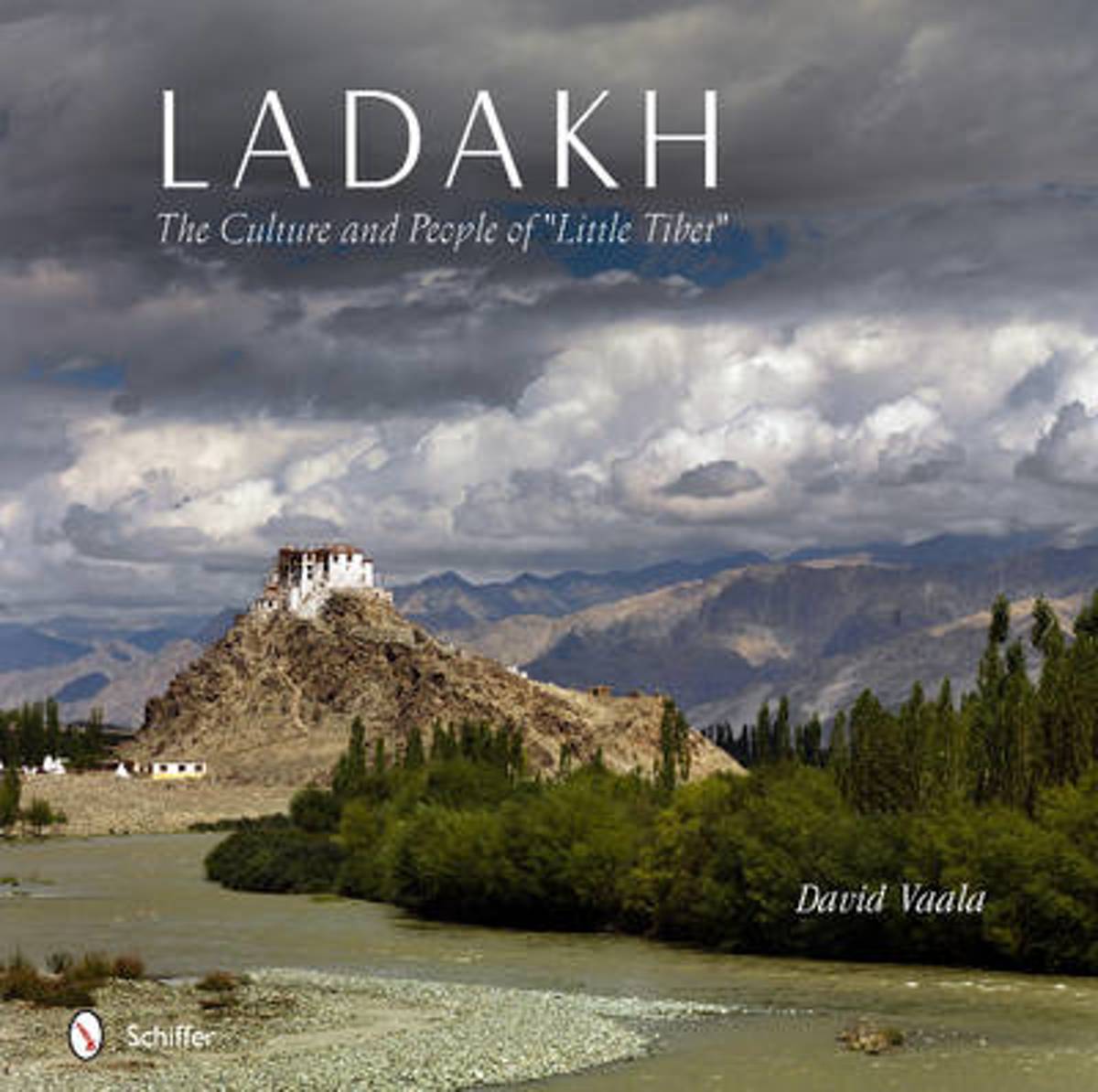
- Ladakh
- Over the course of five years, photographer David Vaala embedded himself in Ladakh, a mountainous corner of Northwestern India, to capture Little Tibet: its landscapes, culture, and people. More than 150 full-color, large-format images focus on the rare cham dances, masked dance-dramas, which are a unique aspect of Tibetan Buddhism. Using a... Read more
- Also available from:
- Bol.com, Belgium
Bol.com
Belgium
Belgium
- Ladakh
- Over the course of five years, photographer David Vaala embedded himself in Ladakh, a mountainous corner of Northwestern India, to capture Little Tibet: its landscapes, culture, and people. More than 150 full-color, large-format images focus on the rare cham dances, masked dance-dramas, which are a unique aspect of Tibetan Buddhism. Using a... Read more
Bol.com
Netherlands
Netherlands
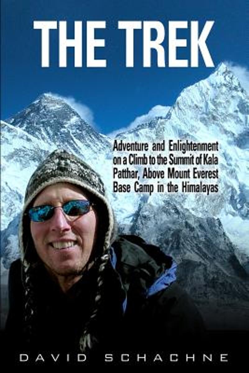
- The Trek
- The Trek: Adventure and Enlightenment on a Climb to the Summit of Kala Patthar, Above Mount Everest Base Camp, tells the story of David Schachne's adventure in November, 2004, when he went on a trek, attempting to summit Kala Patthar, a mountain which towers above Mount Everest Base Camp (17,598 feet) in the Himalayas. At 18,192 feet above sea... Read more
- Also available from:
- Bol.com, Belgium
Bol.com
Belgium
Belgium
- The Trek
- The Trek: Adventure and Enlightenment on a Climb to the Summit of Kala Patthar, Above Mount Everest Base Camp, tells the story of David Schachne's adventure in November, 2004, when he went on a trek, attempting to summit Kala Patthar, a mountain which towers above Mount Everest Base Camp (17,598 feet) in the Himalayas. At 18,192 feet above sea... Read more
Bol.com
Netherlands
Netherlands
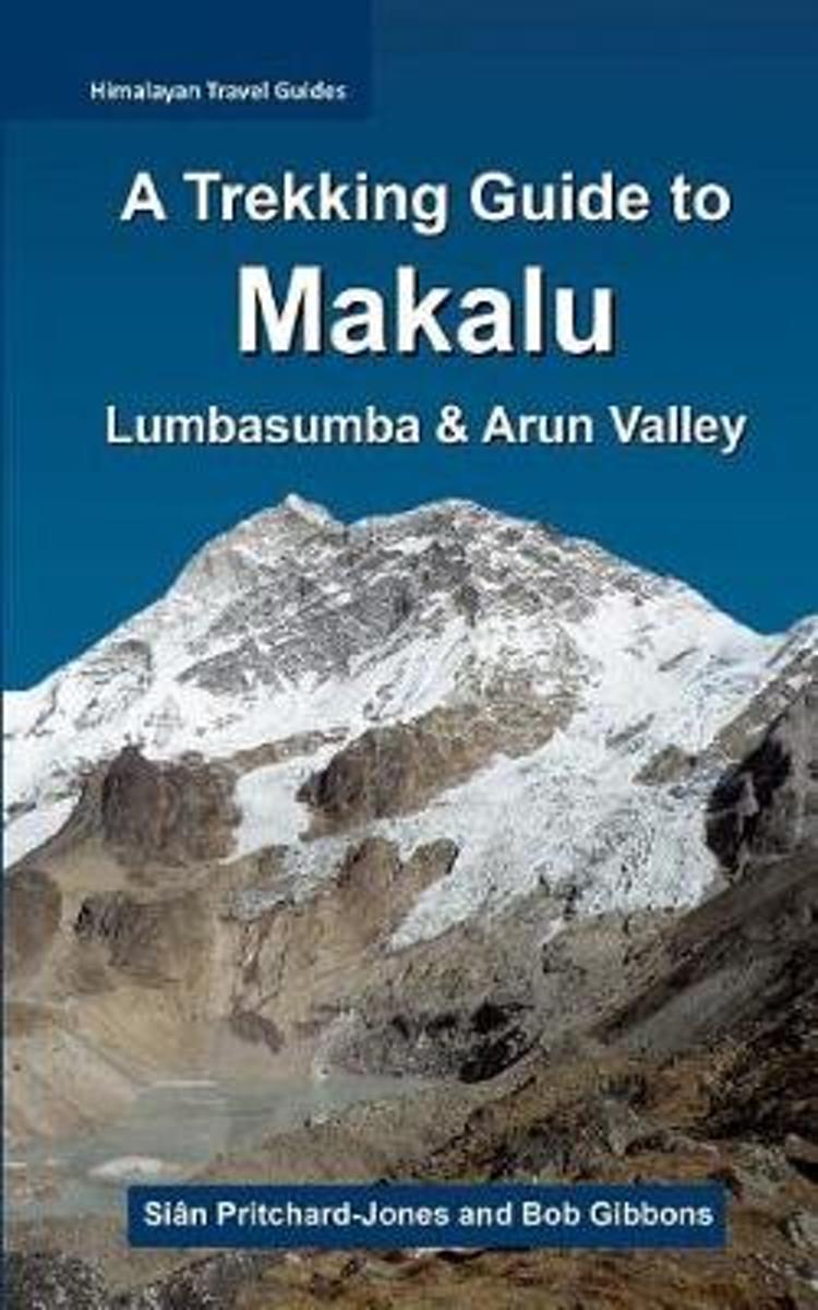
- A Trekking Guide to Makalu
- The trek to Makalu Base Camp is a sensational experience that has been ignored for so long by so many. Where else in the Himalaya can one stand just a few hundred metres below 3800m of soaring rock, ice and glaciers? Unlike Everest and Kanchenjunga, which are both viewed from a few kilometres away from the actual faces, Makalu towers directly... Read more
- Also available from:
- Bol.com, Belgium
Bol.com
Belgium
Belgium
- A Trekking Guide to Makalu
- The trek to Makalu Base Camp is a sensational experience that has been ignored for so long by so many. Where else in the Himalaya can one stand just a few hundred metres below 3800m of soaring rock, ice and glaciers? Unlike Everest and Kanchenjunga, which are both viewed from a few kilometres away from the actual faces, Makalu towers directly... Read more
Bol.com
Netherlands
Netherlands
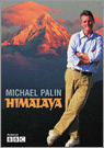
- Himalaya
- In this his most challenging journey, Michael Palin tackles the Himalaya, the greatest mountain range on earth, a virtually unbroken wall of rock stretching 1800 miles from the borders of Afghanistan to south-west China. Penetrated but never conquered, it remains the world's most majestic natural barrier, a magnificent wilderness that shapes... Read more
- Also available from:
- Bol.com, Belgium
Bol.com
Belgium
Belgium
- Himalaya
- In this his most challenging journey, Michael Palin tackles the Himalaya, the greatest mountain range on earth, a virtually unbroken wall of rock stretching 1800 miles from the borders of Afghanistan to south-west China. Penetrated but never conquered, it remains the world's most majestic natural barrier, a magnificent wilderness that shapes... Read more
Bol.com
Netherlands
Netherlands
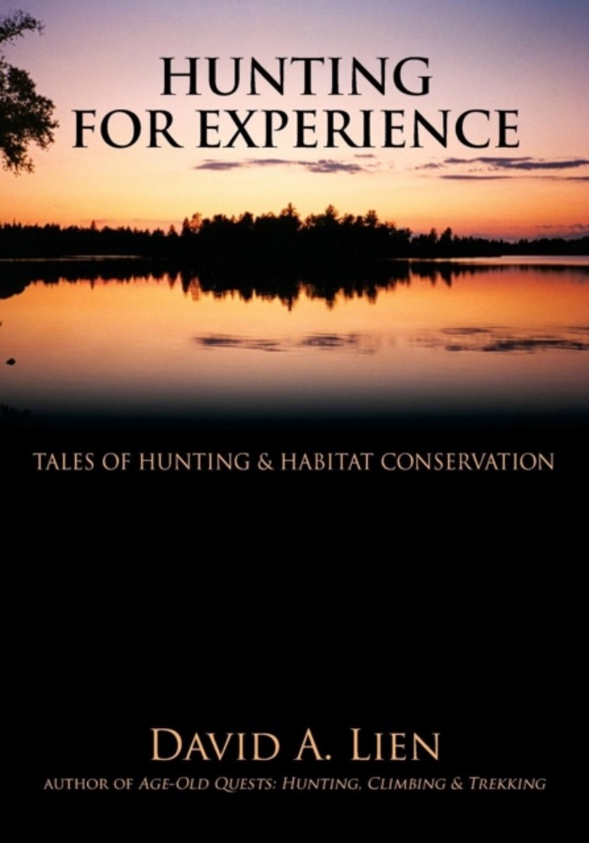
- Hunting for Experience
- David Lien began fishing in northern Minnesota at the age of four, shot his first squirrel when he was eight, and his first deer when he was thirteen. These early hunting experiences laid the foundation for David's later climbing and trekking in some of the world's most remote and rugged regions, including South America's Patagonia, Asia's... Read more
- Also available from:
- Bol.com, Belgium
Bol.com
Belgium
Belgium
- Hunting for Experience
- David Lien began fishing in northern Minnesota at the age of four, shot his first squirrel when he was eight, and his first deer when he was thirteen. These early hunting experiences laid the foundation for David's later climbing and trekking in some of the world's most remote and rugged regions, including South America's Patagonia, Asia's... Read more
Bol.com
Netherlands
Netherlands
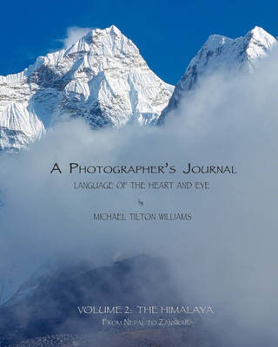
- A Photographer's Journal
- This book is powered by sweat and joy; steep hills and exhilarating telemark skiing descents into silent stands of snowy trees. The land and its smells and tastes are embedded in the memory of those lucky enough to have immersed themselves in it. My goal is to transport you: to the soft meadows, the smooth, hard granite, and the dancing trees... Read more
- Also available from:
- Bol.com, Belgium
Bol.com
Belgium
Belgium
- A Photographer's Journal
- This book is powered by sweat and joy; steep hills and exhilarating telemark skiing descents into silent stands of snowy trees. The land and its smells and tastes are embedded in the memory of those lucky enough to have immersed themselves in it. My goal is to transport you: to the soft meadows, the smooth, hard granite, and the dancing trees... Read more
Bol.com
Netherlands
Netherlands
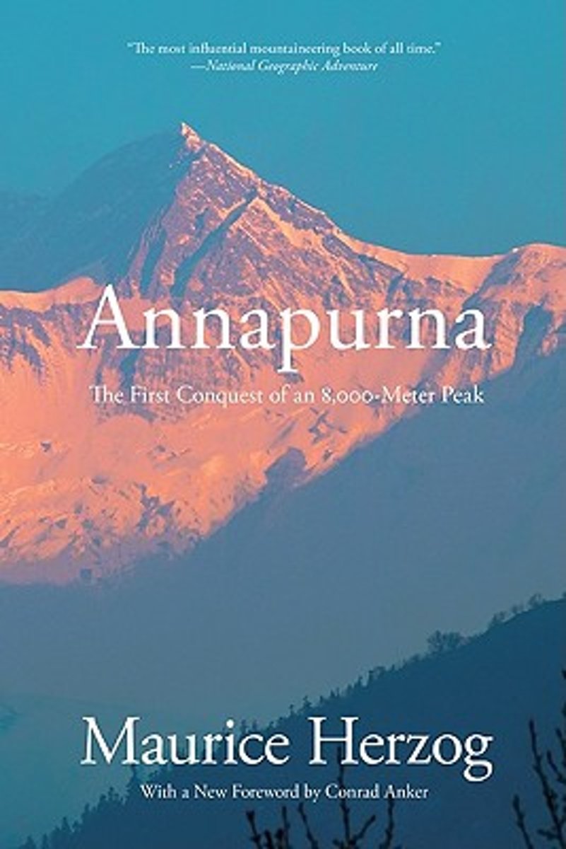
- Annapurna
- Top 100 Sports Books of All Time, Sports Illustrated Those who have never seen the Himalayas, those who never care to risk an assault, will know when they finish this book that they have been a companion of greatness. -New York Times Book Review In 1950, when no mountain taller than 8,000 meters had ever been climbed, Maurice Herzog led an... Read more
- Also available from:
- Bol.com, Belgium
Bol.com
Belgium
Belgium
- Annapurna
- Top 100 Sports Books of All Time, Sports Illustrated Those who have never seen the Himalayas, those who never care to risk an assault, will know when they finish this book that they have been a companion of greatness. -New York Times Book Review In 1950, when no mountain taller than 8,000 meters had ever been climbed, Maurice Herzog led an... Read more
Kaarten
De Zwerver
Netherlands
Netherlands
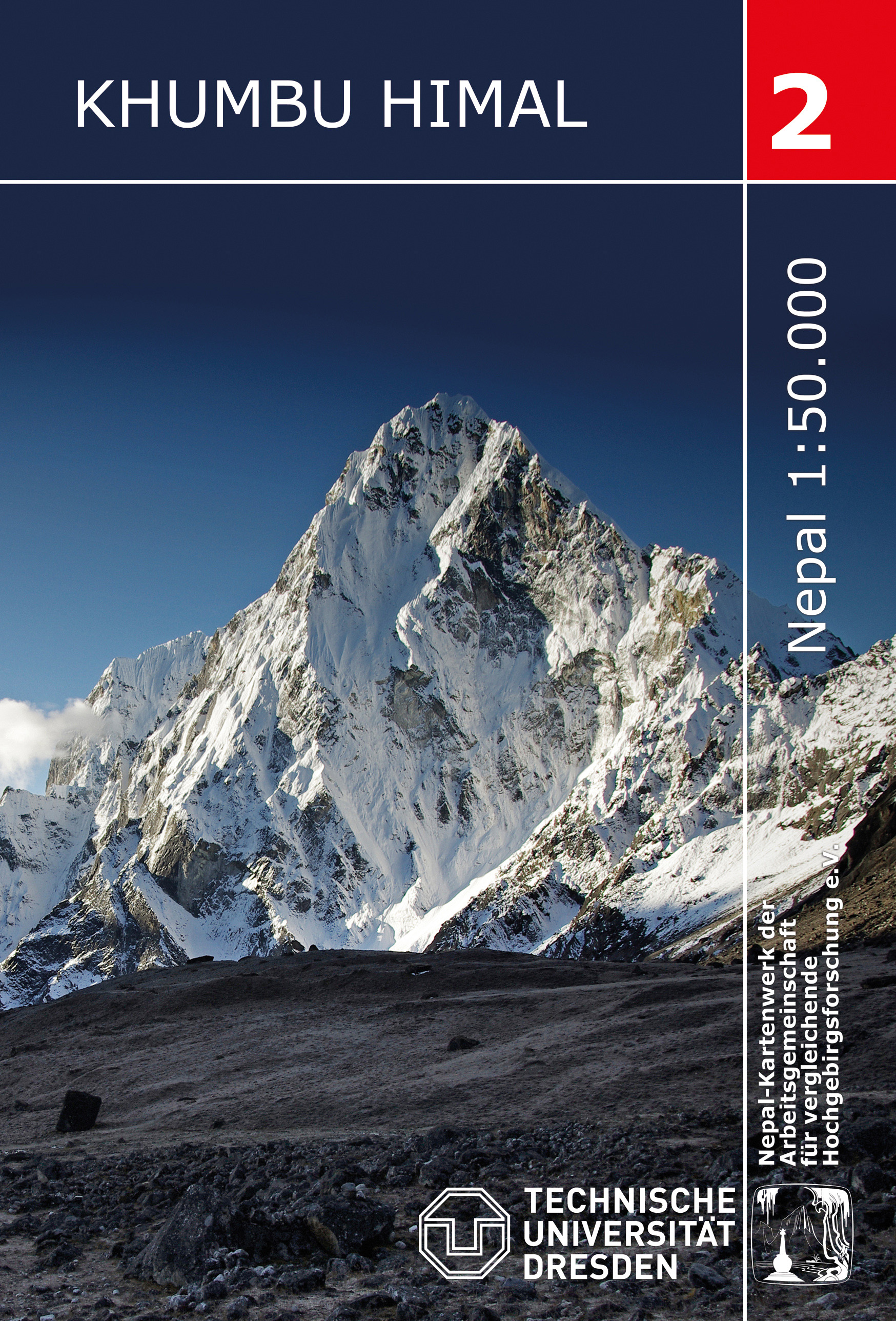
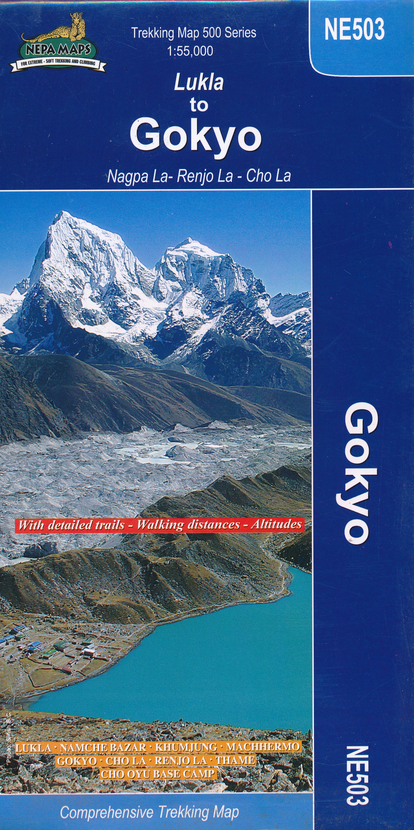
- Wandelkaart 02 Nepal Khumbu Himal | Nepal Kartenwerk
- Khumbu Himal area at 1:50,000 on a waterproof and tear-resistant map in the famous Schneider series, revised in 2013 to include extensive tourist information for trekking routes to the Mount Everest Base Camp, Gokyo Lakes, Island Peak, Makalu Base Camp, etc. Coverage extends north from Namche Bazaar and along the Tibetan border from the Lunag... Read more
- Also available from:
- Stanfords, United Kingdom

Stanfords
United Kingdom
United Kingdom
- Khumbu Himal Schneider Nepal Map 02
- Khumbu Himal area at 1:50,000 on a waterproof and tear-resistant map in the famous Schneider series, revised in 2013 to include extensive tourist information for trekking routes to the Mount Everest Base Camp, Gokyo Lakes, Island Peak, Makalu Base Camp, etc. Coverage extends north from Namche Bazaar and along the Tibetan border from the Lunag... Read more
De Zwerver
Netherlands
Netherlands
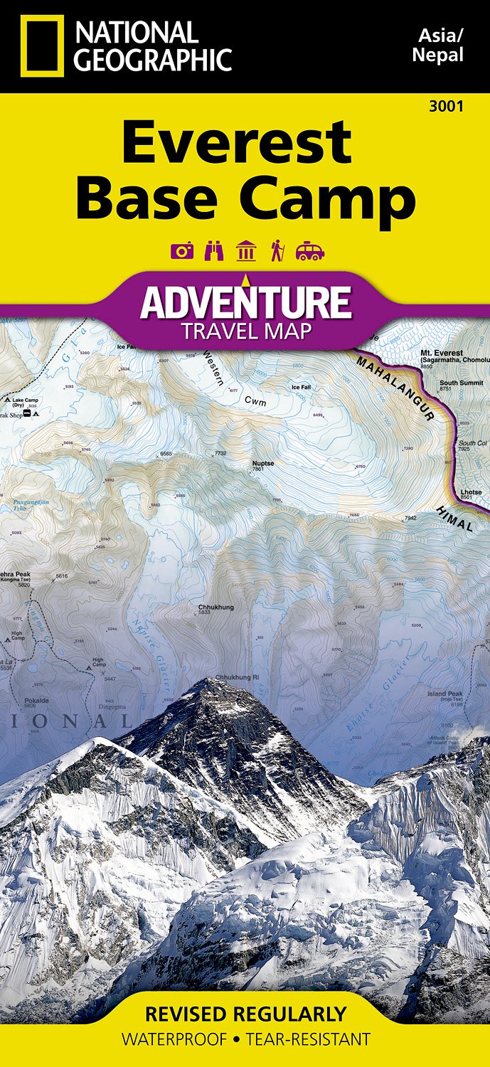
- Wandelkaart 3001 Adventure Map trekking map Everest Base Camp | National Geographic
- Everest Base Camp area at 1:50,000 approx. on indexed, light, waterproof and tear-resistant hiking map, with a plan of the Kathmandu/Patan area including an enlargement of the Thamel district, plus an overview map of the whole country.The map is part of a series covering Nepal Read more
- Also available from:
- Stanfords, United Kingdom

Stanfords
United Kingdom
United Kingdom
- Everest Base Camp NGS Adventure Map 3001
- Everest Base Camp area at 1:50,000 approx. on indexed, light, waterproof and tear-resistant hiking map, with a plan of the Kathmandu/Patan area including an enlargement of the Thamel district, plus an overview map of the whole country.The map is part of a series covering Nepal’s four most popular trekking areas. The maps were prepared by the... Read more
De Zwerver
Netherlands
Netherlands
De Zwerver
Netherlands
Netherlands

De Zwerver
Netherlands
Netherlands
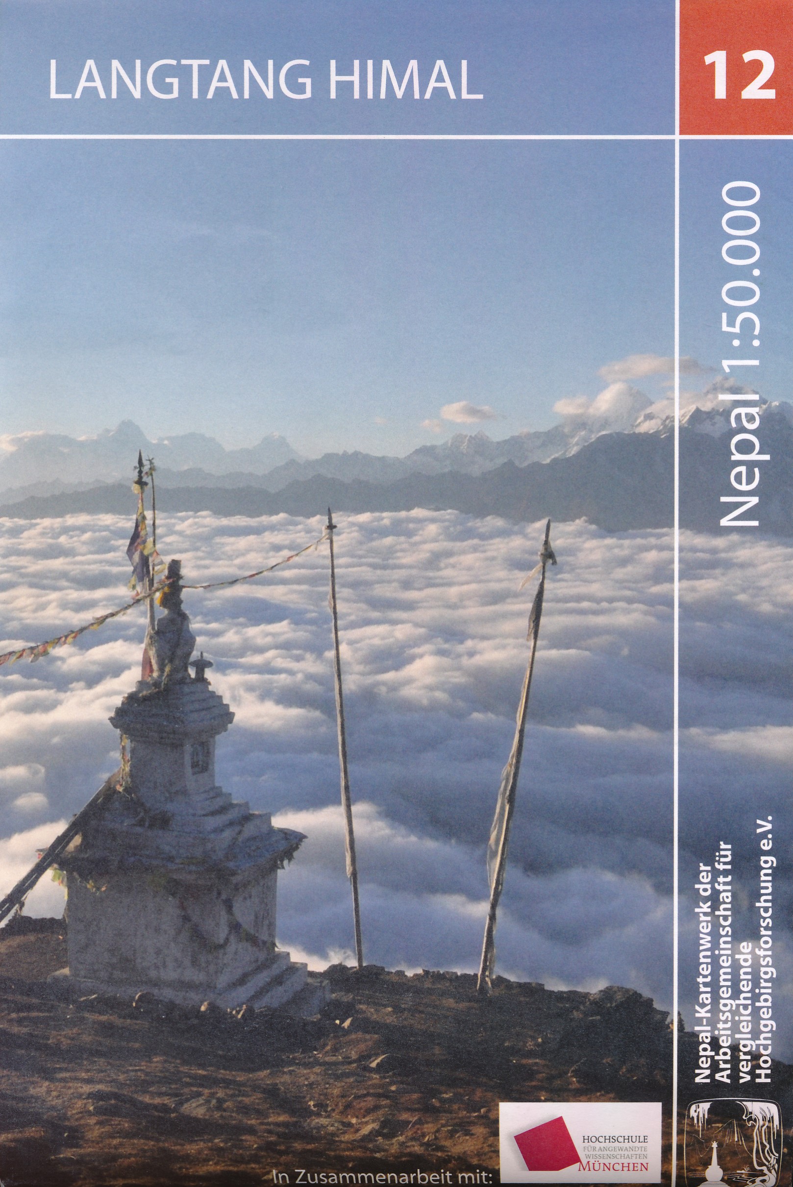
- Wandelkaart The Great Himalaya Trail | GHT
- Prachtige kaartenserie van één van 'swerelds mooiste wandeltochten. The Far West is one of the least explored areas of Nepal. Its area is bounded to the east by mighty, turquoise Karnali river which flows from Tibet’s sacred Mount Kailash. Myth and superstition remain part of the fabric of life here. Though the Nepali language originated... Read more
De Zwerver
Netherlands
Netherlands
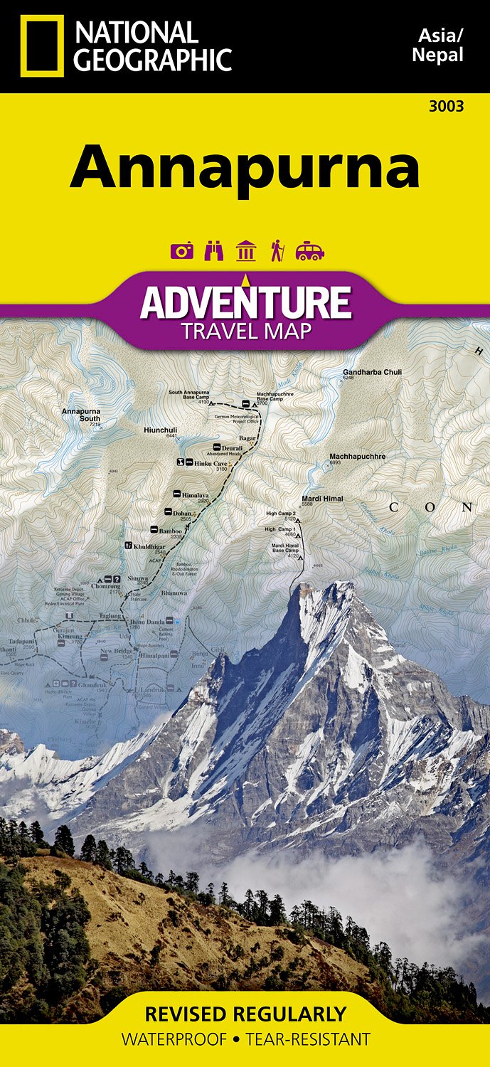
- Wandelkaart 3003 Trekking map Annapurna - Nepal | National Geographic
- Mooie gedetailleerde topografische kaart, voorzien van veel extra info en gedrukt op water- en scheurvast materiaal. Each Adventure Map is highly detailed, incredibly durable, waterproof and tear-resistant. Stunning shaded relief brings each map to life, giving you the power to discover, plan and dream. Trail routes, villages, cultivated areas,... Read more
De Zwerver
Netherlands
Netherlands
De Zwerver
Netherlands
Netherlands
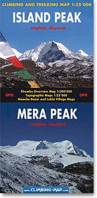
- Wandelkaart trekkingmap Island Peak - Mera Peak | Climbing-map
- Topographic climbing maps from Island & Mera Peak 1:25'000; village maps of Lukla and Namche Bazar, description of climbing routes, Khumbu general map 1:200'000; Panorama view, vegetation illustrations, climatic diagram, GPS information Read more
- Also available from:
- Stanfords, United Kingdom

Stanfords
United Kingdom
United Kingdom
- Island Peak - Mera Peak
- Two peaks of Nepal’s western Himalayas, Island Peak (Imja Tse) and Mera Peak, presented by Swiss publishers Climbing Map on separate contoured and GPS compatible panels at 1:25,000; plus drawings showing approach routes to each peak, plans of Lukla and Namche Bazar, an overview map of the Khumbu Himal region, etc.On one side the main panel is... Read more
De Zwerver
Netherlands
Netherlands
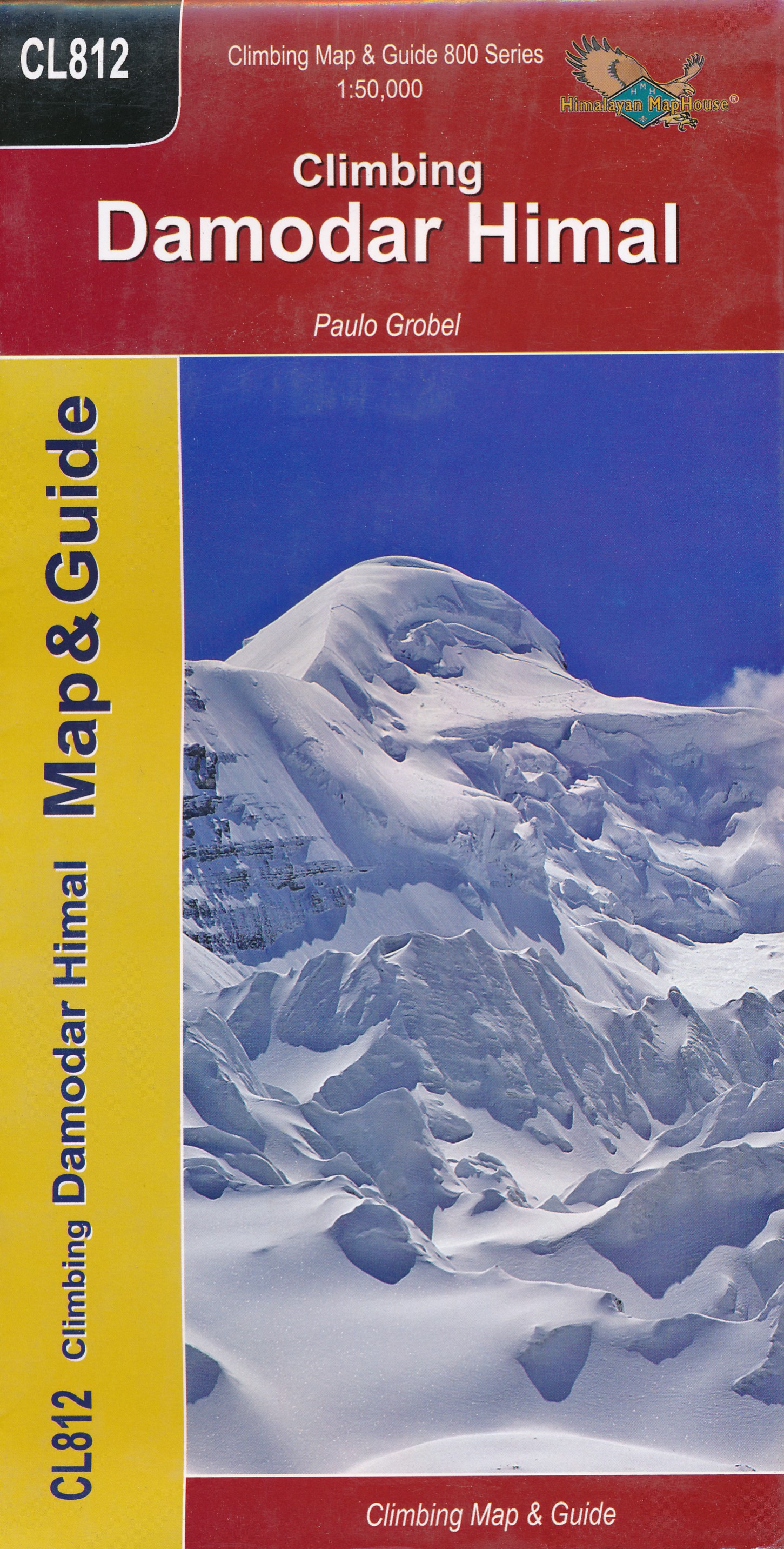
- Wandelkaart CL812 Climbing Damodir Himal - Saribung | Himalayan Maphouse
- Damodar Himal on the northern edge of the Annapurna Conservation area presented by Nepa Maps at 1:50,000 on a map extending from Phu northwards to the Gaurigi and Bhrikuti peaks and west to Muktinath and Ghiling (Geling). Contours are at 40m intervals, with heights for numerous peaks and colouring for the glaciated areas. The map highlights... Read more
- Also available from:
- Stanfords, United Kingdom

Stanfords
United Kingdom
United Kingdom
- Damodar Himal
- Damodar Himal on the northern edge of the Annapurna Conservation area presented by Nepa Maps at 1:50,000 on a map extending from Phu northwards to the Gaurigi and Bhrikuti peaks and west to Muktinath and Ghiling (Geling). Contours are at 40m intervals, with heights for numerous peaks and colouring for the glaciated areas. The map highlights... Read more
De Zwerver
Netherlands
2017
Netherlands
2017
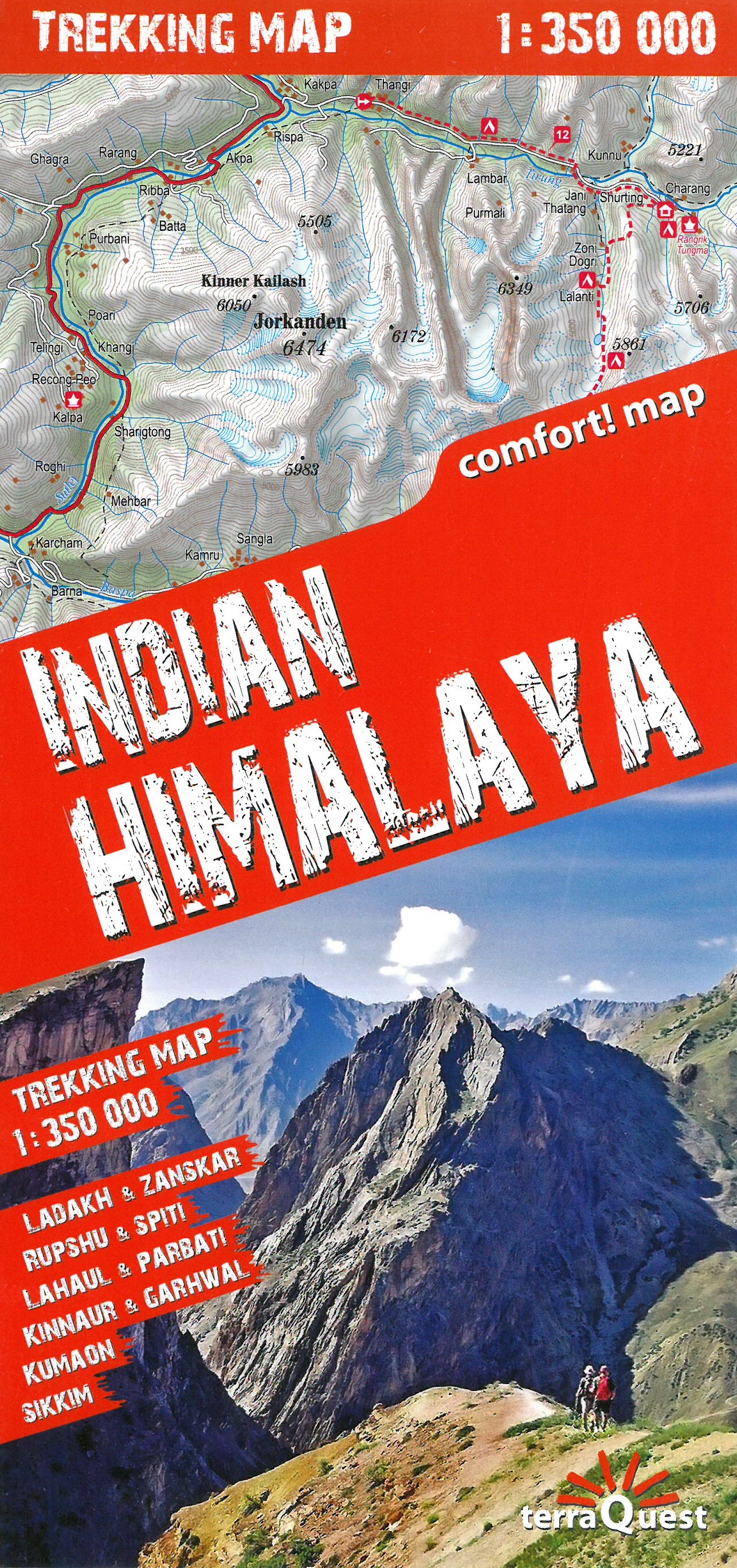
- Wandelkaart Trekking map Indian Himalaya | TerraQuest
- Mooie gedetailleerde kaart, geplastificeerd. De kaart heeft op de ene kant een algemeen overzicht van de Indische Himalaya met schaal 1/750.000 en op de andere zijde vind je de 22 trekking routes op schaal 1/350.000. Op zich geen zeer gedetailleerde wandelkaart. Er van uitgaande dat je de tochten toch met een gids of met een groep doet, dan is... Read more