
Dolomiti di Fiemme
Beschrijving
Kaart

Links
Feiten
Verslagen
Gidsen en kaarten
Overnachting
Organisaties
Reisorganisaties
GPS
Anders
Kaarten
De Zwerver
Netherlands
Netherlands
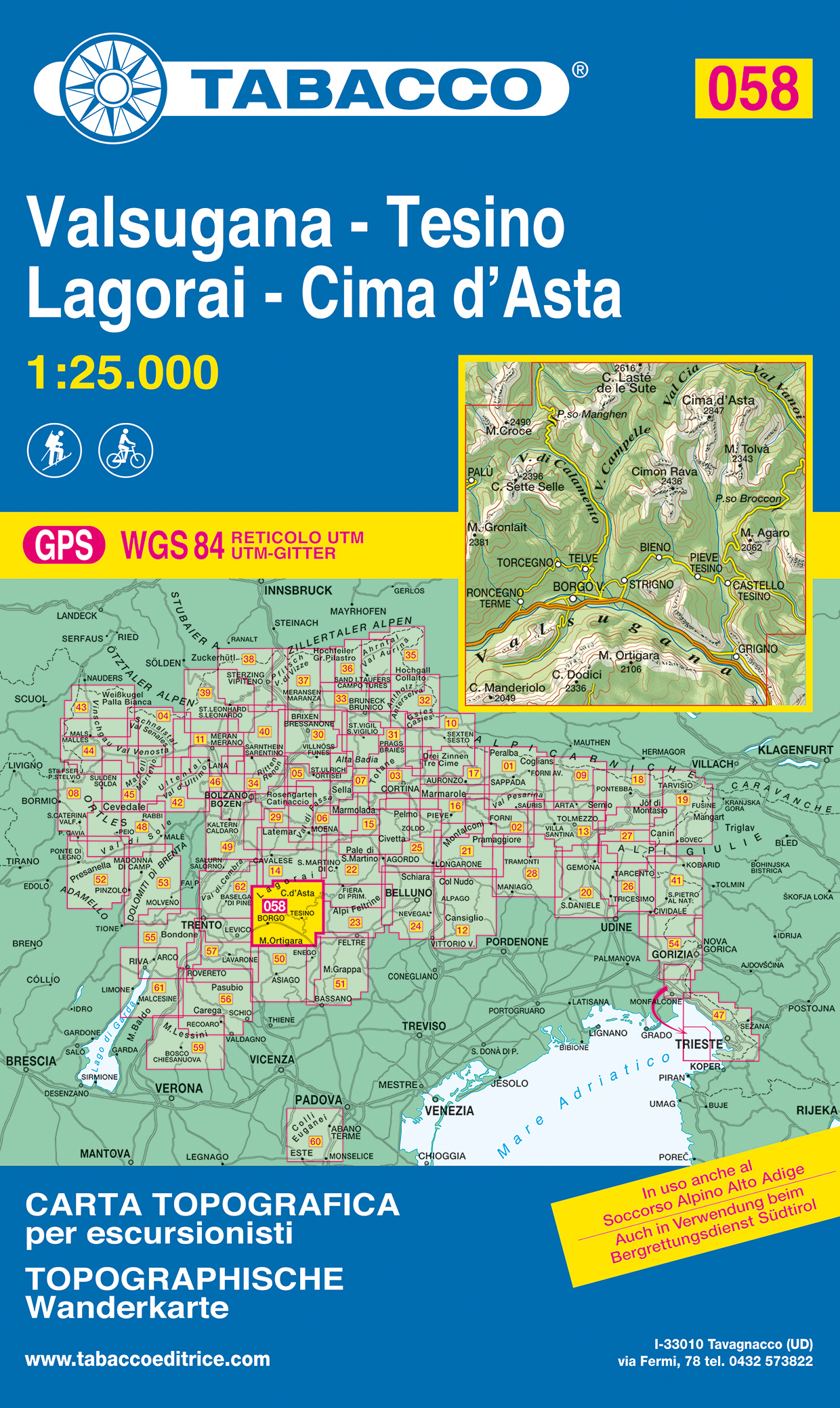
- Wandelkaart 058 Valsugana - Tesino - Lagorai - Cima d'Asta | Tabacco Editrice
- De beste wandelkaarten voor de Dolomieten. Zeer veel topografische details met secure hoogtelijnen (25 meter interval), helder kleurgebruik en bijna alle Tabacco kaarten hebben een UTM grid (voor GPS toepasbaar). Daarnaast zijn op deze wandelkaarten wandelroutes ingetekend met nummering gelijk aan markering onderweg aangebracht door de lokale... Read more
- Also available from:
- Stanfords, United Kingdom

Stanfords
United Kingdom
United Kingdom
- Valsugana - Tesino - Lagorai - Cima d`Asta Tabacco 058
- Valsugana - Tesino - Lagorai - Cima d`Asta area in a series of Tabacco maps at 1:25,000 covering the Dolomites and the mountains of north-eastern Italy - Stanfords’ most popular coverage for this region, with excellent cartography and extensive overprint for hiking routes and other recreational activities, local bus stops, etc. Additional... Read more
De Zwerver
Netherlands
Netherlands
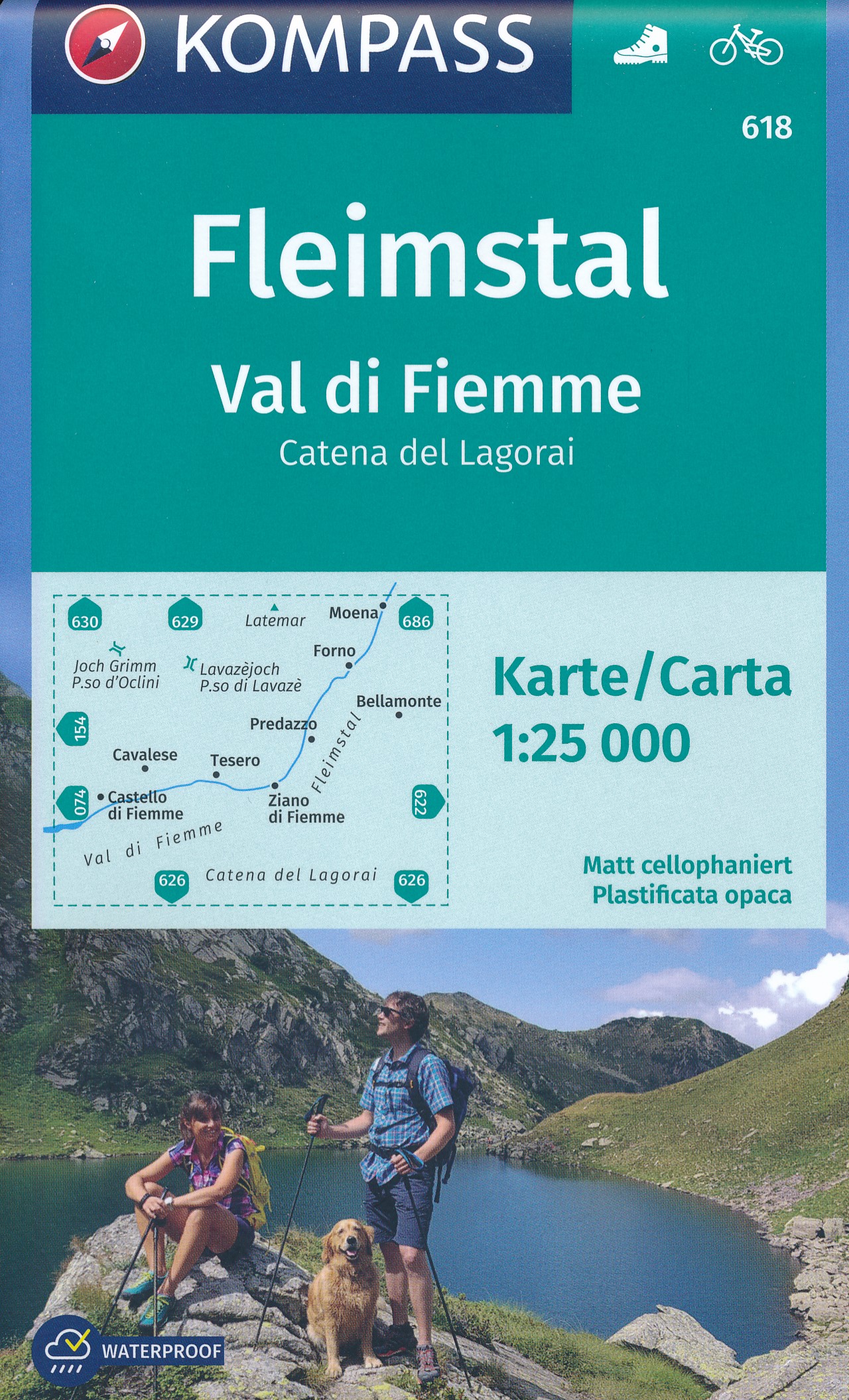
- Wandelkaart 618 Fleimstal | Kompass
- Val di Fiemme/Fleimstal - Catena dei Lagorai area at 1:25,000 on a durable, waterproof and tear-resistant map from Kompass in their series of detailed maps of the Dolomites.CARTOGRAPHY: Kompass maps of the Dolomites at 1:25,000 have contours at 25-m intervals. An overprint shows local and long-distance footpaths, including all the high level... Read more
- Also available from:
- Stanfords, United Kingdom

Stanfords
United Kingdom
United Kingdom
- Val di Fiemme / Fleimstal - Catena dei Lagorai Kompass 618
- Val di Fiemme/Fleimstal - Catena dei Lagorai area at 1:25,000 on a durable, waterproof and tear-resistant map from Kompass in their series of detailed maps of the Dolomites.CARTOGRAPHY: Kompass maps of the Dolomites at 1:25,000 have contours at 25-m intervals. An overprint shows local and long-distance footpaths, including all the high level... Read more
Bol.com
Netherlands
Netherlands
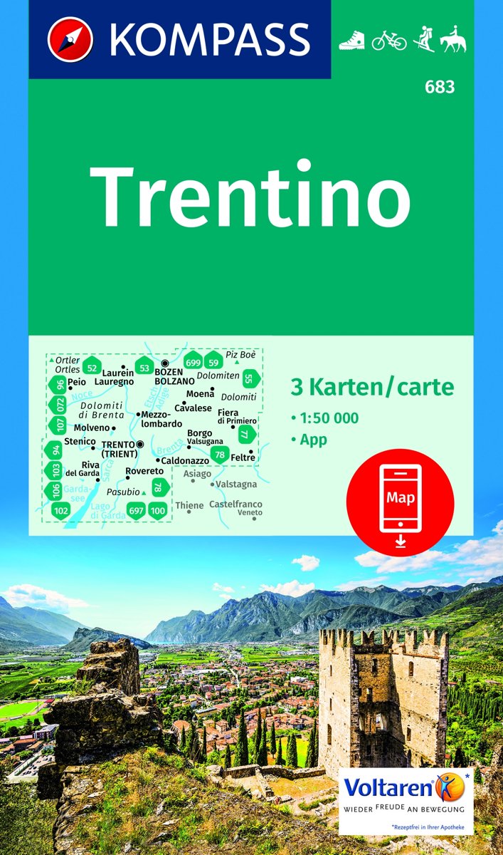
- Trentino 1:50 000
- -Die Provinz Trentino erstreckt sich vom Tonalepass im Westen bis zur Pala-Gruppe bei San Martino di Castrozza im Osten. In der Nord-Süd-Ausdehnung reicht sie von Canazei im Norden und im Süden bis zum Gardasee.-Geprägt wird die östliche Trentino-Region durch einzeln stehende Kalkmassive wie Pala- und Sellagruppe, Latemar-Rosengarten, Marmolata... Read more
- Also available from:
- Bol.com, Belgium
Bol.com
Belgium
Belgium
- Trentino 1:50 000
- -Die Provinz Trentino erstreckt sich vom Tonalepass im Westen bis zur Pala-Gruppe bei San Martino di Castrozza im Osten. In der Nord-Süd-Ausdehnung reicht sie von Canazei im Norden und im Süden bis zum Gardasee.-Geprägt wird die östliche Trentino-Region durch einzeln stehende Kalkmassive wie Pala- und Sellagruppe, Latemar-Rosengarten, Marmolata... Read more
De Zwerver
Netherlands
Netherlands
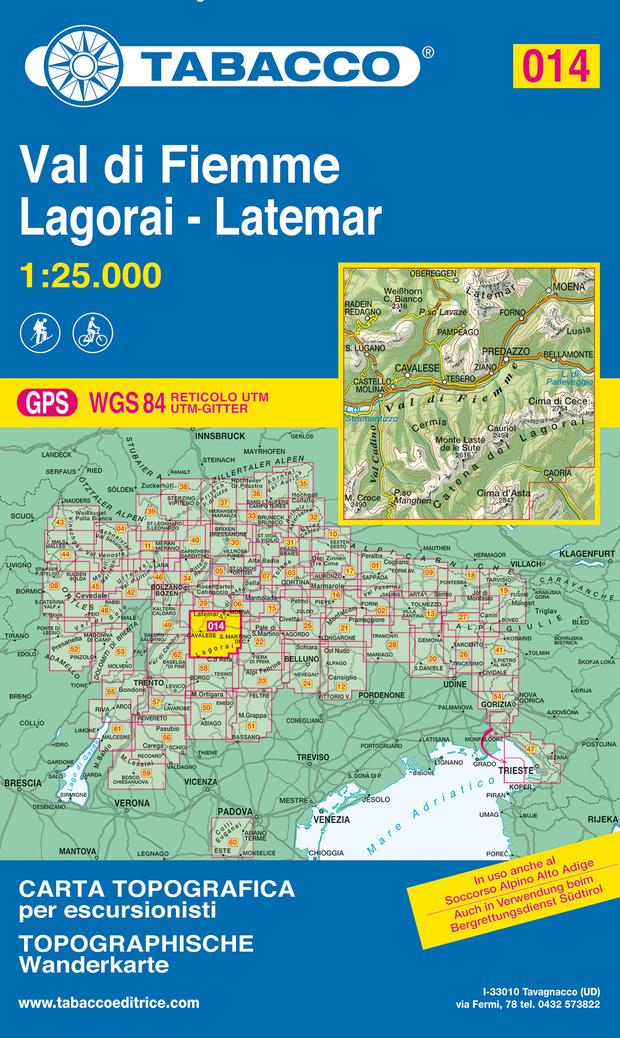
- Wandelkaart 014 Val di Fiemme - Lagorai - Latemar | Tabacco Editrice
- De beste wandelkaarten voor de Dolomieten. Zeer veel topografische details met secure hoogtelijnen (25 meter interval), helder kleurgebruik en bijna alle Tabacco kaarten hebben een UTM grid (voor GPS toepasbaar). Daarnaast zijn op deze wandelkaarten wandelroutes ingetekend met nummering gelijk aan markering onderweg aangebracht door de lokale... Read more
- Also available from:
- Stanfords, United Kingdom
- The Book Depository, United Kingdom

Stanfords
United Kingdom
United Kingdom
- Val di Fiemme - Lagorai - Latemar Tabacco 014
- Val di Fiemme - Lagorai – Latemar area in a series of Tabacco maps at 1:25,000 covering the Dolomites and the mountains of north-eastern Italy - Stanfords’ most popular coverage for this region, with excellent cartography and extensive overprint for hiking routes and other recreational activities, local bus stops, etc. Additional overprint in... Read more

The Book Depository
United Kingdom
United Kingdom
- Val di Fiemme, Lagorai
- De beste wandelkaarten voor de Dolomieten. Zeer veel topografische details met secure hoogtelijnen (25 meter interval), helder kleurgebruik en bijna alle Tabacco kaarten hebben een UTM grid (voor GPS toepasbaar). Daarnaast zijn op deze wandelkaarten wandelroutes ingetekend met nummering gelijk aan markering onderweg aangebracht door de lokale... Read more