
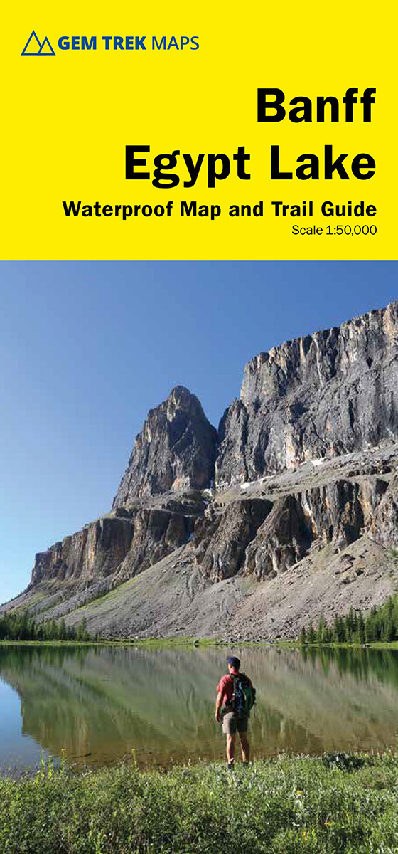
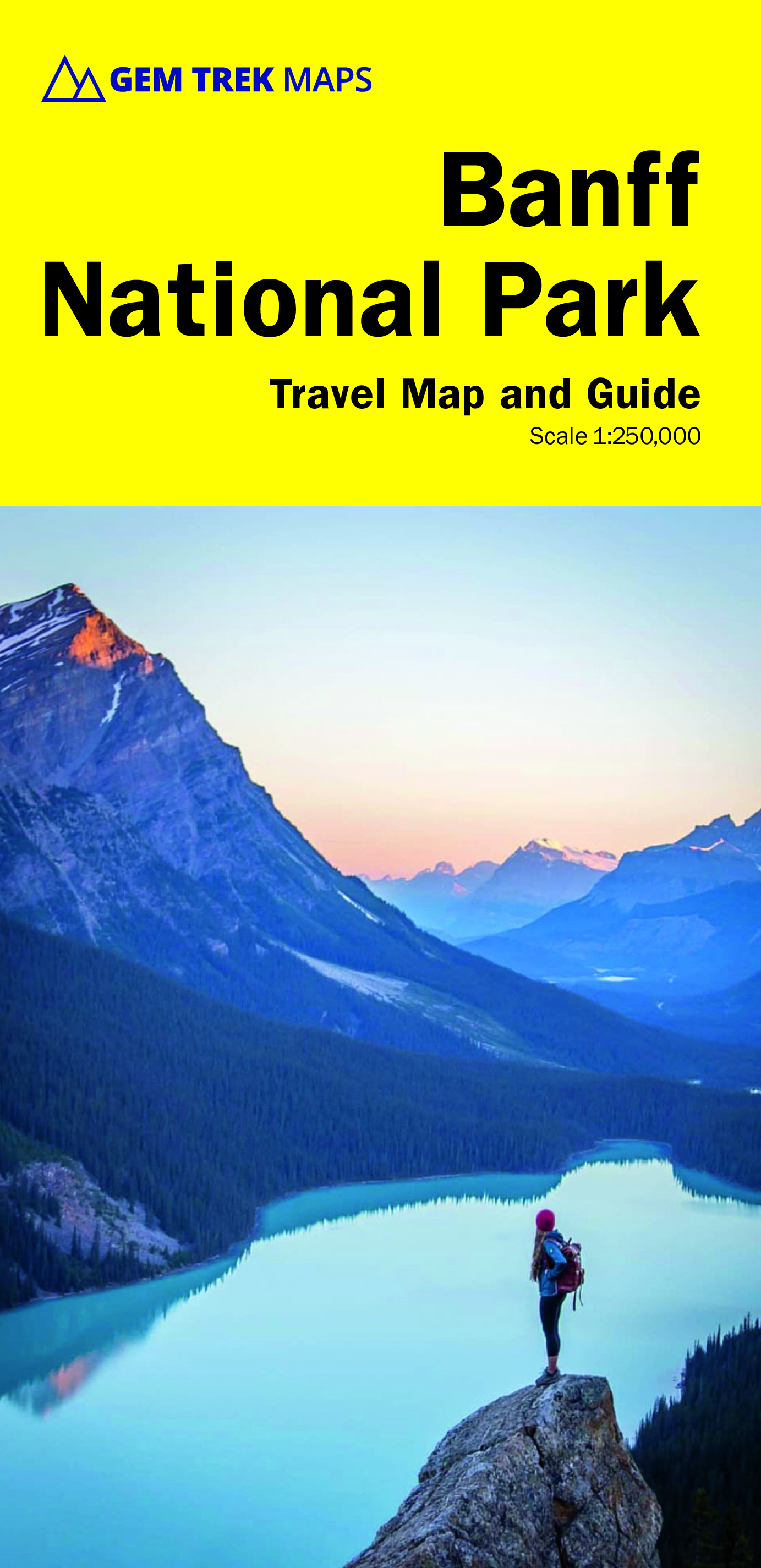
Banff National Park
Beschrijving
National Park in the Canadian Rocky Mountains.
Paden in deze regio
Links
Feiten
Verslagen
Gidsen en kaarten
Overnachting
Organisaties
Reisorganisaties
GPS
Anders
Boeken
De Zwerver
Netherlands
Netherlands
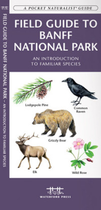
- Vogelgids - Natuurgids Field guide to Banff National Park Wildlife | Waterford Press
- Een bijzonder handige uitklapkaart met alle veelvoorkomende dieren en planten van Banff National Park. Duidelijke illustraties, goede korte omschrijving van soort en leefgebied, geplastificeerd. This fold-up, laminated card features 133 color drawings and short descriptions of commonly encountered wildlife and a map. Laminated for durability,... Read more
De Zwerver
Netherlands
2022
Netherlands
2022
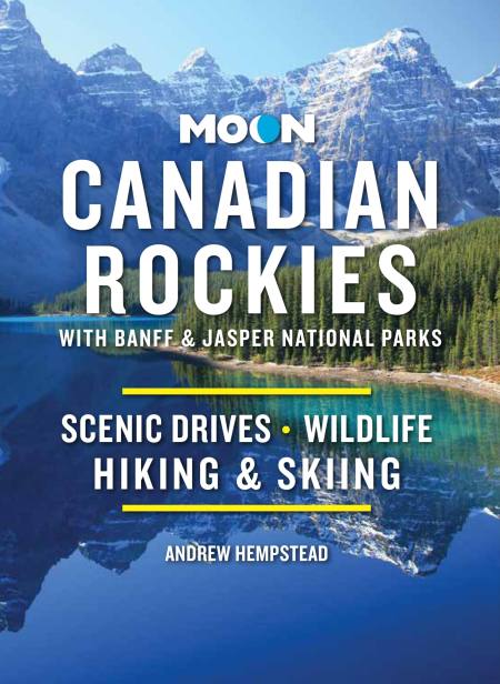
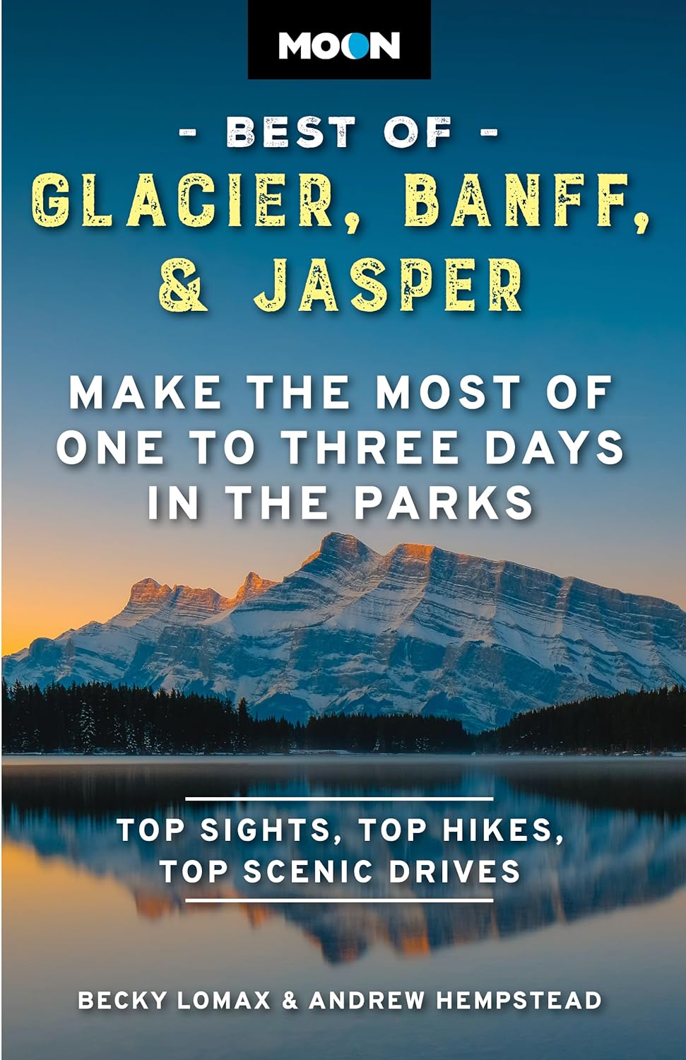
- Reisgids Canadian Rockies, met Banff en Jasper NP | Moon Travel Guides
- Scenic Drives, Wildlife, Hiking & Skiing Read more
De Zwerver
Netherlands
2016
Netherlands
2016
- Also available from:
- Stanfords, United Kingdom

Stanfords
United Kingdom
2016
United Kingdom
2016
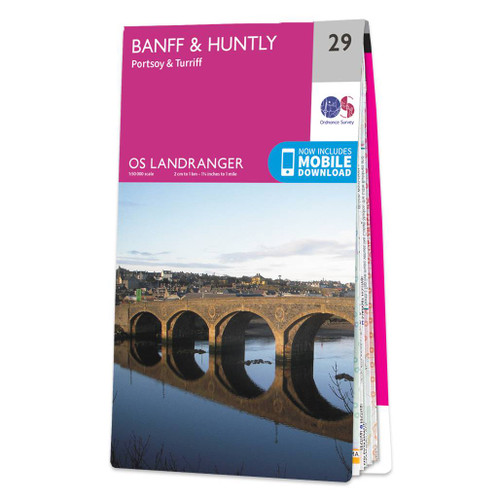
- Banff, Huntly, Portsoy & Turriff OS Landranger Map 29 (paper)
- Paper version of map No. 29 from the Ordnance Survey’s Landranger series at 1:50,000, with contoured and GPS compatible topographic mapping plus tourist information.MOBILE DOWNLOADS: As well as the physical edition of the map, each Landranger title now includes a code for downloading after purchase its digital version onto your smartphone or... Read more
Bol.com
Netherlands
Netherlands
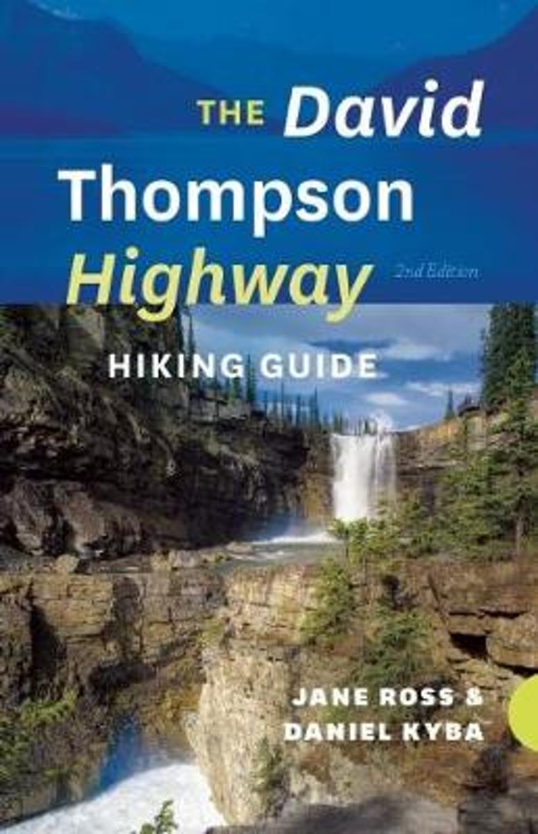
- The David Thompson Highway Hiking Guide
- Another of RMB s bestselling hiking books, The David Thompson Highway Hiking Guide has been completely revised, updated and redesigned for outdoors enthusiasts interested in experiencing a wide variety of easily accessible trails through stunning landscapes in west-central Alberta between the rolling foothills of the Nordegg area and the... Read more
- Also available from:
- Bol.com, Belgium
Bol.com
Belgium
Belgium
- The David Thompson Highway Hiking Guide
- Another of RMB s bestselling hiking books, The David Thompson Highway Hiking Guide has been completely revised, updated and redesigned for outdoors enthusiasts interested in experiencing a wide variety of easily accessible trails through stunning landscapes in west-central Alberta between the rolling foothills of the Nordegg area and the... Read more
Bol.com
Netherlands
Netherlands
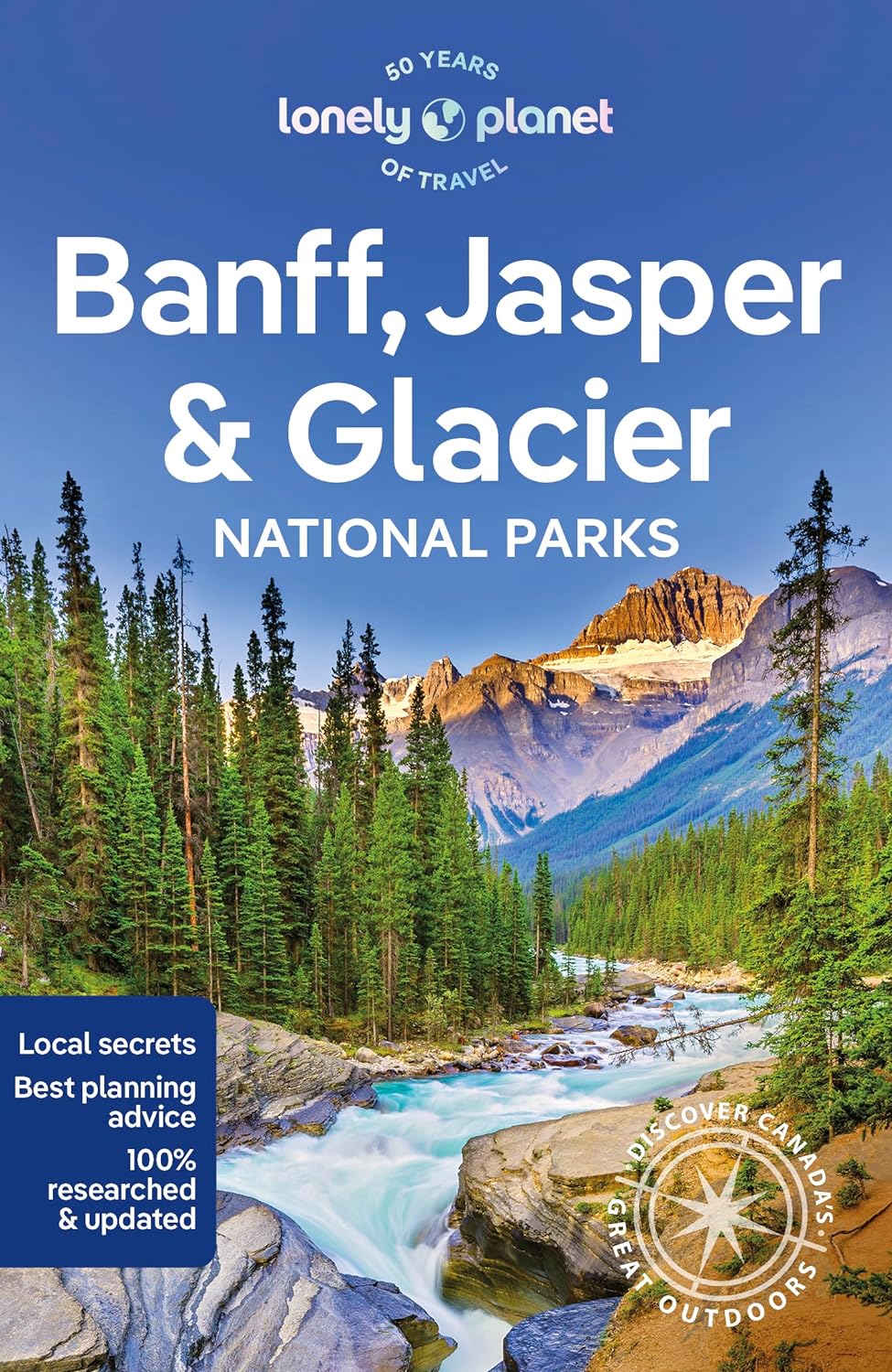
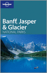
- Lonely Planet Banff, Jasper & Glacier National Parks
- - from hiking the hills to hitting the slopes, summer and winner activities for everyone- special focus on family travel, with short-and long-stay itineraries- over 20 maps with hundreds of miles of trails- covers the parks in their entirety as well as gateway towns and attractions outside the parks- avalanche safety information for backcountry... Read more
- Also available from:
- Bol.com, Belgium
Bol.com
Belgium
Belgium
- Lonely Planet Banff, Jasper & Glacier National Parks
- - from hiking the hills to hitting the slopes, summer and winner activities for everyone- special focus on family travel, with short-and long-stay itineraries- over 20 maps with hundreds of miles of trails- covers the parks in their entirety as well as gateway towns and attractions outside the parks- avalanche safety information for backcountry... Read more
Bol.com
Netherlands
Netherlands
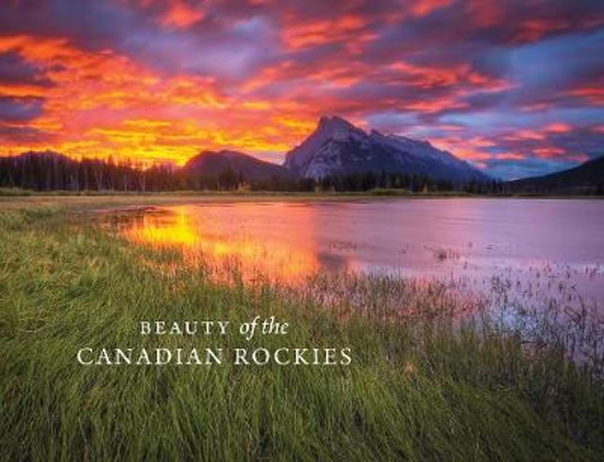
- Beauty of the Canadian Rockies
- In celebration of the 150th anniversary of Canadian Confederation and in conjunction with Parks Canadas announcement that entrance to all of Canadas national parks, national historic sites and national marine conservation areas will be free throughout 2017, RMB is excited to launch an entirely new series of photography books created and... Read more
- Also available from:
- Bol.com, Belgium
Bol.com
Belgium
Belgium
- Beauty of the Canadian Rockies
- In celebration of the 150th anniversary of Canadian Confederation and in conjunction with Parks Canadas announcement that entrance to all of Canadas national parks, national historic sites and national marine conservation areas will be free throughout 2017, RMB is excited to launch an entirely new series of photography books created and... Read more
Bol.com
Netherlands
Netherlands
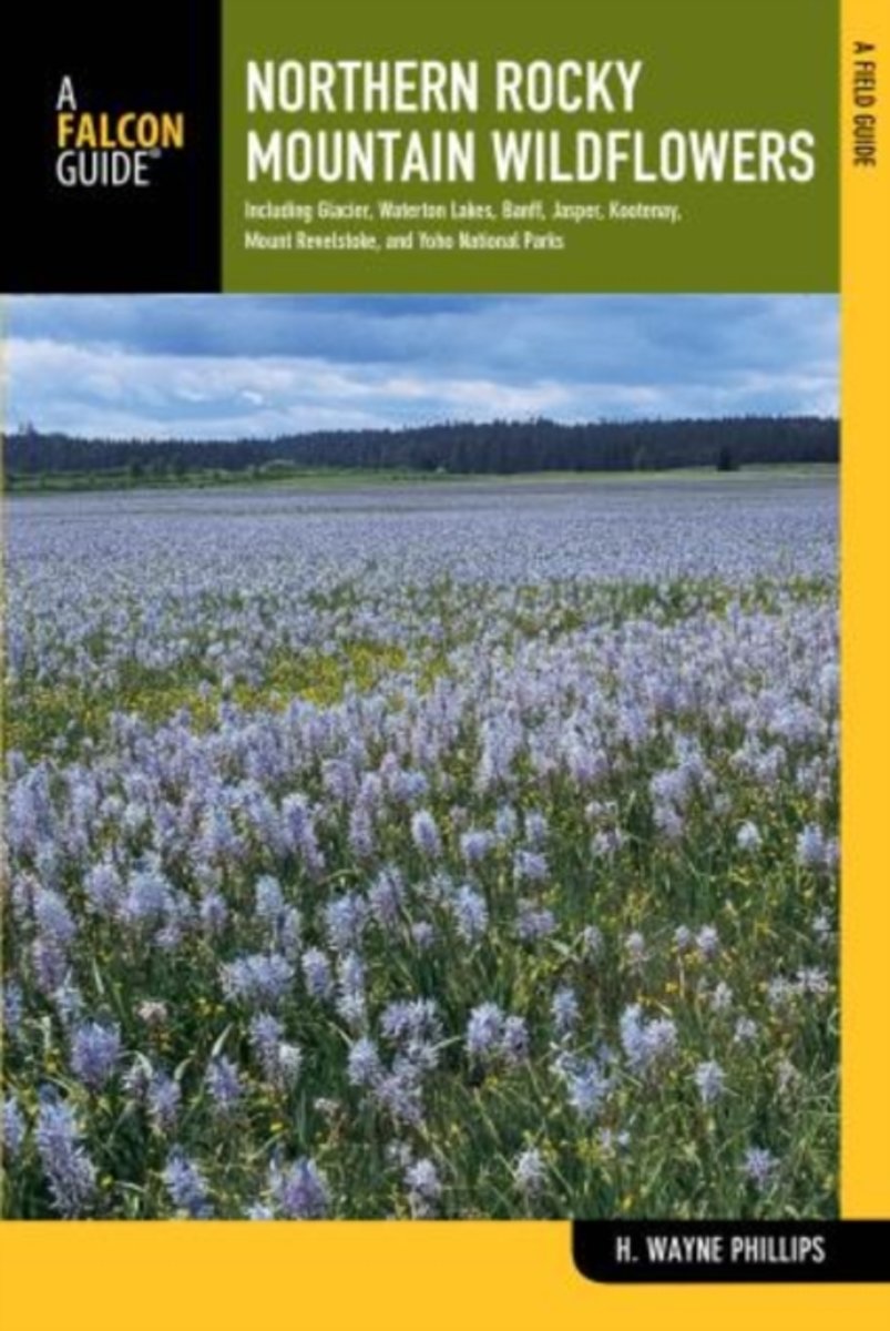
- Northern Rocky Mountain Wildflowers
- Fully revised and upated, Northern Rocky Mountain Wildflowers features more than 300 species of wildflowers found throughout northwestern Montana, northern Idaho, northeastern Washington, southeastern British Columbia, and southwestern Alberta. This valuable reference is organized by color and family for easy plant identification. You won't... Read more
- Also available from:
- Bol.com, Belgium
Bol.com
Belgium
Belgium
- Northern Rocky Mountain Wildflowers
- Fully revised and upated, Northern Rocky Mountain Wildflowers features more than 300 species of wildflowers found throughout northwestern Montana, northern Idaho, northeastern Washington, southeastern British Columbia, and southwestern Alberta. This valuable reference is organized by color and family for easy plant identification. You won't... Read more
Bol.com
Netherlands
Netherlands
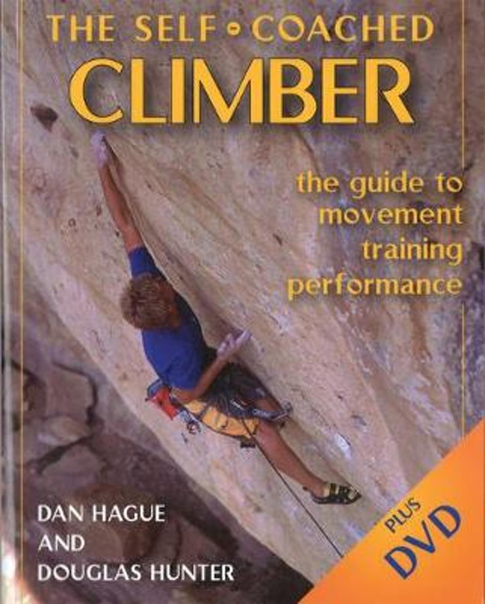
- Self-Coached Climber
- Still the best book on improving at climbing ... worth every penny and more. -- Dave MacLeod, online climbing coach blog In full color with 52 practical training exercises designed to advance technique Detailed anatomical illustrations explain climbing physiology Includes an 85-minute DVD that shows concepts in action A dynamic package of... Read more
- Also available from:
- Bol.com, Belgium
Bol.com
Belgium
Belgium
- Self-Coached Climber
- Still the best book on improving at climbing ... worth every penny and more. -- Dave MacLeod, online climbing coach blog In full color with 52 practical training exercises designed to advance technique Detailed anatomical illustrations explain climbing physiology Includes an 85-minute DVD that shows concepts in action A dynamic package of... Read more
Bol.com
Netherlands
Netherlands
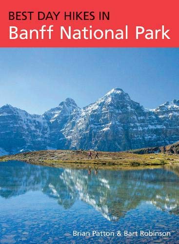
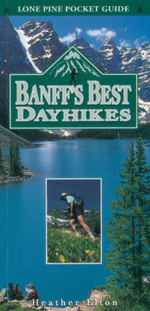
- Banff's Best Dayhikes
- The hikes featured are the best of what can be seen surrounding the townsite of Banff in Canada's National Park. The best trails, their length, elevation, features and estimated hiking times are included. Read more
- Also available from:
- Bol.com, Belgium
Bol.com
Belgium
Belgium
- Banff's Best Dayhikes
- The hikes featured are the best of what can be seen surrounding the townsite of Banff in Canada's National Park. The best trails, their length, elevation, features and estimated hiking times are included. Read more
De Zwerver
Netherlands
2017
Netherlands
2017
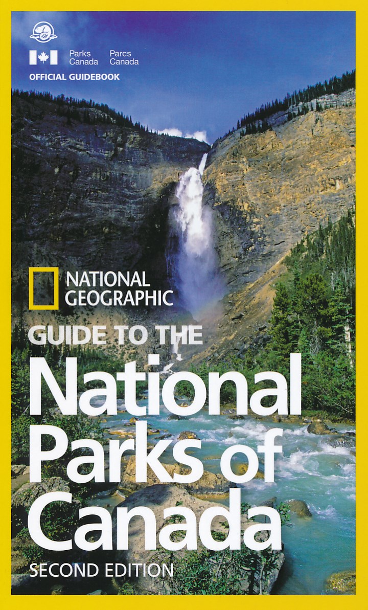
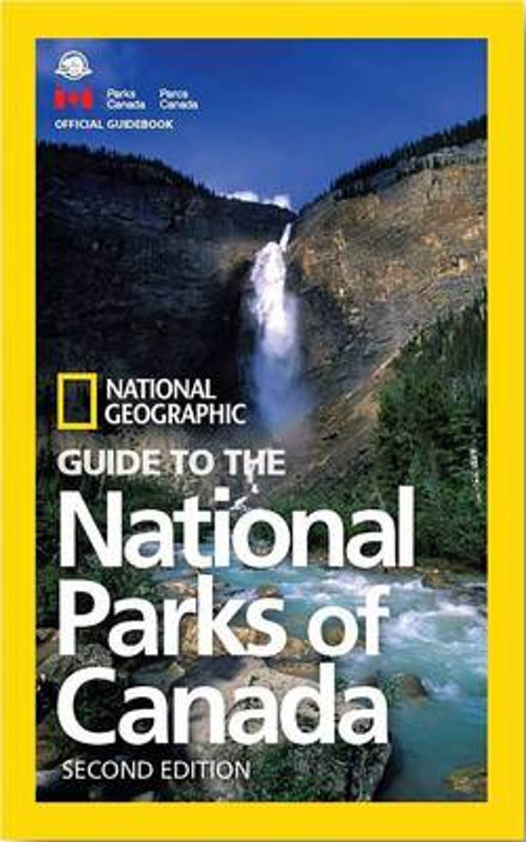
- Reisgids National Parks of Canada | National Geographic
- Per provincie worden de parken helder beschreven en aangevuld met duidelijke kaarten en prachtige foto's zoals we van National Geographic gewend zijn levert dit een complete gids op. This completely updated guidebook shows you how to make the most out of your visit to Canada's 47 gorgeous national parks, just in time for Canada's 150th... Read more
- Also available from:
- Bol.com, Netherlands
- Bol.com, Belgium
Bol.com
Netherlands
2017
Netherlands
2017
- NG Guide to the National Parks of Canada, 2nd Edition
- This completely updated guidebook shows you how to make the most out of your visit to Canada's 47 gorgeous national parks, just in time for Canada's 150th birthday--from Cape Breton Highlands to Banff to Pacific Rim National Park Preserve, plus the five newest additions: Naats'ihch'oh National Park Reserve, Mealy Mountains, Rouge Urban,... Read more
Bol.com
Belgium
2017
Belgium
2017
- NG Guide to the National Parks of Canada, 2nd Edition
- This completely updated guidebook shows you how to make the most out of your visit to Canada's 47 gorgeous national parks, just in time for Canada's 150th birthday--from Cape Breton Highlands to Banff to Pacific Rim National Park Preserve, plus the five newest additions: Naats'ihch'oh National Park Reserve, Mealy Mountains, Rouge Urban,... Read more
Bol.com
Netherlands
Netherlands
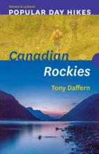
- Popular Day Hikes 2
- Featuring a fresh design and the most recent route updates, Popular Day Hikes is a series of bestselling books written for visitors and locals looking to hike scenic trails from well-established staging areas.Popular Day Hikes 2 covers 37 popular, accessible trails in one of the world s most stunningly beautiful natural environments. Featuring... Read more
- Also available from:
- Bol.com, Belgium
Bol.com
Belgium
Belgium
- Popular Day Hikes 2
- Featuring a fresh design and the most recent route updates, Popular Day Hikes is a series of bestselling books written for visitors and locals looking to hike scenic trails from well-established staging areas.Popular Day Hikes 2 covers 37 popular, accessible trails in one of the world s most stunningly beautiful natural environments. Featuring... Read more
Bol.com
Netherlands
2017
Netherlands
2017
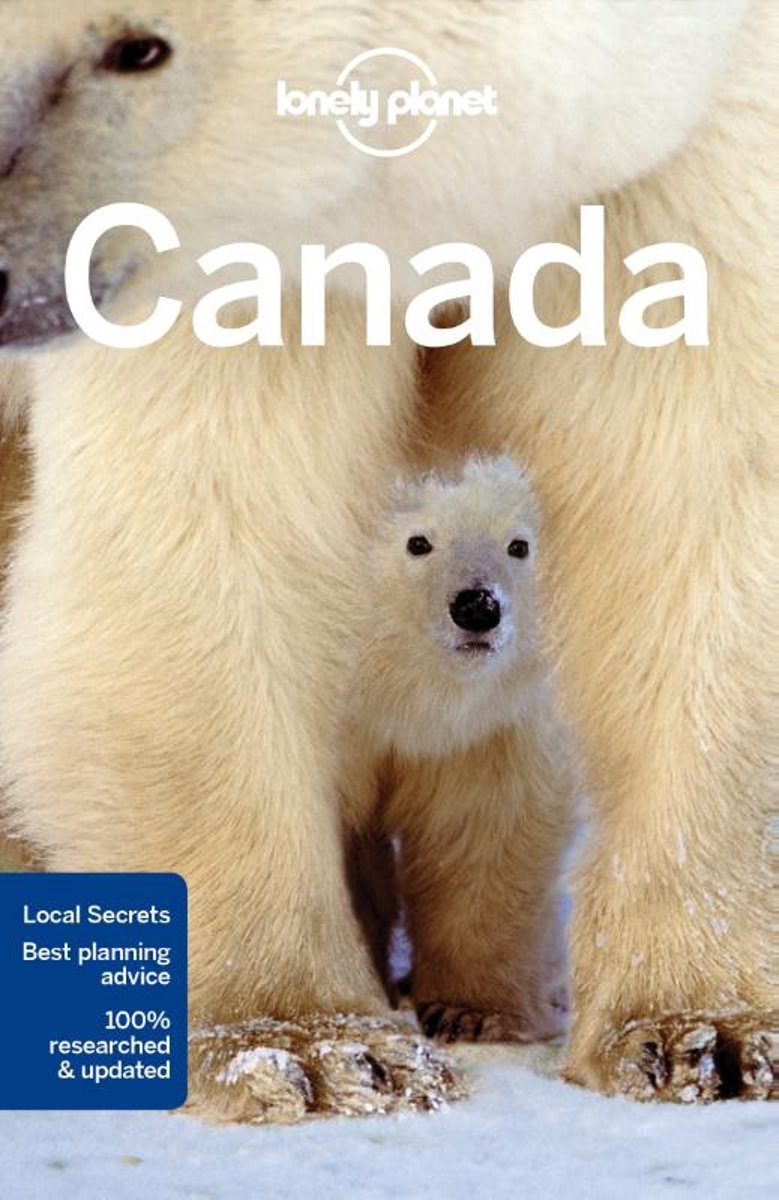
- Lonely Planet Canada
- Lonely Planet: The world's leading travel guide publisher Lonely Planet Canada is your passport to the most relevant, up-to-date advice on what to see and skip, and what hidden discoveries await you. Hike the Rockies, marvel at the Northern Lights, or indulge in cultural delights from Montreal's cafe culture to the island villages of Haida... Read more
- Also available from:
- Bol.com, Belgium
Bol.com
Belgium
2017
Belgium
2017
- Lonely Planet Canada
- Lonely Planet: The world's leading travel guide publisher Lonely Planet Canada is your passport to the most relevant, up-to-date advice on what to see and skip, and what hidden discoveries await you. Hike the Rockies, marvel at the Northern Lights, or indulge in cultural delights from Montreal's cafe culture to the island villages of Haida... Read more
Kaarten
De Zwerver
Netherlands
Netherlands
De Zwerver
Netherlands
2020
Netherlands
2020
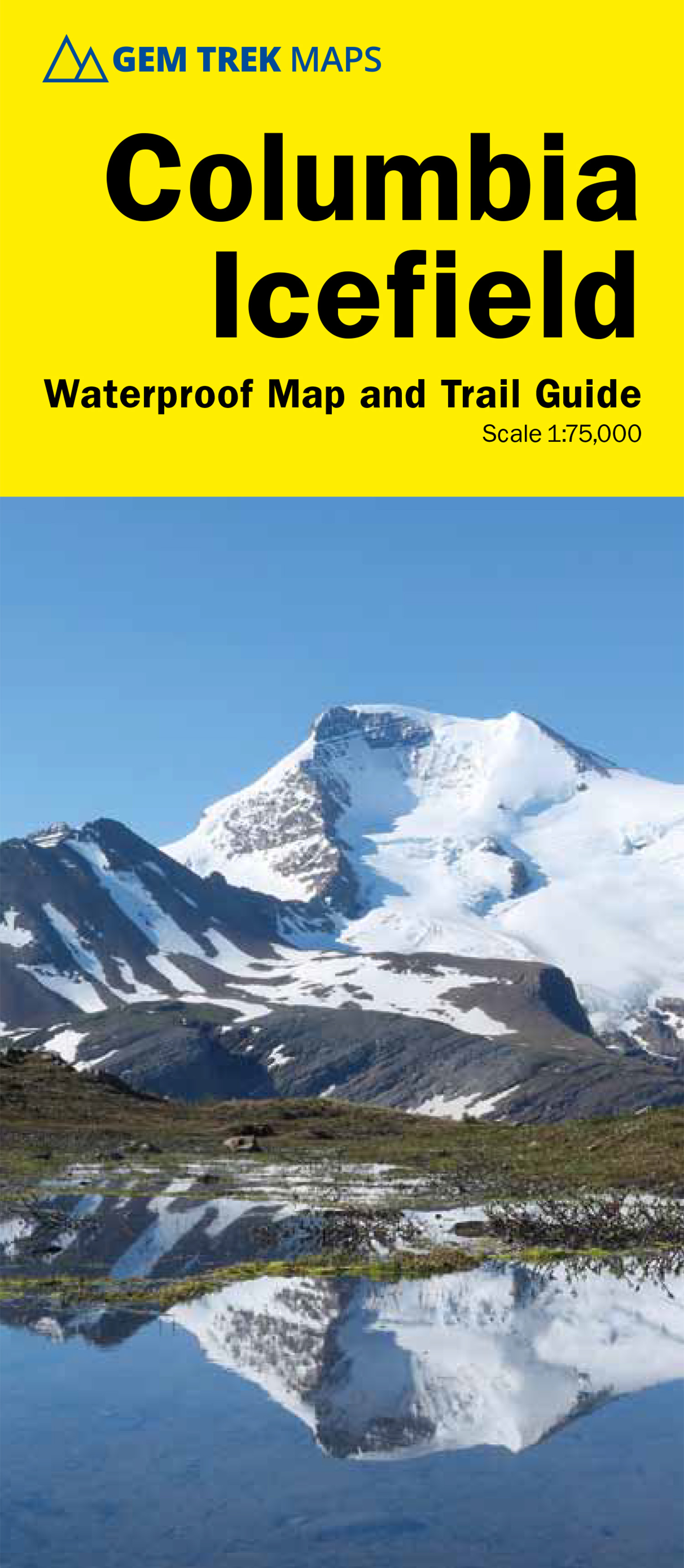
- Wandelkaart 02 Columbia Icefield | Gem Trek Maps
- Columbia Icefield spanning the border between the Banff and the Jasper National Parks in the Canadian Rockies on a contoured and GPS-compatible, waterproof and tear-resistant map at 1:75,000 from Gem Trek, with extensive tourist information including recommended hikes, geology, etc. Coverage extends along both sides of the Icefields Parkway... Read more
- Also available from:
- Stanfords, United Kingdom

Stanfords
United Kingdom
2020
United Kingdom
2020
- Columbia Icefield Gem Trek Map
- Columbia Icefield spanning the border between the Banff and the Jasper National Parks in the Canadian Rockies on a contoured and GPS-compatible, waterproof and tear-resistant map at 1:75,000 from Gem Trek, with extensive tourist information including recommended hikes, geology, etc. Coverage extends along both sides of the Icefields Parkway... Read more
De Zwerver
Netherlands
Netherlands
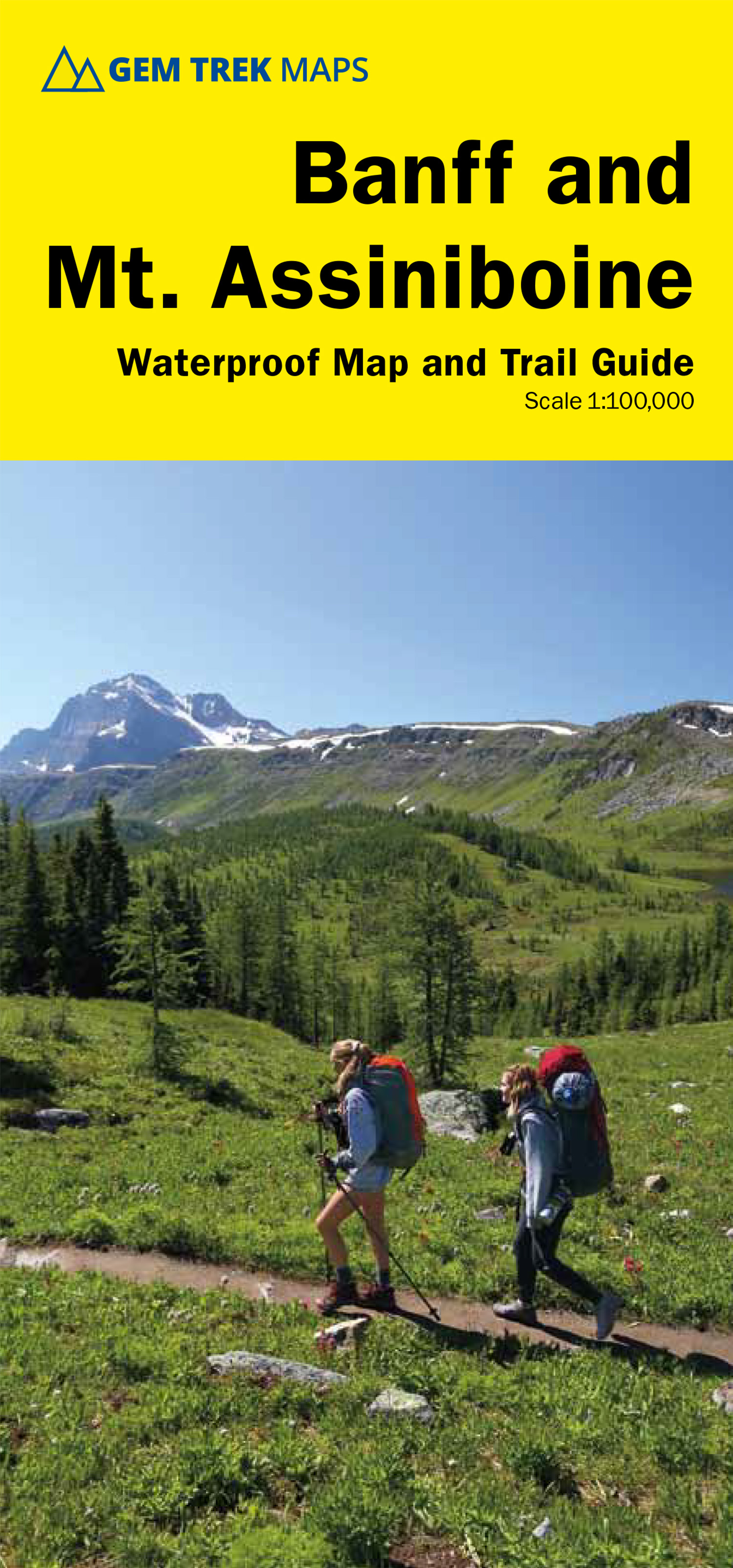
- Wandelkaart 05 Banff National Park and Mt. Assiniboine | Gem Trek Maps
- Banff - Mount Assiniboine area at 1:100,000 on a light, waterproof and tear-resistant map from Gem Trek Publishing in their series of detailed hiking maps of the Canadian Rockies. On the reverse are descriptions of several day hikes and overnight trips, plus plenty of other tourist information.The map covers the most popular hiking and mountain... Read more
- Also available from:
- Stanfords, United Kingdom

Stanfords
United Kingdom
United Kingdom
- Banff & Mount Assiniboine Gem Trek
- Banff - Mount Assiniboine area at 1:100,000 on a light, waterproof and tear-resistant map from Gem Trek Publishing in their series of detailed hiking maps of the Canadian Rockies. On the reverse are descriptions of several day hikes and overnight trips, plus plenty of other tourist information.The map covers the most popular hiking and mountain... Read more
De Zwerver
Netherlands
Netherlands
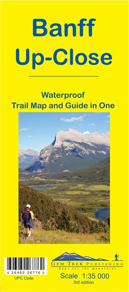
- Wandelkaart 11 Banff Up-Close | Gem Trek Maps
- Gem Trek Map-Guides Banff Up-Close (11) - This map-and-guide-in-one is designed for people who are only going to be in Banff for one to three days, and want to know what the highlights are and how to find them.On the front is a detailed relief-shaded topographic map of the Banff townsite area, from the Sundance and Sulphur Mountain areas in the... Read more
- Also available from:
- Stanfords, United Kingdom

Stanfords
United Kingdom
United Kingdom
- Banff Up-Close Gem Trek
- Banff town and the surrounding area on a contoured and GPS compatible, waterproof and tear-resistant map/guide at 1:35,000 from Gem Trek, designed for people who are only going to be in Banff for one to three days and want to know the highlights. On one side is a detailed, topographic map of the Banff village area, from the Sundance and Sulphur... Read more
De Zwerver
Netherlands
Netherlands
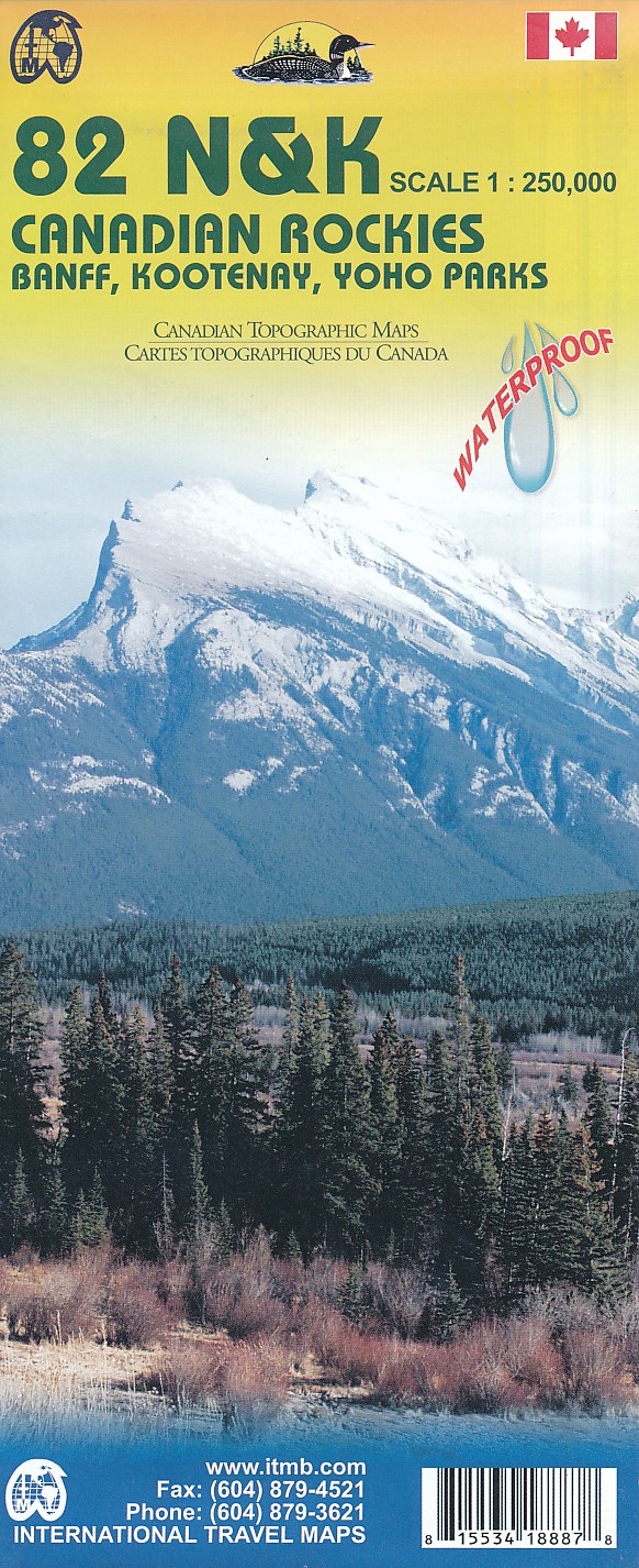
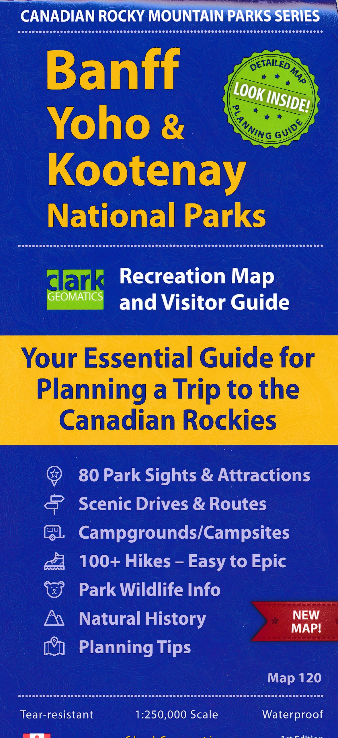
- Topografische kaart 82 N&K Canadian Rockies Banff, Kootenay, Yoho Parks | ITMB
- 1:250,000 scale, 1st Edition, 2008 – This is a fabulous map. The artwork consists of four complete Govt. of Canada Topographic maps (82J, K, N, and O) overprinted with hundreds of touristic attractions – camping sites, hiking trails, canoeing areas, wilderness lodges, youth hostels, golf courses – you name it, it's there. Coverage is from... Read more
- Also available from:
- Stanfords, United Kingdom

Stanfords
United Kingdom
United Kingdom
- Canadian Rockies - Banff - Kootenay - Yoho Parks ITMB
- Canadian Rockies: Banff, Kootenay and Yoho National Parks at 1:250,000 in a series of topographic survey maps of selected areas of British Columbia and the Canadian Rockies from ITMB with cartography from Canada’s national survey organization. Most sheets are printed on light, waterproof and tear- resistant plastic paper.Whilst the Canadian... Read more

De Zwerver
Netherlands
Netherlands
- Wandelkaart 03 Bow Lake and Saskatchewan Crossing | Gem Trek Maps
- Bow Lake - Saskatchewan Crossing region of the Canadian Rockies on a contoured and GPS compatible map at 1:70,000 from Gem Trek with an extension at 1:100,000 to include the Mosquito Creek – Fish Lakes area, plus extensive tourist information on recommended hikes, etc.The map shows trails departing from the southern section of the Icefields... Read more
- Also available from:
- Stanfords, United Kingdom

Stanfords
United Kingdom
United Kingdom
- Bow Lake & Saskatchewan Crossing Gem Trek Map
- Bow Lake - Saskatchewan Crossing region of the Canadian Rockies on a contoured and GPS compatible map at 1:70,000 from Gem Trek with an extension at 1:100,000 to include the Mosquito Creek – Fish Lakes area, plus extensive tourist information on recommended hikes, etc.The map shows trails departing from the southern section of the Icefields... Read more
De Zwerver
Netherlands
Netherlands
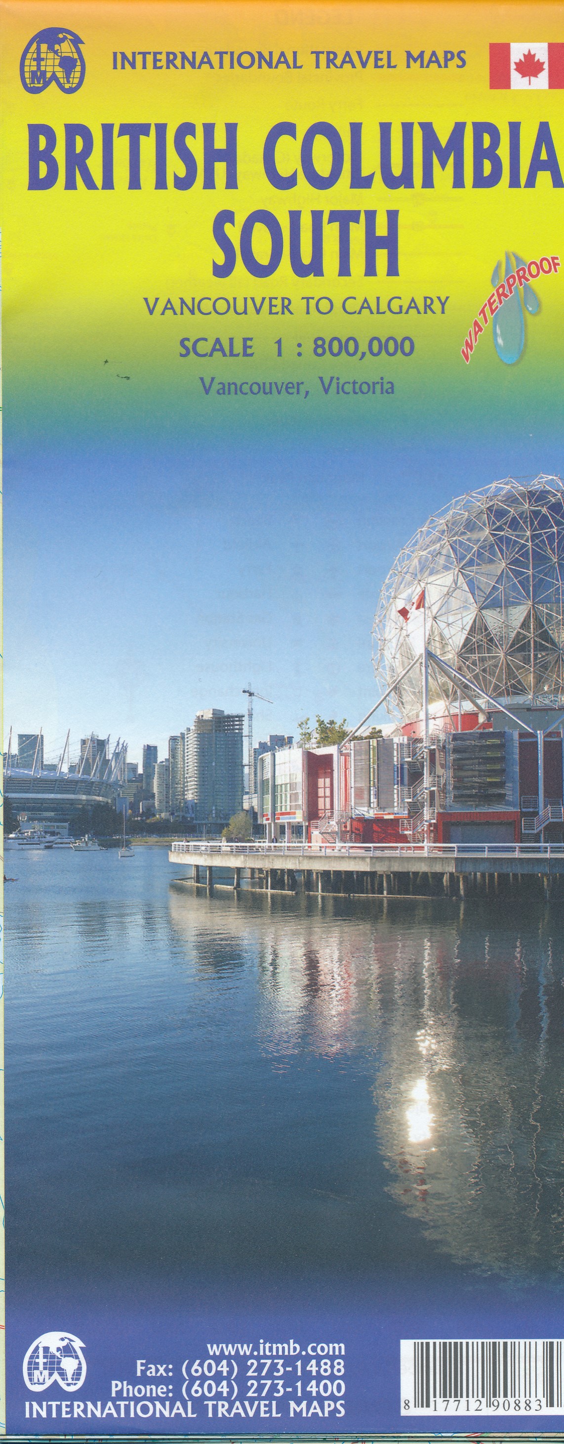
- Wegenkaart - landkaart British Columbia South (Canada) | ITMB
- Indexed double-sided road map at 1:900,000 from ITMB of the southern part of British Columbia, extending from Vancouver Island to Calgary to cover the whole of the Banff and Jasper National Parks, with plans of downtown Vancouver and Victoria. Coverage northwards extends to include the southern part of Haida Gwai (Queen Charlotte) Islands and... Read more
- Also available from:
- Stanfords, United Kingdom

Stanfords
United Kingdom
United Kingdom
- British Columbia South ITMB
- Indexed double-sided road map at 1:800,000 from ITMB of the southern part of British Columbia, extending from Vancouver Island to Calgary to cover the whole of the Banff and Jasper National Parks, with plans of downtown Vancouver and Victoria. Coverage northwards extends to include the southern part of Haida Gwai (Queen Charlotte) Islands and... Read more
De Zwerver
Netherlands
Netherlands
De Zwerver
Netherlands
Netherlands
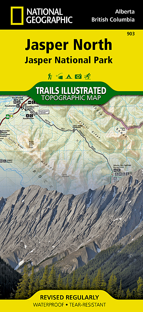
- Wandelkaart - Wegenkaart - landkaart 903 Jasper North National Park | National Geographic
- The northern part of the Jasper National Park on a double-sided, contoured, GPS compatible recreational map at 1:100,000 from the National Geographic printed on light, waterproof and tear-resistant synthetic paper. Coverage extends along the Icefields Parkway from Jasper Village and the Yellowhead Highway to the northern boundary of the... Read more
- Also available from:
- Bol.com, Netherlands
- Bol.com, Belgium
- Stanfords, United Kingdom
Bol.com
Netherlands
Netherlands
- Jasper North
- Waterproof Tear-Resistant Topographic MapNational Geographic's Trails Illustrated map of Jasper North is a two-sided, waterproof map designed to meet the needs of outdoor enthusiasts with unmatched durability and detail. This map was created in conjunction with local land management agencies and is loaded with valuable recreation... Read more
Bol.com
Belgium
Belgium
- Jasper North
- Waterproof Tear-Resistant Topographic MapNational Geographic's Trails Illustrated map of Jasper North is a two-sided, waterproof map designed to meet the needs of outdoor enthusiasts with unmatched durability and detail. This map was created in conjunction with local land management agencies and is loaded with valuable recreation... Read more

Stanfords
United Kingdom
United Kingdom
- Jasper North - Jasper National Park
- The northern part of the Jasper National Park on a double-sided, contoured, GPS compatible recreational map at 1:100,000 from the National Geographic printed on light, waterproof and tear-resistant synthetic paper. Coverage extends along the Icefields Parkway from Jasper Village and the Yellowhead Highway to the northern boundary of the... Read more
De Zwerver
Netherlands
Netherlands
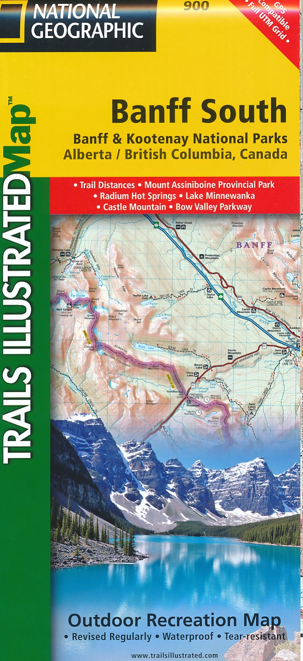
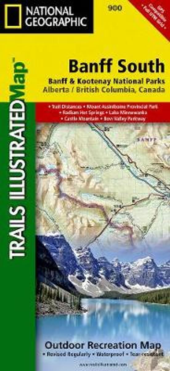
- Wandelkaart 900 Banff South National Park | National Geographic
- The southern part of the Banff National Park on a double-sided, contoured, GPS compatible recreational map at 1:100,000 from the National Geographic printed on light, waterproof and tear-resistant synthetic paper. Coverage extends to the southern boundary of the Kootenay National Park, with a wide overlap and Banff village shown on both sides... Read more
- Also available from:
- Bol.com, Netherlands
- Bol.com, Belgium
- Stanfords, United Kingdom
Bol.com
Netherlands
Netherlands
- Banff South
- Waterproof Tear-Resistant Topographic MapNational Geographic's Trails Illustrated map of Banff South is a two-sided, waterproof map designed to meet the needs of outdoor enthusiasts with unmatched durability and detail. This map was created in conjunction with local land management agencies and is loaded with valuable recreation... Read more
Bol.com
Belgium
Belgium
- Banff South
- Waterproof Tear-Resistant Topographic MapNational Geographic's Trails Illustrated map of Banff South is a two-sided, waterproof map designed to meet the needs of outdoor enthusiasts with unmatched durability and detail. This map was created in conjunction with local land management agencies and is loaded with valuable recreation... Read more

Stanfords
United Kingdom
United Kingdom
- Banff South - Banff & Kootenay National Parks
- The southern part of the Banff National Park on a double-sided, contoured, GPS compatible recreational map at 1:100,000 from the National Geographic printed on light, waterproof and tear-resistant synthetic paper. Coverage extends to the southern boundary of the Kootenay National Park, with a wide overlap and Banff village shown on both sides... Read more

De Zwerver
Netherlands
Netherlands
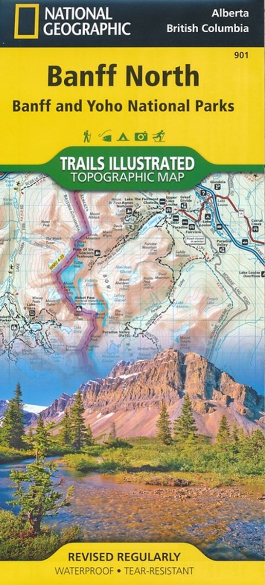
- Wandelkaart 901 Banff North National Park | National Geographic
- The northern part of the Banff National Park on a double-sided, contoured, GPS compatible recreational map at 1:100,000 from the National Geographic printed on light, waterproof and tear-resistant synthetic paper. Coverage includes Lake Louise, the Saskatchewan River Crossing and the Columbia Icefield.This title is part of a series of four... Read more
- Also available from:
- Bol.com, Netherlands
- Bol.com, Belgium
- Stanfords, United Kingdom
Bol.com
Netherlands
Netherlands
- Banff North
- Waterproof Tear-Resistant Topographic MapNational Geographic's Trails Illustrated map of Banff North is a two-sided, waterproof map designed to meet the needs of outdoor enthusiasts with unmatched durability and detail. This map was created in conjunction with local land management agencies and is loaded with valuable recreation... Read more
Bol.com
Belgium
Belgium
- Banff North
- Waterproof Tear-Resistant Topographic MapNational Geographic's Trails Illustrated map of Banff North is a two-sided, waterproof map designed to meet the needs of outdoor enthusiasts with unmatched durability and detail. This map was created in conjunction with local land management agencies and is loaded with valuable recreation... Read more

Stanfords
United Kingdom
United Kingdom
- Banff North - Banff and Yoho National Parks NGS Trails Illustrated Map 901
- The northern part of the Banff National Park on a double-sided, contoured, GPS compatible recreational map at 1:100,000 from the National Geographic printed on light, waterproof and tear-resistant synthetic paper. Coverage includes Lake Louise, the Saskatchewan River Crossing and the Columbia Icefield.This title is part of a series of four... Read more
De Zwerver
Netherlands
Netherlands
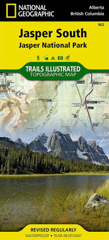
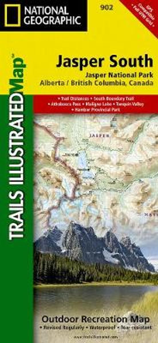
- Wandelkaart - Wegenkaart - landkaart 902 Jasper South National Park | National Geographic
- The southern part of the Jasper National Park on a double-sided, contoured, GPS compatible recreational map at 1:100,000 from the National Geographic printed on light, waterproof and tear-resistant synthetic paper. Coverage extends along the Icefields Parkway to just beyond Jasper Village.This title is part of a series of four recreational maps... Read more
- Also available from:
- Bol.com, Netherlands
- Bol.com, Belgium
- Stanfords, United Kingdom
Bol.com
Netherlands
Netherlands
- Jasper South
- Waterproof Tear-Resistant Topographic MapNational Geographic's Trails Illustrated map of Jasper South is a two-sided, waterproof map designed to meet the needs of outdoor enthusiasts with unmatched durability and detail. This map was created in conjunction with local land management agencies and is loaded with valuable recreation... Read more
Bol.com
Belgium
Belgium
- Jasper South
- Waterproof Tear-Resistant Topographic MapNational Geographic's Trails Illustrated map of Jasper South is a two-sided, waterproof map designed to meet the needs of outdoor enthusiasts with unmatched durability and detail. This map was created in conjunction with local land management agencies and is loaded with valuable recreation... Read more

Stanfords
United Kingdom
United Kingdom
- Jasper South - Jasper National Park
- The southern part of the Jasper National Park on a double-sided, contoured, GPS compatible recreational map at 1:100,000 from the National Geographic printed on light, waterproof and tear-resistant synthetic paper. Coverage extends along the Icefields Parkway to just beyond Jasper Village.This title is part of a series of four recreational maps... Read more