E6
Beschrijving
- Name E6 (E6)
- Lengte van pad 6,283 km, 3,904 mijl
- Lengte in dagen 315 dagen
- Start van pad Kilpisjärvi (Fin)
- Einde van pad Alexandroupolis (Gr)
- Traildino graad EW, Makkelijke wandeling, natuurpad

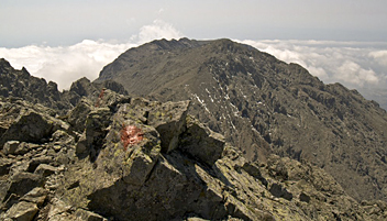 E6: Kilpisjärvi (Fin) - Alexandroupolis (Gr), 5200 km
Lapland - Baltic Sea – Wachau – Adriatic – Aegean Sea
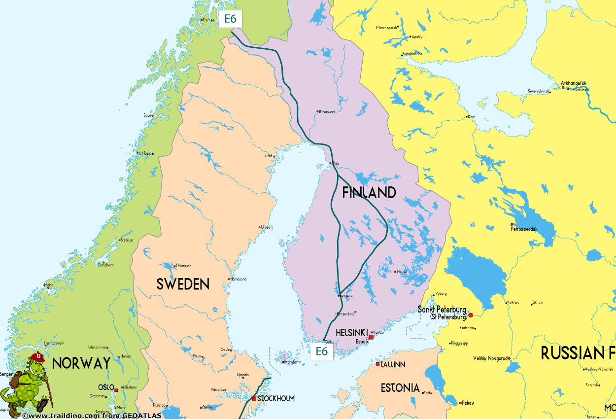
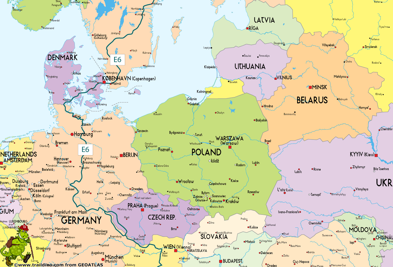
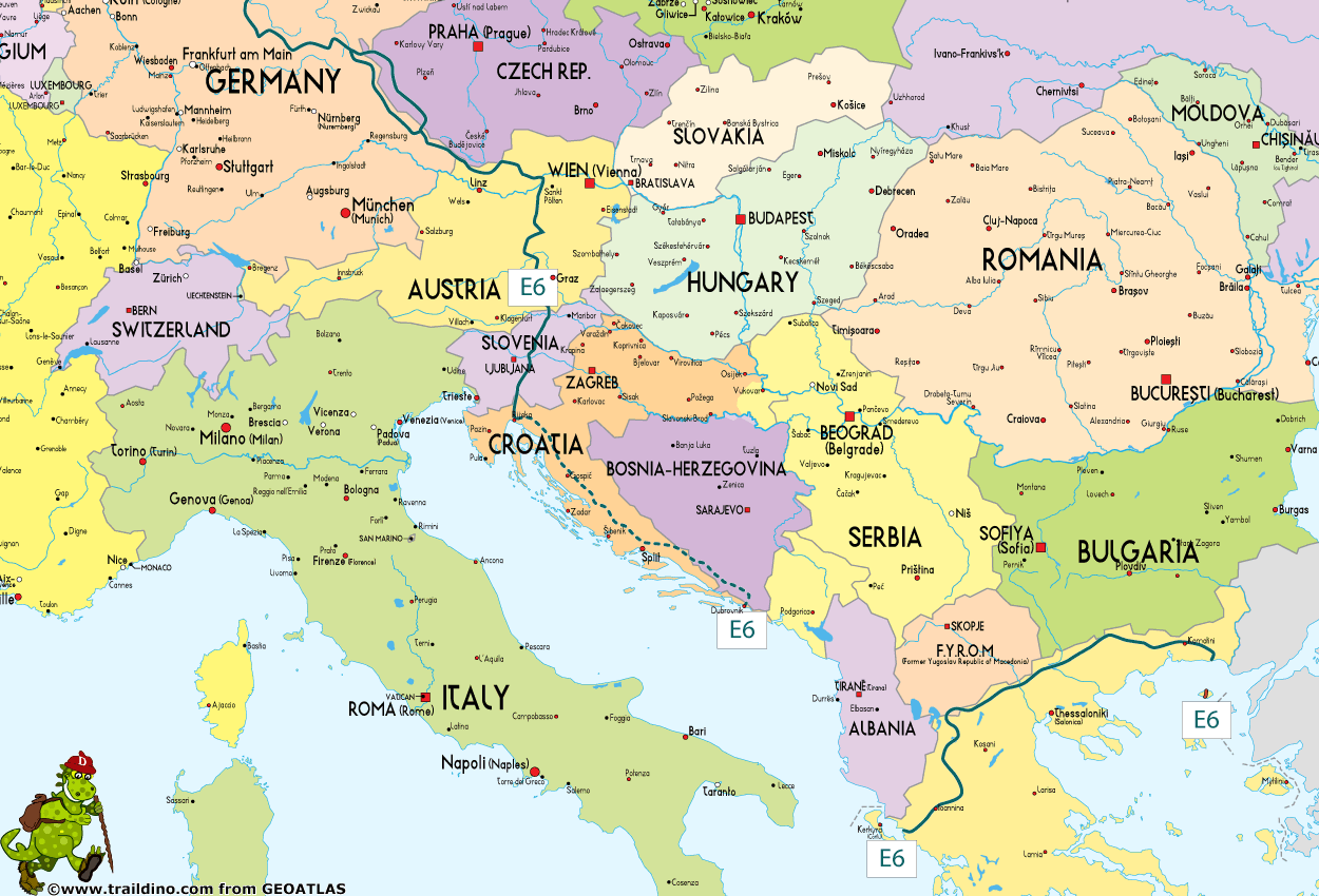
Stretching out for 6300km, this path sets off from Kilpisjärvi, way up in the northwest of Finland. It leads south through Sweden, Denmark, Germany, Austria and Slovenia until it reaches the Adriatic. From here there is a gap until Greece, to be bridged by ferry to Igoumenitsa. The trail then continues across northern Greece to end on the Aegean sea.
Finnland (2000 km, mostly unmarked)
Important Note: Suomen Latu ry from Finland is not a member of the ERA anymore. The information below is outdated information, just in case you are interested anyway. The proposed E6 trail through Finland is probably incomplete and unmarked.
- Start in Kilpisjärvi, border with Norway
- Kilpisjärvi - Iso-Syöte, not marked
- Urho Kaleva Kekkonen trail, Iso-Syöte - Vuokatti - Maanselkä, 400 km marked
- Maanselkä - Keuruu, not marked
- Keski-Soumen-Maakuntaura, Keuruu - Saarijärvi, 184 km marked
- Keuruu – Tevanniemi, 136 km, marked
- Tevanniemi - Turku, not marked
- Side trail: Helsinki - Turku, marked
- End in Turku
Sweden (1312 km, marked)
- Ferry from Turku to Grisslehamn
- Start in Grisslehamn
- Roslagsleden, Grisslehamn, Norrtälje - Danderyd (Stockholm), 107 km
- Sörmlandsleden, Stockholm – Norrköpping, 300 km
- Östgötaleden, Norrköpping – near Eksjö, 210 km
- Höglandsleden, near Eksjö - near Isaberg, 250 km
- Gislavedsleden, near Isaberg – near Kinnared, 85 km
- Hallandsleden, near Kinnared – near Båstad, 110 km
- Kust till kustleden plus
- Nord till Sydleden, till Malmö, 250 km
- Last city is Malmö
Denmark (342 km, marked)
- Bridge from Malmö
- Start in Kastrup
Sjælland:
- Sjællandsleden, Kastrup - Korsør, 163 km marked
- Bridge to Nyborg
Fyn:
- Local trails, Nyborg - Hesselagergård, 30 km, bicycle route
- Øhavsstien, Hesselagergård - Svendborg, 33 km marked
- Boat to Ærøskøbing
Ærø:
- Øhavsstien, Ærøskøbing - Søby, 20 km marked
- Boat to Fynshav
Als and Jylland:
- Local trails, Fynshav - Høruphav, 17 km not marked
- Gendarmstien, Høruphav - Kruså, 79 km marked
Germany (1522 km, marked)
- Start in Kruså (Dk) / Kupfermühle (D)
- Kupfermühle - Flensburg – Schleswig – Kiel, 135 km
- Kiel – Lübeck, 152 km
- Lübeck – Lauenburg, 103 km
- Lauenburg – Gifhorn, 164
- Gifhorn – Wolfenbüttel – Goslar, 102 km
- Goslar – Göttingen, 98 km
- Werraburgsteig, Wartburgpfad, Frau-Holle-pfad, Göttingen – Münden- Eschwege – Hünfeld, 223 km
- Hünfeld – Coburg, 183 km
- Quellenweg, Coburg – Marktredwitz, 163 km
- From here, you can take the alternative route via Czech Republic to Bayerisch Eisenstein, see below
- Ostweg, Nurtschweg, Marktredwitz - Waldmünchen - Bayerisch Eisenstein, 199 km
- Nordwaldkammweg, Bayerisch Eisenstein - Dreisesselberg, 190 km
- Last village: Haidmühle
- Last place
Czech Republic (220 km, marked, alternative route between Marktredwitz and Bayerisch Eisenstein)
- Start in Marktredwitz (Germany)
- First village in Czech Republic: Pomezí nad Ohří
- Marktredwitz - Pomezí nad Ohří, about 20 km not marked
- Pomezí - Mariánské Lázně -Železná Ruda, 220 km marked
- Last village: Železná Ruda, border with Germany (Bayerisch Eisenstein)
Austria (670 km, marked)
- First place: Dreissesselberg in Germany
- Nord-Süd-Weg, Weitwanderweg 05, Dreisesselberg - Freistadt – Karlstift – Melk (167 km), Melk – Mariazell – Leoben (197 km), Leoben – Pack – Eibiswald - Radlpass/Radelj (140 km)
- Last village: Eibiswald, border with Slovenia
Maps:
WK 262 Böhmerwald-Mühlviertel-Moldau Stausee, 1:50.000, Freitag & berndt, 2007.
WK 261 Mühlviertel-Freistadt-Linz/Urfahr, 1:50.000, Freitag & berndt, 2008.
WK 071 Wachau-Donautal-Yspertal-Jauerling-Dunkelsteinerwald, 1:50.000, Freitag & berndt, 2010.
WK 031 Ötscherland-Mariazell-Erlauftal-Lunzer See-Scheibbs-Melker Alpenvorland, 1:50.000, Freitag & berndt, 2009.
WK 041 Hochschwab-Veitschalpe-Eisenerz-Bruck a.d. Mur 1:50.000, Freitag & berndt, 2008.
WK 132 Gleinalpe-Leoben-Voitsberg 1:50.000, Freitag & berndt, 2010.
WK 411 Steirisches Weinland-Südwest-Steiermark, 1:50.000, Freitag & berndt, 2009.

Slovenia (315 km, marked)
- Start in Radl-Pass, border with Austria
- Local trails: Radlje ob Dravi – Mala Kopa – Turiška vas – Mozirje – Trojane – Moravče – Jevnica – Grosuplje, 142 km marked
- Local trails: Grosuplje - Turjak (variant through Iška) – Mačkovec – Loški Potok – Snežnik – Ilirska Bistrica – Slavnik – Podgorje – Hrastovlje – Kubed – Šmarje pri Kopru – Strunjan (Adriatic Coast), 160 km marked
- End in Strunjan (Adriatic Coast)
- Boat to Igoumenitsa from Koper, Trieste, or Venice
Guidebooks:
Vodnik po E6 SLO, Turistična zveza Slovenije, 2003. (guide) also in Englisch
Dario Cortese: Evropska pešpot E6, Mladinska knjiga, 2005 (guide).
Maps:
Pohorje 1:50.000, Planinska zveza Slovenije, 2008.
Kamniško-savinjske Alpe 1.50.000, Planinska zveza Slovenije, 2009
Posavsko hribovje – zahodni del 1:50.000, Planinska zveza Slovenije, 2002.
Ljubljana in okolica 1:50.000, Planinska zveza Slovenije, 2003.
Snežnik 1:50.000, Planinska zveza Slovenije, 2008.
Slovenska Istra, Čičarija, Brkini in Kras 1:50.000, Planinska zveza Slovenije, 2010.
Bosnia-Herzegovina (5 km, marked)
- Mount Igman, Sarajevo, 5 km
Greece (1166 km, mostly unmarked and probably in poor condition)
- Boat from Koper, Trieste, or Venice
- Start in Igoumenitsa
- Igoumenits - Ioannina - Florina, 430 km
- Florina - Paranesti, 492 km
- Paranesti - Xanthia - Dikella, 244 km
- End in Alexandropolis
- Real end in Smothraki (an island)
Kaart
Links
Feiten
Verslagen
Gidsen en kaarten
Overnachting
Organisaties
Reisorganisaties
GPS
Anders
Boeken

United Kingdom
- Istria Kompass 238
- Istria at 1:75,000 on a double-sided, waterproof and tear-resistant, detailed contoured map from Kompass, with hiking and cycling routes, street plans of 10 main towns, plus tourist information. Coverage extends north beyond the Croatian border to include Trieste and the coast of Slovenia. Contours at 50m intervals and spot heights present the... Read more
Kaarten
Netherlands
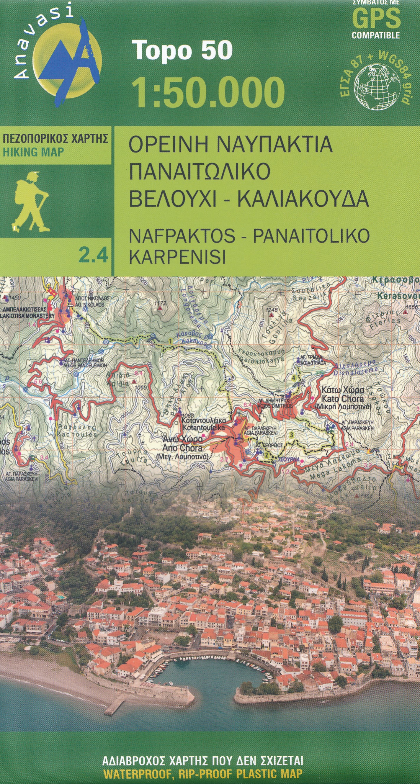
- Wandelkaart 2.4 Nafpaktos - Panaitoliko - Karpenisi | Anavasi
- Prespa - Vitsi – Voras area of northern Greece at 1:50,000 on a light, waterproof and tear-resistant, GPS compatible, contoured map from Anavasi, with recommendations for three hiking trails and notes on the E4 and E6 cross-European trails. The map is double-sided; coverage in the west starts from the Prespa Lake on the border with Albania and... Read more

United Kingdom
- Central Rhodopes / Rodopi Geopsis 132
- Central Rhodopes Mountains on the border of north-eastern Greece and Bulgaria on a waterproof and tear-resistant, contoured and GPS compatible map from Geopsis highlighting nine recommended hiking trails and the local section of the E6 cross-Europe long-distance route. All place names are in both Greek and Latin alphabet, with several villages... Read more

United Kingdom
- Eastern Rhodopes / Rodopi Geopsis 131
- Eastern Rhodopes Mountains on the border of north-eastern Greece and Bulgaria on a waterproof and tear-resistant, contoured and GPS compatible map from Geopsis highlighting nine recommended hiking trails and the local section of the E6 cross-Europe long-distance route. All place names are in both Greek and Latin alphabet, with several villages... Read more

United Kingdom
- Western Rhodopes / Rodopi - Falakro Geopsis 133
- Central Rhodopes Mountains on the border of north-eastern Greece and Bulgaria on a waterproof and tear-resistant, contoured and GPS compatible map from Geopsis highlighting nine recommended hiking trails and the local section of the E6 cross-Europe long-distance route. All place names are in both Greek and Latin alphabet, with several villages... Read more

United Kingdom
2012
- Valia Kalda - Vasilitsa Anavasi 6.4
- Pindos: Valia Kalda - Vasilitsa area at 1:50,000in a series of waterproof and tear-resistant hiking maps from Anavasi with a UTM grid for GPS users. The map covers part of the northern Pindus highlands, extending northwards from Metsovo to well beyond Smixi, ski centre on the northern slpes of Mt. Vasilitsa. With Samarina on its western margin... Read more

United Kingdom
- Istria K+F Outdoor Map
- Istria at 1:75,000 on a double-sided, durable, waterproof and tear-resistant, GPS compatible recreational map from Kümmerly + Frey, with street plans of Pula, Rovinj, Opatija, Umag, Novigrad, Porec and Vrsar. Topography is indicated by contours at 50m intervals, with relief shading and colouring for woodlands. Road network includes small local... Read more
Netherlands
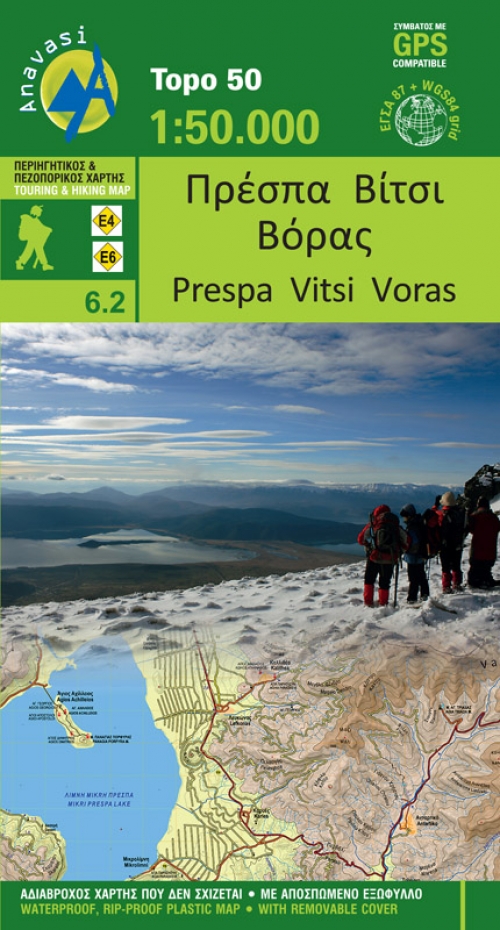
- Wandelkaart 6.2 Prespa - Vitsi - Voras | Anavasi
- Uitstekende topografische kaarten van een deel van Griekenland: zonder meer hele goede kaarten voor wandeltochten in een onbekend stuk Griekenland! Ze zijn gedrukt op scheurvast en watervast papier op een schaal van 1:50.000 met een UTM grid voor GPS gebruikers. Op de meeste kaarten is geven de hoogtelijnen een interval van 20m. aan. Met... Read more
- Also available from:
- Stanfords, United Kingdom
- The Book Depository, United Kingdom

United Kingdom
- Prespa - Vitsi - Voras Anavasi 6.2
- Prespa - Vitsi – Voras area of northern Greece at 1:50,000 on a light, waterproof and tear-resistant, GPS compatible, contoured map from Anavasi, with recommendations for three hiking trails and notes on the E4 and E6 cross-European trails. The map is double-sided; coverage in the west starts from the Prespa Lake on the border with Albania and... Read more

United Kingdom
- Prespa - Vitsi - Voras
- Uitstekende topografische kaarten van een deel van Griekenland: zonder meer hele goede kaarten voor wandeltochten in een onbekend stuk Griekenland! Ze zijn gedrukt op scheurvast en watervast papier op een schaal van 1:50.000 met een UTM grid voor GPS gebruikers. Op de meeste kaarten is geven de hoogtelijnen een interval van 20m. aan. Met... Read more


