Eisenwurzenweg - 8
Beschrijving
- Name Eisenwurzenweg - 8 (WWW08)
- Lengte van pad 548 km, 341 mijl
- Lengte in dagen 36 dagen
- Traildino graad SW, Inspannende wandeling, bergpad
- Huttentrektocht graad T2, Bergtocht


Eisenwurzenweg, Weitwanderweg 8, 548 km
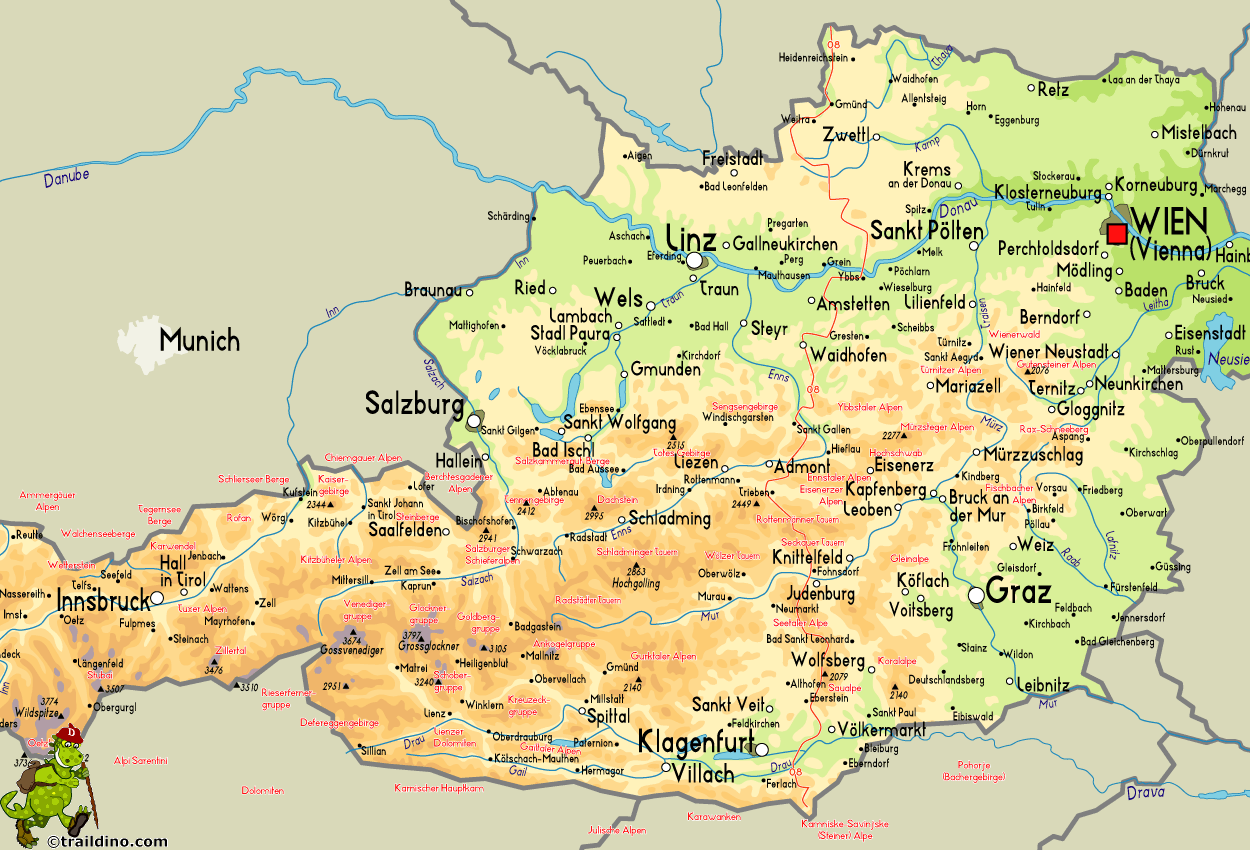
As you can see on the map, the Eisenwurzenway connects Austria's northernmost point to its southernmost point.
The start of the trail is easy, mostly through extensive forests of this part of Austria, locally known as Waldviertel. Heading south, the river Danube is crossed. Then starts an altogether different trail, one that goes well into the high mountains of the Alps. Highlights are the Ennstaler Alps and the Gesäuse, a National Park. The trail passes many mountain huts.
The last part of the Eisenwurzenweg heads for the more gently, but still elevated, regions of the Seetaler Alps and Sau Alps. These regions are less popular, more quiet.
The end of the trail culminates in the spectacular Karawanken, shaping the border with Slovenia.


