
Gorges du Tarn
Beschrijving
Famous canyon in the South of France, Languedoc
Links
Feiten
Verslagen
Gidsen en kaarten
Overnachting
Organisaties
Reisorganisaties
GPS
Anders
Boeken
De Zwerver
Netherlands
Netherlands
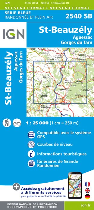
- Wandelkaart - Topografische kaart 2540SB St-Beauzély, Aguessac, Gorges-du-Tarn | IGN - Institut Géographique National
- L'indispensable carte de randonnée IGN aux alentours de Saint-Beauzély - Aguessac - Gorges du Tarn. A conserver dans son sac à dos. Read more
- Also available from:
- Stanfords, United Kingdom

Stanfords
United Kingdom
United Kingdom
- St-Beauzely - Aguessac - Gorges du Tarn IGN 25K Série Bleue Map 2540SB
- Topographic survey of France at 1:25,000 in IGN`s excellent TOP25 / Série Bleue series. All the maps are GPS compatible, with a 1km UTM grid plus latitude and longitude lines at 5’ intervals. Contours are at 5m intervals except for mountainous areas where the maps have contours at 10m intervals, vividly enhanced by hill shading and graphics for... Read more
De Zwerver
Netherlands
Netherlands
- Also available from:
- Stanfords, United Kingdom
- The Book Depository, United Kingdom

Stanfords
United Kingdom
United Kingdom
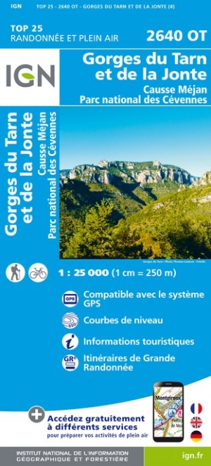
- Gorges du Tarn et de la Jonte - Causse Mejan - PN des Cevennes IGN 2640OT
- Topographic survey of France at 1:25,000 in IGN`s excellent TOP25 / Série Bleue series. All the maps are GPS compatible, with a 1km UTM grid plus latitude and longitude lines at 5’ intervals. Contours are at 5m intervals except for mountainous areas where the maps have contours at 10m intervals, vividly enhanced by hill shading and graphics for... Read more

Kaarten

Stanfords
United Kingdom
United Kingdom
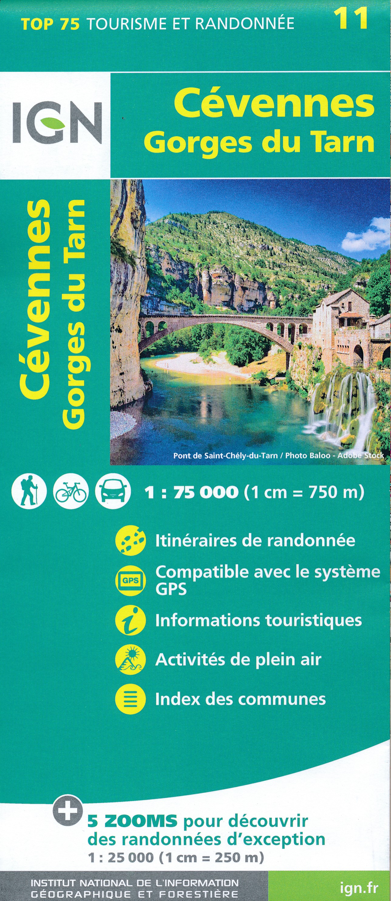
- Cévennes - Gorges du Tarn IGN 75011
- Cévennes - Gorges du Tarn region in a series of GPS compatible, contoured TOP75 maps at 1:75,000 from the IGN, highlighting local and long-distance hiking paths, cycling routes and sites for other recreational activities. The map includes five large panels showing the areas around Trèves Col du Minier, Vialas, Gorges du Tarn, and Col de... Read more


Stanfords
United Kingdom
United Kingdom
- Gorges du Tarn et de la Jonte - Causse Mejan - PN des Cevennes IGN WATERPROOF 2640OTR
- Topographic survey of France at 1:25,000 in IGN`s excellent TOP25 / Série Bleue series. All the maps are GPS compatible, with a 1km UTM grid plus latitude and longitude lines at 5’ intervals. Contours are at 5m intervals except for mountainous areas where the maps have contours at 10m intervals, vividly enhanced by hill shading and graphics for... Read more
- Also available from:
- The Book Depository, United Kingdom

De Zwerver
Netherlands
Netherlands
- Also available from:
- Stanfords, United Kingdom
- The Book Depository, United Kingdom

Stanfords
United Kingdom
United Kingdom
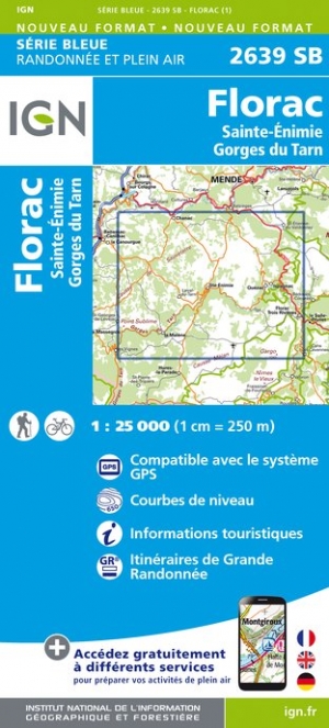
- Florac - Sainte-Enimie - Gorges du Tarn IGN 2639SB
- Topographic survey of France at 1:25,000 in IGN`s excellent TOP25 / Série Bleue series. All the maps are GPS compatible, with a 1km UTM grid plus latitude and longitude lines at 5’ intervals. Contours are at 5m intervals except for mountainous areas where the maps have contours at 10m intervals, vividly enhanced by hill shading and graphics for... Read more
