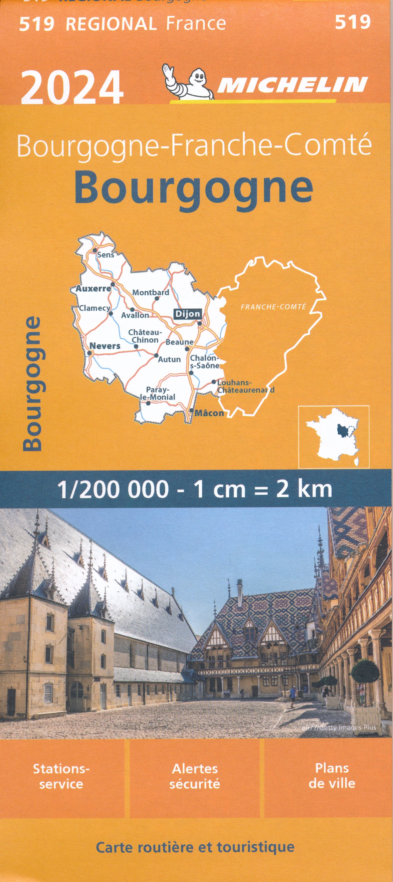
Bourgogne
Beschrijving
Paden in deze regio
Links
Feiten
Verslagen
Gidsen en kaarten
Overnachting
Organisaties
Reisorganisaties
GPS
Anders
Boeken

De Zwerver
Netherlands
2014
Netherlands
2014
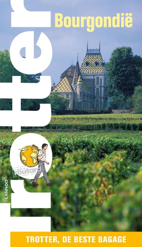
- Reisgids Trotter Bourgondië - Bourgondie | Lannoo
- De Trottergidsen, gebaseerd op de Franse Guides du Routard, zijn bestemd voor de minder conventioneel ingestelde jonge reiziger en staan garant voor enorm veel informatie die bijna vertrouwelijk wordt meegedeeld en steeds gebaseerd is op recente ervaringen. In deze Bourgondie-gids wordt uiteraard serieus aandacht besteed aan de belangrijkste... Read more
De Zwerver
Netherlands
2016
Netherlands
2016
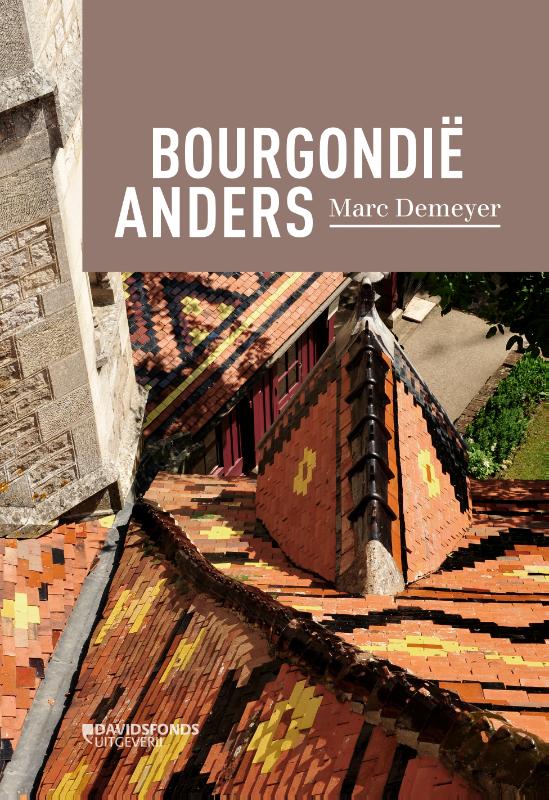
- Reisgids Bourgondië anders | Davidsfonds
- De informatieve bruine borden langsheen de 'Autoroute du Soleil' met de geruststellende boodschap 'Vous êtes en Bourgogne' klinken vertrouwd. Gaan wij er niet prat op 'bourgondiërs' te zijn? Zien we de hertogen van Bourgondië niet defileren doorheen de meest roemrijke bladzijden van onze 'vaderlandse geschiedenis'? Om nog maar te zwijgen van de... Read more
De Zwerver
Netherlands
2019
Netherlands
2019
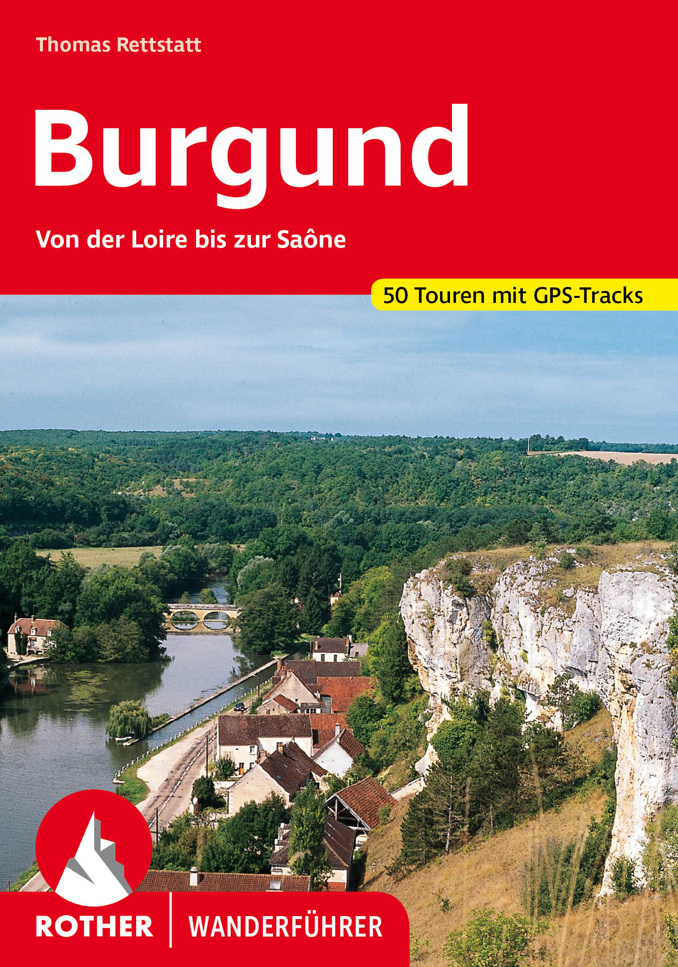
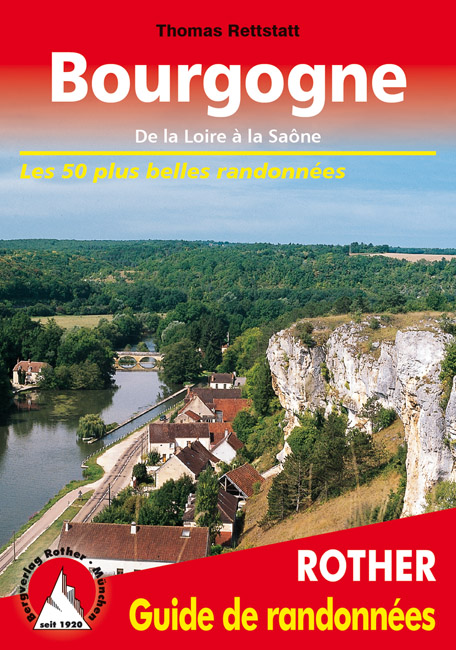
- Wandelgids Bourgogne (Franstalig) | Rother Bergverlag
- De la Loire à la Saône. Les 50 plus belles randonnées Read more
De Zwerver
Netherlands
Netherlands
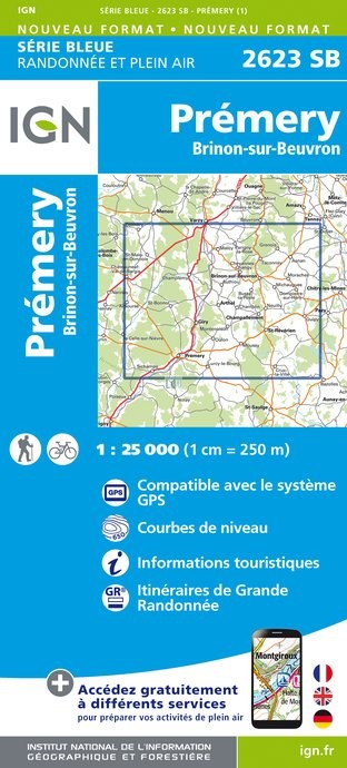
- Topografische kaart - Wandelkaart 2623SB Prémery | IGN - Institut Géographique National
- L'indispensable carte de randonnée IGN aux alentours de Prémery / Brinon-sur-Beuvron. A conserver dans son sac à dos Read more
- Also available from:
- Stanfords, United Kingdom

Stanfords
United Kingdom
United Kingdom
- Premery - Brinon-sur-Beuvron IGN 25K Série Bleue Map 2623SB
- Topographic survey of France at 1:25,000 in IGN`s excellent TOP25 / Série Bleue series. All the maps are GPS compatible, with a 1km UTM grid plus latitude and longitude lines at 5’ intervals. Contours are at 5m intervals except for mountainous areas where the maps have contours at 10m intervals, vividly enhanced by hill shading and graphics for... Read more
De Zwerver
Netherlands
Netherlands
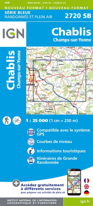
- Wandelkaart - Topografische kaart 2720SB Chablis, Champs-sur-Yonne | IGN - Institut Géographique National
- L'indispensable carte de randonnée IGN aux alentours de Chablis - Champs-sur-Yonne. A conserver dans son sac à dos. Read more
- Also available from:
- Stanfords, United Kingdom

Stanfords
United Kingdom
United Kingdom
- Chablis - Champs-sur-Yonne IGN 2720SB
- Topographic survey of France at 1:25,000 in IGN`s excellent TOP25 / Série Bleue series. All the maps are GPS compatible, with a 1km UTM grid plus latitude and longitude lines at 5’ intervals. Contours are at 5m intervals except for mountainous areas where the maps have contours at 10m intervals, vividly enhanced by hill shading and graphics for... Read more
De Zwerver
Netherlands
Netherlands
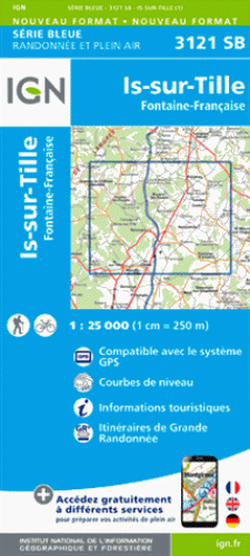
- Topografische kaart - Wandelkaart 3121SB Is-sur-Tille | IGN - Institut Géographique National
- L'indispensable carte de randonnée IGN aux alentours de Is-sur-Tille. A conserver dans son sac à dos. Read more
- Also available from:
- Stanfords, United Kingdom

Stanfords
United Kingdom
United Kingdom
- Is-sur-Tille - Fontaine-Francaise IGN 25K Série Bleue Map 3121SB
- Topographic survey of France at 1:25,000 in IGN`s excellent TOP25 / Série Bleue series. All the maps are GPS compatible, with a 1km UTM grid plus latitude and longitude lines at 5’ intervals. Contours are at 5m intervals except for mountainous areas where the maps have contours at 10m intervals, vividly enhanced by hill shading and graphics for... Read more
De Zwerver
Netherlands
Netherlands
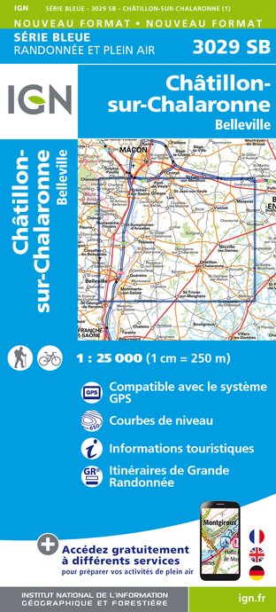
- Wandelkaart - Topografische kaart 3029SB Châtillon-sur-Chalaronne - Belleville | IGN - Institut Géographique National
- L'indispensable carte de randonnée IGN aux alentours de Chatillon-sur-Chalaronne - Belleville. A conserver dans son sac à dos. Read more
- Also available from:
- Stanfords, United Kingdom

Stanfords
United Kingdom
United Kingdom
- Chatillon-sur-Chalaronne - Belleville IGN 25K Série Bleue Map 3029SB
- Topographic survey of France at 1:25,000 in IGN`s excellent TOP25 / Série Bleue series. All the maps are GPS compatible, with a 1km UTM grid plus latitude and longitude lines at 5’ intervals. Contours are at 5m intervals except for mountainous areas where the maps have contours at 10m intervals, vividly enhanced by hill shading and graphics for... Read more
De Zwerver
Netherlands
Netherlands
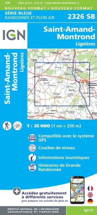
- Topografische kaart - Wandelkaart 2326SB Saint-Amand-Montrond | IGN - Institut Géographique National
- L'indispensable carte de randonnée IGN Saint-Amand-Montrond / Lignières. A conserver dans son sac à dos Read more
- Also available from:
- Stanfords, United Kingdom

Stanfords
United Kingdom
United Kingdom
- Saint-Amand-Montrond - Lignieres IGN 25K Série Bleue Map 2326SB
- Topographic survey of France at 1:25,000 in IGN`s excellent TOP25 / Série Bleue series. All the maps are GPS compatible, with a 1km UTM grid plus latitude and longitude lines at 5’ intervals. Contours are at 5m intervals except for mountainous areas where the maps have contours at 10m intervals, vividly enhanced by hill shading and graphics for... Read more
De Zwerver
Netherlands
Netherlands
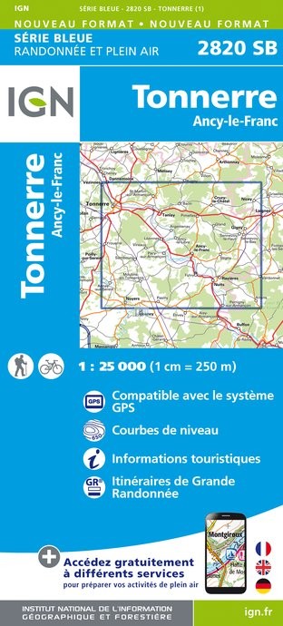
- Topografische kaart - Wandelkaart 2820SB Tonnerre | IGN - Institut Géographique National
- L'indispensable carte de randonnée IGN aux alentours de Tonnerre / Ancy-le-Franc. A conserver dans son sac à dos Read more
- Also available from:
- Stanfords, United Kingdom

Stanfords
United Kingdom
United Kingdom
- Tonnerre - Ancy-le-Franc IGN 2820SB
- Topographic survey of France at 1:25,000 in IGN`s excellent TOP25 / Série Bleue series. All the maps are GPS compatible, with a 1km UTM grid plus latitude and longitude lines at 5’ intervals. Contours are at 5m intervals except for mountainous areas where the maps have contours at 10m intervals, vividly enhanced by hill shading and graphics for... Read more
De Zwerver
Netherlands
Netherlands
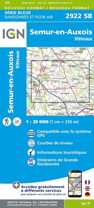
- Wandelkaart - Topografische kaart 2922SB Semur-en-Auxois - Vitteaux | IGN - Institut Géographique National
- L'indispensable carte de randonnée IGN aux alentours de Semur-en-Auxois - Vitteaux. A conserver dans son sac à dos. Read more
- Also available from:
- Stanfords, United Kingdom

Stanfords
United Kingdom
United Kingdom
- Semur-en-Auxois - Vitteaux IGN 25K Série Bleue Map 2922SB
- Topographic survey of France at 1:25,000 in IGN`s excellent TOP25 / Série Bleue series. All the maps are GPS compatible, with a 1km UTM grid plus latitude and longitude lines at 5’ intervals. Contours are at 5m intervals except for mountainous areas where the maps have contours at 10m intervals, vividly enhanced by hill shading and graphics for... Read more
Kaarten
De Zwerver
Netherlands
Netherlands
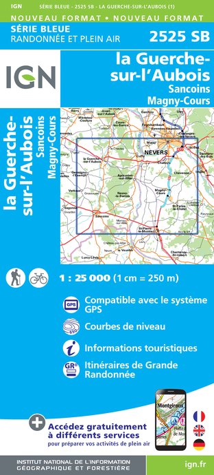
- Wandelkaart - Topografische kaart 2525SB La Guerche-sur-l'Aubois, Sancoins, Magny-Cours | IGN - Institut Géographique National
- Topographic survey of France at 1:25,000 in IGN's excellent TOP25 / S Read more
- Also available from:
- Stanfords, United Kingdom

Stanfords
United Kingdom
United Kingdom
- La Guerche-sur-l`Aubois - Sancoins - Magny-Cours IGN 25K Série Bleue Map 2525SB
- Topographic survey of France at 1:25,000 in IGN`s excellent TOP25 / Série Bleue series. All the maps are GPS compatible, with a 1km UTM grid plus latitude and longitude lines at 5’ intervals. Contours are at 5m intervals except for mountainous areas where the maps have contours at 10m intervals, vividly enhanced by hill shading and graphics for... Read more
De Zwerver
Netherlands
Netherlands
- Also available from:
- Stanfords, United Kingdom

Stanfords
United Kingdom
United Kingdom
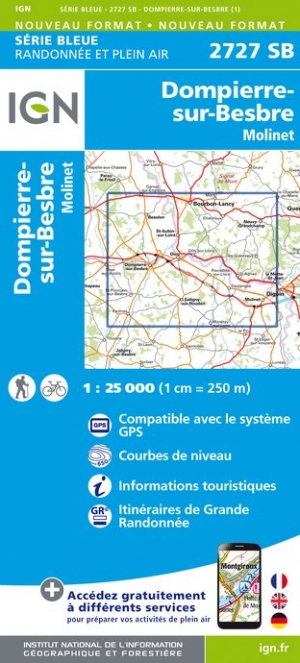
- Dompierre-sur-Besbre - Molinet IGN 2727SB
- Topographic survey of France at 1:25,000 in IGN`s excellent TOP25 / Série Bleue series. All the maps are GPS compatible, with a 1km UTM grid plus latitude and longitude lines at 5’ intervals. Contours are at 5m intervals except for mountainous areas where the maps have contours at 10m intervals, vividly enhanced by hill shading and graphics for... Read more

De Zwerver
Netherlands
Netherlands
- Also available from:
- Stanfords, United Kingdom

Stanfords
United Kingdom
United Kingdom
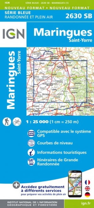
- Maringues - Saint-Yorre IGN 2630SB
- Topographic survey of France at 1:25,000 in IGN`s excellent TOP25 / Série Bleue series. All the maps are GPS compatible, with a 1km UTM grid plus latitude and longitude lines at 5’ intervals. Contours are at 5m intervals except for mountainous areas where the maps have contours at 10m intervals, vividly enhanced by hill shading and graphics for... Read more
De Zwerver
Netherlands
Netherlands
- Also available from:
- Stanfords, United Kingdom

Stanfords
United Kingdom
United Kingdom
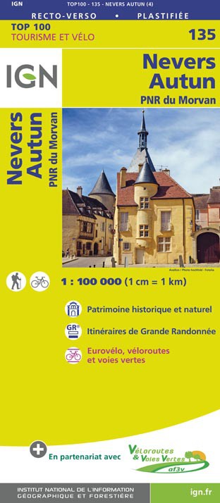
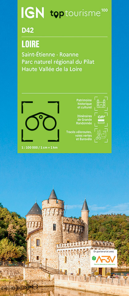
- Nevers - Autun - PNR du Morvan IGN TOP100 135
- Discover the new double-sided laminated edition of TOP100 road maps of France from the Institut Géographique National (IGN); exceptionally detailed, contoured road maps which include the cycle paths and greenways of the AF3V (French Association for the Development of Cycle Paths and Greenways), ideal for exploring the French countryside by car,... Read more

De Zwerver
Netherlands
Netherlands
- Wandelkaart - Topografische kaart 2625SB Decize - Imphy | IGN - Institut Géographique National
- Topographic survey of France at 1:25,000 in IGN's excellent TOP25 / S Read more
- Also available from:
- Stanfords, United Kingdom

Stanfords
United Kingdom
United Kingdom
- Decize - Imphy IGN 25K Série Bleue Map 2625SB
- Topographic survey of France at 1:25,000 in IGN`s excellent TOP25 / Série Bleue series. All the maps are GPS compatible, with a 1km UTM grid plus latitude and longitude lines at 5’ intervals. Contours are at 5m intervals except for mountainous areas where the maps have contours at 10m intervals, vividly enhanced by hill shading and graphics for... Read more

De Zwerver
Netherlands
Netherlands
- Also available from:
- Stanfords, United Kingdom
Stanfords
United Kingdom
United Kingdom
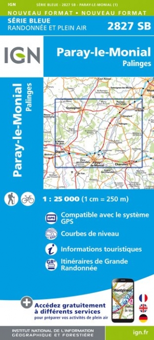
- Paray-le-Monial - Palinges IGN 2827SB
- Topographic survey of France at 1:25,000 in IGN`s excellent TOP25 / Série Bleue series. All the maps are GPS compatible, with a 1km UTM grid plus latitude and longitude lines at 5’ intervals. Contours are at 5m intervals except for mountainous areas where the maps have contours at 10m intervals, vividly enhanced by hill shading and graphics for... Read more
De Zwerver
Netherlands
Netherlands
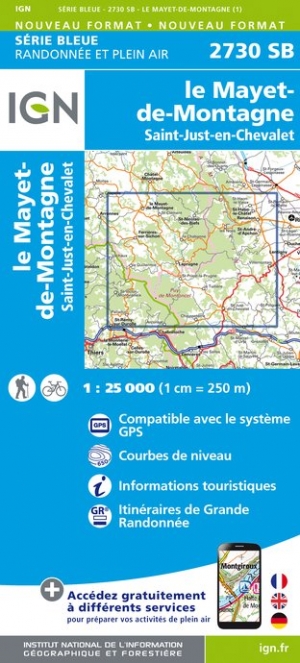
- Wandelkaart - Topografische kaart 2730SB le Mayet-de-Montagne | IGN - Institut Géographique National
- Topographic survey of France at 1:25,000 in IGN`s excellent TOP25 / Série Bleue series. All the maps are GPS compatible, with a 1km UTM grid plus latitude and longitude lines at 5’ intervals. Contours are at 5m intervals except for mountainous areas where the maps have contours at 10m intervals, vividly enhanced by hill shading and graphics for... Read more
- Also available from:
- Stanfords, United Kingdom

Stanfords
United Kingdom
United Kingdom
- Le Mayet-de-Montagne - Saint-Just-en-Chevalet IGN 2730SB
- Topographic survey of France at 1:25,000 in IGN`s excellent TOP25 / Série Bleue series. All the maps are GPS compatible, with a 1km UTM grid plus latitude and longitude lines at 5’ intervals. Contours are at 5m intervals except for mountainous areas where the maps have contours at 10m intervals, vividly enhanced by hill shading and graphics for... Read more
De Zwerver
Netherlands
Netherlands
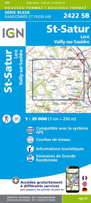
- Wandelkaart - Topografische kaart 2422SB St-Satur, Léré, Vailly-sur-Sauldre | IGN - Institut Géographique National
- Topographic survey of France at 1:25,000 in IGN's excellent TOP25 / S Read more
- Also available from:
- Stanfords, United Kingdom

Stanfords
United Kingdom
United Kingdom
- St-Satur - Lère - Vailly-sur-Sauldre IGN 25K Série Bleue Map 2422SB
- Topographic survey of France at 1:25,000 in IGN`s excellent TOP25 / Série Bleue series. All the maps are GPS compatible, with a 1km UTM grid plus latitude and longitude lines at 5’ intervals. Contours are at 5m intervals except for mountainous areas where the maps have contours at 10m intervals, vividly enhanced by hill shading and graphics for... Read more
De Zwerver
Netherlands
Netherlands
- Also available from:
- Stanfords, United Kingdom

Stanfords
United Kingdom
United Kingdom
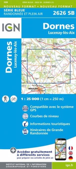
- Dornes - Lucenay-les-Aix IGN 2626SB
- Topographic survey of France at 1:25,000 in IGN`s excellent TOP25 / Série Bleue series. All the maps are GPS compatible, with a 1km UTM grid plus latitude and longitude lines at 5’ intervals. Contours are at 5m intervals except for mountainous areas where the maps have contours at 10m intervals, vividly enhanced by hill shading and graphics for... Read more
De Zwerver
Netherlands
Netherlands
- Also available from:
- Stanfords, United Kingdom

Stanfords
United Kingdom
United Kingdom
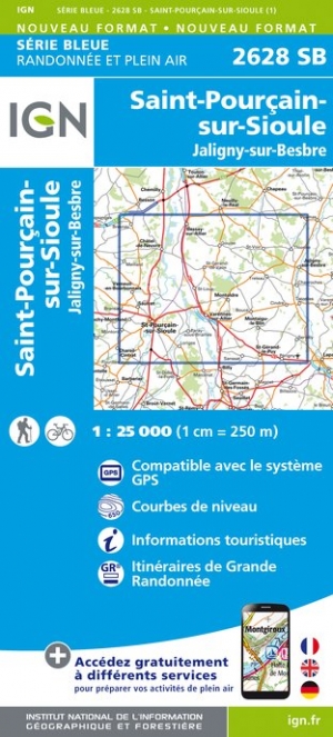
- Saint-Pourcain-sur-Sioule - Jaligny-sur-Besbre IGN 2628SB
- Topographic survey of France at 1:25,000 in IGN`s excellent TOP25 / Série Bleue series. All the maps are GPS compatible, with a 1km UTM grid plus latitude and longitude lines at 5’ intervals. Contours are at 5m intervals except for mountainous areas where the maps have contours at 10m intervals, vividly enhanced by hill shading and graphics for... Read more
De Zwerver
Netherlands
2024
Netherlands
2024
De Zwerver
Netherlands
Netherlands
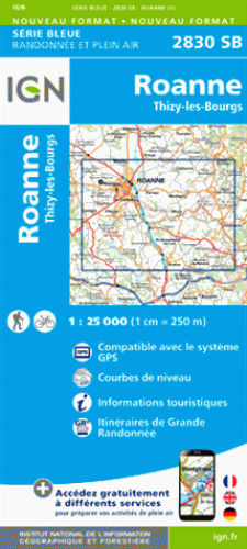
- Wandelkaart - Topografische kaart 2830SB Roanne - Thizy-les-Bourgs | IGN - Institut Géographique National
- Roanne - ThizyEntre 2014 et 2018, l?IGN renouvelle l?intégralité de sa collection SERIE BLEUE. Read more
- Also available from:
- Stanfords, United Kingdom

Stanfords
United Kingdom
United Kingdom
- Roanne - Thizy IGN 25K Série Bleue Map 2830SB
- Topographic survey of France at 1:25,000 in IGN`s excellent TOP25 / Série Bleue series. All the maps are GPS compatible, with a 1km UTM grid plus latitude and longitude lines at 5’ intervals. Contours are at 5m intervals except for mountainous areas where the maps have contours at 10m intervals, vividly enhanced by hill shading and graphics for... Read more
Meer kaarten…